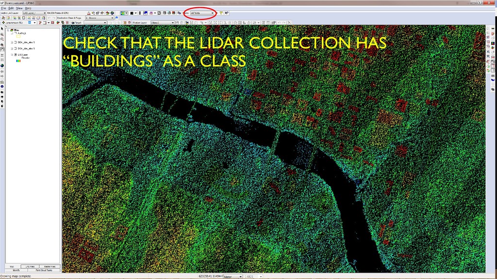
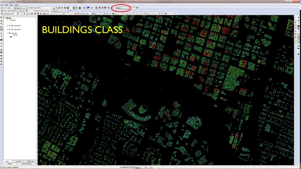
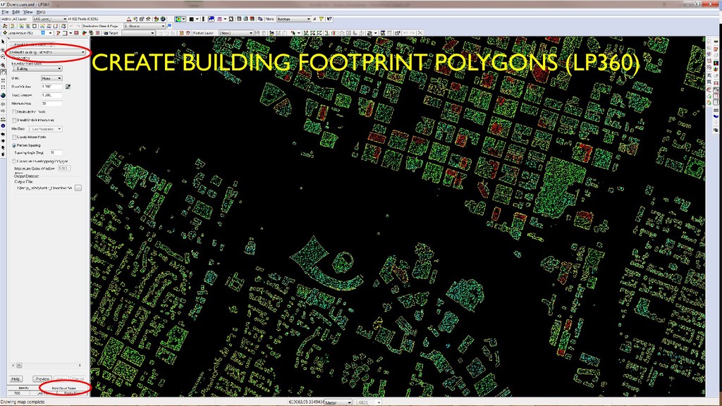
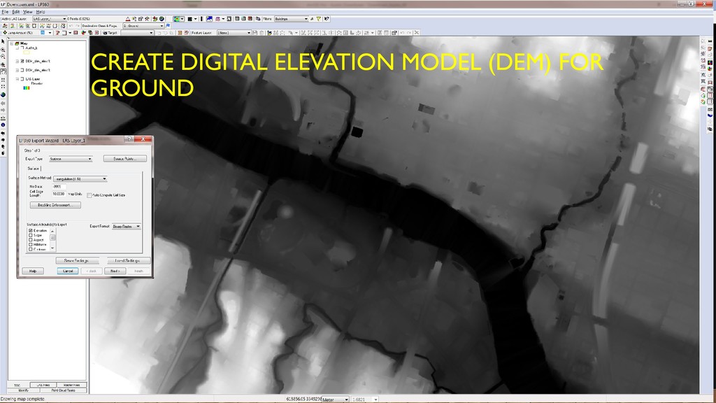
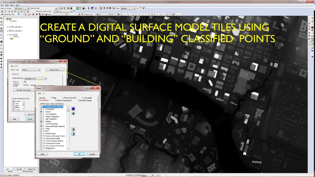
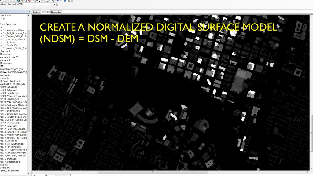
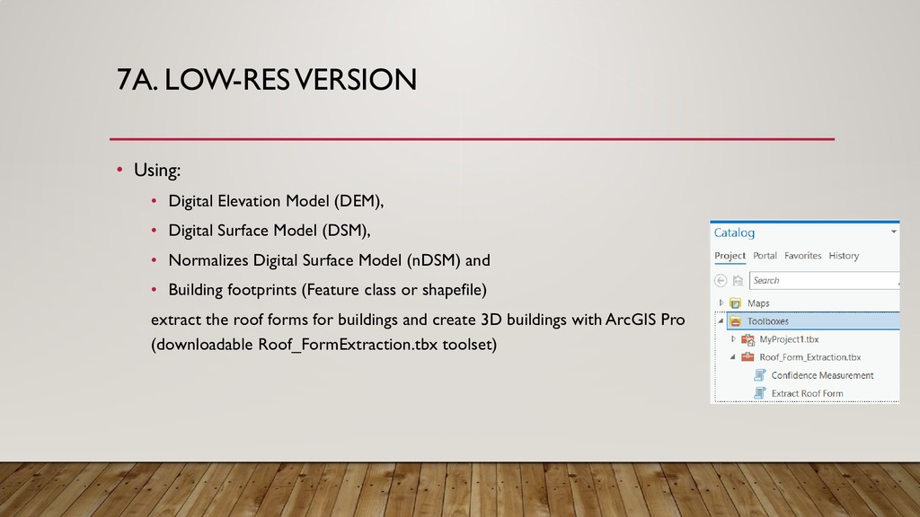
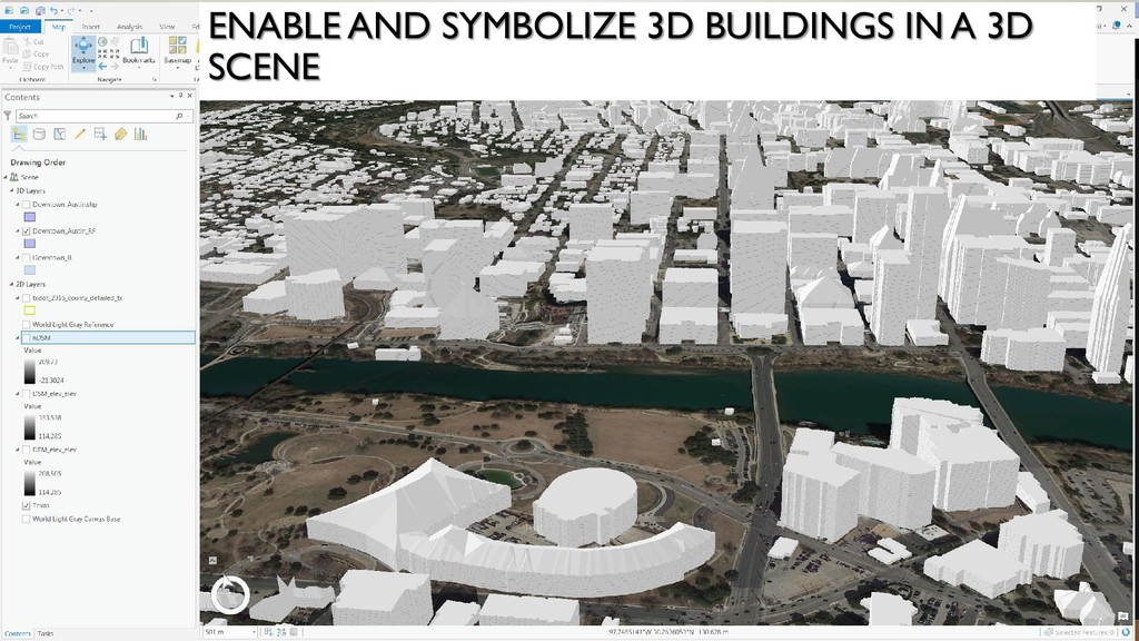
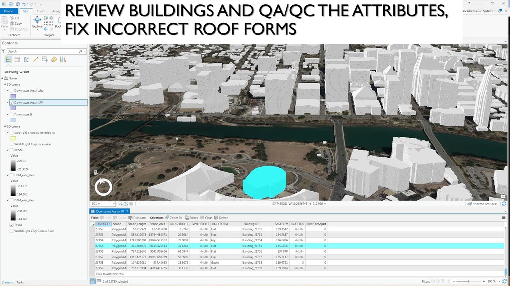
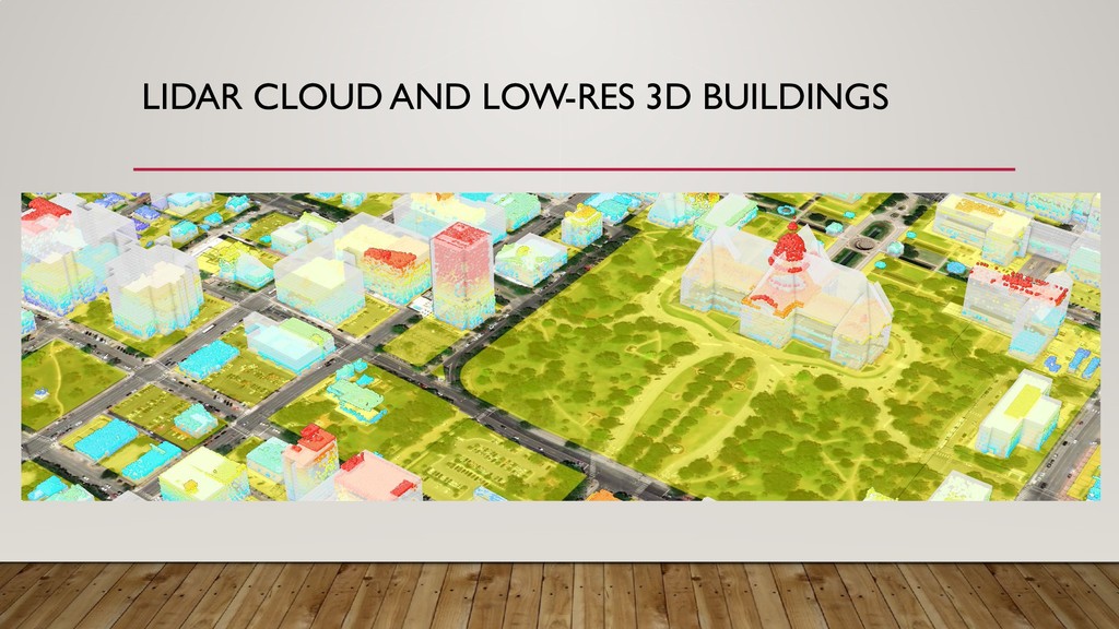
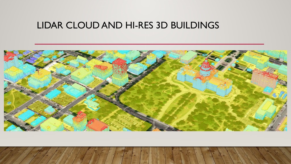
“buildings” as one of the classifications of the point cloud (LP360) 2. Create building footprint polygons (LP360) 3. If Digital Elevation Model is not available create it using “ground” classified points (LP360) 4. Create a Digital Surface Model using “ground” and “building” classified points (LP360) 5. Create a new raster mosaic for DEM if DEM tiles available from vendor (ArcGIS Pro) 6. Create a normalized Digital Surface Model (nDSM) subtracting the DEM from the DSM to get object heights (ArcMap or ArcGIS Pro) 7. a) Low-res version: using DEM, DSM, nDSM and building footprints extract the roof forms for buildings and Create 3D buildings (ArcGIS Pro) or b) High-res. using lidar cloud and footprints create 3D multipatch building 8. Enable and symbolize 3D buildings in a 3D Scene (ArcGIS Pro) 9. Review buildings and QA/QC the attributes, fix incorrect roof forms (ArcGIS Pro) 10. Next Steps
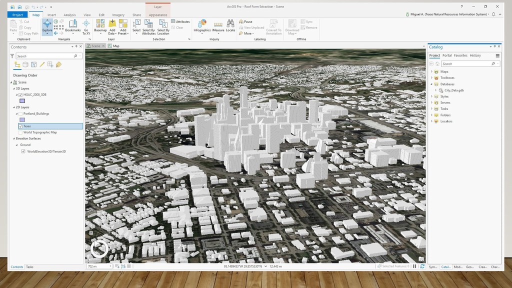
• Digital Surface Model (DSM), • Normalizes Digital Surface Model (nDSM) and • Building footprints (Feature class or shapefile) extract the roof forms for buildings and create 3D buildings with ArcGIS Pro (downloadable Roof_FormExtraction.tbx toolset)
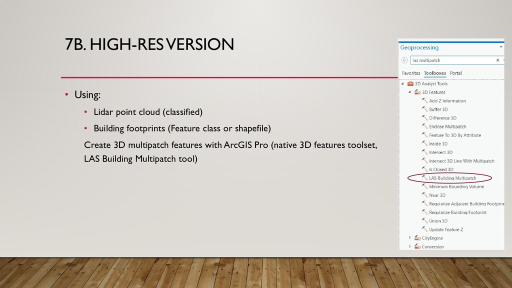
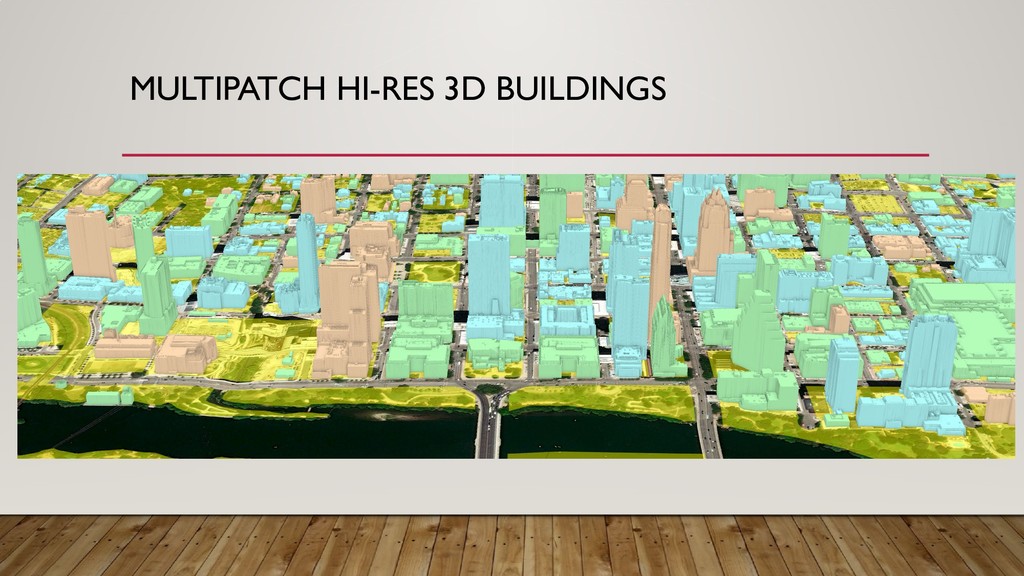
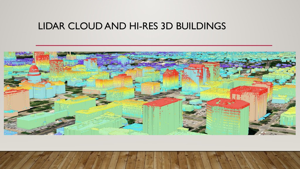
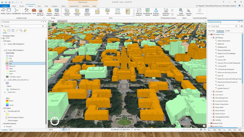
• Building footprints (Feature class or shapefile) Create 3D multipatch features with ArcGIS Pro (native 3D features toolset, LAS Building Multipatch tool)
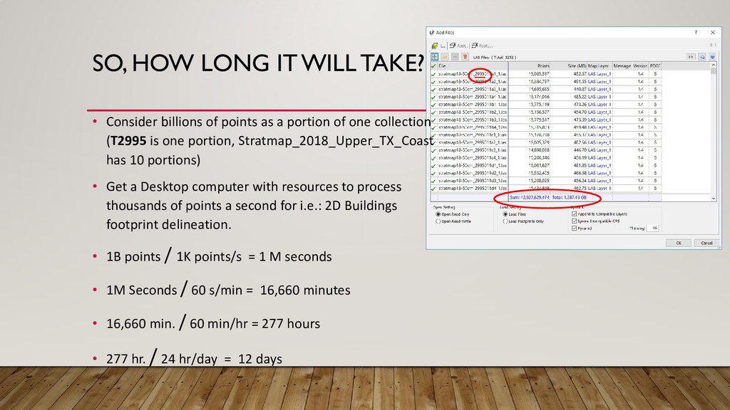
points as a portion of one collection (T2995 is one portion, Stratmap_2018_Upper_TX_Coast has 10 portions) • Get a Desktop computer with resources to process thousands of points a second for i.e.: 2D Buildings footprint delineation. • 1B points / 1K points/s = 1 M seconds • 1M Seconds / 60 s/min = 16,660 minutes • 16,660 min. / 60 min/hr = 277 hours • 277 hr. / 24 hr/day = 12 days
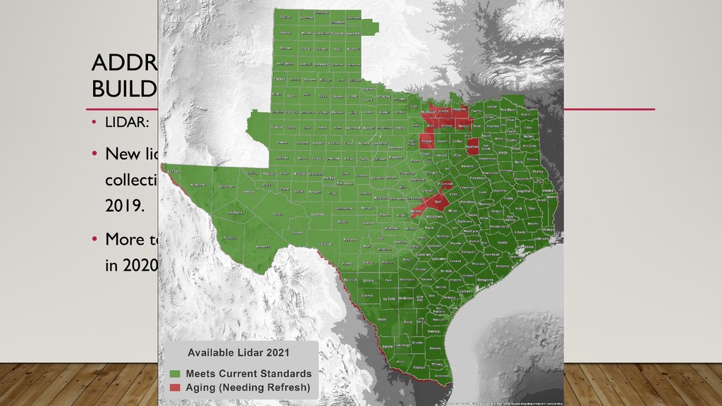
911 Use • Repetitive Loss • Building type • Appraisal values • Texture • Texas Completion* • . . . * We will have buildings statewide a few months or a year after we complete lidar for the state (statewide lidar may happen in 2020-21).