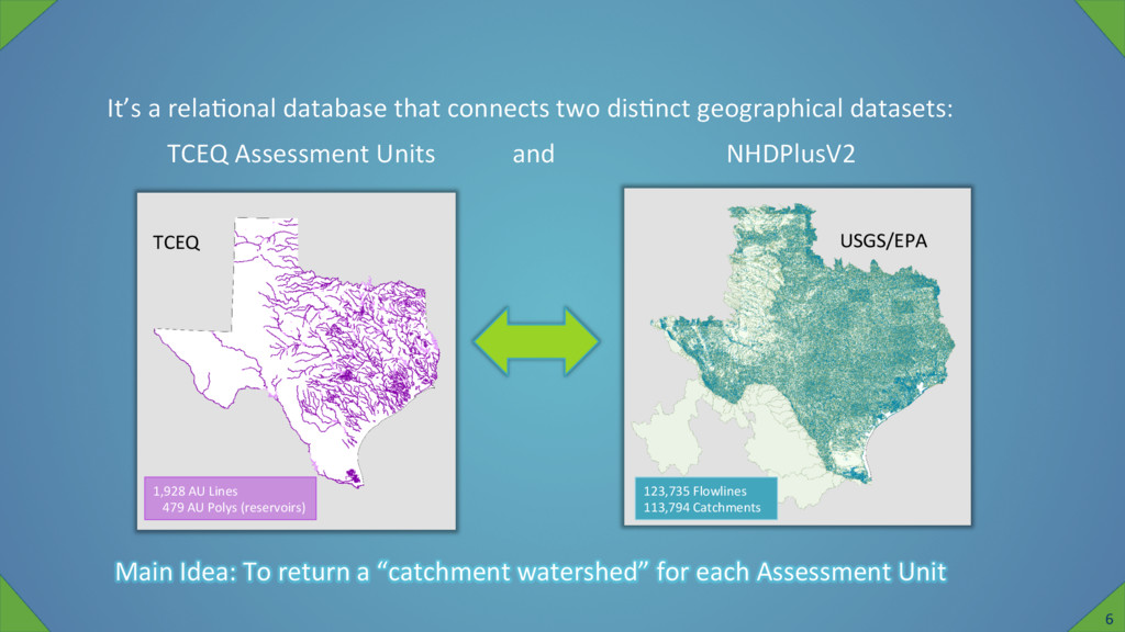
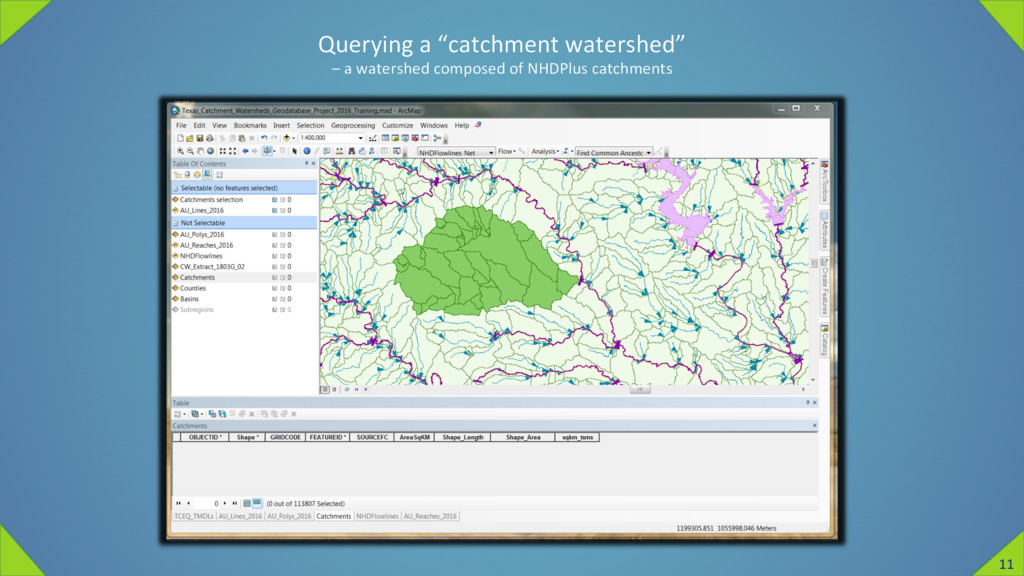
Main Idea: To return a “catchment watershed” for each Assessment Unit TCEQ 1,928 AU Lines 479 AU Polys (reservoirs) USGS/EPA 123,735 Flowlines 113,794 Catchments TCEQ Assessment Units and NHDPlusV2 6
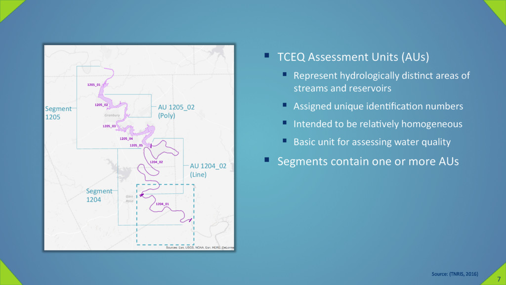
of streams and reservoirs § Assigned unique idenZficaZon numbers § Intended to be relaZvely homogeneous § Basic unit for assessing water quality § Segments contain one or more AUs Source: (TNRIS, 2016) AU 1205_02 (Poly) AU 1204_02 (Line) Segment 1205 Segment 1204 7
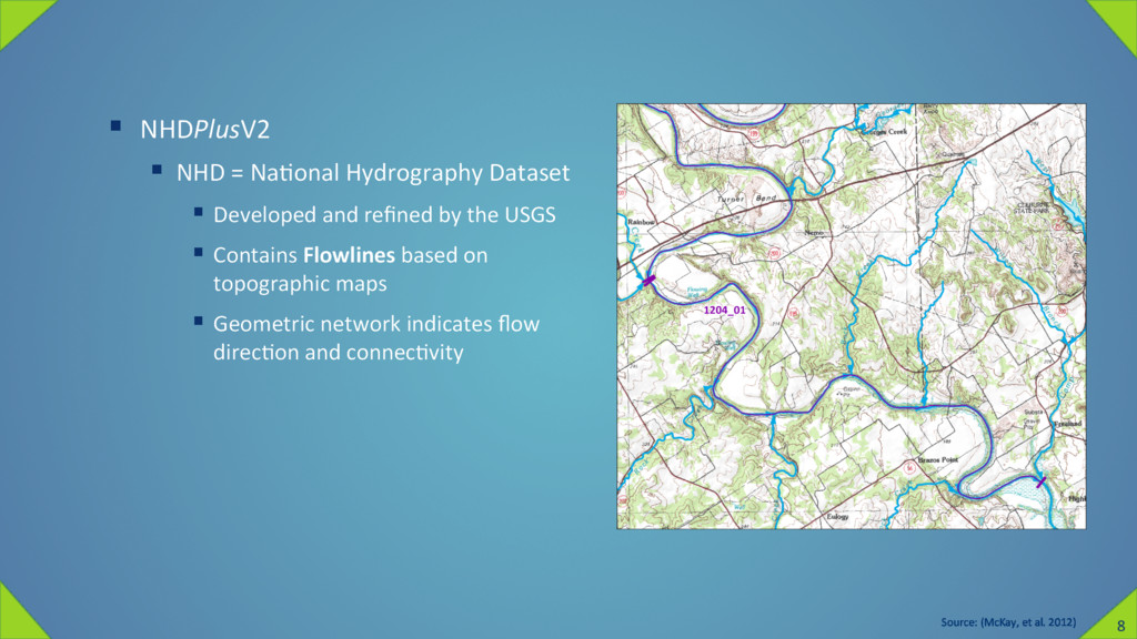
and refined by the USGS § Contains Flowlines based on topographic maps § Geometric network indicates flow direcZon and connecZvity Source: (McKay, et al. 2012) 8
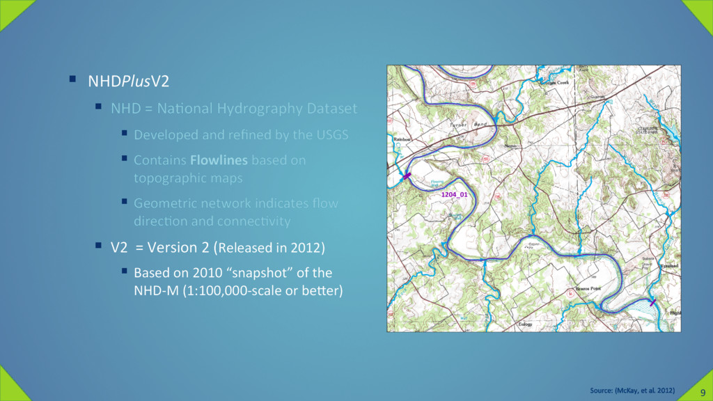
and refined by the USGS § Contains Flowlines based on topographic maps § Geometric network indicates flow direcZon and connecZvity § V2 = Version 2 (Released in 2012) § Based on 2010 “snapshot” of the NHD-M (1:100,000-scale or bener) Source: (McKay, et al. 2012) 9
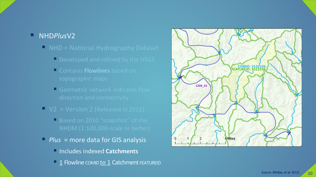
and refined by the USGS § Contains Flowlines based on topographic maps § Geometric network indicates flow direcZon and connecZvity § V2 = Version 2 (Released in 2012) § Based on 2010 “snapshot” of the NHDM (1:100,000-scale or bener) § Plus = more data for GIS analysis § Includes indexed Catchments § 1 Flowline COMID to 1 Catchment FEATUREID Source: (McKay, et al. 2012) 0 2 4 1 Miles 0 2 4 1 Miles 10
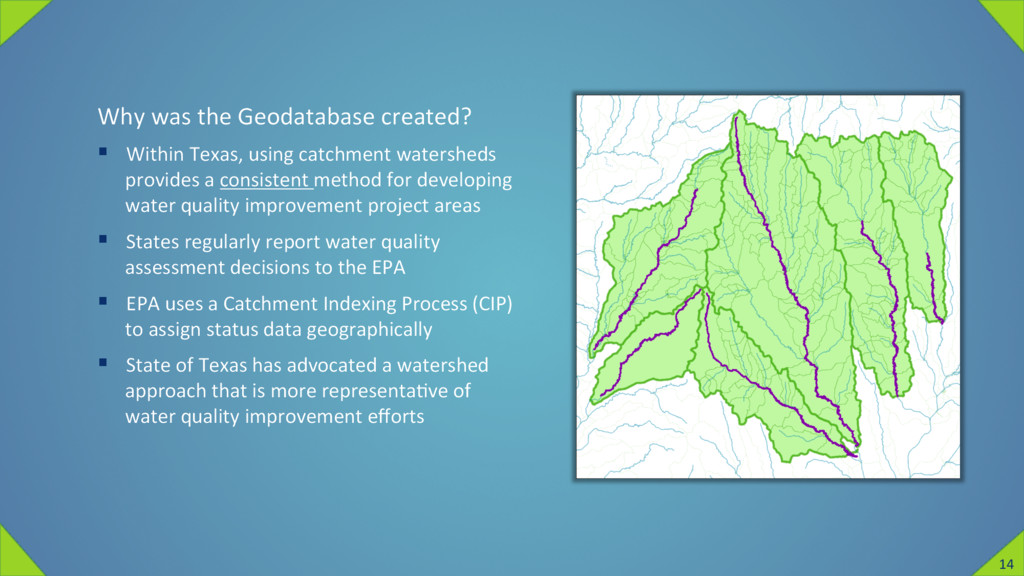
watersheds provides a consistent method for developing water quality improvement project areas § States regularly report water quality assessment decisions to the EPA § EPA uses a Catchment Indexing Process (CIP) to assign status data geographically § State of Texas has advocated a watershed approach that is more representaZve of water quality improvement efforts 14
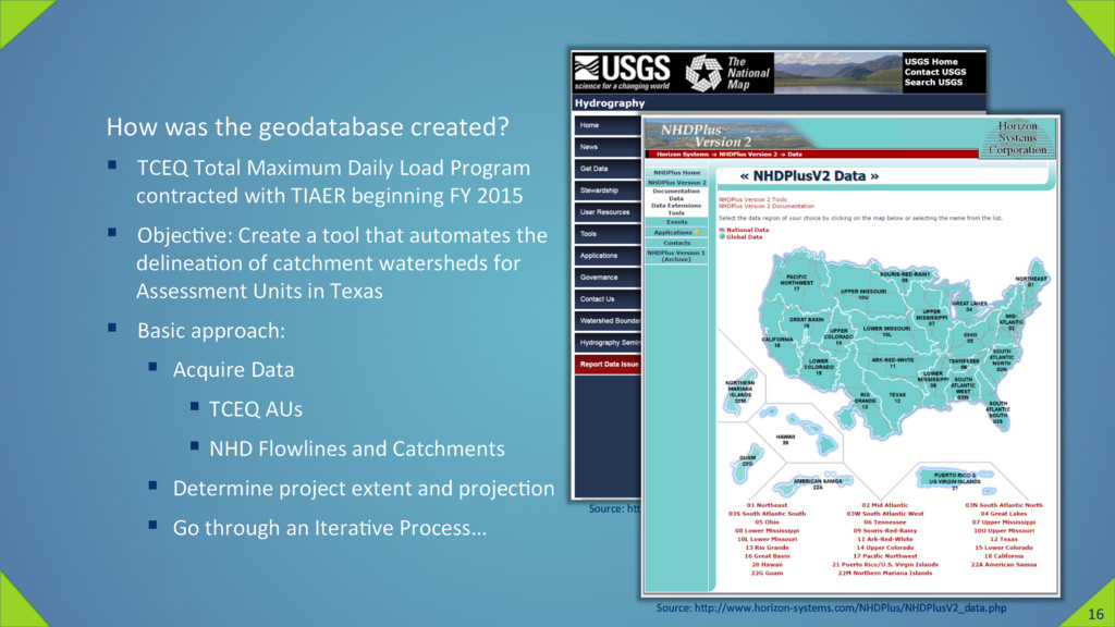
Load Program contracted with TIAER beginning FY 2015 § ObjecZve: Create a tool that automates the delineaZon of catchment watersheds for Assessment Units in Texas § Basic approach: § Acquire Data § TCEQ AUs § NHD Flowlines and Catchments § Determine project extent and projecZon § Go through an IteraZve Process… Source: hnp://nhd.usgs.gov/data.html Source: hnp://www.horizon-systems.com/NHDPlus/NHDPlusV2_data.php 16
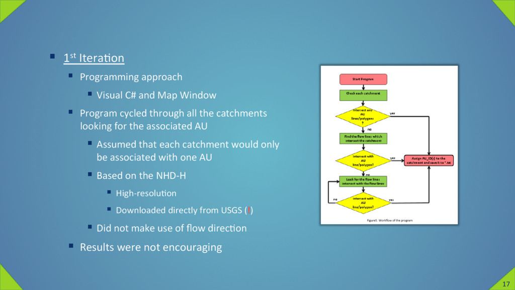
Map Window § Program cycled through all the catchments looking for the associated AU § Assumed that each catchment would only be associated with one AU § Based on the NHD-H § High-resoluZon § Downloaded directly from USGS (!) § Did not make use of flow direcZon § Results were not encouraging 17
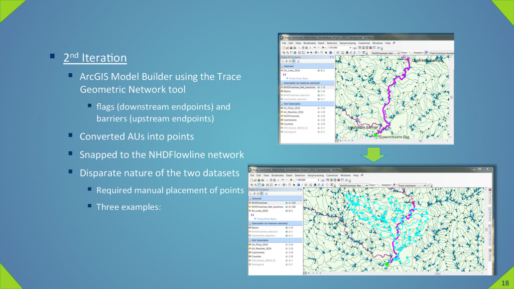
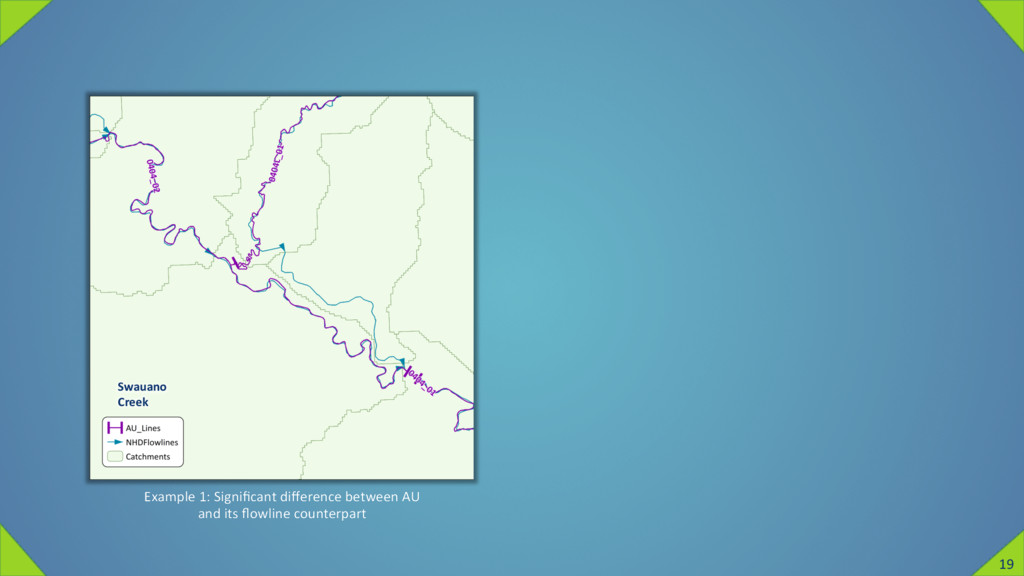
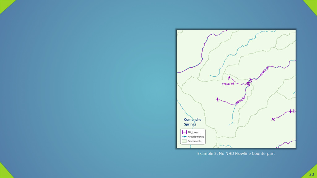
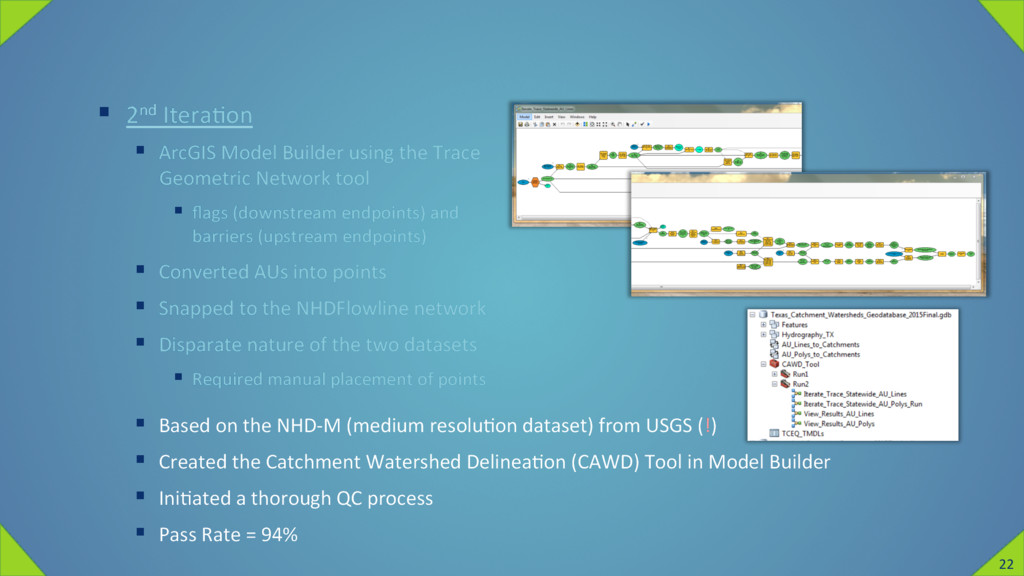
ArcGIS Model Builder using the Trace Geometric Network tool § flags (downstream endpoints) and barriers (upstream endpoints) § Converted AUs into points § Snapped to the NHDFlowline network § Disparate nature of the two datasets § Required manual placement of points § Three examples: 18
Geometric Network tool § flags (downstream endpoints) and barriers (upstream endpoints) § Converted AUs into points § Snapped to the NHDFlowline network § Disparate nature of the two datasets § Required manual placement of points § Based on the NHD-M (medium resoluZon dataset) from USGS (!) § Created the Catchment Watershed DelineaZon (CAWD) Tool in Model Builder § IniZated a thorough QC process § Pass Rate = 94% 22
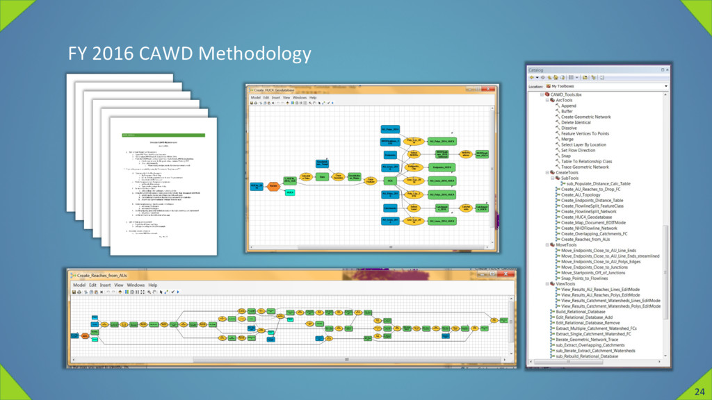
and the QC process § Based on the NHDSnapshot from Horizon Systems CorporaZon (ü) § Incorporated a modified linear-referencing approach § AUs were converted to AU Reaches § Allowed greater degree of control over the output § Pass Rate = 99% § Remaining challenges relate to complex overlapping catchments (generally in coastal areas) § Deliverable includes custom database ediZng tools 23
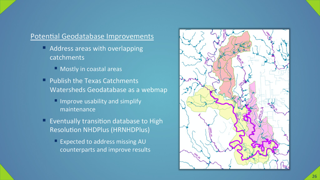
Mostly in coastal areas § Publish the Texas Catchments Watersheds Geodatabase as a webmap § Improve usability and simplify maintenance § Eventually transiZon database to High ResoluZon NHDPlus (HRNHDPlus) § Expected to address missing AU counterparts and improve results 26
Bondelid, Tommy Dewald, Craig Johnston, Richard Moore, and Alan Rea. 2012. "NHDPlus Version 2 User Guide." Accessed Sep 22, 2016. hnp://www.horizon-systems.com/nhdplus/NHDPlusV2_documentaZon.php. o TNRIS. 2016. "TCEQ Assessment Units." Texas Natural Resources Informa,on System. Sept 22. hnps://tnris.org/data-catalog/entry/tceq-assessment-units/. Thank you 28
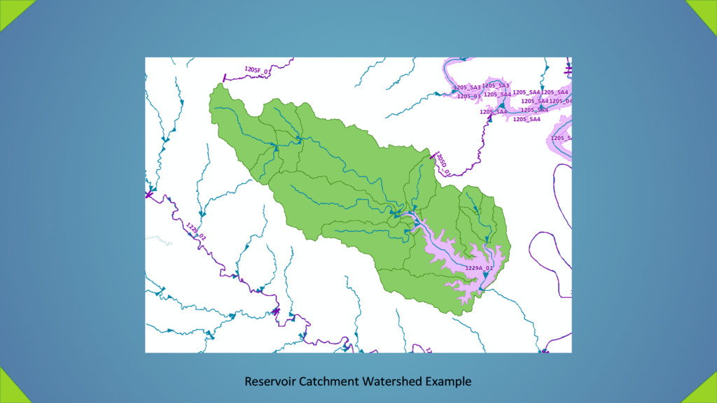
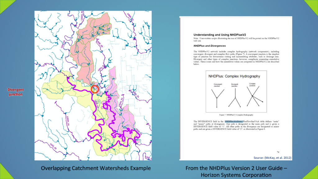
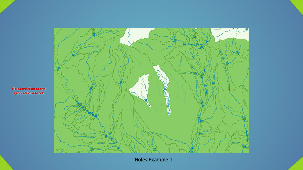
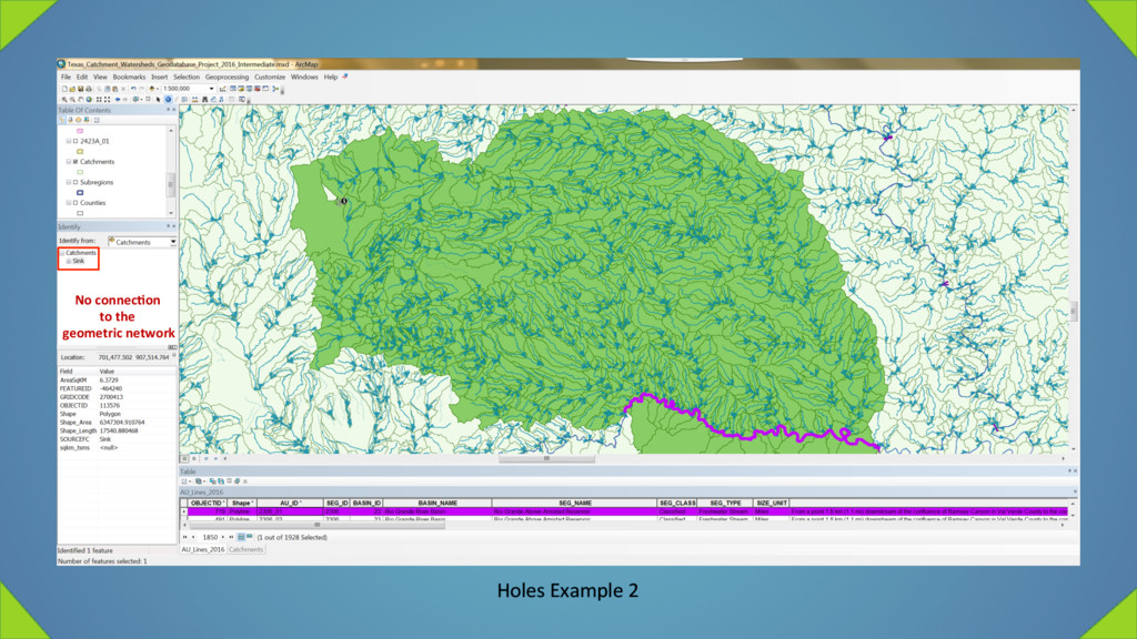
Example of overlapping catchment watersheds § Example of holes resulZng from § flowlines disconnected from the network, and § sinks Source: (McKay, et al. 2012)