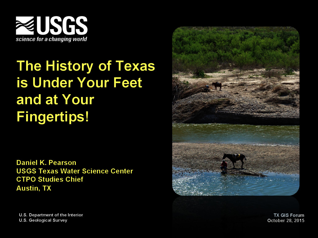
of Texas is Under Your Feet and at Your Fingertips! Daniel K. Pearson USGS Texas Water Science Center CTPO Studies Chief Austin, TX TX GIS Forum October 28, 2015
of Texas (GAT) § Project History § Development Approach § Texas Geology Web Map Viewer § Press Release and Response § Joe Vrabel (USGS), Florence Thompson (USGS), Data and Spatial Studies (USGS), TNRIS, UT-BEG Credits/Acknowledgements
1879 § Six Science Mission Areas § Water Resources § Ecosystems § Energy, Minerals and Environmental Health § Core Science Systems § Climate and Land-Use Change § Natural Hazards § Nationwide about 9,000 employees § Conduct interdisciplinary scientific monitoring, assessment, and research… distribute that information to the public
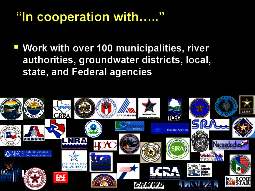
achieve the best use and management of the Nation’s water resources. USGS accomplishes this mission in cooperation with State, Local, and Other Federal Agencies. Water Resources Mission –
data custodian § Strategic Mapping Program established in 1997 by Senate Bill 1 to develop consistent statewide digital data layers § Geology was not one of the core layers, but the GIS Community in Texas realized the need § …and so it was in the early days
Project was first cited in the 1961 UT-BEG Annual Report § 38 GAT hardcopy map sheets in the series – 1:250,000 § Production involved the work of 28 geologists from UT-BEG and collaboration with other agencies, seven cartographers, and several editors § The last GAT sheet was published in 1987, map sheets remain best seller from UT-BEG
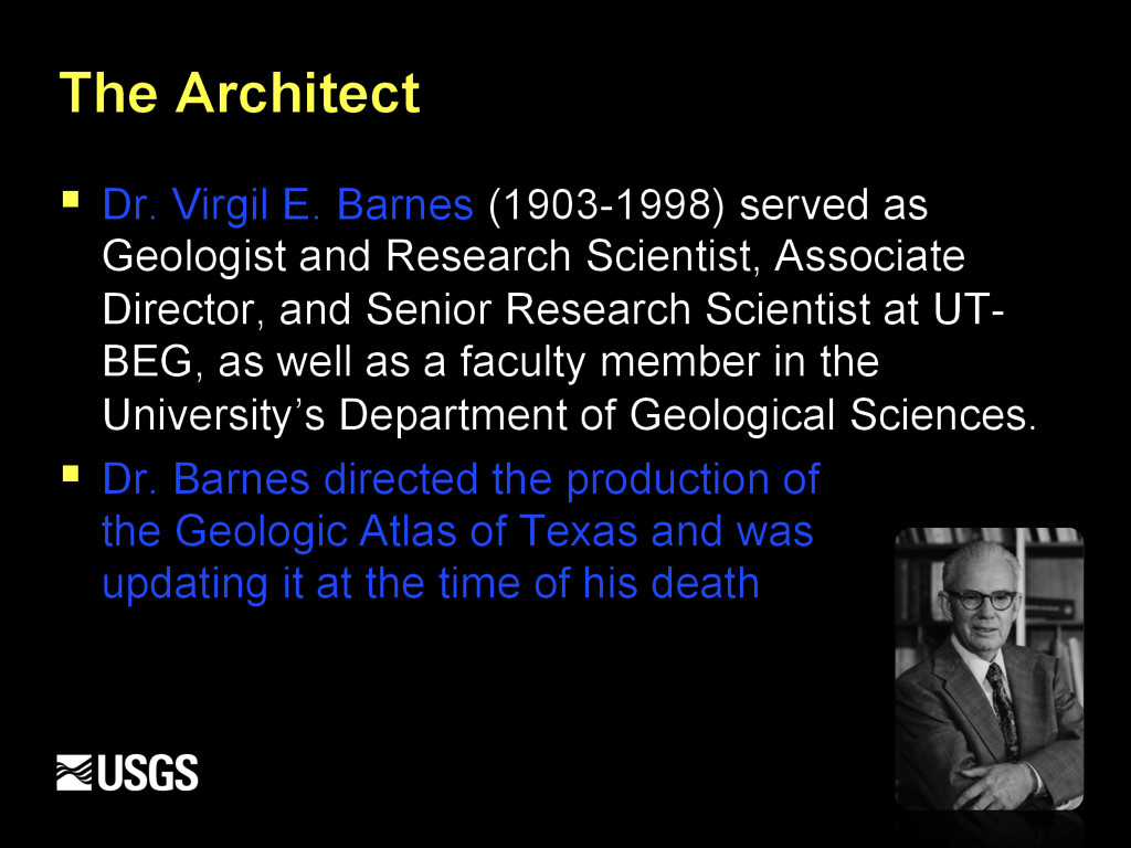
Geologist and Research Scientist, Associate Director, and Senior Research Scientist at UT- BEG, as well as a faculty member in the University’s Department of Geological Sciences. § Dr. Barnes directed the production of the Geologic Atlas of Texas and was updating it at the time of his death
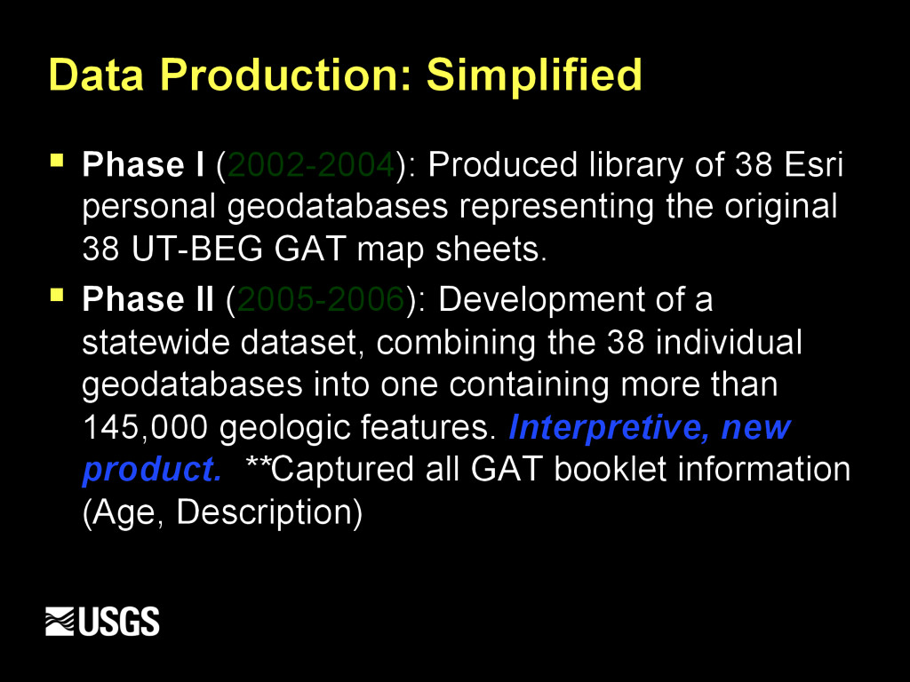
Survey, in cooperation with the Texas Water Development Board (TWDB/TNRIS), began development of a simple geodatabase model to capture the power of these data.
38 Esri personal geodatabases representing the original 38 UT-BEG GAT map sheets. § Phase II (2005-2006): Development of a statewide dataset, combining the 38 individual geodatabases into one containing more than 145,000 geologic features. Interpretive, new product. **Captured all GAT booklet information (Age, Description)
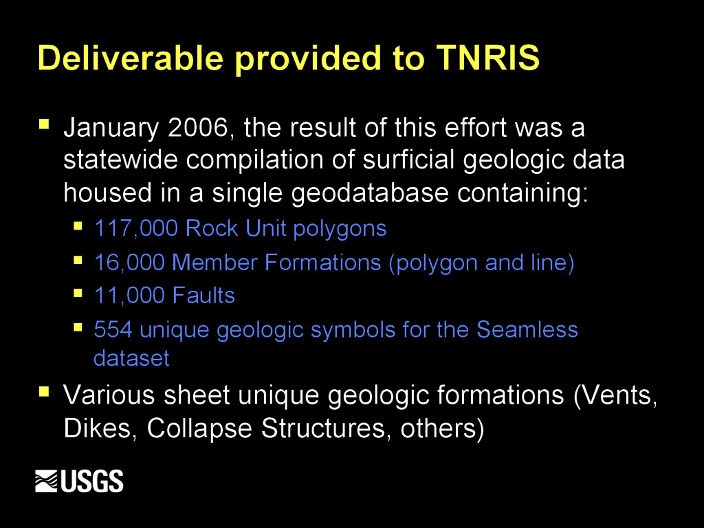
this effort was a statewide compilation of surficial geologic data housed in a single geodatabase containing: § 117,000 Rock Unit polygons § 16,000 Member Formations (polygon and line) § 11,000 Faults § 554 unique geologic symbols for the Seamless dataset § Various sheet unique geologic formations (Vents, Dikes, Collapse Structures, others)
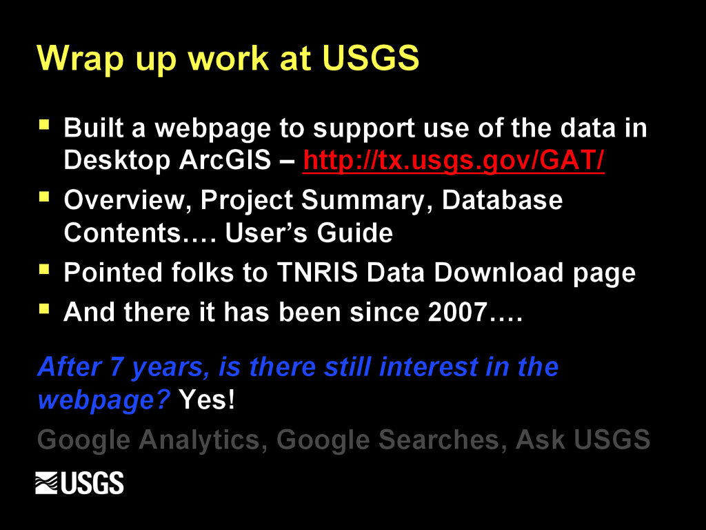
support use of the data in Desktop ArcGIS – http://tx.usgs.gov/GAT/ § Overview, Project Summary, Database Contents…. User’s Guide § Pointed folks to TNRIS Data Download page § And there it has been since 2007…. After 7 years, is there still interest in the webpage? Yes! Google Analytics, Google Searches, Ask USGS
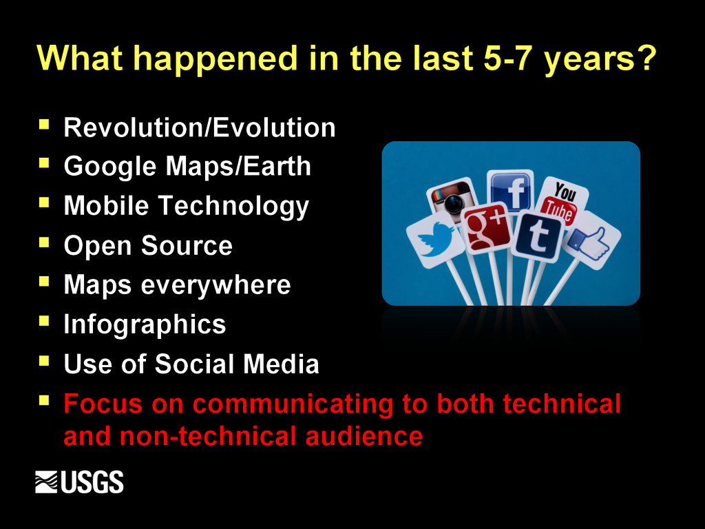
Google Maps/Earth § Mobile Technology § Open Source § Maps everywhere § Infographics § Use of Social Media § Focus on communicating to both technical and non-technical audience
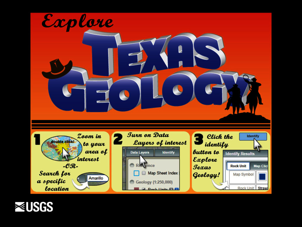
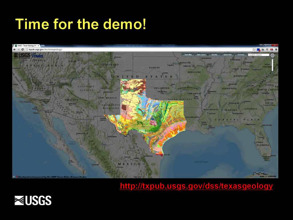
have slowly transitioned from data production shop to web visualization and geospatial analysis § Focused on simplifying our science for public consumption § “Simple, clean and modern” § Why not build a click and point web application to explore the Geology of Texas?
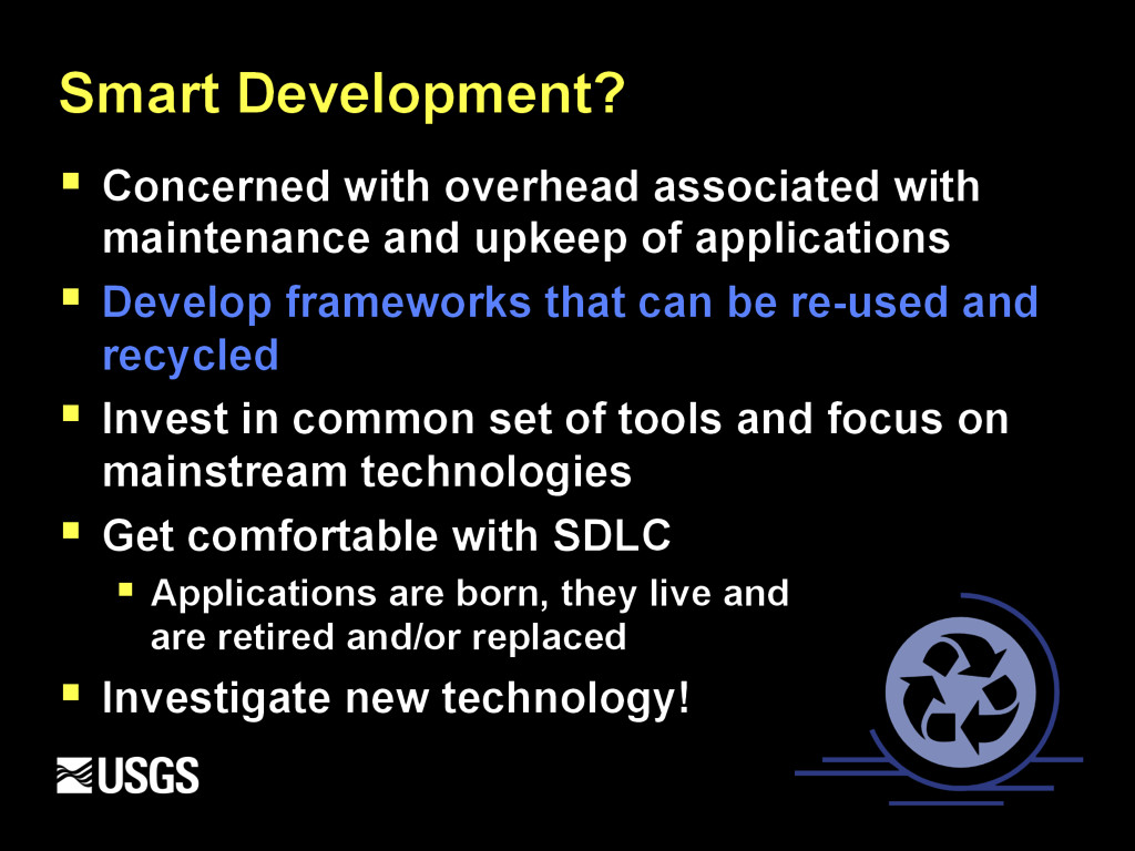
upkeep of applications § Develop frameworks that can be re-used and recycled § Invest in common set of tools and focus on mainstream technologies § Get comfortable with SDLC § Applications are born, they live and are retired and/or replaced § Investigate new technology!
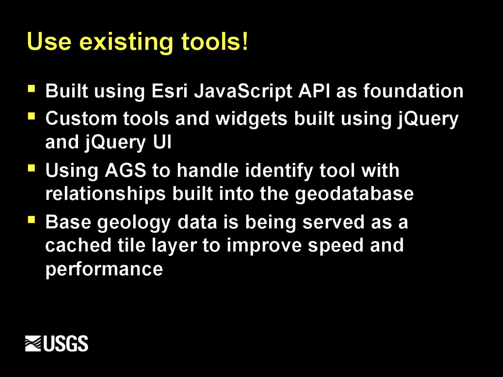
foundation § Custom tools and widgets built using jQuery and jQuery UI § Using AGS to handle identify tool with relationships built into the geodatabase § Base geology data is being served as a cached tile layer to improve speed and performance
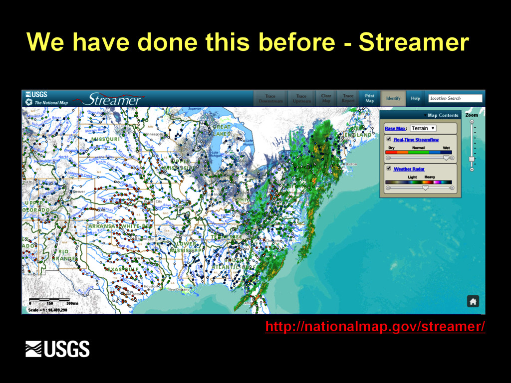
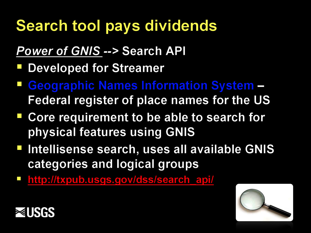
§ Developed for Streamer § Geographic Names Information System – Federal register of place names for the US § Core requirement to be able to search for physical features using GNIS § Intellisense search, uses all available GNIS categories and logical groups § http://txpub.usgs.gov/dss/search_api/
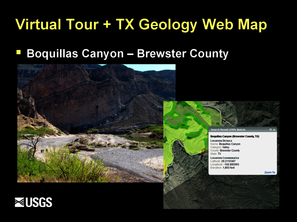
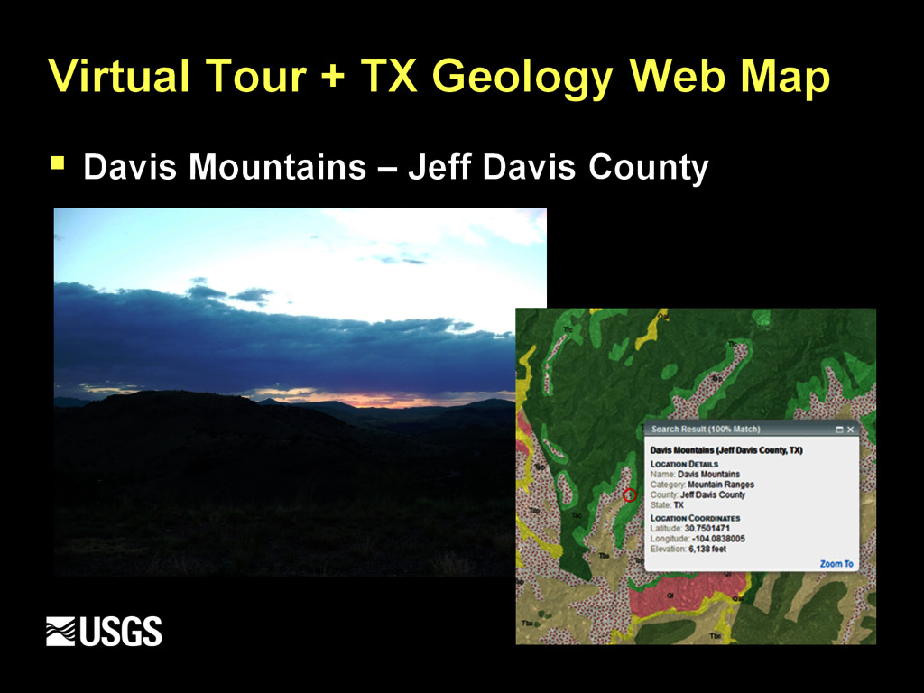
then you might want to see it too! § Panoramio Widget API lets you display the photos from Panoramio on your own web site § Geolocated photos from Panoramio are great to enrich your maps or illustrate information where location is an important factor § So… we added the QC’d library of landscape photos into the application
resolution available § Audience – General Public, K-12, Universities, Industry, Natural Resource Developers, more § To be able to provide baseline descriptions about surface geology and rock age via web browser in one-stop-shop § Share the “Story of Texas Geology”
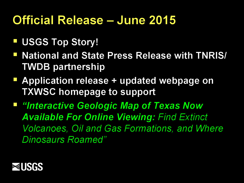
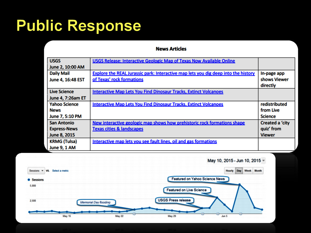
National and State Press Release with TNRIS/ TWDB partnership § Application release + updated webpage on TXWSC homepage to support § “Interactive Geologic Map of Texas Now Available For Online Viewing: Find Extinct Volcanoes, Oil and Gas Formations, and Where Dinosaurs Roamed”
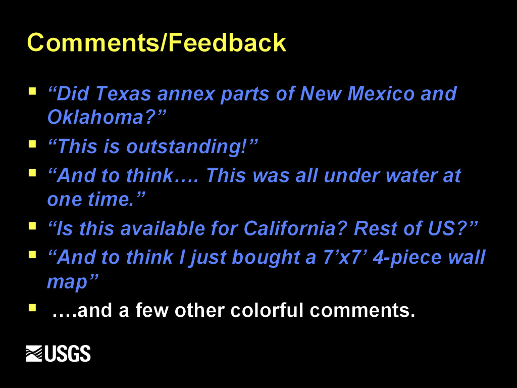
Oklahoma?” § “This is outstanding!” § “And to think…. This was all under water at one time.” § “Is this available for California? Rest of US?” § “And to think I just bought a 7’x7’ 4-piece wall map” § ….and a few other colorful comments.
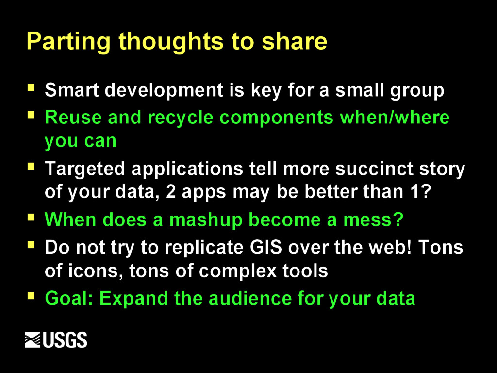
a small group § Reuse and recycle components when/where you can § Targeted applications tell more succinct story of your data, 2 apps may be better than 1? § When does a mashup become a mess? § Do not try to replicate GIS over the web! Tons of icons, tons of complex tools § Goal: Expand the audience for your data