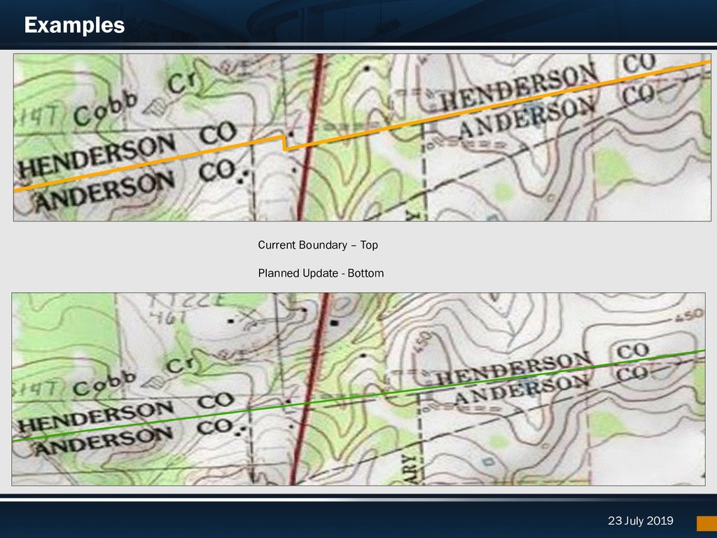
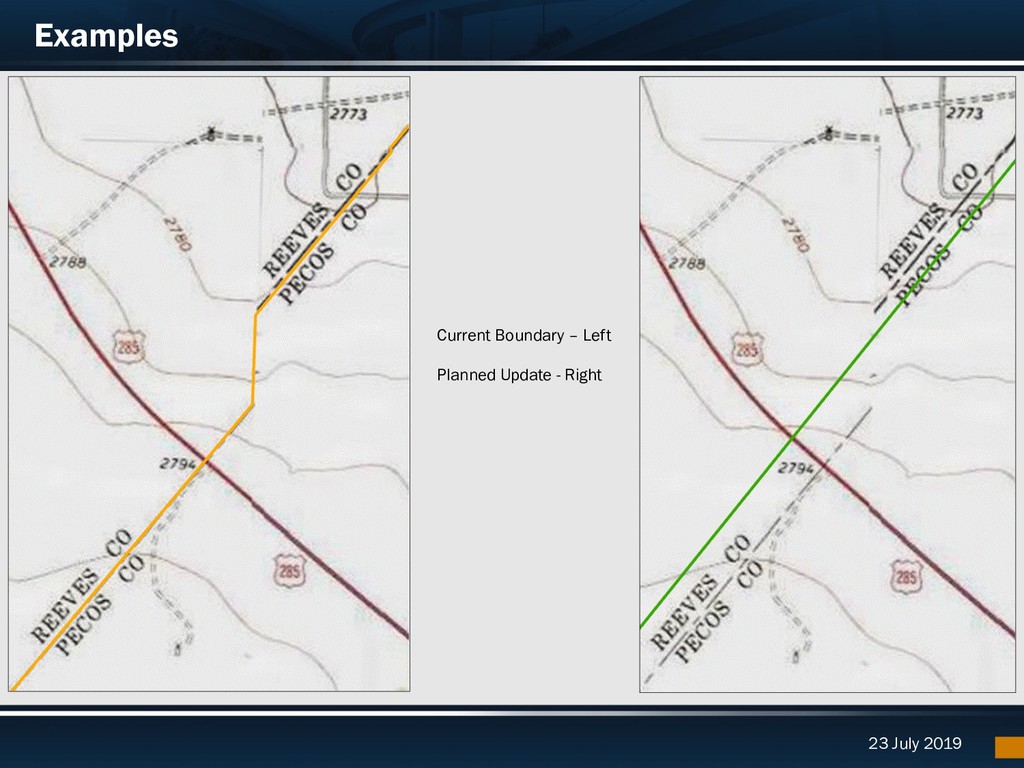
Quad, Original Texas Land Survey (OTLS), and Tiger Line file § Identify secondary layers impacted by the change – MPO, MSA, UZA, Cities, COG, Roadways, TxDOT Districts
released in August of 2019 – Available via the TxDOT Open Data Portal and TxDOT.gov – First TxDOT Network with routing capabilities § County Boundary Update Point Layer on AGO – We published a point layer where modifications will be made. You can review to gauge impact to your operations. – Update Point Layer on AGO § Drive Texas Data (highway conditions) available via API: – http://api.drivetexas.org/
Director of Data Management TxDOT – Transportation Planning and Programming Division 512.486.5054 [email protected] Helpful links: Statewide Planning Map | Project Tracker | Open Data Portal | Annual Reports