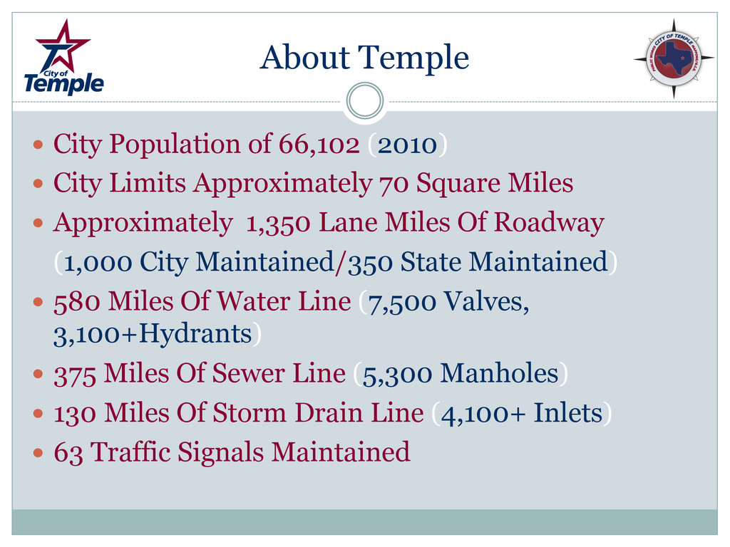
Limits Approximately 70 Square Miles Approximately 1,350 Lane Miles Of Roadway (1,000 City Maintained/350 State Maintained) 580 Miles Of Water Line (7,500 Valves, 3,100+Hydrants) 375 Miles Of Sewer Line (5,300 Manholes) 130 Miles Of Storm Drain Line (4,100+ Inlets) 63 Traffic Signals Maintained
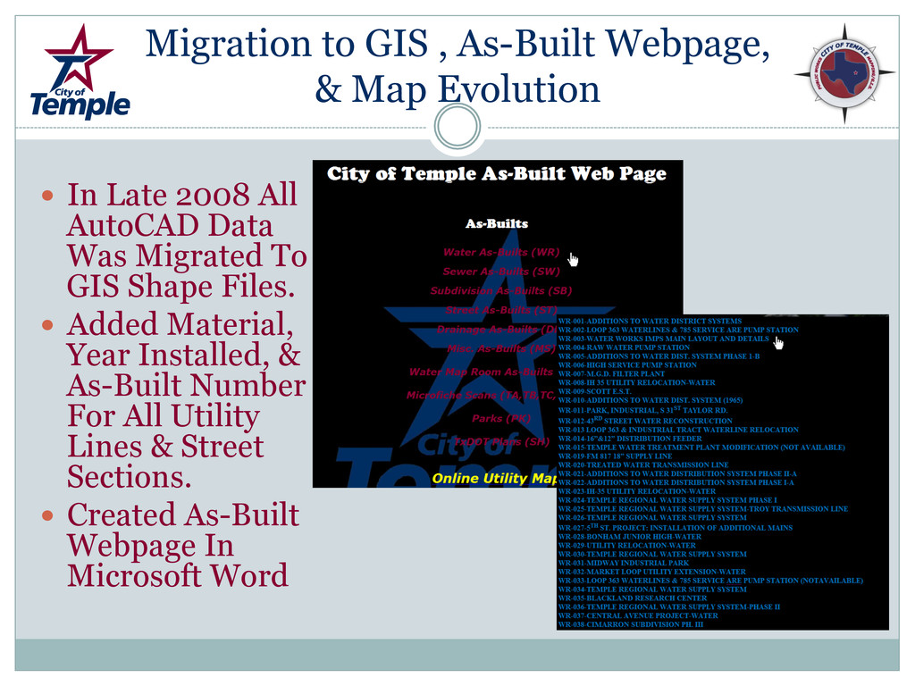
In Late 2008 All AutoCAD Data Was Migrated To GIS Shape Files. Added Material, Year Installed, & As-Built Number For All Utility Lines & Street Sections. Created As-Built Webpage In Microsoft Word
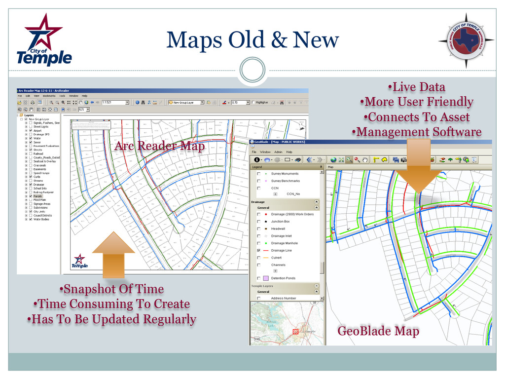
Created ArcReader Maps That Were Department Specific (Streets, Drainage, Engineering, Etc) Problem With ArcReader Was These Were Only Snapshot Of Data At Time Of Creation. In 2012 Moved To Online Maps So Data Viewed Is Real-Time. Most Prominent Online Map Used Is GeoBlade Due To Its Compatibility With HTE Asset Management Software.
GPS Purchased (Not To Be Confused With The Illudium Q-36 Explosive Space Modulator!) Since January 2012 500 Signs Have Been GPS’d. All Signs That Are Replaced Are GPS’d.
Is GPS’d. Spreadsheet Is Converted Into Shape File For GIS Records. Shape File Is Converted Into Google Earth File For Viewing By Streets Director To Keep Track Of Progress.
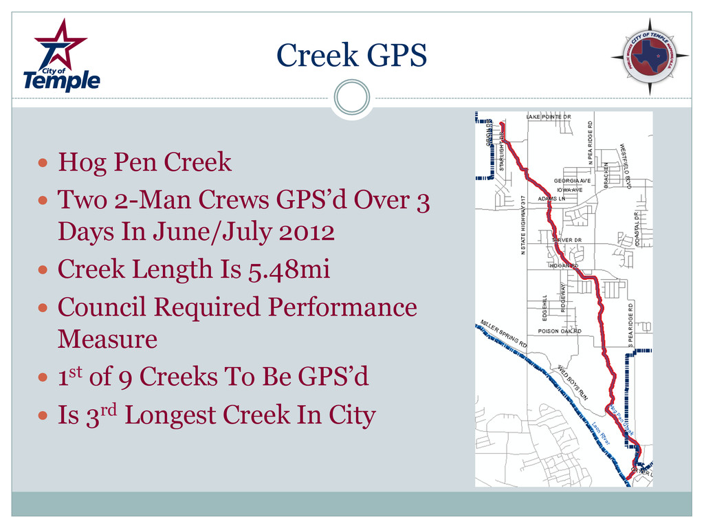
GPS’d Over 3 Days In June/July 2012 Creek Length Is 5.48mi Council Required Performance Measure 1st of 9 Creeks To Be GPS’d Is 3rd Longest Creek In City
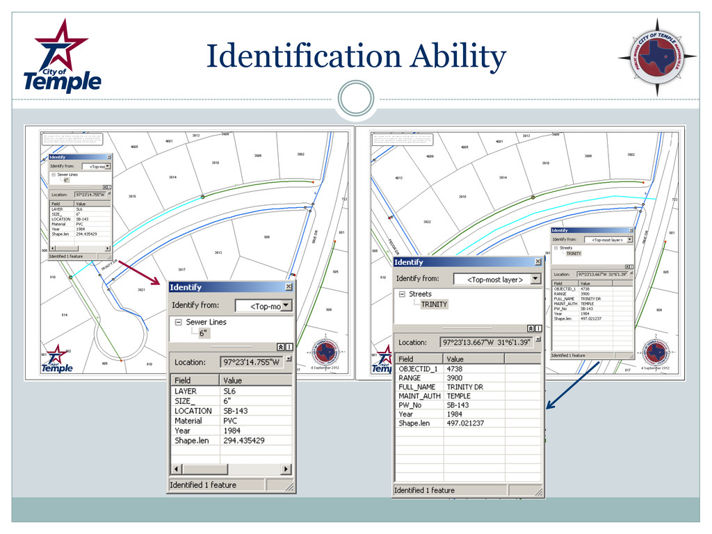
Inventory Ability Tracking Water Leaks, Sewer Overflows & Rain Event I&I’s Ability To See Line Size, Material, & Year Ability To View Map Data In Field & Pull Up As- Builts Without Need To Come Into Office GPS’d Hydrants, Valves, & Dead-End Mains Office Staff Has The Ability To Make Their Own Maps For Utility Locates
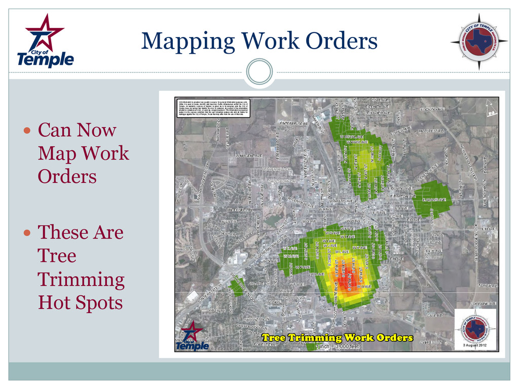
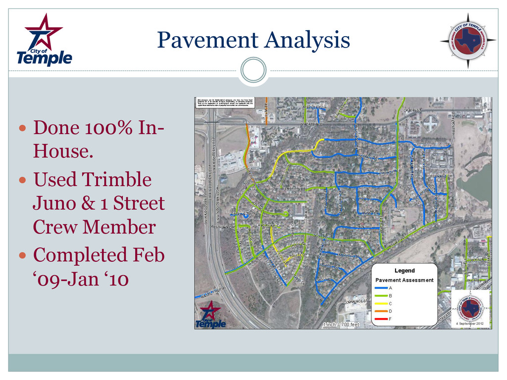
All Sealcoats & Overlays from 1999-Current GPS’d Storm Drain Inlets & School Zones Foremen Can Look Up ROW Width /Easement Info Without Help From GIS Personnel Conducted Pavement Assessment Pavement Assessment Led To Addition Of Cracksealing Crew Now Have A Long-Range Plan Of Capital Improvements/Additions To City Streets
![Presenters Kenny Henderson-Director of Streets [email protected] Thomas Brown-Director Of Distribution](https://files.speakerdeck.com/presentations/5089855f60167a0002007c0c/slide_20.jpg)