Upgrade to Pro — share decks privately, control downloads, hide ads and more …

Time Travel: Mapping Dinosaur Trackways in Arkansas by Malcolm Williamson and Jack Cothren

Time Travel: Mapping Dinosaur Trackways in Arkansas by Malcolm Williamson and Jack Cothren

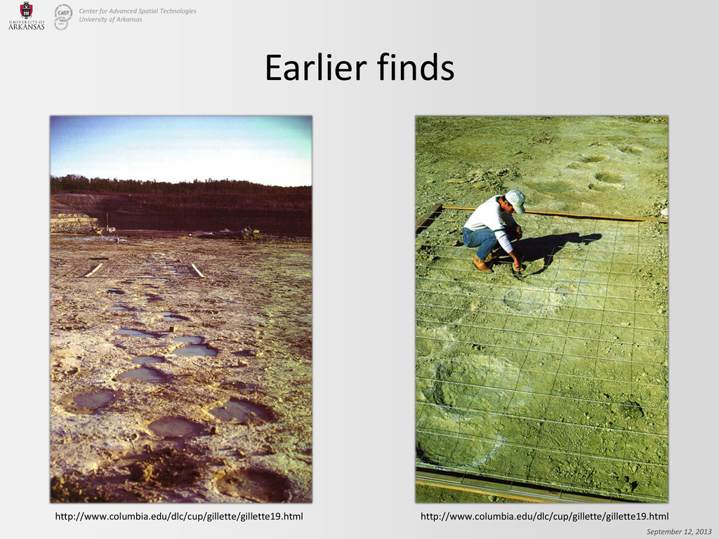
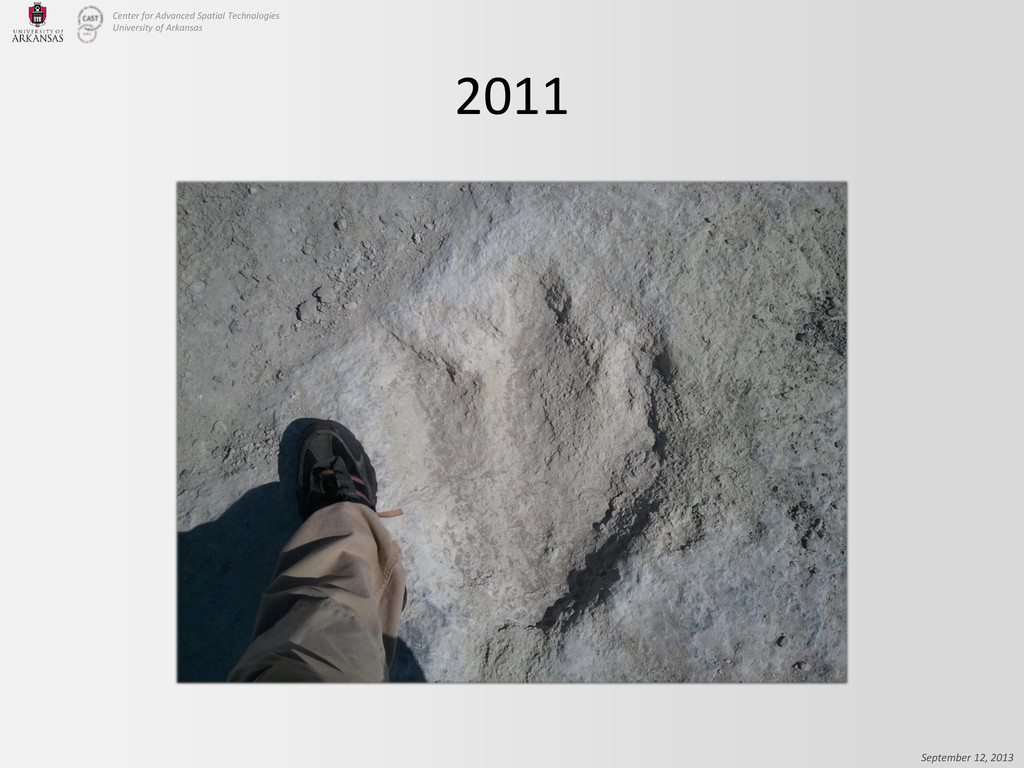
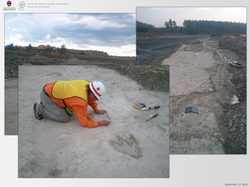
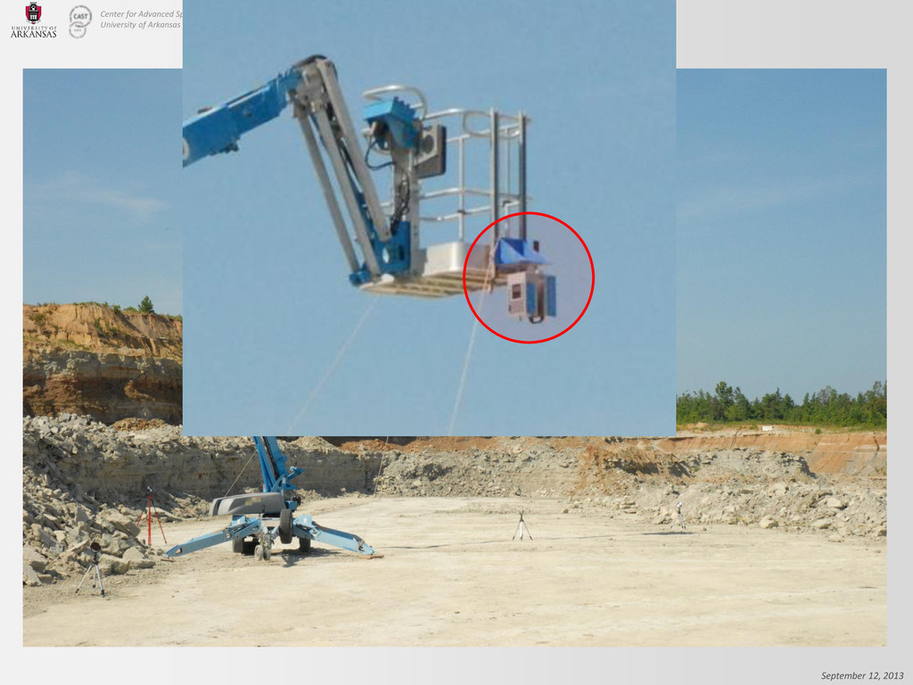
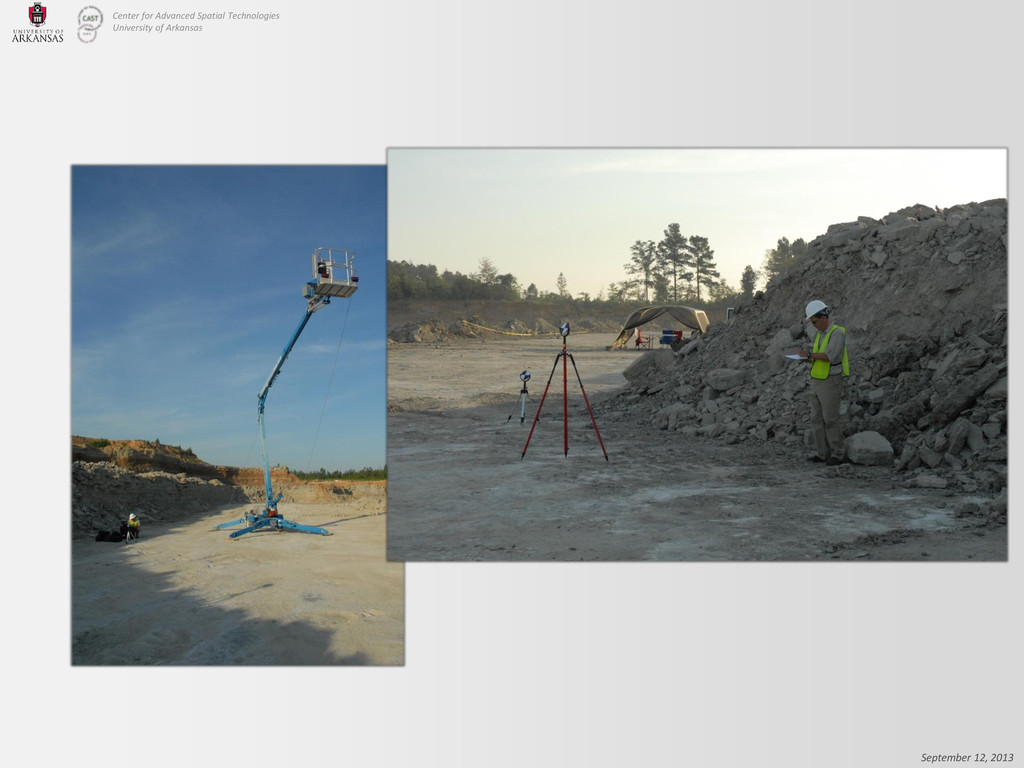
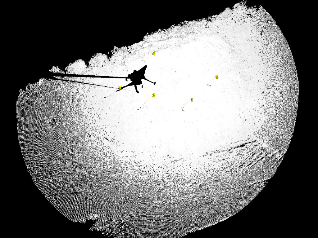
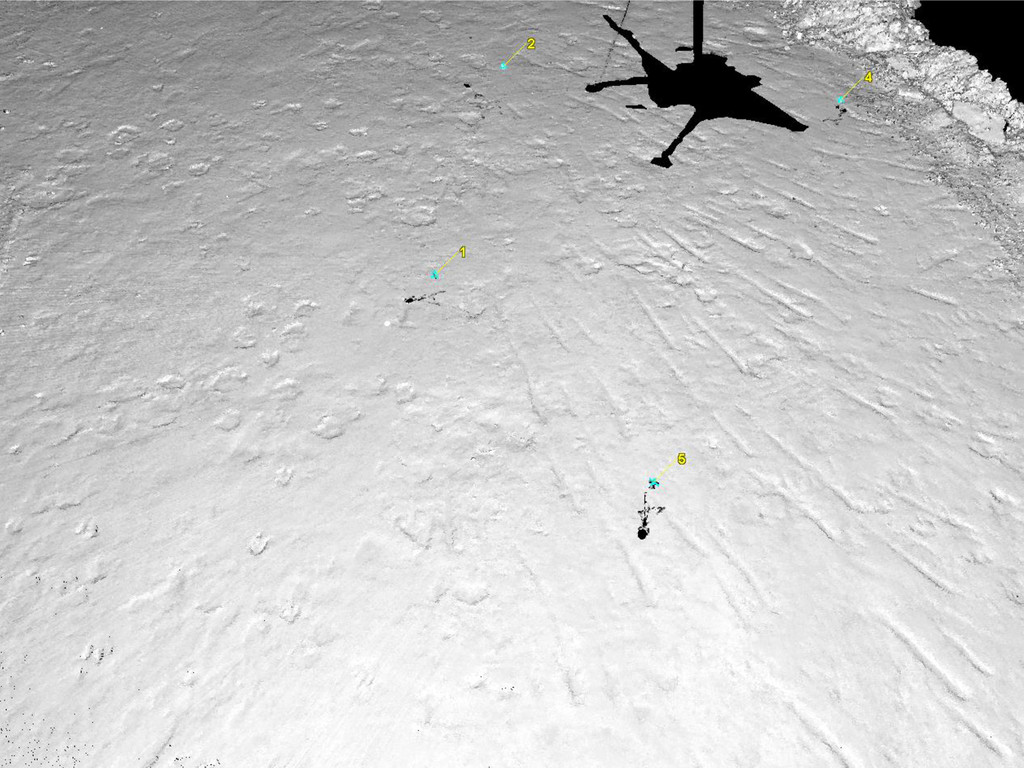
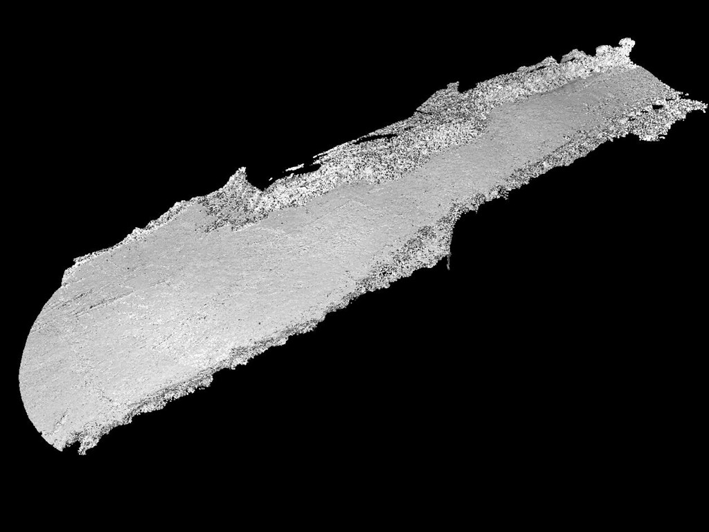
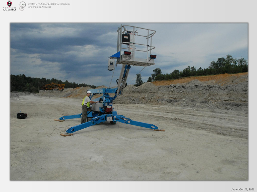
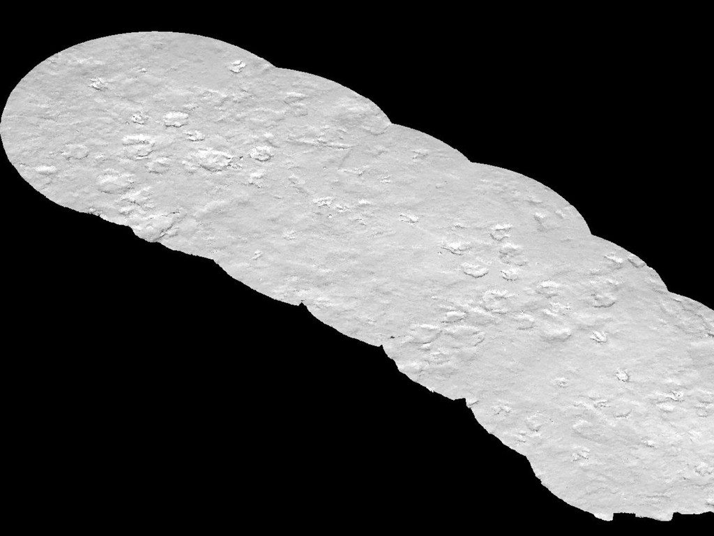
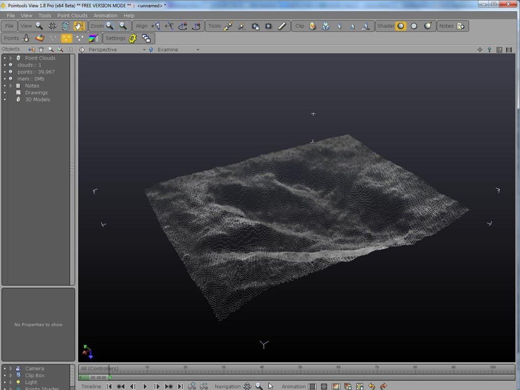
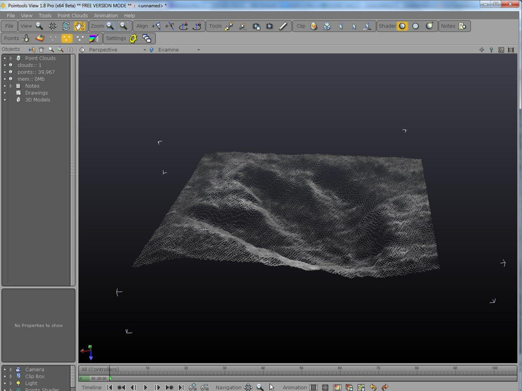
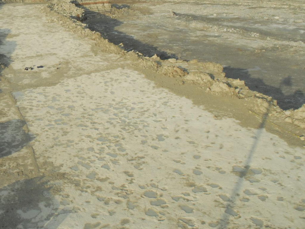
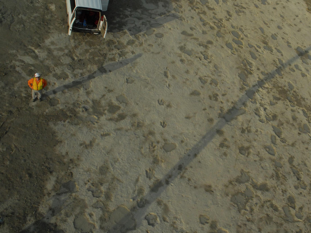
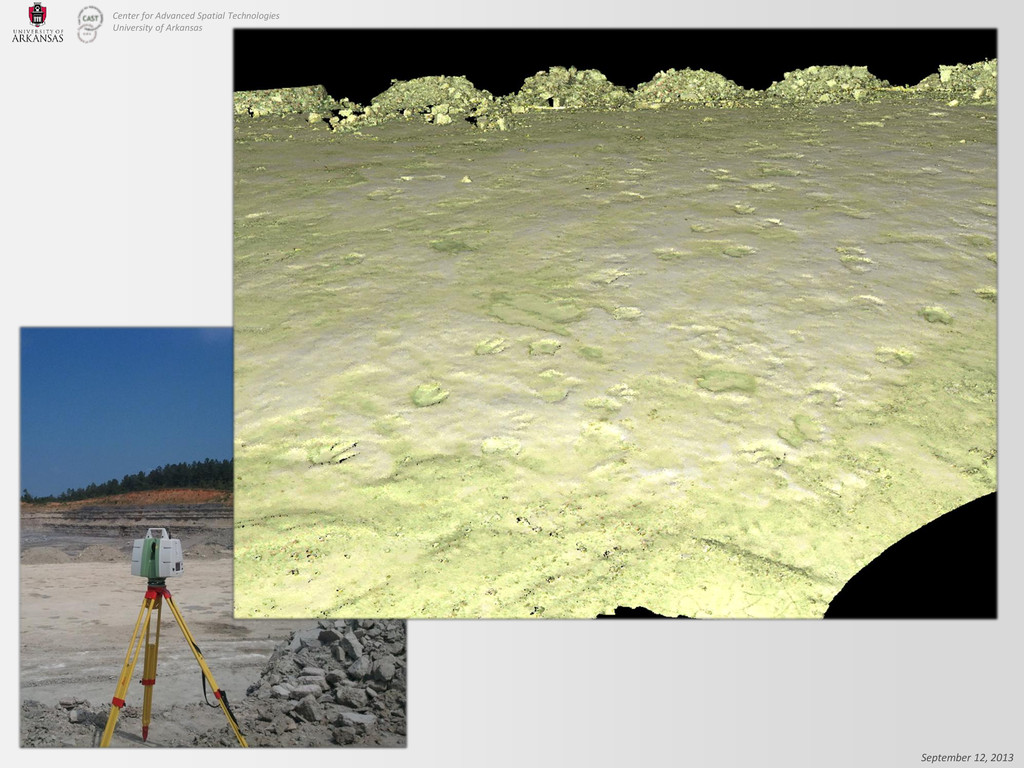
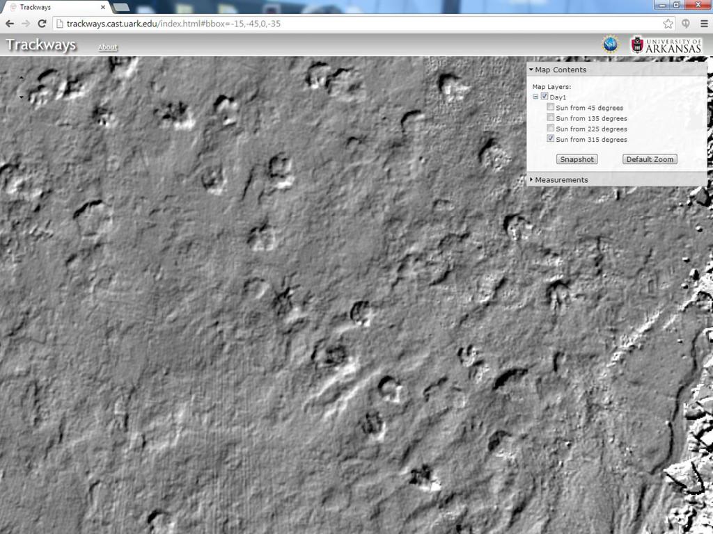
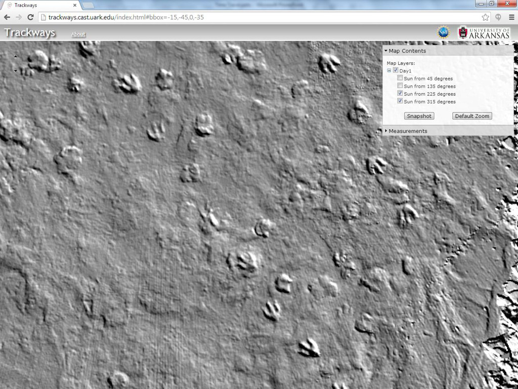
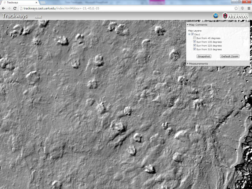
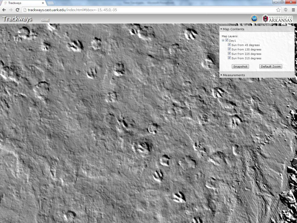
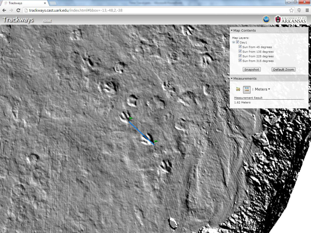
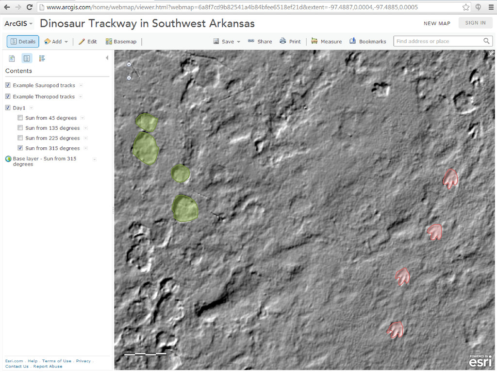
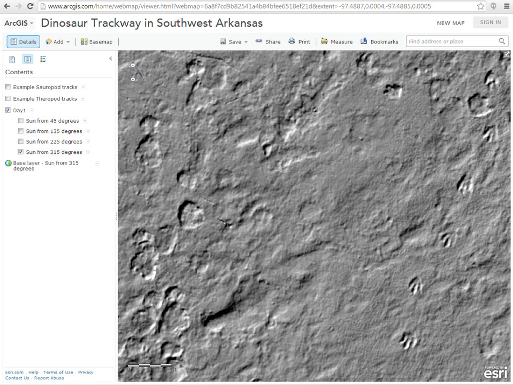
In the hottest part of the summer of 2011, a team from University of Arkansas and the University of Kansas made an intense effort to document a spectacular dinosaur track site discovered in southwest Arkansas. With hundreds of footprints, covering a site the size of two football fields, the team quickly realized that a creative solution was needed to be able to record as much as possible in the short window of site access that had been granted. Team members from CAST brought a pair of terrestrial LiDAR systems and a 50-foot manlift, enabling data capture of the entire site from overhead. By processing the data as if it were airborne LiDAR, a very high-resolution DEM and hillshade layers were created. Finally, an ArcGIS for Server web mapping site was built to allow everyone to view, measure, and analyze the data.

More Decks by Arkansas GIS Users Forum Conference

Other Decks in Science

Transcript

  1. Center for Advanced Spatial Technologies University of Arkansas September 12,

    2013 Time Travel: Mapping Dinosaur Trackways in Arkansas Malcolm Williamson1 Jackson Cothren1 Stephen Boss2 Brian Platt3 Celina Suarez2 1CAST – Univ. of Arkansas 2Dept. Of Geosciences, Univ. of Arkansas 3Dept. Of Geology and Geological Engineering, Univ. of Mississippi http://www.youtube.com/watch?v=93B072j-E3I
  2. Center for Advanced Spatial Technologies University of Arkansas September 12,

    2013 A long, long time ago… http://www.geology.ar.gov/education/gulf_coastal_plain.htm
  3. Center for Advanced Spatial Technologies University of Arkansas September 12,

    2013 A long, long time ago… http://www.columbia.edu/dlc/cup/gillette/gillette19ab.gif
  4. Center for Advanced Spatial Technologies University of Arkansas September 12,

    2013 Earlier finds http://www.columbia.edu/dlc/cup/gillette/gillette19.html http://www.columbia.edu/dlc/cup/gillette/gillette19.html
  5. Center for Advanced Spatial Technologies University of Arkansas September 12,

    2013 “I’m not sure how well this plan was thought through…” http://www.youtube.com/watch?v=93B072j-E3I
  6. Center for Advanced Spatial Technologies University of Arkansas September 12,

    2013 The challenge: how to share the data • Very large files – Streaming not an option • Limited choice of free viewers • Lighting direction has huge effect on visibility of tracks
  7. Center for Advanced Spatial Technologies University of Arkansas September 12,

    2013 The solution: GIS! • Convert terrestrial point clouds to LAS format, then rasterize (LAStools) – Tricky because of varying point density • Generate series of “hillshade”maps with different sun azimuth values (ArcGIS Desktop) • Create map services (ArcGIS for Server) • Consume services in a web app and an ArcGIS Online map
  8. Center for Advanced Spatial Technologies University of Arkansas September 12,

    2013 URLs • http://trackways.cast.uark.edu • http://bit.ly/19jDQMy (shortcut to ArcGIS Online map)
  9. Center for Advanced Spatial Technologies University of Arkansas September 12,

    2013 Acknowledgments • Many thanks to Steve Boss and Brian Platt. • This project was supported by a grant from the National Science Foundation, Award No. 1143968 with additional support from the University of Arkansas Fulbright College of Arts & Sciences and University of Arkansas Office of Research and Economic Development.