Upgrade to Pro — share decks privately, control downloads, hide ads and more …

SOC 4650 & SOC 5650 - Lecture 13

SOC 4650 & SOC 5650 - Lecture 13

Slides for Lecture 13 of the Saint Louis University Course Introduction to GIS. These slides introduce concepts related to geoprocessing data, including merging, intersecting, and unioning features.

Christopher Prener

April 23, 2018
Tweet

More Decks by Christopher Prener

Other Decks in Education

Transcript

  1. AGENDA 1. Front Matter 2. Merging Features 3. Intersects 4.

    Unions INTRO TO GISC / WEEK 13 / LECTURE 13
  2. Due Next Lecture: Lab-12 (from today), PS-05 (from last week)

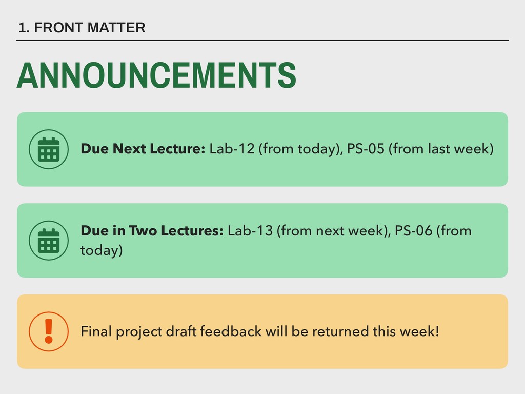
    1. FRONT MATTER ANNOUNCEMENTS Due in Two Lectures: Lab-13 (from next week), PS-06 (from today) Final project draft feedback will be returned this week!
  3. KEY TERM A merge combines 
 features from two distinct


    feature classes (from a 
 geodatabase) or shapefiles.
  4. MERGE (CONCEPTUAL) Input Dataset 104 105 106 107 ID Shape

    Type 104 Point A 105 Point A 106 Point A 107 Point A
  5. MERGE (CONCEPTUAL) Input Dataset ID Shape Type 104 Point A

    105 Point A 106 Point A 107 Point A 204 205 206 207 ID Shape Type 204 Point B 205 Point B 206 Point B 207 Point B
  6. MERGE (CONCEPTUAL) Input Datasets ID Shape Type 104 Point A

    105 Point A 106 Point A 107 Point A 104 105 106 107 ID Shape Type 204 Point B 205 Point B 206 Point B 207 Point B 204 205 206 207
  7. MERGE (CONCEPTUAL) Output Dataset ID Shape Type 104 Point A

    105 Point A 106 Point A 107 Point A 204 Point B 205 Point B 206 Point B 207 Point B 104 105 106 107 204 205 206 207
  8. ▸ Will allow features to overlap each other, which may

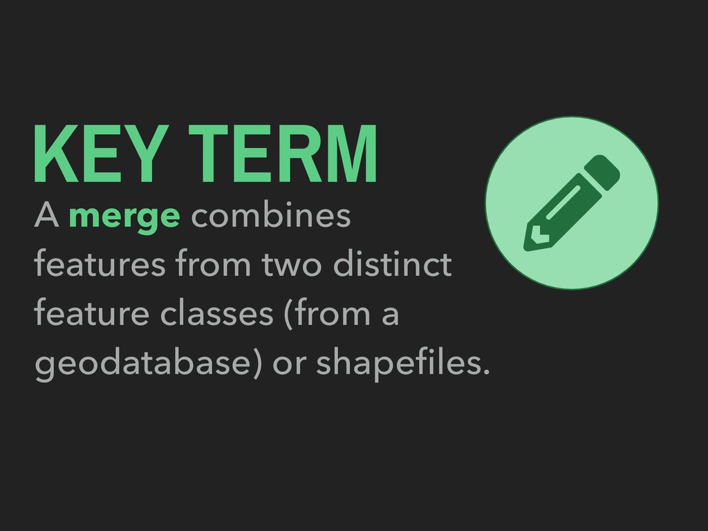
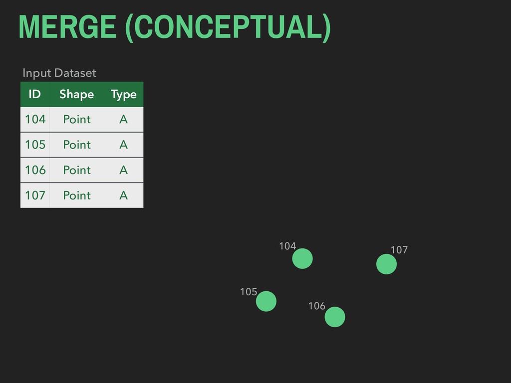
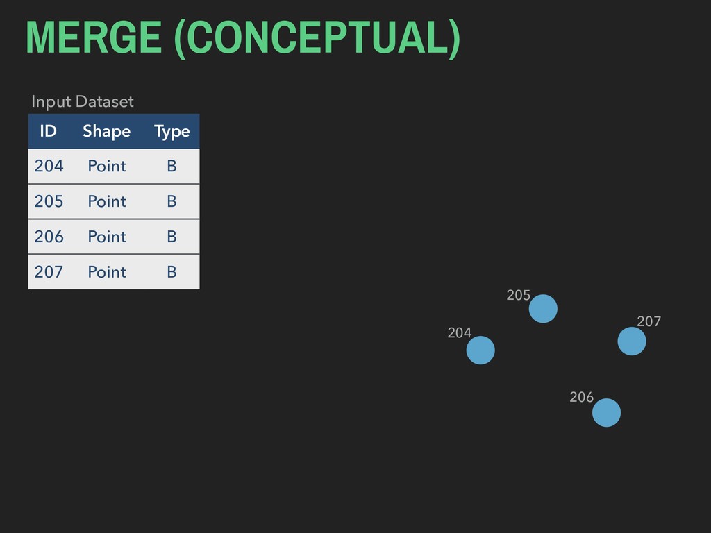
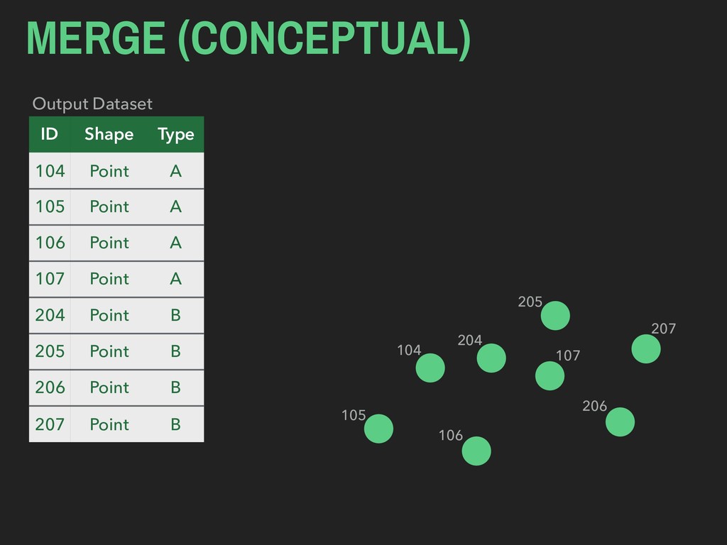
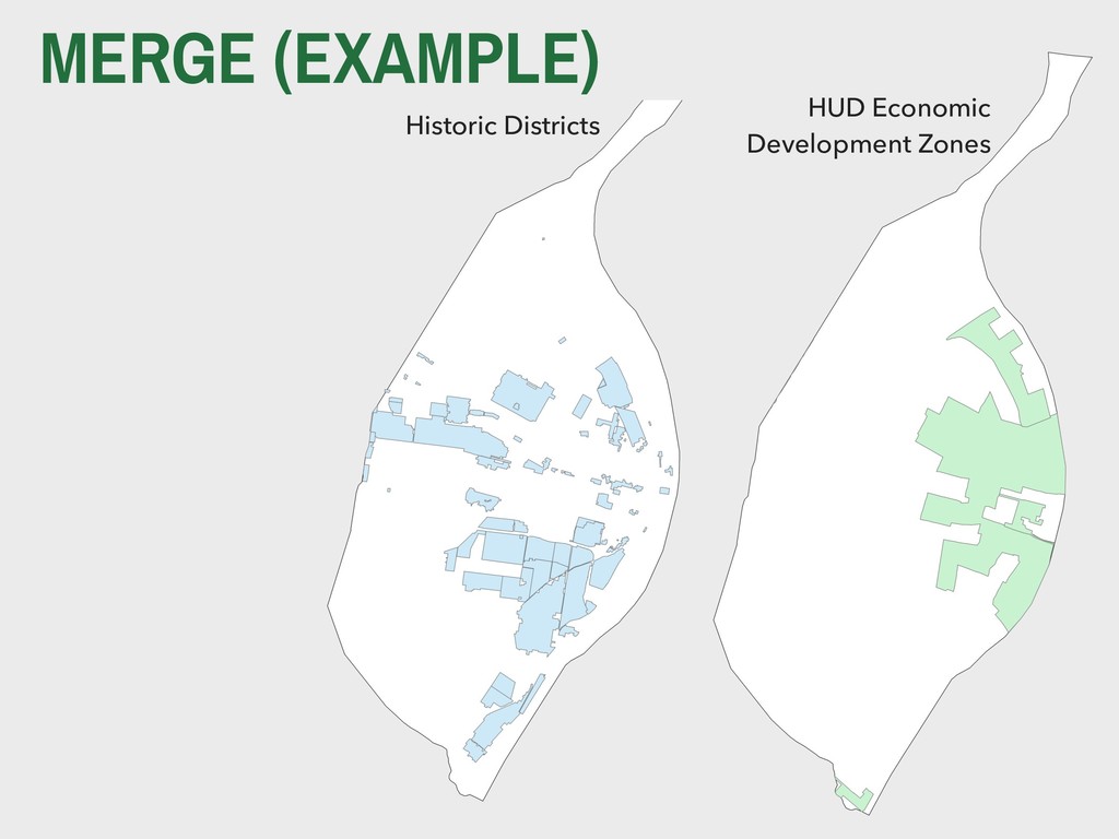
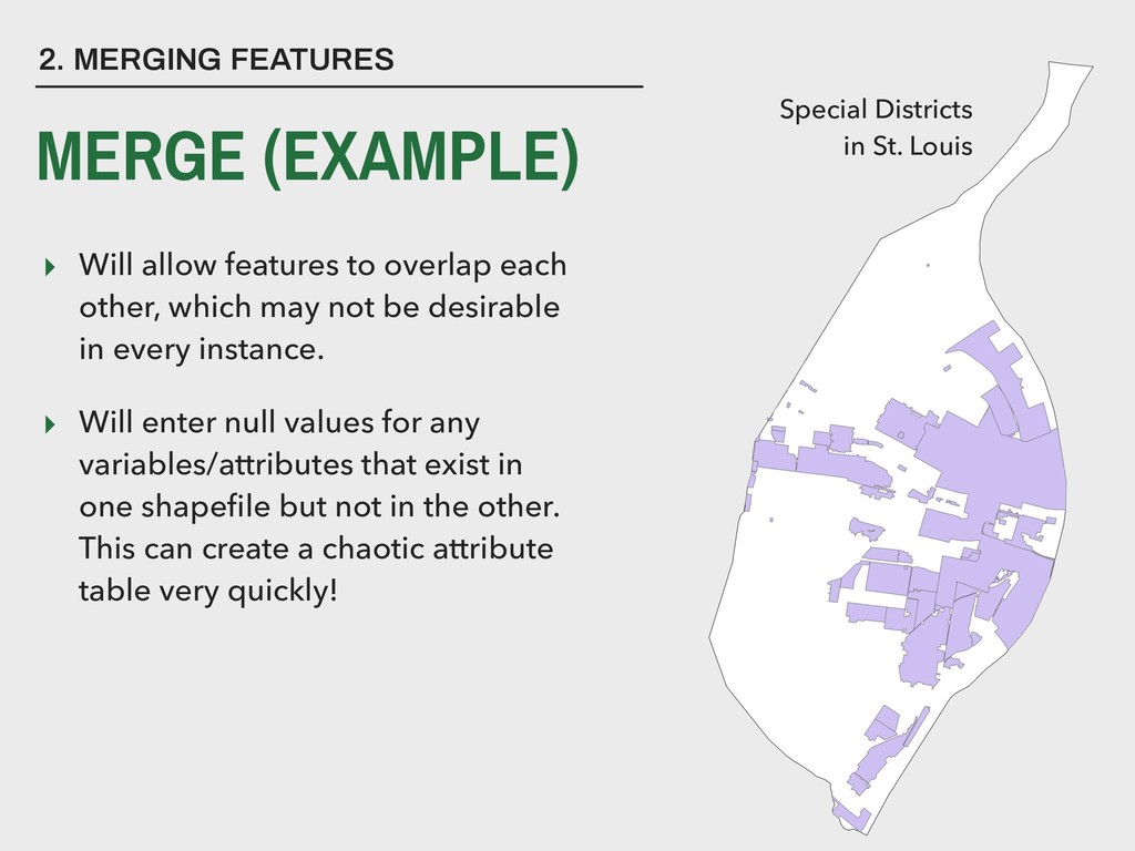
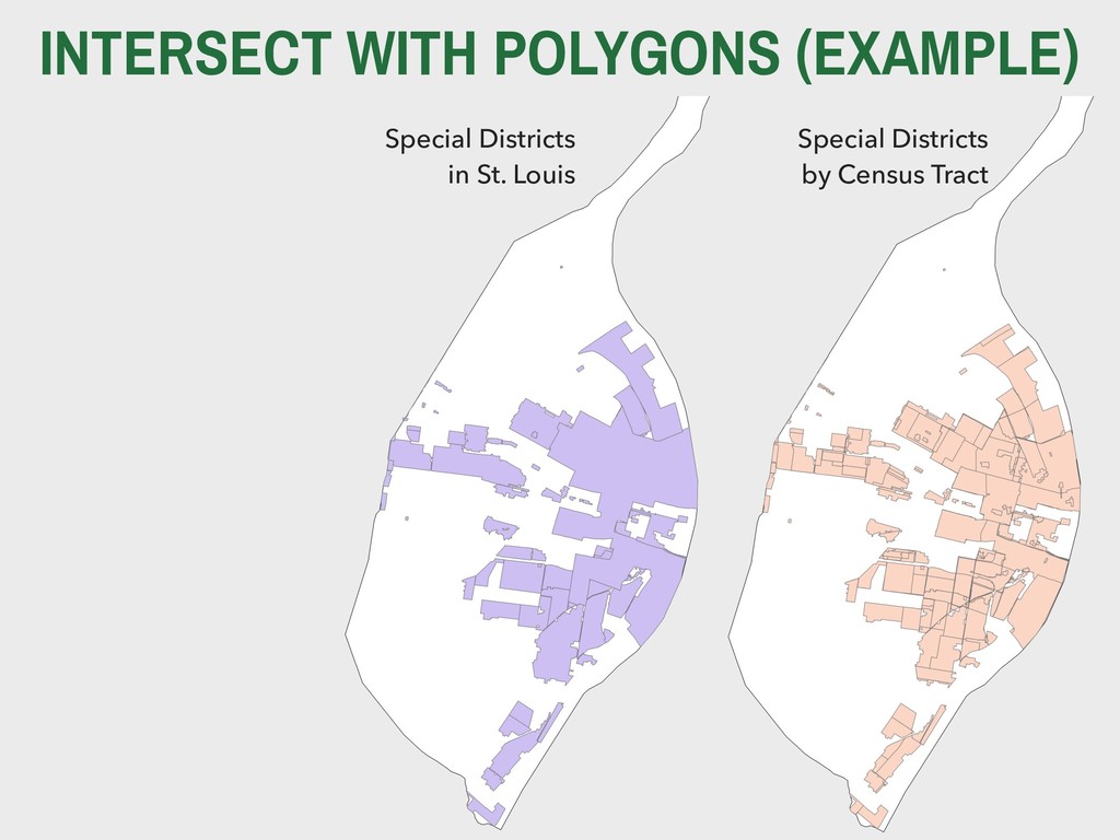
    not be desirable in every instance. ▸ Will enter null values for any variables/attributes that exist in one shapefile but not in the other. This can create a chaotic attribute table very quickly! 2. MERGING FEATURES Special Districts
 in St. Louis MERGE (EXAMPLE)
  9. ▸ “A intersect B” … ▸ … means “both A

    and B” ▸ In other words, the area of overlap between A and B 3. INTERSECTS INTERSECT IN PROBABILITY THEORY B A∩B A
  10. KEY TERM An intersect is used to 
 combine both

    the geometry 
 and the attributes (variables) 
 for overlapping features.
  11. INTERSECT WITH POINTS (CONCEPTUAL) Input Features ID Shape Type 104

    Point A 105 Point B 106 Point A 107 Point B 104 105 106 107
  12. INTERSECT WITH POINTS (CONCEPTUAL) Input Features ID Shape Type 104

    Point A 105 Point B 106 Point A 107 Point B ID Shape Zone 23 Polygon 2 Intersect Features 104 105 106 107 23
  13. INTERSECT WITH POINTS (CONCEPTUAL) Output Feature ID Shape Type ID_2

    Zone 104 Point A 23 2 105 Point B 23 2 106 Point A 23 2 104 105 106 107 23
  14. INTERSECT WITH LINES (CONCEPTUAL) Input Features ID Shape Type 104

    Line A 105 Line B 106 Line A 107 Line B 104 105 106 107
  15. INTERSECT WITH LINES (CONCEPTUAL) Input Features ID Shape Type 104

    Line A 105 Line B 106 Line A 107 Line B 104 105 106 107 ID Shape Zone 23 Polygon 2 Intersect Features 23
  16. INTERSECT WITH LINES (CONCEPTUAL) Output Feature ID Shape Type ID_2

    Zone 104 Line A 23 2 105 Line B 23 2 106 Line A 23 2 107 Line B 23 2 23 104 105 106 107
  17. INTERSECT WITH POLYGONS (CONCEPTUAL) Input Features ID Shape Type 104

    Polygon A 105 Polygon B 106 Polygon A 107 Polygon B 104 105 106 107
  18. INTERSECT WITH POLYGONS (CONCEPTUAL) Input Features ID Shape Type 104

    Polygon A 105 Polygon B 106 Polygon A 107 Polygon B 104 105 106 107 ID Shape Zone 23 Polygon 2 Intersect Features 23
  19. INTERSECT WITH POLYGONS (CONCEPTUAL) Output Features 104 105 106 23

    ID Shape Type ID_2 Zone 104 Polygon A 23 2 105 Polygon B 23 2 106 Polygon A 23 2
  20. ▸ Intersects are one way to cut down large shapefiles

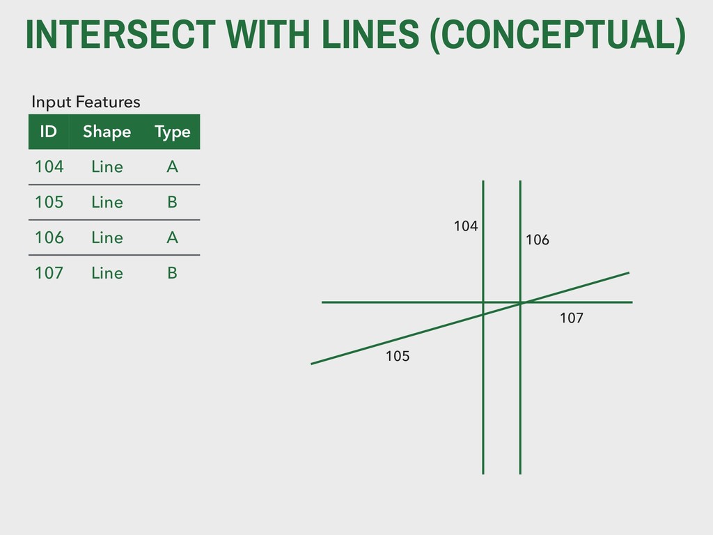
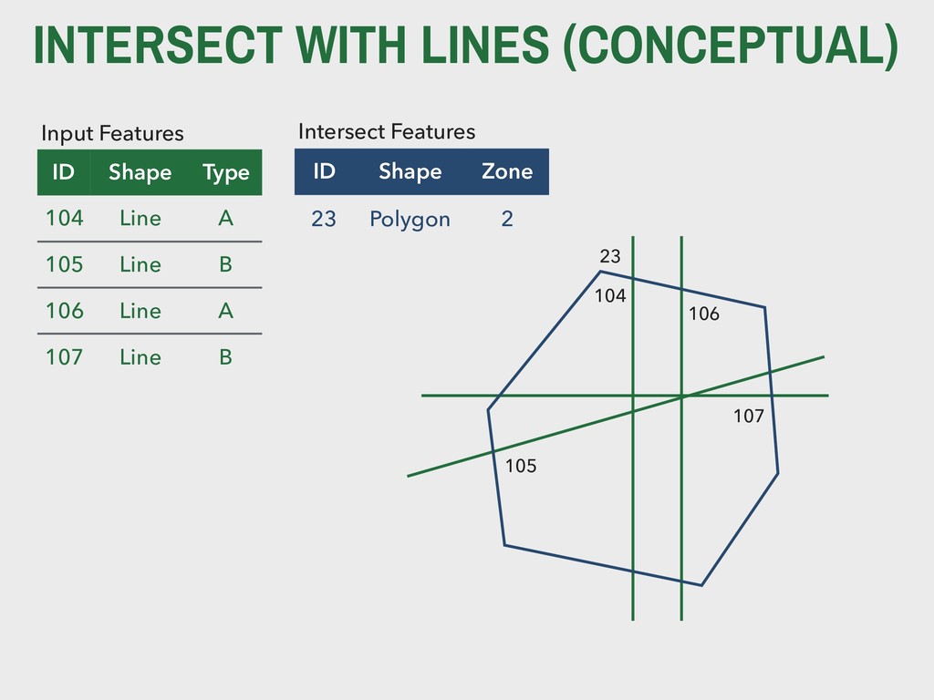
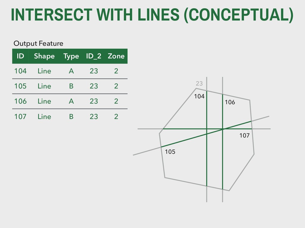
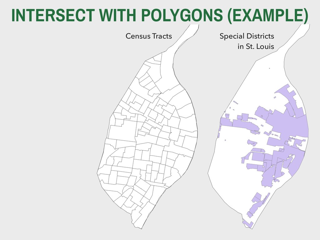
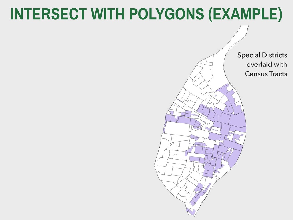
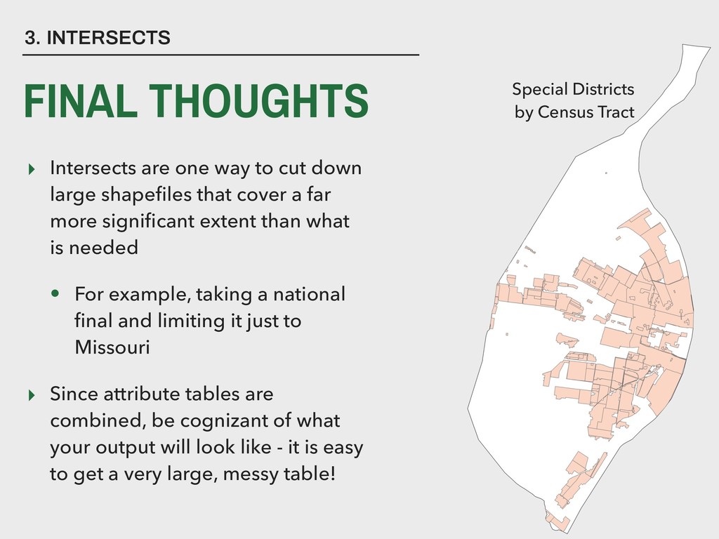
    that cover a far more significant extent than what is needed • For example, taking a national final and limiting it just to Missouri ▸ Since attribute tables are combined, be cognizant of what your output will look like - it is easy to get a very large, messy table! 3. INTERSECTS FINAL THOUGHTS Special Districts
 by Census Tract
  21. ▸ “A union B” … ▸ … means “either A,

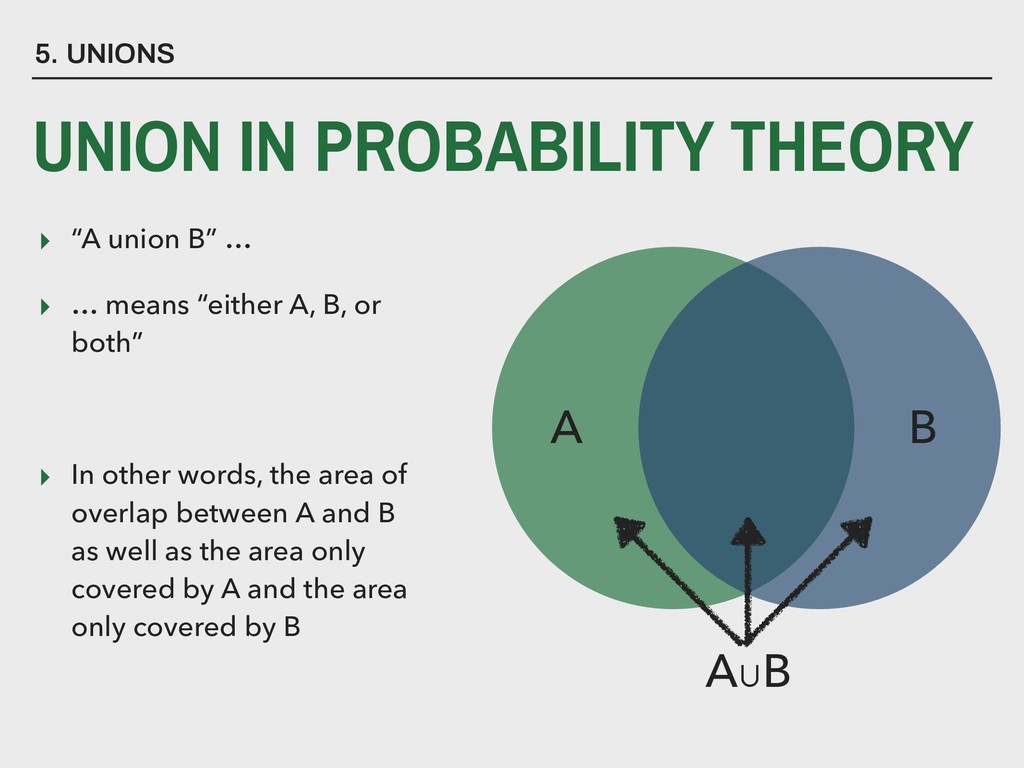
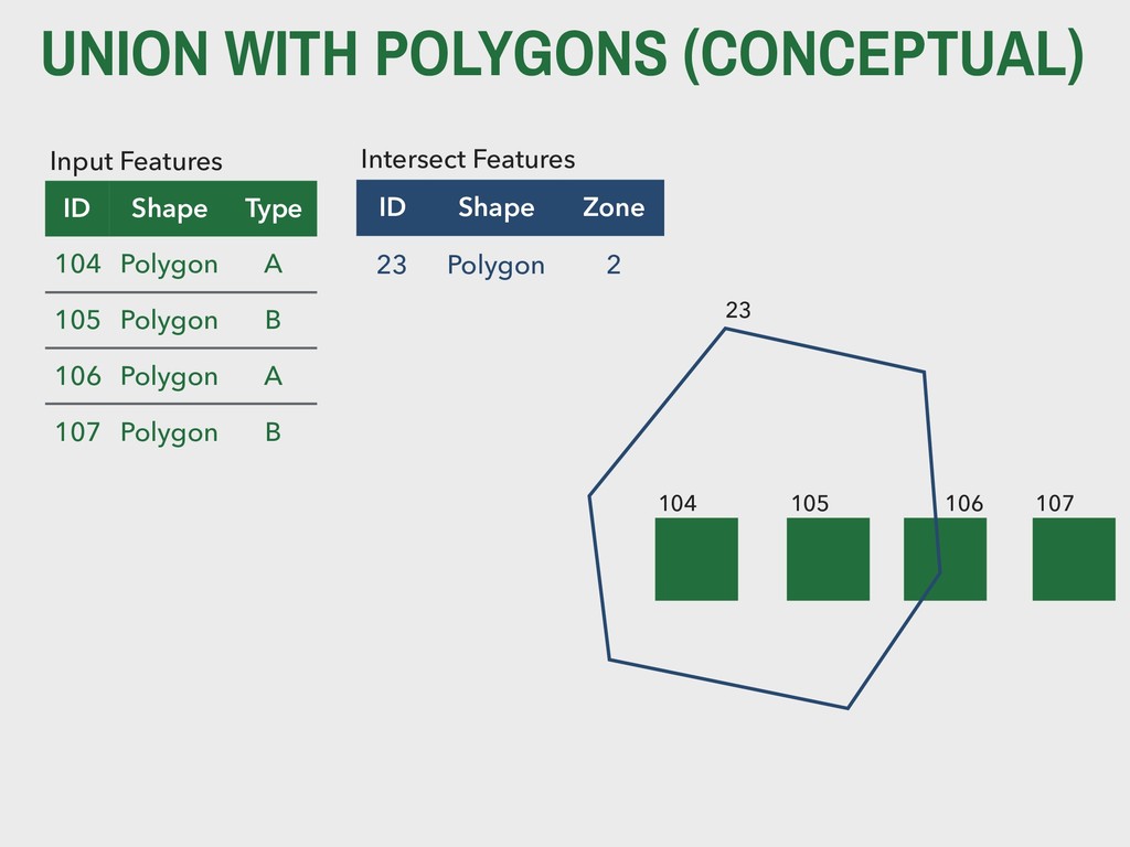
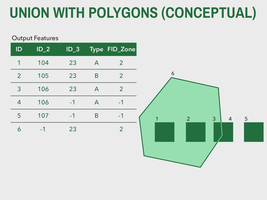
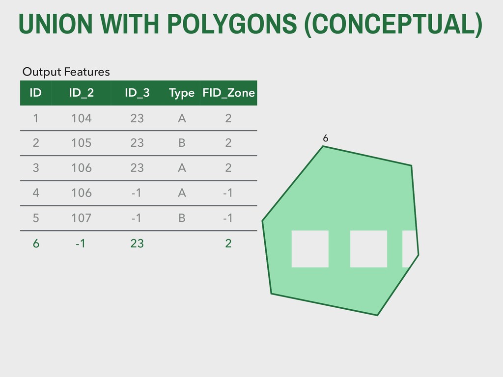
    B, or both” ▸ In other words, the area of overlap between A and B as well as the area only covered by A and the area only covered by B 5. UNIONS UNION IN PROBABILITY THEORY B A A∪B
  22. KEY TERM An union is used to 
 combine both

    the geometry 
 and the attributes (variables) 
 for all features.
  23. UNION WITH POLYGONS (CONCEPTUAL) Input Features ID Shape Type 104

    Polygon A 105 Polygon B 106 Polygon A 107 Polygon B 104 105 106 107 ID Shape Zone 23 Polygon 2 Intersect Features 23
  24. UNION WITH POLYGONS (CONCEPTUAL) 1 2 4 5 6 Output

    Features ID ID_2 ID_3 Type FID_Zone 1 104 23 A 2 2 105 23 B 2 3 106 23 A 2 4 106 -1 A -1 5 107 -1 B -1 6 -1 23 2 3
  25. UNION WITH POLYGONS (CONCEPTUAL) 6 Output Features ID ID_2 ID_3

    Type FID_Zone 1 104 23 A 2 2 105 23 B 2 3 106 23 A 2 4 106 -1 A -1 5 107 -1 B -1 6 -1 23 2
  26. ▸ Unions, however, a good way to merge two polygon

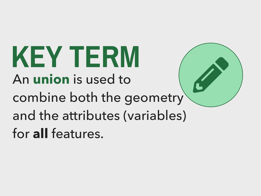
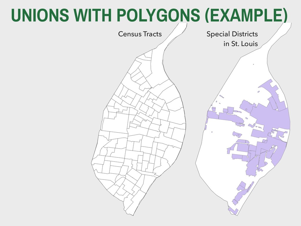
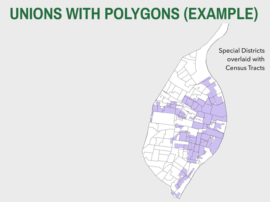
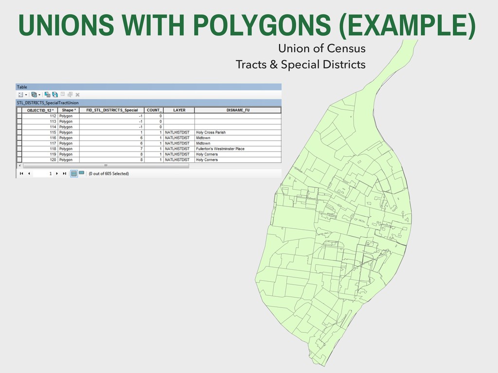
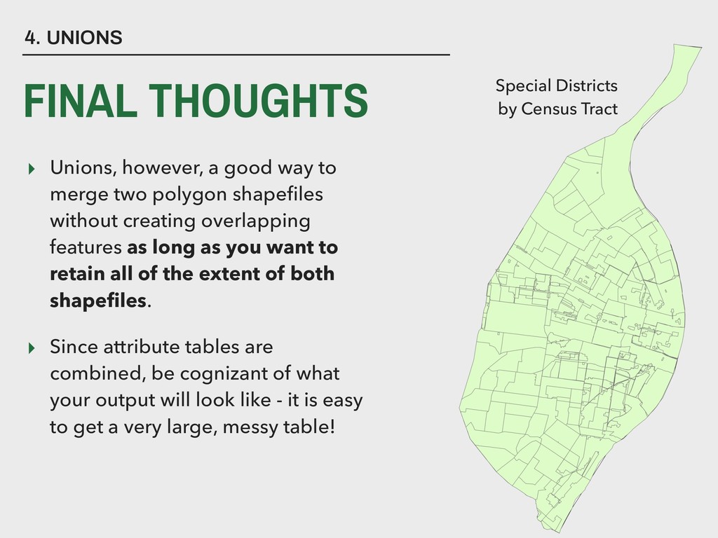
    shapefiles without creating overlapping features as long as you want to retain all of the extent of both shapefiles. ▸ Since attribute tables are combined, be cognizant of what your output will look like - it is easy to get a very large, messy table! 4. UNIONS FINAL THOUGHTS Special Districts
 by Census Tract