Upgrade to Pro
— share decks privately, control downloads, hide ads and more …
Speaker Deck
Features
Speaker Deck
PRO
Sign in
Sign up for free
Search
Search
Towards automated substrate mapping with low-co...
Search
Daniel Buscombe
March 26, 2015
Science
120
0
Share
Embed
Copy iframe code
Copy JS code
Copy link
Start on current slide
Towards automated substrate mapping with low-cost sidescan sonar
2nd Multibeam in Rivers Workshop, Flagstaff, AZ
Daniel Buscombe
March 26, 2015
More Decks by Daniel Buscombe
See All by Daniel Buscombe
Mapping echoes: the acoustics of riverbed and shallow seafloors
dbuscombe
0
200
Exploring Sand Dune Scaling Relations in a Canyon River: Colorado River in Grand Canyon
dbuscombe
1
140
Automated substrate characterization using low-cost sidescan sonar
dbuscombe
0
200
Particle Size by Proxy: Decoding the Textural Information in Scattered Sound and Light
dbuscombe
0
100
Structure-from-Motion, Grand Canyon style
dbuscombe
0
190
Particle Size by Proxy: Decoding the Textural Information in Remotely Sensed Landforms
dbuscombe
0
160
Stochasticity of riverbed backscattering, with implications for acoustical classification of non-cohesive sediment using multibeam sonar
dbuscombe
0
120
The Digital Grain Size Web Application
dbuscombe
0
200
Addressing scale dependence in roughness and morphometric statistics derived from point cloud data
dbuscombe
0
63
Other Decks in Science
See All in Science
「遂行理論の未来」(松島斉教授最終講義記念セッションの発表資料)
shunyanoda
0
930
ITTF卓球世界ランキングのポイント比を用いた試合結果予測モデルの性能評価 / Performance evaluation of match result prediction models using the point ratio of the ITTF Table Tennis World Ranking
konakalab
0
140
TypeScript で WebAssembly を用いた 型安全なプラグイン設計
nagano
2
570
データベース11: 正規化(1/2) - 望ましくない関係スキーマ
trycycle
PRO
0
1.3k
1. CPC理論の展開と集合的知能モデル(JSAI2026 KS-27 集合的予測符号化と新たな知性の時代)
hayashiyus884
1
300
医療 LLM ベンチマークの現在地:多面的評価 と日本ローカライズ
analokmaus
1
600
Bリーグのショットデータを活用した得点期待値モデルの構築 / Construction of expected points model using shot data of B.LEAGUE
konakalab
0
160
機械学習 - DBSCAN
trycycle
PRO
0
1.9k
生成AI・プレプリント時代における 研究成果公開の再設計 ― トップカンファレンス文化はどこへ向かうのか / Redesigning the Dissemination of Research Outputs in the Age of Generative AI and Preprints — Where Is the Top-Conference Culture Heading?
ykiyota
0
29k
明治薬科大学講義_ビッグデータ解析を支えるデータベース技術とクラウドコンピューティング
ktatsuya
1
130
Understanding CVP Waveforms: Interpretation and Clinical Implications in Anesthesiology
taka88
0
660
機械学習 - SVM
trycycle
PRO
2
1.2k
Featured
See All Featured
Six Lessons from altMBA
skipperchong
29
4.3k
Bootstrapping a Software Product
garrettdimon
PRO
307
120k
How People are Using Generative and Agentic AI to Supercharge Their Products, Projects, Services and Value Streams Today
helenjbeal
1
240
Improving Core Web Vitals using Speculation Rules API
sergeychernyshev
21
1.5k
[RailsConf 2023] Rails as a piece of cake
palkan
59
6.7k
Connecting the Dots Between Site Speed, User Experience & Your Business [WebExpo 2025]
tammyeverts
11
970
10 Git Anti Patterns You Should be Aware of
lemiorhan
PRO
659
62k
Chasing Engaging Ingredients in Design
codingconduct
0
240
Data-driven link building: lessons from a $708K investment (BrightonSEO talk)
szymonslowik
1
1.2k
How To Speak Unicorn (iThemes Webinar)
marktimemedia
1
510
Claude Code のすすめ
schroneko
67
230k
Automating Front-end Workflow
addyosmani
1370
210k
Transcript
Towards automated substrate mapping with low-cost sidescan sonar Daniel Buscombe,
GCMRC-USGS MBES in Rivers Workshop Flagstaff, AZ, March 2015
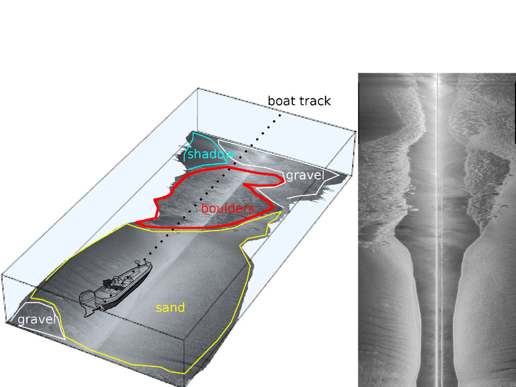
None
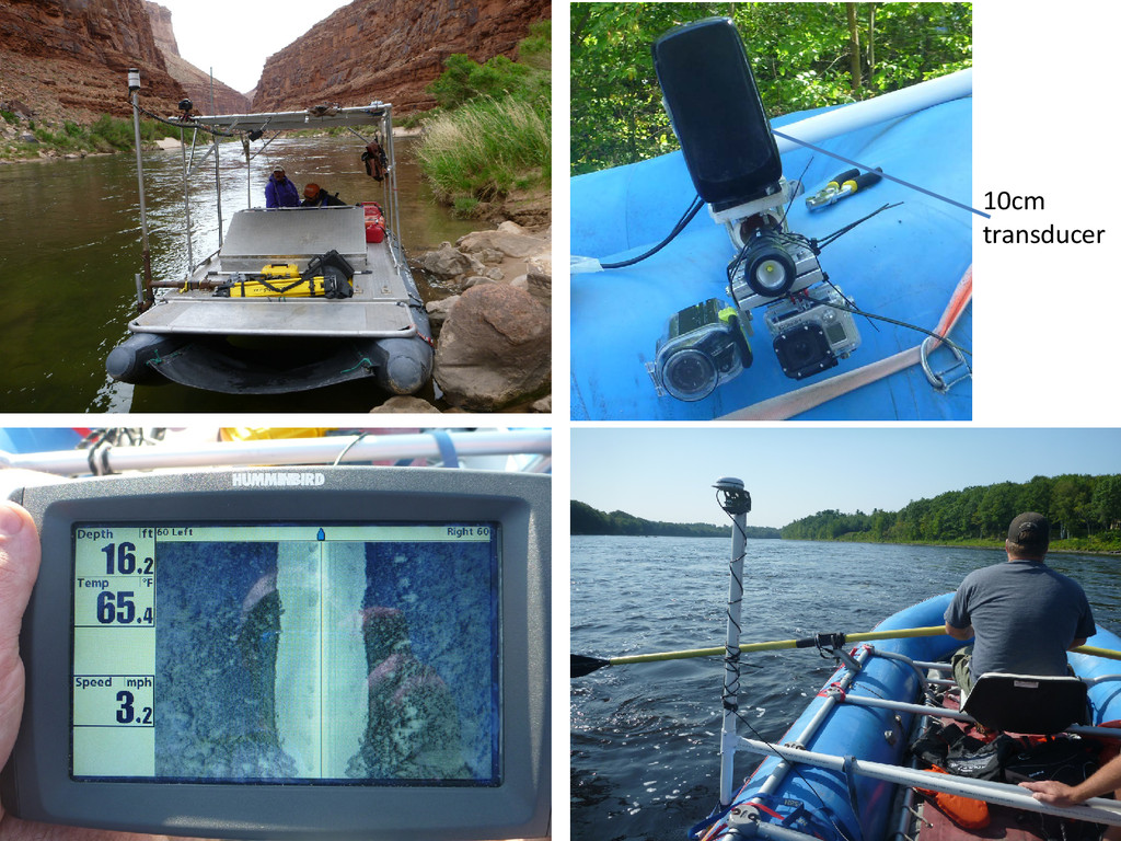
10cm transducer
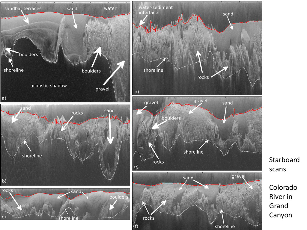
Starboard scans Colorado River in Grand Canyon
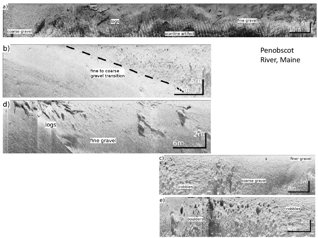
Penobscot River, Maine
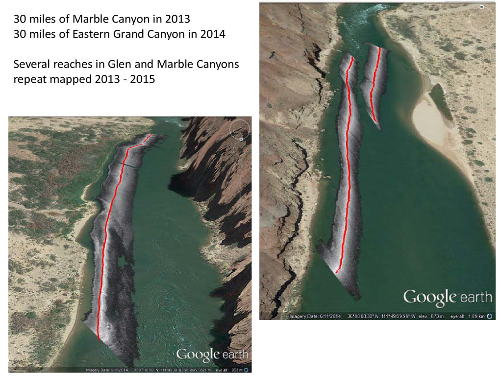
30 miles of Marble Canyon in 2013 30 miles of
Eastern Grand Canyon in 2014 Several reaches in Glen and Marble Canyons repeat mapped 2013 - 2015
None
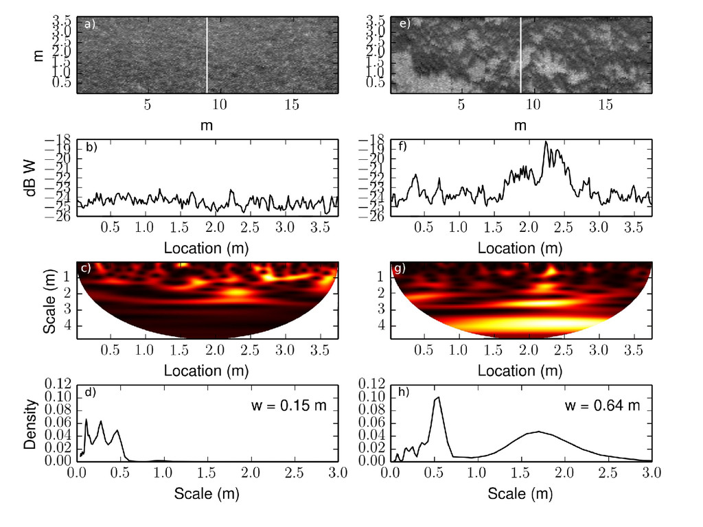
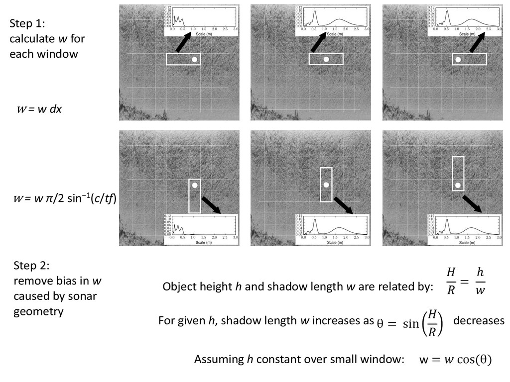
w = cos (θ) = ℎ For given h, shadow
length w increases as decreases θ = sin Assuming h constant over small window: Step 1: calculate w for each window Step 2: remove bias in w caused by sonar geometry Object height h and shadow length w are related by: w = w π/2 sin−1(c/tf) w = w dx
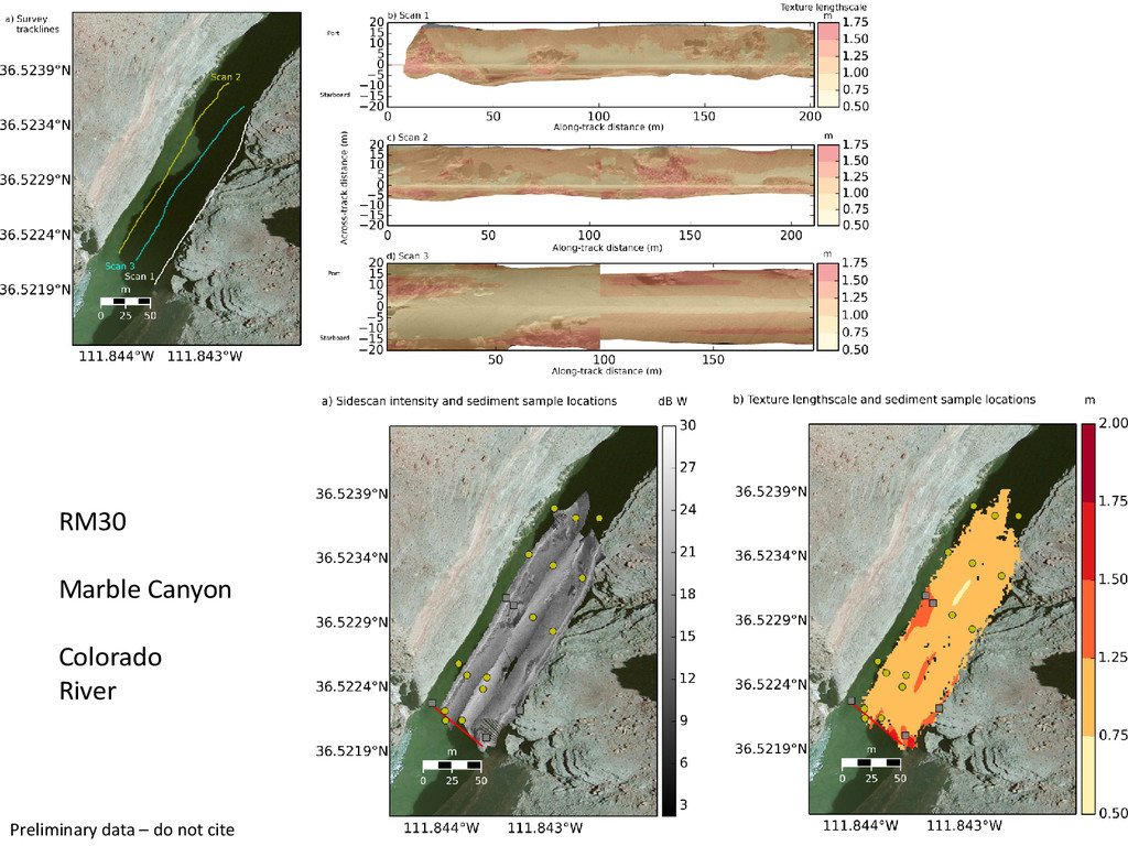
RM30 Marble Canyon Colorado River Preliminary data – do not
cite
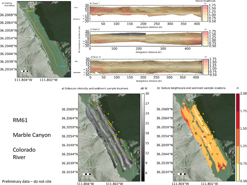
RM61 Marble Canyon Colorado River Preliminary data – do not
cite
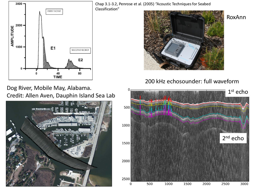
Dog River, Mobile May, Alabama. Credit: Allen Aven, Dauphin Island
Sea Lab 200 kHz echosounder: full waveform 1st echo 2nd echo Chap 3.1-3.2, Penrose et al. (2005) “Acoustic Techniques for Seabed Classification” RoxAnn
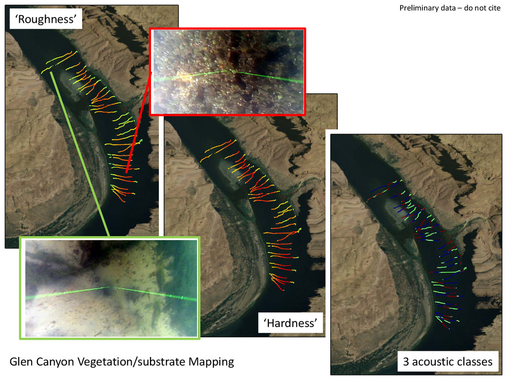
‘Roughness’ ‘Hardness’ Volume scattering coefficients K=3 means acoustic ‘classes’ Preliminary
data – do not cite
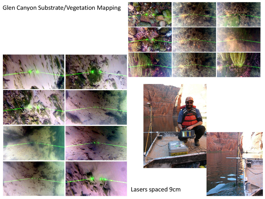
Glen Canyon Substrate/Vegetation Mapping Lasers spaced 9cm
Glen Canyon Vegetation/substrate Mapping ‘Roughness’ ‘Hardness’ 3 acoustic classes Preliminary
data – do not cite
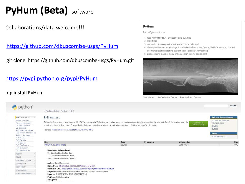
PyHum (Beta) software Collaborations/data welcome!!! https://pypi.python.org/pypi/PyHum pip install PyHum https://github.com/dbuscombe-usgs/PyHum
git clone https://github.com/dbuscombe-usgs/PyHum.git
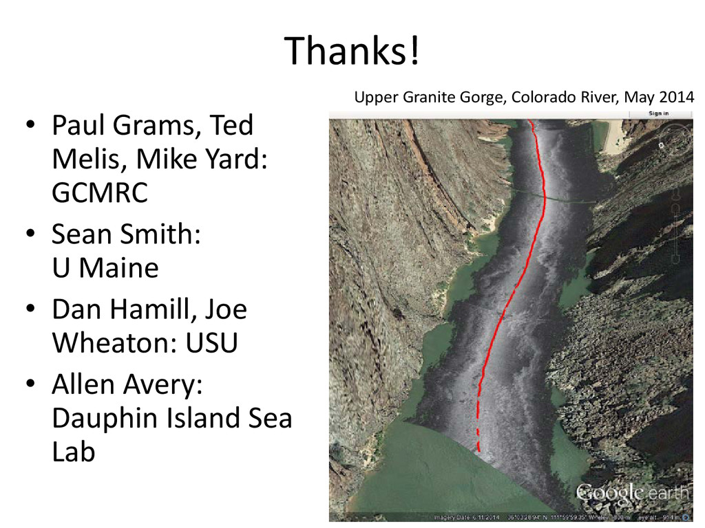
Thanks! • Paul Grams, Ted Melis, Mike Yard: GCMRC •
Sean Smith: U Maine • Dan Hamill, Joe Wheaton: USU • Allen Avery: Dauphin Island Sea Lab Upper Granite Gorge, Colorado River, May 2014
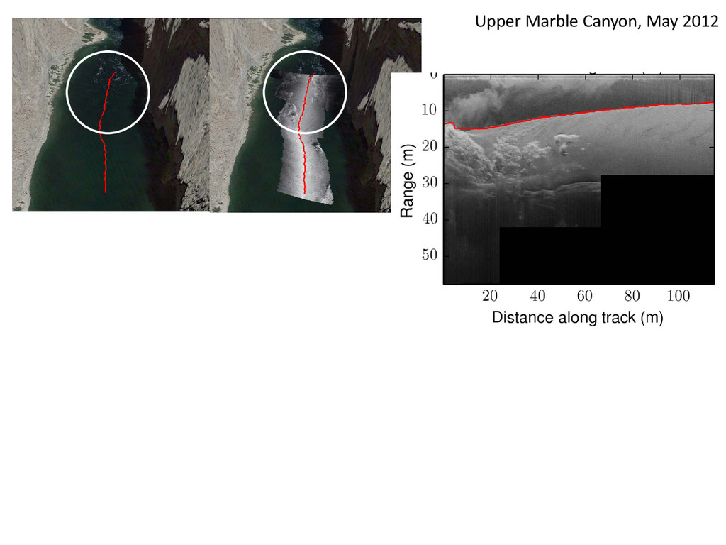
Upper Marble Canyon, May 2012
None