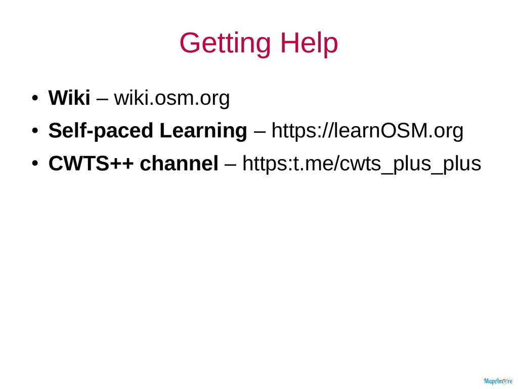
the OSM website • [ST] Recap of editing with iD • [CL, HO] OpenStreetMap Elements • [CL, HO] Micro-tasking Managers – [PA] Improve OSM – [CL] HOT Tasking Manager
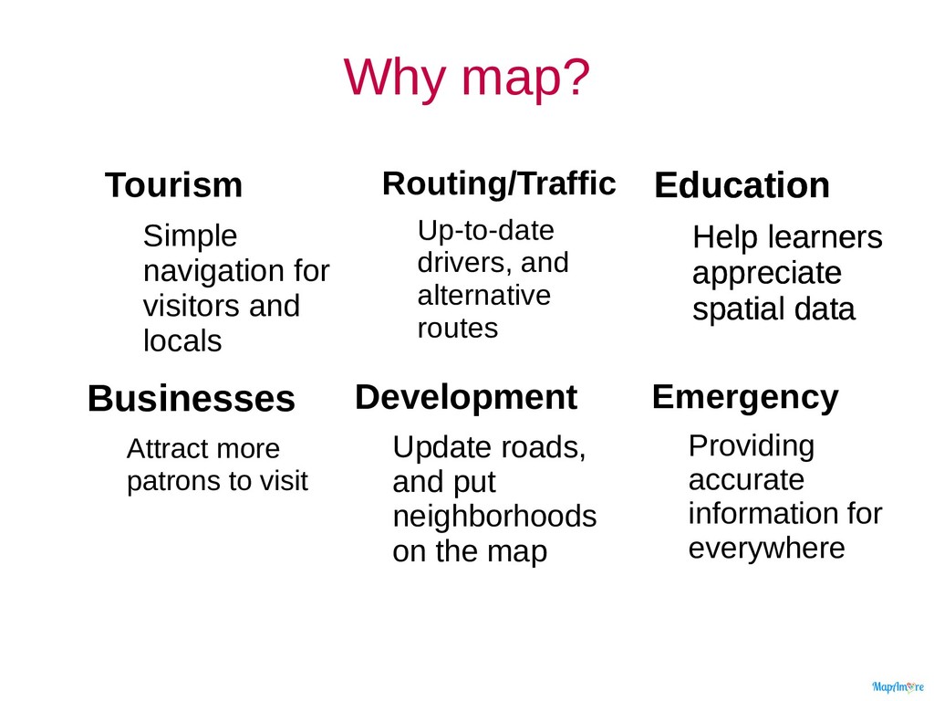
accurate information for everywhere Development Update roads, and put neighborhoods on the map Businesses Attract more patrons to visit Education Help learners appreciate spatial data Tourism Simple navigation for visitors and locals Routing/Traffic Up-to-date drivers, and alternative routes
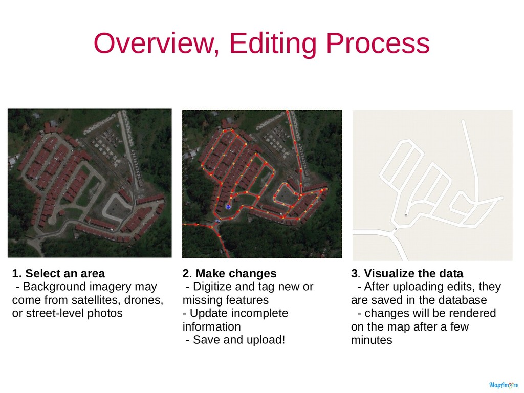
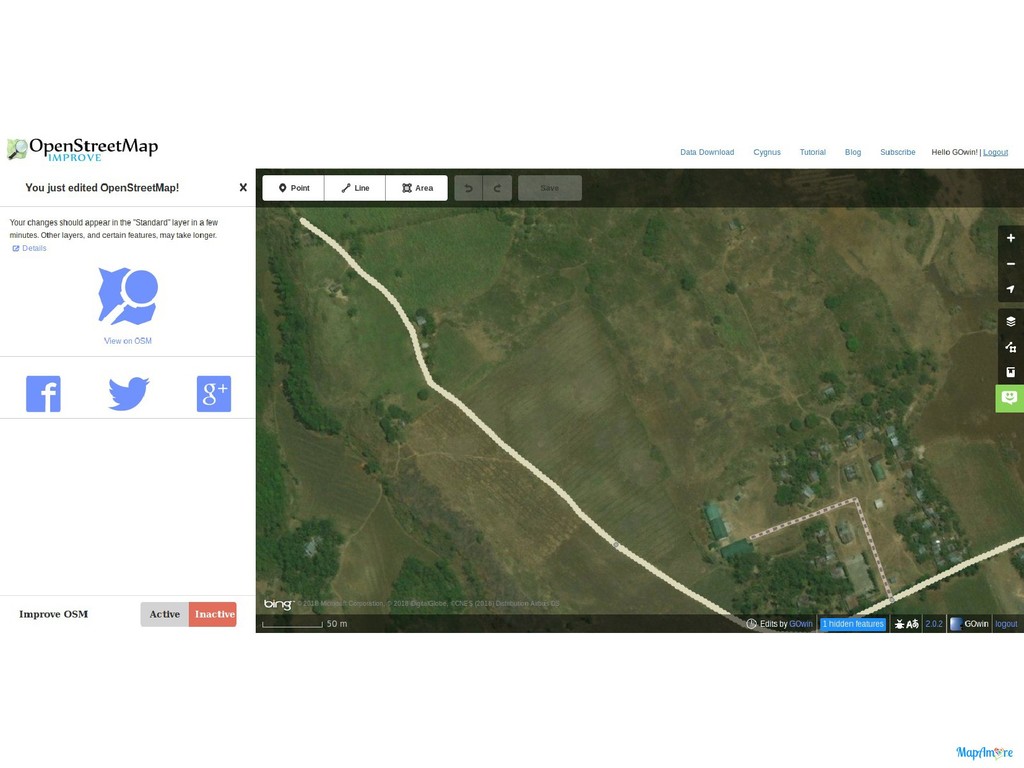
may come from satellites, drones, or street-level photos 2. Make changes - Digitize and tag new or missing features - Update incomplete information - Save and upload! 3. Visualize the data - After uploading edits, they are saved in the database - changes will be rendered on the map after a few minutes
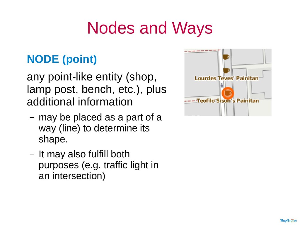
post, bench, etc.), plus additional information – may be placed as a part of a way (line) to determine its shape. – It may also fulfill both purposes (e.g. traffic light in an intersection)
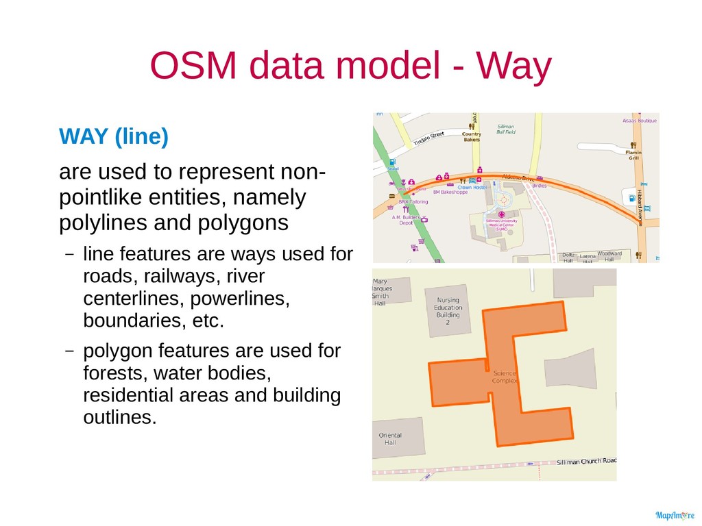
represent non- pointlike entities, namely polylines and polygons – line features are ways used for roads, railways, river centerlines, powerlines, boundaries, etc. – polygon features are used for forests, water bodies, residential areas and building outlines.
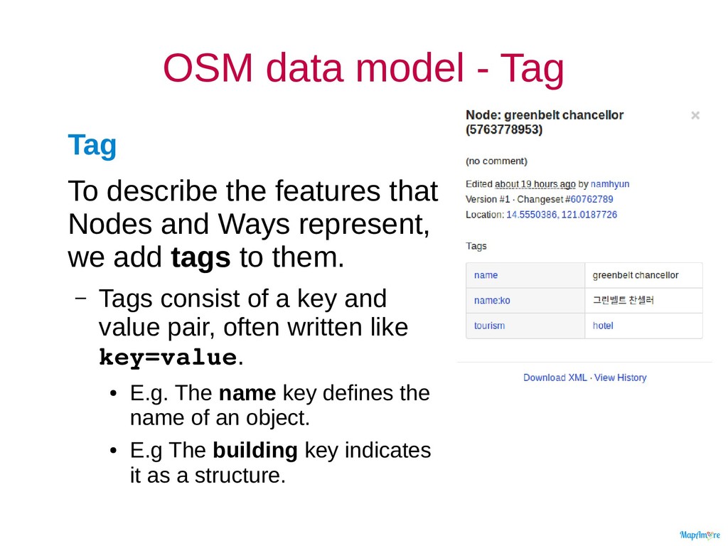
that Nodes and Ways represent, we add tags to them. – Tags consist of a key and value pair, often written like key=value. • E.g. The name key defines the name of an object. • E.g The building key indicates it as a structure.
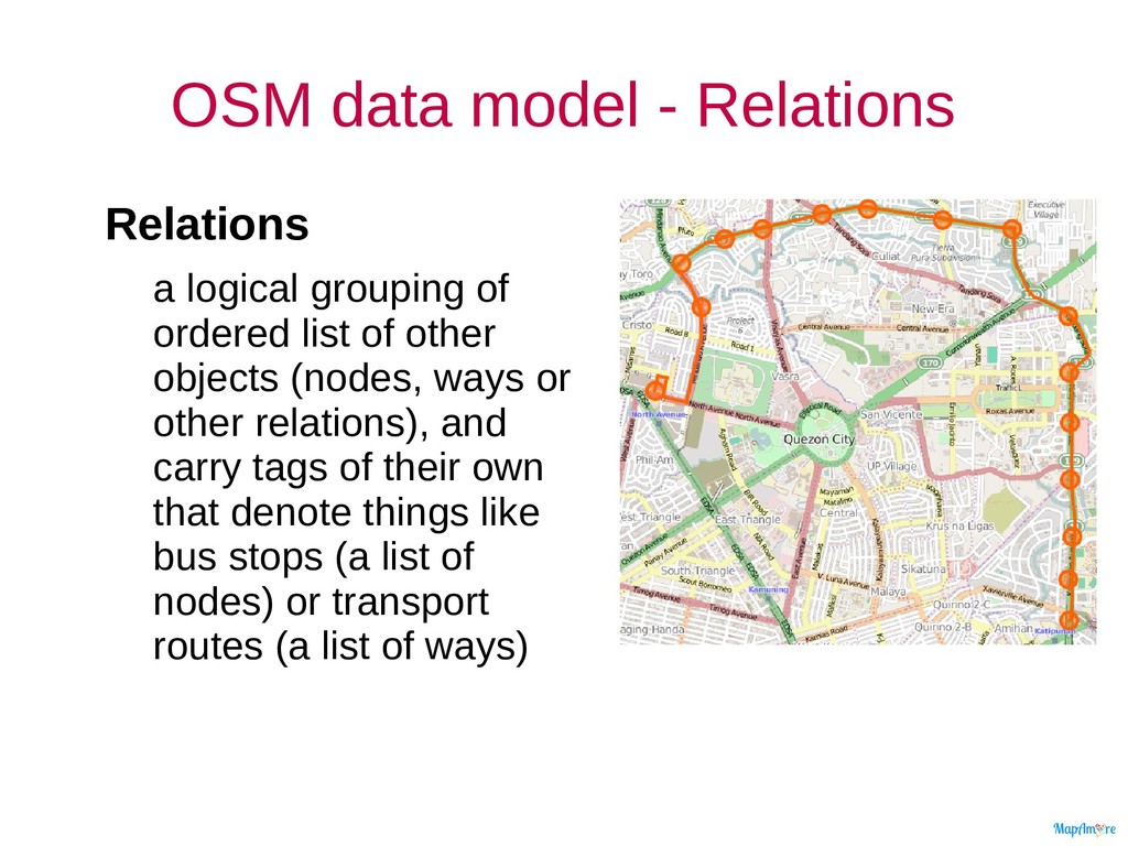
ordered list of other objects (nodes, ways or other relations), and carry tags of their own that denote things like bus stops (a list of nodes) or transport routes (a list of ways)
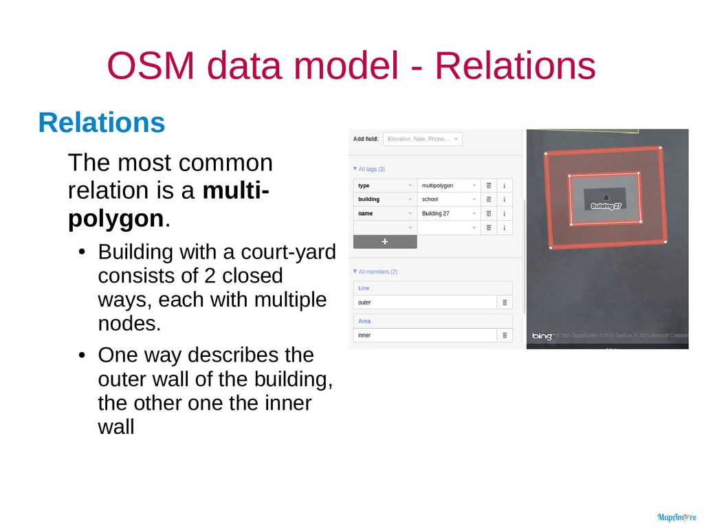
is a multi- polygon. • Building with a court-yard consists of 2 closed ways, each with multiple nodes. • One way describes the outer wall of the building, the other one the inner wall
![CWTS++ Pilot for PUPSJ n: erwin olario e: [email protected] m:](https://files.speakerdeck.com/presentations/ea3c7f2dec1d4ac49c091d6be22702d4/slide_0.jpg)
![Topics Today • [CL] Intro to maps • [ST] Navigating](https://files.speakerdeck.com/presentations/ea3c7f2dec1d4ac49c091d6be22702d4/slide_1.jpg)