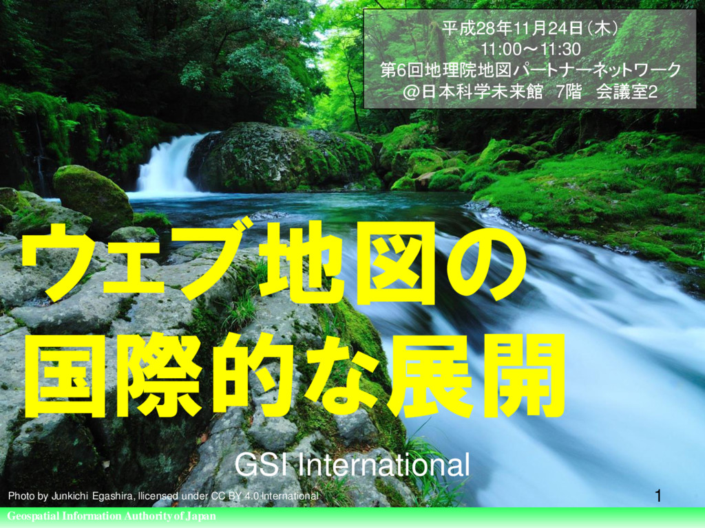
of Japan ウェブ地図の 国際的な展開 GSI International 1 平成28年11月24日(木) 11:00〜11:30 第6回地理院地図パートナーネットワーク @日本科学未来館 7階 会議室2 Photo by Junkichi Egashira, llicensed under CC BY 4.0 International
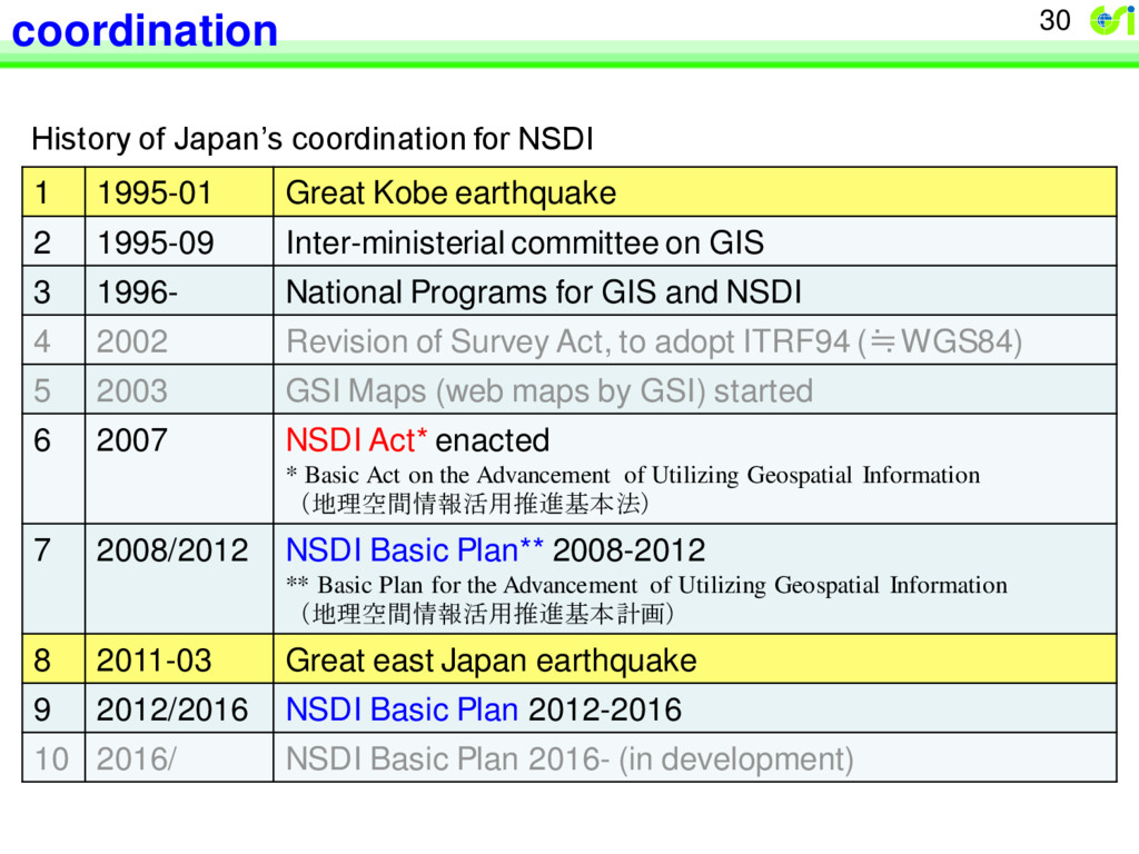
Great Kobe earthquake 2 1995-09 Inter-ministerial committee on GIS 3 1996- National Programs for GIS and NSDI 4 2002 Revision of Survey Act, to adopt ITRF94 (≒WGS84) 5 2003 GSI Maps (web maps by GSI) started 6 2007 NSDI Act* enacted * Basic Act on the Advancement of Utilizing Geospatial Information (地理空間情報活用推進基本法) 7 2008/2012 NSDI Basic Plan** 2008-2012 ** Basic Plan for the Advancement of Utilizing Geospatial Information (地理空間情報活用推進基本計画) 8 2011-03 Great east Japan earthquake 9 2012/2016 NSDI Basic Plan 2012-2016 10 2016/ NSDI Basic Plan 2016- (in development)
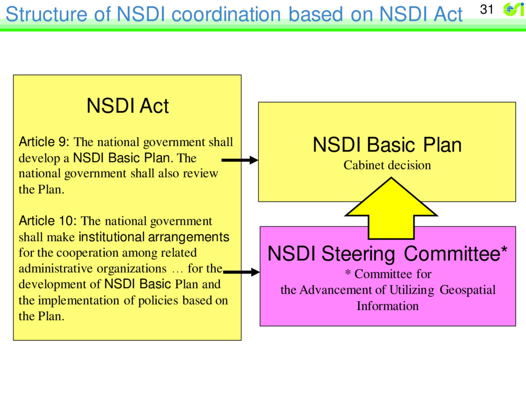
Act Article 9: The national government shall develop a NSDI Basic Plan. The national government shall also review the Plan. Article 10: The national government shall make institutional arrangements for the cooperation among related administrative organizations … for the development of NSDI Basic Plan and the implementation of policies based on the Plan. NSDI Basic Plan Cabinet decision NSDI Steering Committee* * Committee for the Advancement of Utilizing Geospatial Information
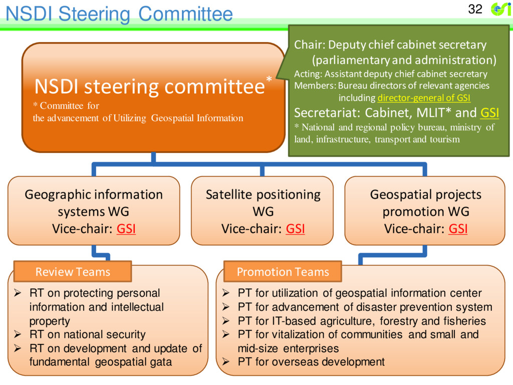
Satellite positioning WG Vice-chair: GSI RT on protecting personal information and intellectual property RT on national security RT on development and update of fundamental geospatial gata NSDI steering committee* * Committee for the advancement of Utilizing Geospatial Information Chair: Deputy chief cabinet secretary (parliamentary and administration) Acting: Assistant deputy chief cabinet secretary Members: Bureau directors of relevant agencies including director-general of GSI Secretariat: Cabinet, MLIT* and GSI * National and regional policy bureau, ministry of land, infrastructure, transport and tourism Geospatial projects promotion WG Vice-chair: GSI PT for utilization of geospatial information center PT for advancement of disaster prevention system PT for IT-based agriculture, forestry and fisheries PT for vitalization of communities and small and mid-size enterprises PT for overseas development Promotion Teams Review Teams
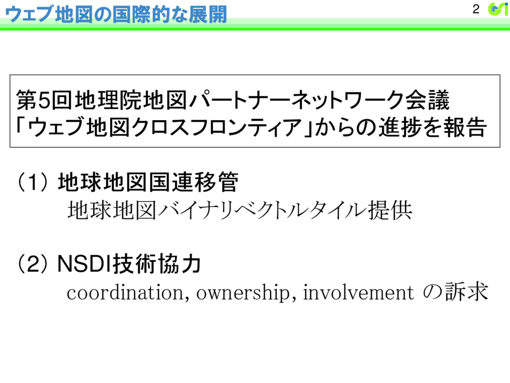
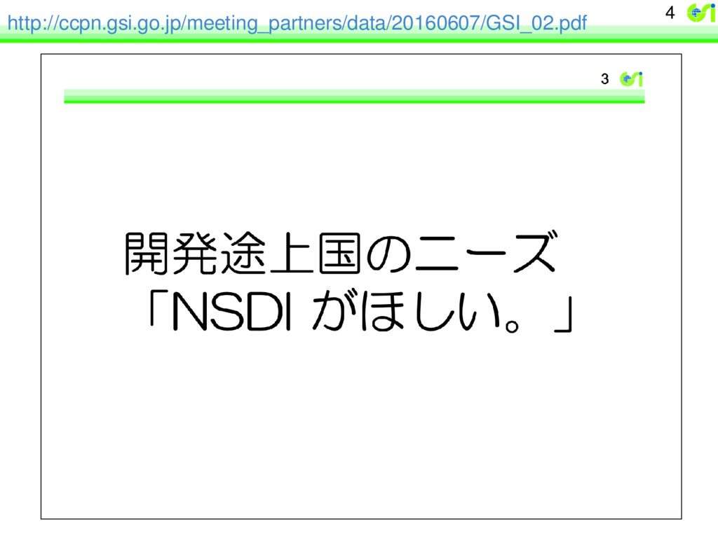
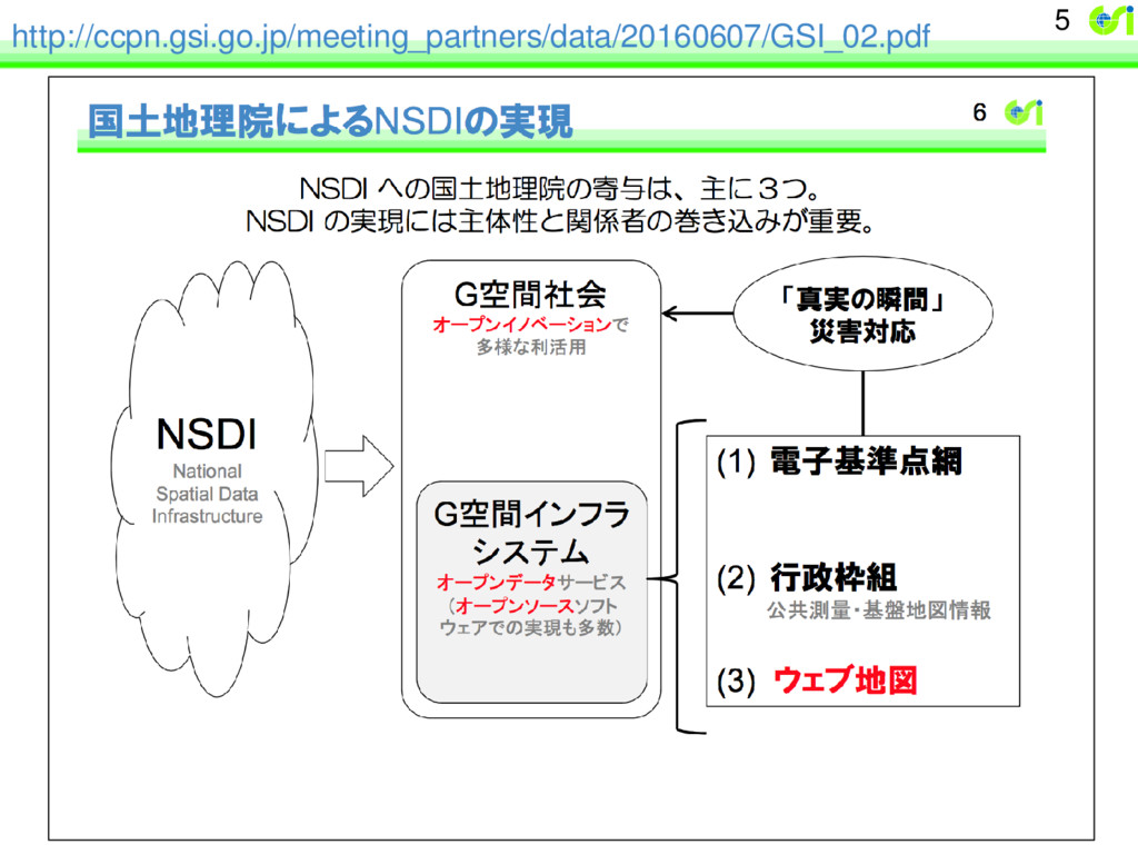
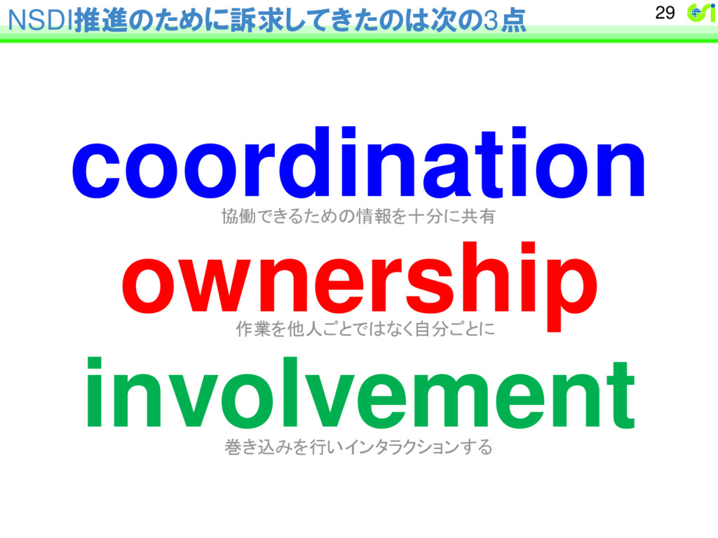
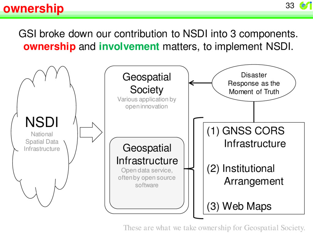
application by open innovation Geospatial Infrastructure Open data service, often by open source software (1) GNSS CORS Infrastructure (2) Institutional Arrangement (3) Web Maps Disaster Response as the Moment of Truth GSI broke down our contribution to NSDI into 3 components. ownership and involvement matters, to implement NSDI. These are what we take ownership for Geospatial Society.
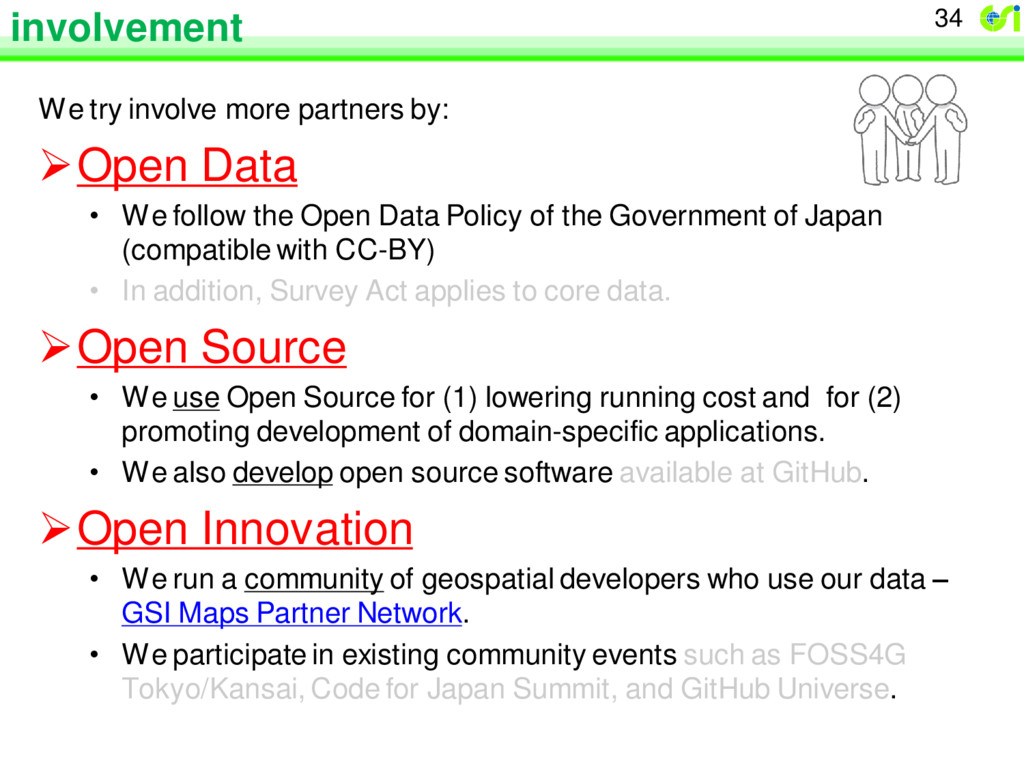
We follow the Open Data Policy of the Government of Japan (compatible with CC-BY) • In addition, Survey Act applies to core data. Open Source • We use Open Source for (1) lowering running cost and for (2) promoting development of domain-specific applications. • We also develop open source software available at GitHub. Open Innovation • We run a community of geospatial developers who use our data – GSI Maps Partner Network. • We participate in existing community events such as FOSS4G Tokyo/Kansai, Code for Japan Summit, and GitHub Universe. 34
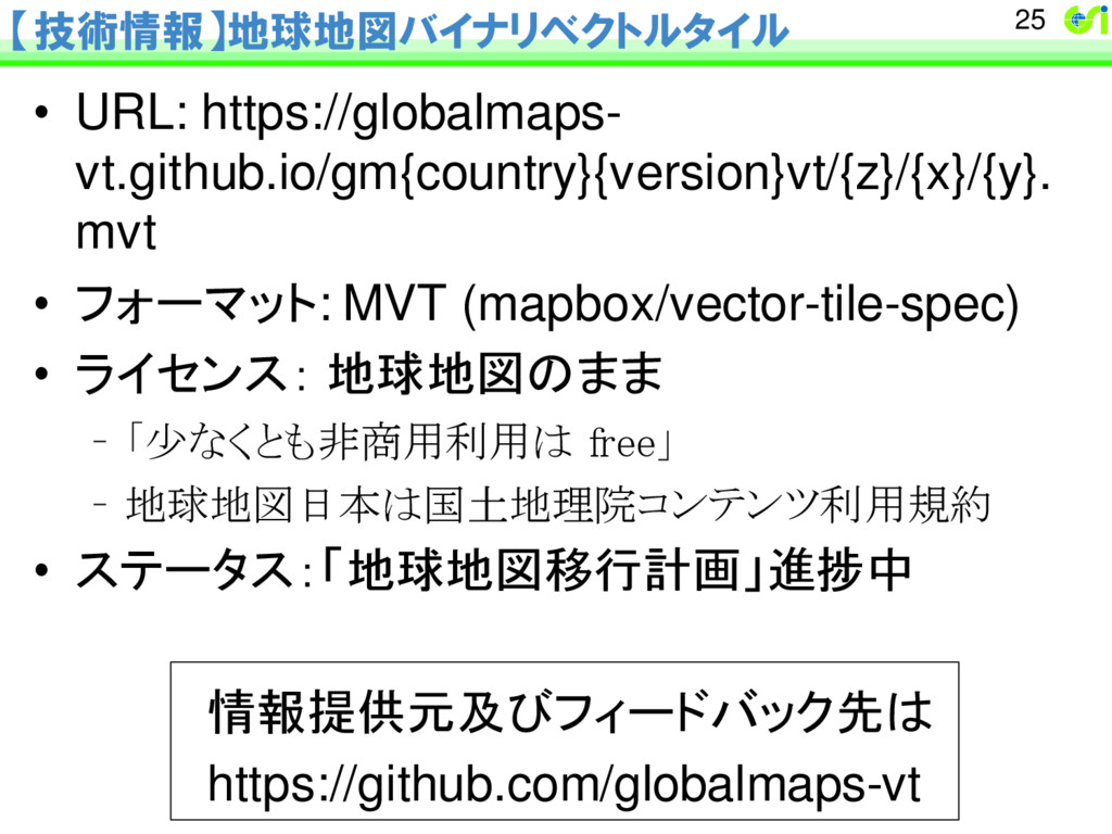