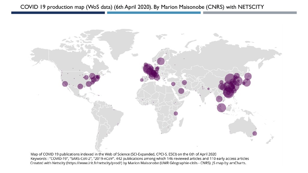
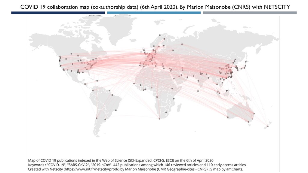
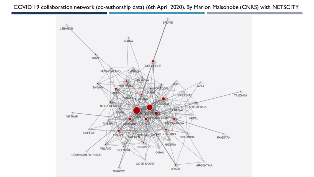
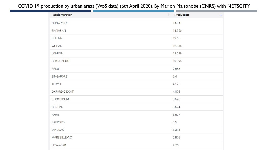
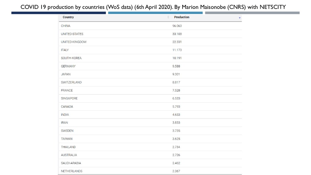
Mapping COVID-19 researches with NETSCITY (a geospatial application developped by CNRS researchers from three labs : Géographie-cités, LISST and IRIT). An analysis updated on the 6th April 2020. Publications indexed in the Web of Science (SCI-EXPANDED, CPCI-S, ESCI).