Library Initiatives Conference Finding Our Way: Collaborative Strategies for Developing Geospatial Services Initial proposal: November 2014 Proposed to involve four institutions, but 10-11 expressed possible interest Revised proposal: February 2015 Participating institutions: Illinois, Iowa, Maryland, Michigan, Michigan State, Minnesota (host), Penn State, Purdue, and Wisconsin
access, and connect scholars across the CIC to geospatial data resources Launch and populate a geoportal instance for (participating) CIC institutions Support the creation and guide the aggregation of discovery-focused metadata describing geospatial data resources relevant to researchers at participating institutions Provide the technology project staffing and infrastructure to host the services
Force 18 people from nine institutions Map Librarians, GIS Specialists, Metadata Specialists Hiring new position CIC Geospatial Project Metadata Coordinator Project officially began on July 1 Two-year pilot phase Optional third year (and beyond?)
November In-person meeting for the entire group Project logistics, directions, and priorities Metadata training and template creation Project site: http://z.umn.edu/cicgddp Proposal and Project Documentation Meeting notes
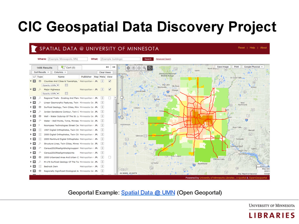
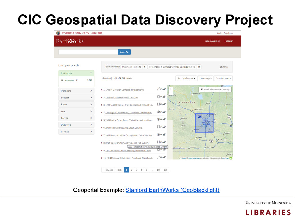