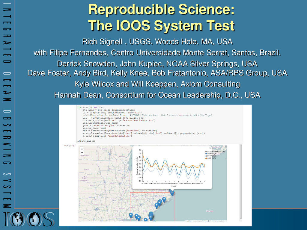
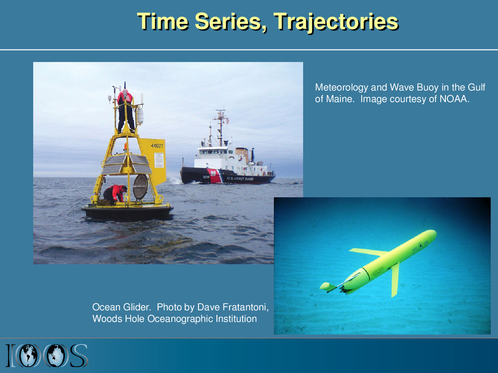
Woods Hole, MA, USA with Filipe Fernandes, Centro Universidade Monte Serrat, Santos, Brazil. Derrick Snowden, John Kupiec, NOAA Silver Springs, USA Dave Foster, Andy Bird, Kelly Knee, Bob Fratantonio, ASA/RPS Group, USA Kyle Wilcox and Will Koeppen, Axiom Consulting Hannah Dean, Consortium for Ocean Leadership, D.C., USA
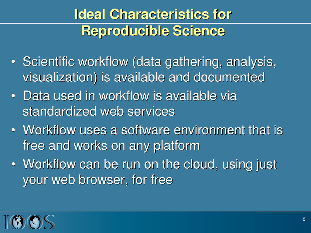
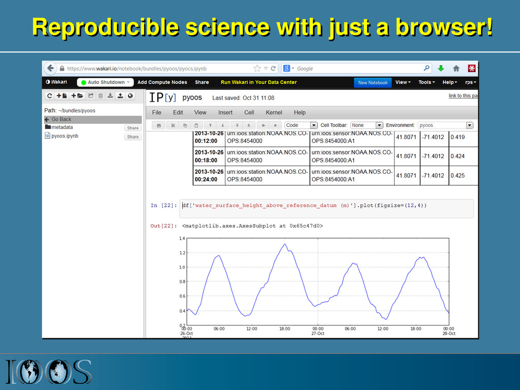
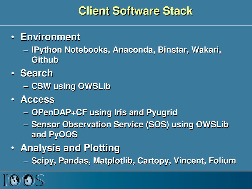
analysis, visualization) is available and documented • Data used in workflow is available via standardized web services • Workflow uses a software environment that is free and works on any platform • Workflow can be run on the cloud, using just your web browser, for free 2
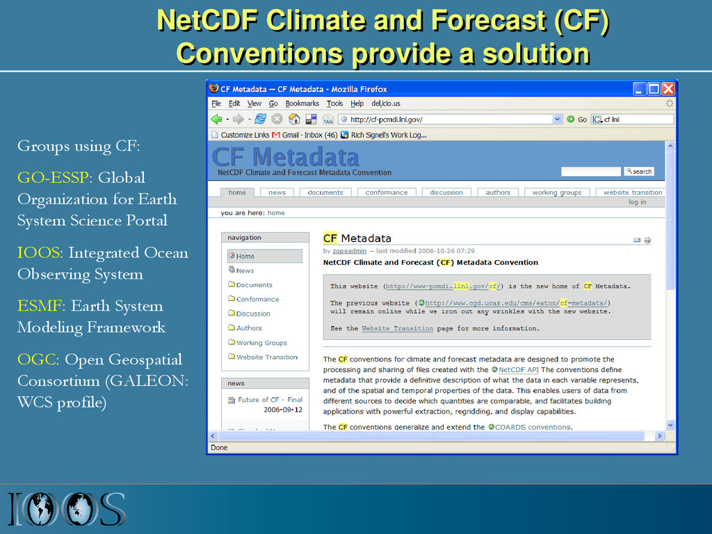
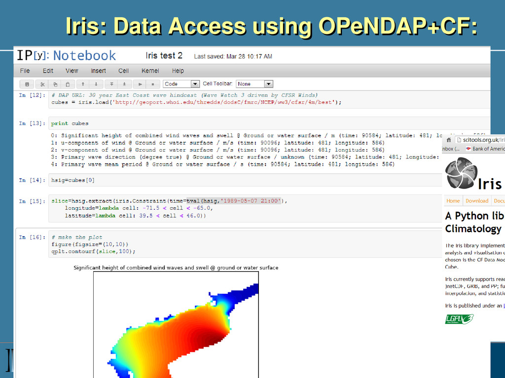
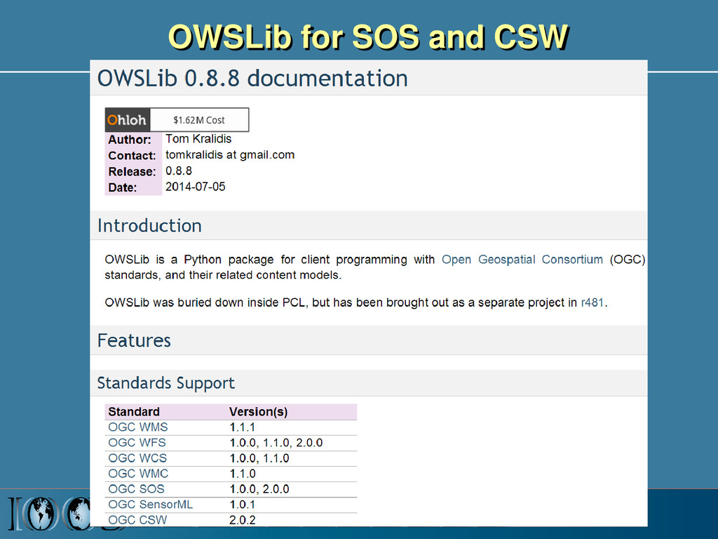
using CF: GO-ESSP: Global Organization for Earth System Science Portal IOOS: Integrated Ocean Observing System ESMF: Earth System Modeling Framework OGC: Open Geospatial Consortium (GALEON: WCS profile)
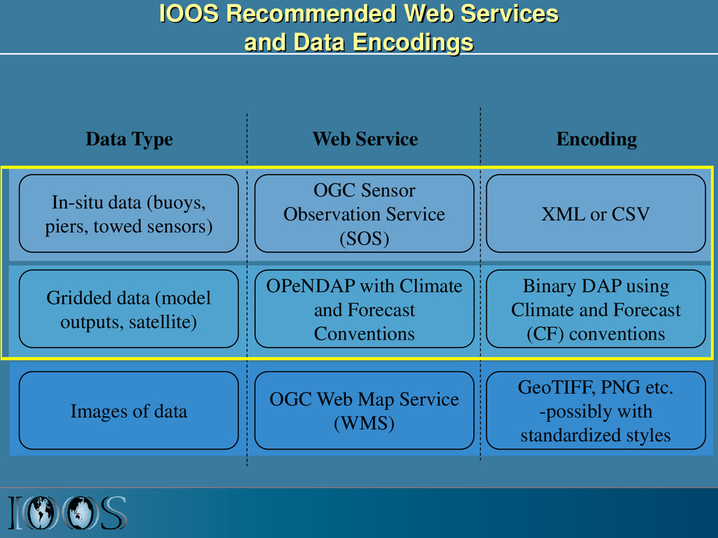
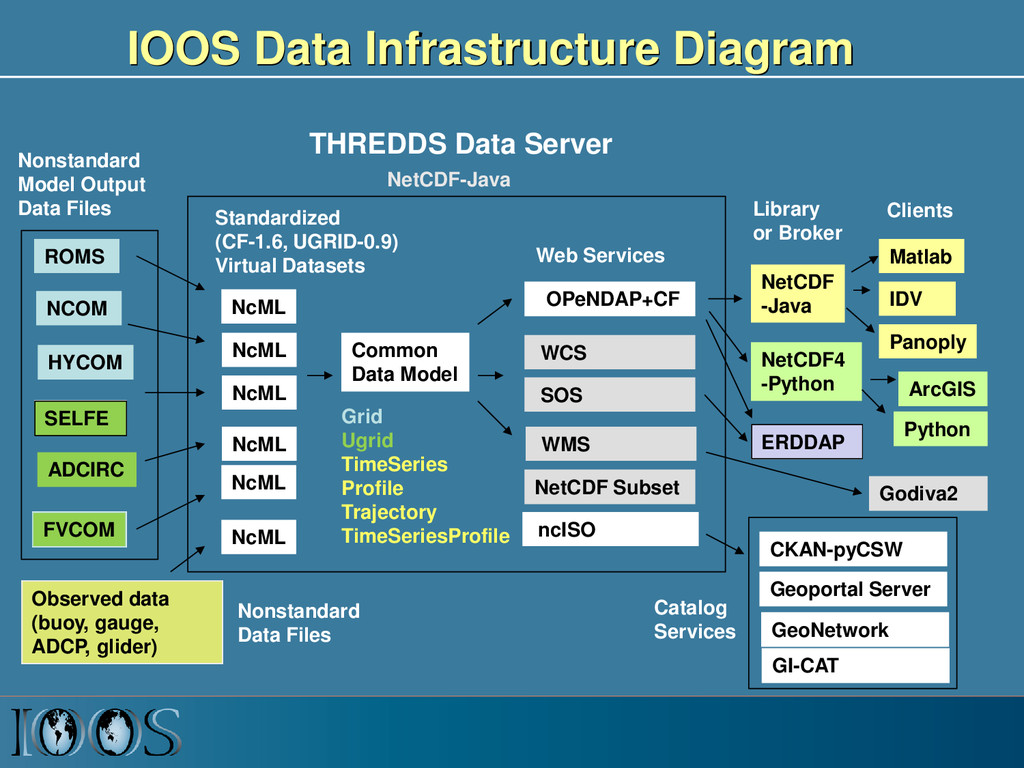
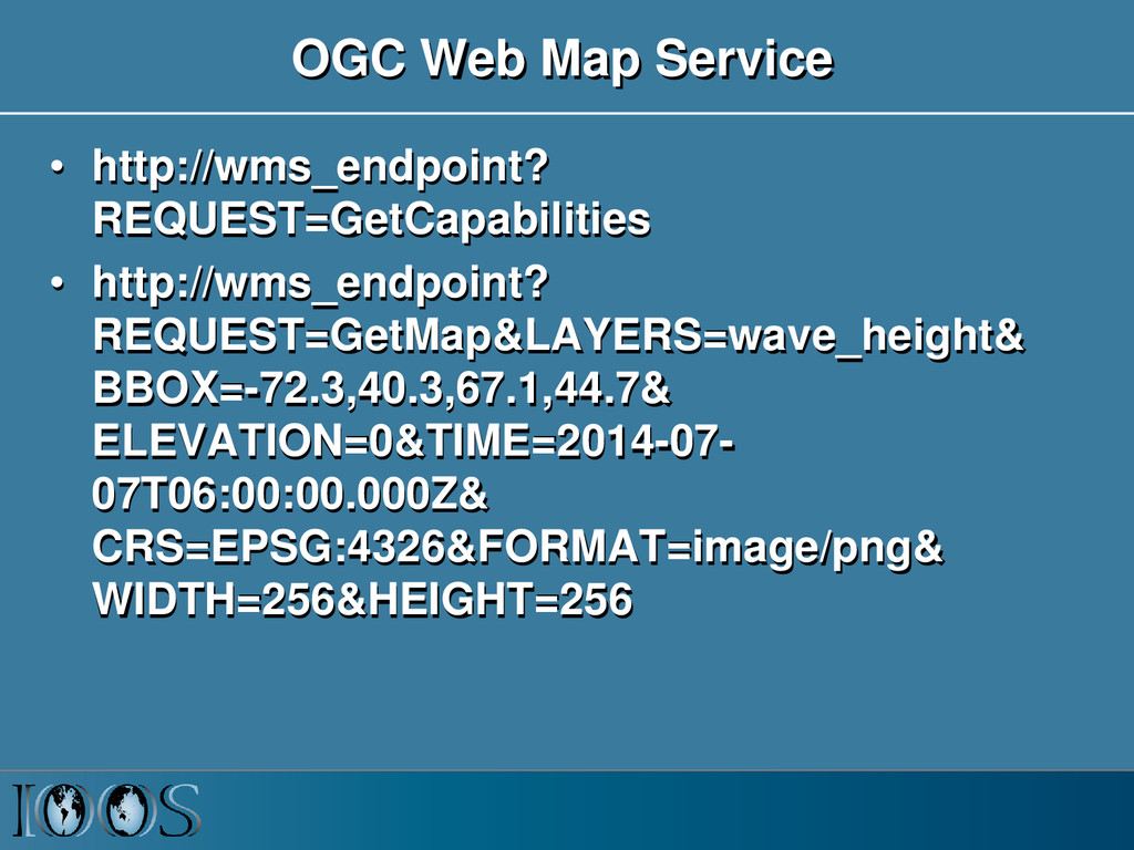
piers, towed sensors) Gridded data (model outputs, satellite) OGC Sensor Observation Service (SOS) OPeNDAP with Climate and Forecast Conventions XML or CSV Binary DAP using Climate and Forecast (CF) conventions Images of data OGC Web Map Service (WMS) GeoTIFF, PNG etc. -possibly with standardized styles Data Type Web Service Encoding
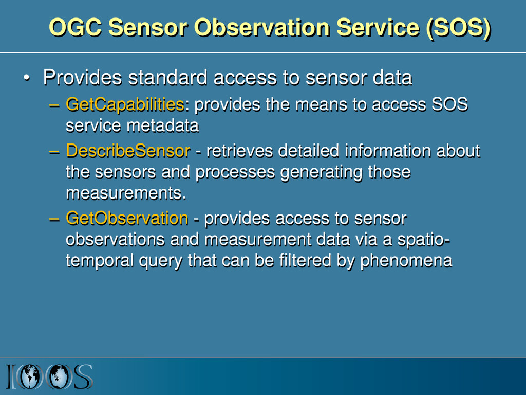
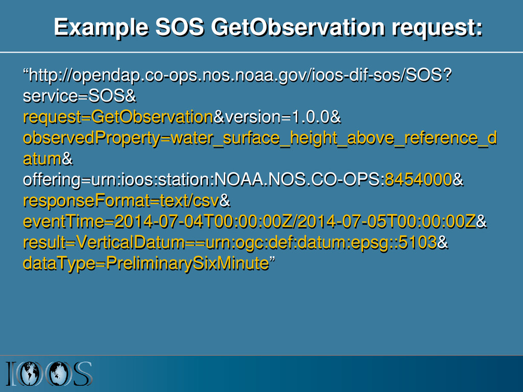
sensor data – GetCapabilities: provides the means to access SOS service metadata – DescribeSensor - retrieves detailed information about the sensors and processes generating those measurements. – GetObservation - provides access to sensor observations and measurement data via a spatio- temporal query that can be filtered by phenomena
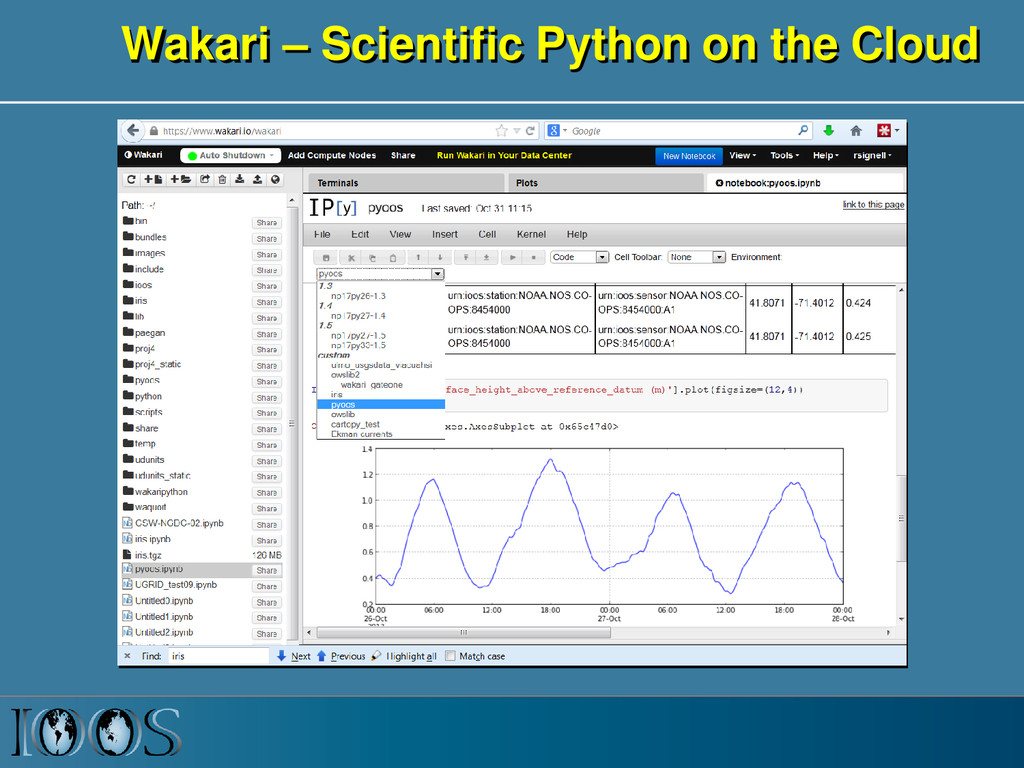
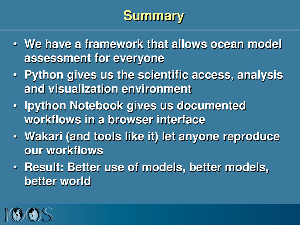
assessment for everyone • Python gives us the scientific access, analysis and visualization environment • Ipython Notebook gives us documented workflows in a browser interface • Wakari (and tools like it) let anyone reproduce our workflows • Result: Better use of models, better models, better world
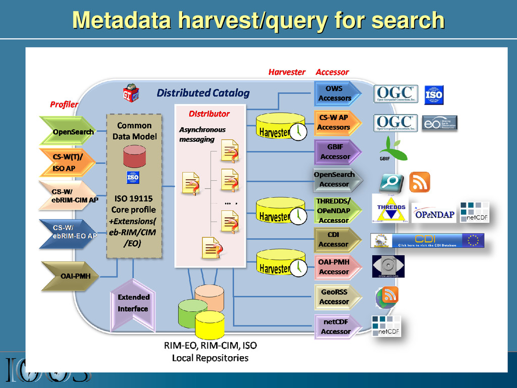
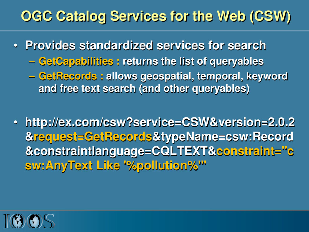
services for search – GetCapabilities : returns the list of queryables – GetRecords : allows geospatial, temporal, keyword and free text search (and other queryables) • http://ex.com/csw?service=CSW&version=2.0.2 &request=GetRecords&typeName=csw:Record &constraintlanguage=CQLTEXT&constraint="c sw:AnyText Like '%pollution%'"
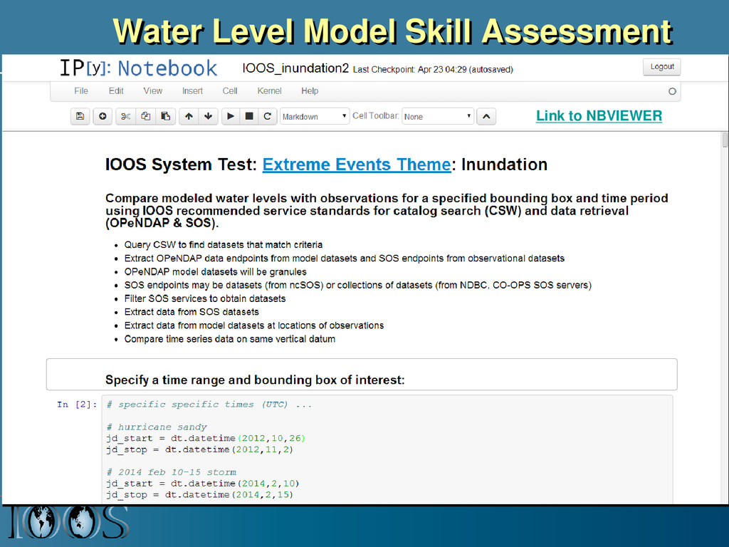
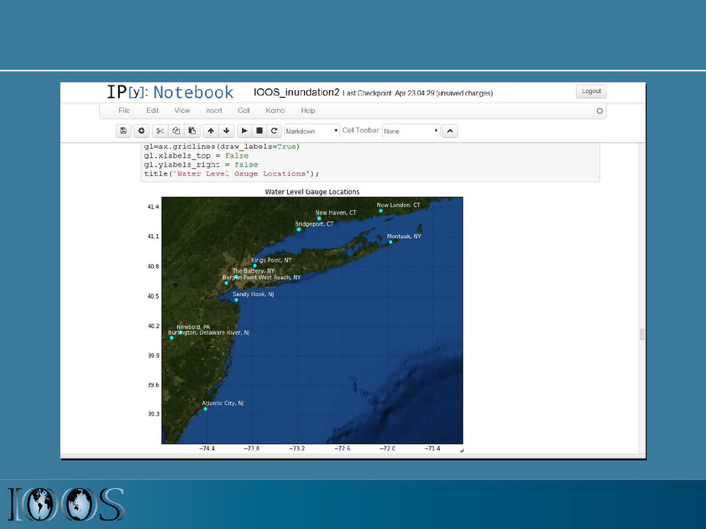
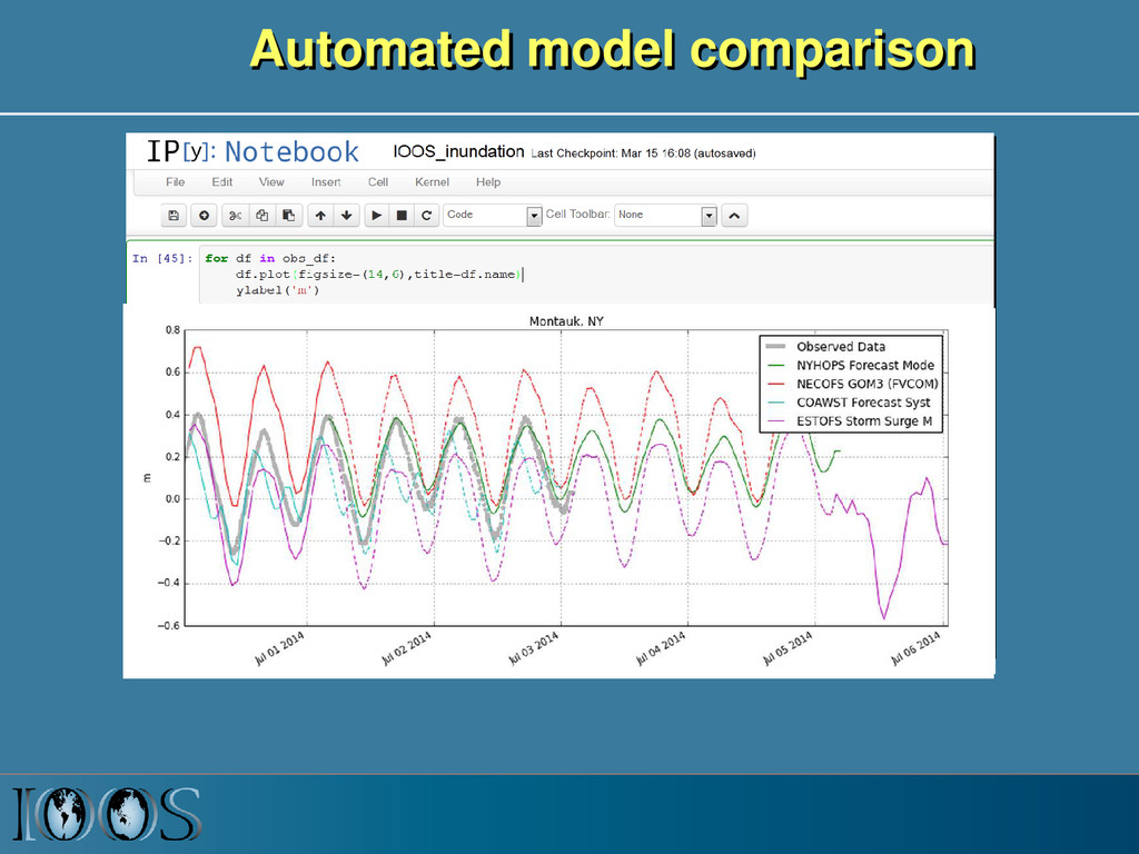
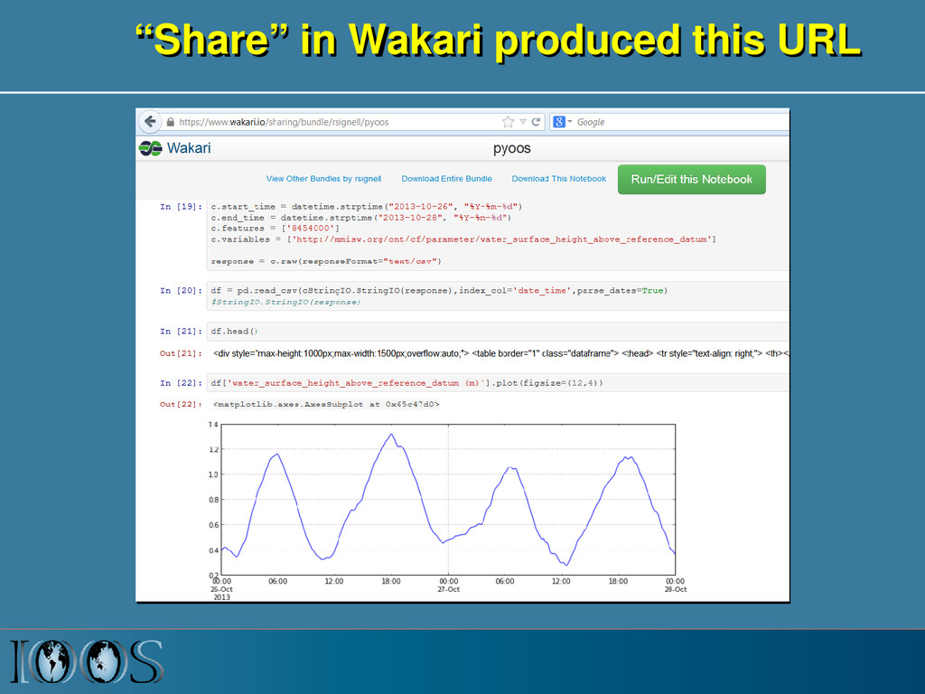
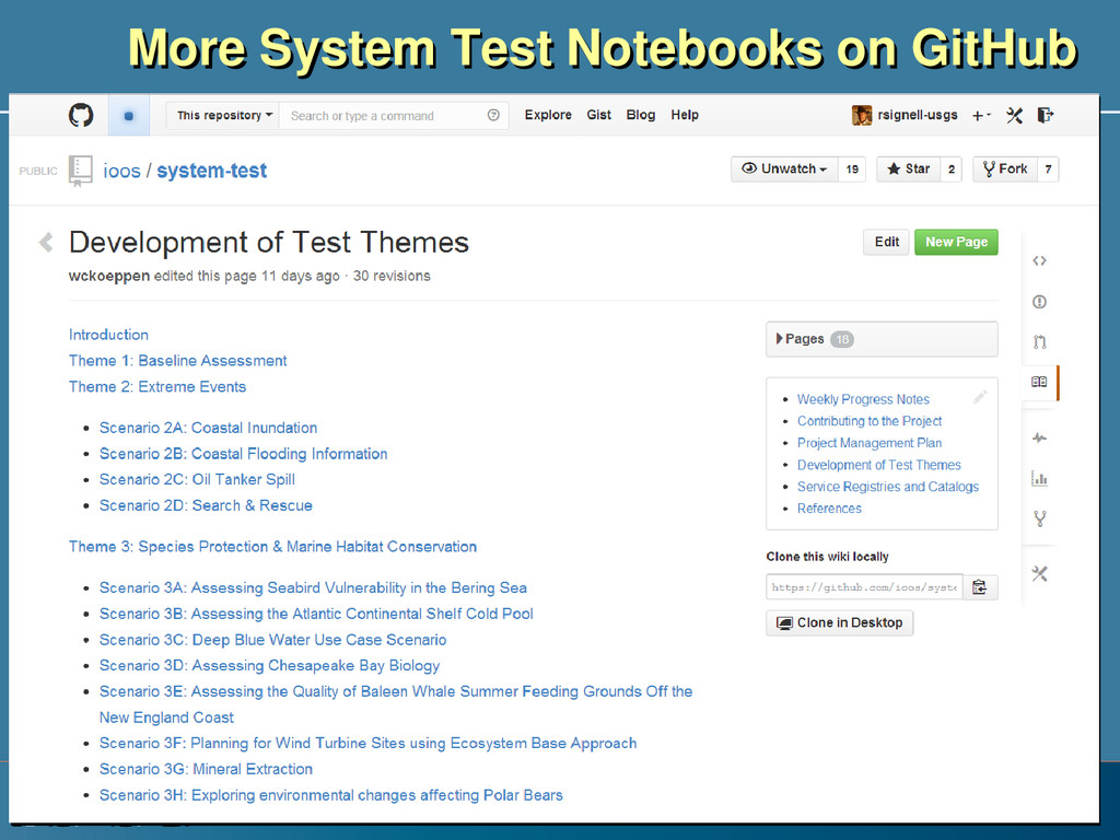
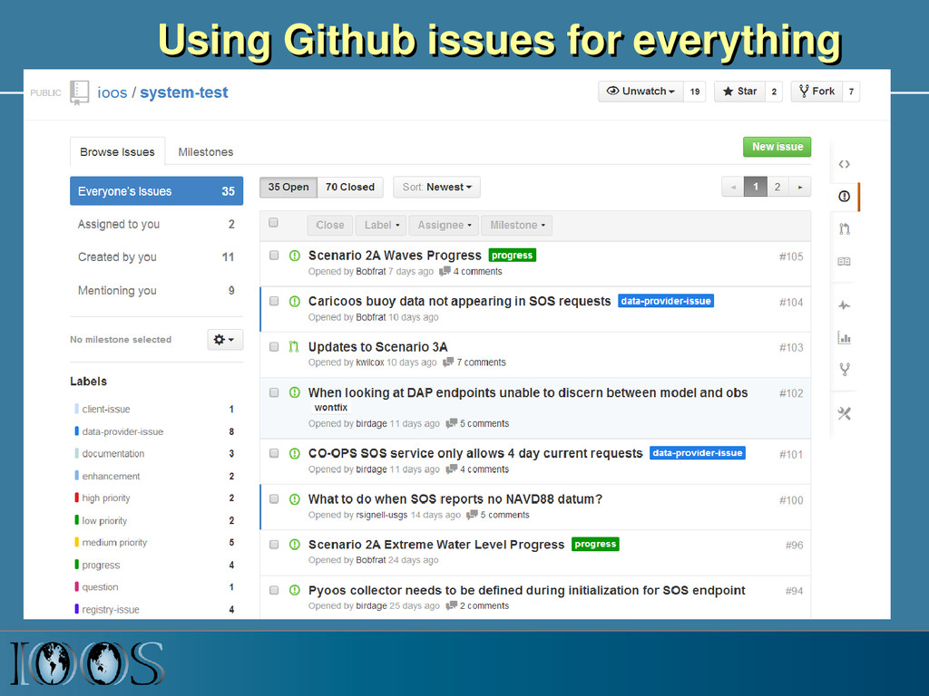
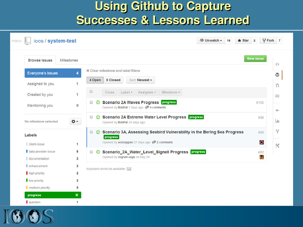
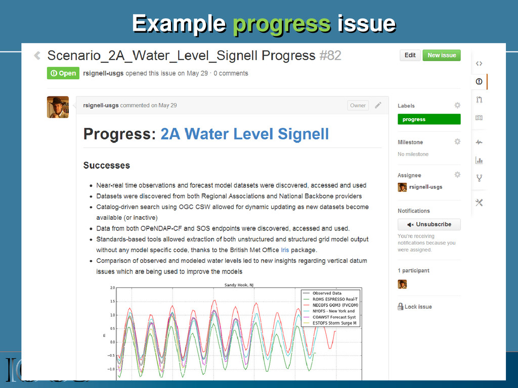
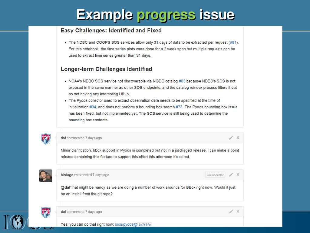
to solve actual physical and biological scenarios: eat our own dog food • Demonstrates successes as well as issues with standards, metadata, services, tools and data providers • Using Ipython Notebooks as documentation, end-to-end examples and products • Shared Notebooks lead to more efficient, effective and widespread use of model and insitu data System Test Funding from US IOOS Program Office Director: Zdenka Willis Project Lead: Derrick Snowden