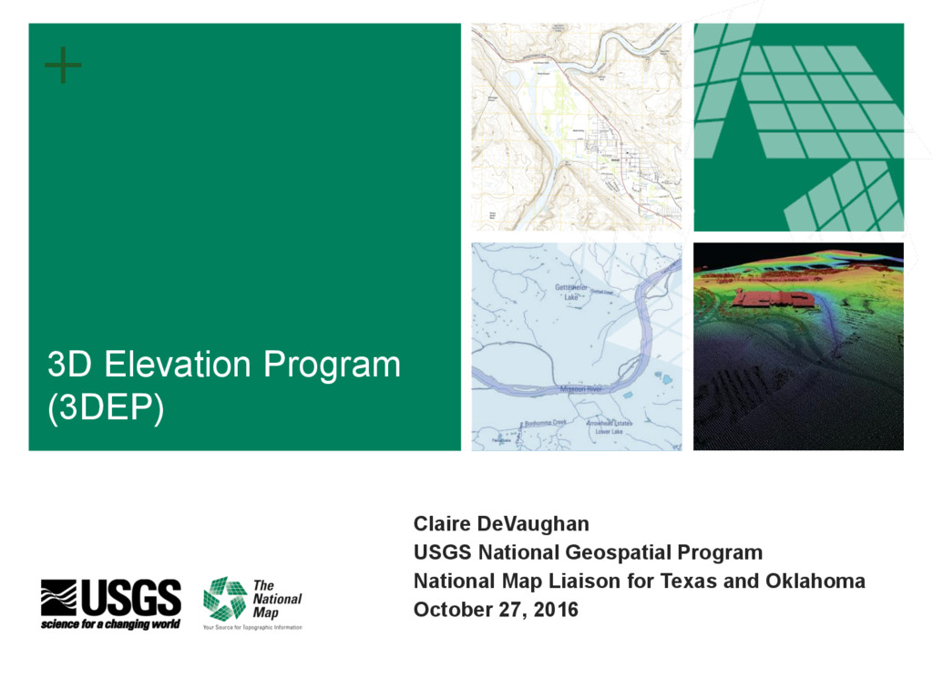
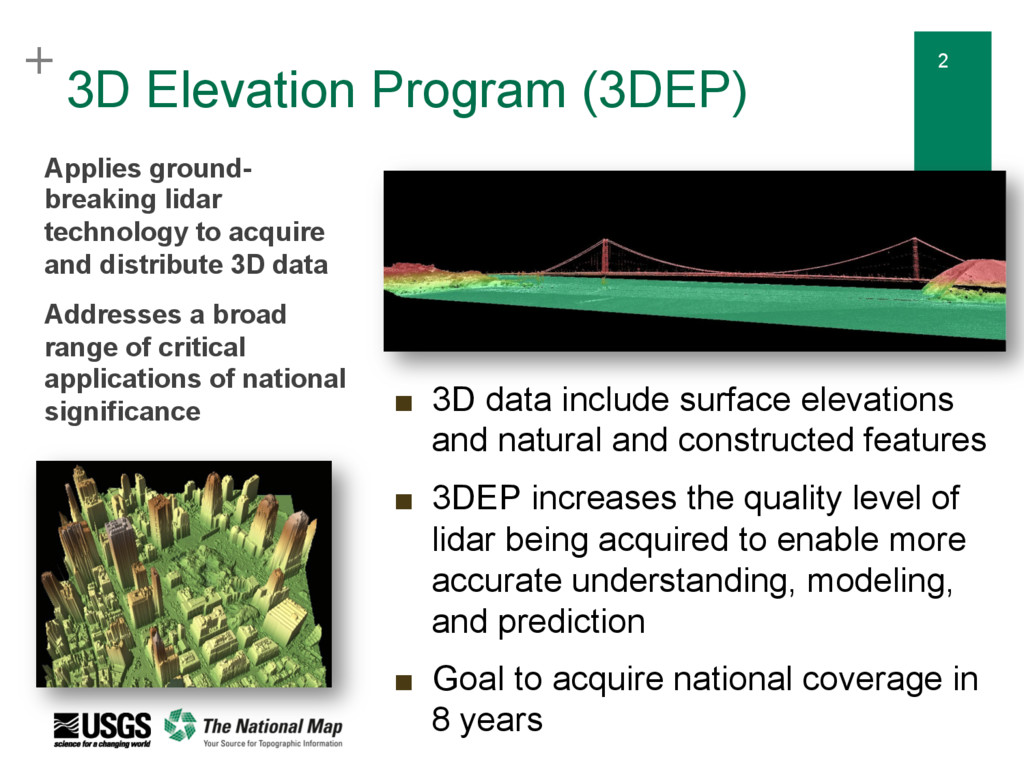
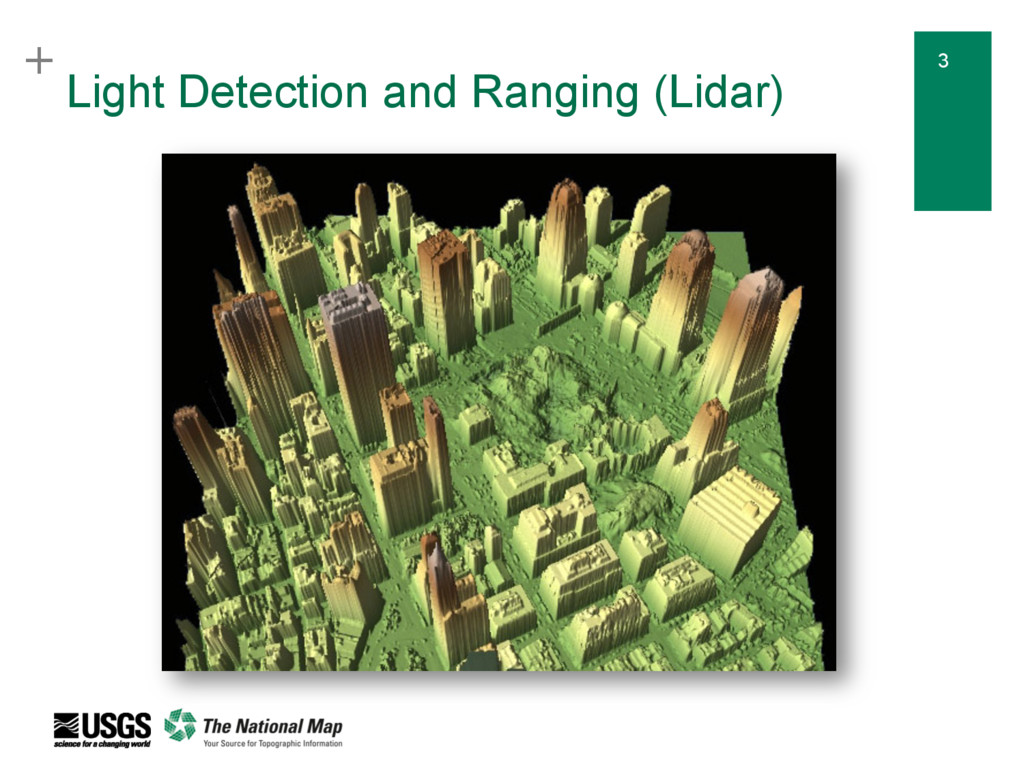
natural and constructed features ▪ 3DEP increases the quality level of lidar being acquired to enable more accurate understanding, modeling, and prediction ▪ Goal to acquire national coverage in 8 years Applies ground- breaking lidar technology to acquire and distribute 3D data Addresses a broad range of critical applications of national significance 3D Elevation Program (3DEP)
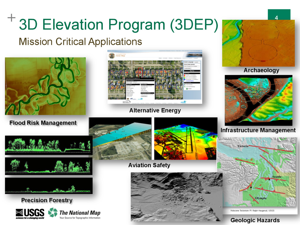
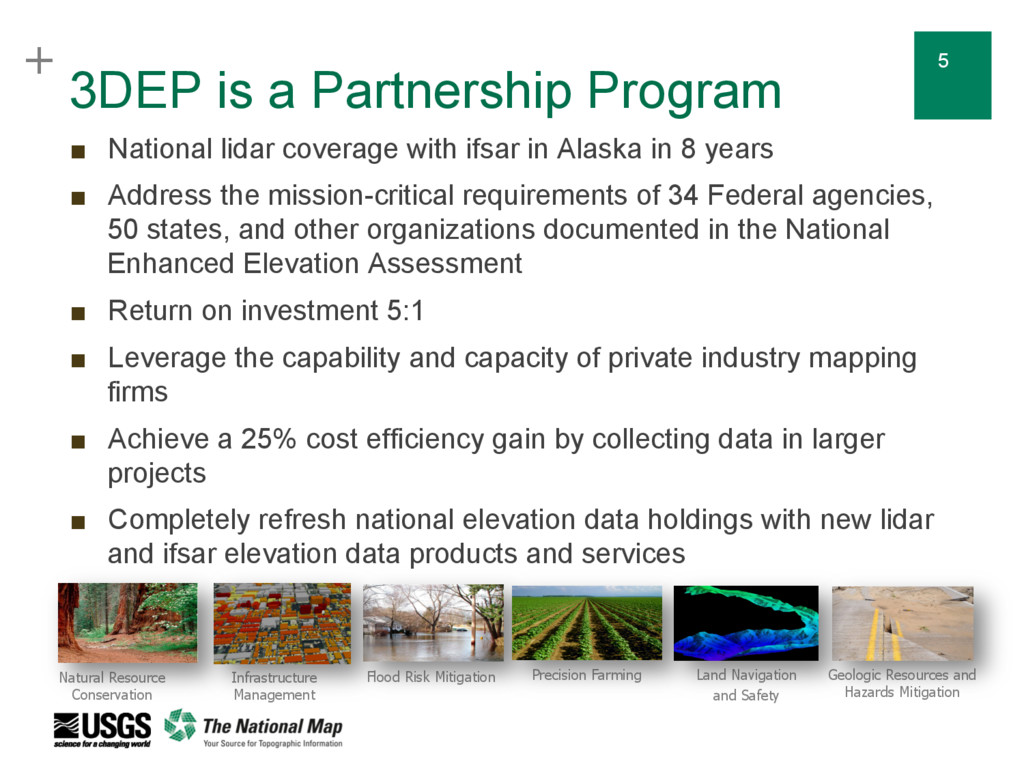
lidar coverage with ifsar in Alaska in 8 years ▪ Address the mission-critical requirements of 34 Federal agencies, 50 states, and other organizations documented in the National Enhanced Elevation Assessment ▪ Return on investment 5:1 ▪ Leverage the capability and capacity of private industry mapping firms ▪ Achieve a 25% cost efficiency gain by collecting data in larger projects ▪ Completely refresh national elevation data holdings with new lidar and ifsar elevation data products and services Natural Resource Conservation Infrastructure Management Flood Risk Mitigation Precision Farming Land Navigation and Safety Geologic Resources and Hazards Mitigation
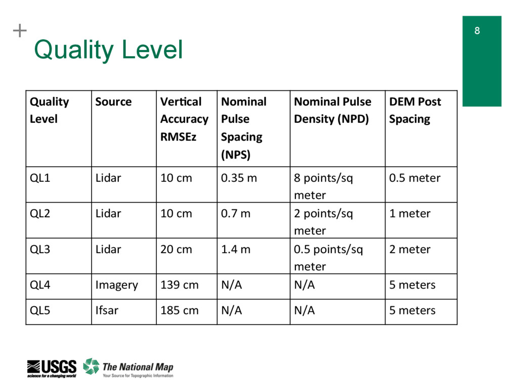
Spacing (NPS) Nominal Pulse Density (NPD) DEM Post Spacing QL1 Lidar 10 cm 0.35 m 8 points/sq meter 0.5 meter QL2 Lidar 10 cm 0.7 m 2 points/sq meter 1 meter QL3 Lidar 20 cm 1.4 m 0.5 points/sq meter 2 meter QL4 Imagery 139 cm N/A N/A 5 meters QL5 Ifsar 185 cm N/A N/A 5 meters Quality Level
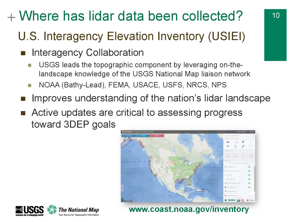
U.S. Interagency Elevation Inventory (USIEI) n Interagency Collaboration n USGS leads the topographic component by leveraging on-the- landscape knowledge of the USGS National Map liaison network n NOAA (Bathy-Lead), FEMA, USACE, USFS, NRCS, NPS n Improves understanding of the nation’s lidar landscape n Active updates are critical to assessing progress toward 3DEP goals www.coast.noaa.gov/inventory
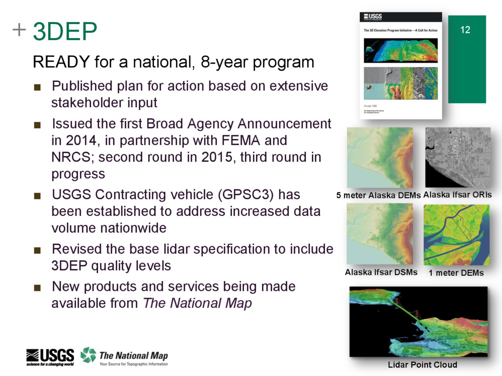
▪ Published plan for action based on extensive stakeholder input ▪ Issued the first Broad Agency Announcement in 2014, in partnership with FEMA and NRCS; second round in 2015, third round in progress ▪ USGS Contracting vehicle (GPSC3) has been established to address increased data volume nationwide ▪ Revised the base lidar specification to include 3DEP quality levels ▪ New products and services being made available from The National Map Lidar Point Cloud 1 meter DEMs 5 meter Alaska DEMs Alaska Ifsar ORIs Alaska Ifsar DSMs
unit costs through pooled funding with other partners, and economy of scale that 3DEP provides ▪ Access to qualified and experienced firms under contract that acquire and process aerial lidar data ▪ USGS programmatic infrastructure that issues and manages data acquisition contracts, and inspects, accepts, and distributes point cloud and derived data products ▪ The opportunity to “buy up” higher-quality data for demanding applications that are not satisfied by standard 3DEP data ▪ The opportunity to receive funding and acquire data on behalf of 3DEP Maximize Project Benefits and Minimize Project Risks
in 30 states + 1 territory n 3DEP funding was offered for 28 proposals in 25 states n Information on each award is online at nationalmap.gov/3dep n FY17 BAA RFP closed on October 10, proposals are currently under review FY16 Broad Agency Announcement (BAA)
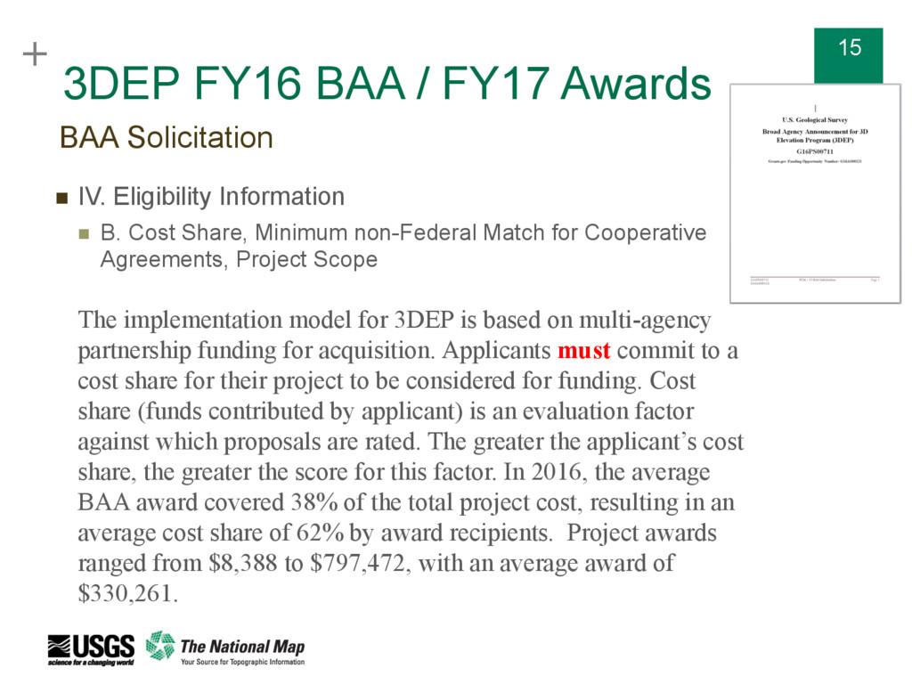
n IV. Eligibility Information n B. Cost Share, Minimum non-Federal Match for Cooperative Agreements, Project Scope The implementation model for 3DEP is based on multi-agency partnership funding for acquisition. Applicants must commit to a cost share for their project to be considered for funding. Cost share (funds contributed by applicant) is an evaluation factor against which proposals are rated. The greater the applicant’s cost share, the greater the score for this factor. In 2016, the average BAA award covered 38% of the total project cost, resulting in an average cost share of 62% by award recipients. Project awards ranged from $8,388 to $797,472, with an average award of $330,261. BAA Solicitation
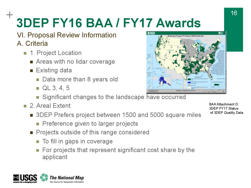
n 1. Project Location n Areas with no lidar coverage n Existing data n Data more than 8 years old n QL 3, 4, 5 n Significant changes to the landscape have occurred n 2. Areal Extent n 3DEP Prefers project between 1500 and 5000 square miles n Preference given to larger projects n Projects outside of this range considered n To fill in gaps in coverage n For projects that represent significant cost share by the applicant VI. Proposal Review Information A. Criteria BAA Attachment D: 3DEP FY17 Status of 3DEP Quality Data
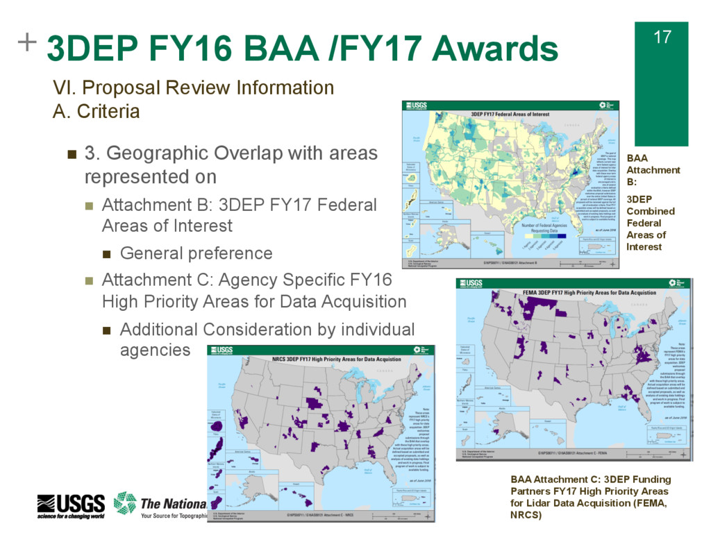
Proposal Review Information A. Criteria n 3. Geographic Overlap with areas represented on n Attachment B: 3DEP FY17 Federal Areas of Interest n General preference n Attachment C: Agency Specific FY16 High Priority Areas for Data Acquisition n Additional Consideration by individual agencies BAA Attachment B: 3DEP Combined Federal Areas of Interest BAA Attachment C: 3DEP Funding Partners FY17 High Priority Areas for Lidar Data Acquisition (FEMA, NRCS)
Proposal Review Information A. Criteria n 4.Project Cost and Cost Share (funds contributed by applicant) n 5. Maturity of Applicant’s Proposal and maturity of designated funding sources n 6.Technical Approach n Projects making use of the GPSC as the acquisition mechanism receive full score for technical approach n Applicants proposing to mange their own contract will be evaluated on the applicant’s approach to data acquisition and required project deliverables n 7. Past Performance
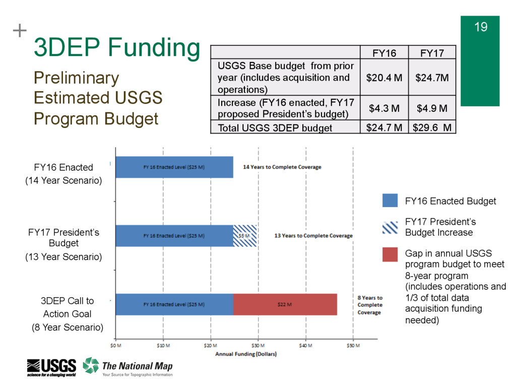
Budget FY16 Enacted (14 Year Scenario) FY17 President’s Budget (13 Year Scenario) 3DEP Call to Action Goal (8 Year Scenario) FY16 FY17 USGS Base budget from prior year (includes acquisition and operations) $20.4 M $24.7M Increase (FY16 enacted, FY17 proposed President’s budget) $4.3 M $4.9 M Total USGS 3DEP budget $24.7 M $29.6 M FY16 Enacted Budget FY17 President’s Budget Increase Gap in annual USGS program budget to meet 8-year program (includes operations and 1/3 of total data acquisition funding needed)
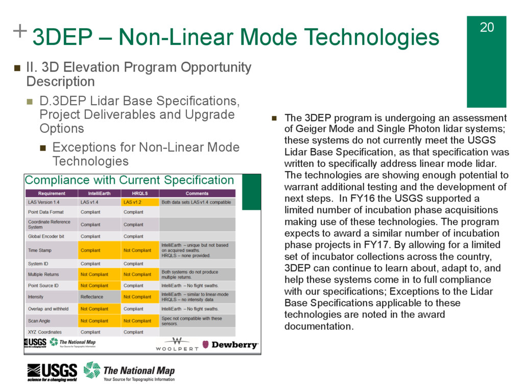
II. 3D Elevation Program Opportunity Description n D.3DEP Lidar Base Specifications, Project Deliverables and Upgrade Options n Exceptions for Non-Linear Mode Technologies n The 3DEP program is undergoing an assessment of Geiger Mode and Single Photon lidar systems; these systems do not currently meet the USGS Lidar Base Specification, as that specification was written to specifically address linear mode lidar. The technologies are showing enough potential to warrant additional testing and the development of next steps. In FY16 the USGS supported a limited number of incubation phase acquisitions making use of these technologies. The program expects to award a similar number of incubation phase projects in FY17. By allowing for a limited set of incubator collections across the country, 3DEP can continue to learn about, adapt to, and help these systems come in to full compliance with our specifications; Exceptions to the Lidar Base Specifications applicable to these technologies are noted in the award documentation.
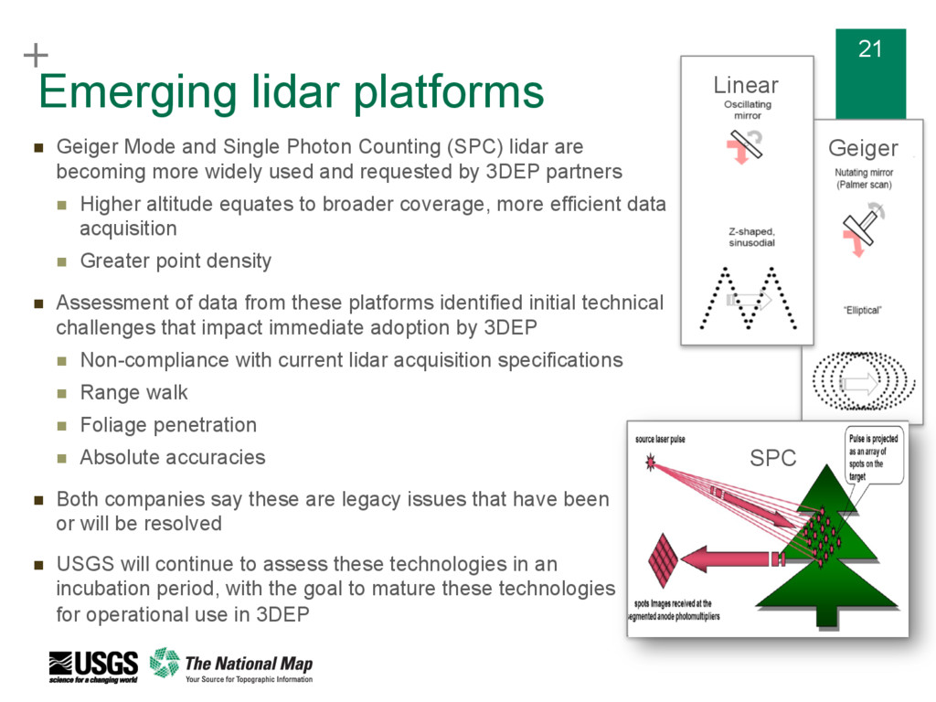
Photon Counting (SPC) lidar are becoming more widely used and requested by 3DEP partners n Higher altitude equates to broader coverage, more efficient data acquisition n Greater point density n Assessment of data from these platforms identified initial technical challenges that impact immediate adoption by 3DEP n Non-compliance with current lidar acquisition specifications n Range walk n Foliage penetration n Absolute accuracies n Both companies say these are legacy issues that have been or will be resolved n USGS will continue to assess these technologies in an incubation period, with the goal to mature these technologies for operational use in 3DEP Geiger SPC Linear
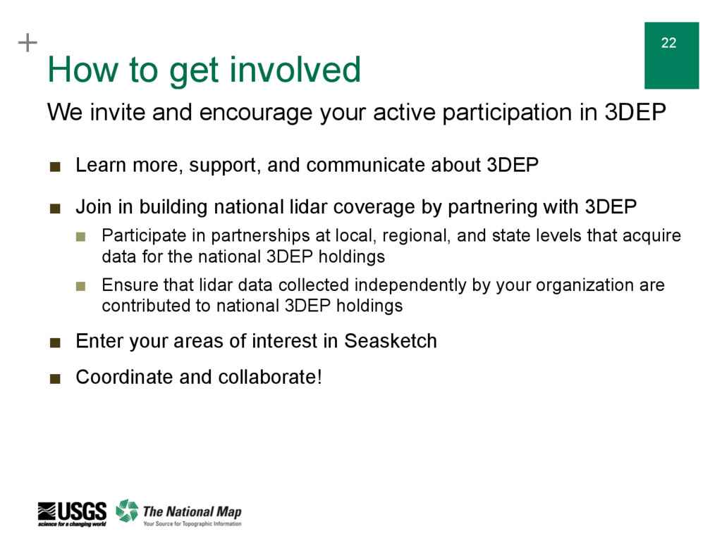
encourage your active participation in 3DEP ▪ Learn more, support, and communicate about 3DEP ▪ Join in building national lidar coverage by partnering with 3DEP ▪ Participate in partnerships at local, regional, and state levels that acquire data for the national 3DEP holdings ▪ Ensure that lidar data collected independently by your organization are contributed to national 3DEP holdings ▪ Enter your areas of interest in Seasketch ▪ Coordinate and collaborate!
Web Pages http://nationalmap.gov/3DEP 3D Elevation Program (3DEP) FY16/17 Broad Agency Announcement (BAA) Information Sharing Site https://cms.geoplatform.gov/elevation/3DEP BAA Reference Materials Page http://nationalmap.gov/3DEP/BAAReferenceMaterials.html NOAA sponsored Seasketch site: U.S. Federal Mapping Coordination, A Demonstration Site for Federal Mapping Data Acquisition http://seasket.ch/hwpR3E-MxO NOAA sponsored US Interagency Elevation Inventory (USIEI) site http://www.coast.noaa.gov/inventory The 3D Elevation Program Initiative – A Call for Action http://pubs.usgs.gov/circ/1399/ USGS NGP Lidar Base Specification V1.2 http://pubs.usgs.gov/tm/11b4/pdf/tm11-B4.pdf Resources
the 3D Elevation Program in general: [email protected] Or contact your National Map Liaison with questions about 3DEP in your state/area: Claire DeVaughan National Map Liaison for Texas and Oklahoma 512-927-3583 [email protected]