Upgrade to Pro — share decks privately, control downloads, hide ads and more …

3D GIS and GeoDesign: Changing the Planning Conversation

3D GIS and GeoDesign: Changing the Planning Conversation

Presented by:
Nathan Brigmon - Civic Analytics

More Decks by Texas Natural Resources Information System

Other Decks in Technology

Transcript

  1. 3D  GIS  and  GeoDesign:   Changing  the  Planning  Conversa7on  

      Nathan  Brigmon   TNRIS  |  Oct  23rd  2014  
  2. 2   GeoDesign   Geodesign  is  a  set  of  techniques

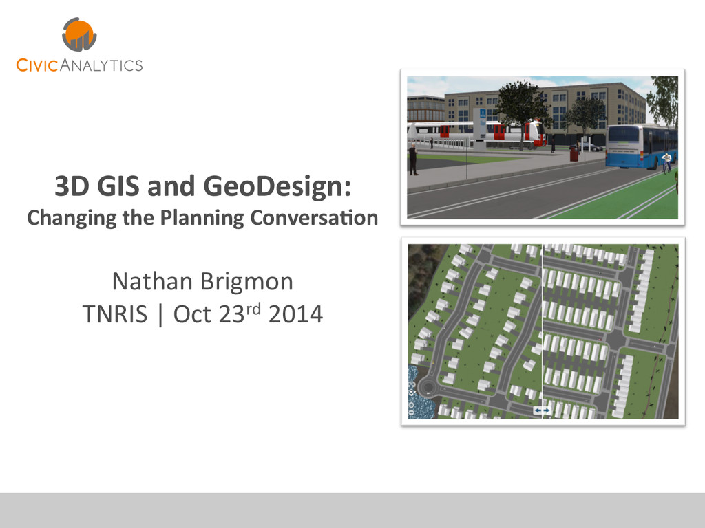
     and  enabling   technologies  for  planning  built  and  natural   environments  in  an  integrated  process,  including   project  conceptualizaGon,  analysis,  design   specificaGon,  stakeholder  parGcipaGon  and   collaboraGon,  design  creaGon,  simulaGon,  and   evaluaGon  (among  other  stages).       Geodesign  is  a  design  and  planning  method  which   Gghtly  couples  the  creaGon  of  design  proposals  with   impact  simulaGons  informed  by  geographic  contexts.     -­‐  hQp://en.wikipedia.org/wiki/Geodesign  
  3. 4   New  Technology   3D  Modeling  –  CityEngine  (uses

     WebGL)   •  Shareable   •  InteracGve      
  4. 5   My  Basic  Workflow   GeWng  shareable,  interacGve  models:

      Import   Export   Code   .SHP   .GDB   .OSM   .DXF   .OBJ   .DAE   .PY   .PNG,  .JPG,  etc.  
  5. 6   Four  TX  Examples   Four  examples  of  integra7ng

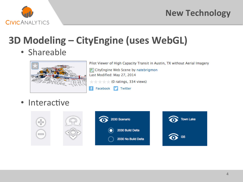
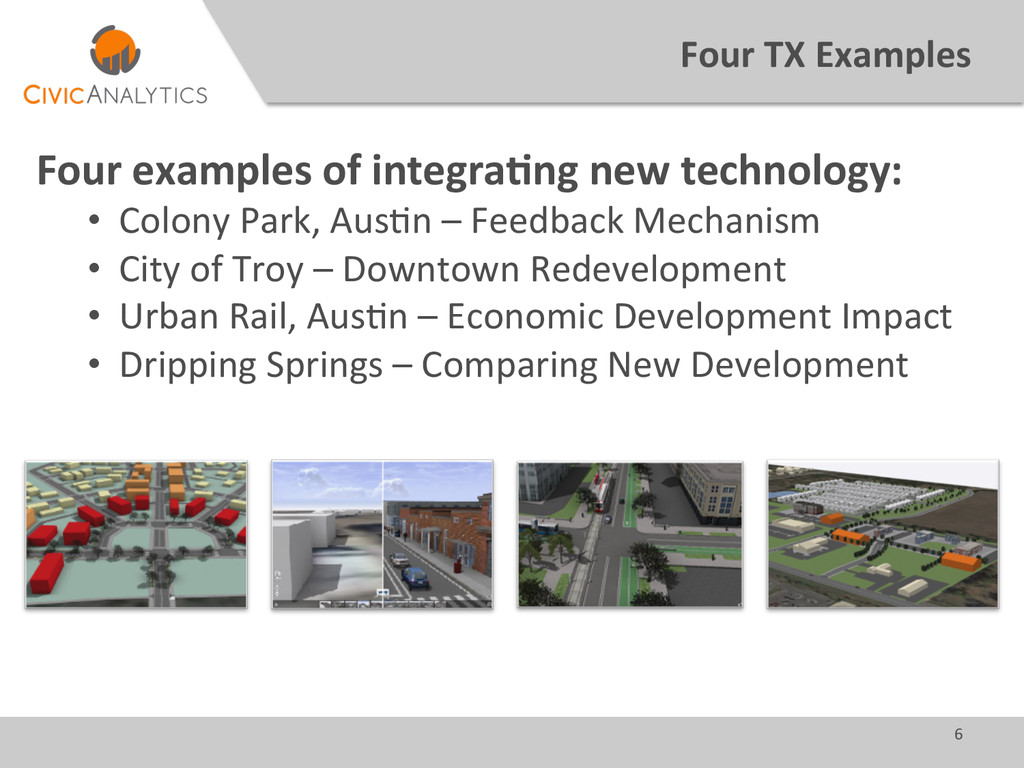
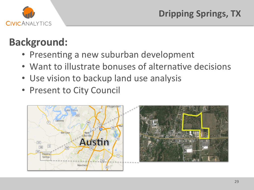
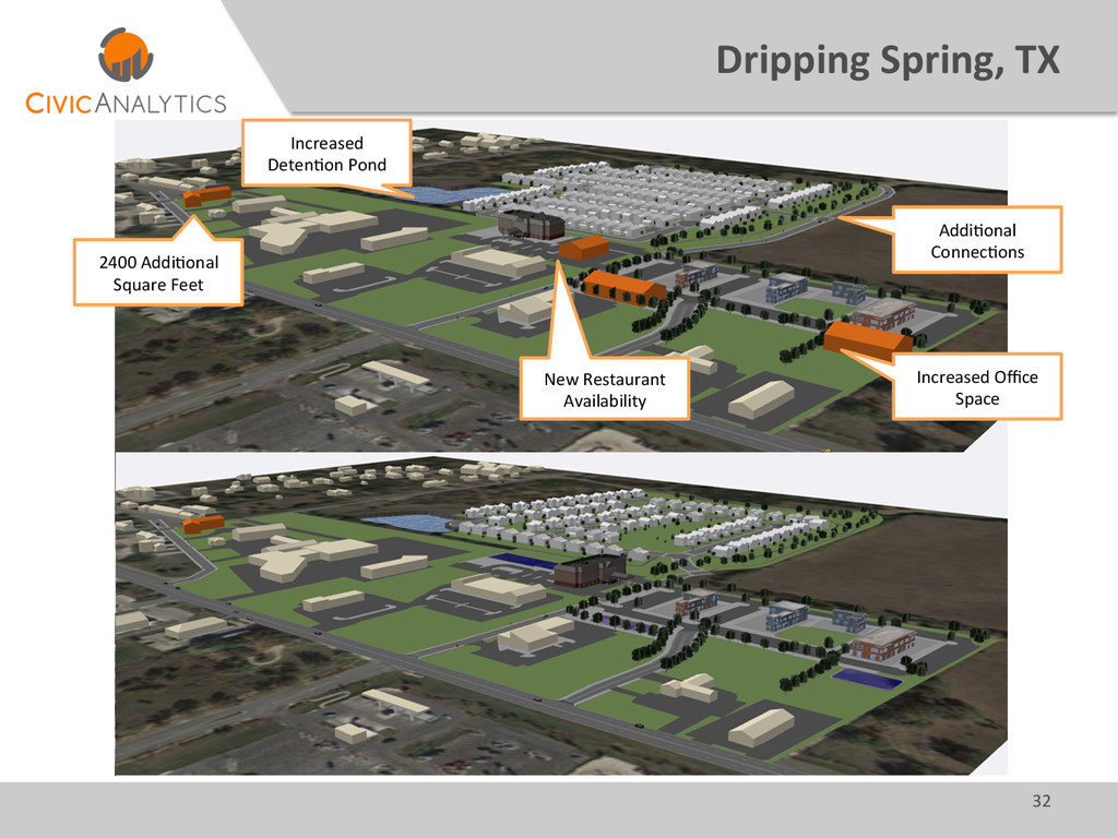
     new  technology:   •  Colony  Park,  AusGn  –  Feedback  Mechanism   •  City  of  Troy  –  Downtown  Redevelopment   •  Urban  Rail,  AusGn  –  Economic  Development  Impact   •  Dripping  Springs  –  Comparing  New  Development  
  6. 7   Colony  Park  –  Aus7n,  TX   Background:  

    •  Future  development     •  Three  unique  land  use  plan   •  Scenario  planning  using  Envision  Tomorrow   •  Building  envelope  analysis  
  7. 8   Colony  Park  –  Aus7n,  TX   Process:  

    •  Get  basic  design  parameters   •  Measure  and  visualize  impacts   •  Share  models   •  Get  unique  feedback  
  8. 9   Colony  Park  –  Aus7n,  TX     Blue

     Stem   Moonrise   Five  Hills  
  9. 12   Colony  Park  –  Aus7n,  TX   Tension:  

    •  New  tech  caused  anxiety   •  Would  it  deliver  what  was  promised?   •  How  would  it  contribute?   •  Does  it  overlap  with  exisGng  roles  and  workflows?   •  Resulted  in   •  Poor  internal  feedback   •  Hardly  used  at  public  meeGng  
  10. 13   City  of  Troy,  TX   Background:   • 

    PopulaGon:  1,645   •  No  source  data   •  “People  are  visual”  and  seeing  is  believing   •  Build  a  possible  downtown  extension  
  11. 14   City  of  Troy,  TX   Process:   • 

    UGlize  exisGng  resources     •  Use  exisGng  downtown  as  style-­‐guide  
  12. 15   City  of  Troy,  TX   UGlize  ExisGng  Resources

     (aka  free):     OpenStreetMap   Google  Maps   ArcGIS  Online   3D  Warehouse   •  Streets   •  Trails   •  Rail   •  Aerials   •  Building   Outlines   •  Cars   •  People   •  Trees   •  Furniture   •  Textures   •  Train   •  Cars  
  13. 16   City  of  Troy,  TX   Use  exisGng  downtown

     as  style  guide     CE  Web  Viewer   Google  Street  View  
  14. 19   City  of  Troy,  TX   Marke7ng  and  Awareness:

      •  Communicate  exisGng  and  future  condiGons   •  PotenGal  for  downtown  redevelopment   •  Can  reach  much  larger  audience      
  15. 20   Urban  Rail  –  Aus7n,  TX   Background:  

    •  Econ.  development  impact  of  “build”  vs.  “no  build”   •  Looking  into  the  future  –  2030   •  3D  model  was  seen  as  a  distant  concern    
  16. 21   Urban  Rail  –  Aus7n,  TX   Process:  

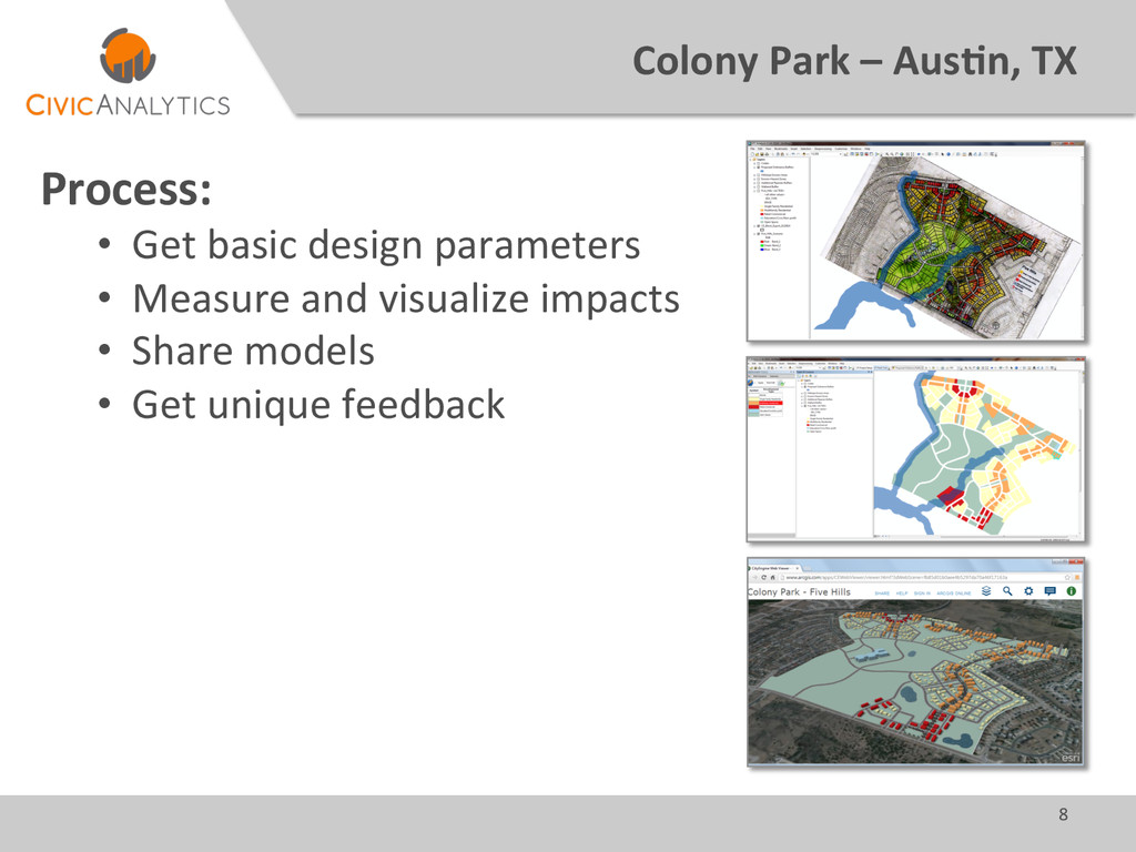
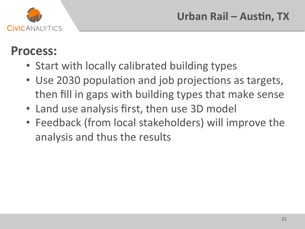
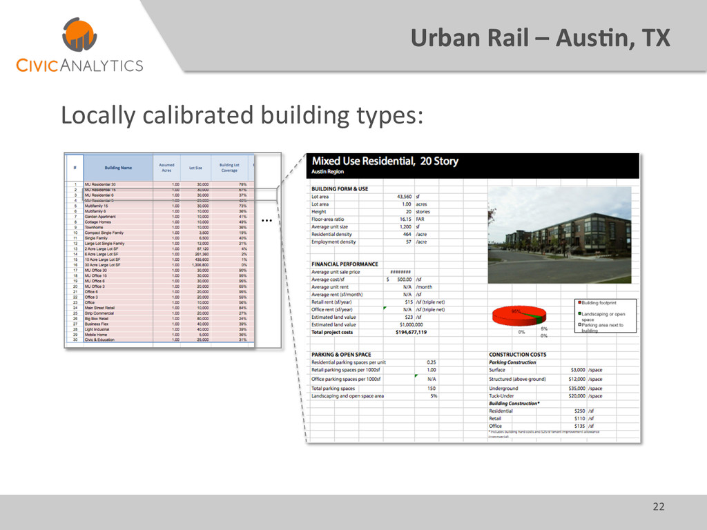
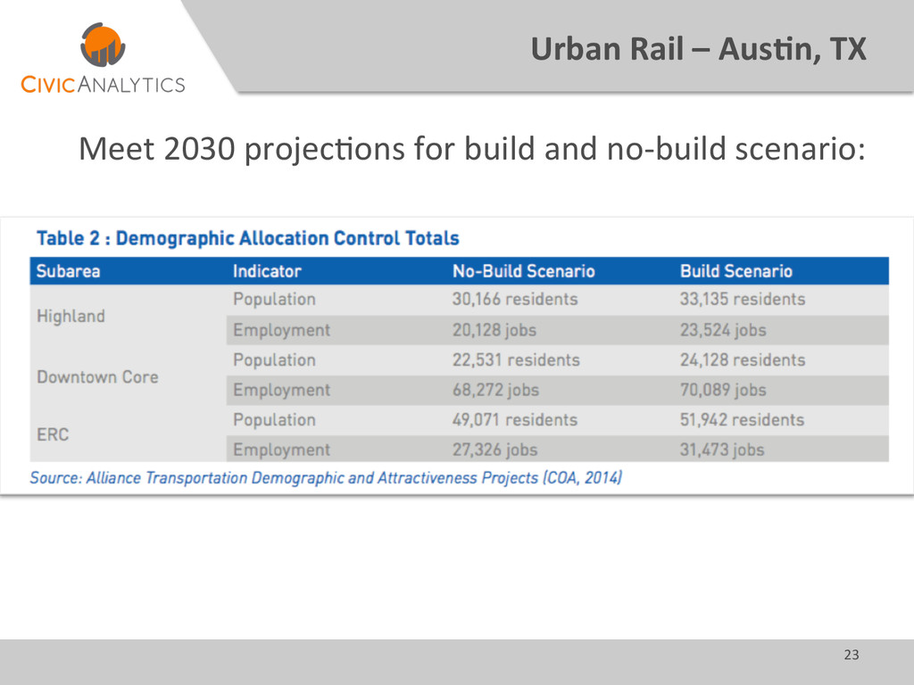
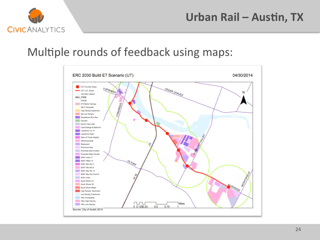
    •  Start  with  locally  calibrated  building  types   •  Use  2030  populaGon  and  job  projecGons  as  targets,   then  fill  in  gaps  with  building  types  that  make  sense   •  Land  use  analysis  first,  then  use  3D  model   •  Feedback  (from  local  stakeholders)  will  improve  the   analysis  and  thus  the  results  
  17. 23   Urban  Rail  –  Aus7n,  TX   Meet  2030

     projecGons  for  build  and  no-­‐build  scenario:  
  18. 24   Urban  Rail  –  Aus7n,  TX   MulGple  rounds

     of  feedback  using  maps:    
  19. 26   Urban  Rail  –  Aus7n,  TX   No  Build

     versus  Build  visualized     2030  No  Build  –  ACC/Highland   2030  Build  –  ACC/Highland  
  20. 28   Urban  Rail  –  Aus7n,  TX   Facilita7ng  Feedback:

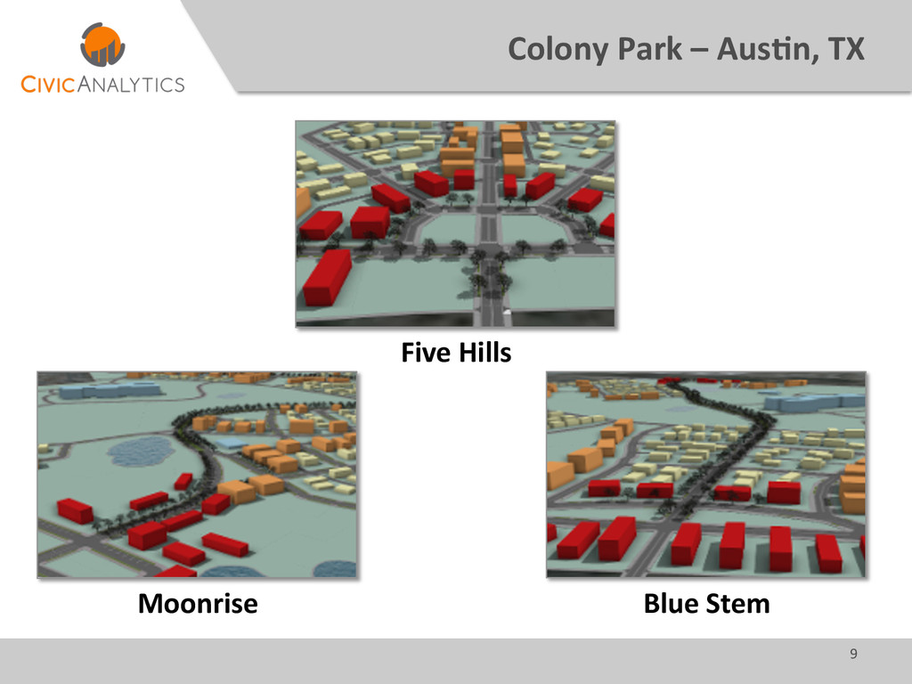
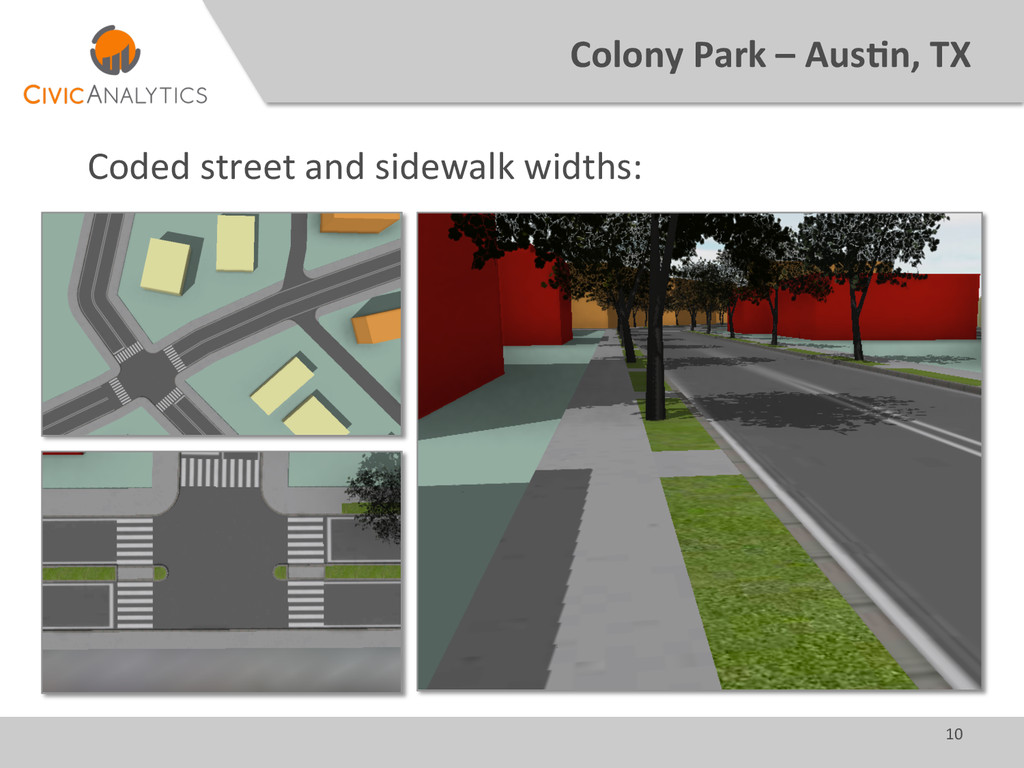
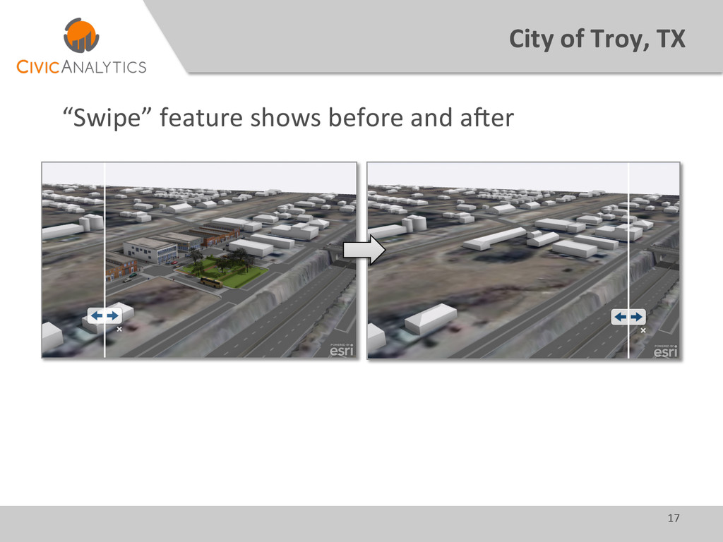
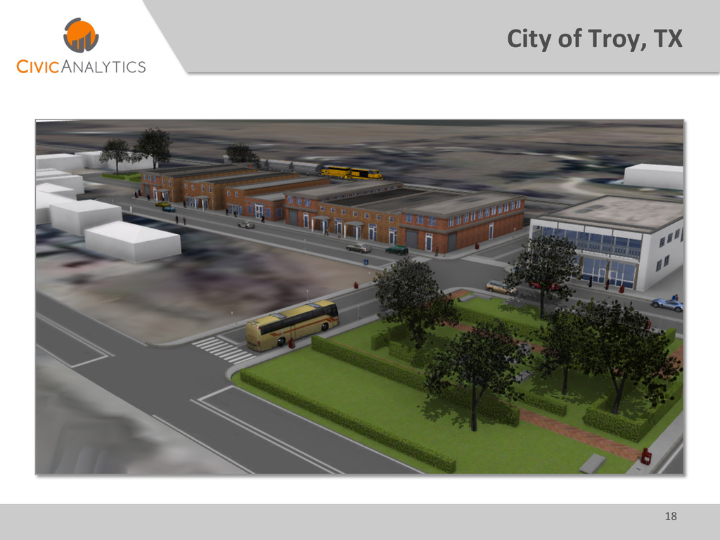
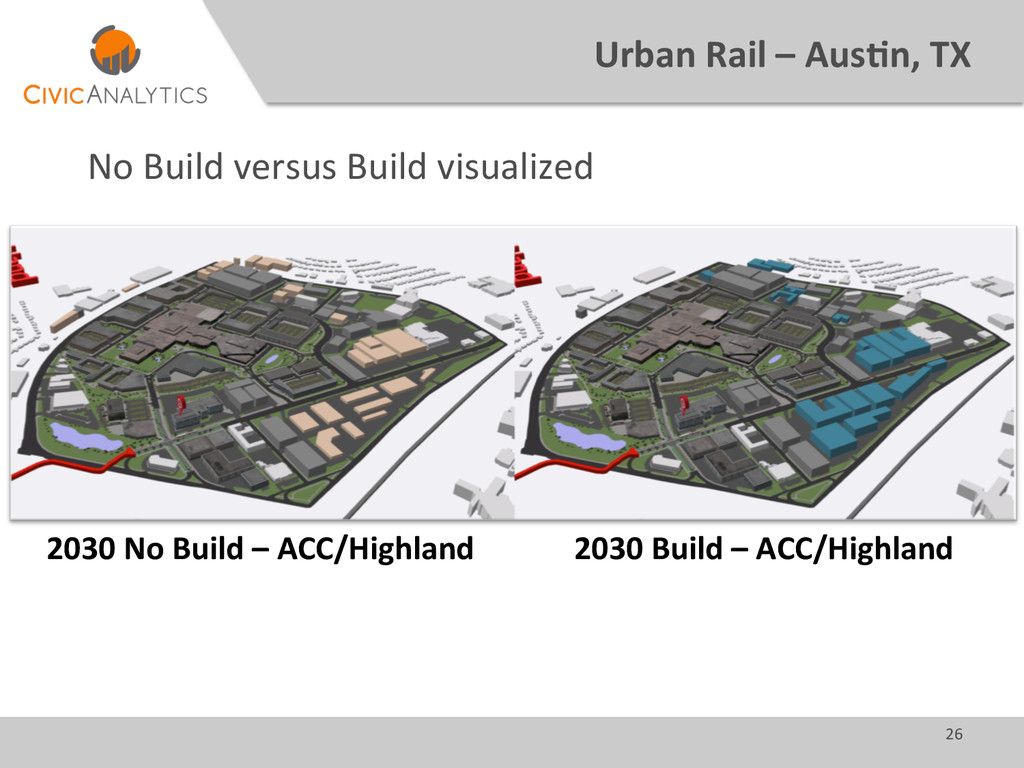
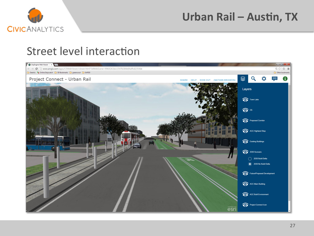
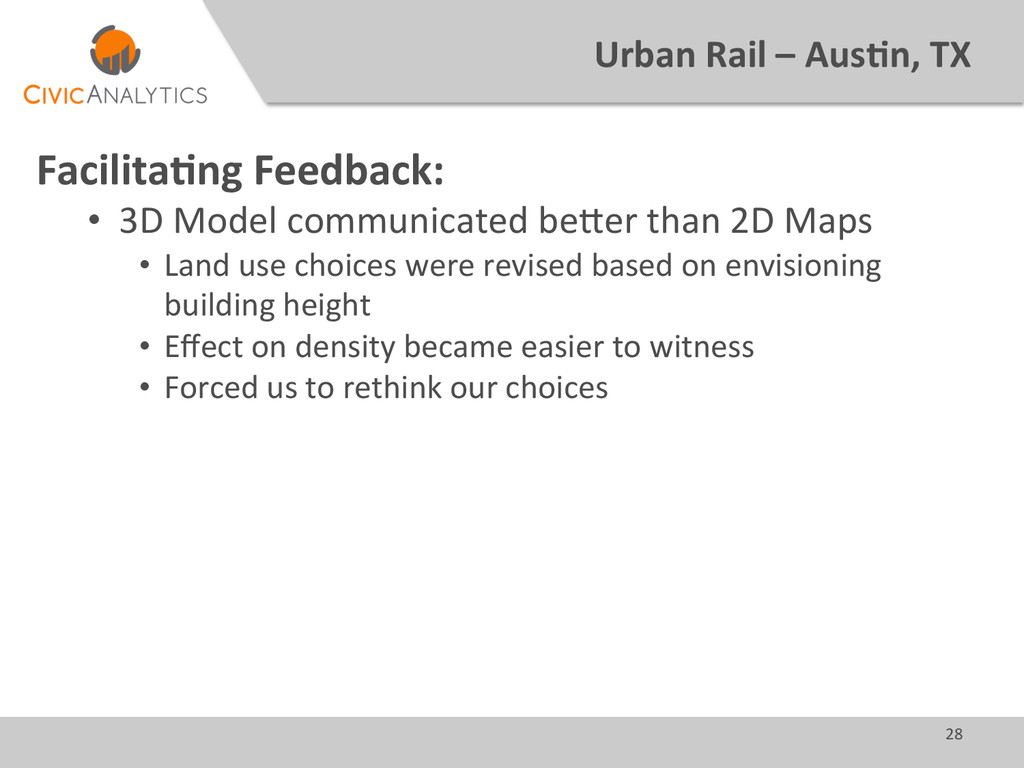
      •  3D  Model  communicated  beQer  than  2D  Maps   •  Land  use  choices  were  revised  based  on  envisioning   building  height   •  Effect  on  density  became  easier  to  witness   •  Forced  us  to  rethink  our  choices  
  21. 29   Dripping  Springs,  TX   Background:   •  PresenGng

     a  new  suburban  development   •  Want  to  illustrate  bonuses  of  alternaGve  decisions   •  Use  vision  to  backup  land  use  analysis   •  Present  to  City  Council  
  22. 32   Dripping  Spring,  TX   2400  AddiGonal   Square

     Feet   Increased   DetenGon  Pond   AddiGonal   ConnecGons   Increased  Office   Space   New  Restaurant   Availability  
  23. 33   Dripping  Springs,  TX   Suppor7ng  Arguments:   • 

    Communicate  alternate  vision   •  Illustrate  definiGon  of  “density”  
  24. 34   Future  of  3D  GIS  and  GeoDesign   What

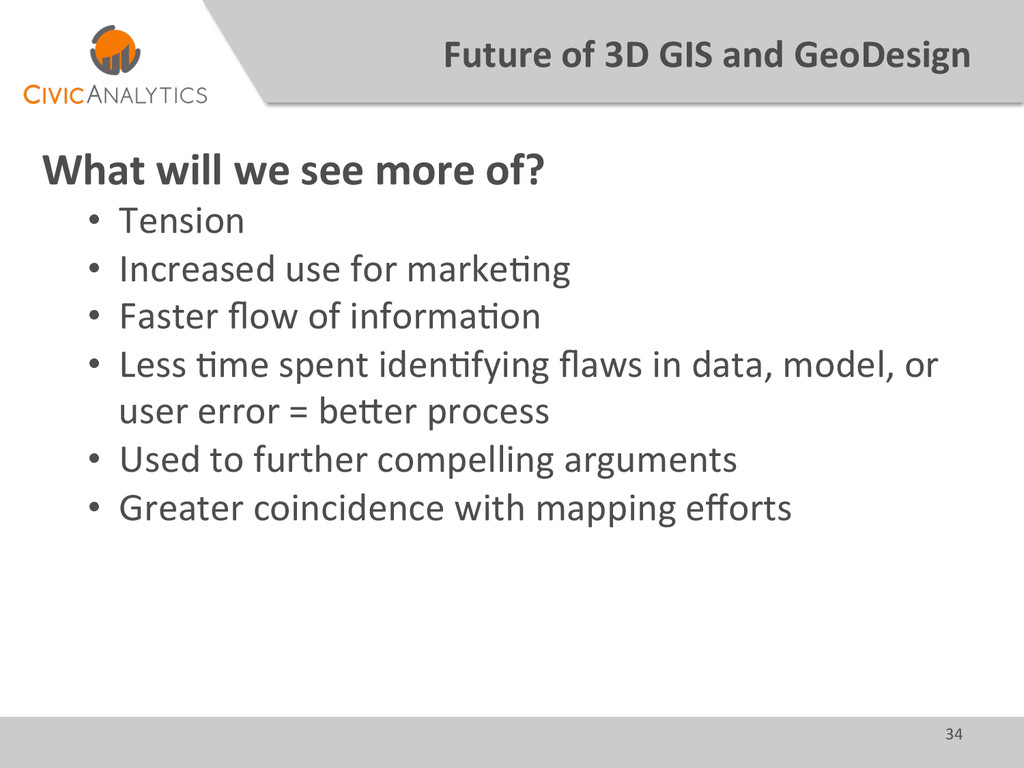
     will  we  see  more  of?   •  Tension   •  Increased  use  for  markeGng   •  Faster  flow  of  informaGon     •  Less  Gme  spent  idenGfying  flaws  in  data,  model,  or   user  error  =  beQer  process   •  Used  to  further  compelling  arguments   •  Greater  coincidence  with  mapping  efforts  
  25. @civicanalyGcs   hQp://civicanalyGcs.com   866-­‐512-­‐3835   [email protected]   7600  Burnet

     Road   Suite  108   AusGn,  TX  78757   [email protected]   866-­‐512-­‐3835  x  702   @natebrigmon