Detection and Ranging (LIDAR) is an airborne mapping technique. • Think about using a laser to measure the distance between the aircraft and the ground. • You know the speed of light is ~ constant. • You can measure aircraft position and pulse interval very accurately. • Up to 100,000 measurements per second are made of the ground, allowing highly detailed terrain and structure mapping and improving as we speak.
CURIOSITIES? • How simple ideas lead to outstanding discoveries • Earth is round and big (challenging for flat earthers), we can discuss it after the presentation (if you insist!). • Measure the speed of light. . . https://www.ted.com/talks/how_simple_ideas_lead_to_scientific_discoveries
physical. • Weather is wet and cold for outside exercises, impractical right now, we only have 30 min. • According to a study in the Proceedings of the National Academy of Sciences, certain memory training exercises can increase “fluid intelligence,” the ability to reason and solve new problems. • While exercise is good for the brain and the body, so is meditation. • Put on your “GIS” cap and think what, who, how was HERE 1000 years ago.
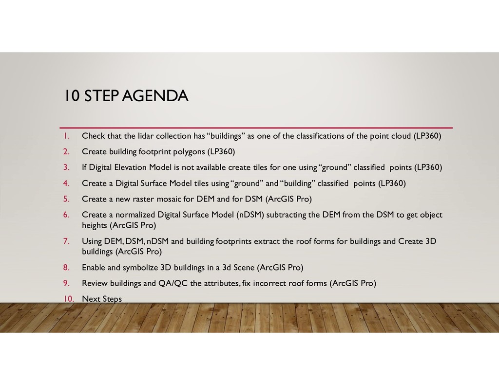
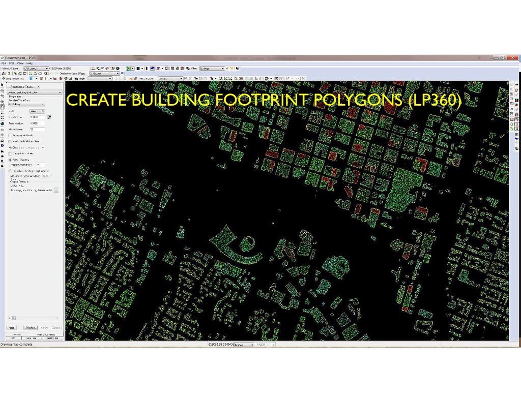
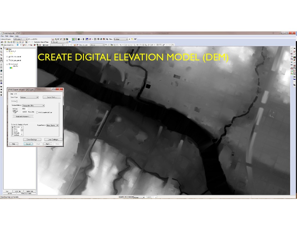
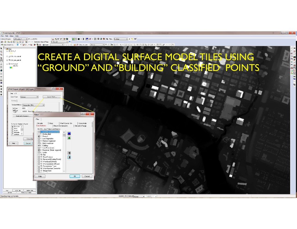
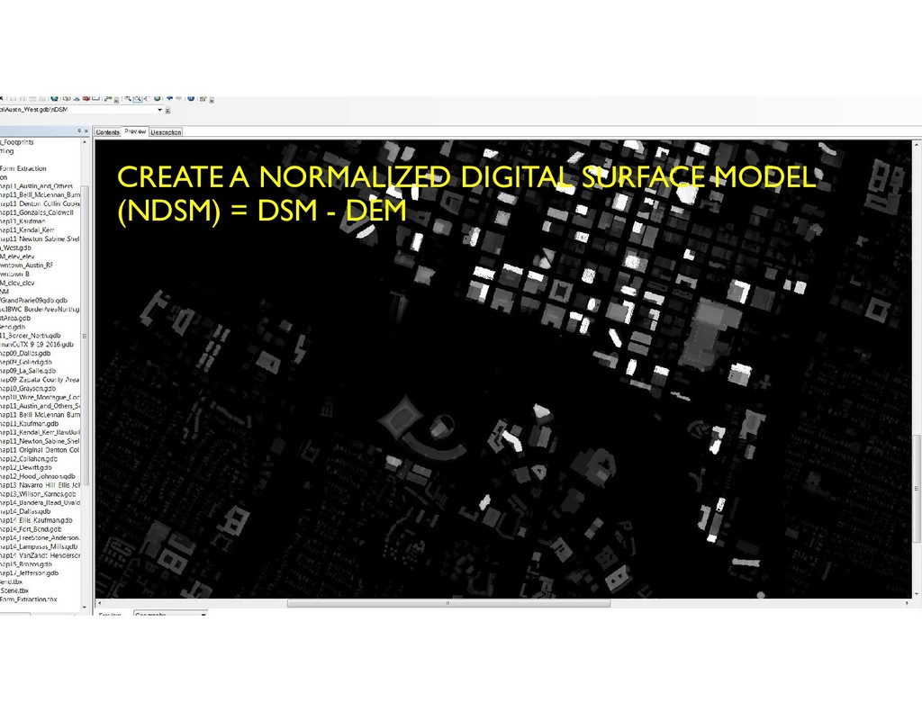
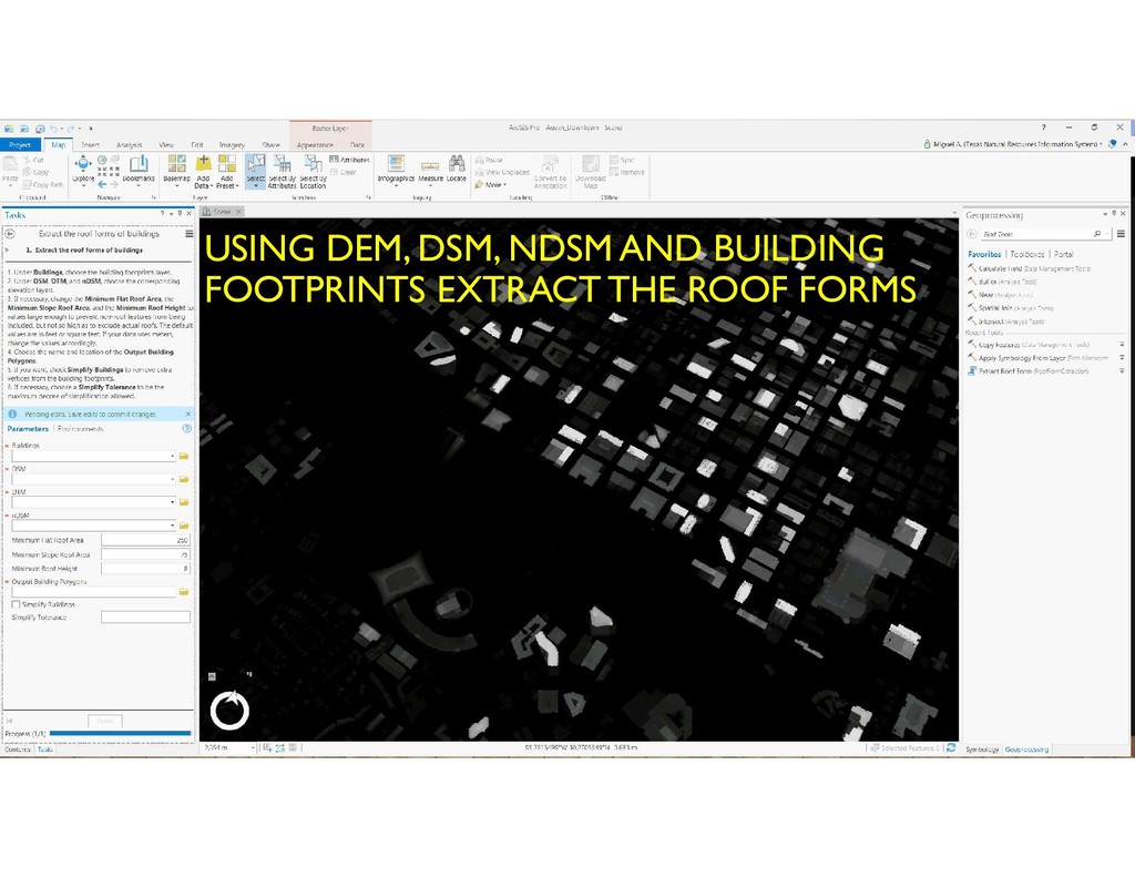
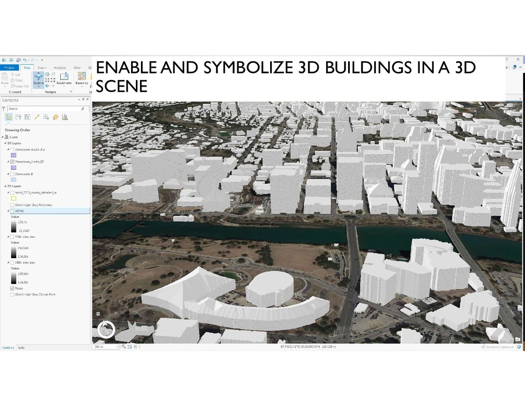
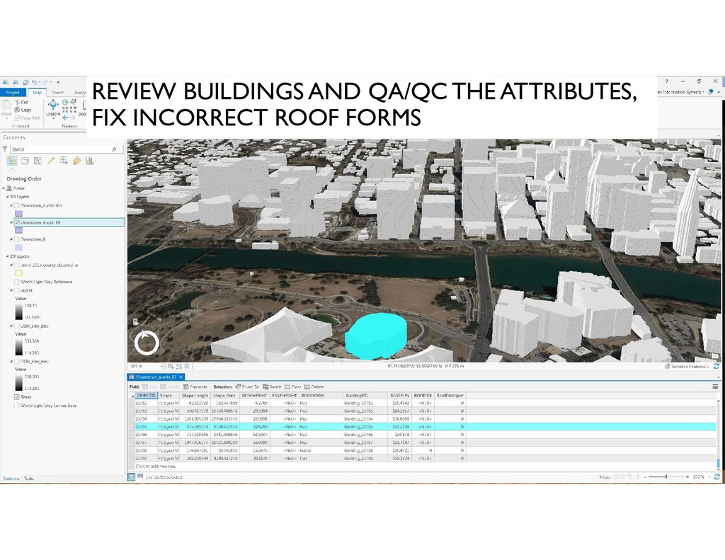
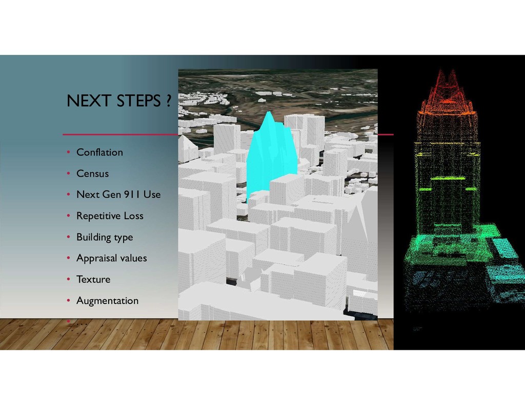
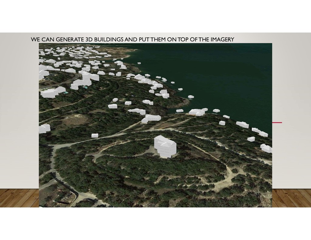
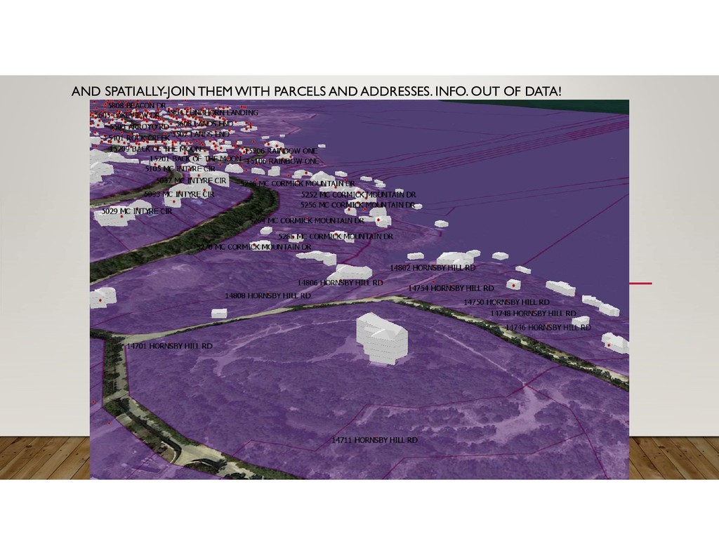
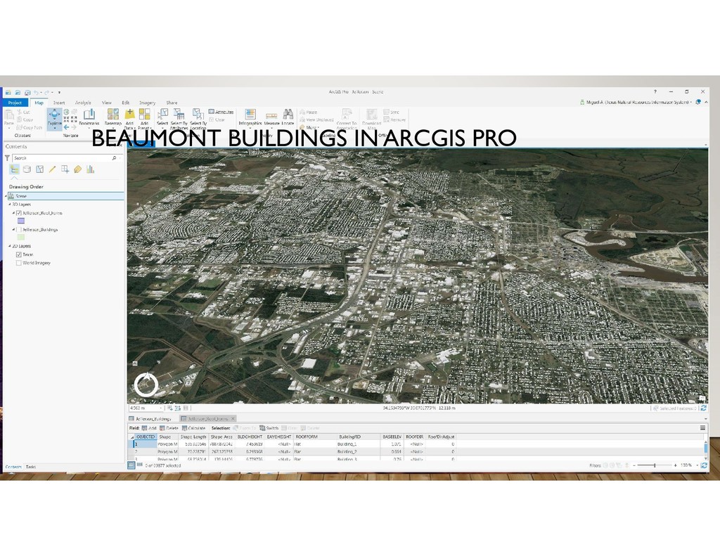
“buildings” as one of the classifications of the point cloud (LP360) 2. Create building footprint polygons (LP360) 3. If Digital Elevation Model is not available create tiles for one using “ground” classified points (LP360) 4. Create a Digital Surface Model tiles using “ground” and “building” classified points (LP360) 5. Create a new raster mosaic for DEM and for DSM (ArcGIS Pro) 6. Create a normalized Digital Surface Model (nDSM) subtracting the DEM from the DSM to get object heights (ArcGIS Pro) 7. Using DEM, DSM, nDSM and building footprints extract the roof forms for buildings and Create 3D buildings (ArcGIS Pro) 8. Enable and symbolize 3D buildings in a 3d Scene (ArcGIS Pro) 9. Review buildings and QA/QC the attributes, fix incorrect roof forms (ArcGIS Pro) 10. Next Steps