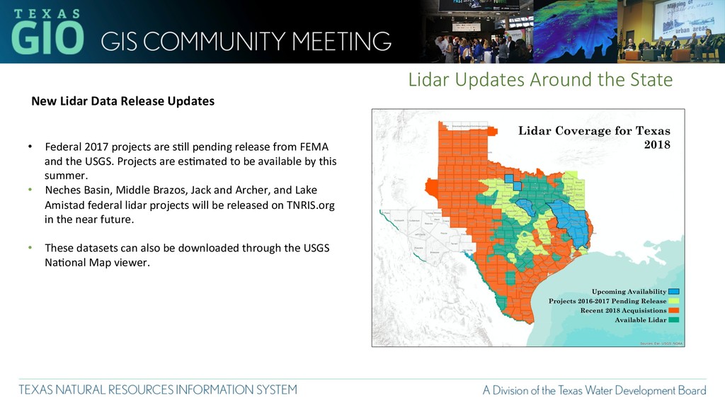
• Federal 2017 projects are s2ll pending release from FEMA and the USGS. Projects are es2mated to be available by this summer. • Neches Basin, Middle Brazos, Jack and Archer, and Lake Amistad federal lidar projects will be released on TNRIS.org in the near future. • These datasets can also be downloaded through the USGS Na2onal Map viewer.
Texas is nearing complete coverage of Lidar for Texas. • FEMA has Planned/Proposed a West Texas acquisis2on for this winter that should finish off a majority of remaining gaps. • This will result in Texas being ~98% covered with some form of lidar aZer almost 20 years and over 55 lidar acquisis2ons!
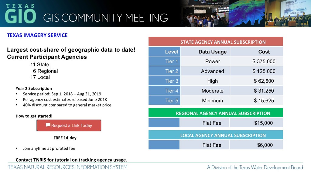
Current Participant Agencies 11 State 6 Regional 17 Local Year 2 SubscripEon • Service period: Sep 1, 2018 – Aug 31, 2019 • Per agency cost es2mates released June 2018 • 40% discount compared to general market price How to get started! FREE 14-day • Join any2me at prorated fee Contact TNRIS for tutorial on tracking agency usage. STATE AGENCY ANNUAL SUBSCRIPTION Level Data Usage Cost Tier 1 Power $ 375,000 Tier 2 Advanced $ 125,000 Tier 3 High $ 62,500 Tier 4 Moderate $ 31,250 Tier 5 Minimum $ 15,625 REGIONAL AGENCY ANNUAL SUBSCRIPTION Flat Fee $15,000 LOCAL AGENCY ANNUAL SUBSCRIPTION Flat Fee $6,000
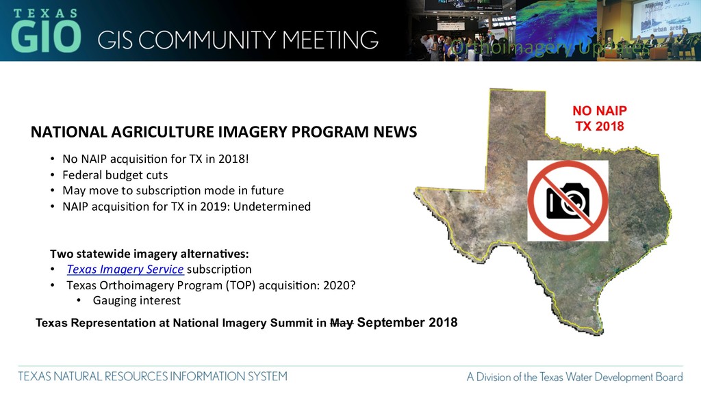
No NAIP acquisi2on for TX in 2018! • Federal budget cuts • May move to subscrip2on mode in future • NAIP acquisi2on for TX in 2019: Undetermined Two statewide imagery alternaEves: • Texas Imagery Service subscrip2on • Texas Orthoimagery Program (TOP) acquisi2on: 2020? • Gauging interest Orthoimagery Updates Texas Representation at National Imagery Summit in May September 2018