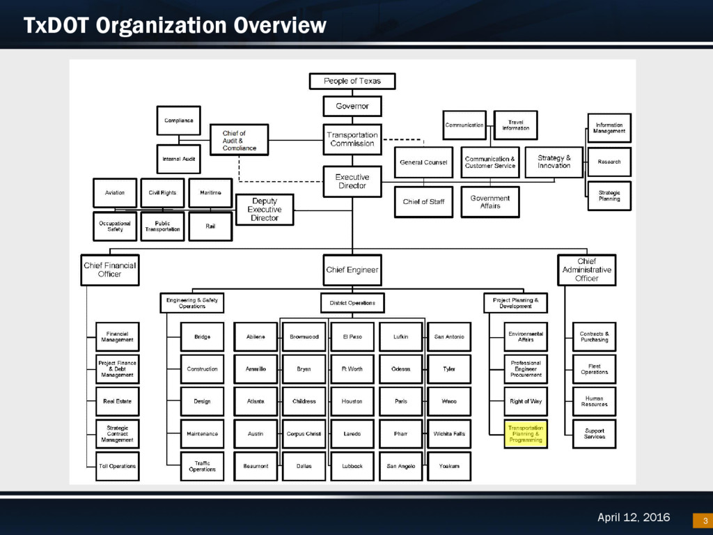
Who we are: – Transportation Planning and Programming Division • GIS Branch of the Data Management Section What we do: – Deliver the HPMS Submittal & Certified Mileage to FHWA each year – Roadway Inventory Maintenance (Geospatial and Attribute Data) • 300,000 Miles of Roads • City Limit Boundaries • Metropolitan Planning Organization boundaries • Reference Markers – Creation of TxDOTs official basemap tiles and service – Create and maintain the Statewide Planning Map Web, Desktop, and Open Data Portal 4
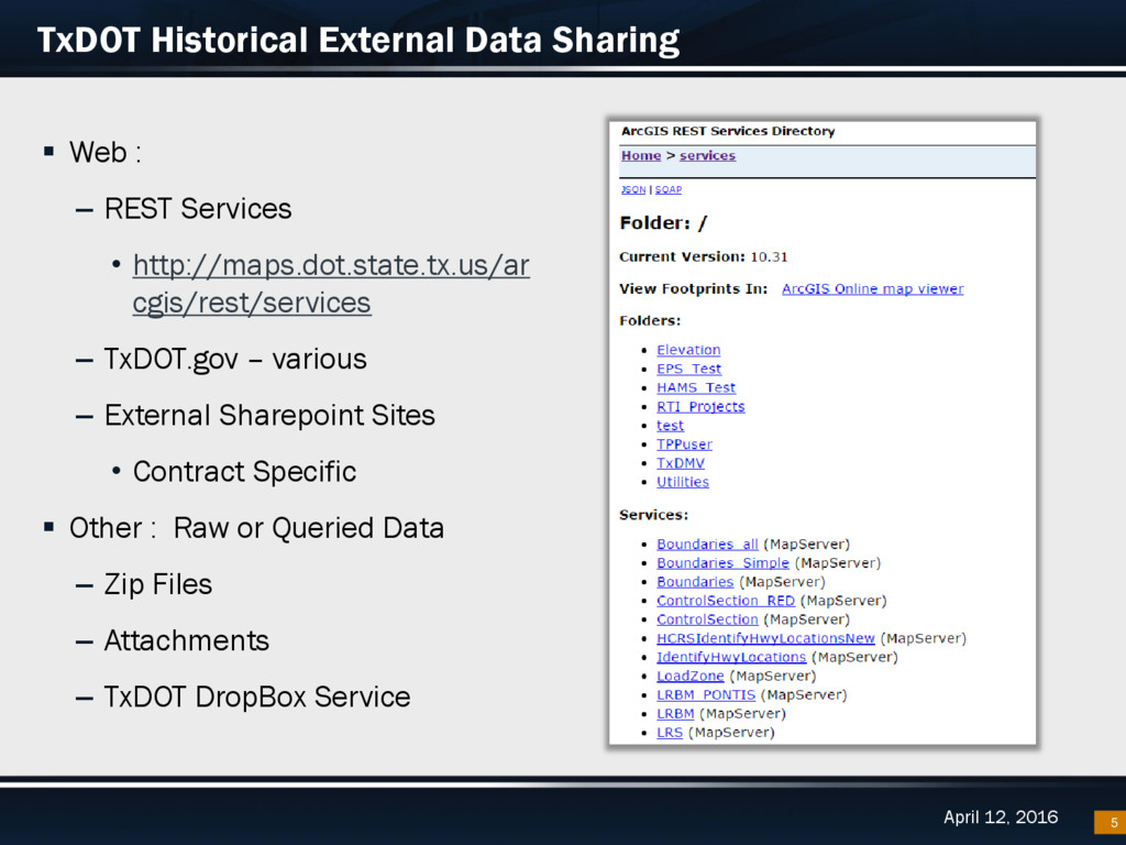
Web : – REST Services • http://maps.dot.state.tx.us/ar cgis/rest/services – TxDOT.gov – various – External Sharepoint Sites • Contract Specific Other : Raw or Queried Data – Zip Files – Attachments – TxDOT DropBox Service
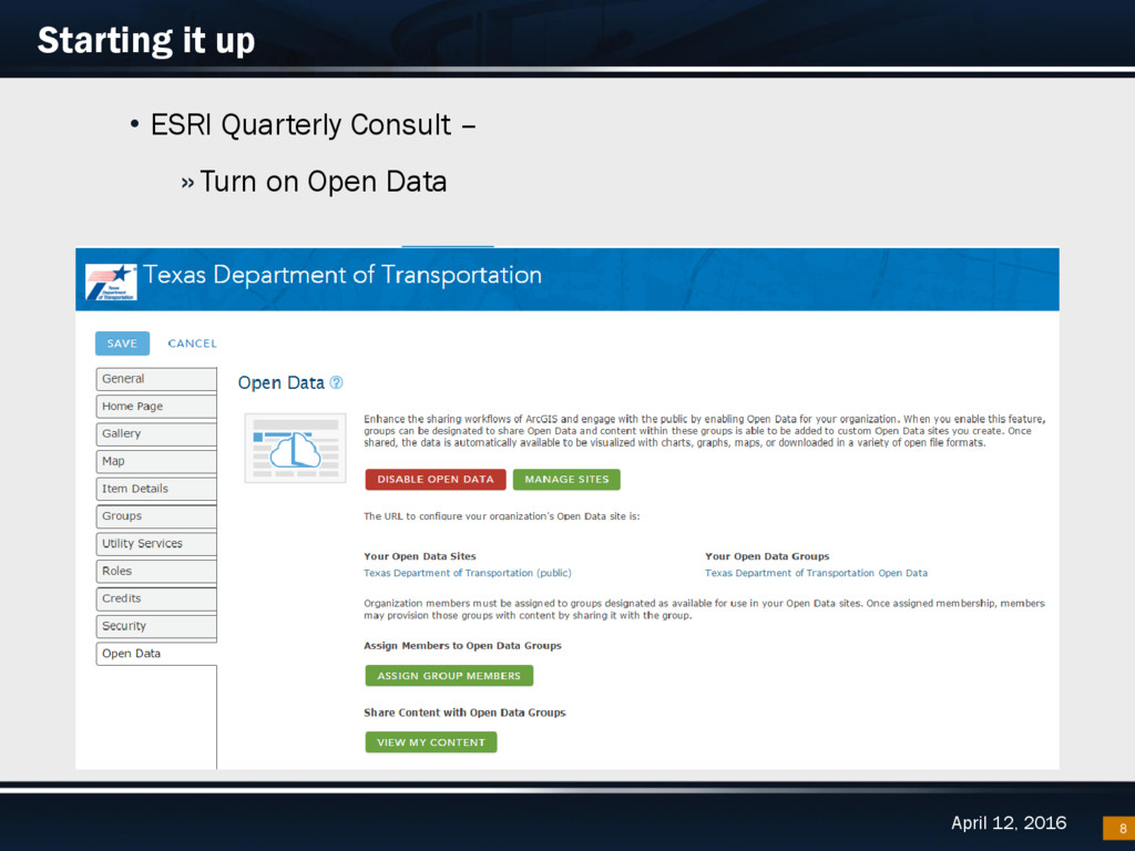
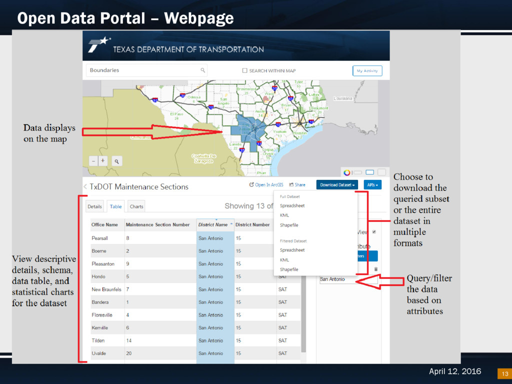
“Open data is data that can be freely used, re-used and redistributed by anyone - subject only, at most, to the requirement to attribute and sharealike.” –Open Data Handbook Provides an avenue for other divisions and the public to explore TxDOT’s data catalog Data available to be downloaded in multiple formats Reduce data requests and centralize publicly available data TxDOT’s license agreement with ESRI provides an out-of-the-box Open Data webpage GIS oriented but you can publish and share over 60 formats including: SHP, FGDB, CSV, XLS, PDF, CAD, JSON, LYR, KML, and much more. Open Data webpage is a portal to organization’s ArcServer and ArcGIS Online REST Services --- ‘Share’ services with Open Data Group within AGO Organization to make them available 9
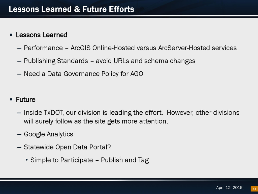
Learned – Performance – ArcGIS Online-Hosted versus ArcServer-Hosted services – Publishing Standards – avoid URLs and schema changes – Need a Data Governance Policy for AGO Future – Inside TxDOT, our division is leading the effort. However, other divisions will surely follow as the site gets more attention. – Google Analytics – Statewide Open Data Portal? • Simple to Participate – Publish and Tag 14