Upgrade to Pro — share decks privately, control downloads, hide ads and more …

Storms & Spills - GIS Readiness at the Texas General Land Office

Storms & Spills - GIS Readiness at the Texas General Land Office

Scot Friedman, Steve Buschang, Alex Sanders - Texas General Land Office

More Decks by Texas Natural Resources Information System

Other Decks in Technology

Transcript

  1. Storms & Spills – GIS Readiness
    at the Texas General Land Office

    View Slide

  2. General Land Office
    1836: Republic of Texas Congress formed the General Land Office to manage the public domain
    Charge: Collect and keep records, provide maps and surveys, and issue titles to encourage
    settlement of public lands via land grants
    Permanent School Fund (PSF): The Texas Constitution of 1876 set aside half of Texas' remaining
    public lands to establish to help finance public schools.
    Today: The Texas General Land Office is focused on maximizing and diversifying revenue sources for
    the Permanent School Fund—through oil & gas exploration on historic leases, as well as wind, solar,
    and geothermal energy.
    Future: With over 175 years of history, the Texas General Land Office is moving into the
    future and finding new and innovative ways to serve the people of Texas.

    View Slide

  3. Agency Mission
    The Texas General Land Office primarily serves the schoolchildren, veterans,
    and the environment of Texas. The agency does so by preserving our history,
    maximizing state revenue through innovative administration, and through the
    prudent stewardship of state lands and natural resources.

    View Slide

  4. Functions of the GLO
    The Texas General Land Office is the state’s oldest agency, established in the Republic of Texas
    constitution in 1836. The Land Office was established to oversee the distribution of public lands, to
    register titles, issue patents on land and maintain records of land granted. Since then, the agency’s
    responsibilities have grown and diversified, and now include:
    • Maximizing revenues from 13 million surface and mineral acres of state-
    owned land for the Permanent School Fund;
    • Auditing oil, gas and hard mineral leases on state lands to ensure
    payment of royalties to the Permanent School Fund;
    • Unifying state acreage into more manageable tracts by analyzing
    acreage and coordinating land trades and sales;
    • Conducting ground and aerial surveys of state-owned land;
    • Leasing state lands for renewable energy projects;
    • Identifying underused state properties and recommending uses for
    them;
    • Funding low-cost home, land and home improvement loans for Texas
    veterans;
    • Providing long-term care nursing homes for Texas veterans, their
    spouses and Gold Star parents;
    • Overseeing state veterans cemeteries for Texas veterans and their
    spouses;
    • Preserving the memories of Texas veterans through the Voices of
    Veterans oral history program;
    • Archiving more than 35 million historical land documents;
    • Digitizing historical land documents and making them available over the
    Internet;
    • Managing the Save Texas History program to conserve our historic
    documents ― buy maps, calendars and educational CDs at
    www.savetexashistory.org;
    • Preventing oil spills and ensuring cleanup of oil spills in state waters;
    • Providing free disposal of oily bilge water along the Texas coast;
    • Inspecting coastal refineries and fishing vessels to prevent oil spills;
    • Reversing coastal erosion through beach renourishment projects;
    • Protecting coastal dunes that alleviate storm surge impacts;
    • Helping coastal communities prepare for and recover from tropical
    storms;
    • Managing the Adopt-A-Beach cleanup program to keep our coast free of
    trash and debris ― do your part to help keep our beaches clean at
    www.texasadoptabeach.org;
    • Enforcing the Texas open beaches act on behalf of all Texans

    View Slide

  5. GIS Team Mission
    The Geographic Information Systems team provides geospatial tools, data, and
    analyses to GLO staff, other state and federal agencies, local governments, project
    partners, and the general public. We strive to understand the technology, set the
    standard for GIS in the state, and advance geospatial information technologies
    to further the agency mission.

    View Slide

  6. Geographic Information Systems
    The job of the GIS team at 
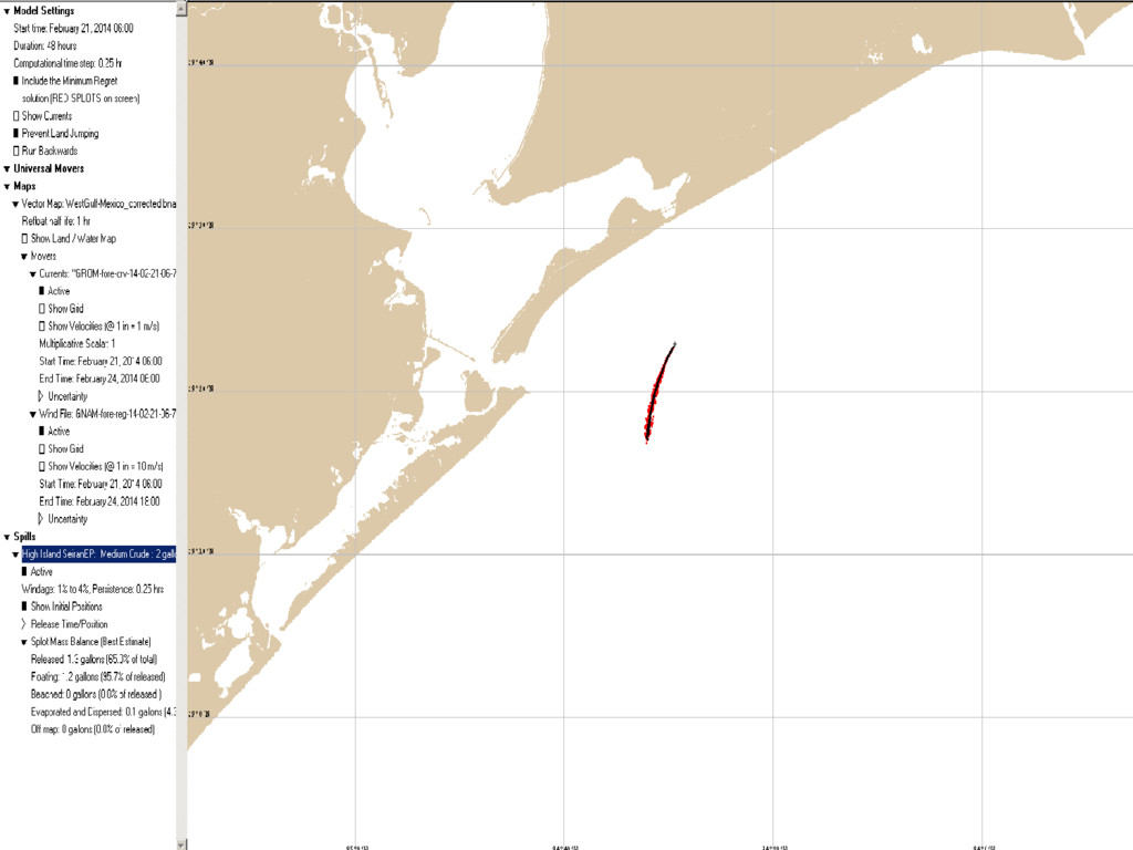
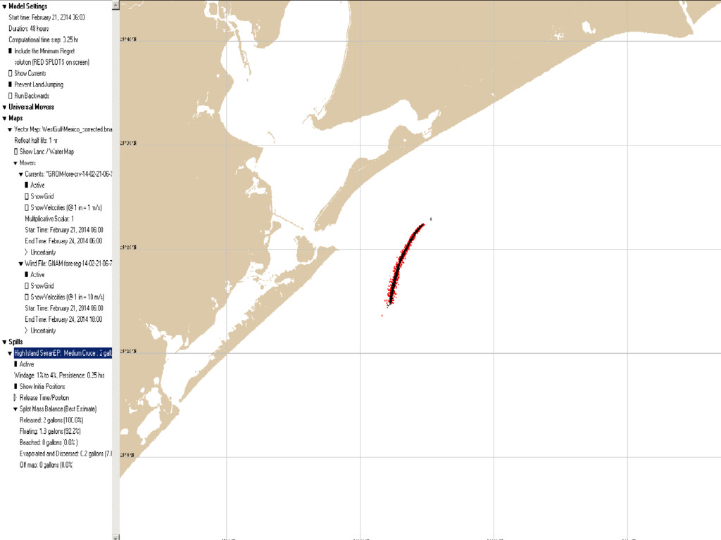
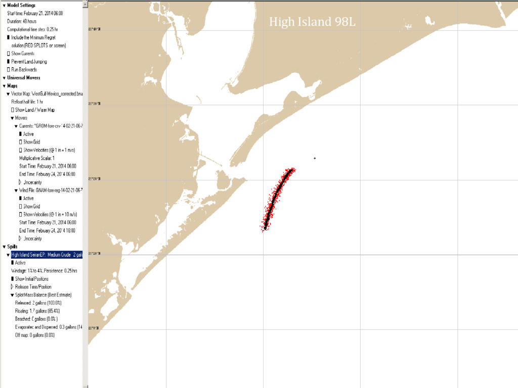
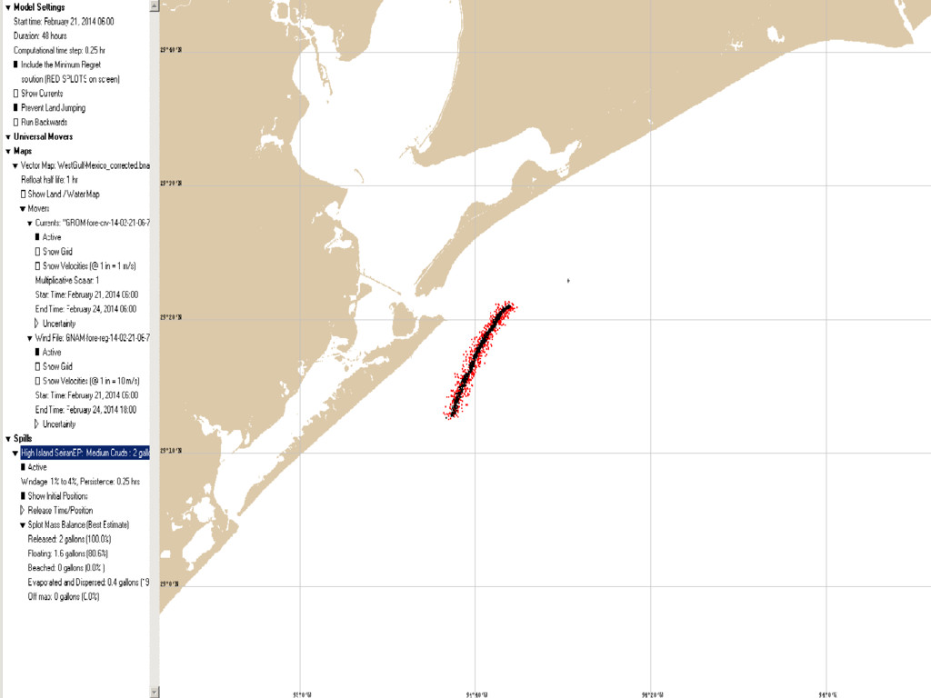
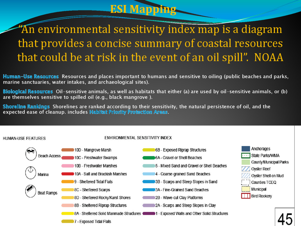
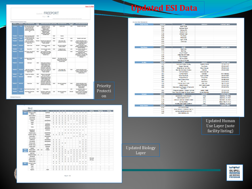
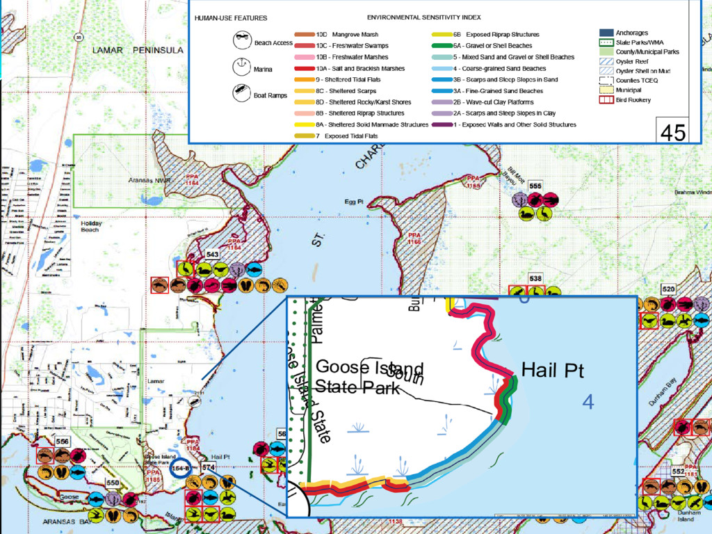
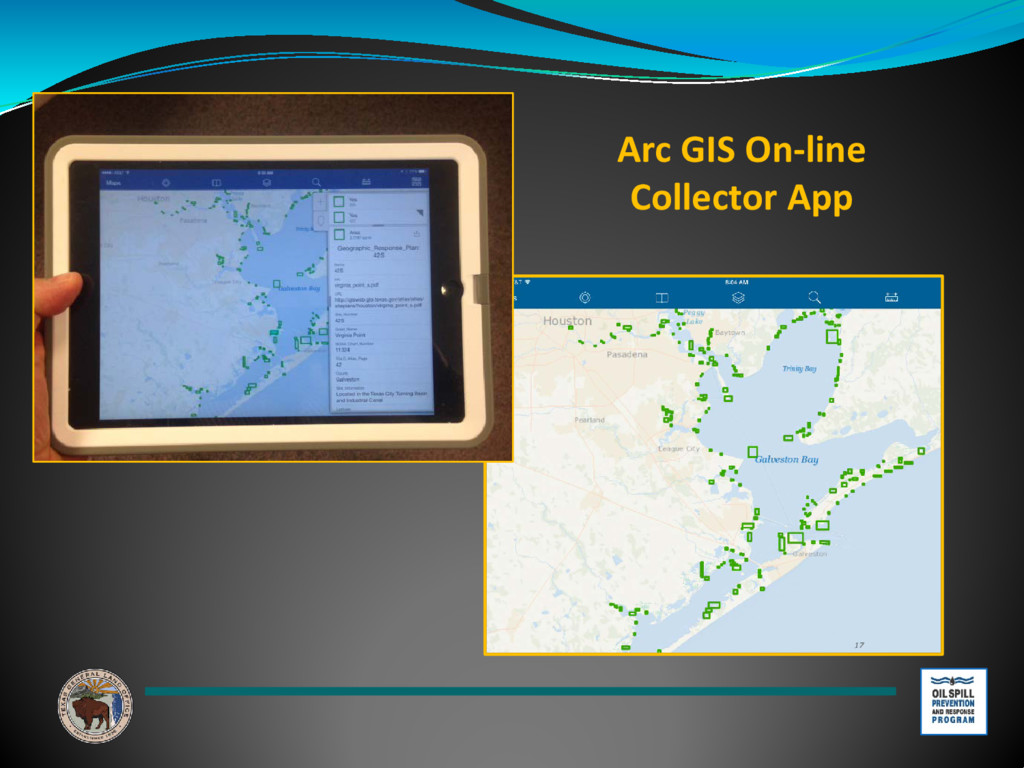
the Land Office is to understand the technology and provide tools and data to General
    Land Office staff, other state and federal agencies, local governments, project partners, and the general public. With
    100+ years combined experience in GIS, we regularly utilize geographic data, including features, maps, coordinates,
    tabular data, aerial imagery, and elevation data, to analyze situations on the ground to enable management to make
    more informed decisions and for GLO staff to perform their jobs more effectively. Critical functions of the GIS team
    include:
    • Research and develop geospatial data
    • Maintain and administer all GIS data layers for the agency
    • Incorporate geospatial data from other sources and create new data as required
    • Create custom map products, both paper and online
    • Provide mobile data collection solutions for staff in the field
    • Develop, manage, and administer GISWeb and all online map viewers
    • Manage and administer all GIS Servers
    • Develop and manage Web pages for GIS
    • Process and manage all aerial photography, digital imagery, elevation data, and other remotely
    acquired geospatial data
    • Develop and maintain GIS databases
    • Provide GIS services for the Commissioner's Office, Coastal Resources, Oil Spill, Energy
    Resources, Office of General Counsel, Asset Management, Construction Services, Governmental
    Relations, Archives & Records, Veterans Land Board, and others

    View Slide

  7. Storms & Spills – GIS Readiness
    at the Texas General Land Office
    • Oil Spill Prevention & Response:
    Updated Toolkit
    • GLO Storm Team:
    Disaster Risk Assessment Viewer (DRAV)

    View Slide

  8. Texas General Land Office
    Oil Spill Prevention and Response Readiness
    Steven Buschang, State Scientific Support Coordinator/Director of Research
    and Development Alternate RRT VI, Science and Tech Committee Chair
    Texas General Land Office

    View Slide

  9. OPA ’90 / OSPRA ’91
     The Oil Pollution Act (OPA 90), Exxon Valdez
    incident
     March 28, 1991 Oil Spill Prevention and Response
    Act (OSPRA 91)
     TGLO became the lead state agency in preventing,
    and responding to, coastal and marine oil spills
     3 marine leagues (9 nm/10.36 statute miles) offshore
     Tidally- influenced waters, rivers, and bays of Texas
     Mouth of the Rio Grande River to the Sabine River

    View Slide

  10. Five Field Offices
    Strategically located along the
    Texas Coast , allowing for two
    hour response time to all oil
    spill reported.
    Field personnel conduct
    -Facility Audits
    -Facility Inspections
    -Boat & Vehicle Patrols
    -Design and participate in oil
    spill response exercises

    View Slide

  11. Prepare, Prevent, Respond
    •Established a 24-hour 1-800-832-8224 state-wide
    •reporting line for all discharges or releases in Texas.
    •Over 4000 calls are received per year
    •GLO responders go to the scene of all reported oil spills that enter
    or threaten to enter Texas coastal waters
    •Coastal Protection Fund 20M
    Texas has some 367 miles
    of linear shoreline and
    miles of 3359 tidal
    shoreline
    1.2 billion barrels of oil passing near Texas wetlands, bays
    and beaches along the Texas Gulf Coast each year

    View Slide

  12. 1994, the Texas General Land Office
    (TGLO) contracted the Geochemical and
    Environmental Research Group (GERG)
    of Texas A&M University (TAMU) to
    develop the Texas Automated Buoy
    System (TABS).
    Remote Sensing &
    Modeling

    View Slide

  13. Drone use
    Steven Buschang, State Scientific Support Coordinator -
    Director of Research and Development
    Texas General Land Office

    View Slide

  14. High Island 98L

    View Slide

  15. View Slide

  16. High Island 98L

    View Slide

  17. High Island 98L

    View Slide

  18. View Slide

  19. High Island 98L

    View Slide

  20. View Slide

  21. TGLO Oil Spill Toolkit

    View Slide

  22. TGLO Oil Spill
    Toolkit

    View Slide

  23. TGLO Oil Spill
    Toolkit

    View Slide

  24. “An environmental sensitivity index map is a diagram
    that provides a concise summary of coastal resources
    that could be at risk in the event of an oil spill”. NOAA
    ESI Mapping
    Human-Use Resources Resources and places important to humans and sensitive to oiling (public beaches and parks,
    marine sanctuaries, water intakes, and archaeological sites).
    Biological Resources Oil-sensitive animals, as well as habitats that either (a) are used by oil-sensitive animals, or (b)
    are themselves sensitive to spilled oil (e.g., black mangrove ).
    Shoreline Rankings Shorelines are ranked according to their sensitivity, the natural persistence of oil, and the
    expected ease of cleanup. includes Habitat Priority Protection Areas.

    View Slide

  25. Priority
    Protecti
    on
    Updated Biology
    Layer
    Updated Human
    Use Layer (note
    facility listing)
    Updated ESI Data

    View Slide

  26. View Slide

  27. Updated GRPs database

    View Slide

  28. Arc GIS On-line
    Collector App

    View Slide

  29. Aerial Location Type Platform
    Possible Responsible
    Party
    Storm Damage Present Unknown
    Current Damage Present Unknown
    Structure Type Field ID Platform
    Field Inspector ddavis
    Inspection Date April 4, 2016
    Inspection Comments MU 818-L-B:
    Appears in
    disrepair, 8 pile,
    no crew lines,
    ladders in
    disrepair, helo
    pad unusable,
    appears in
    unused
    Field Inspection
    Completed
    Yes
    Field Analysis
    Appear Operational No
    Appear Derelict Unknown
    ID Information Available No
    Safety Lighting
    Operational
    None seen
    Horns Operational No
    Storage Tank Present No
    Manager Analysis
    OSI ID Number 3730
    Tract Number 818
    Control Number 03-008131
    Waterbody Gulf of Mexico
    Waterbody Abbrev GOM
    Waterbody Tract GOM-818
    Site ID GOM-818-3730
    API Number
    RRC Number
    Offshore Structures
    Inventory: GOM-818-3730 Offshore Structure
    Inventory Database

    View Slide

  30. Offshore Structures
    Inventory: GOM-818-3727
    Aerial Location Type Well
    Possible Responsible Party SAMEDAN OIL
    Storm Damage Present Unknown
    Current Damage Present Unknown
    Structure Type Field ID Platform
    Field Inspector ddavis
    Inspection Date April 4, 2016
    Inspection Comments PHOC-MU 818-L-A:
    Looks in unused
    condition , 4 pile,
    ladder in disrepair,
    crew boat landing in
    disrepair, no crew
    lines
    Field Inspection Completed Yes
    Field Analysis
    Appear Operational No
    Appear Derelict Unknown
    ID Information Available Yes
    Safety Lighting Operational Unknown
    Horns Operational Unknown
    Storage Tank Present Yes
    Manager Analysis
    OSI ID Number 3727
    Tract Number 818
    Control Number 03-008131
    Waterbody Gulf of Mexico
    Waterbody Abbrev GOM
    Waterbody Tract GOM-818
    Site ID GOM-818-3727
    API Number
    RRC Number

    View Slide

  31. LiDAR image showing small scale elevation changes
    of a bird rookery island.
    Colonial Waterbird Rookery Island Geoenvironmental
    Mapping for Oil Spill Response. LIDaR Project

    View Slide

  32. Thank You
    Steven Buschang,
    State Scientific Support Coordinator -
    Director of Research and Development
    Contact Info:
    [email protected]
    512-475-4611
    Texas General Land Office

    View Slide