Upgrade to Pro
— share decks privately, control downloads, hide ads and more …
Speaker Deck
Features
Speaker Deck
PRO
Sign in
Sign up for free
Search
Search
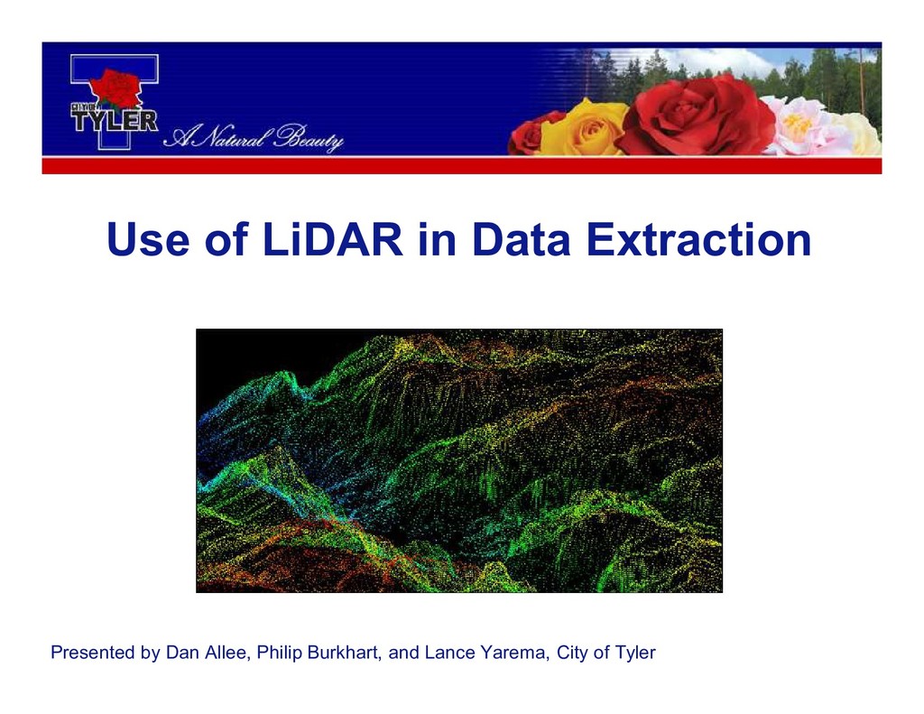
Use of Lidar of Data Extraction
Search
Texas Natural Resources Information System
October 24, 2018
Technology
190
0
Share
Embed
Copy iframe code
Copy JS code
Copy link
Start on current slide
Use of Lidar of Data Extraction
Presented by Dan Allee, Philip Burkhart, and Lance Yarema - City of Tyler
Texas Natural Resources Information System
October 24, 2018
More Decks by Texas Natural Resources Information System
See All by Texas Natural Resources Information System
The 3rd Quarter GIS Community Meeting of 2020
texasnaturalresourcesinformationsytem
0
200
The 2nd Quarter GIS Community Meeting of 2020
texasnaturalresourcesinformationsytem
0
640
2020 1st Quarter GIS Community Meeting
texasnaturalresourcesinformationsytem
0
760
PLANET OVERVIEW for TNRIS first Quarter Meeting
texasnaturalresourcesinformationsytem
0
650
Hurricane Harvey H-E-B Disaster Response
texasnaturalresourcesinformationsytem
0
530
Improving Community Services by Helping Citizens Find Their Lost Pets
texasnaturalresourcesinformationsytem
0
360
National Address Database (NAD) and NG9-1-1
texasnaturalresourcesinformationsytem
0
280
StratMap Celebrating Successful Public and Private Partnerships
texasnaturalresourcesinformationsytem
1
370
2019 State of the State Town Hall Meeting
texasnaturalresourcesinformationsytem
1
350
Other Decks in Technology
See All in Technology
データベース研修【MIXI 26新卒技術研修】
mixi_engineers
PRO
1
440
iOS/Androidの二刀流エンジニアがFlutter & TypeScriptへ越境後の現在地 - Flutterがメインになって見えた景色と現在の醍醐味 / Dual-Platform Mobile Engineer Shifts to Flutter & TypeScript - The View and Real Thrill of Going Flutter-First
bitkey
PRO
0
110
AWS環境のセキュリティ不安を解消した企業事例 ~よくある課題と対策を一挙公開~
asanoharuki
0
210
GoでCコンパイラを作った話
repunit
0
170
変更し続けられるシステムをどう保つか — AI時代のSSoTという設計原則
kawauso
1
1.4k
人とエージェントが高め合う協業設計
kintotechdev
0
990
AI研修(Day1)【MIXI 26新卒技術研修】
mixi_engineers
PRO
1
1.6k
Oracle Base Database Service 技術詳細
oracle4engineer
PRO
15
110k
AI研修(Day2)【MIXI 26新卒技術研修】
mixi_engineers
PRO
1
940
「待ち時間」の消滅と「自我消耗」の加速:生成AI時代のエンジニアを救うメンタル・リソース管理
poropinai1966
0
230
41歳でAWSが好きすぎてITエンジニアになったおっさんの話
yama3133
1
780
基調講演:人とAIをつなぐIoTの今と未来 ー 「フィジカル」と「デジタル」が出会うその先へ【SORACOM Discovery 2026】
soracom
PRO
0
270
Featured
See All Featured
So, you think you're a good person
axbom
PRO
2
2.1k
New Earth Scene 8
popppiees
3
2.4k
Principles of Awesome APIs and How to Build Them.
keavy
128
18k
Cheating the UX When There Is Nothing More to Optimize - PixelPioneers
stephaniewalter
287
14k
The Pragmatic Product Professional
lauravandoore
37
7.4k
Agile that works and the tools we love
rasmusluckow
331
22k
What the history of the web can teach us about the future of AI
inesmontani
PRO
1
640
A Modern Web Designer's Workflow
chriscoyier
698
190k
Building Flexible Design Systems
yeseniaperezcruz
330
40k
Art, The Web, and Tiny UX
lynnandtonic
304
22k
HDC tutorial
michielstock
2
750
State of Search Keynote: SEO is Dead Long Live SEO
ryanjones
0
230
Transcript
Use of LiDAR in Data Extraction Presented by Dan Allee,
Philip Burkhart, and Lance Yarema, City of Tyler
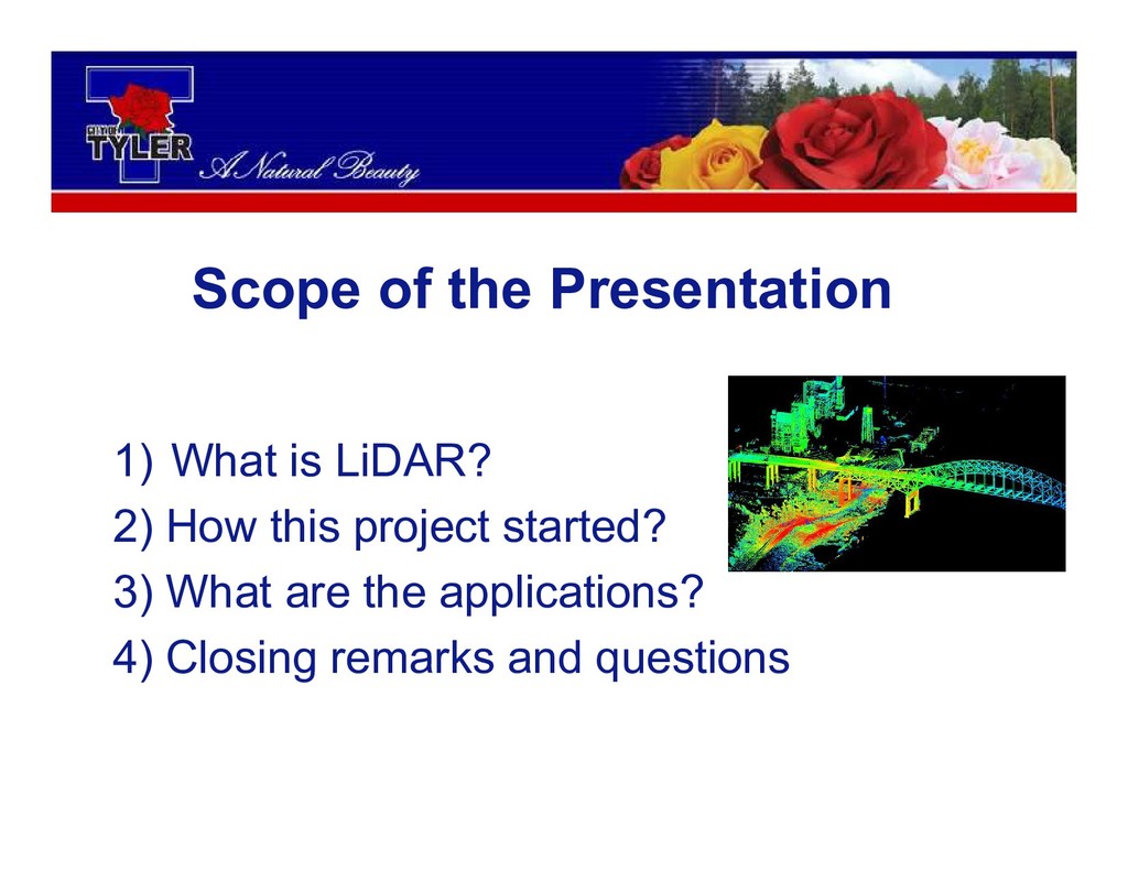
1) What is LiDAR? 2) How this project started? 3)
What are the applications? 4) Closing remarks and questions Scope of the Presentation
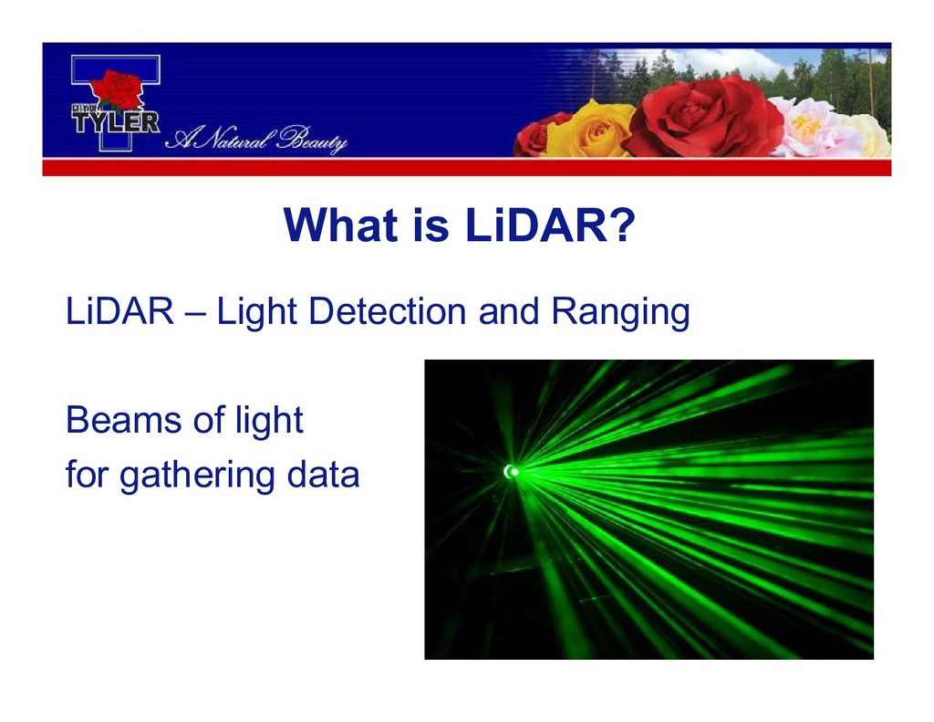
What is LiDAR?
What is LiDAR? LiDAR – Light Detection and Ranging Beams
of light for gathering data
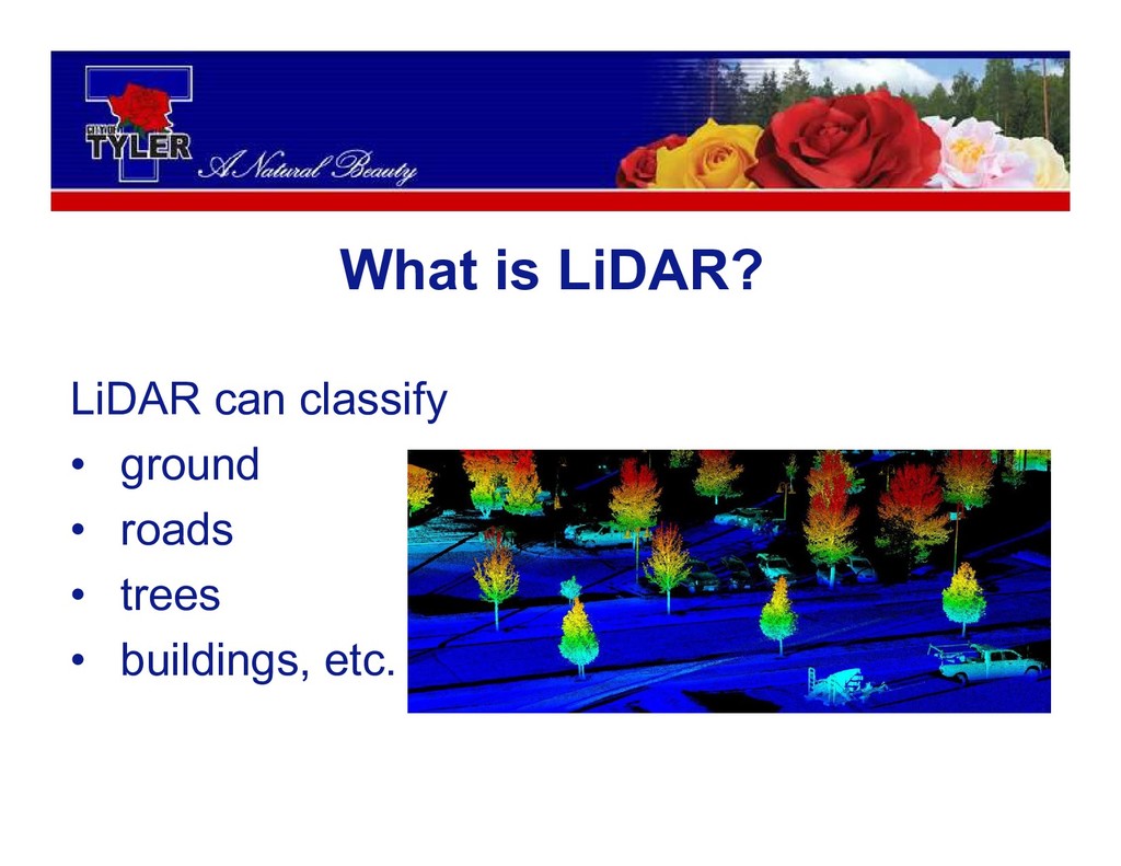
LiDAR can classify • ground • roads • trees •
buildings, etc. What is LiDAR?
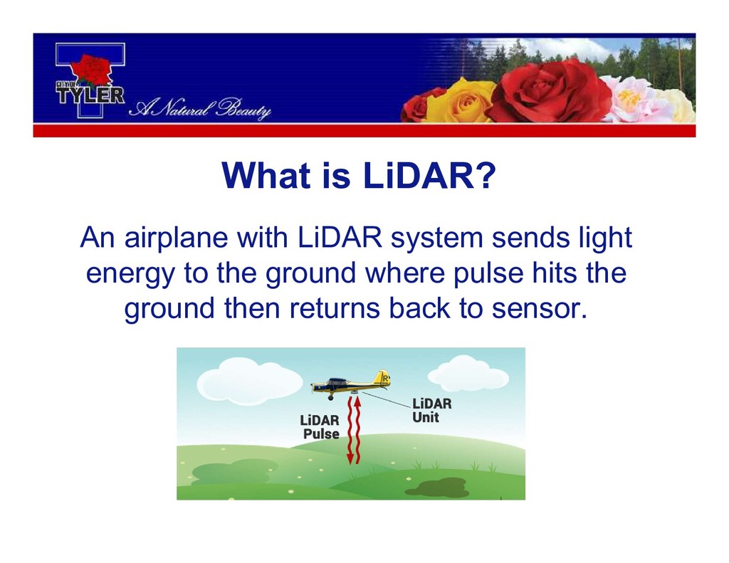
An airplane with LiDAR system sends light energy to the
ground where pulse hits the ground then returns back to sensor. What is LiDAR?
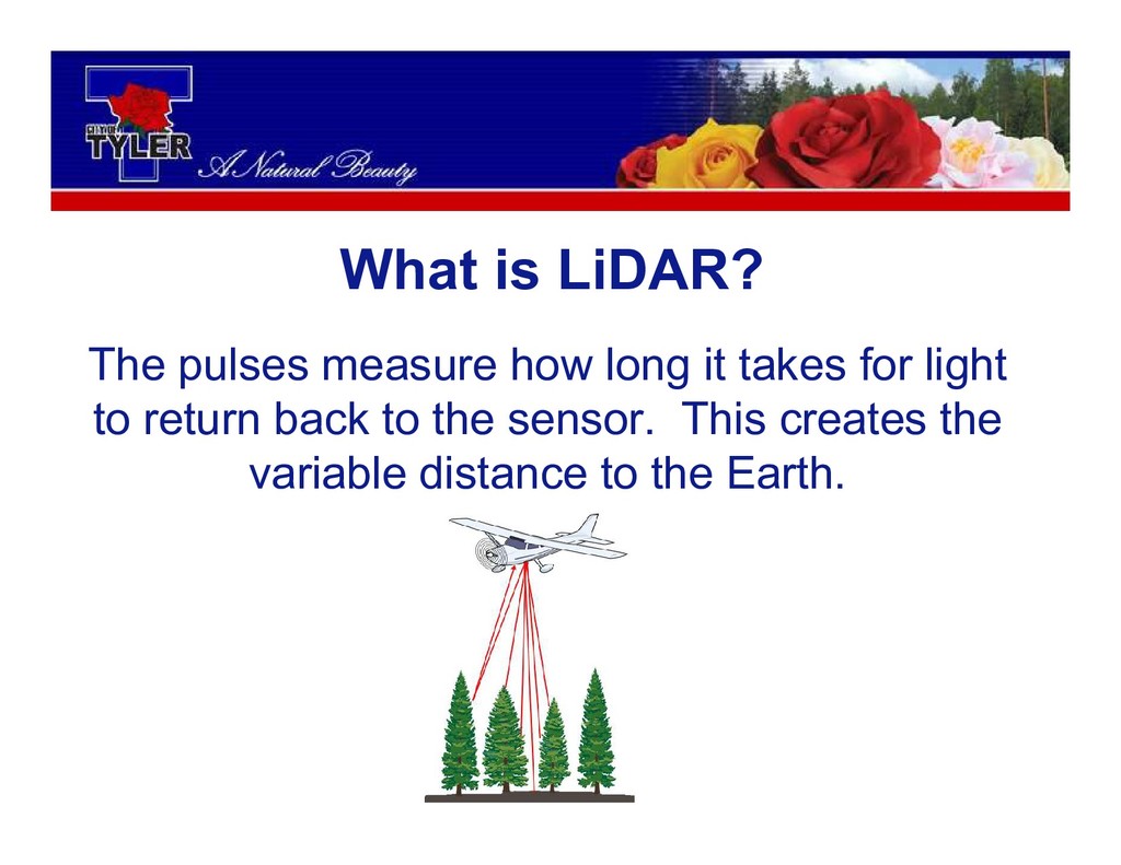
The pulses measure how long it takes for light to
return back to the sensor. This creates the variable distance to the Earth. What is LiDAR?
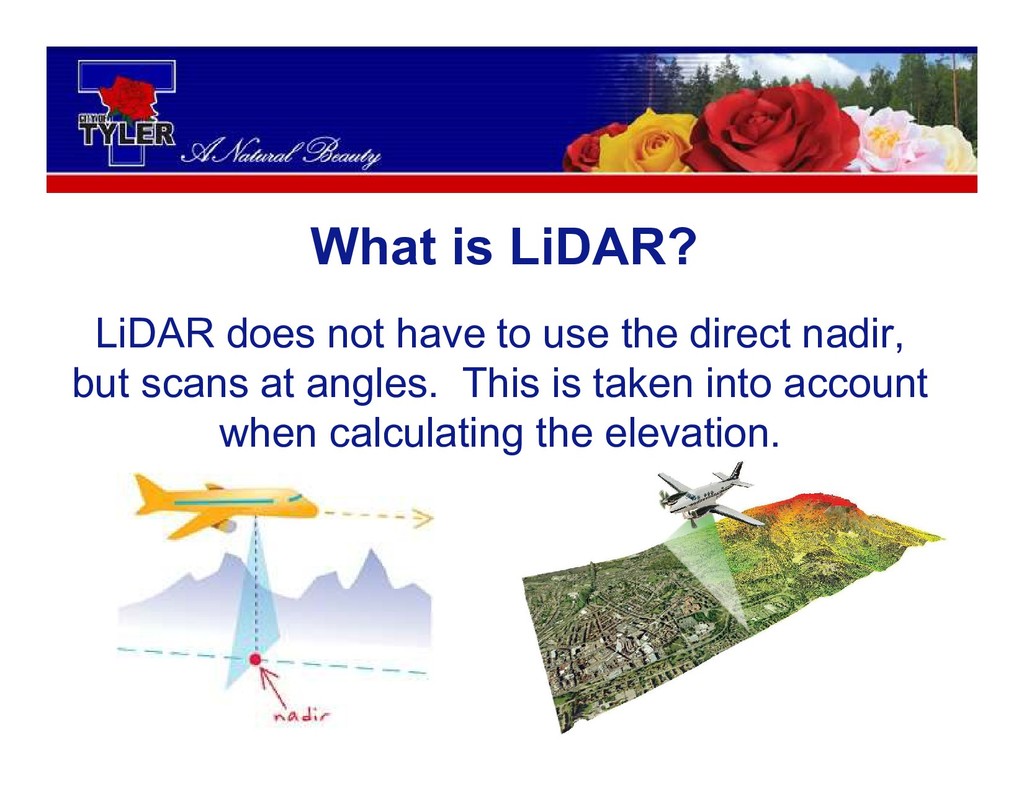
What is LiDAR? LiDAR does not have to use the
direct nadir, but scans at angles. This is taken into account when calculating the elevation.
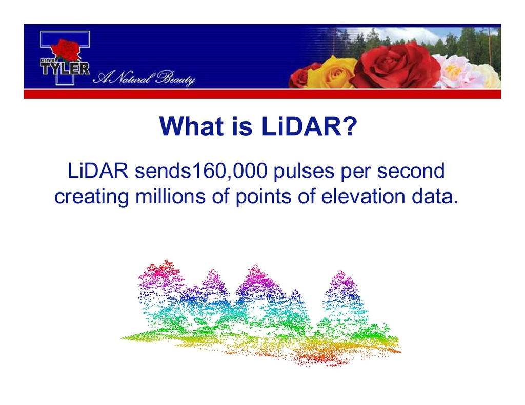
LiDAR sends160,000 pulses per second creating millions of points of
elevation data. What is LiDAR?
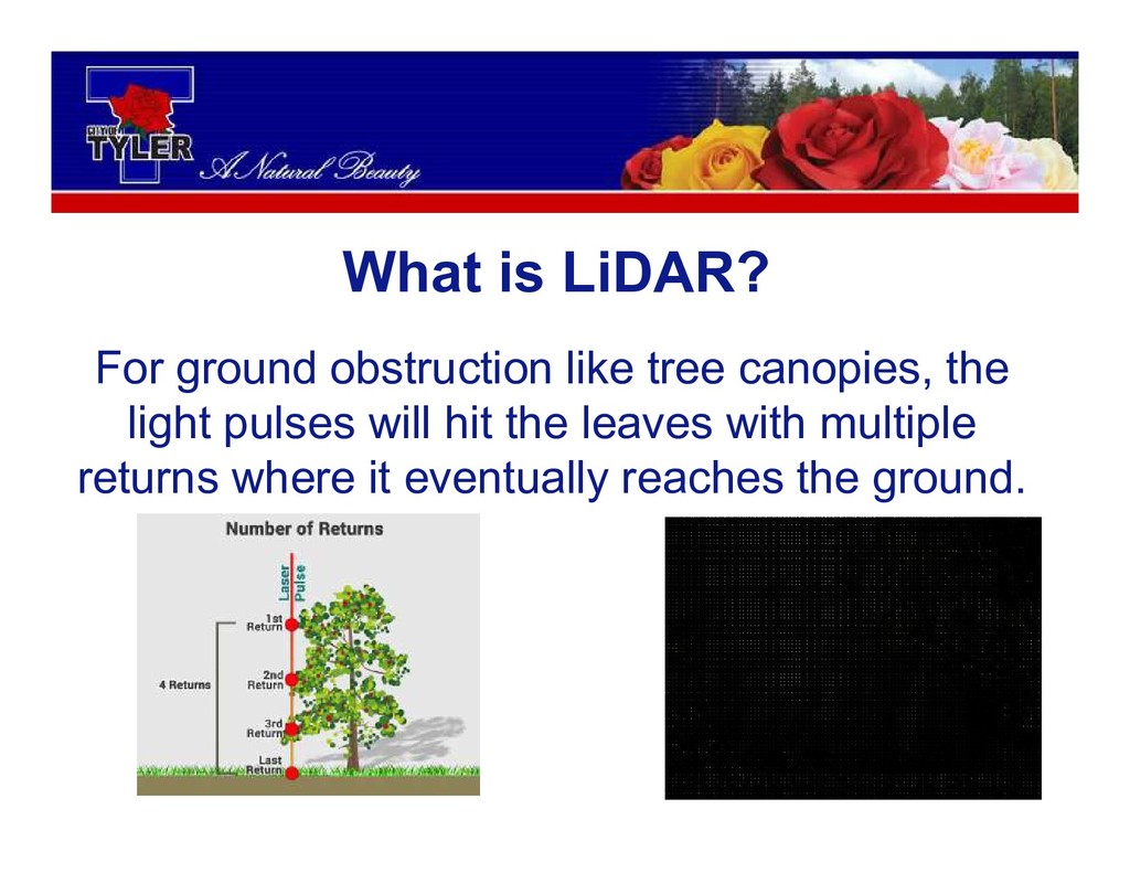
For ground obstruction like tree canopies, the light pulses will
hit the leaves with multiple returns where it eventually reaches the ground. What is LiDAR?
How this project started?
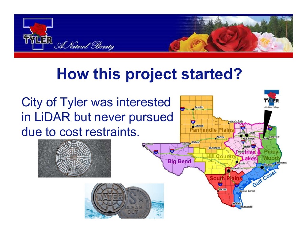
How this project started? City of Tyler was interested in
LiDAR but never pursued due to cost restraints.
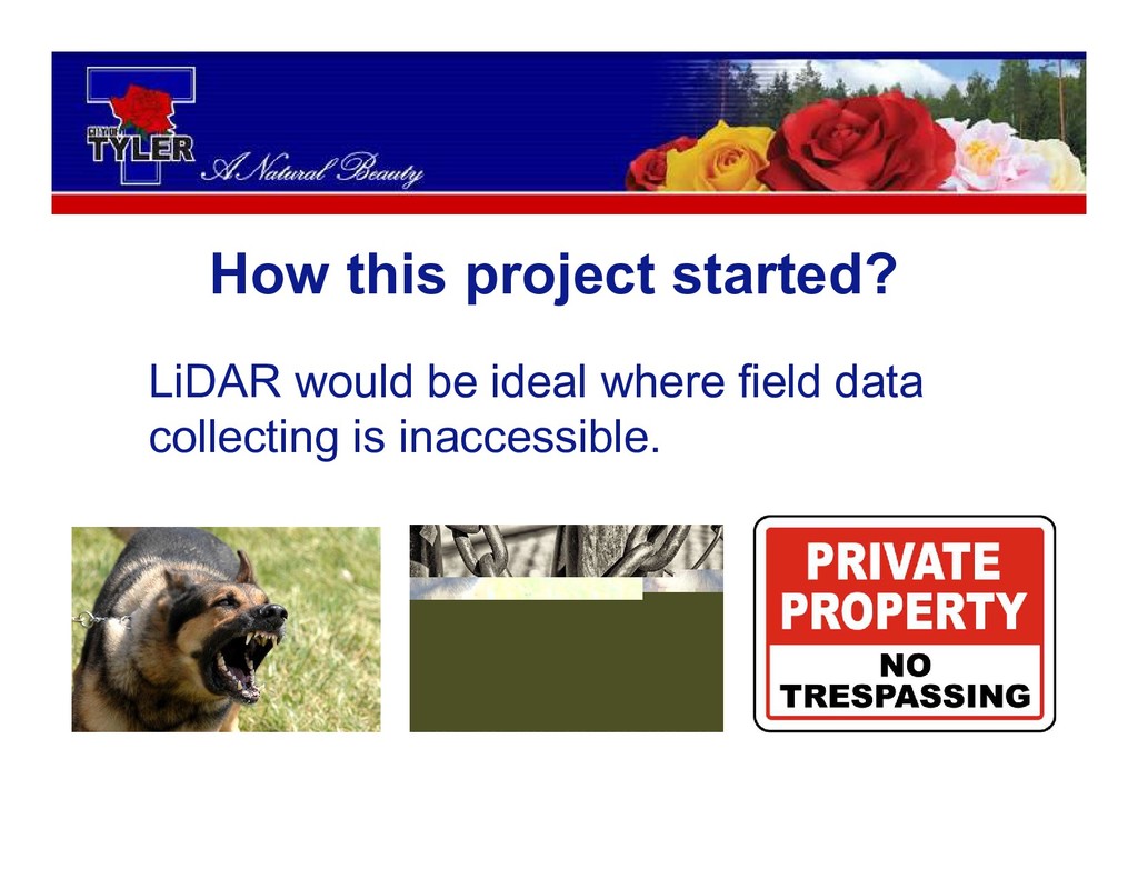
How this project started? LiDAR would be ideal where field
data collecting is inaccessible.
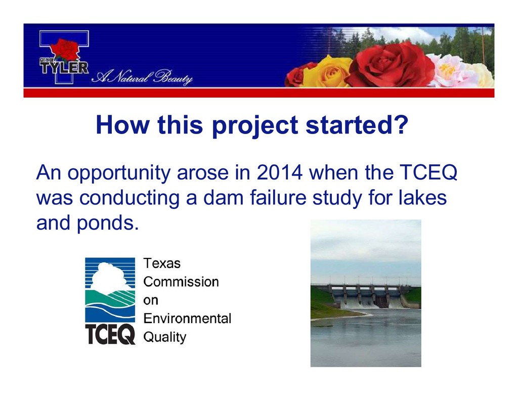
How this project started? An opportunity arose in 2014 when
the TCEQ was conducting a dam failure study for lakes and ponds.
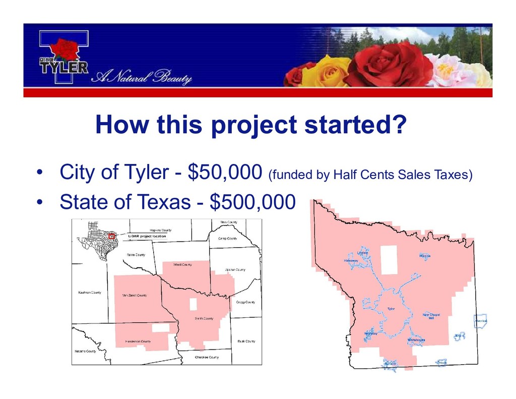
How this project started? • City of Tyler - $50,000
(funded by Half Cents Sales Taxes) • State of Texas - $500,000
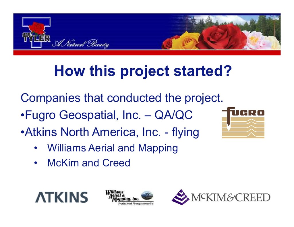
How this project started? Companies that conducted the project. •Fugro
Geospatial, Inc. – QA/QC •Atkins North America, Inc. - flying • Williams Aerial and Mapping • McKim and Creed
What are the applications?
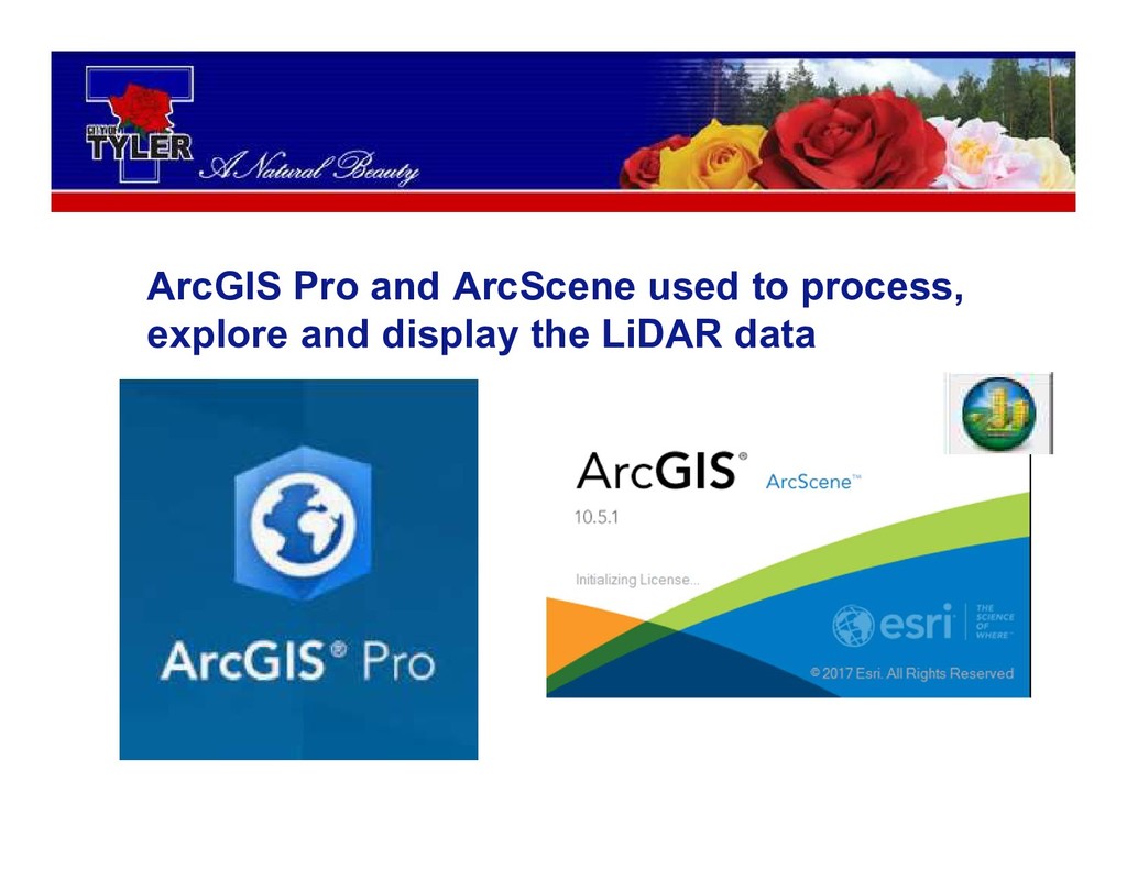
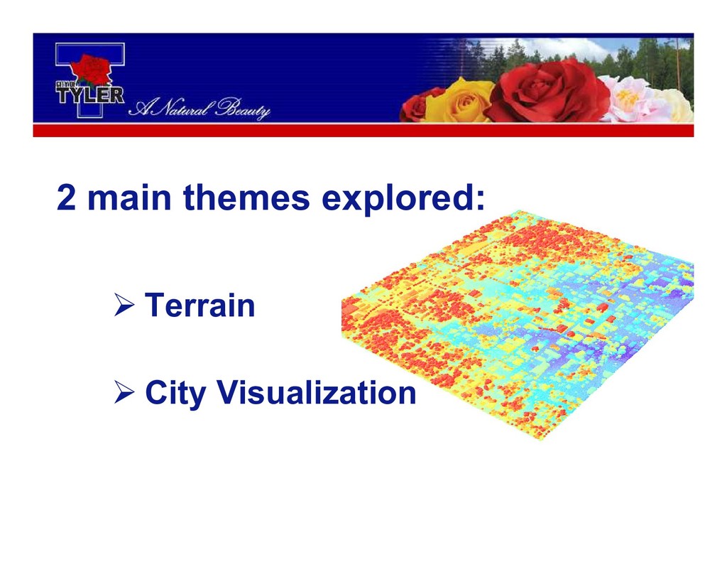
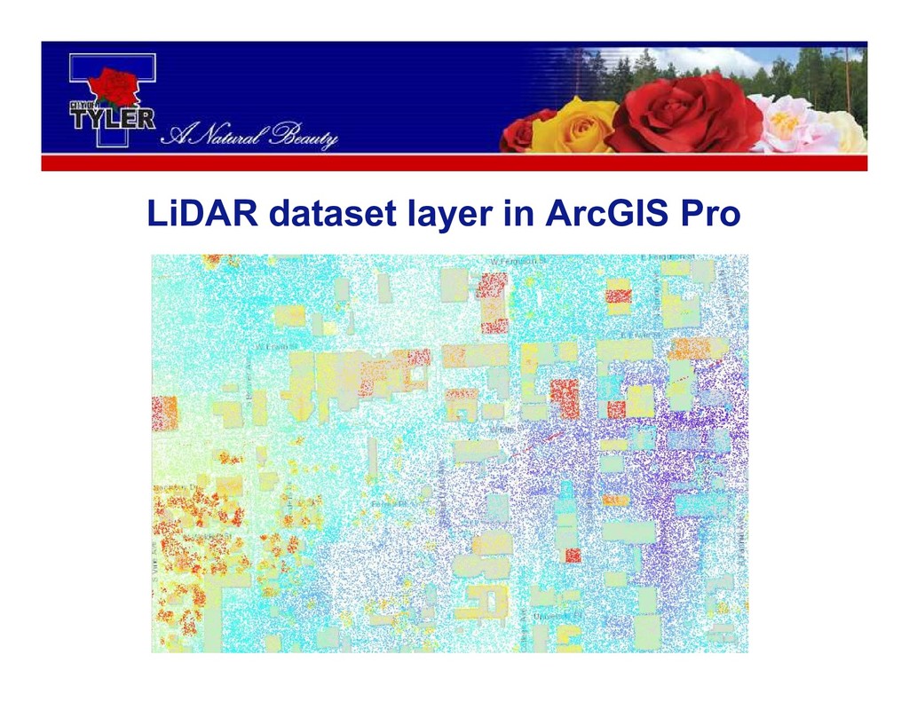
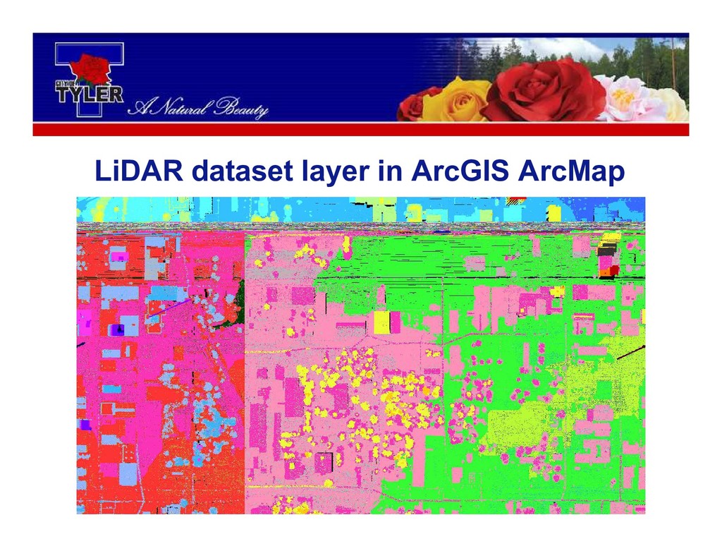
ArcGIS Pro and ArcScene used to process, explore and display
the LiDAR data
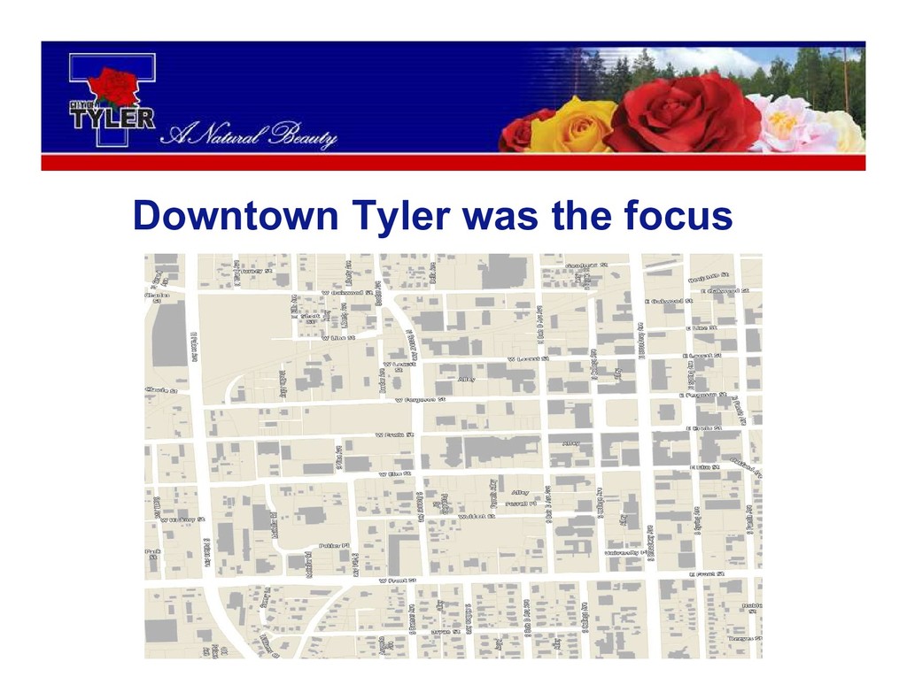
Downtown Tyler was the focus
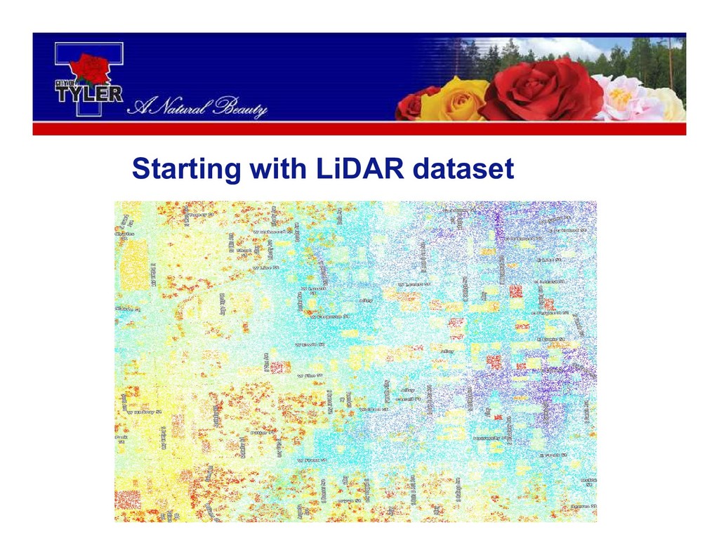
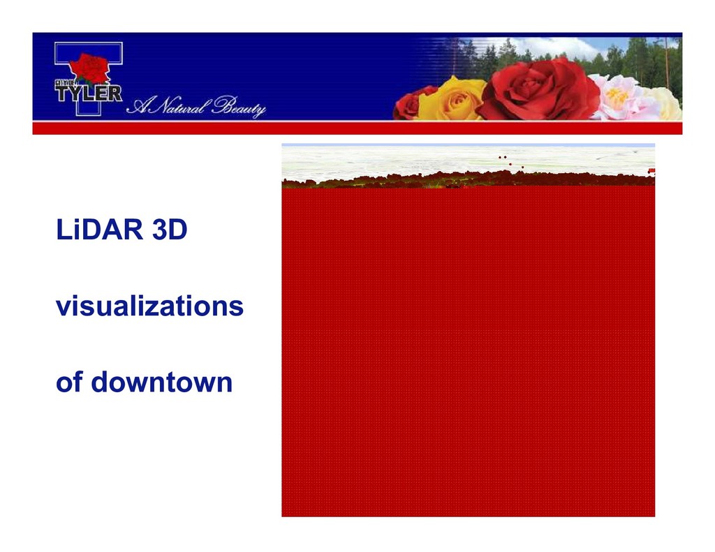
Terrain City Visualization 2 main themes explored:
Starting with LiDAR dataset
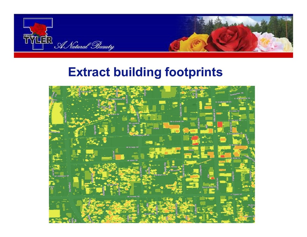
Extract building footprints
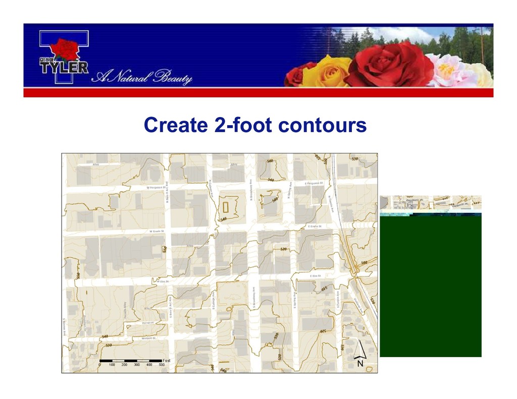
Create 2-foot contours
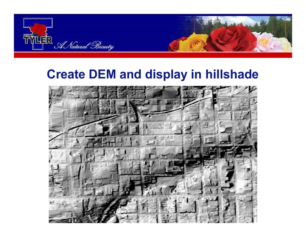
Create DEM and display in hillshade
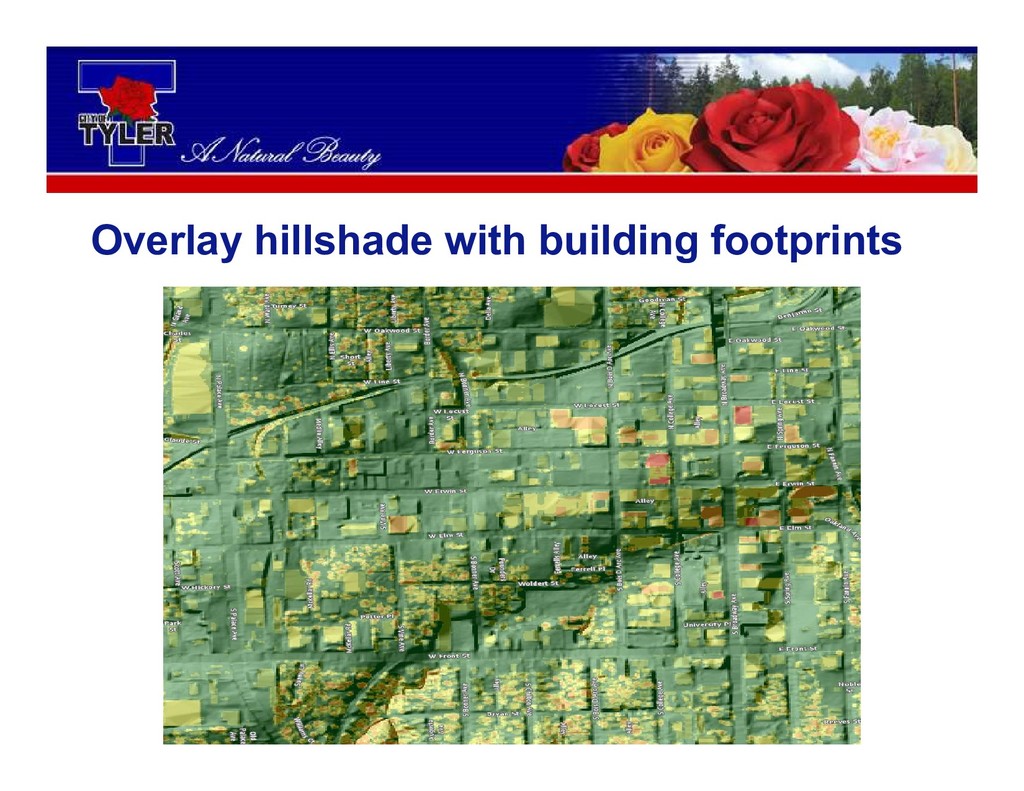
Overlay hillshade with building footprints
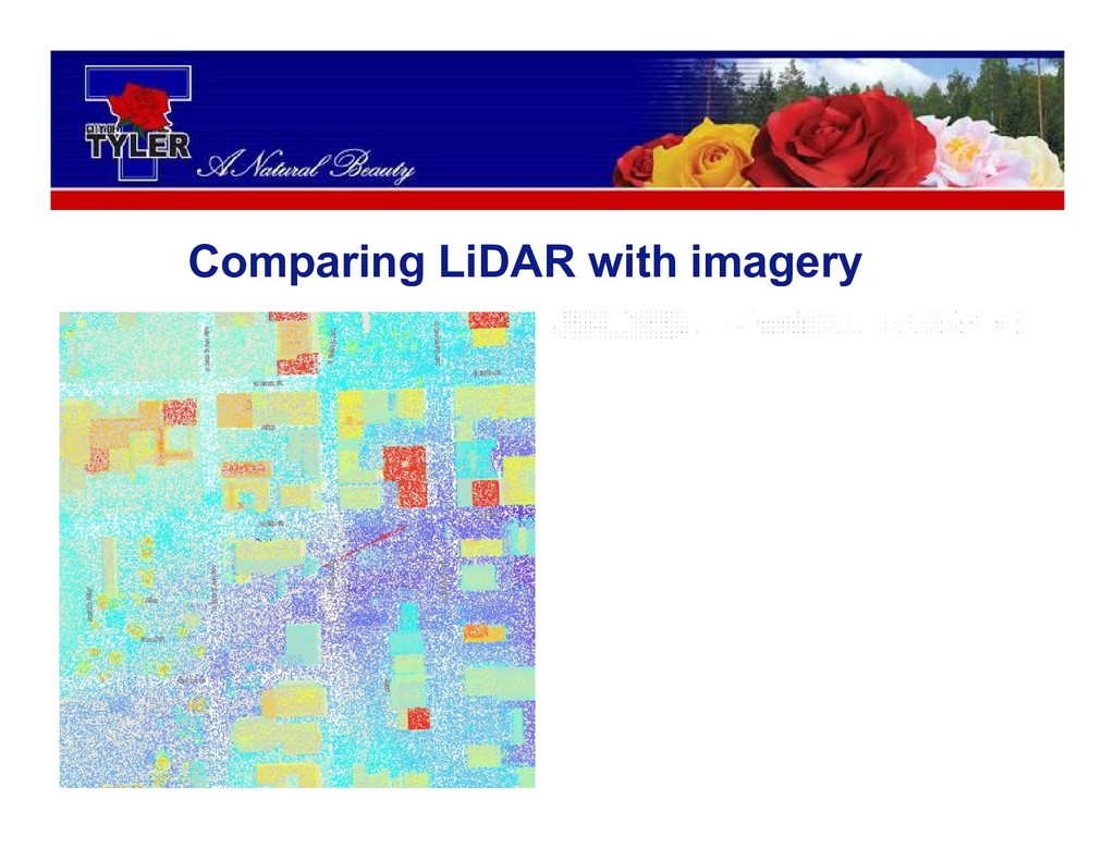
Overlay hillshade with imagery
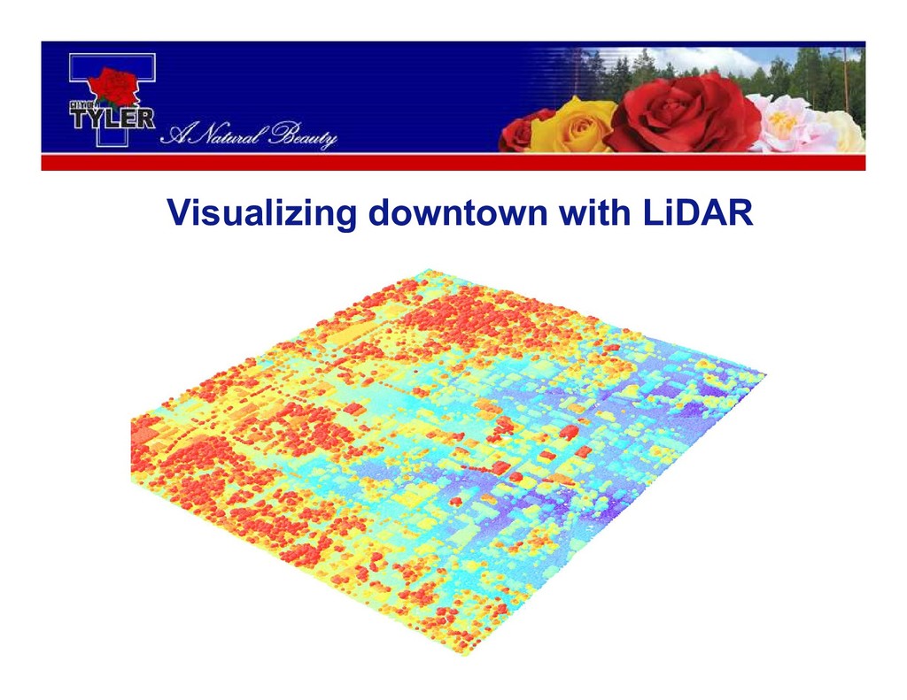
Visualizing downtown with LiDAR
LiDAR dataset layer in ArcGIS Pro
LiDAR dataset layer in ArcGIS ArcMap
Comparing LiDAR with imagery
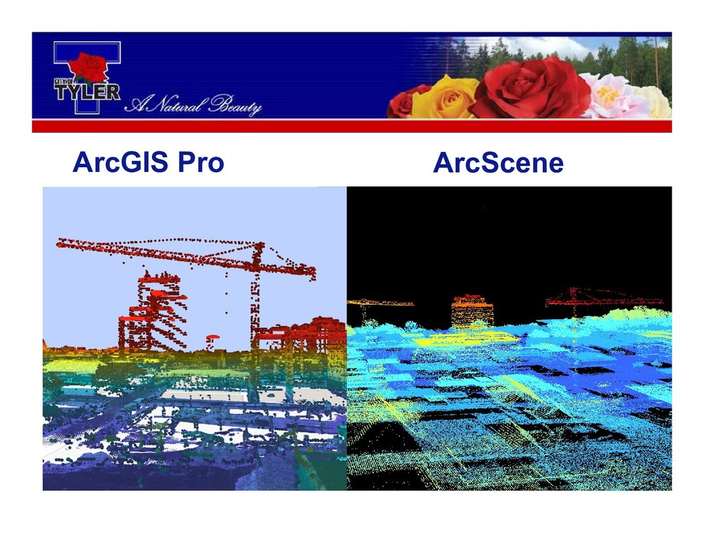
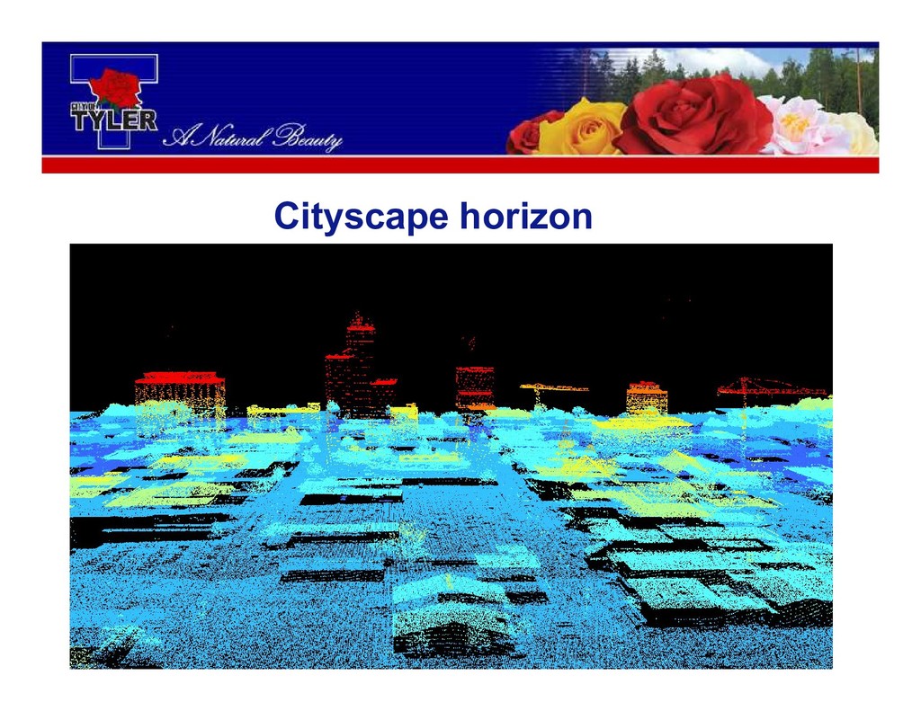
LiDAR 3D visualizations of downtown
ArcGIS Pro Type here ArcScene
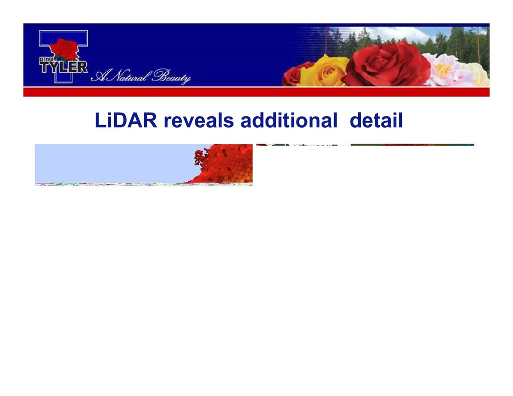
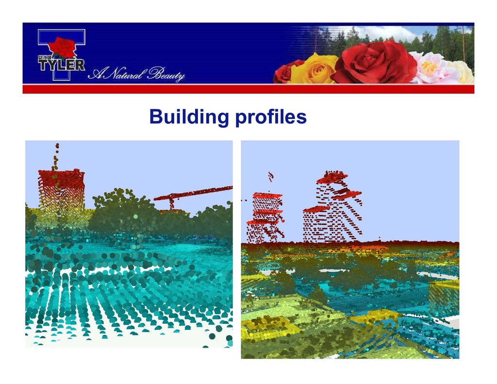
LiDAR reveals additional detail
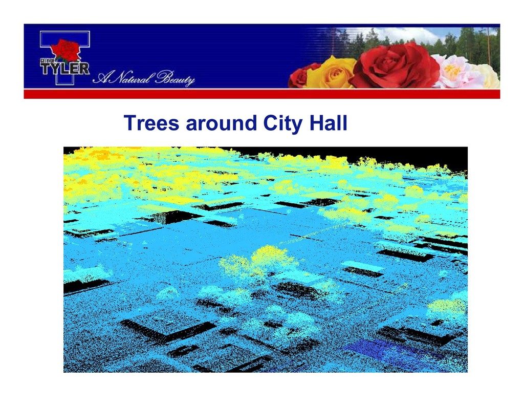
Trees around City Hall
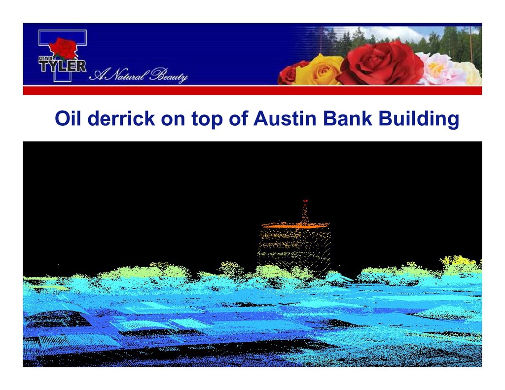
Oil derrick on top of Austin Bank Building
Building profiles
Cityscape horizon
Closing Remarks LiDAR is a useful tool for terrain and
surface structure visualization in addition to its initial role in modeling scenarios of hydrological events
Questions?
None