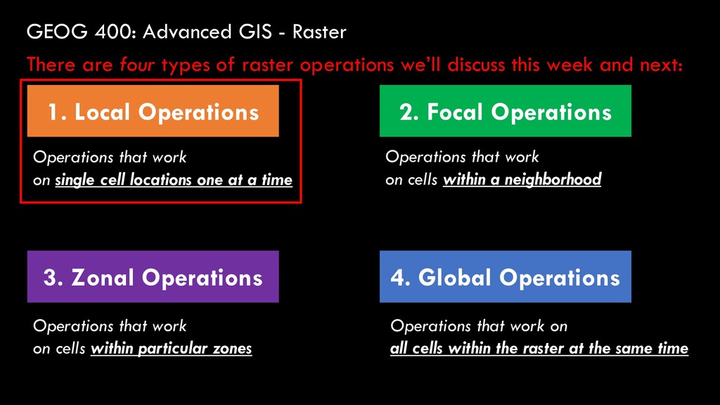
Global Operations 2. Focal Operations 3. Zonal Operations There are four types of raster operations we’ll discuss this week and next: Operations that work on single cell locations one at a time Operations that work on cells within a neighborhood Operations that work on cells within particular zones Operations that work on all cells within the raster
Global Operations 2. Focal Operations 3. Zonal Operations There are four types of raster operations we’ll discuss this week and next: Operations that work on single cell locations one at a time Operations that work on cells within a neighborhood Operations that work on cells within particular zones Operations that work on all cells within the raster at the same time
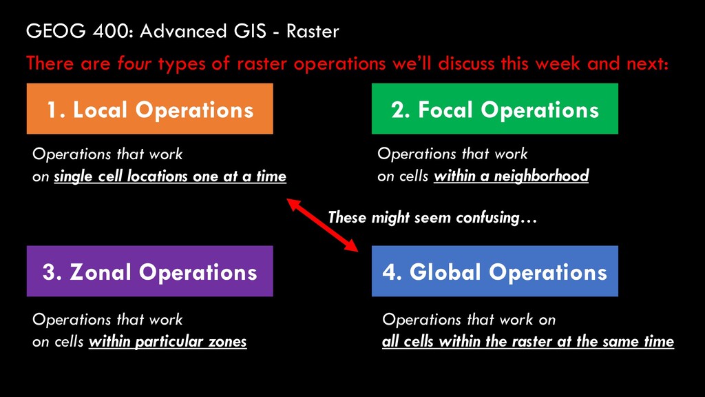
Global Operations 2. Focal Operations 3. Zonal Operations There are four types of raster operations we’ll discuss this week and next: Operations that work on single cell locations one at a time Operations that work on cells within a neighborhood Operations that work on cells within particular zones Operations that work on all cells within the raster at the same time These might seem confusing…
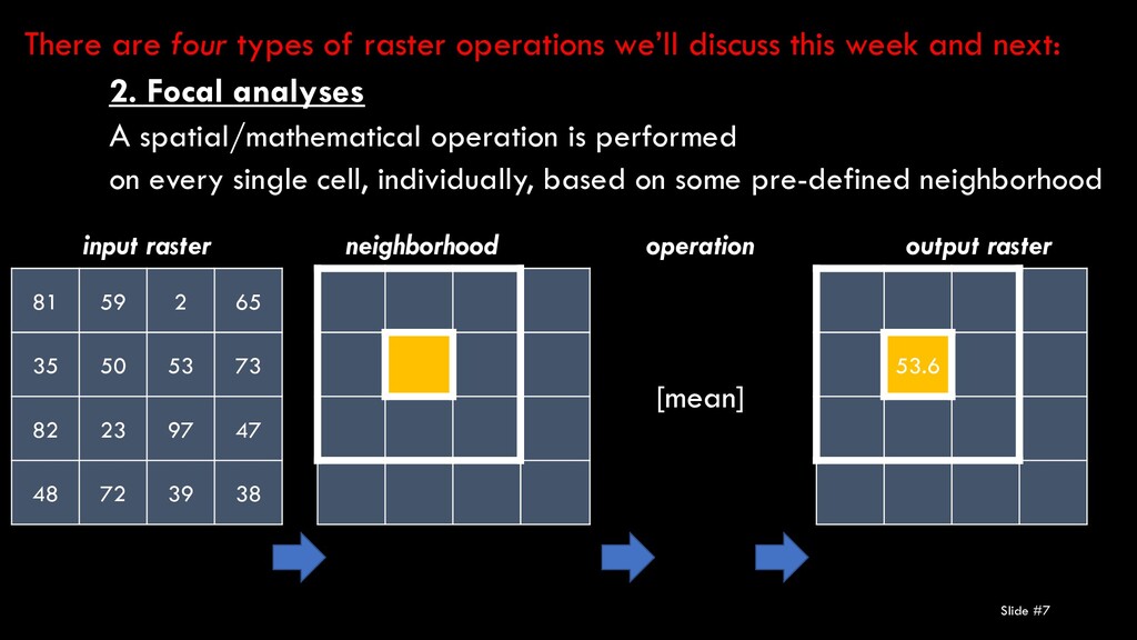
82 23 97 47 48 72 39 38 input raster operation [mean] output raster 53.6 neighborhood 2. Focal analyses A spatial/mathematical operation is performed on every single cell, individually, based on some pre-defined neighborhood There are four types of raster operations we’ll discuss this week and next:
3. Zonal analyses A spatial/mathematical operation is performed on groups of cells at the same time, based on some pre-defined neighborhood There are four types of raster operations we’ll discuss this week and next: input raster operation output raster neighborhood 81 59 2 65 35 50 53 73 82 23 97 47 48 72 39 38
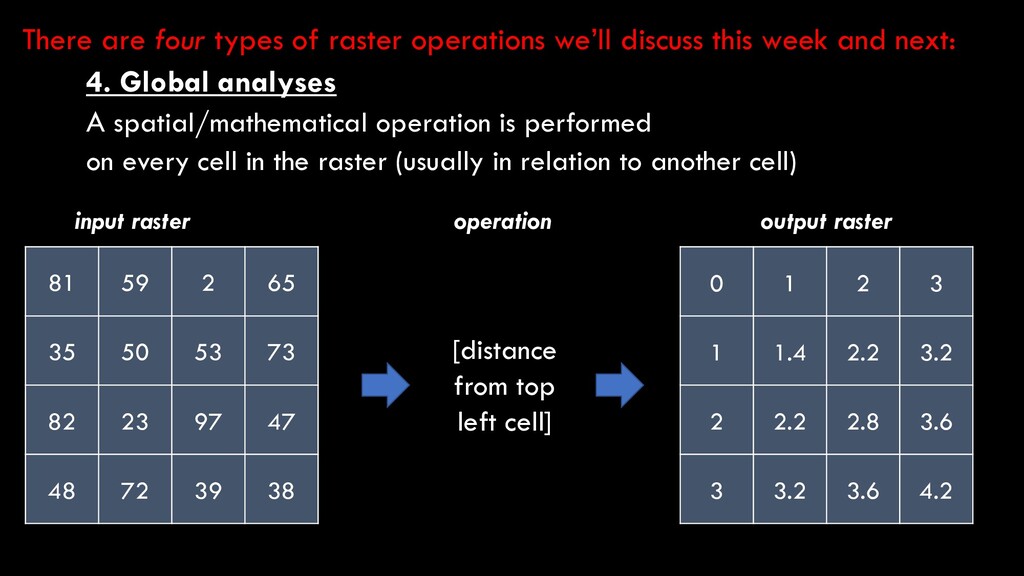
97 47 48 72 39 38 [distance from top left cell] 0 1 2 3 1 1.4 2.2 3.2 2 2.2 2.8 3.6 3 3.2 3.6 4.2 4. Global analyses A spatial/mathematical operation is performed on every cell in the raster (usually in relation to another cell) There are four types of raster operations we’ll discuss this week and next: input raster operation output raster
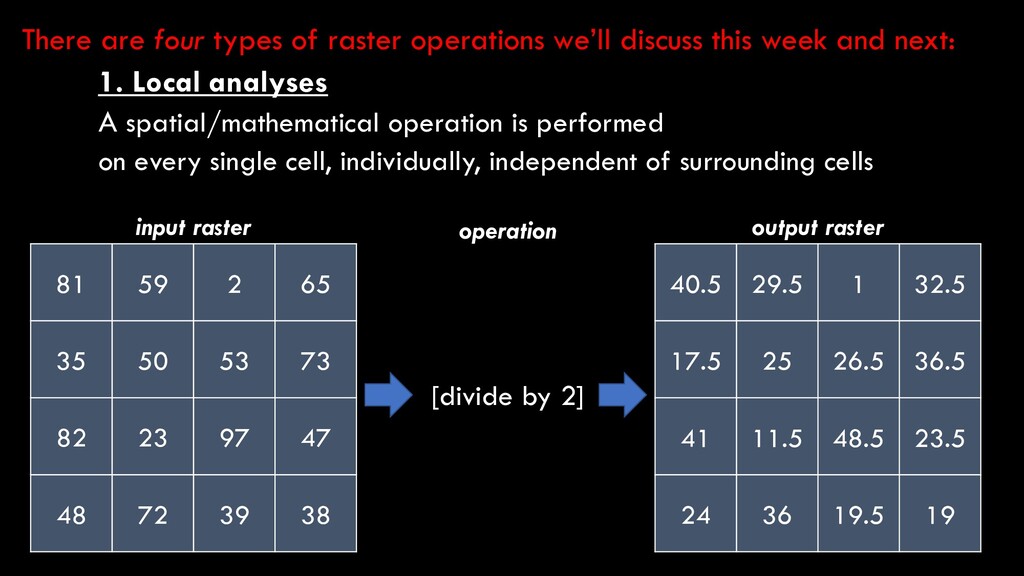
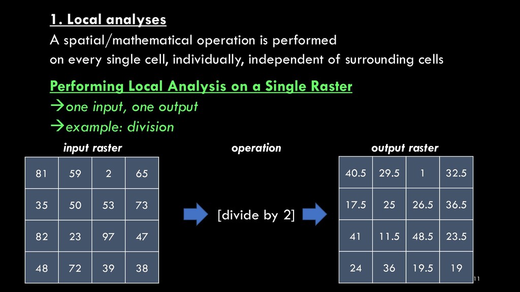
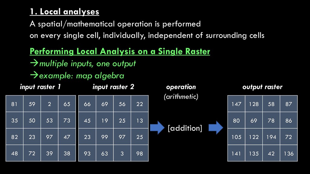
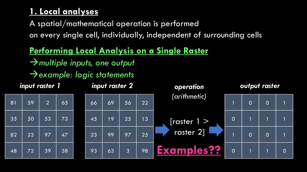
on a single raster dataset 1b. Local analyses on multiple raster datasets 1. Local analyses A spatial/mathematical operation is performed on every single cell, individually, independent of surrounding cells
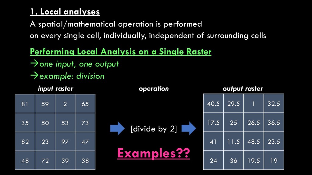
82 23 97 47 48 72 39 38 input raster operation [divide by 2] output raster 40.5 29.5 1 32.5 17.5 25 26.5 36.5 41 11.5 48.5 23.5 24 36 19.5 19 1. Local analyses A spatial/mathematical operation is performed on every single cell, individually, independent of surrounding cells Performing Local Analysis on a Single Raster one input, one output example: division
97 47 48 72 39 38 input raster operation [divide by 2] output raster 40.5 29.5 1 32.5 17.5 25 26.5 36.5 41 11.5 48.5 23.5 24 36 19.5 19 1. Local analyses A spatial/mathematical operation is performed on every single cell, individually, independent of surrounding cells Performing Local Analysis on a Single Raster one input, one output example: division Examples??
97 47 48 72 39 38 input raster operation [divide by 2] output raster 40.5 29.5 1 32.5 17.5 25 26.5 36.5 41 11.5 48.5 23.5 24 36 19.5 19 1. Local analyses A spatial/mathematical operation is performed on every single cell, individually, independent of surrounding cells Performing Local Analysis on a Single Raster one input, one output example: division Examples??
world, the Spatial Analyst toolbox is where the magic happens! We will not go over every tool in these toolboxes, but we will review some of the most widely-used and valuable tools in the Spatial Analyst Toolbox. Toolboxes containing primarily LOCAL operators
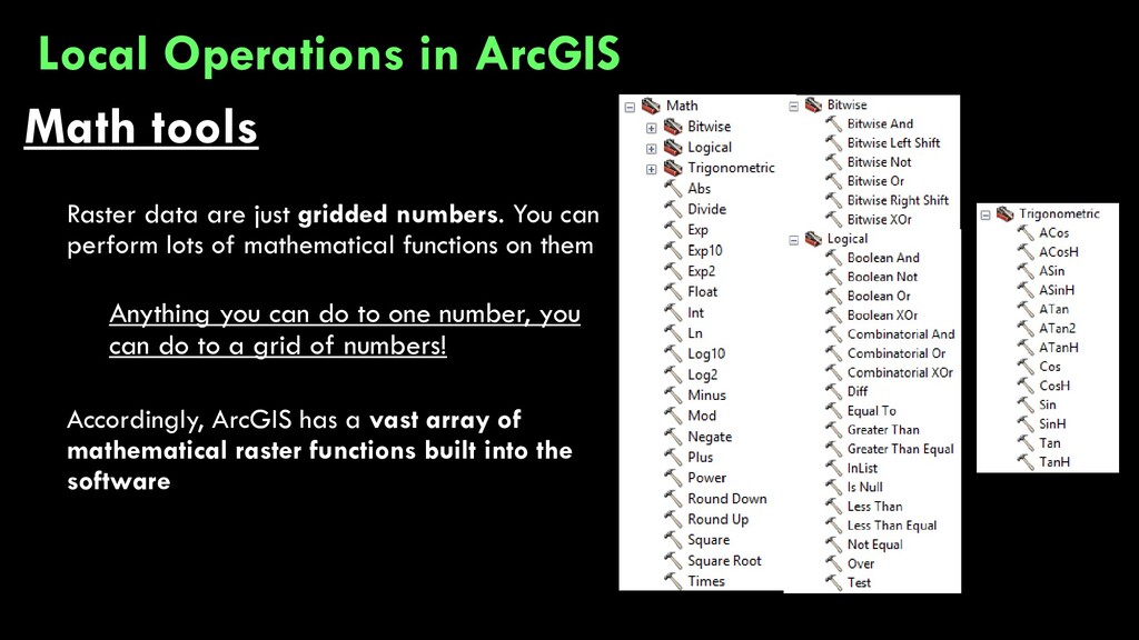
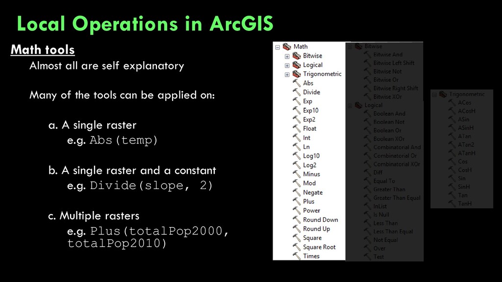
perform lots of mathematical functions on them Anything you can do to one number, you can do to a grid of numbers! Accordingly, ArcGIS has a vast array of mathematical raster functions built into the software Local Operations in ArcGIS
tools can be applied on: a. A single raster e.g. Abs(temp) b. A single raster and a constant e.g. Divide(slope, 2) c. Multiple rasters e.g. Plus(totalPop2000, totalPop2010) Local Operations in ArcGIS
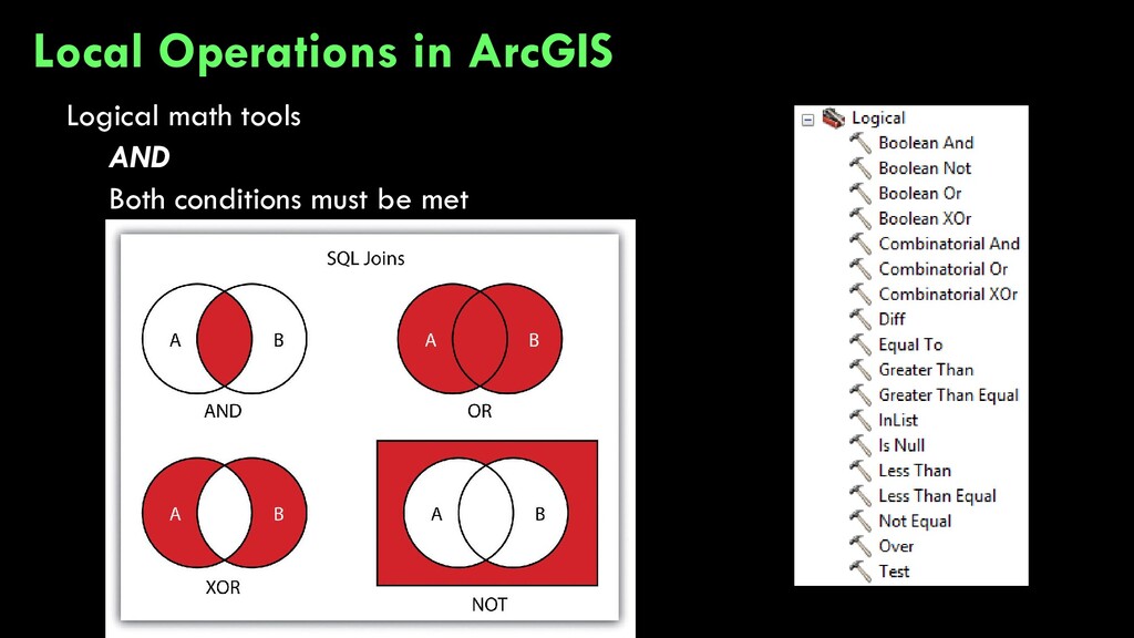
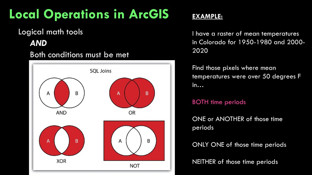
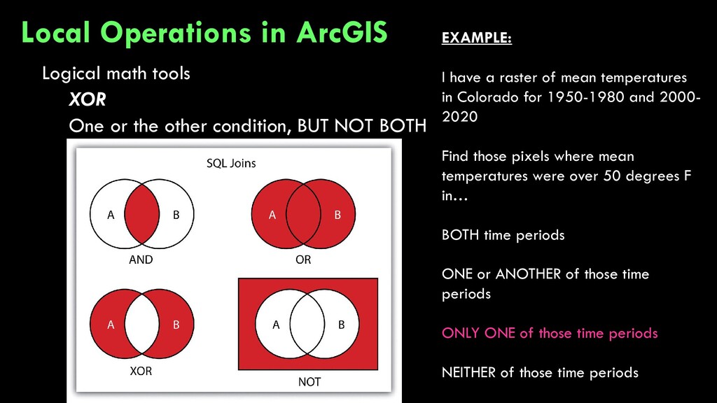
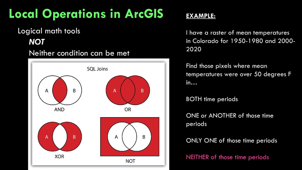
Operations in ArcGIS EXAMPLE: I have a raster of mean temperatures in Colorado for 1950-1980 and 2000- 2020 Find those pixels where mean temperatures were over 50 degrees F in… BOTH time periods ONE or ANOTHER of those time periods ONLY ONE of those time periods NEITHER of those time periods
be met Local Operations in ArcGIS EXAMPLE: I have a raster of mean temperatures in Colorado for 1950-1980 and 2000- 2020 Find those pixels where mean temperatures were over 50 degrees F in… BOTH time periods ONE or ANOTHER of those time periods ONLY ONE of those time periods NEITHER of those time periods
NOT BOTH Local Operations in ArcGIS EXAMPLE: I have a raster of mean temperatures in Colorado for 1950-1980 and 2000- 2020 Find those pixels where mean temperatures were over 50 degrees F in… BOTH time periods ONE or ANOTHER of those time periods ONLY ONE of those time periods NEITHER of those time periods
Operations in ArcGIS EXAMPLE: I have a raster of mean temperatures in Colorado for 1950-1980 and 2000- 2020 Find those pixels where mean temperatures were over 50 degrees F in… BOTH time periods ONE or ANOTHER of those time periods ONLY ONE of those time periods NEITHER of those time periods
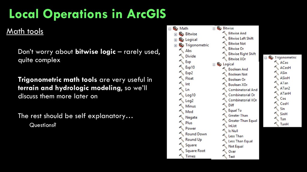
quite complex Trigonometric math tools are very useful in terrain and hydrologic modeling, so we’ll discuss them more later on The rest should be self explanatory… Questions? Local Operations in ArcGIS
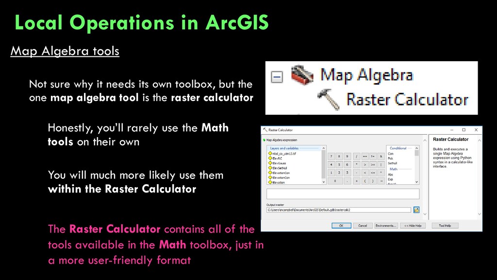
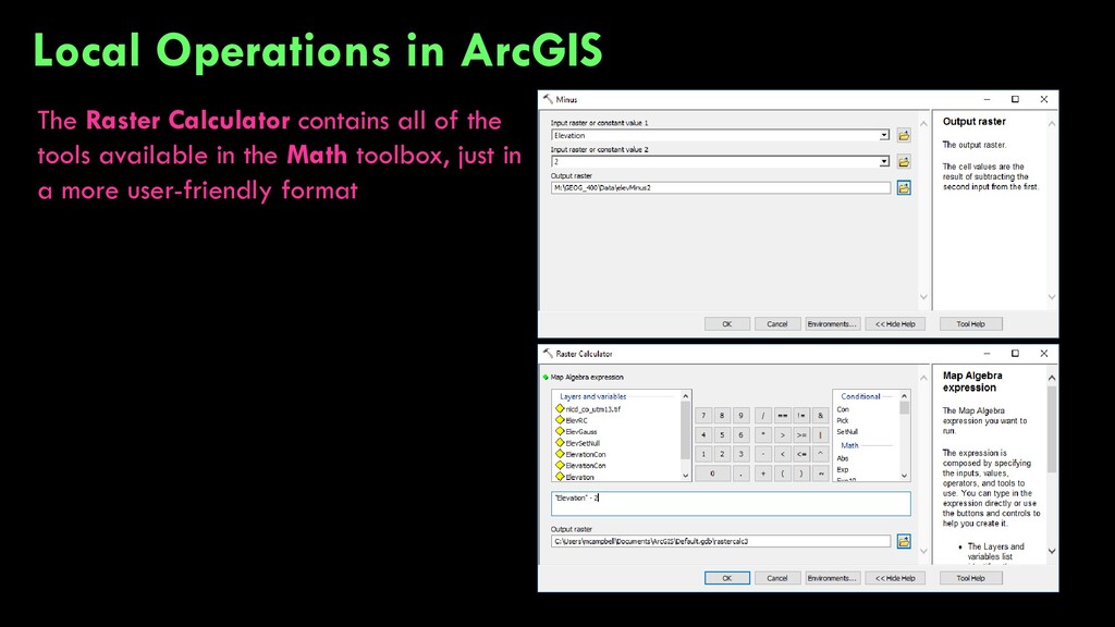
toolbox, but the one map algebra tool is the raster calculator Honestly, you’ll rarely use the Math tools on their own You will much more likely use them within the Raster Calculator Local Operations in ArcGIS The Raster Calculator contains all of the tools available in the Math toolbox, just in a more user-friendly format
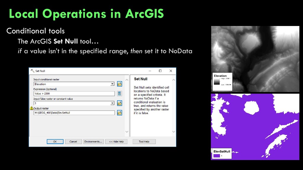
statement IF [condition is met] THEN [do something] Very common in computer programming • IF 4 < 5 THEN print “Duh” • Duh IF CONDITION TRUE DO SOMETHING DO SOMETHING ELSE FALSE Local Operations in ArcGIS
basis, such that every cell/pixel is assessed individually to determine if some criterion (or criteria) is (are) met • IF [input raster] [condition] THEN [output raster] ELSE [output raster] • IF InRas1 >= 2 THEN OutRas = 40 ELSE OutRas = 30 Local Operations in ArcGIS
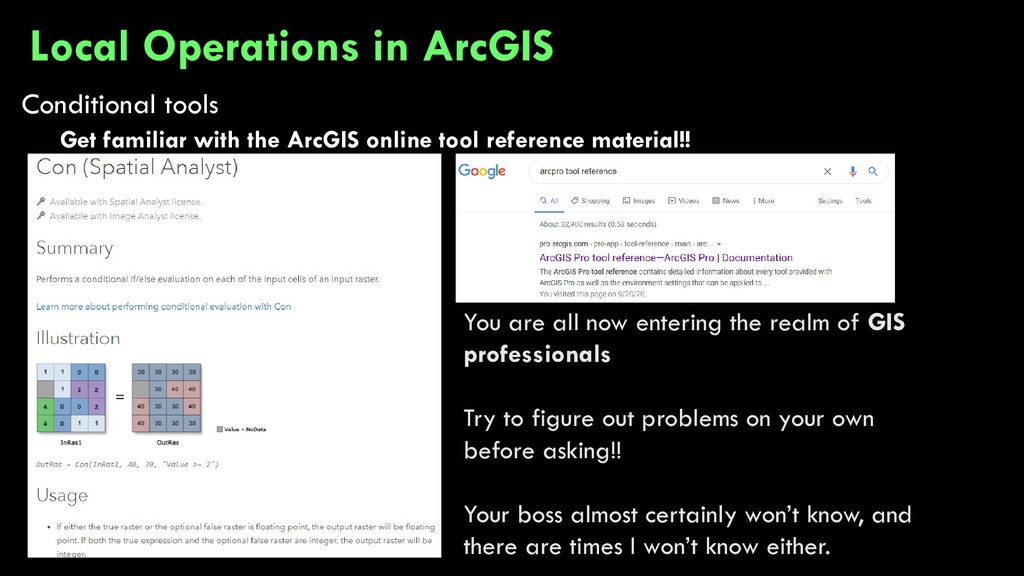
material!! Local Operations in ArcGIS You are all now entering the realm of GIS professionals Try to figure out problems on your own before asking!! Your boss almost certainly won’t know, and there are times I won’t know either.
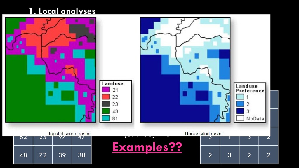
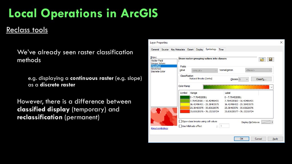
a continuous raster (e.g. slope) as a discrete raster However, there is a difference between classified display (temporary) and reclassification (permanent) Local Operations in ArcGIS
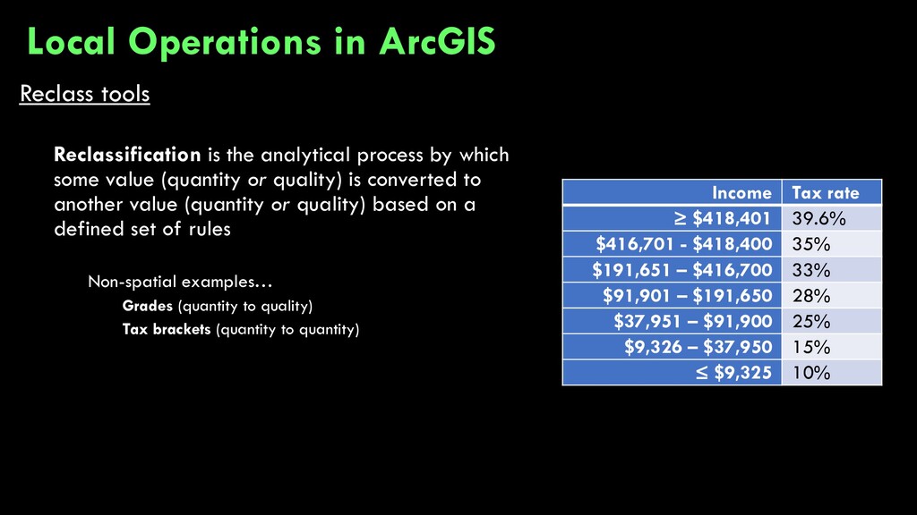
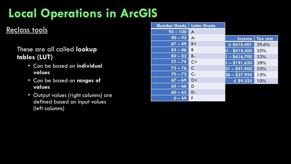
value (quantity or quality) is converted to another value (quantity or quality) based on a defined set of rules Non-spatial examples… Grades (quantity to quality) Number Grade Letter Grade 93 – 100 A 90 – 92 A- 87 – 89 B+ 83 – 86 B 80 – 82 B- 77 – 79 C+ 73 – 76 C 70 – 72 C- 67 – 69 D+ 63 – 66 D 60 – 62 D- 0 – 59 F Local Operations in ArcGIS
value (quantity or quality) is converted to another value (quantity or quality) based on a defined set of rules Non-spatial examples… Grades (quantity to quality) Tax brackets (quantity to quantity) Income Tax rate ≥ $418,401 39.6% $416,701 - $418,400 35% $191,651 – $416,700 33% $91,901 – $191,650 28% $37,951 – $91,900 25% $9,326 – $37,950 15% ≤ $9,325 10% Local Operations in ArcGIS
Can be based on individual values • Can be based on ranges of values • Output values (right columns) are defined based on input values (left columns) Income Tax rate ≥ $418,401 39.6% $416,701 - $418,400 35% $191,651 – $416,700 33% $91,901 – $191,650 28% $37,951 – $91,900 25% $9,326 – $37,950 15% ≤ $9,325 10% Number Grade Letter Grade 93 – 100 A 90 – 92 A- 87 – 89 B+ 83 – 86 B 80 – 82 B- 77 – 79 C+ 73 – 76 C 70 – 72 C- 67 – 69 D+ 63 – 66 D 60 – 62 D- 0 – 59 F Local Operations in ArcGIS
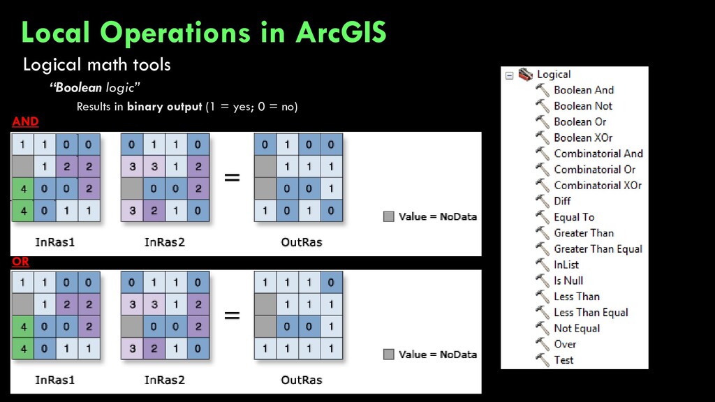
are… the Local tools Each tool takes a list of two or more rasters and performs some cell-by-cell (local!) analysis e.g. take the past 10 years of temperature raster data and determine the mean e.g. take the past 10 years of snowpack data and determine the minimum (…2017-2018) Local Operations in ArcGIS
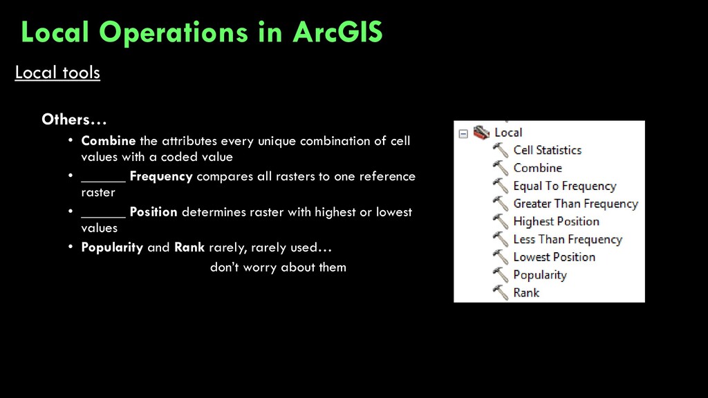
of cell values with a coded value • ______ Frequency compares all rasters to one reference raster • ______ Position determines raster with highest or lowest values • Popularity and Rank rarely, rarely used… don’t worry about them Local Operations in ArcGIS
![[mean] 53.6 53.6 53.6 53.6 53.6 53.6 53.6 53.6 53.6](https://files.speakerdeck.com/presentations/d3c2a0324a624a8b8c0635a08078dc99/slide_7.jpg)