Candidate, University of British Columbia [email protected] @mappingmashups CSCW Workshop: Advancing an Industry/Academic Partnership Model for Open Collaboration Research March 14, 2015
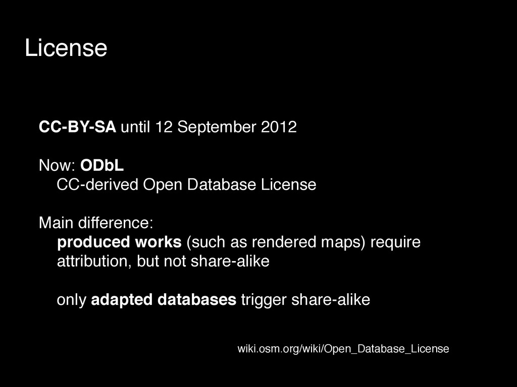
Database License Main difference: produced works (such as rendered maps) require attribution, but not share-alike only adapted databases trigger share-alike wiki.osm.org/wiki/Open_Database_License
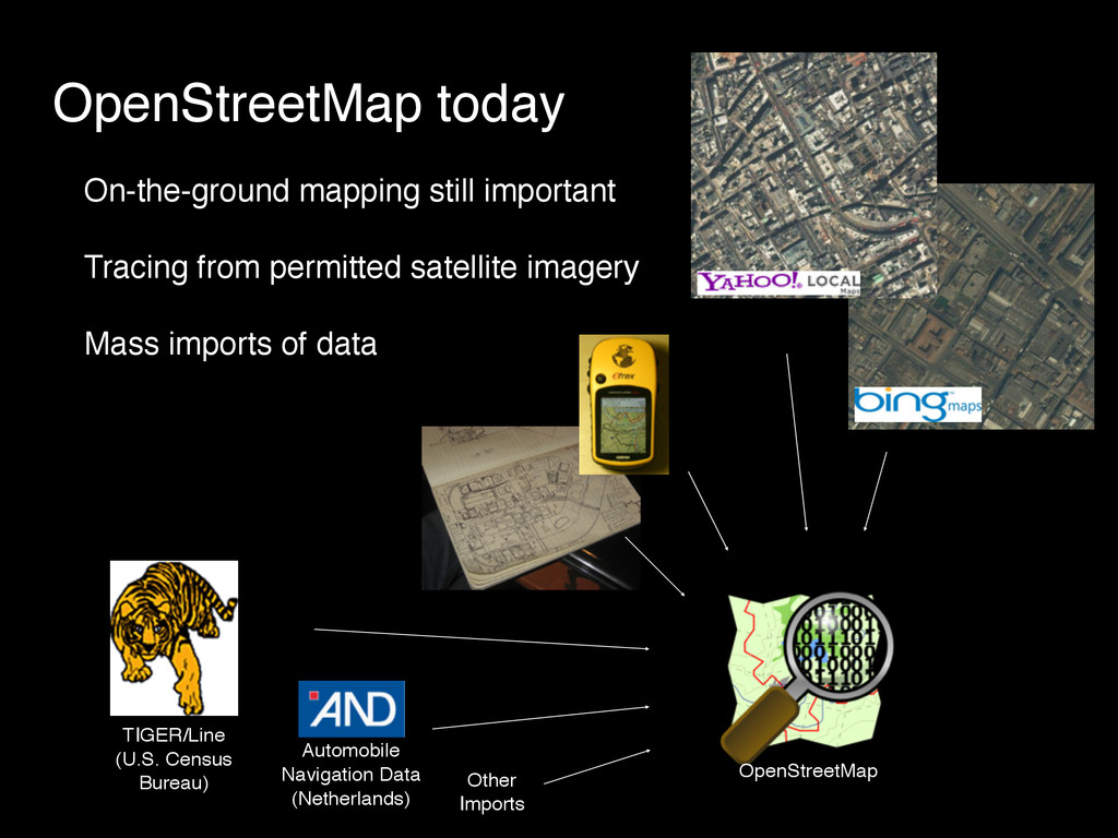
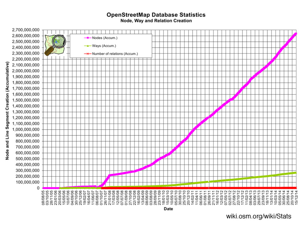
Referencing” TIGER is a product of the United States Census Bureau, therefore in the Public Domain OpenStreetMap imported TIGER’s 2005 data starting in late 2007: animation: wiki.osm.org/wiki/Tiger
manually upload each chunk NOTE: The term "Import" is highly loaded in the OSM community. "A distributed and curated merge," is a more accurate description of what Seattle OSM planning to do. — wiki.osm.org/wiki/Seattle_Import
![@mappingmashups [email protected]](https://files.speakerdeck.com/presentations/b7d6ebad4fb941d7b95e97fef45bfd83/slide_30.jpg)