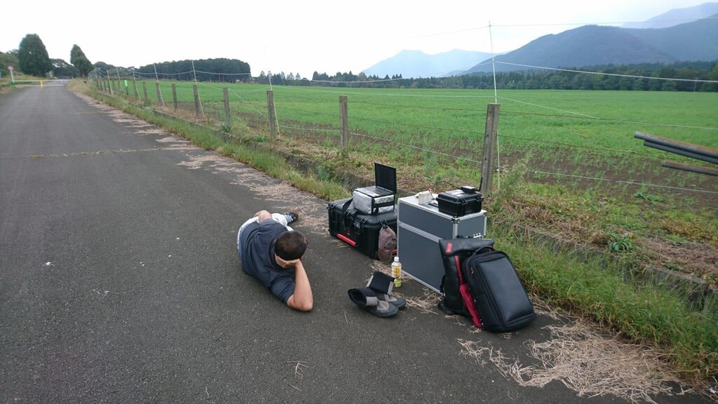
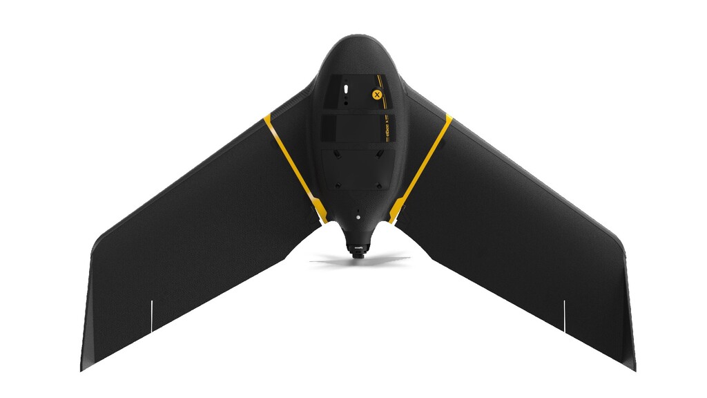
configuration • Endurance Extension option: • 90 min max flight time (camera dependent) • 500ha (1,235ac) max. coverage at 122m (400ft) with senseFly S.O.D.A. 3D • Some countries only! • Endurance Extension = firmware unlock + new batteries (some paperwork required) • Perfect for BVLOS missions • Large capacity batteries will also become available with out extension over the next months • 10x more coverage per flight than state of the art multi- rotor drones • 75% - 80% quicker and 3 -5 x lower cost than terrestrial measurement eBee X Endurance Extension
senseFly Duet T Parrot Sequoia+ Surveying companies / Aerial Imagery companies (manned aircraft) / Drone service providers • Mining, quarries & aggregates • Government (eg: urban planning) • Environmental agencies • Construction companies • Utility companies • Environmental researchers • Utilities, Energy companies • Oil & Gas companies • Environmental researchers • Agronomists • Crop Consultants • Cooperatives & farm managers eBee X has optimized payloads for all use cases and customers • senseFly S.O.D.A. and senseFly S.O.D.A. Corridor are also compatible and available! • Further payloads will become available over next months
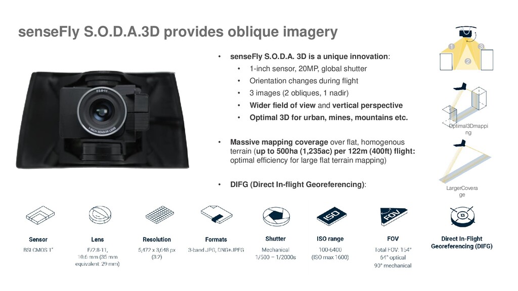
sensor, 20MP, global shutter • Orientation changes during flight • 3 images (2 obliques, 1 nadir) • Wider field of view and vertical perspective • Optimal 3D for urban, mines, mountains etc. • Massive mapping coverage over flat, homogenous terrain (up to 500ha (1,235ac) per 122m (400ft) flight: optimal efficiency for large flat terrain mapping) • DIFG (Direct In-flight Georeferencing): LargerCovera ge Optimal3Dmappi ng 1 2 3 senseFly S.O.D.A.3D provides oblique imagery
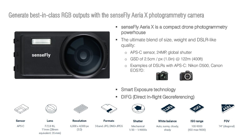
camera senseFly Aeria X is a compact drone photogrammetry powerhouse The ultimate blend of size, weight and DSLR-like quality: o APS-C sensor, 24MP , global shutter o GSD of 2.5cm / px (1.0in) @ 122m (400ft) o Examples of DSLRs with APS-C: Nikon D500, Canon EOS7D: Smart Exposure technology DIFG (Direct In-flight Georeferencing)
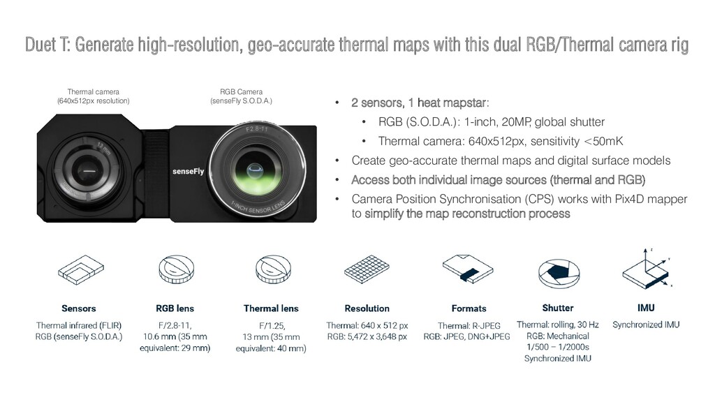
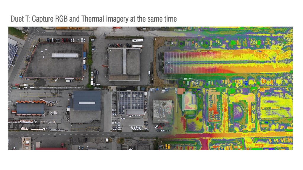
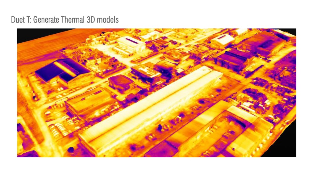
RGB/Thermal camera rig • 2 sensors, 1 heat mapstar: • RGB (S.O.D.A.): 1-inch, 20MP , global shutter • Thermal camera: 640x512px, sensitivity <50mK • Create geo-accurate thermal maps and digital surface models • Access both individual image sources (thermal and RGB) • Camera Position Synchronisation (CPS) works with Pix4D mapper to simplify the map reconstruction process Thermal camera (640x512px resolution) RGB Camera (senseFly S.O.D.A.)