Upgrade to Pro — share decks privately, control downloads, hide ads and more …

BiDS'17 (Big Data from Space)

Magellium
November 28, 2017

BiDS'17 (Big Data from Space)

Magellium attends the BiDS'17 (Big Data from Space) conference. This was a great place to share and discuss about deep learning applications for remote sensing.

Magellium

November 28, 2017
Tweet

More Decks by Magellium

Other Decks in Science

Transcript

  1. Domain Activity 2 20/09/2017 propriété Magellium 2003 creation 150+ employees

    2 sites Paris Toulouse* 14,2 M€ Turnover 2016 Earth observation Geo-Information Imagery and applications In ARTAL group since September 1st, 2016
  2. Offer & markets 3 propriété Magellium Scientific and technical studies

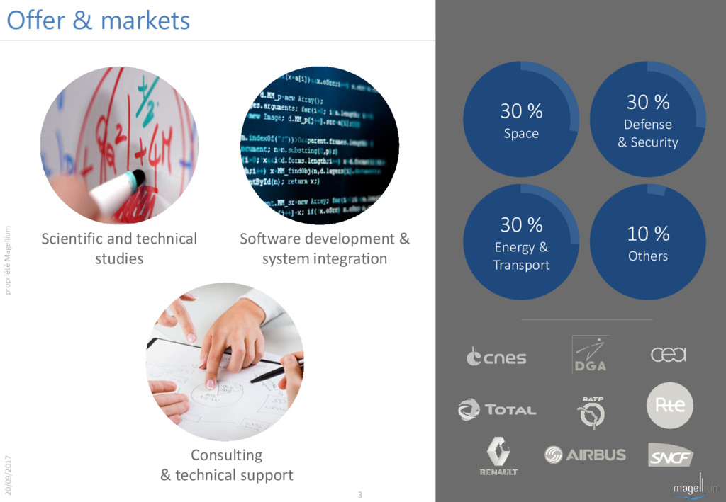
    Software development & system integration 30 % Energy & Transport 10 % Others 30 % Space Consulting & technical support 30 % Defense & Security 20/09/2017
  3. Deep Learning @ Magellium Work Group Team lead by 3

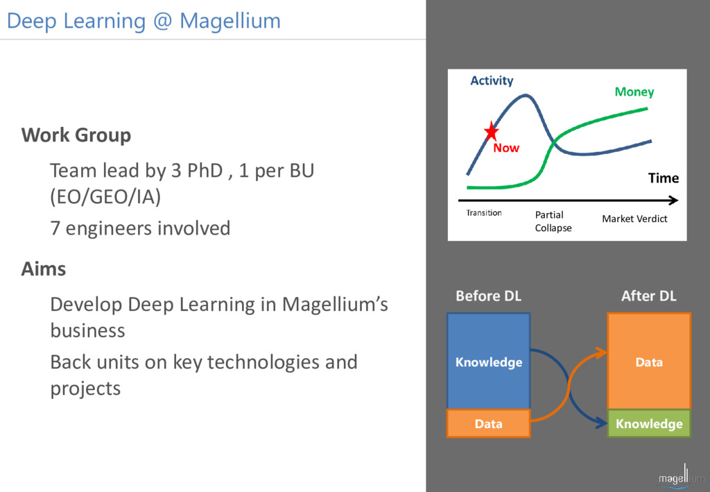
    PhD , 1 per BU (EO/GEO/IA) 7 engineers involved Aims Develop Deep Learning in Magellium’s business Back units on key technologies and projects Knowledge Data Data Knowledge Before DL After DL Market Verdict Partial Collapse
  4. Activities/ Urban Area Detection Internal Research Project Urban Zone Detection

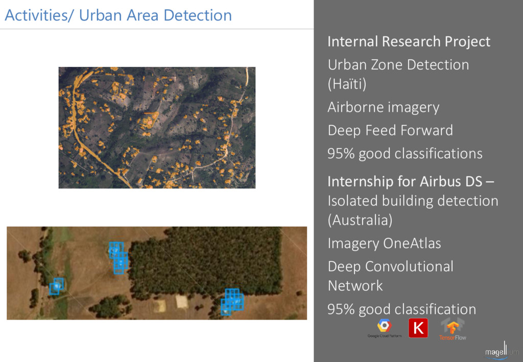
    (Haïti) Airborne imagery Deep Feed Forward 95% good classifications Internship for Airbus DS – Isolated building detection (Australia) Imagery OneAtlas Deep Convolutional Network 95% good classification
  5. Internal Research Project Spot5 album 5 classes CNN 94% good

    classification S2 imagery 4 classes Autoencoder WIP Activities/ Cloud Classification
  6. Activities/ Ship Detection Airbus DS Spot 6/7 Imagery + Pleiades

    from Airbus OneAtlas Detection aiming high recall before experts validation Locks : high size variability, haze, rough seas
  7. Activities/ Building Footprint Extraction Internal Research Project Building footprints Airborne

    + Pléiades OCS-GE + OSM DBs Autoencoder Robust and solid results 98% good classification
  8. Activities/ Automatic Land Cover Internal Research Project Land Cover over

    11 classes S2 simulated imagery with Pleiades + OCS-GE + OSM Autoencoder WIP
  9. Activities/ Handwritten Digit Recognition SHOM Locks: previous centuries handwriting, heterogeneous

    handwritten digits, dataset small learning data set (~2000 examples) Learning on exogenous data and fine tuning on SHOM’s dataset
  10. Activities/ Urban Area Segmentation Deep NG ISAE students project Building

    and road extraction on satellite images from Africa for humanitarian purpose OpenStreetMap integration through JOSM plugin
  11. Activities/ Others Biophysical parameters inversion (Hyperspectral) Estimating water and chlorophyll

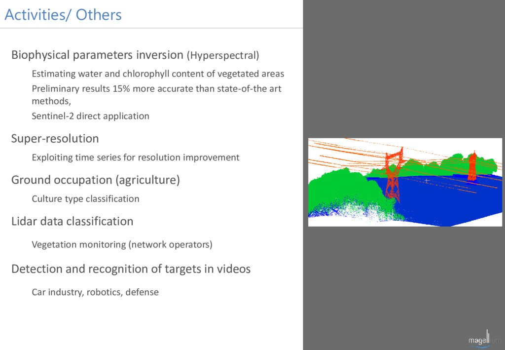
    content of vegetated areas Preliminary results 15% more accurate than state-of-the art methods, Sentinel-2 direct application Super-resolution Exploiting time series for resolution improvement Ground occupation (agriculture) Culture type classification Lidar data classification Vegetation monitoring (network operators) Detection and recognition of targets in videos Car industry, robotics, defense