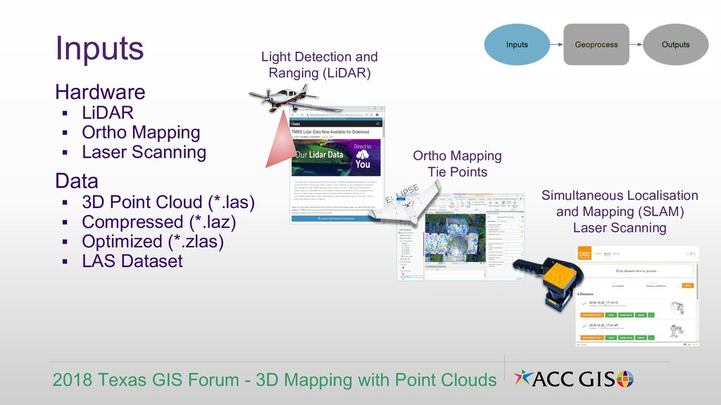
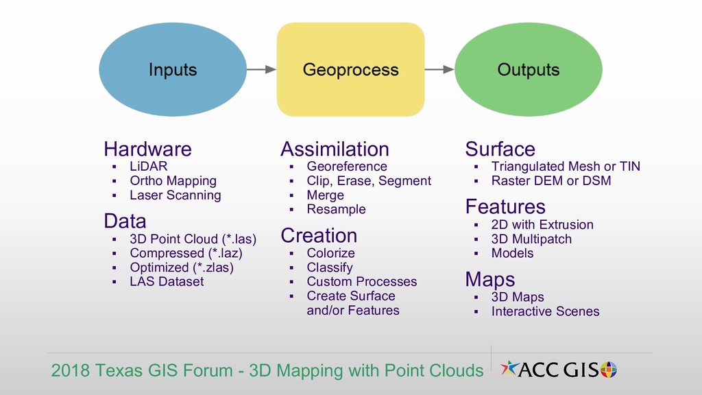
▪ 3D Point Cloud (*.las) ▪ Compressed (*.laz) ▪ Optimized (*.zlas) ▪ LAS Dataset Inputs 2018 Texas GIS Forum - 3D Mapping with Point Clouds Light Detection and Ranging (LiDAR) Ortho Mapping Tie Points Simultaneous Localisation and Mapping (SLAM) Laser Scanning
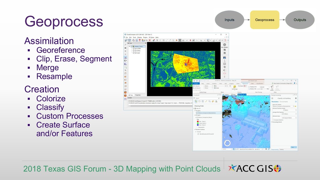
Resample Creation ▪ Colorize ▪ Classify ▪ Custom Processes ▪ Create Surface and/or Features Geoprocess 2018 Texas GIS Forum - 3D Mapping with Point Clouds
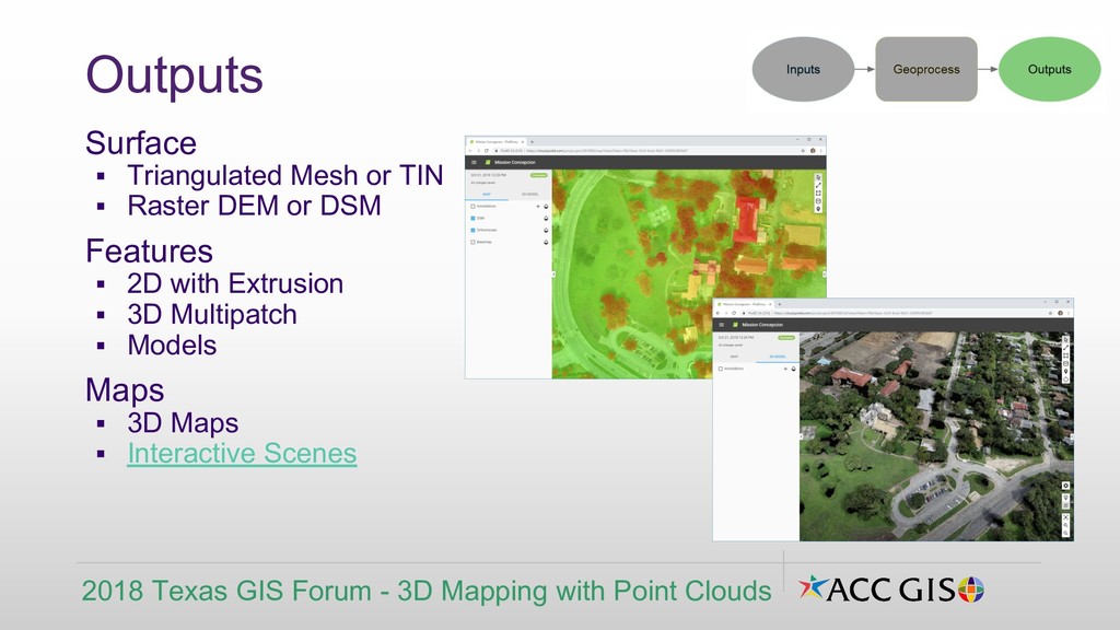
DSM Features ▪ 2D with Extrusion ▪ 3D Multipatch ▪ Models Maps ▪ 3D Maps ▪ Interactive Scenes Outputs 2018 Texas GIS Forum - 3D Mapping with Point Clouds
▪ 3D Point Cloud (*.las) ▪ Compressed (*.laz) ▪ Optimized (*.zlas) ▪ LAS Dataset Assimilation ▪ Georeference ▪ Clip, Erase, Segment ▪ Merge ▪ Resample Creation ▪ Colorize ▪ Classify ▪ Custom Processes ▪ Create Surface and/or Features Surface ▪ Triangulated Mesh or TIN ▪ Raster DEM or DSM Features ▪ 2D with Extrusion ▪ 3D Multipatch ▪ Models Maps ▪ 3D Maps ▪ Interactive Scenes 2018 Texas GIS Forum - 3D Mapping with Point Clouds
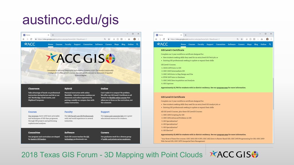
from 9 AM to 1 PM at Highland ▪ Christian Hartnett, FAA Certified sUAS Pilot Intro to Drone Mapping - Part 2 ▪ Saturday, 11/17 from 9 AM to 1 PM at Northridge ▪ Christian Hartnett, FAA Certified sUAS Pilot 3D Mapping with Point Clouds ▪ Friday, 11/30 from 9 AM to 1 PM at Northridge ▪ Sean Moran, GISP ACC GIS Micro Courses 4-hr CE Adv Applications in GIS Courses for $95 2018 Texas GIS Forum - 3D Mapping with Point Clouds continue.austincc.edu/gis