Upgrade to Pro — share decks privately, control downloads, hide ads and more …

Advancing Public Access to Oil and Gas Data using Web GIS

Advancing Public Access to Oil and Gas Data using Web GIS

Harold Rogers, Aaron Averett - UT-Bureau of Economic Geology

More Decks by Texas Natural Resources Information System

Other Decks in Technology

Transcript

  1. Advancing Public Access to Oil and Gas Data using Web

    GIS Harold H. Rogers, III Research Scientist Associate II [email protected] Aaron R. Averett Research Scientist Associate III [email protected] October 27, 2016 Texas GIS Forum
  2. Outline What is the STARR Program at the Bureau of

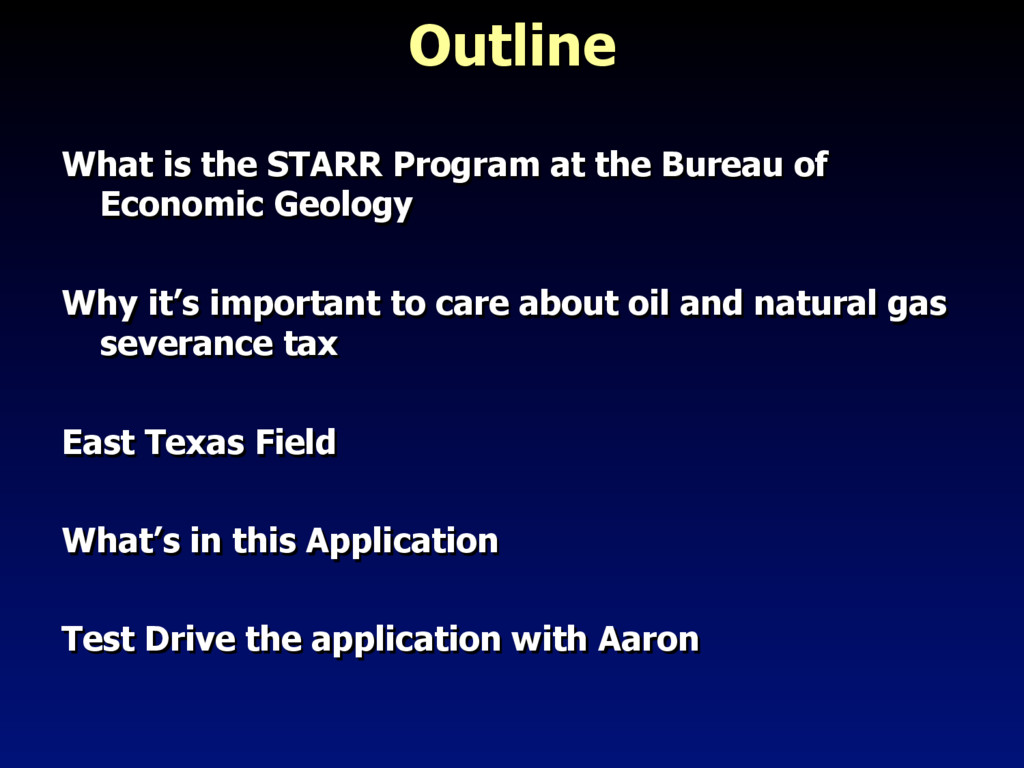
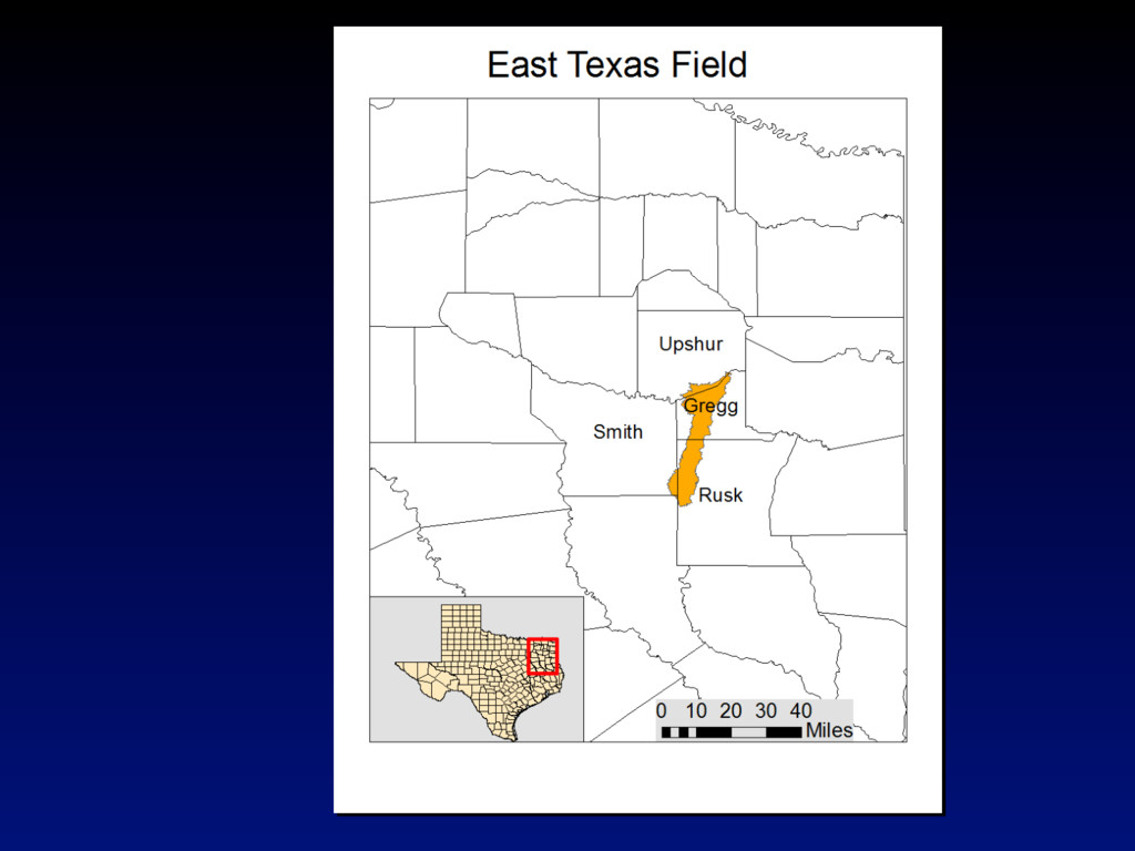
    Economic Geology Why it’s important to care about oil and natural gas severance tax East Texas Field What’s in this Application Test Drive the application with Aaron
  3. Mission: Increase income to the State through working with operators

    to… •  Characterize new hydrocarbon plays •  Recommend drilling new wells •  Recommend enhanced recovery programs
  4. Who is a Stakeholder? STARR partners (Oil and Gas Companies)

    State Government Counties And YOU, the general public
  5. What is the Severance Tax? What is the Severance Tax?

    The severance tax is charged by the state of Texas to anyone who extracts, produces, or has a royalty on the extraction of any nonrenewable resource
  6. State of Texas Direct Income from oil and gas production

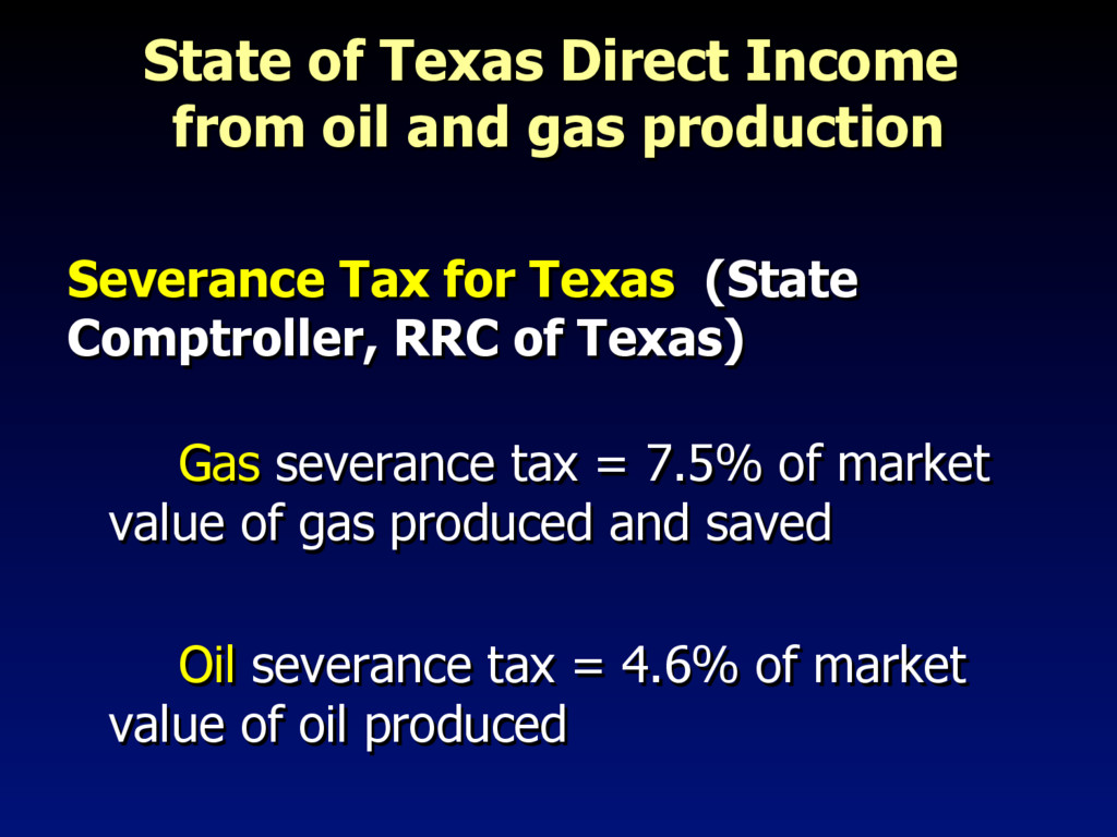
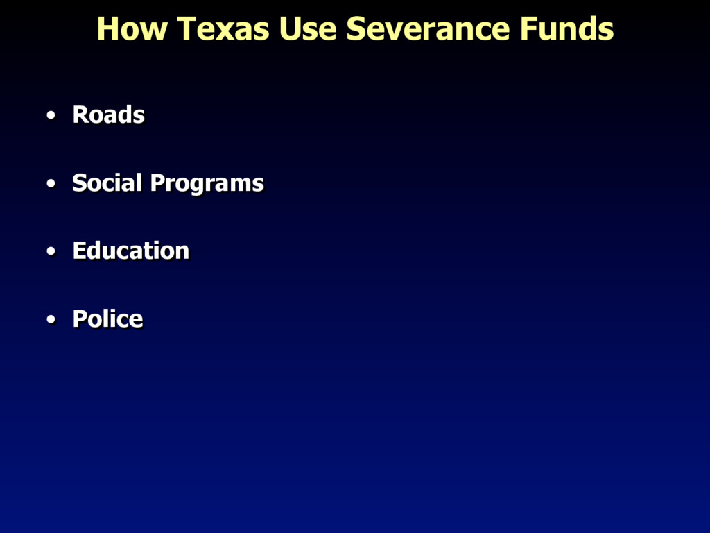
    Severance Tax for Texas (State Comptroller, RRC of Texas) Gas severance tax = 7.5% of market value of gas produced and saved Oil severance tax = 4.6% of market value of oil produced
  7. Texas Oil Production by Year 0 200,000 400,000 600,000 800,000

    1,000,000 1,200,000 1,400,000 1935 1945 1955 1965 1975 1985 1995 2005 2015 OIL PRODUCTION ( MBBL ) Crude Oil Production (Mbbl) Crude Oil Production (Mbbl)
  8. Recent Oil & Gas Production in Texas 125,157 active gas

    wells 293,595 active oil wells Overlapping Active gas and oil well areas 200 miles
  9. Vital Statistics: East Texas Field • Discovered in 1930 • ~31,000 wells

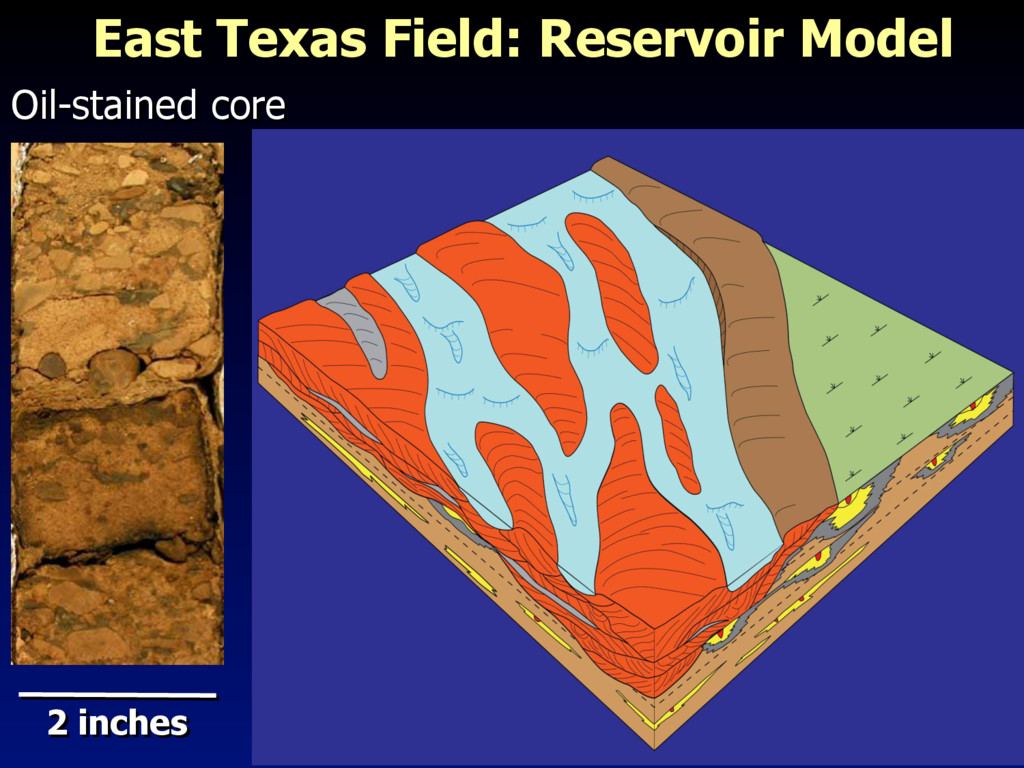
    over 134,000 acres (~210 square miles) •  7.03 Billion bbl oil in place, most productive oil field in the U.S. lower 48 states •  5.42 Billion bbl produced so far •  23% oil remaining
  10. What is in the Web Application? •  Track oil and

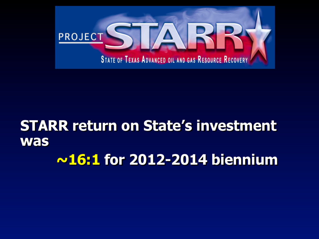
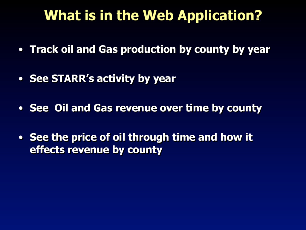
    Gas production by county by year •  See STARR’s activity by year •  See Oil and Gas revenue over time by county •  See the price of oil through time and how it effects revenue by county
  11. Why is this application important to you? The Bureau of

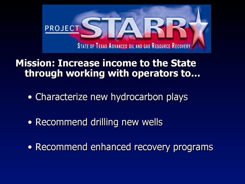
    Economic Geology is developing a web-based, interactive mapping application that will provide information to STARR stakeholders on the special distribution of oil and gas production in Texas.
  12. The Web Application – AJAX Pattern Asynchronous Client-server Communication (“AJAX”)

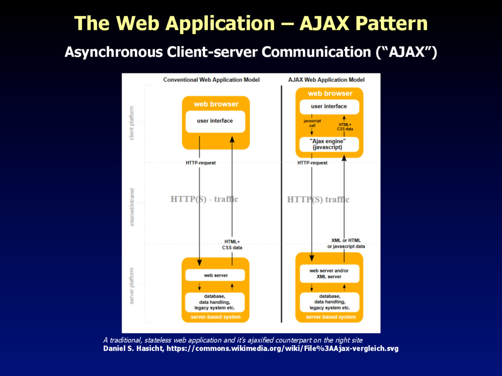
    A traditional, stateless web application and it's ajaxified counterpart on the right site Daniel S. Hasicht, https://commons.wikimedia.org/wiki/File%3AAjax-vergleich.svg
  13. Web Application – MVC Pattern •  Model-View-Controller •  Separates data,

    application logic and presentation Model View Controller
  14. Application Architecture – Server Side SQL Server 2012 ArcGIS Server

    10.3.1 (REST API, Map Server) Internet Information Services 8 Client The Internet
  15. Application Architecture – Client Side Browser - Javascript Host Leaflet

    D3 Angular Angular-Material ArcGIS REST API The Internet ArcGISService (Custom Module)