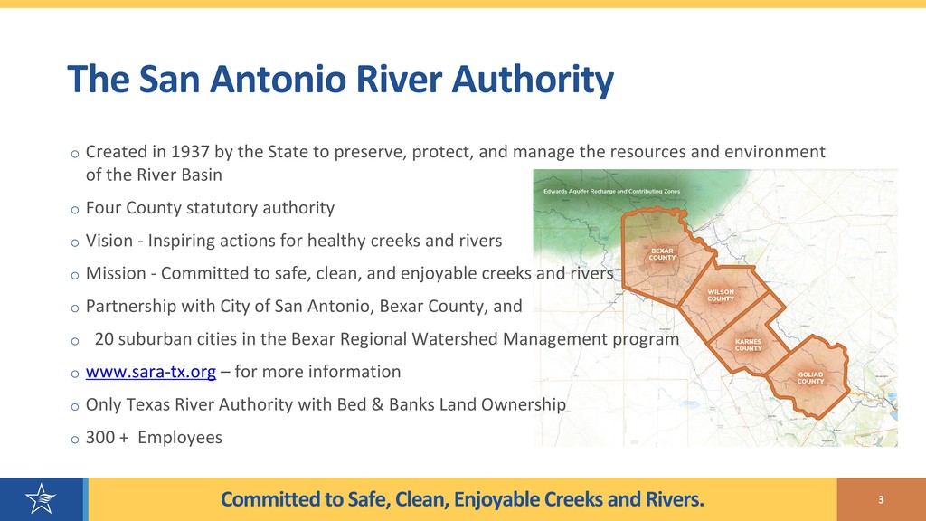
Antonio River Authority o Created in 1937 by the State to preserve, protect, and manage the resources and environment of the River Basin o Four County statutory authority o Vision - Inspiring actions for healthy creeks and rivers o Mission - Committed to safe, clean, and enjoyable creeks and rivers o Partnership with City of San Antonio, Bexar County, and o 20 suburban cities in the Bexar Regional Watershed Management program o www.sara-tx.org – for more information o Only Texas River Authority with Bed & Banks Land Ownership o 300 + Employees 3
the SA River Authority 4 § Very-Wide Breadth of GIS Disciplines o Parks Maintenance & Operation Mapping § San Antonio Missions – Connected with the Mission Reach - Only World Heritage Site in Texas o Watershed Engineering GIS and Web Mapping § Predictive Flood Modeling and watershed master plans § FEMA Delegate for Letter of Map Revisions (LOMR) Updates § Utilities Waste Water Treatment Mapping: 40k points, lines, and polygons § Surveyor Team – AutoCAD to ArcGIS o Environmental Science Monitoring GIS and Web Mapping § Conduct water quality monitoring and assessment for State of Texas’ Clean Rivers Program (CRP) § Advance Low Impact Development (LID) and green stormwater infrastructure development practices o Real Estate
Estate GIS System oInitially created approximately 12 years ago by an non-GIS firm with no documentation oThis system failed approximately 6 years ago oRE Transaction based and not actual current ownership oManual workflows implemented and the RE & GIS staff struggled oRE began corrections to attribute database; GIS paused new shapes or correcting existing shape oNew RE Manager and GIS team revived effort 6
Real Estate Web Application o Internal Viewer ONLY o Real Estate (RE) land assets § Color coded by type of land rights § 56 attributes o River Authority utility services o Major creeks/rivers o Appraiser districts o Floodplain o PaperVision link § Document management system What Can You view?
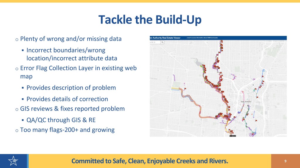
the Build-Up o Plenty of wrong and/or missing data § Incorrect boundaries/wrong location/incorrect attribute data o Error Flag Collection Layer in existing web map § Provides description of problem § Provides details of correction o GIS reviews & fixes reported problem § QA/QC through GIS & RE o Too many flags-200+ and growing
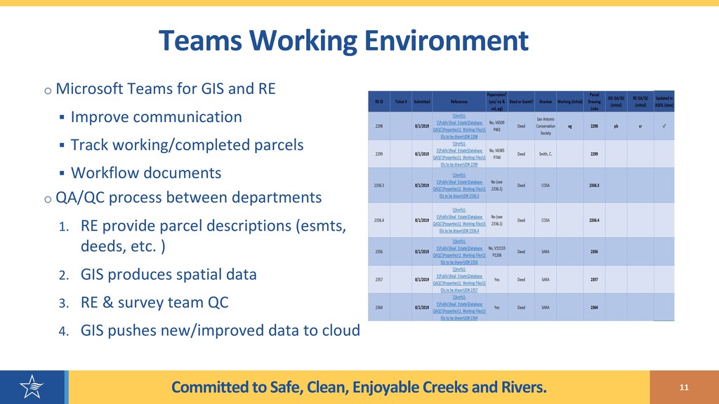
Working Environment o Microsoft Teams for GIS and RE § Improve communication § Track working/completed parcels § Workflow documents o QA/QC process between departments 1. RE provide parcel descriptions (esmts, deeds, etc. ) 2. GIS produces spatial data 3. RE & survey team QC 4. GIS pushes new/improved data to cloud
Geo ? o A Fresh Review was Needed – Can’t See the Forest for the Trees o App Geo has Experience with Colorado DOT Real Estate o App Geo is an Existing Vendor of the SA River Good Existing Working Relationship 12
- Approach o Overall goal to help answer the question: What real estate does San Antonio River Authority own? o Assessed workflows, processes, and technology to determine what improvements could be made o Core Goals: § Reduce duplicative workflows and data entry § Promote interoperability between critical business systems § Increase efficiency in processing workflows § Allow subject matter experts to manage authoritative data
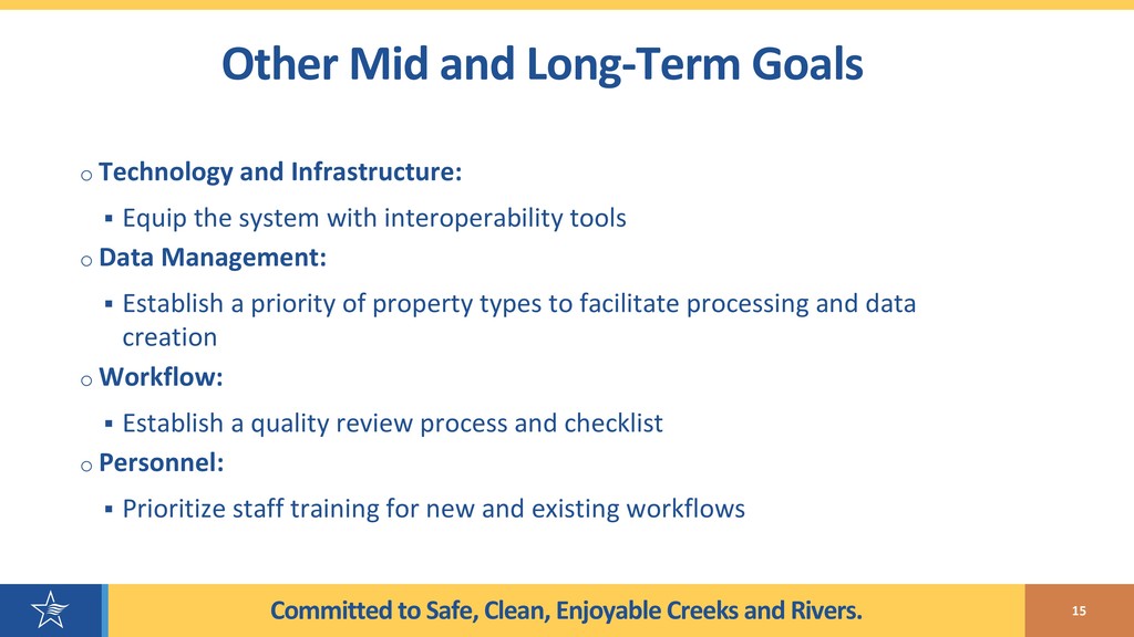
Mid and Long-Term Goals o Technology and Infrastructure: § Equip the system with interoperability tools o Data Management: § Establish a priority of property types to facilitate processing and data creation o Workflow: § Establish a quality review process and checklist o Personnel: § Prioritize staff training for new and existing workflows
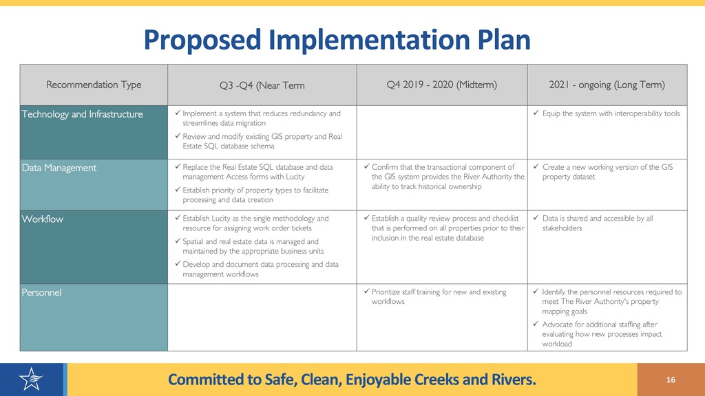
Implementation Plan Recommendation Type Q3 -Q4 (Near Term Q4 2019 - 2020 (Midterm) 2021 - ongoing (Long Term) Technology and Infrastructure ü Implement a system that reduces redundancy and streamlines data migration ü Review and modify existing GIS property and Real Estate SQL database schema ü Equip the system with interoperability tools Data Management ü Replace the Real Estate SQL database and data management Access forms with Lucity ü Establish priority of property types to facilitate processing and data creation ü Confirm that the transactional component of the GIS system provides the River Authority the ability to track historical ownership ü Create a new working version of the GIS property dataset Workflow ü Establish Lucity as the single methodology and resource for assigning work order tickets ü Spatial and real estate data is managed and maintained by the appropriate business units ü Develop and document data processing and data management workflows ü Establish a quality review process and checklist that is performed on all properties prior to their inclusion in the real estate database ü Data is shared and accessible by all stakeholders Personnel ü Prioritize staff training for new and existing workflows ü Identify the personnel resources required to meet The River Authority's property mapping goals ü Advocate for additional staffing after evaluating how new processes impact workload
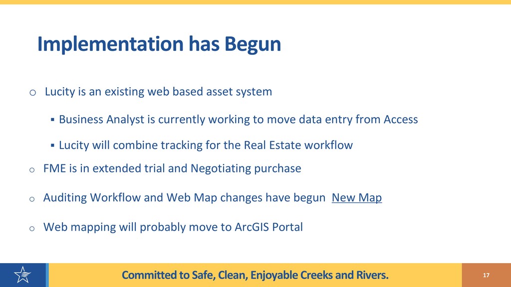
Begun o Lucity is an existing web based asset system § Business Analyst is currently working to move data entry from Access § Lucity will combine tracking for the Real Estate workflow o FME is in extended trial and Negotiating purchase o Auditing Workflow and Web Map changes have begun New Map o Web mapping will probably move to ArcGIS Portal 17