with professional skills ▪ Partnerships include: • Commission on State Emergency Communications (CSEC) • Texas Natural Resources Information System (TNRIS) • Texas General Land Office (GLO) ▪ Since 2012, ACC Inc and partner organizations have funded 35 paid GIS internships valued over $340,000 ▪ Almost all of these interns have progressed to full-time employment as a GIS Professional ACC Inc ACC Incubator for Professional Skills NG 9-1-1 Roadway Match Points
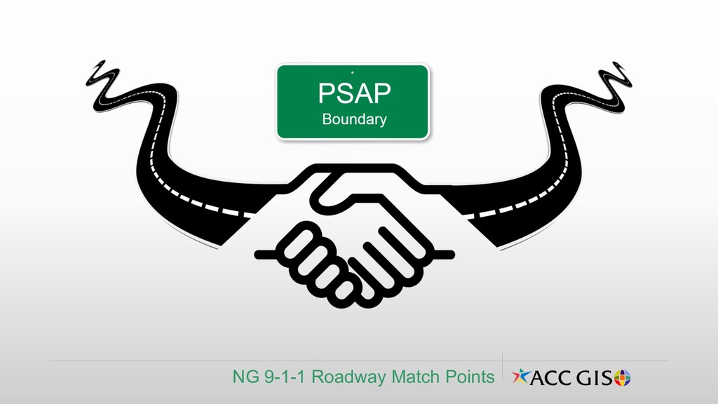
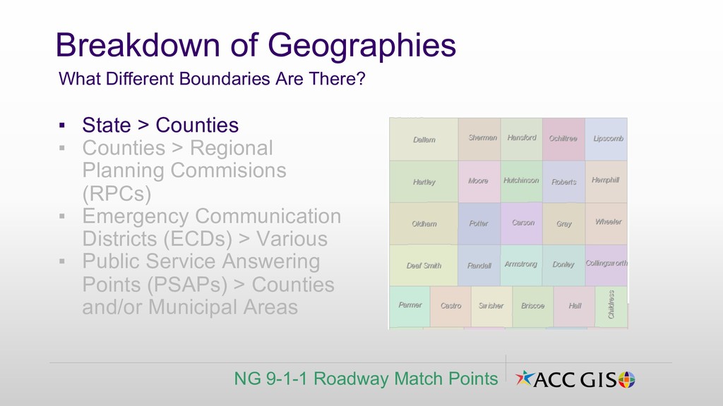
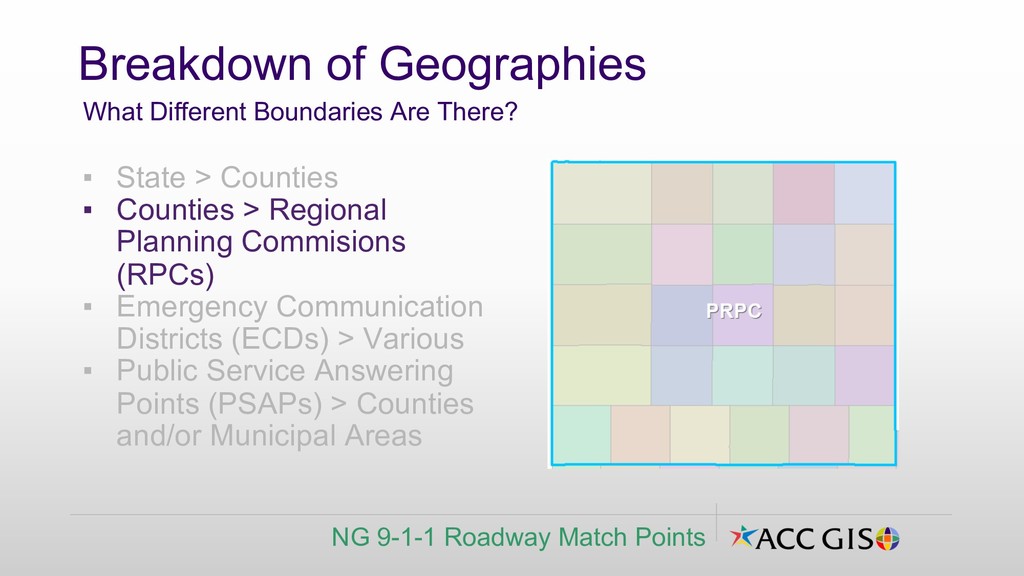
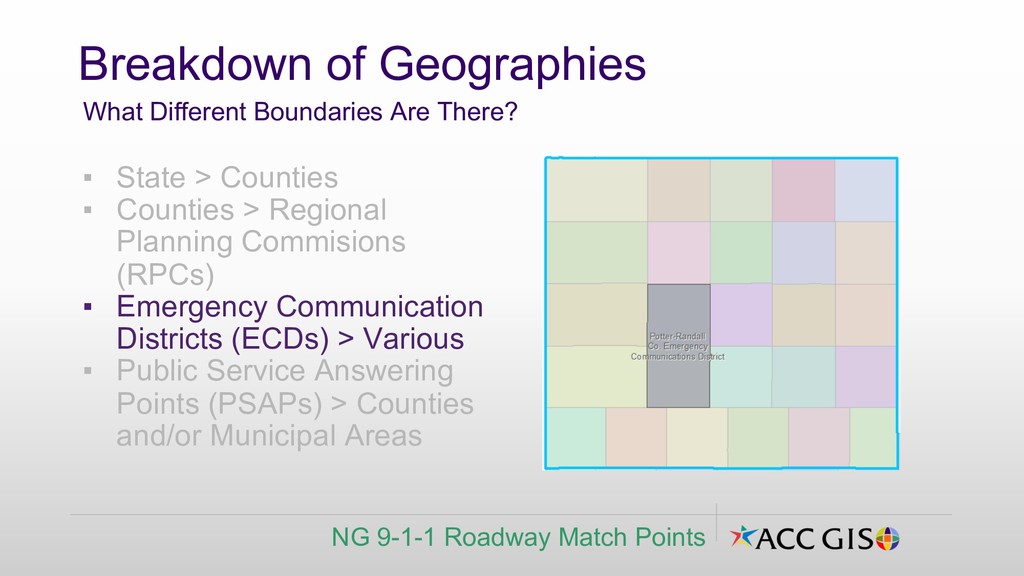
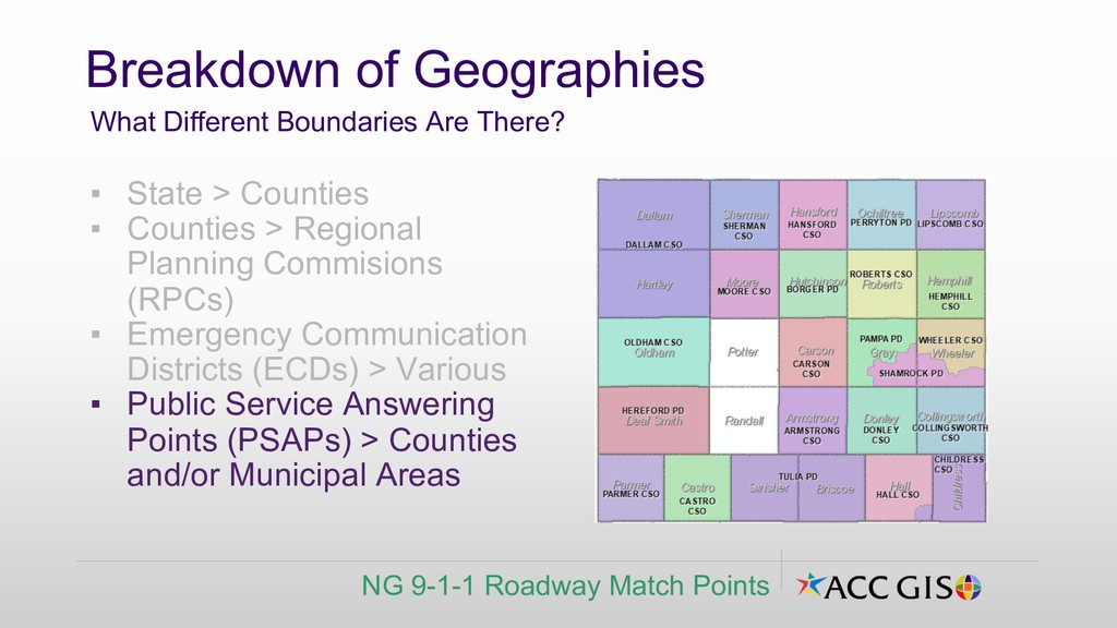
(RPCs) ▪ Emergency Communication Districts (ECDs) > Various ▪ Public Service Answering Points (PSAPs) > Counties and/or Municipal Areas Breakdown of Geographies What Different Boundaries Are There? NG 9-1-1 Roadway Match Points
Roadway Match Points ▪ State > Counties ▪ Counties > Regional Planning Commisions (RPCs) ▪ Emergency Communication Districts (ECDs) > Various ▪ Public Service Answering Points (PSAPs) > Counties and/or Municipal Areas
Roadway Match Points ▪ State > Counties ▪ Counties > Regional Planning Commisions (RPCs) ▪ Emergency Communication Districts (ECDs) > Various ▪ Public Service Answering Points (PSAPs) > Counties and/or Municipal Areas
Roadway Match Points ▪ State > Counties ▪ Counties > Regional Planning Commisions (RPCs) ▪ Emergency Communication Districts (ECDs) > Various ▪ Public Service Answering Points (PSAPs) > Counties and/or Municipal Areas
and prepare data ▪ Analyze - Choose methods and perform analysis ▪ Decide - Examine and refine results ▪ Present - Present the analysis GIS Analytical Process Structured Approach to Solving GIS Problems NG 9-1-1 Roadway Match Points From Use the Five-Step GIS Analysis Process by S.Boden, ESRI
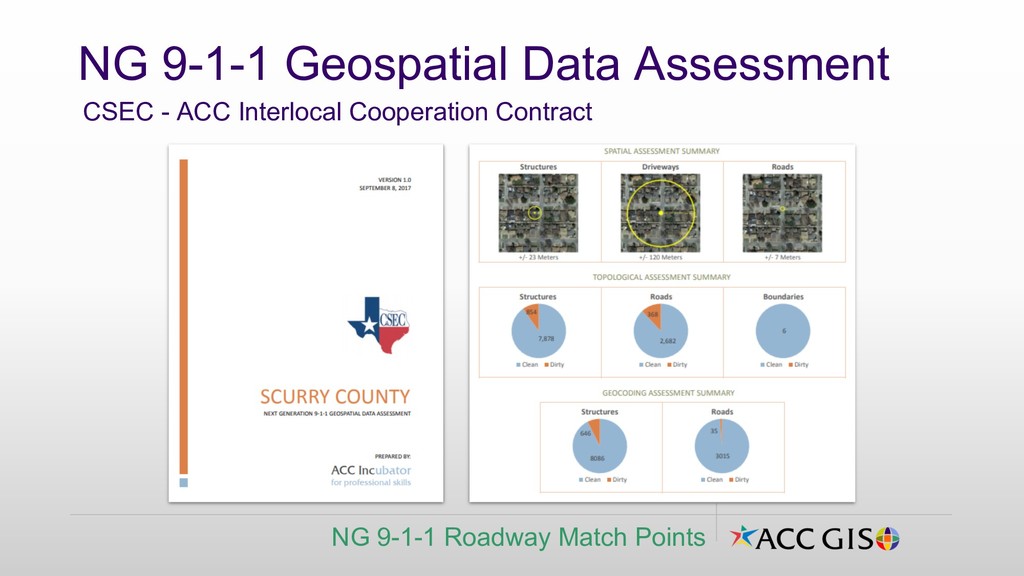
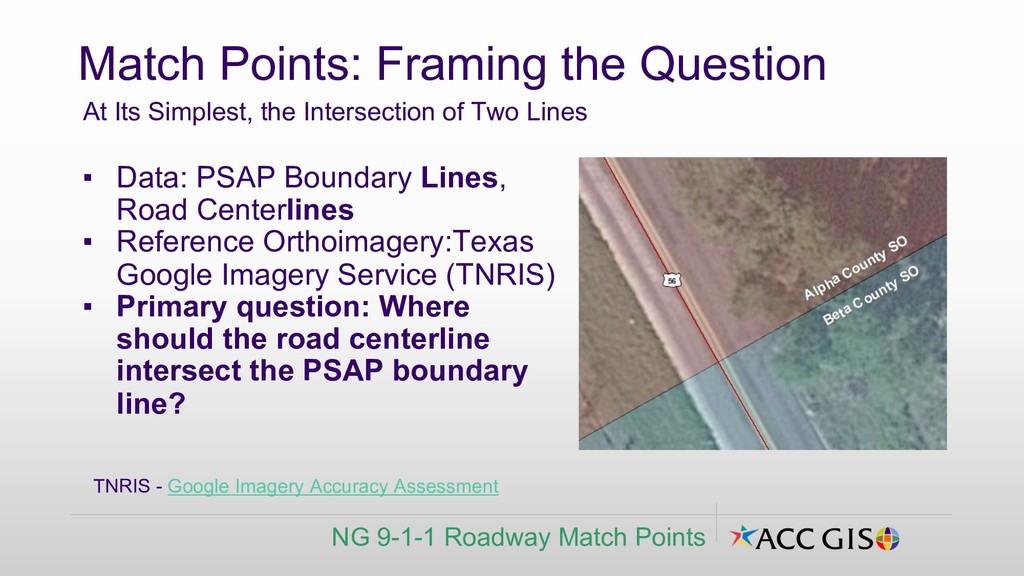
Google Imagery Service (TNRIS) ▪ Primary question: Where should the road centerline intersect the PSAP boundary line? Match Points: Framing the Question At Its Simplest, the Intersection of Two Lines NG 9-1-1 Roadway Match Points TNRIS - Google Imagery Accuracy Assessment
▪ Are PSAP boundaries coincident/clean at the roadway? ▪ What PSAP boundaries are present at the road? ▪ What is the Road name? ▪ Are Road Centerlines located near center of roadway? ▪ Which other boundaries are conceptually present at intersection? (County, RPC, ECD)? Additional Match Point Questions What Data Fields Do We Need? NG 9-1-1 Roadway Match Points
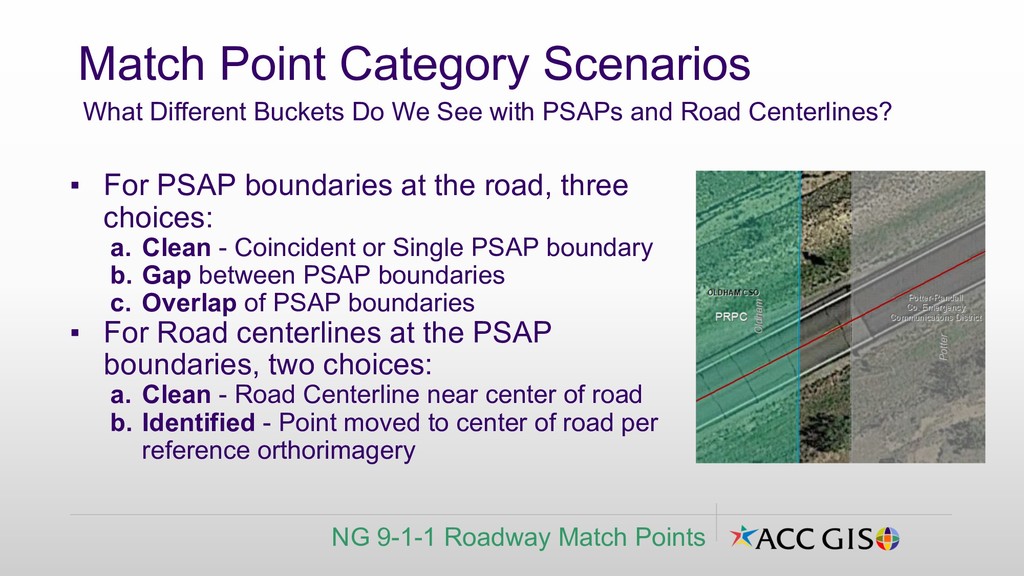
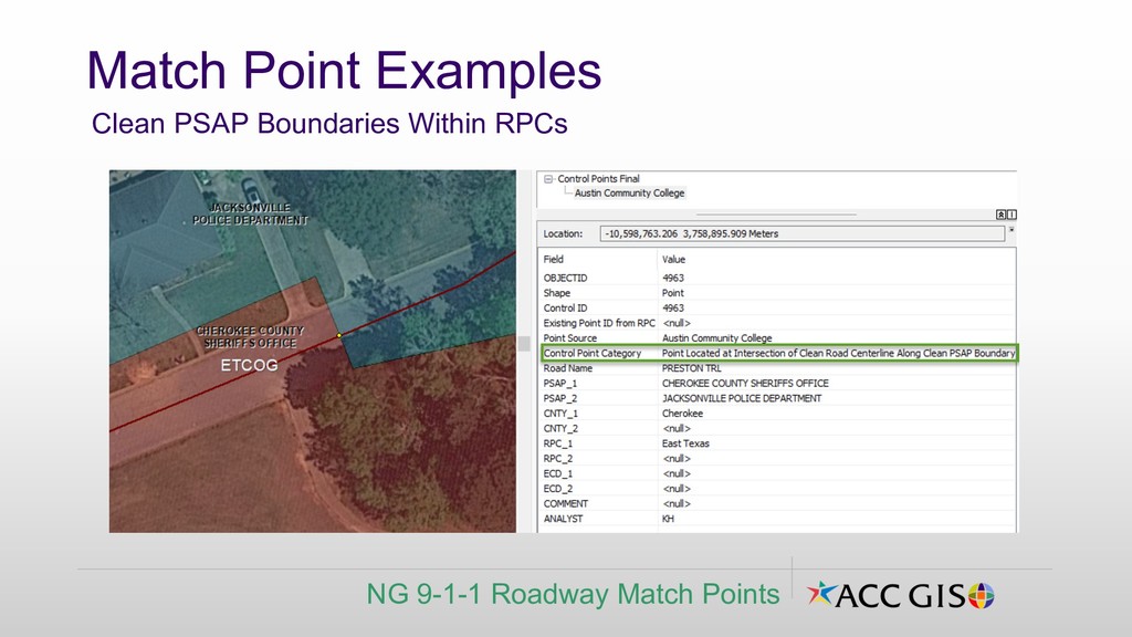
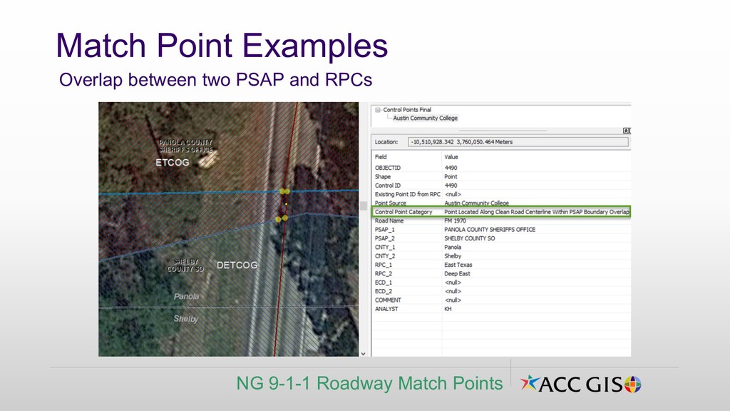
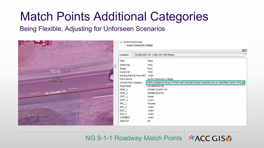
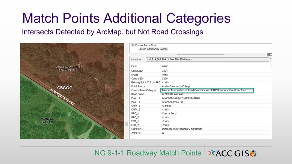
Clean - Coincident or Single PSAP boundary b. Gap between PSAP boundaries c. Overlap of PSAP boundaries ▪ For Road centerlines at the PSAP boundaries, two choices: a. Clean - Road Centerline near center of road b. Identified - Point moved to center of road per reference orthorimagery Match Point Category Scenarios What Different Buckets Do We See with PSAPs and Road Centerlines? NG 9-1-1 Roadway Match Points
Inform phase work. ▪ Proposed match point categories ▪ Proposed gap/overlap plan ▪ RPC Analysts noted some existing sets of regional match/stitch points. Client/Stakeholder Meeting Pre-Analyze Phase Exit Inflection Point NG 9-1-1 Roadway Match Points
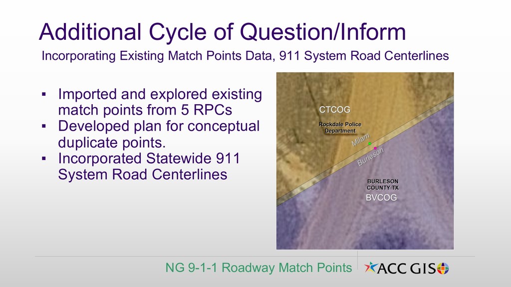
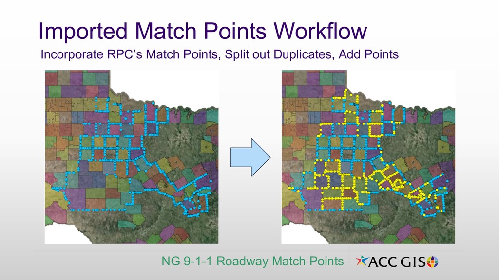
▪ Developed plan for conceptual duplicate points. ▪ Incorporated Statewide 911 System Road Centerlines Additional Cycle of Question/Inform Incorporating Existing Match Points Data, 911 System Road Centerlines NG 9-1-1 Roadway Match Points
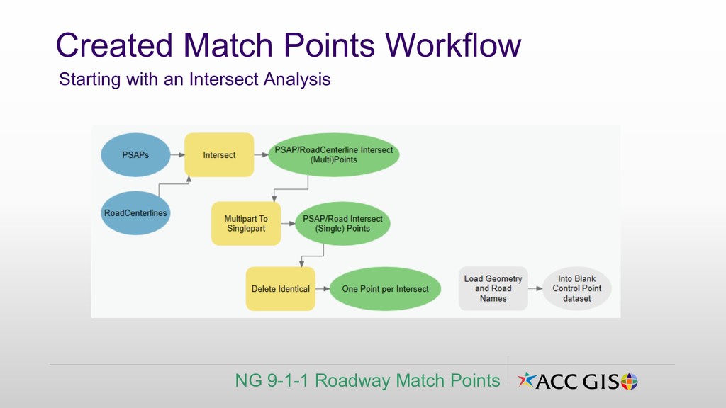
match point categories ▪ Build initial/blank dataset, break project into RPC chunks ▪ Develop and document geoprocesses and workflow for the two primary match point workflows. Moving to the Analyze Phase Preparations NG 9-1-1 Roadway Match Points
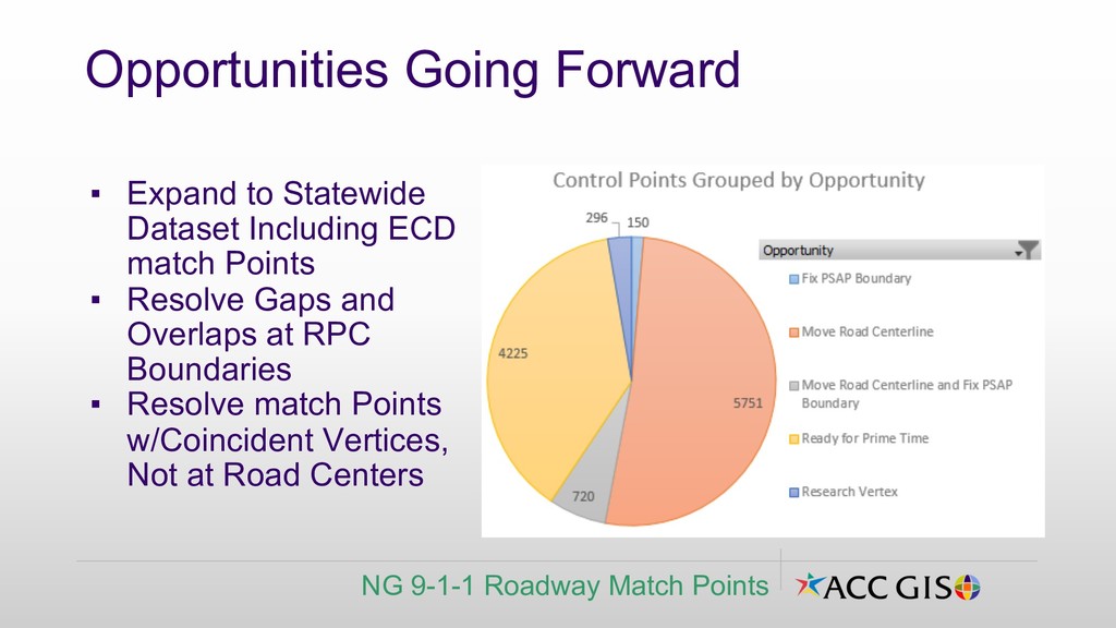
Resolve Gaps and Overlaps at RPC Boundaries ▪ Resolve match Points w/Coincident Vertices, Not at Road Centers Opportunities Going Forward NG 9-1-1 Roadway Match Points