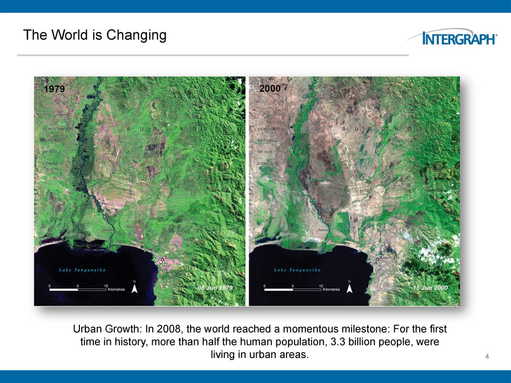
world reached a momentous milestone: For the first time in history, more than half the human population, 3.3 billion people, were living in urban areas.
entire measurement cycle and deliver real-time information to our customers about their business and associated activities” Ola Rollen President and CEO – Hexagon AB
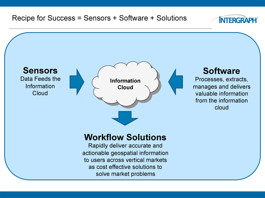
Data Feeds the Information Cloud Software Processes, extracts, manages and delivers valuable information from the information cloud Workflow Solutions Rapidly deliver accurate and actionable geospatial information to users across vertical markets as cost effective solutions to solve market problems Information Cloud
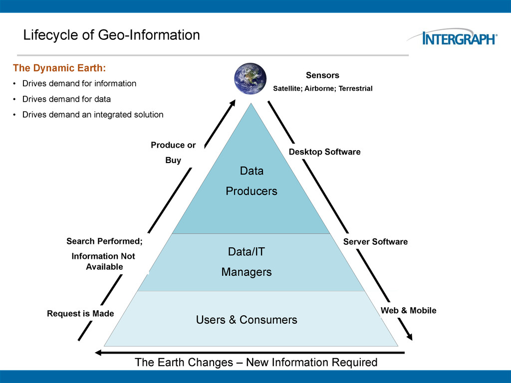
Desktop Software Server Software Web & Mobile Request is Made Search Performed; Information Not Available Produce or Buy The Dynamic Earth: • Drives demand for information • Drives demand for data • Drives demand an integrated solution The Earth Changes – New Information Required Sensors Satellite; Airborne; Terrestrial
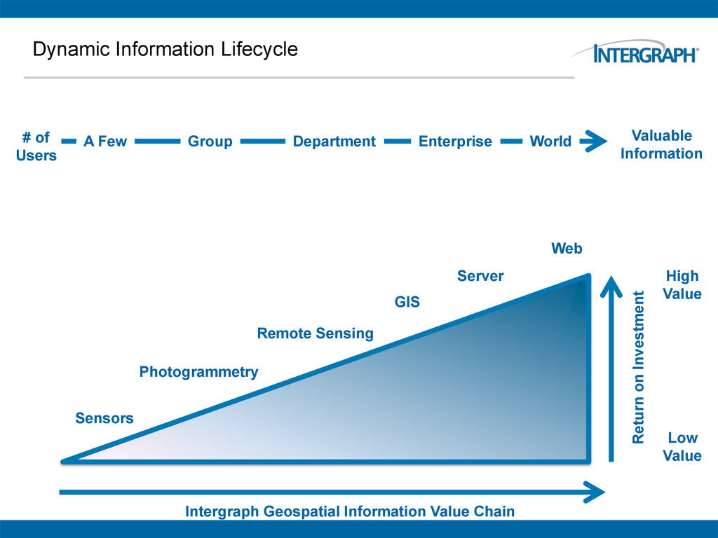
Geospatial Information Value Chain Return on Investment Sensors Photogrammetry Remote Sensing A Few Department Enterprise World # of Users Group GIS Server Web
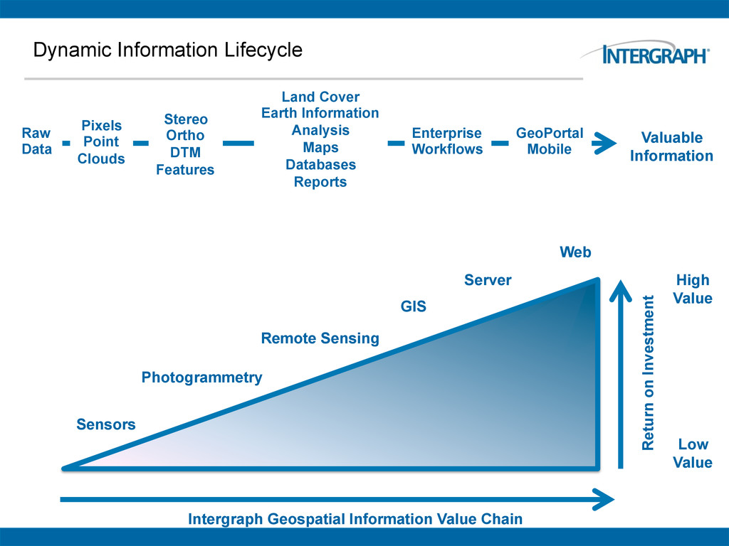
Geospatial Information Value Chain Return on Investment Sensors Photogrammetry Remote Sensing Raw Data Pixels Point Clouds Land Cover Earth Information Analysis Maps Databases Reports Enterprise Workflows GeoPortal Mobile Stereo Ortho DTM Features GIS Server Web
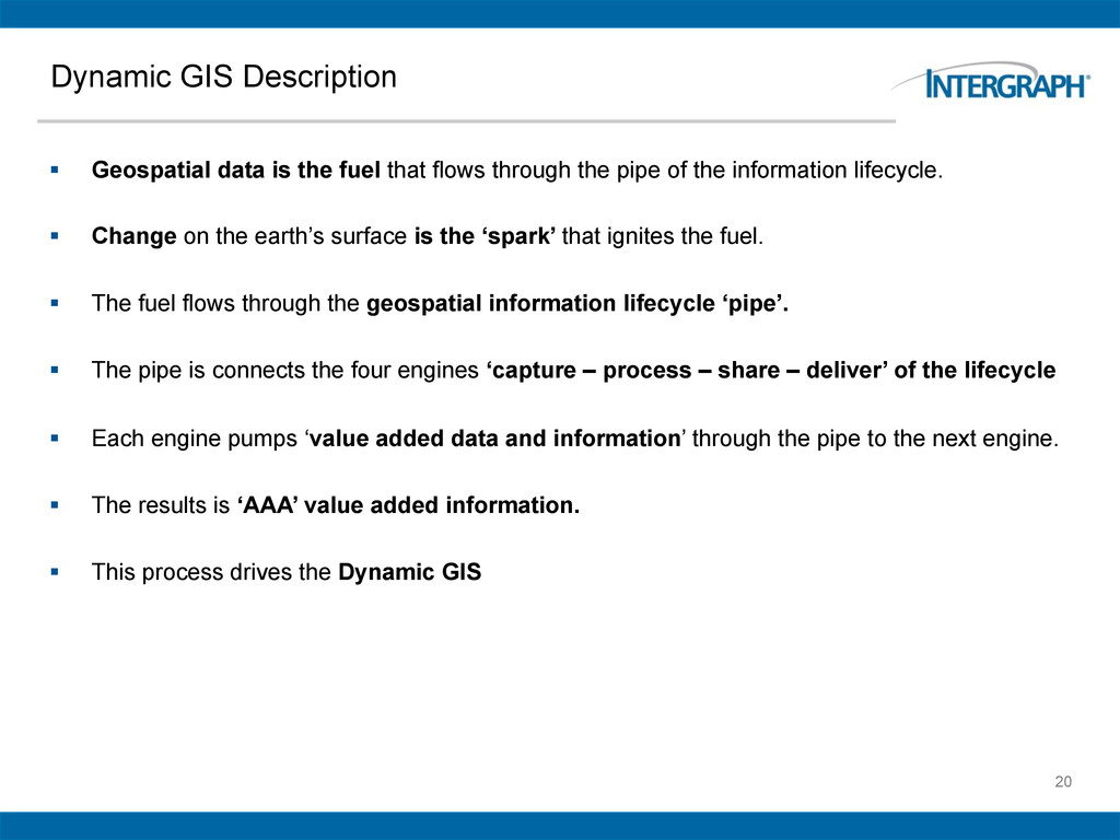
that flows through the pipe of the information lifecycle. § Change on the earth’s surface is the ‘spark’ that ignites the fuel. § The fuel flows through the geospatial information lifecycle ‘pipe’. § The pipe is connects the four engines ‘capture – process – share – deliver’ of the lifecycle § Each engine pumps ‘value added data and information’ through the pipe to the next engine. § The results is ‘AAA’ value added information. § This process drives the Dynamic GIS
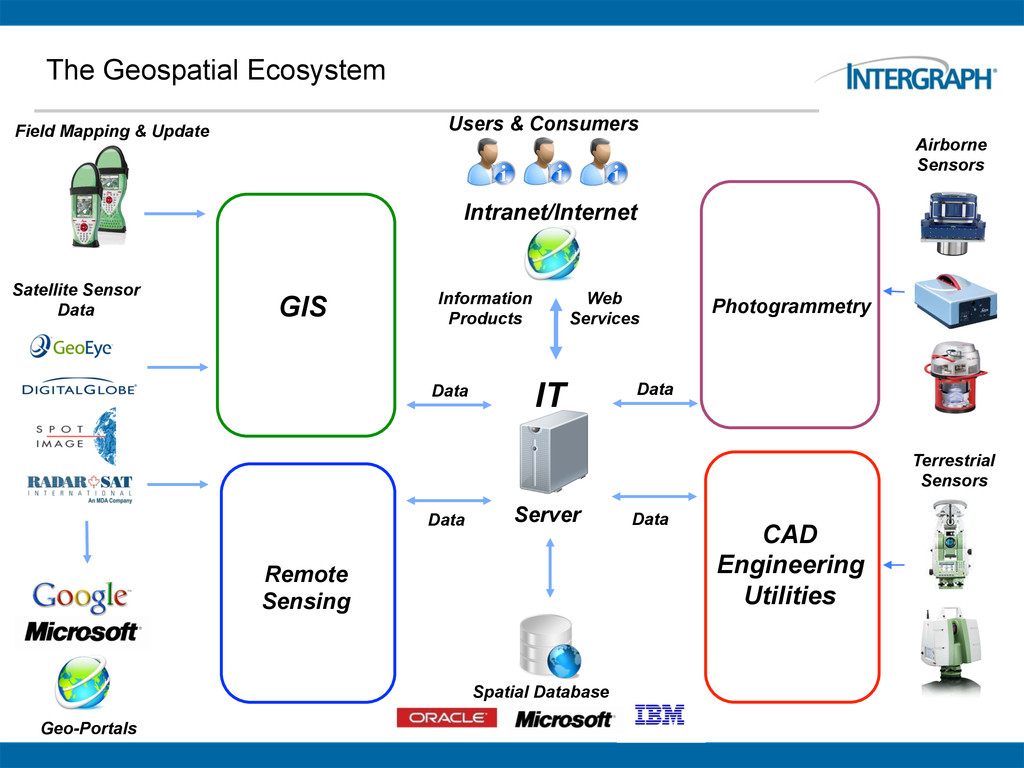
Web Services Information Products IT Server GIS Data Field Mapping & Update Satellite Sensor Data Geo-Portals Photogrammetry Data Airborne Sensors Data CAD Engineering Utilities Terrestrial Sensors Spatial Database
Management Services Delivery Services Enterprise Services GIS Photogrammetry Remote Sensing Web Mapping Geospatial Data (Imagery, Features, Terrain) Geospatial Database Web Services Mobile Mapping Geospatial Data Management & Delivery Geospatial Server SDI Web Mapping Web Editing & Workflow Optimization Geo- Processing Intranet/ Internet Data & Web Services Server Intranet/ Internet Clients
social geography are changing at a rapid pace § Our customers job is to rapidly understand, react and influence that change. § Geospatial technologies are critical to obtaining accurate, authoritative and actionable information about our dynamic earth. § Intergraph is the only company in the world that has ALL the geospatial products needed to address the entire Dynamic GIS information lifecycle.