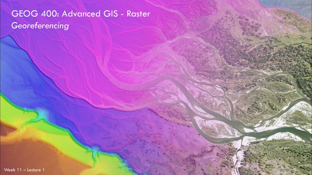
on Graduate School 3. A Review of coordinate systems, projections, datums 4. Background on Georeferencing 5. Hands-On Georeferencing Exercise in ArcPro No Lecture – Alan’s at a (ugh) Virtual Conference For this Week… Today [Monday] Wednesday
school, check out the online seminar on Weds. evening! …and know that graduate school often pays you to attend, so if the financial aspect is turning you away, this seminar is worth attending. I’m always glad to talk about post-graduate opportunities, particularly - graduate school - federal employment …so don’t hesitate to email me!
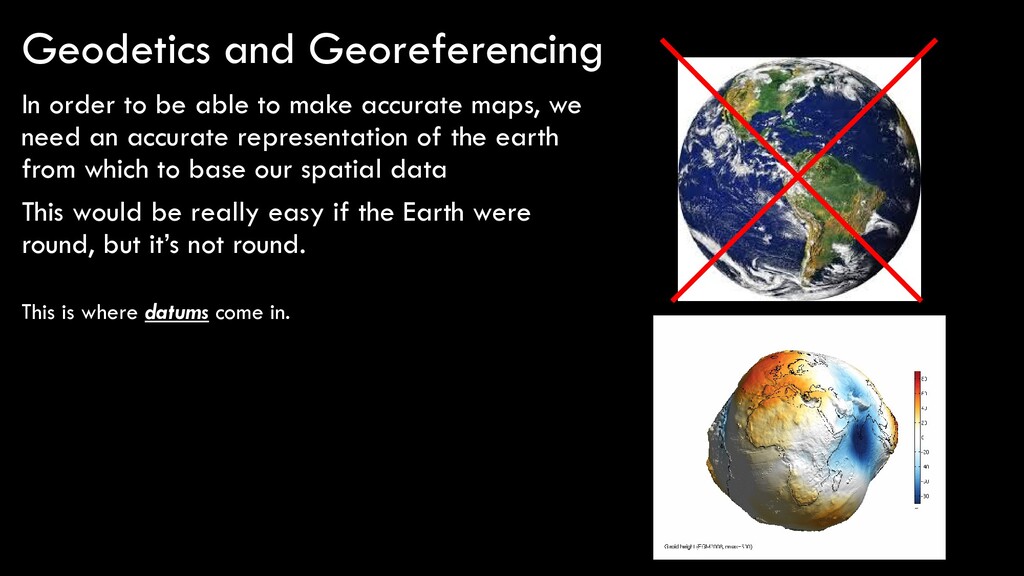
need an accurate representation of the earth from which to base our spatial data This would be really easy if the Earth were round, but it’s not round. Geodetics and Georeferencing This is where datums come in.
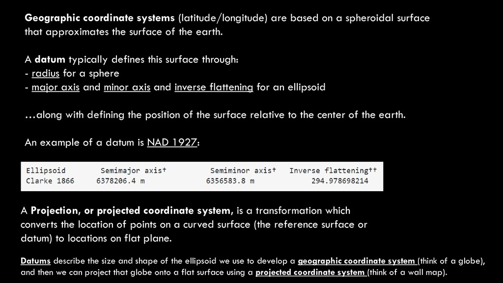
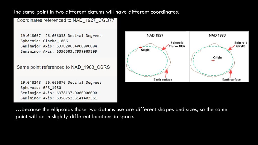
that approximates the surface of the earth. A datum typically defines this surface through: - radius for a sphere - major axis and minor axis and inverse flattening for an ellipsoid …along with defining the position of the surface relative to the center of the earth. An example of a datum is NAD 1927: A Projection, or projected coordinate system, is a transformation which converts the location of points on a curved surface (the reference surface or datum) to locations on flat plane. Datums describe the size and shape of the ellipsoid we use to develop a geographic coordinate system (think of a globe), and then we can project that globe onto a flat surface using a projected coordinate system (think of a wall map).
coordinates: …because the ellipsoids those two datums use are different shapes and sizes, so the same point will be in slightly different locations in space.
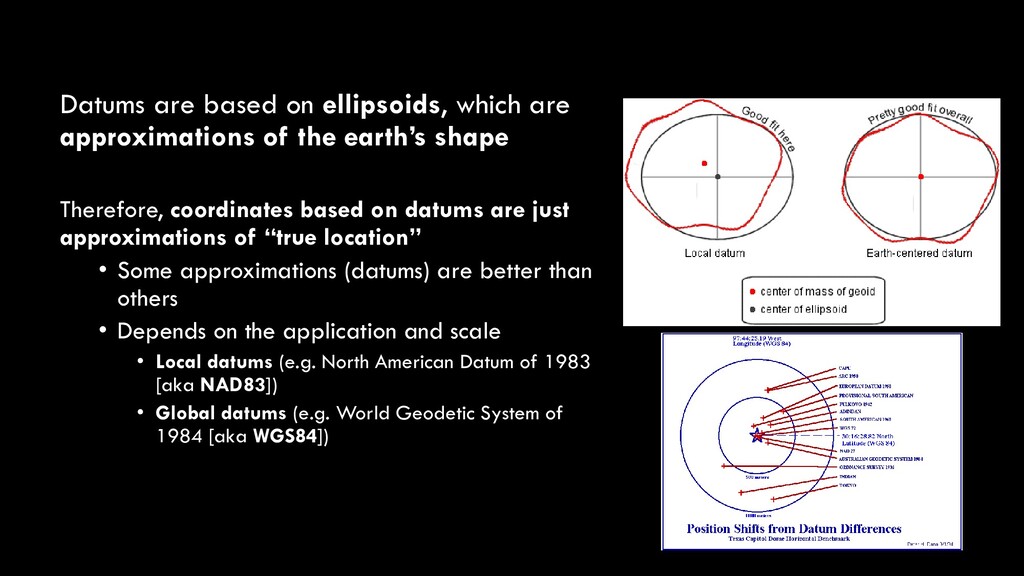
earth’s shape Therefore, coordinates based on datums are just approximations of “true location” • Some approximations (datums) are better than others • Depends on the application and scale • Local datums (e.g. North American Datum of 1983 [aka NAD83]) • Global datums (e.g. World Geodetic System of 1984 [aka WGS84])
system by which to measure distance, according to the datums • There are two types of coordinate systems: • Spherical (or global) coordinate systems • Latitude and longitude • Projected coordinate systems • More on these later
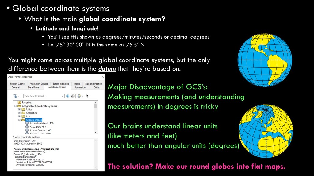
coordinate system? • Latitude and longitude! • You’ll see this shown as degrees/minutes/seconds or decimal degrees • i.e. 75º 30’ 00’’ N is the same as 75.5º N You might come across multiple global coordinate systems, but the only difference between them is the datum that they’re based on. Major Disadvantage of GCS’s: Making measurements (and understanding measurements) in degrees is tricky Our brains understand linear units (like meters and feet) much better than angular units (degrees) The solution? Make our round globes into flat maps.
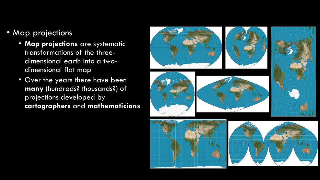
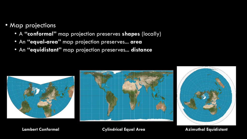
the three- dimensional earth into a two- dimensional flat map • Over the years there have been many (hundreds? thousands?) of projections developed by cartographers and mathematicians
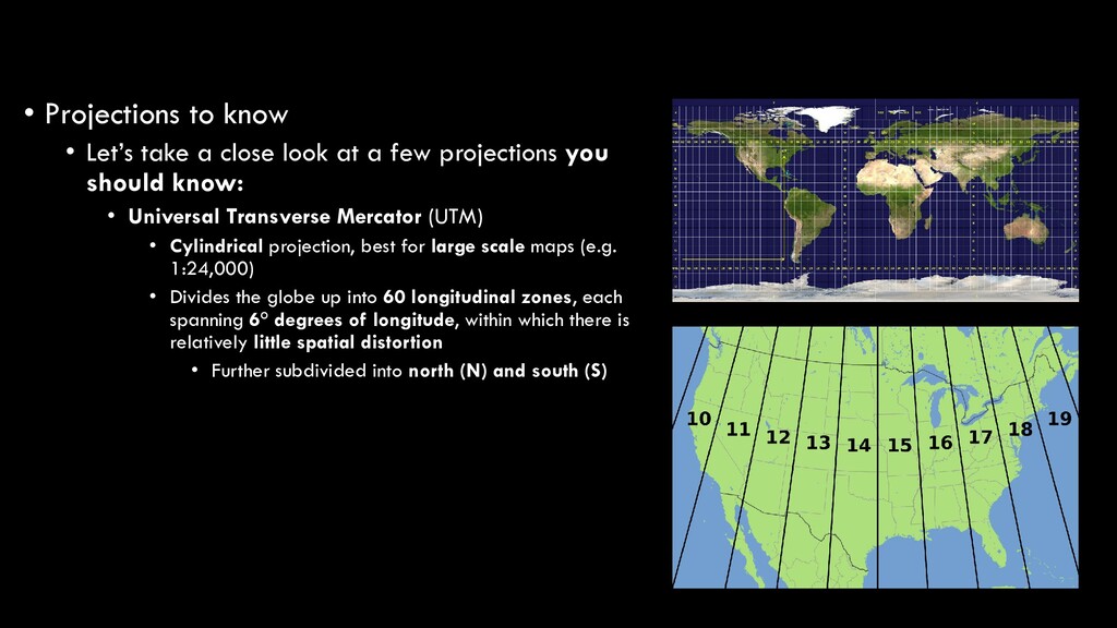
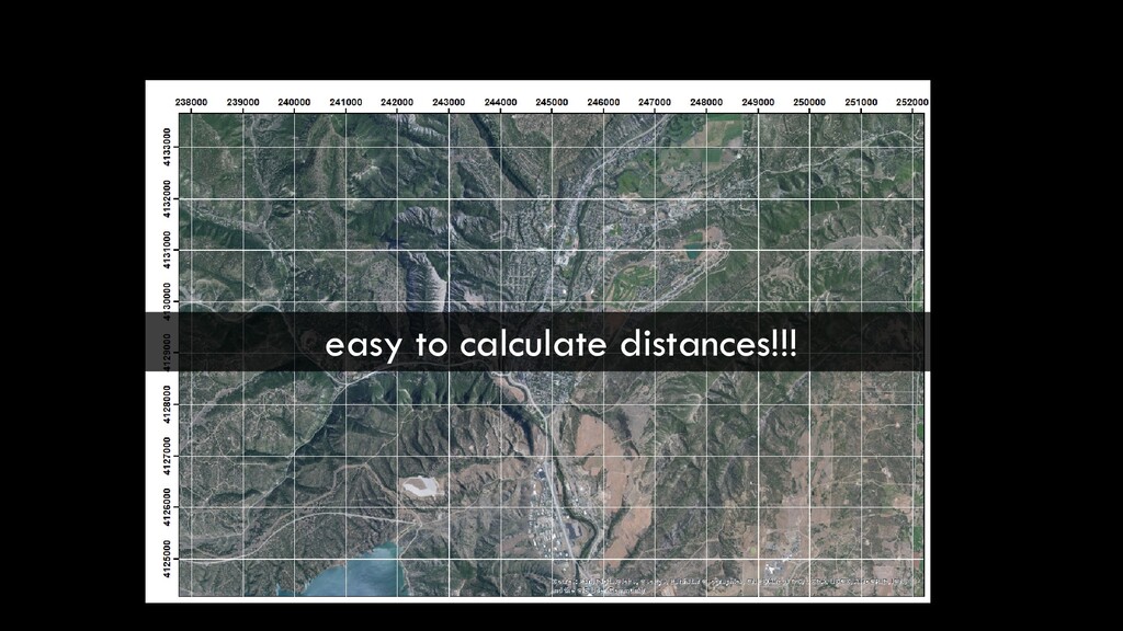
at a few projections you should know: • Universal Transverse Mercator (UTM) • Cylindrical projection, best for large scale maps (e.g. 1:24,000) • Divides the globe up into 60 longitudinal zones, each spanning 6° degrees of longitude, within which there is relatively little spatial distortion • Further subdivided into north (N) and south (S)
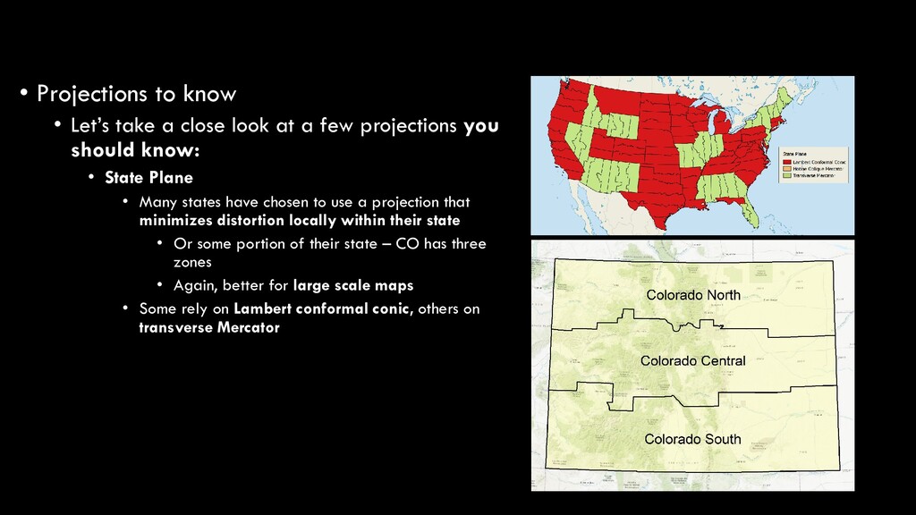
at a few projections you should know: • State Plane • Many states have chosen to use a projection that minimizes distortion locally within their state • Or some portion of their state – CO has three zones • Again, better for large scale maps • Some rely on Lambert conformal conic, others on transverse Mercator
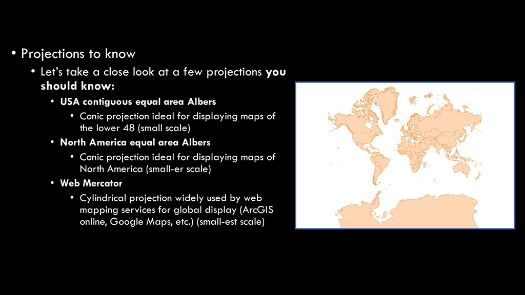
at a few projections you should know: • USA contiguous equal area Albers • Conic projection ideal for displaying maps of the lower 48 (small scale) • North America equal area Albers • Conic projection ideal for displaying maps of North America (small-er scale) • Web Mercator • Cylindrical projection widely used by web mapping services for global display (ArcGIS online, Google Maps, etc.) (small-est scale)
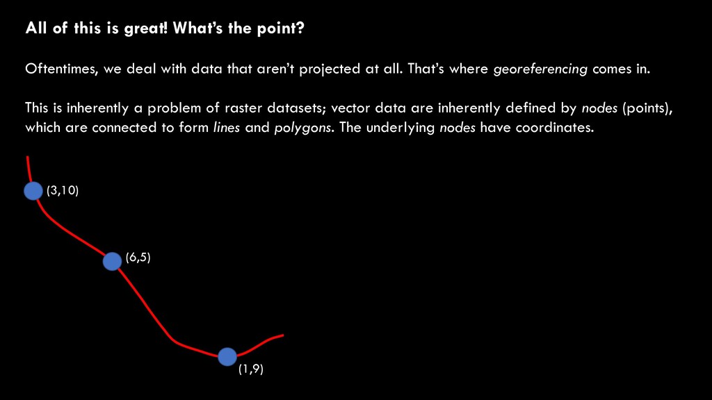
deal with data that aren’t projected at all. That’s where georeferencing comes in. This is inherently a problem of raster datasets; vector data are inherently defined by nodes (points), which are connected to form lines and polygons. The underlying nodes have coordinates. (3,10) (6,5) (1,9)
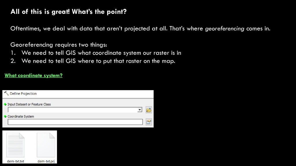
deal with data that aren’t projected at all. That’s where georeferencing comes in. Georeferencing requires two things: 1. We need to tell GIS what coordinate system our raster is in 2. We need to tell GIS where to put that raster on the map. What coordinate system?
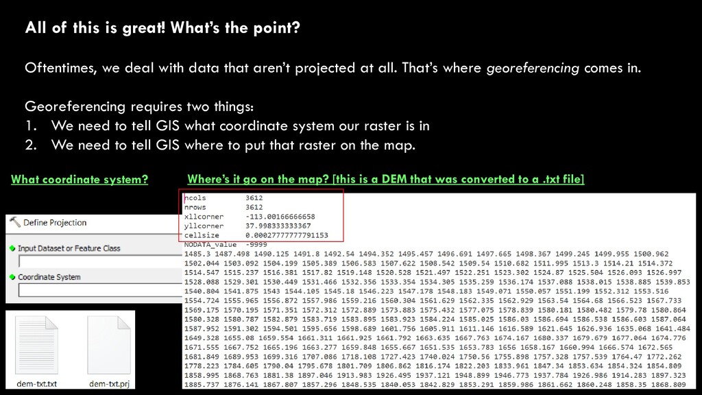
deal with data that aren’t projected at all. That’s where georeferencing comes in. Georeferencing requires two things: 1. We need to tell GIS what coordinate system our raster is in 2. We need to tell GIS where to put that raster on the map. What coordinate system? Where’s it go on the map? [this is a DEM that was converted to a .txt file]
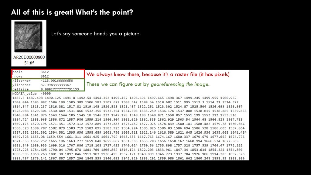
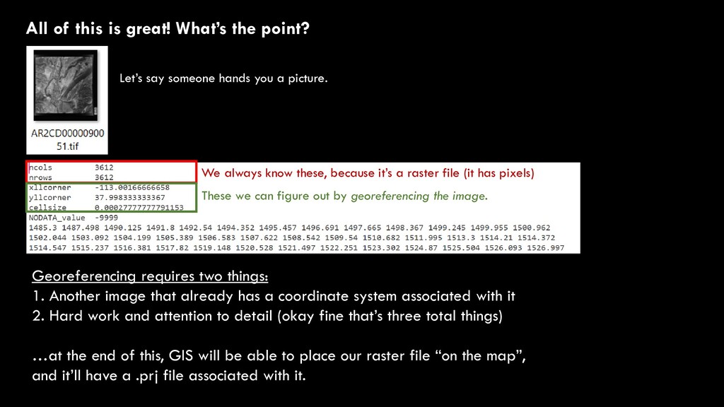
someone hands you a picture. We always know these, because it’s a raster file (it has pixels) These we can figure out by georeferencing the image. Georeferencing requires two things: 1. Another image that already has a coordinate system associated with it 2. Hard work and attention to detail (okay fine that’s three total things) …at the end of this, GIS will be able to place our raster file “on the map”, and it’ll have a .prj file associated with it.
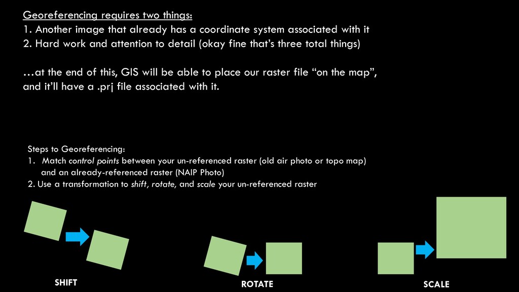
a coordinate system associated with it 2. Hard work and attention to detail (okay fine that’s three total things) …at the end of this, GIS will be able to place our raster file “on the map”, and it’ll have a .prj file associated with it. Steps to Georeferencing: 1. Match control points between your un-referenced raster (old air photo or topo map) and an already-referenced raster (NAIP Photo) 2. Use a transformation to shift, rotate, and scale your un-referenced raster SHIFT ROTATE SCALE
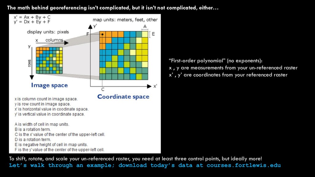
complicated, either… To shift, rotate, and scale your un-referenced raster, you need at least three control points, but ideally more! Let’s walk through an example; download today’s data at courses.fortlewis.edu “First-order polynomial” (no exponents): x , y are measurements from your un-referenced raster x’ , y’ are coordinates from your referenced raster