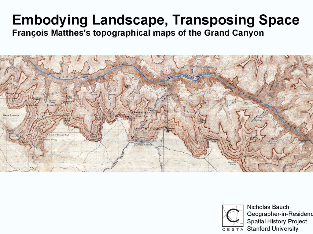
symbols and colors, and on a scale large enough to serve all normal foreseeable uses, the 3,000,000 square miles of the United States.” - Wallace Stegner, 1954
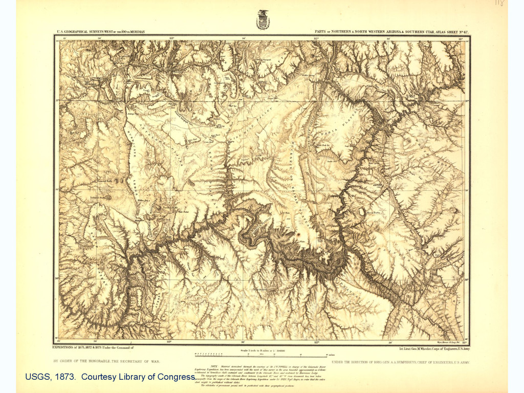
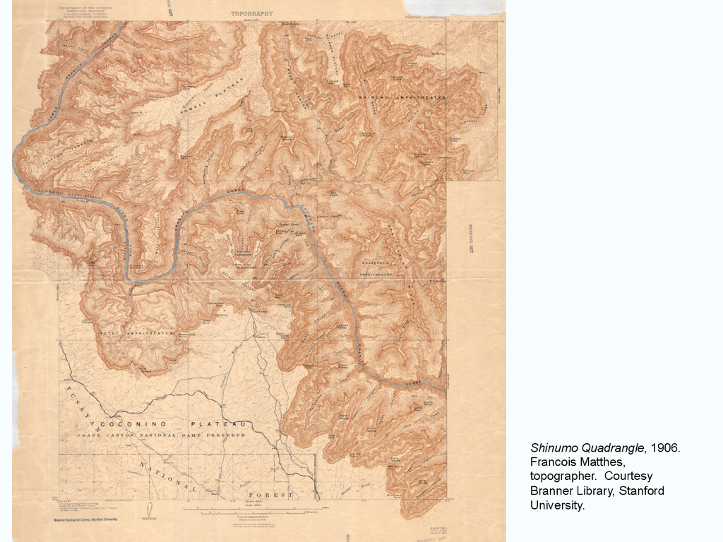
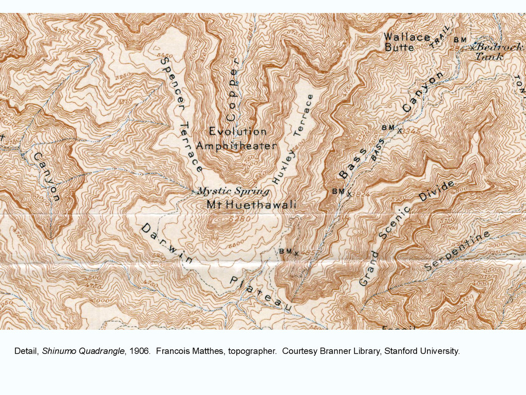
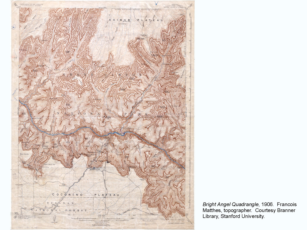
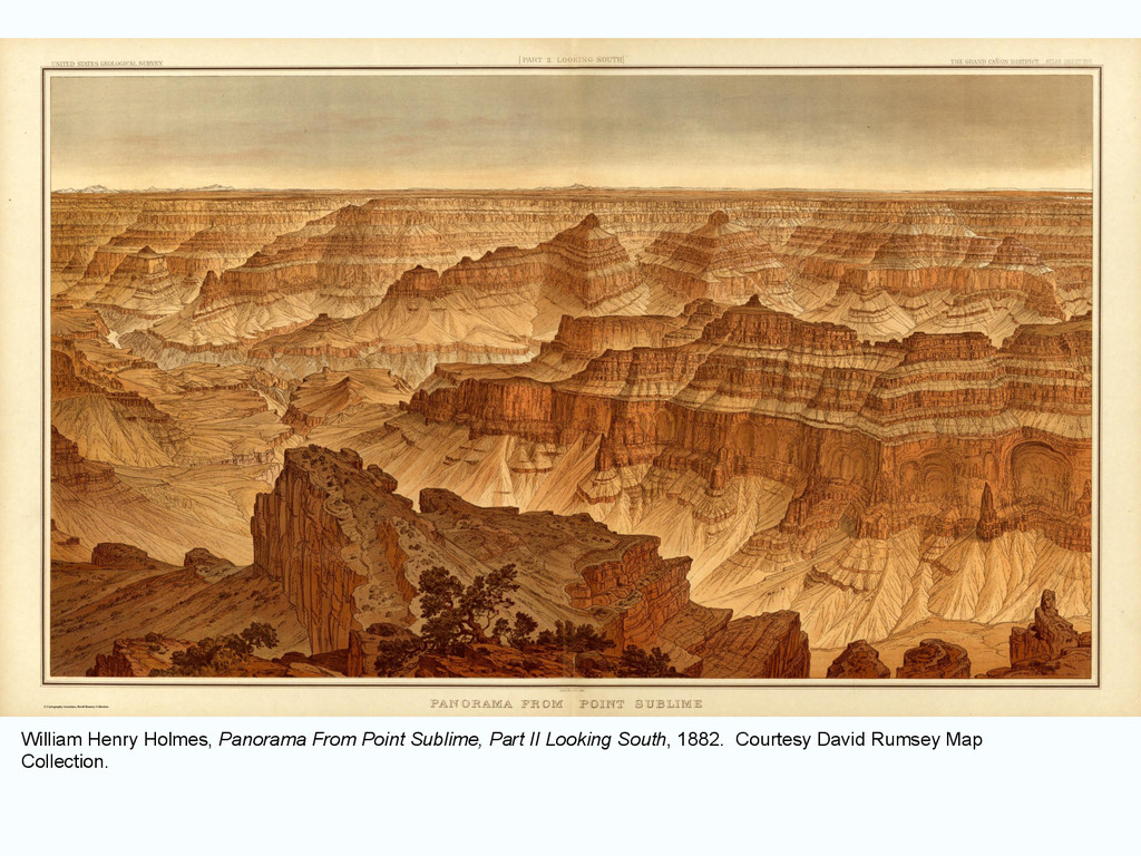
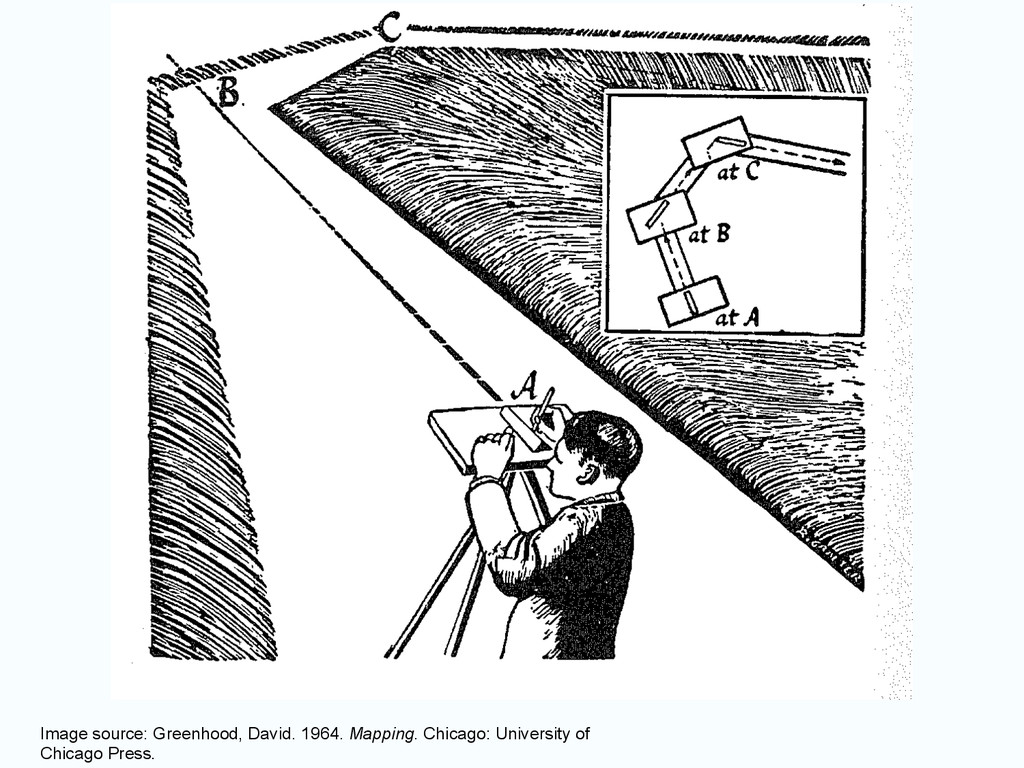
to ideal for plane-table methods …. Thousands of intersections and hundreds of elevations from one instrument station, - there is no other place on earth where it can be done.” - Francois Matthes, 1905
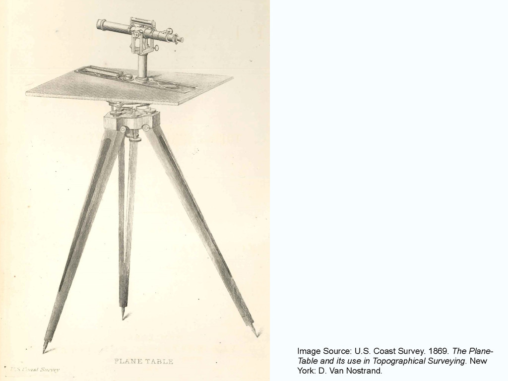
grows under your hand right out there in the field! …. It's mapping direct from nature, at first hand, like a painter with a landscape.” - David Greenhood, 1964
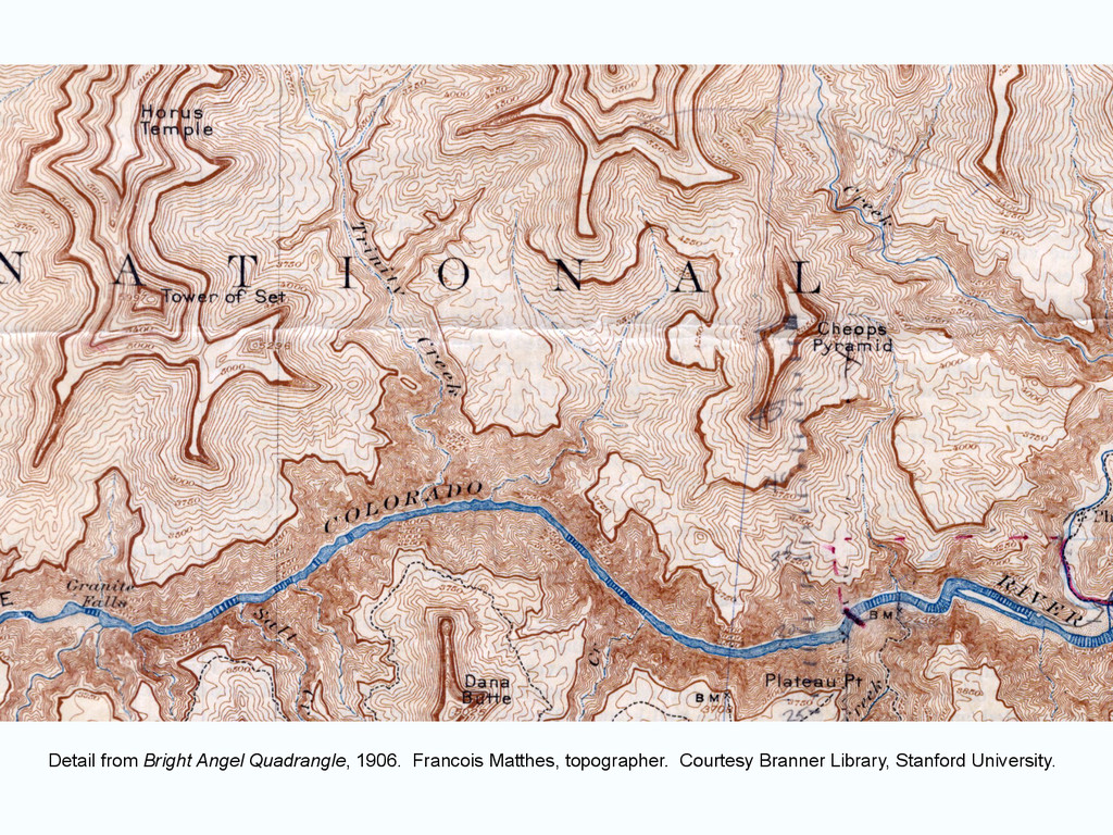
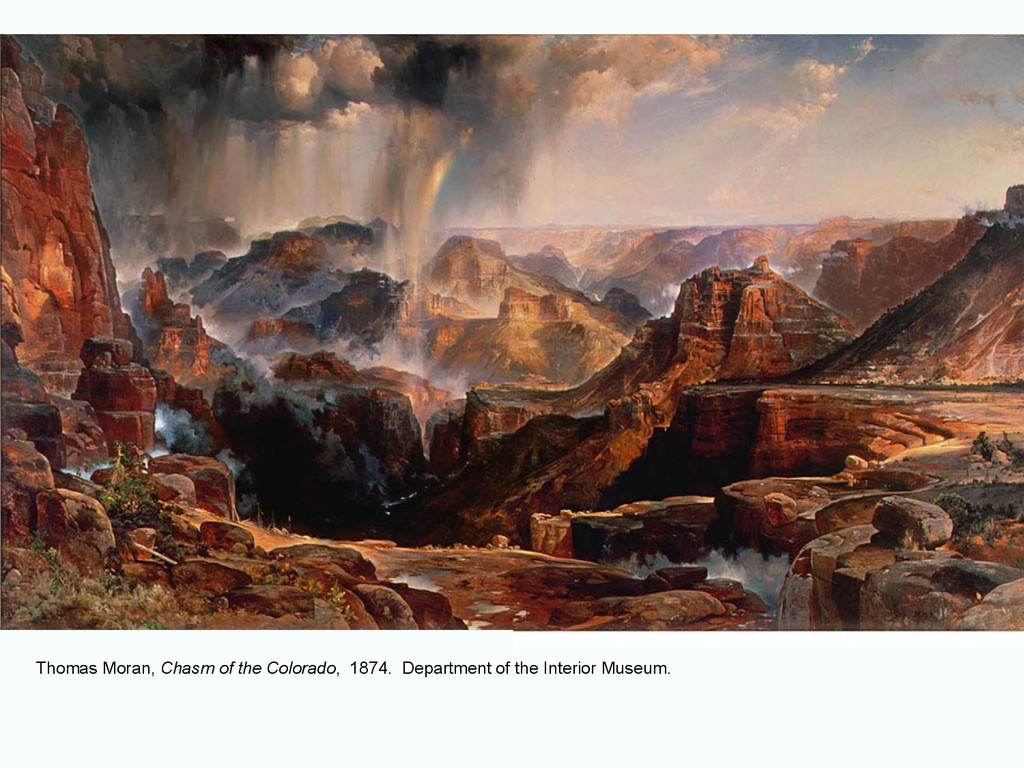
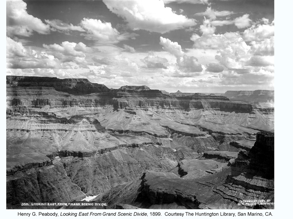
painted, or photographed .... Nearly diagramatic, it reproduces rock strata with miraculous accuracy - which is precisely what it was intended to do .... Not intended to be art, it succeeds in being art of a striking kind.” - Wallace Stegner, 1977
![Thank you! [email protected] Detail from Bright Angel Quadrangle, 1906. Francois](https://files.speakerdeck.com/presentations/90ed6a3053354bc3bdc3f0c0b94cb7ed/slide_28.jpg)