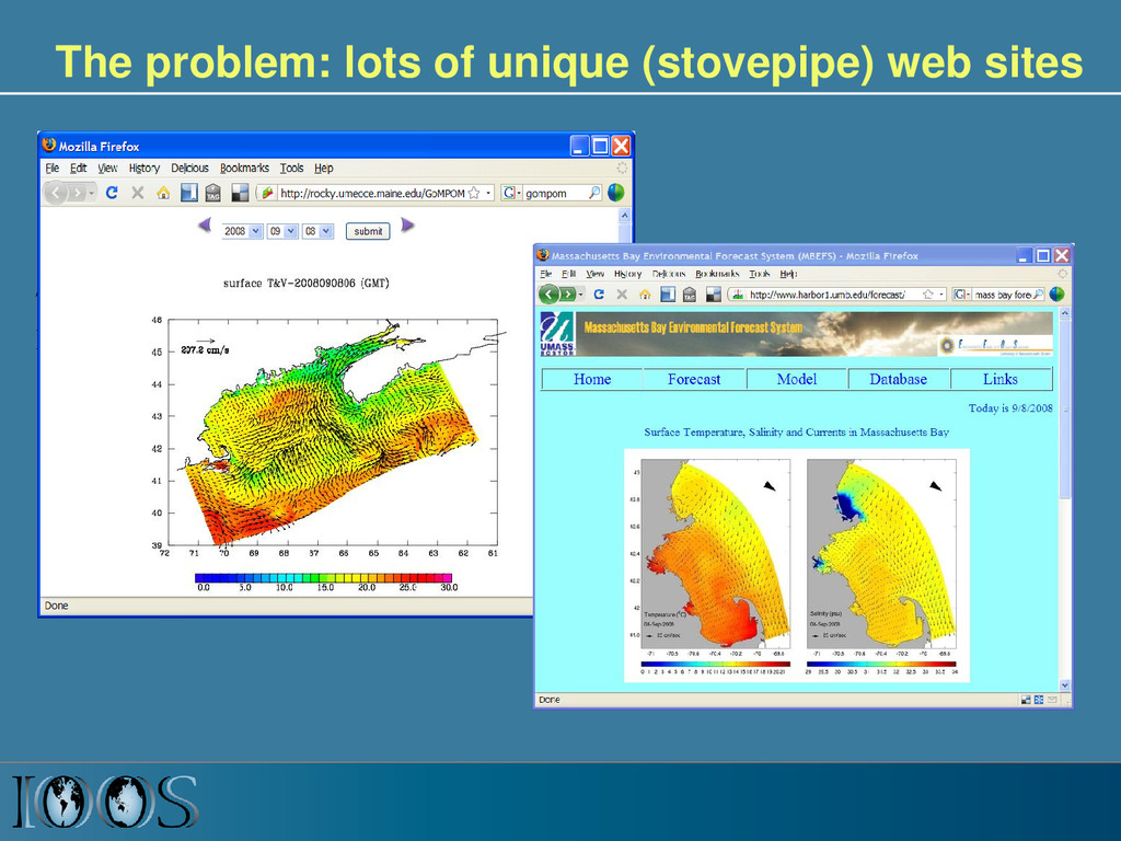
Avoid customer-specific stovepipes • Standardized access services implemented at data providers 5 Customer Web access service Data Provider Observations Models
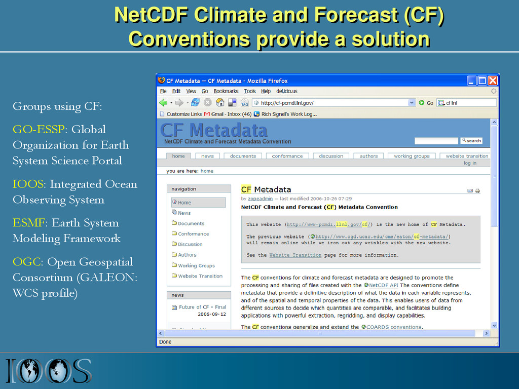
using CF: GO-ESSP: Global Organization for Earth System Science Portal IOOS: Integrated Ocean Observing System ESMF: Earth System Modeling Framework OGC: Open Geospatial Consortium (GALEON: WCS profile)
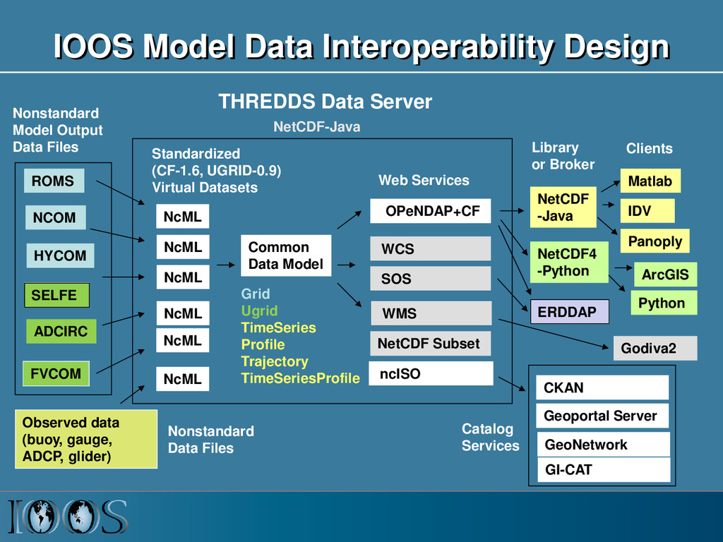
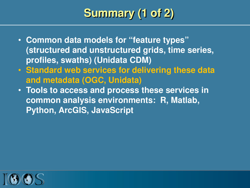
types” (structured and unstructured grids, time series, profiles, swaths) (Unidata CDM) • Standard web services for delivering these data and metadata (OGC, Unidata) • Tools to access and process these services in common analysis environments: R, Matlab, Python, ArcGIS, JavaScript
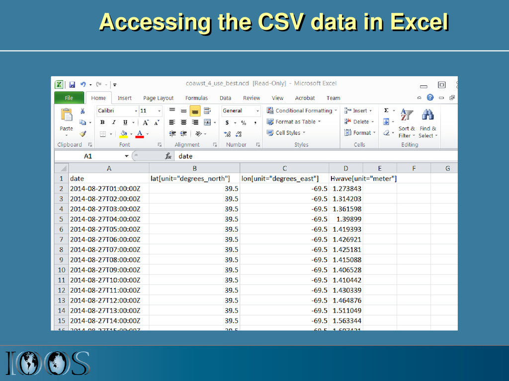
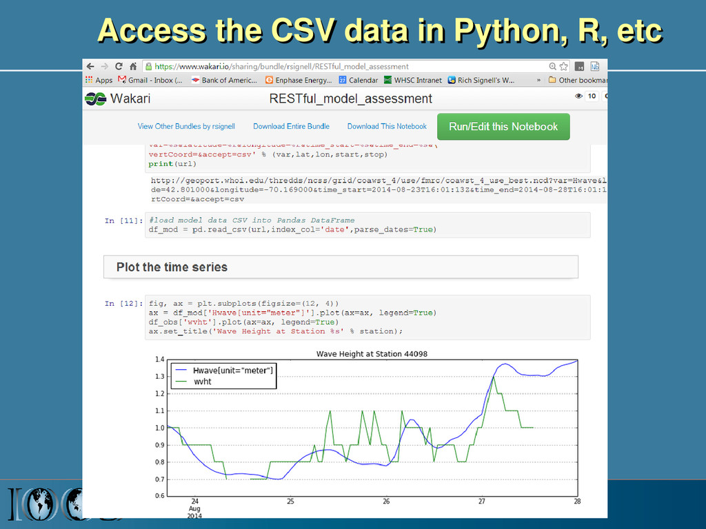
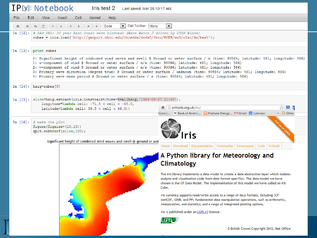
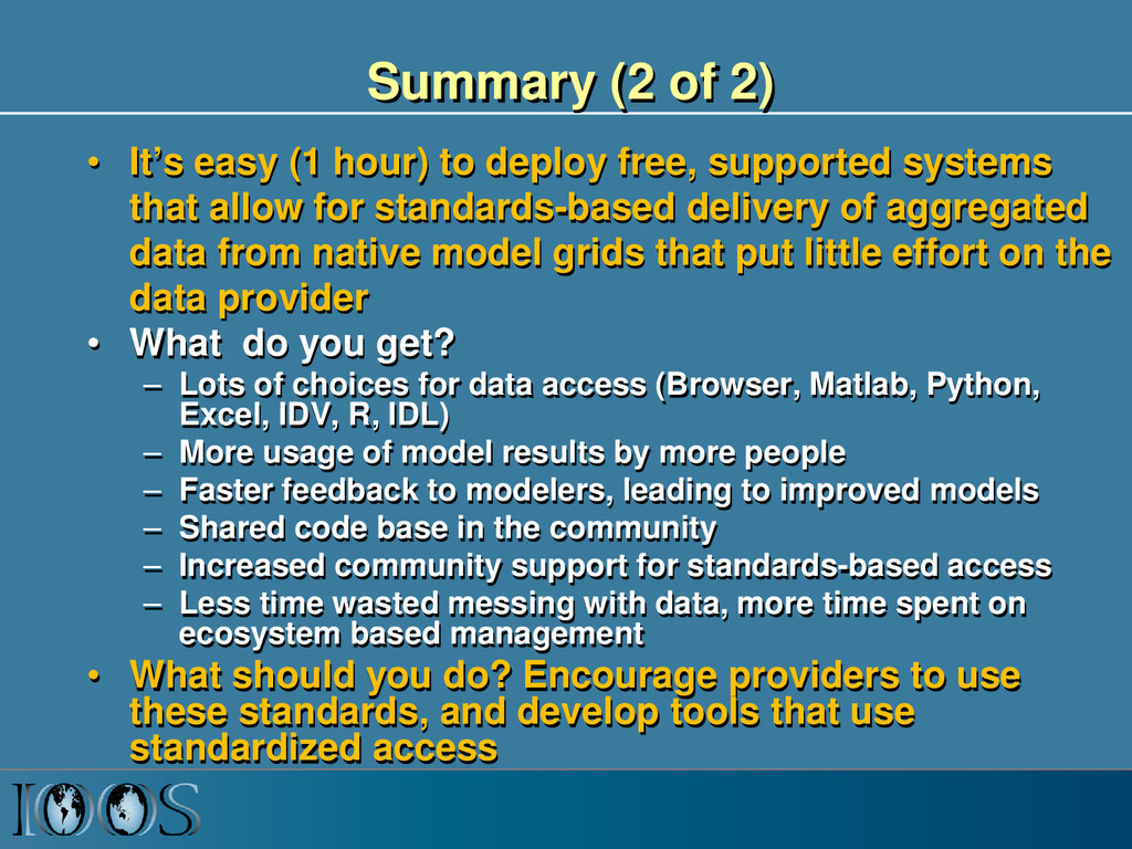
deploy free, supported systems that allow for standards-based delivery of aggregated data from native model grids that put little effort on the data provider • What do you get? – Lots of choices for data access (Browser, Matlab, Python, Excel, IDV, R, IDL) – More usage of model results by more people – Faster feedback to modelers, leading to improved models – Shared code base in the community – Increased community support for standards-based access – Less time wasted messing with data, more time spent on ecosystem based management • What should you do? Encourage providers to use these standards, and develop tools that use standardized access
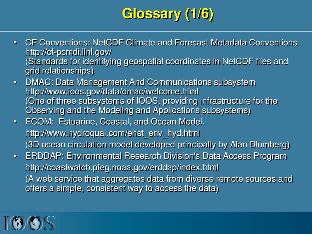
Conventions http://cf-pcmdi.llnl.gov/ (Standards for identifying geospatial coordinates in NetCDF files and grid relationships) • DMAC: Data Management And Communications subsystem http://www.ioos.gov/data/dmac/welcome.html (One of three subsystems of IOOS, providing infrastructure for the Observing and the Modeling and Applications subsystems) • ECOM: Estuarine, Coastal, and Ocean Model. http://www.hydroqual.com/ehst_env_hyd.html (3D ocean circulation model developed principally by Alan Blumberg) • ERDDAP: Environmental Research Division's Data Access Program http://coastwatch.pfeg.noaa.gov/erddap/index.html (A web service that aggregates data from diverse remote sources and offers a simple, consistent way to access the data)
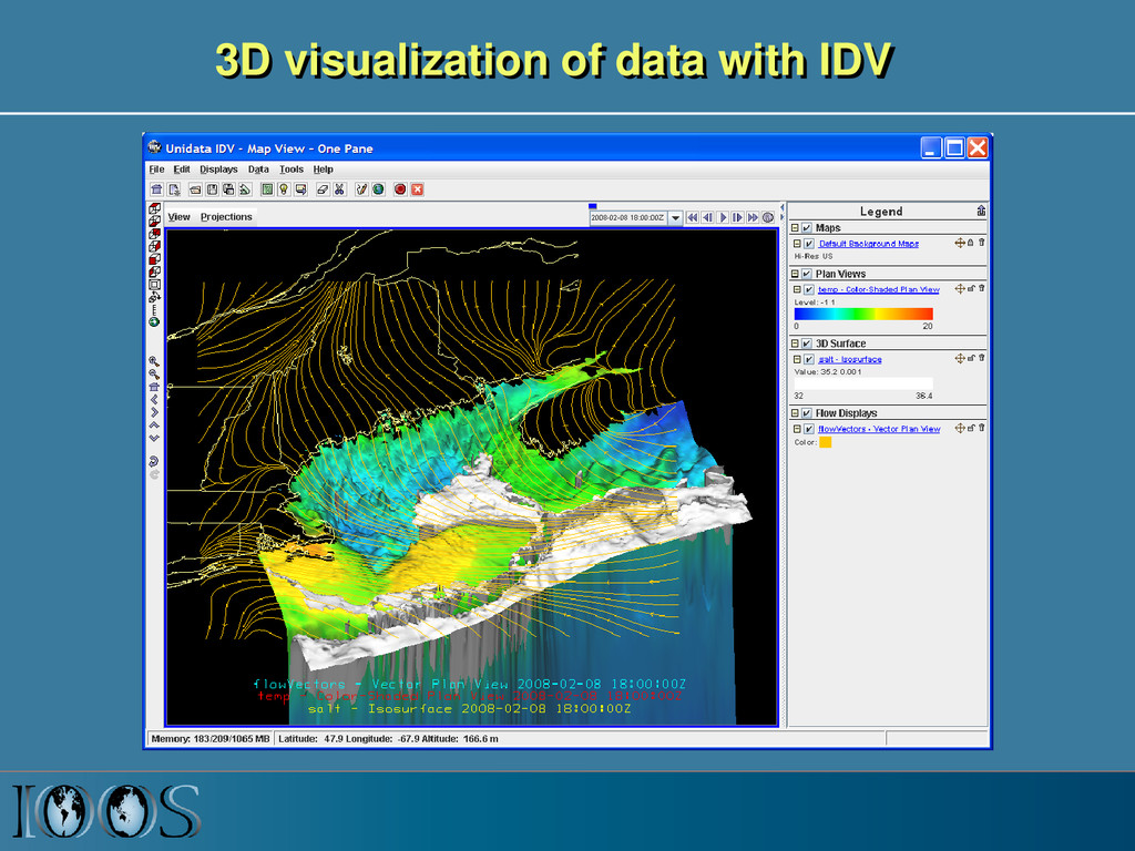
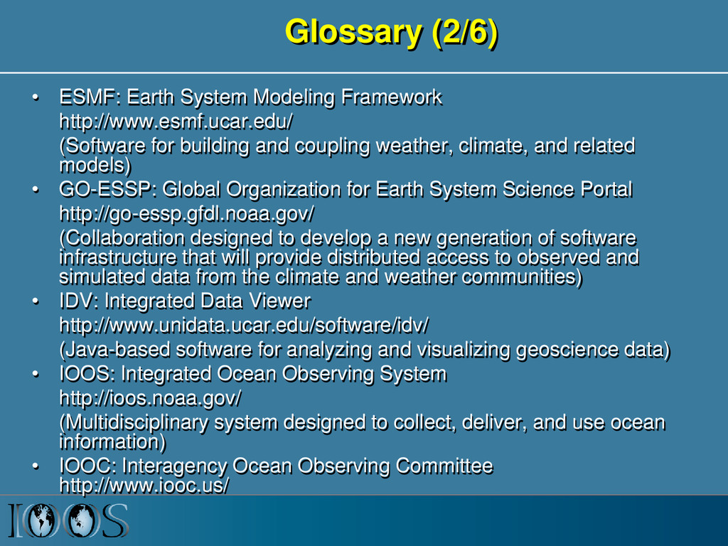
for building and coupling weather, climate, and related models) • GO-ESSP: Global Organization for Earth System Science Portal http://go-essp.gfdl.noaa.gov/ (Collaboration designed to develop a new generation of software infrastructure that will provide distributed access to observed and simulated data from the climate and weather communities) • IDV: Integrated Data Viewer http://www.unidata.ucar.edu/software/idv/ (Java-based software for analyzing and visualizing geoscience data) • IOOS: Integrated Ocean Observing System http://ioos.noaa.gov/ (Multidisciplinary system designed to collect, deliver, and use ocean information) • IOOC: Interagency Ocean Observing Committee http://www.iooc.us/
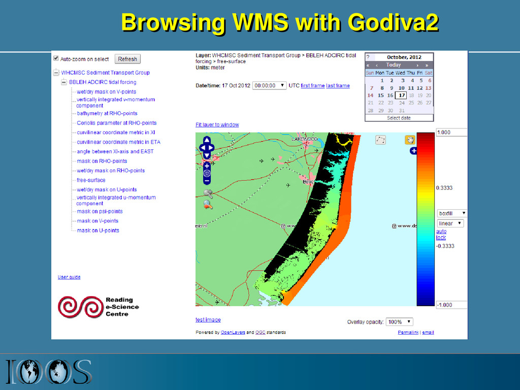
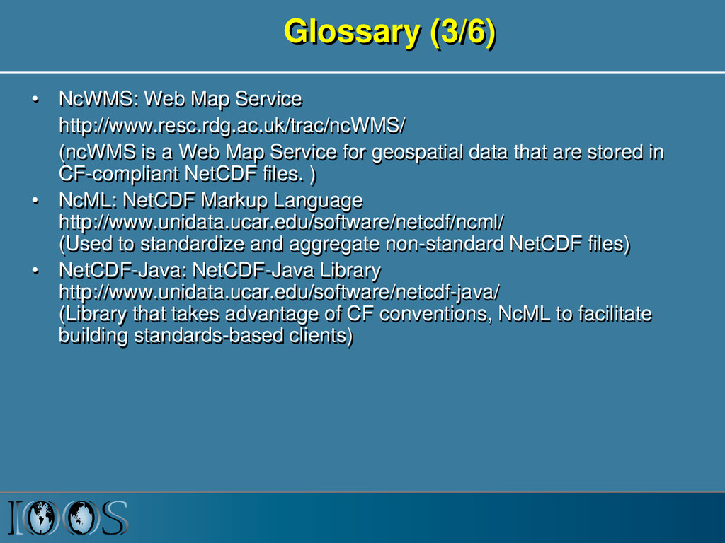
a Web Map Service for geospatial data that are stored in CF-compliant NetCDF files. ) • NcML: NetCDF Markup Language http://www.unidata.ucar.edu/software/netcdf/ncml/ (Used to standardize and aggregate non-standard NetCDF files) • NetCDF-Java: NetCDF-Java Library http://www.unidata.ucar.edu/software/netcdf-java/ (Library that takes advantage of CF conventions, NcML to facilitate building standards-based clients)
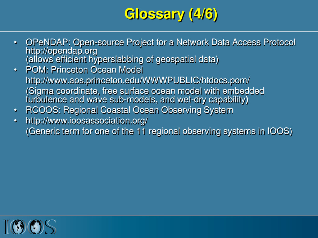
Access Protocol http://opendap.org (allows efficient hyperslabbing of geospatial data) • POM: Princeton Ocean Model http://www.aos.princeton.edu/WWWPUBLIC/htdocs.pom/ (Sigma coordinate, free surface ocean model with embedded turbulence and wave sub-models, and wet-dry capability) • RCOOS: Regional Coastal Ocean Observing System • http://www.ioosassociation.org/ (Generic term for one of the 11 regional observing systems in IOOS)
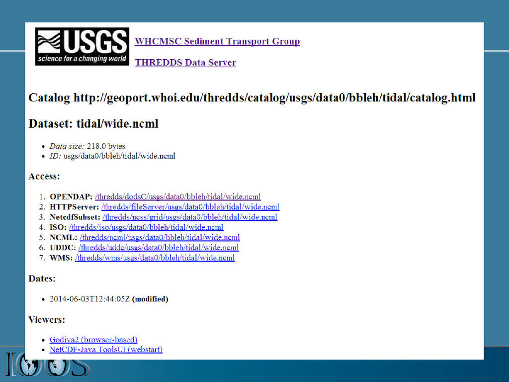
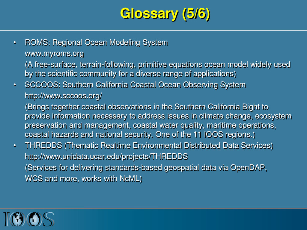
free-surface, terrain-following, primitive equations ocean model widely used by the scientific community for a diverse range of applications) • SCCOOS: Southern California Coastal Ocean Observing System http://www.sccoos.org/ (Brings together coastal observations in the Southern California Bight to provide information necessary to address issues in climate change, ecosystem preservation and management, coastal water quality, maritime operations, coastal hazards and national security. One of the 11 IOOS regions.) • THREDDS (Thematic Realtime Environmental Distributed Data Services) http://www.unidata.ucar.edu/projects/THREDDS (Services for delivering standards-based geospatial data via OpenDAP, WCS and more, works with NcML)
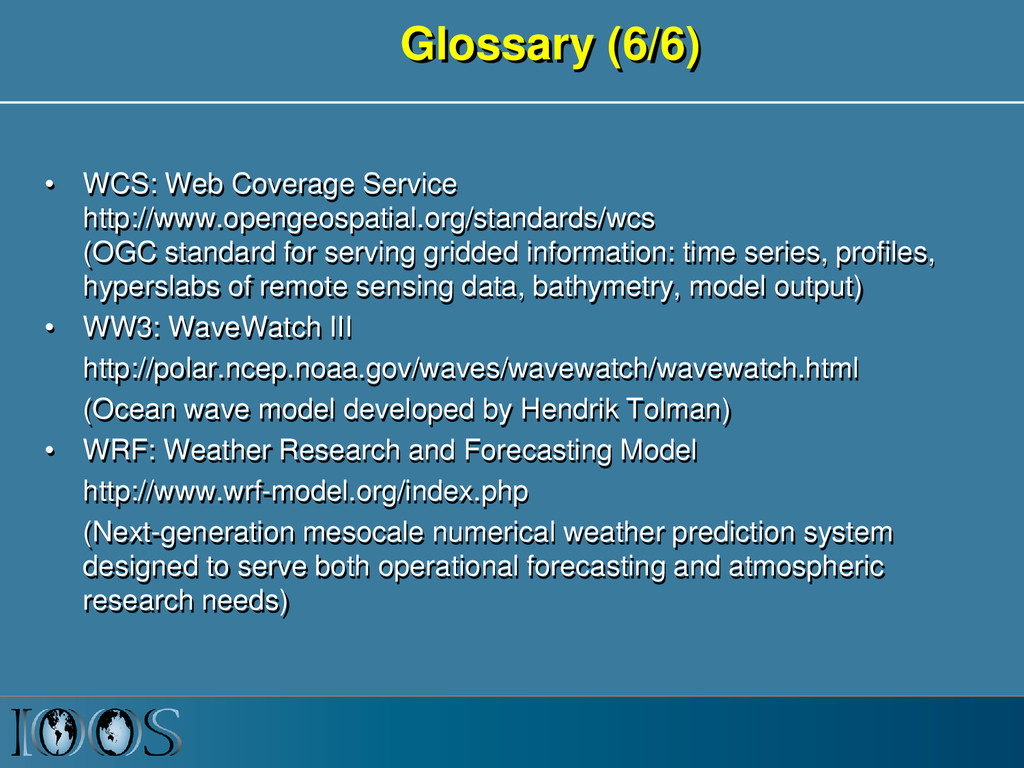
for serving gridded information: time series, profiles, hyperslabs of remote sensing data, bathymetry, model output) • WW3: WaveWatch III http://polar.ncep.noaa.gov/waves/wavewatch/wavewatch.html (Ocean wave model developed by Hendrik Tolman) • WRF: Weather Research and Forecasting Model http://www.wrf-model.org/index.php (Next-generation mesocale numerical weather prediction system designed to serve both operational forecasting and atmospheric research needs)