Upgrade to Pro
— share decks privately, control downloads, hide ads and more …
Speaker Deck
Features
Speaker Deck
PRO
Sign in
Sign up for free
Search
Search
A Case Study on Stafford, Texas: GIS and Open D...
Search
Sponsored
·
Your Podcast. Everywhere. Effortlessly.
Share. Educate. Inspire. Entertain. You do you. We'll handle the rest.
→
Texas Natural Resources Information System
November 12, 2014
Technology
120
0
Share
Embed
Copy iframe code
Copy JS code
Copy link
Start on current slide
A Case Study on Stafford, Texas: GIS and Open Data for Small Communities
Presented by Jonathan Farmer, GIS Manager, City of Stafford
Texas Natural Resources Information System
November 12, 2014
More Decks by Texas Natural Resources Information System
See All by Texas Natural Resources Information System
The 3rd Quarter GIS Community Meeting of 2020
texasnaturalresourcesinformationsytem
0
200
The 2nd Quarter GIS Community Meeting of 2020
texasnaturalresourcesinformationsytem
0
640
2020 1st Quarter GIS Community Meeting
texasnaturalresourcesinformationsytem
0
760
PLANET OVERVIEW for TNRIS first Quarter Meeting
texasnaturalresourcesinformationsytem
0
650
Hurricane Harvey H-E-B Disaster Response
texasnaturalresourcesinformationsytem
0
530
Improving Community Services by Helping Citizens Find Their Lost Pets
texasnaturalresourcesinformationsytem
0
360
National Address Database (NAD) and NG9-1-1
texasnaturalresourcesinformationsytem
0
280
StratMap Celebrating Successful Public and Private Partnerships
texasnaturalresourcesinformationsytem
1
370
2019 State of the State Town Hall Meeting
texasnaturalresourcesinformationsytem
1
350
Other Decks in Technology
See All in Technology
ダッシュボード"開発"について 〜使われるダッシュボードのつくりかた〜
kimichan
0
230
Vポイント分析基盤におけるデータモデリング20年史
taromatsui_cccmkhd
4
780
データベース研修【MIXI 26新卒技術研修】
mixi_engineers
PRO
1
490
オートマトンと字句解析でRoslynを読む
tomokusaba
0
100
Claude Mythos、Fable...フロンティアAIの最新動向と企業のセキュリティ対策
flatt_security
0
160
AI Native なプロダクト組織の立ち上げ方 : 生産性 100 倍への挑戦
mikesorae
0
1.6k
Power Automateアップデート情報
miyakemito
0
260
人手不足への挑戦:車両保全を支えるIoTとクラウド内製化の道【SORACOM Discovery 2026】
soracom
PRO
0
110
Playwright × AI Agent でE2Eテストはどう変わるか AI駆動テストの可能性と実用検証の結果
taiga7543
2
900
変更し続けられるシステムをどう保つか — AI時代のSSoTという設計原則
kawauso
1
1.4k
CloudWatchから始めるAWS監視
butadora
0
250
AWS環境のセキュリティ不安を解消した企業事例 ~よくある課題と対策を一挙公開~
asanoharuki
0
220
Featured
See All Featured
WCS-LA-2024
lcolladotor
0
760
Pawsitive SEO: Lessons from My Dog (and Many Mistakes) on Thriving as a Consultant in the Age of AI
davidcarrasco
0
200
Accessibility Awareness
sabderemane
1
160
Building Better People: How to give real-time feedback that sticks.
wjessup
370
20k
The Straight Up "How To Draw Better" Workshop
denniskardys
239
140k
Let's Do A Bunch of Simple Stuff to Make Websites Faster
chriscoyier
508
140k
brightonSEO & MeasureFest 2025 - Christian Goodrich - Winning strategies for Black Friday CRO & PPC
cargoodrich
3
760
Being A Developer After 40
akosma
91
590k
Leading Effective Engineering Teams in the AI Era
addyosmani
9
2.2k
The World Runs on Bad Software
bkeepers
PRO
72
12k
Optimizing for Happiness
mojombo
378
71k
Prompt Engineering for Job Search
mfonobong
0
380
Transcript
None
None
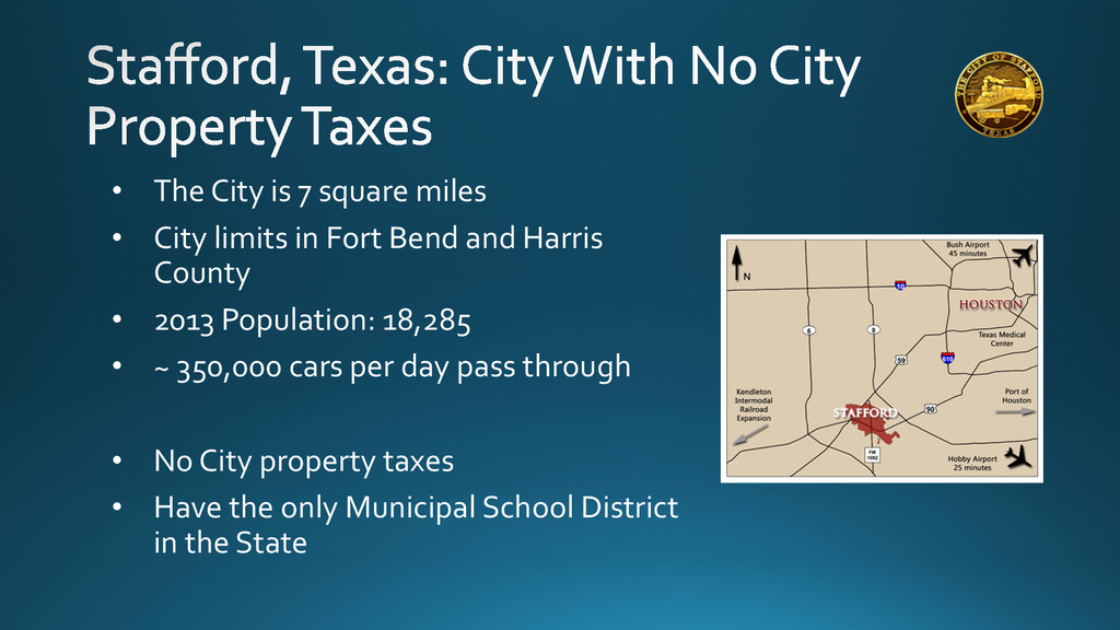
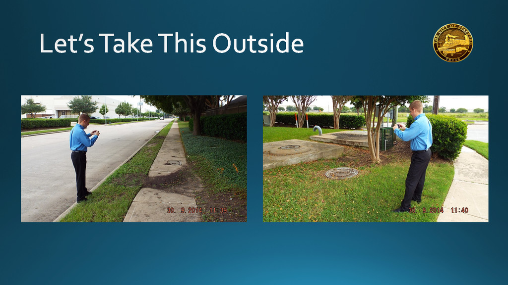
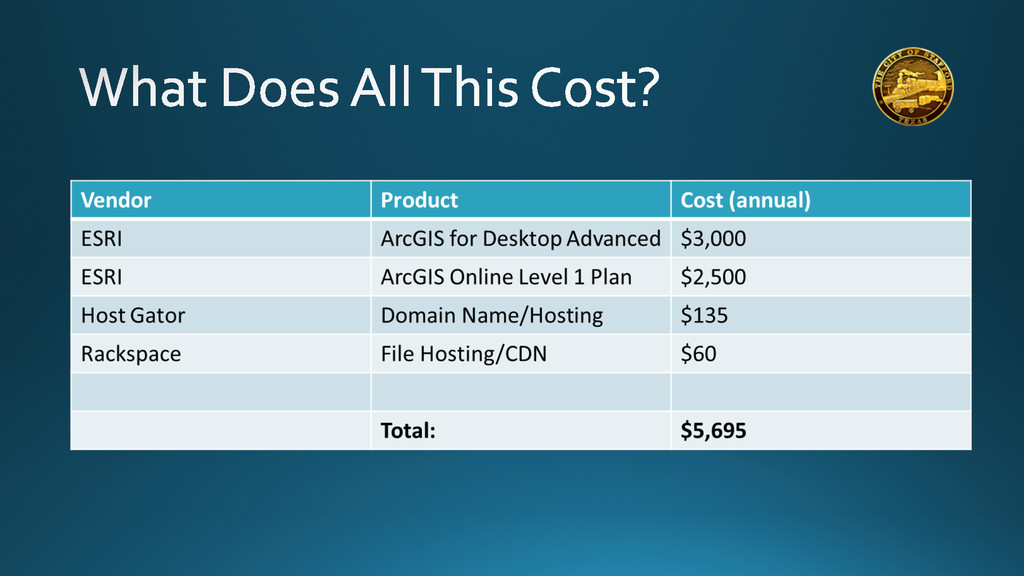
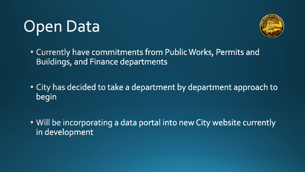
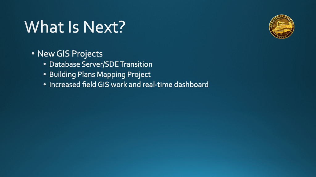
• The City is 7 square miles • City
limits in Fort Bend and Harris County • 2013 Population: 18,285 • ~ 350,000 cars per day pass through • No City property taxes • Have the only Municipal School District in the State
None
None
None
None
Staff Map Public GIS/Maps Website Stafford Economic Development Corporation Website
None
None
None
None
None
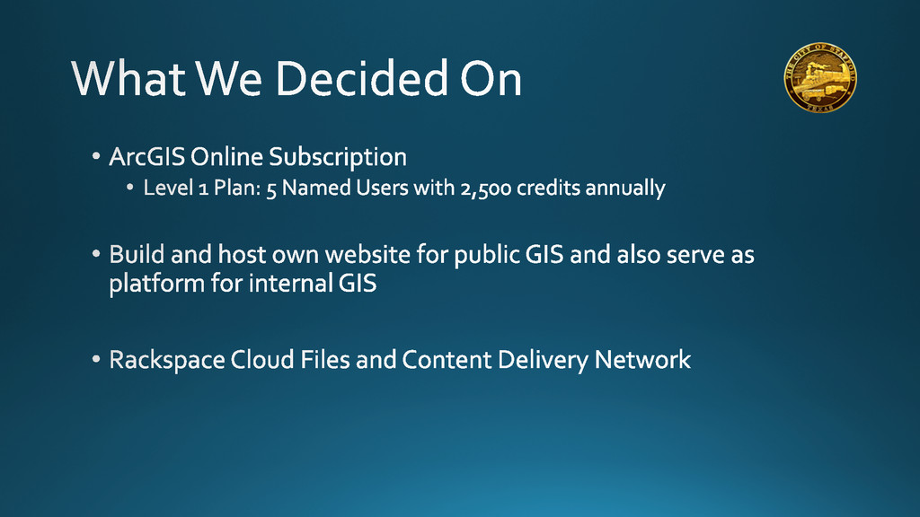
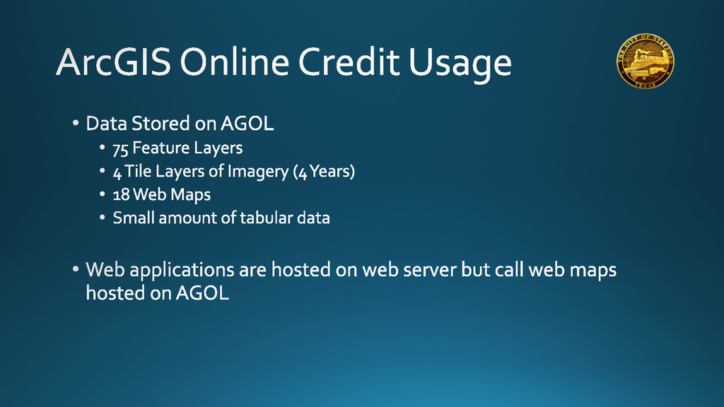
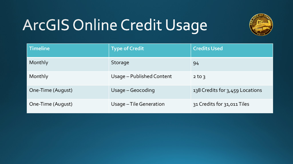
Timeline Type of Credit Credits Used Monthly
Storage 94 Monthly Usage – Published Content 2 to 3 One-‐Time (August) Usage – Geocoding 138 Credits for 3,459 Locations One-‐Time (August) Usage – Tile Generation 31 Credits for 31,011 Tiles
None
• One Definition: • In Other Words: ESRI
Data Portal
None
None
None
None
jfarmer@cityofstafford.com