Academic Skills Minimum: General Equivalency Degree (GED) or High School Diploma Preferred: Associate's or Bachelor’s Degree ☑ Technical Skills Minimum: Demonstrated Experience Preferred: Certificate or License ☑ Professional Skills Minimum: Internship or Part-time Experience Preferred: 1 to 3-years Experience
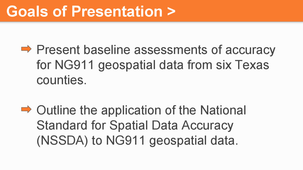
NG911 geospatial data from six Texas counties. Outline the application of the National Standard for Spatial Data Accuracy (NSSDA) to NG911 geospatial data.
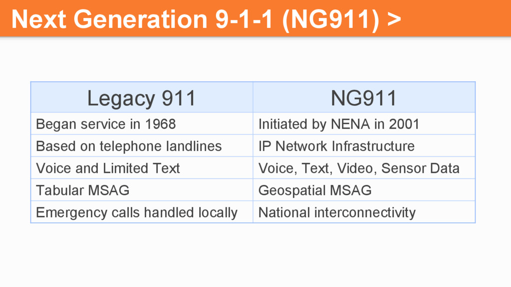
in 1968 Initiated by NENA in 2001 Based on telephone landlines IP Network Infrastructure Voice and Limited Text Voice, Text, Video, Sensor Data Tabular MSAG Geospatial MSAG Emergency calls handled locally National interconnectivity
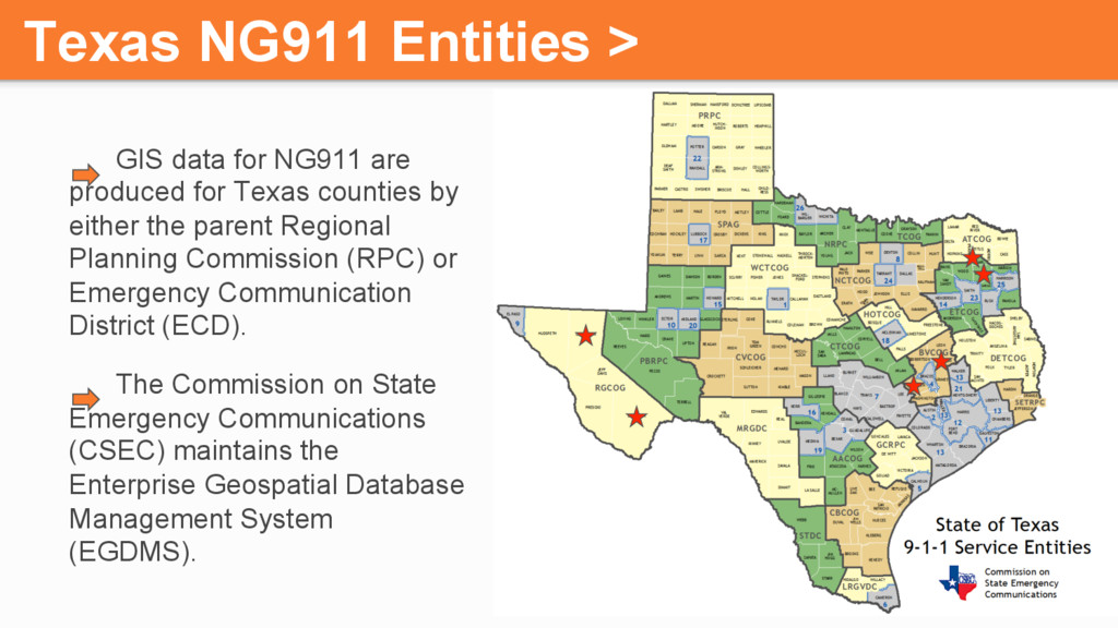
for Texas counties by either the parent Regional Planning Commission (RPC) or Emergency Communication District (ECD). The Commission on State Emergency Communications (CSEC) maintains the Enterprise Geospatial Database Management System (EGDMS).
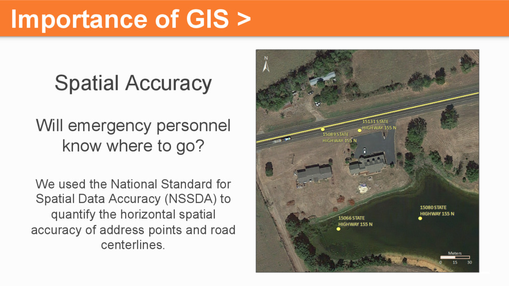
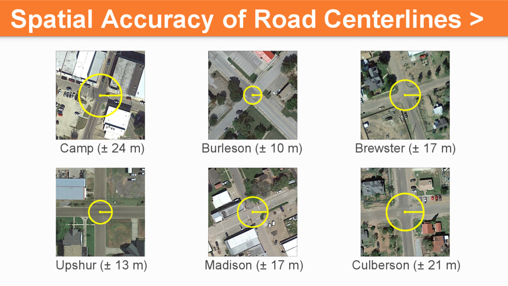
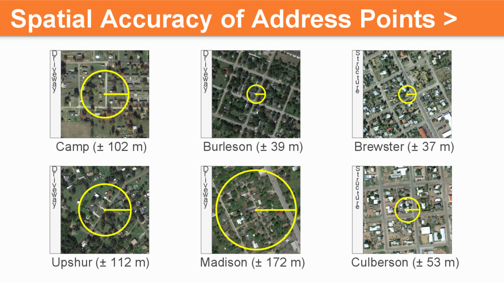
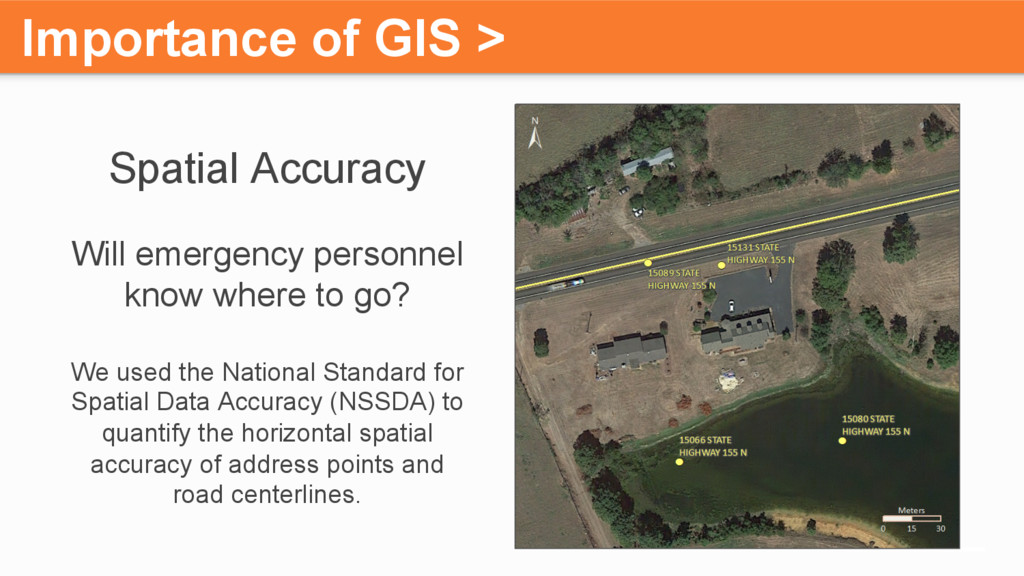
where to go? We used the National Standard for Spatial Data Accuracy (NSSDA) to quantify the horizontal spatial accuracy of address points and road centerlines.
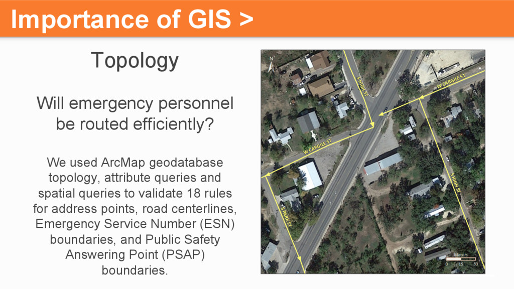
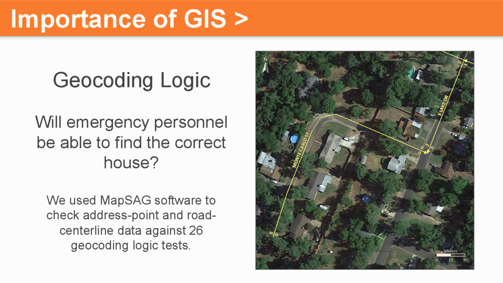
efficiently? We used ArcMap geodatabase topology, attribute queries and spatial queries to validate 18 rules for address points, road centerlines, Emergency Service Number (ESN) boundaries, and Public Safety Answering Point (PSAP) boundaries.
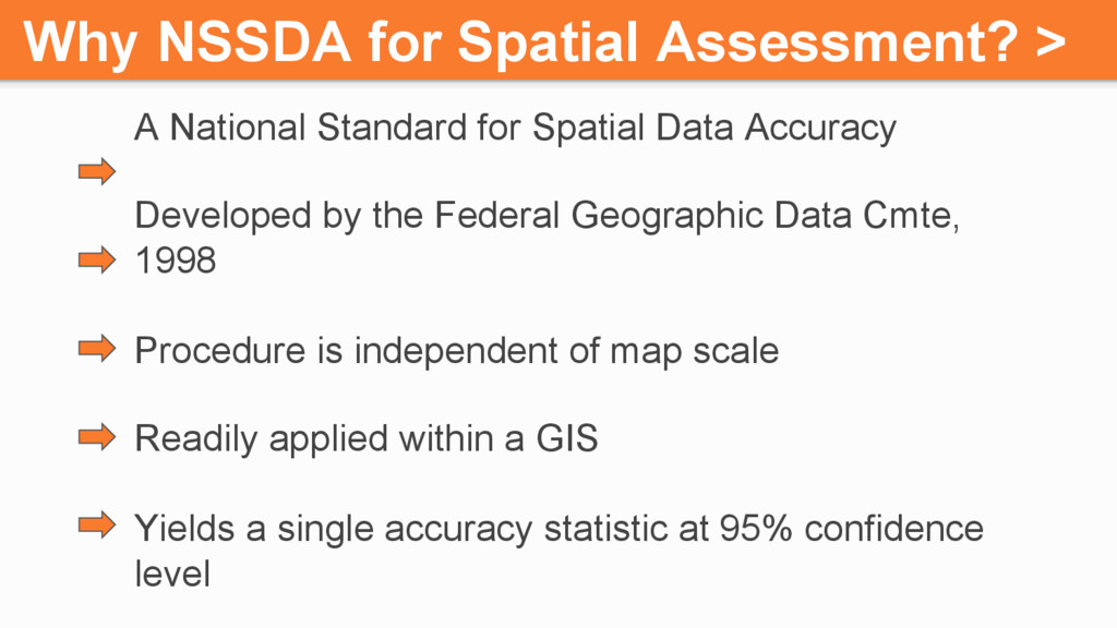
Spatial Data Accuracy Developed by the Federal Geographic Data Cmte, 1998 Procedure is independent of map scale Readily applied within a GIS Yields a single accuracy statistic at 95% confidence level
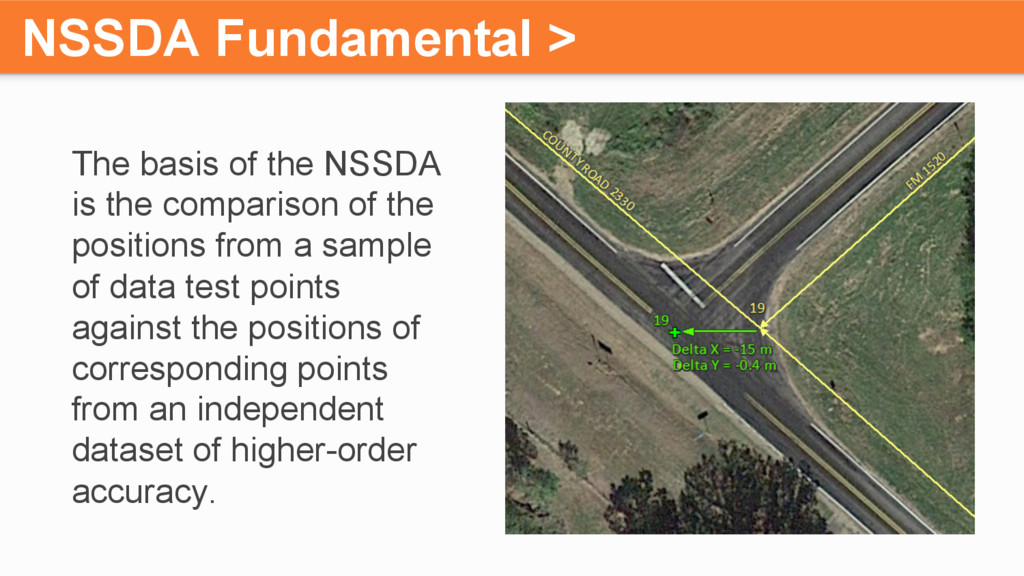
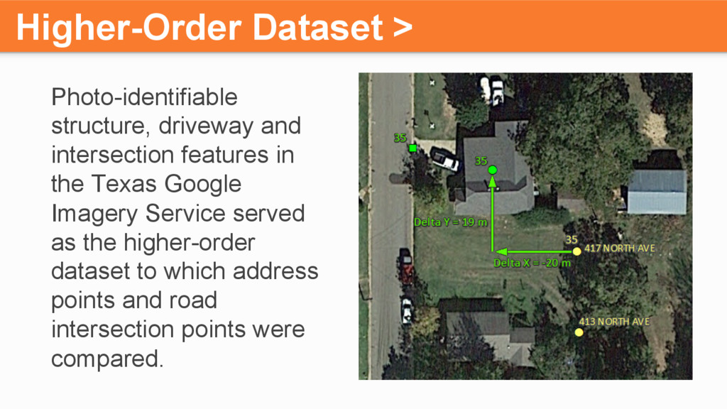
comparison of the positions from a sample of data test points against the positions of corresponding points from an independent dataset of higher-order accuracy.
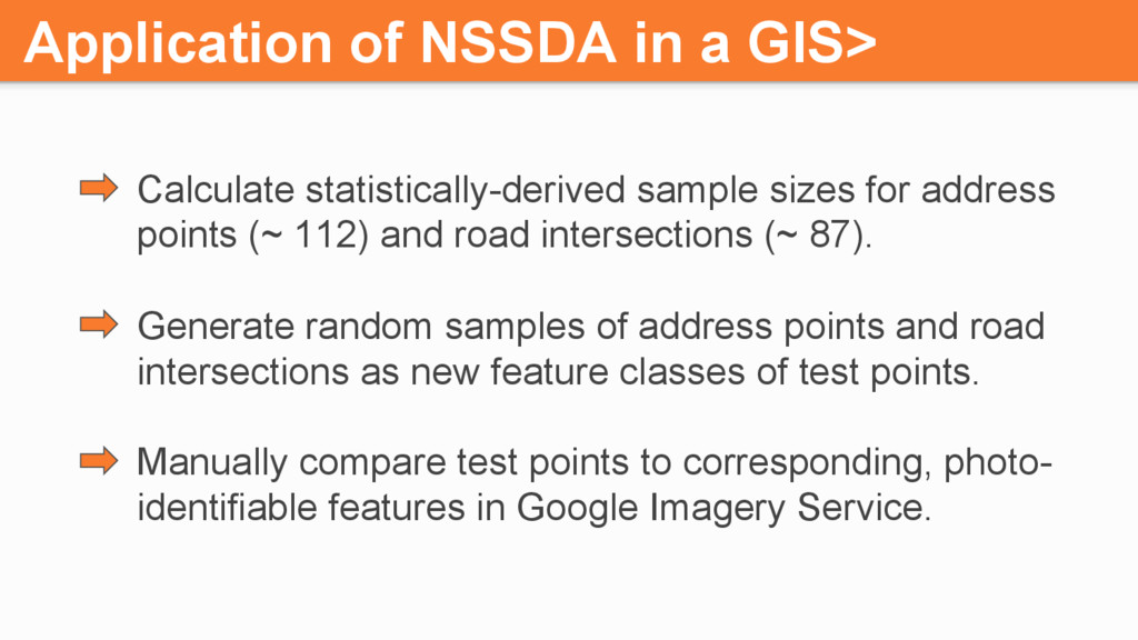
for address points (~ 112) and road intersections (~ 87). Generate random samples of address points and road intersections as new feature classes of test points. Manually compare test points to corresponding, photo- identifiable features in Google Imagery Service.
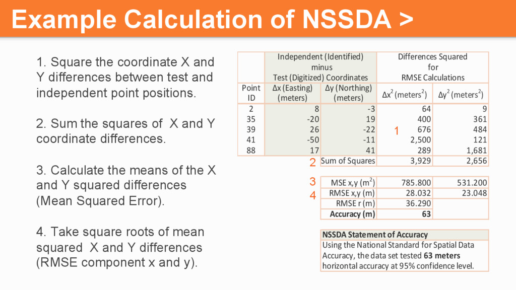
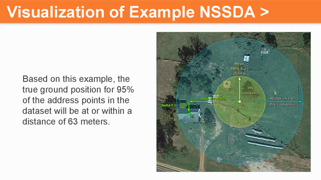
-3 64 9 35 -20 19 400 361 39 26 -22 676 484 41 -50 -11 2,500 121 88 17 41 289 1,681 Sum of Squares 3,929 2,656 MSE x,y (m2) 785.800 531.200 RMSE x,y (m) 28.032 23.048 RMSE r (m) 36.290 Accuracy (m) 63 Using the National Standard for Spatial Data Accuracy, the data set tested 63 meters horizontal accuracy at 95% confidence level. NSSDA Statement of Accuracy Δx2 (meters2) Δy2 (meters2) minus for Test (Digitized) Coordinates RMSE Calculations Independent (Identified) Differences Squared 1. Square the coordinate X and Y differences between test and independent point positions. 2. Sum the squares of X and Y coordinate differences. 3. Calculate the means of the X and Y squared differences (Mean Squared Error). 4. Take square roots of mean squared X and Y differences (RMSE component x and y). Example Calculation of NSSDA > 1 2 3 4
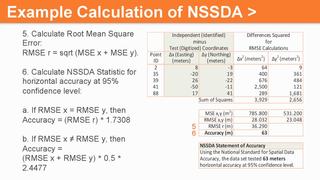
-3 64 9 35 -20 19 400 361 39 26 -22 676 484 41 -50 -11 2,500 121 88 17 41 289 1,681 Sum of Squares 3,929 2,656 MSE x,y (m2) 785.800 531.200 RMSE x,y (m) 28.032 23.048 RMSE r (m) 36.290 Accuracy (m) 63 Using the National Standard for Spatial Data Accuracy, the data set tested 63 meters horizontal accuracy at 95% confidence level. NSSDA Statement of Accuracy Δx2 (meters2) Δy2 (meters2) minus for Test (Digitized) Coordinates RMSE Calculations Independent (Identified) Differences Squared 5. Calculate Root Mean Square Error: RMSE r = sqrt (MSE x + MSE y). 6. Calculate NSSDA Statistic for horizontal accuracy at 95% confidence level: a. If RMSE x = RMSE y, then Accuracy = (RMSE r) * 1.7308 b. If RMSE x ≠ RMSE y, then Accuracy = (RMSE x + RMSE y) * 0.5 * 2.4477 Example Calculation of NSSDA > 6 5
Camp (± 102 m) Brewster (± 37 m) Burleson (± 39 m) Culberson (± 53 m) Madison (± 172 m) D r i v e w a y D r i v e w a y D r i v e w a y D r i v e w a y S t r u c t u r e S t r u c t u r e
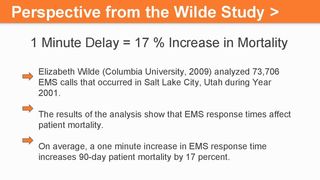
17 % Increase in Mortality Elizabeth Wilde (Columbia University, 2009) analyzed 73,706 EMS calls that occurred in Salt Lake City, Utah during Year 2001. The results of the analysis show that EMS response times affect patient mortality. On average, a one minute increase in EMS response time increases 90-day patient mortality by 17 percent.
where to go? We used the National Standard for Spatial Data Accuracy (NSSDA) to quantify the horizontal spatial accuracy of address points and road centerlines.
efficiently? We used ArcMap geodatabase topology, attribute queries and spatial queries to validate 18 rules for address points, road centerlines, ESN boundaries, and PSAP boundaries.
the project. Vonda Payne with CSEC for managing the project. Jennifer Lindsey with ACC for her contributions in streamlining the workflow and completing Madison and Culberson County assessments.