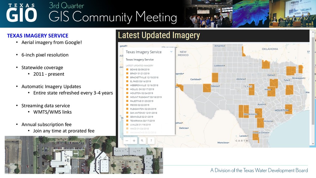
pixel resolution • Statewide coverage • 2011 - present • Automatic Imagery Updates • Entire state refreshed every 3-4 years • Streaming data service • WMTS/WMS links • Annual subscription fee • Join any time at prorated fee
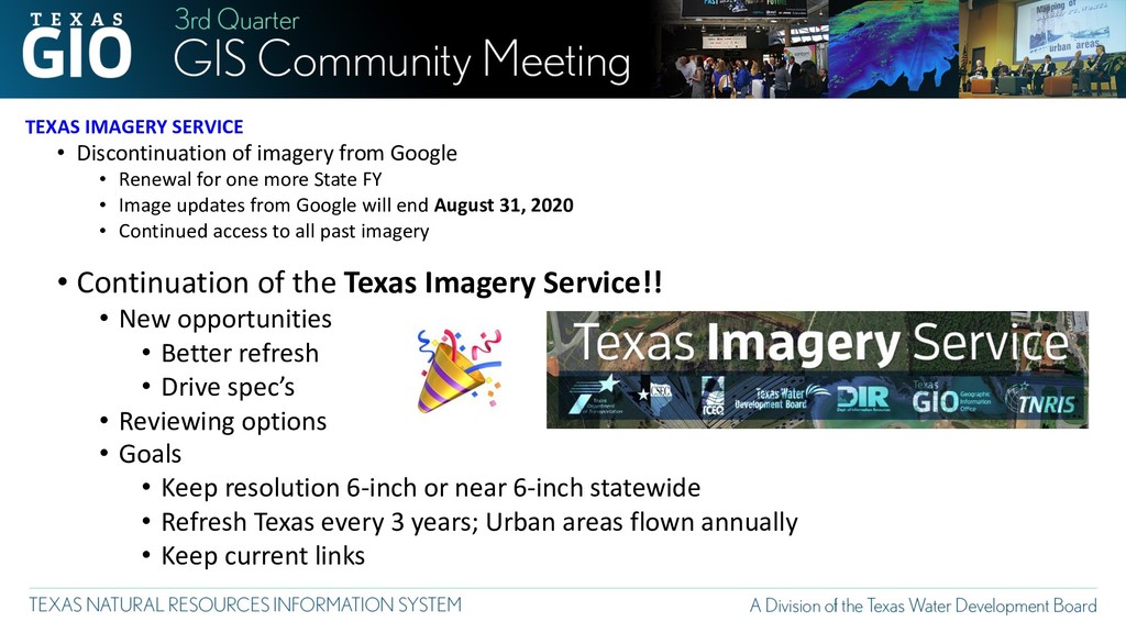
Renewal for one more State FY • Image updates from Google will end August 31, 2020 • Continued access to all past imagery • Continuation of the Texas Imagery Service!! • New opportunities • Better refresh • Drive spec’s • Reviewing options • Goals • Keep resolution 6-inch or near 6-inch statewide • Refresh Texas every 3 years; Urban areas flown annually • Keep current links
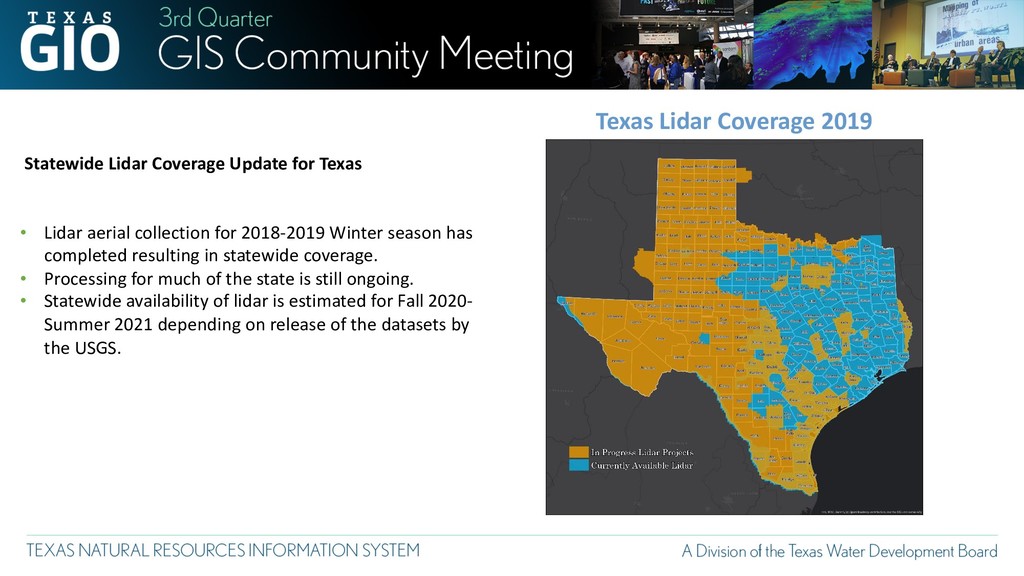
• Lidar aerial collection for 2018-2019 Winter season has completed resulting in statewide coverage. • Processing for much of the state is still ongoing. • Statewide availability of lidar is estimated for Fall 2020- Summer 2021 depending on release of the datasets by the USGS.
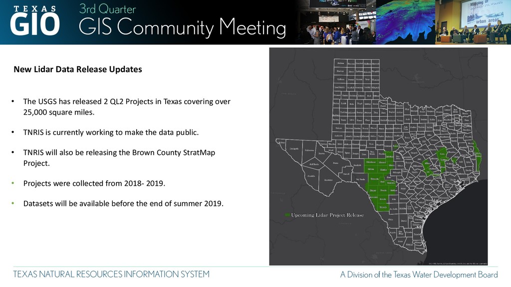
2 QL2 Projects in Texas covering over 25,000 square miles. • TNRIS is currently working to make the data public. • TNRIS will also be releasing the Brown County StratMap Project. • Projects were collected from 2018- 2019. • Datasets will be available before the end of summer 2019.
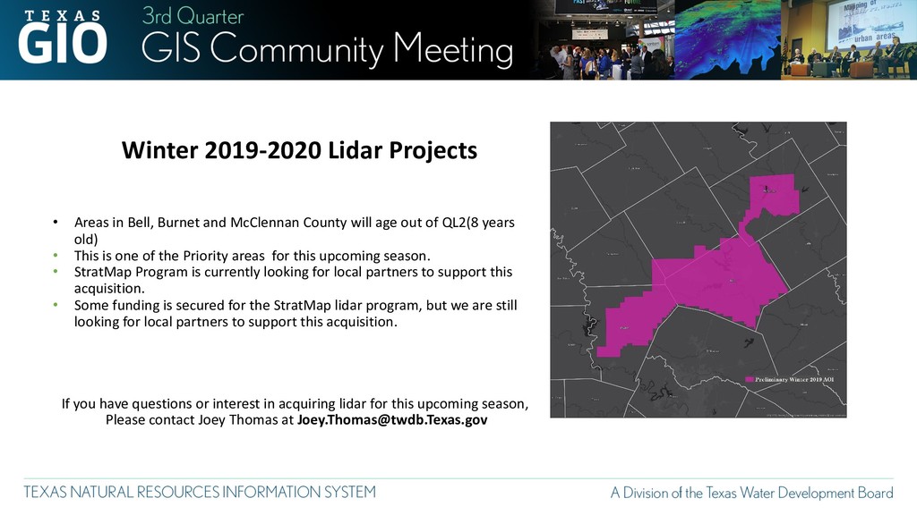
McClennan County will age out of QL2(8 years old) • This is one of the Priority areas for this upcoming season. • StratMap Program is currently looking for local partners to support this acquisition. • Some funding is secured for the StratMap lidar program, but we are still looking for local partners to support this acquisition. If you have questions or interest in acquiring lidar for this upcoming season, Please contact Joey Thomas at [email protected]
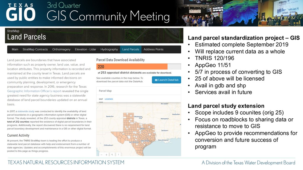
2019 • Will replace current data as a whole • TNRIS 120/196 • AppGeo 11/51 • 5/7 in process of converting to GIS • 25 of above will be licensed • Avail in gdb and shp • Services avail in future Land parcel study extension • Scope includes 9 counites (orig 25) • Focus on roadblocks to sharing data or resistance to move to GIS • AppGeo to provide recommendations for conversion and future success of program