• Why we do what we do? • How we do what we do? • StratMap and AECOM Geospa4al Solu4ons • Geospa4al Data Products (Category 1) • Custom Geospa4al Data and Services (Category 2) • Ques4ons and Group Discussion
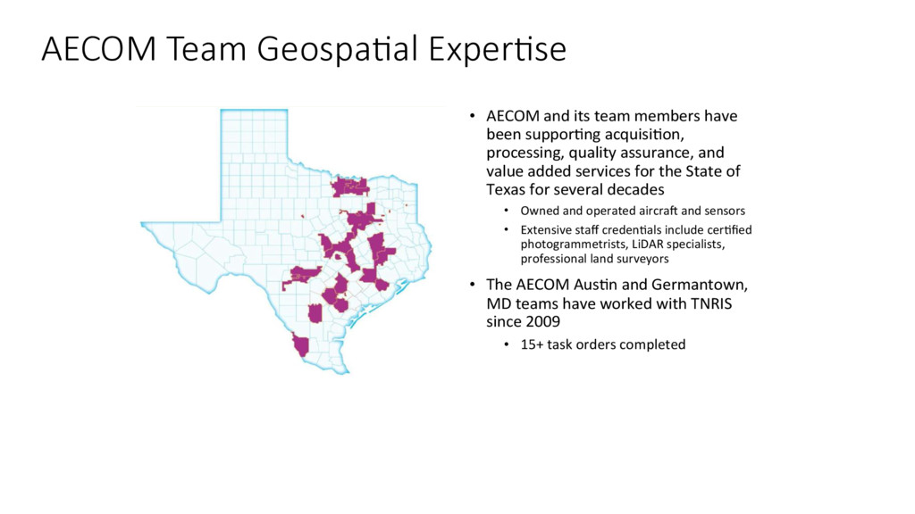
processing, quality assurance, and value added services for the State of Texas for several decades • Owned and operated aircraX and sensors • Extensive staff creden4als include cer4fied photogrammetrists, LiDAR specialists, professional land surveyors • The AECOM Aus4n and Germantown, MD teams have worked with TNRIS since 2009 • 15+ task orders completed AECOM Team Geospa>al Exper>se
of informa4on over large areas: • Feature Data • Air Quality • Change detec4on • Environmental and Social Impact Assessments • Environmental Disaster Response monitoring • Forest Canopy Health assessments • Power Line rou4ng studies • Land Use/Land Cover • Natural Resources • Geology • ReseFlement • Water U4liza4on • Wetland Mapping • Etc… Satellite Imagery Applica>ons
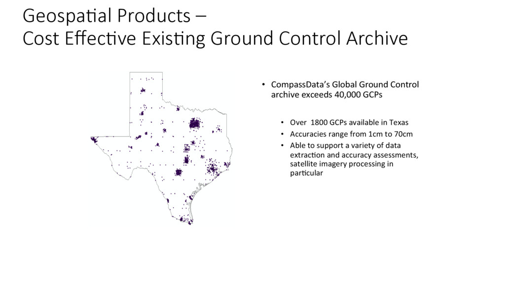
Over 1800 GCPs available in Texas • Accuracies range from 1cm to 70cm • Able to support a variety of data extrac4on and accuracy assessments, satellite imagery processing in par4cular Geospa>al Products – Cost Effec>ve Exis>ng Ground Control Archive
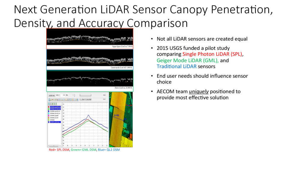
USGS funded a pilot study comparing Single Photon LiDAR (SPL), Geiger Mode LiDAR (GML), and Tradi4onal LiDAR sensors • End user needs should influence sensor choice • AECOM team uniquely posi4oned to provide most effec4ve solu4on Next Genera>on LiDAR Sensor Canopy Penetra>on, Density, and Accuracy Comparison Red= SPL DSM, Green= GML DSM, Blue= QL2 DSM
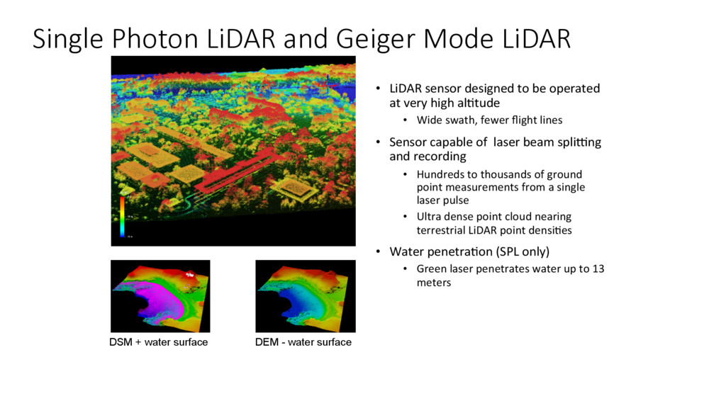
al4tude • Wide swath, fewer flight lines • Sensor capable of laser beam spliqng and recording • Hundreds to thousands of ground point measurements from a single laser pulse • Ultra dense point cloud nearing terrestrial LiDAR point densi4es • Water penetra4on (SPL only) • Green laser penetrates water up to 13 meters Single Photon LiDAR and Geiger Mode LiDAR DSM + water surface DEM - water surface
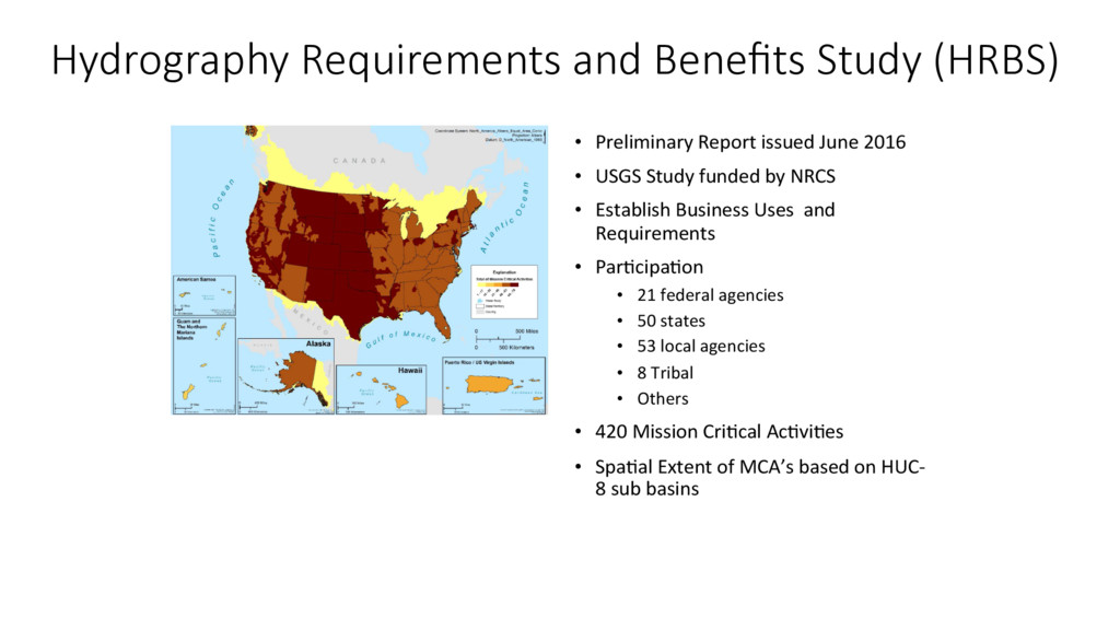
by NRCS • Establish Business Uses and Requirements • Par4cipa4on • 21 federal agencies • 50 states • 53 local agencies • 8 Tribal • Others • 420 Mission Cri4cal Ac4vi4es • Spa4al Extent of MCA’s based on HUC- 8 sub basins Hydrography Requirements and Benefits Study (HRBS)
Resource Management and Protec4on • Implemen4ng Programs of the Clean Water Act • Natural Resource Iden4ficaton and Conserva4on • Science Based Decision Making • Surface Water Data Colleciton and Analysis • Sustaining Healthy Water and EcoSystems • Water Rights Permiqng and Administra4on HRBS and Texas Mission Cri>cal Ac>vi>es
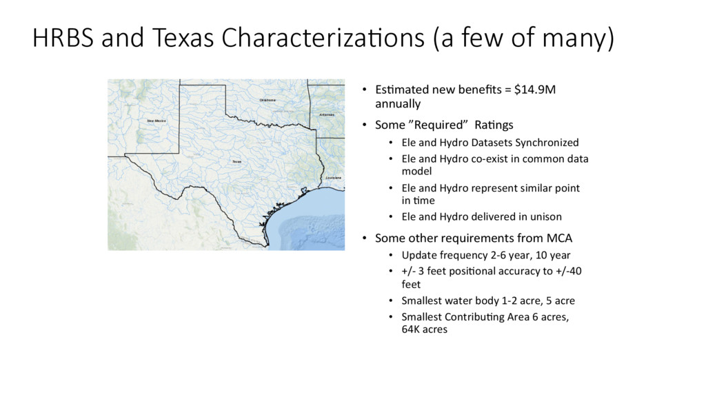
Ra4ngs • Ele and Hydro Datasets Synchronized • Ele and Hydro co-exist in common data model • Ele and Hydro represent similar point in 4me • Ele and Hydro delivered in unison • Some other requirements from MCA • Update frequency 2-6 year, 10 year • +/- 3 feet posi4onal accuracy to +/-40 feet • Smallest water body 1-2 acre, 5 acre • Smallest Contribu4ng Area 6 acres, 64K acres HRBS and Texas Characteriza>ons (a few of many)
user base • Base Data Collec4on and Prepara4on • LiDAR, imagery, exis4ng NHD, local hydro and stormwater data, dams, etc. • Generate Terrain Reference Files • Local-Res NHD Linework Using Reference Files – Confla4on / AFribu4on for GNIS, Na4onal Map, Reach Numbers, Upload to Na4onal Map, TNRIS, as steward or through steward AECOM Experience with Ele-Hydro (Since 2006)
extraction • Improve techniques for automated conflation/ replacement • Develop services and staged product extractions based on data model Future State • Hydrography data are acquired from lidar source • Integrated Z values • Integrated data model with 3DEP • Data model can relay hydro, 3DEP, or both • Interoperability between NHD, WBD, 3DEP, StreamStats • Produce 20% of CONUS lidar derived hydrography • Produce 10% of CONUS lidar-derived NHD+ • Establish volunteer committees • Establish breakline committee • Event migration for generalization capability • NHD+HR pilot apps • Elehydro research (Committee) • Begin to develop integrated data model Major Actions Early Stages of Development and Planning Draft Timeline, V. Lukas, USGS, March 2016
![Thank You [email protected] [email protected] [email protected] July 2016](https://files.speakerdeck.com/presentations/4bf7ef610e474c2c996ed22dacff6bed/slide_31.jpg)