Upgrade to Pro — share decks privately, control downloads, hide ads and more …

Geiger Mode Lidar: The Leap from Single Pulse to Avalanche and What it means to the End User

Geiger Mode Lidar: The Leap from Single Pulse to Avalanche and What it means to the End User

Harold Rempel - ESP Associates

More Decks by Texas Natural Resources Information System

Other Decks in Technology

Transcript

  1. ESP  Associates,  P.A.   January  27,  2015   GEIGER-MODE LiDAR

    The  leap  from  single  pulse  to  avalanche     and  what  it  means  to  the  end  user.  
  2. ESP  Associates,  P.A.   OVERVIEW Geiger  Mode  vs.  TradiEonal  LiDAR

      The  Pilot  Project   Test  Results   What  to  Expect  with  Geiger   Flexibility  of  the  Data      
  3. ESP  Associates,  P.A.   GmAPD Camera Uses 32x128 Flash Array

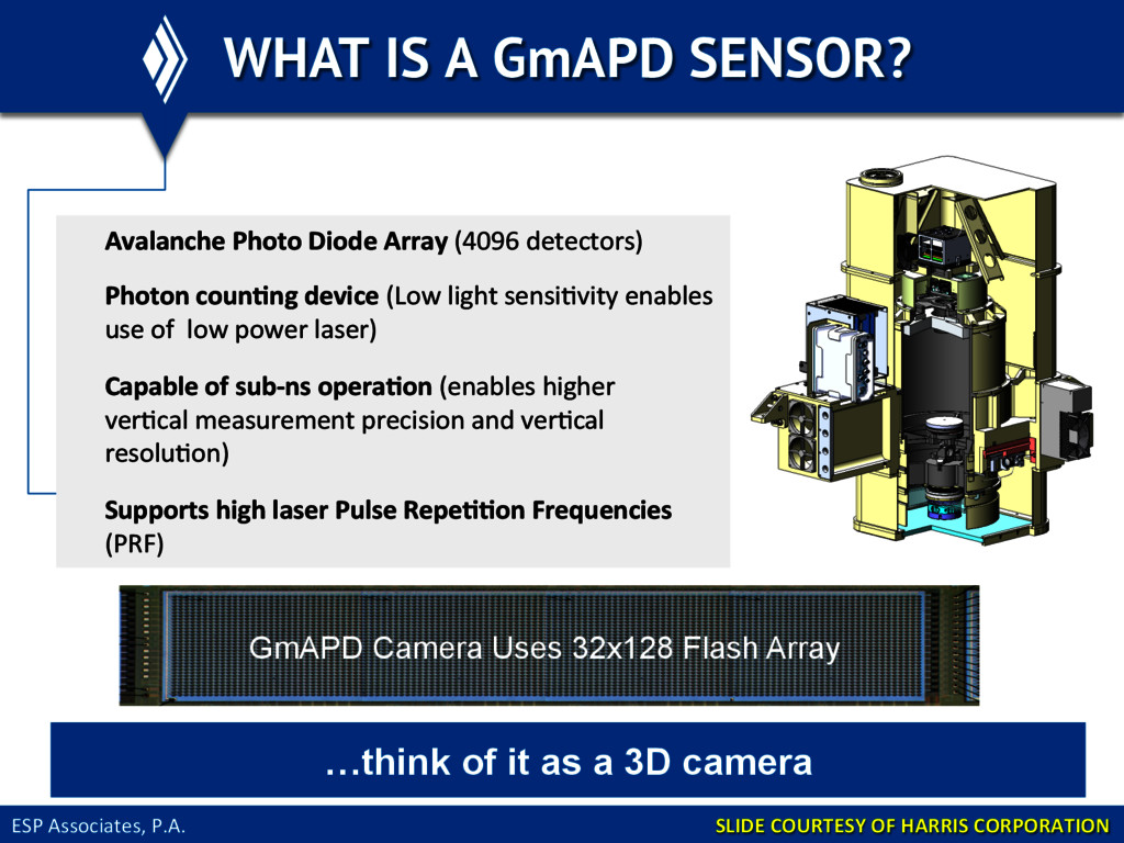
    WHAT IS A GmAPD SENSOR? SLIDE  COURTESY  OF  HARRIS  CORPORATION   Avalanche  Photo  Diode  Array  (4096  detectors)   Photon  coun@ng  device  (Low  light  sensiEvity  enables   use  of    low  power  laser)   Capable  of  sub-­‐ns  opera@on  (enables  higher     verEcal  measurement  precision  and  verEcal   resoluEon)   Supports  high  laser  Pulse  Repe@@on  Frequencies   (PRF)   …think of it as a 3D camera
  4. ESP  Associates,  P.A.   TRADITIONAL SYSTEMS Single  pulse  with  mulEple

     returns   Single  measurement   Low  sample  rate  (500KHz  sec)   OscillaEng   Mirror   PaWern   RotaEng   Polygonal Mirror   PaWern  
  5. ESP  Associates,  P.A.   LIMITATIONS OF TRADITIONAL SYSTEMS The  higher

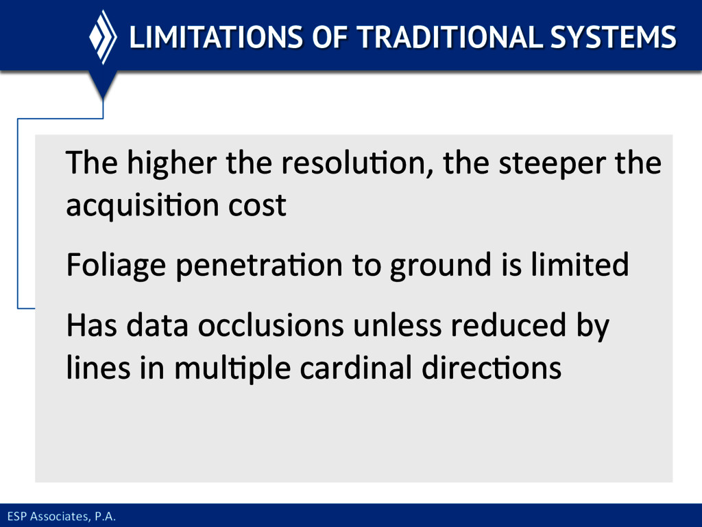
     the  resoluEon,  the  steeper  the   acquisiEon  cost   Foliage  penetraEon  to  ground  is  limited   Has  data  occlusions  unless  reduced  by   lines  in  mulEple  cardinal  direcEons    
  6. ESP  Associates,  P.A.   GEIGER MODE SYSTEMS Large  array  sensor

      MulEple  “looks”  at  each  spot  on  the   ground   High  sample  rate  (200MHz  sec.)   Geiger   Array   PaWern  
  7. ESP  Associates,  P.A.   HIGHLIGHTS OF GEIGER MODE Collect  at

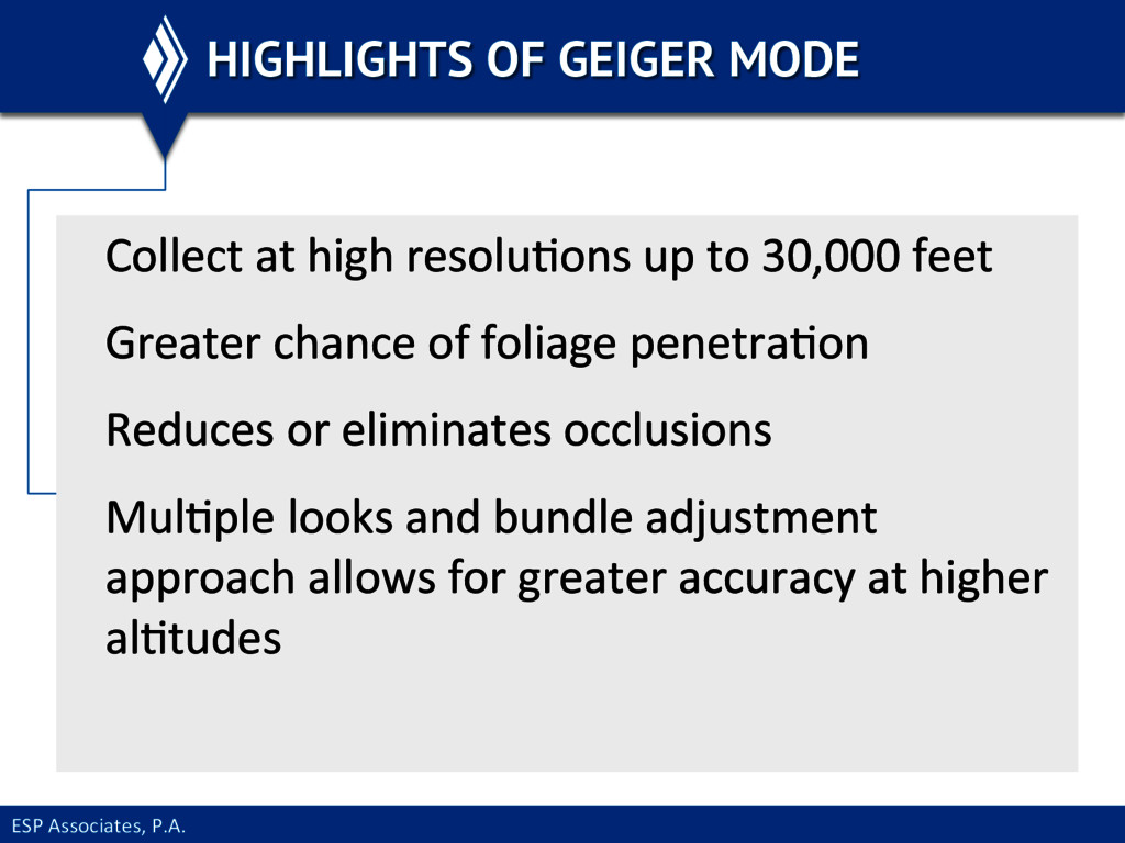
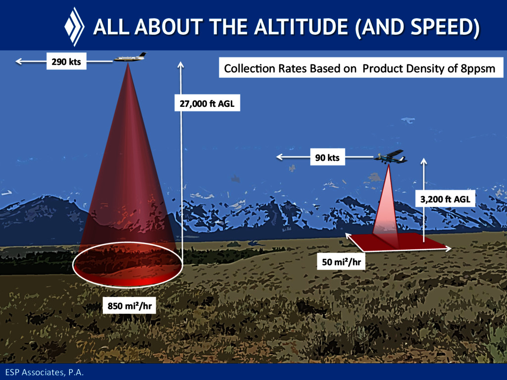
     high  resoluEons  up  to  30,000  feet   Greater  chance  of  foliage  penetraEon   Reduces  or  eliminates  occlusions   MulEple  looks  and  bundle  adjustment   approach  allows  for  greater  accuracy  at  higher   alEtudes    
  8. ESP  Associates,  P.A.   ALL ABOUT THE ALTITUDE For  any

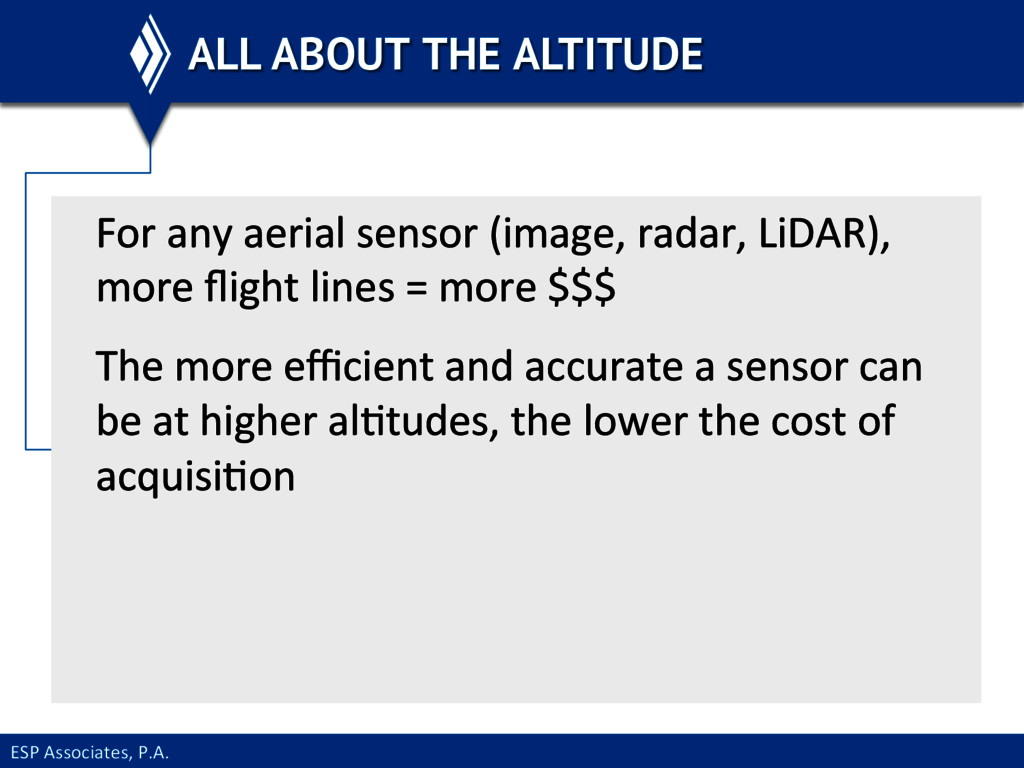
     aerial  sensor  (image,  radar,  LiDAR),   more  flight  lines  =  more  $$$   The  more  efficient  and  accurate  a  sensor  can   be  at  higher  alEtudes,  the  lower  the  cost  of   acquisiEon  
  9. ESP  Associates,  P.A.   ALL ABOUT THE ALTITUDE (AND SPEED)

    50  mi²/hr   90  kts   3,200  S  AGL   850  mi²/hr   27,000  S  AGL   290  kts   CollecEon  Rates  Based  on    Product  Density  of  8ppsm  
  10. ESP  Associates,  P.A.   NC PILOT PROJECT It  is  not

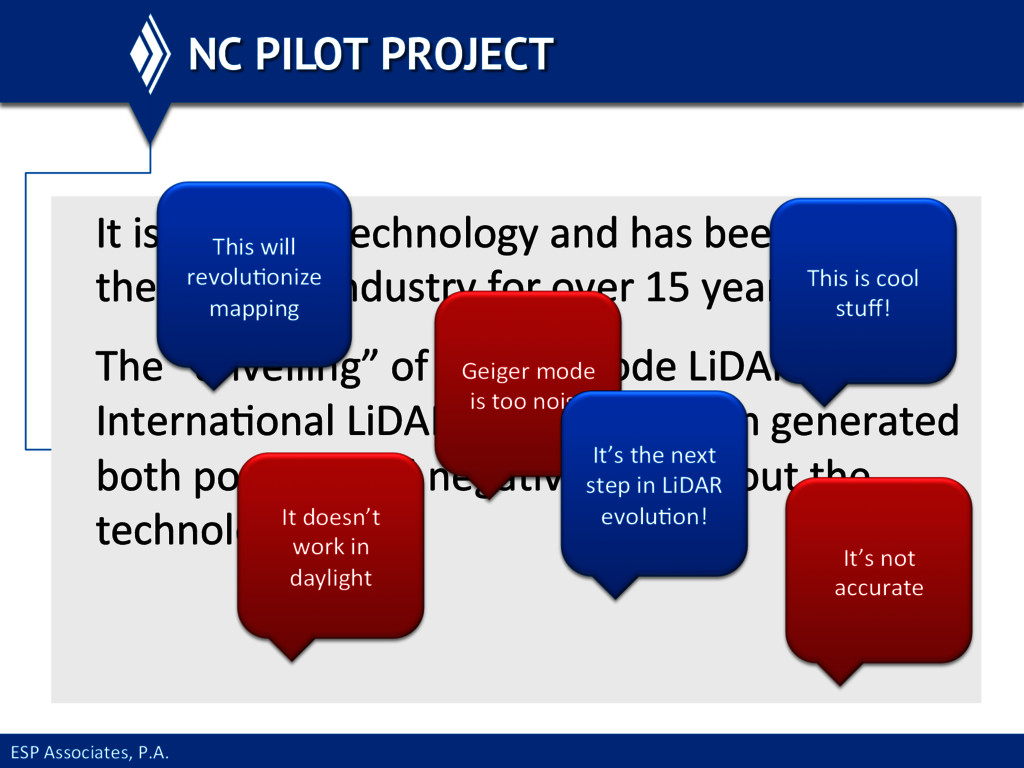
     new  technology  and  has  been  used  in   the  defense  industry  for  over  15  years   The  “unveiling”  of  Geiger  mode  LiDAR  at  the   InternaEonal  LiDAR  Mapping  Forum  generated   both  posiEve  and  negaEve  buzz  about  the   technology   This  will   revoluEonize   mapping   This  is  cool   stuff!   It’s  not   accurate   Geiger  mode   is  too  noisy   It  doesn’t   work  in   daylight   It’s  the  next   step  in  LiDAR   evoluEon!  
  11. ESP  Associates,  P.A.   NC PILOT PROJECT To  see  if

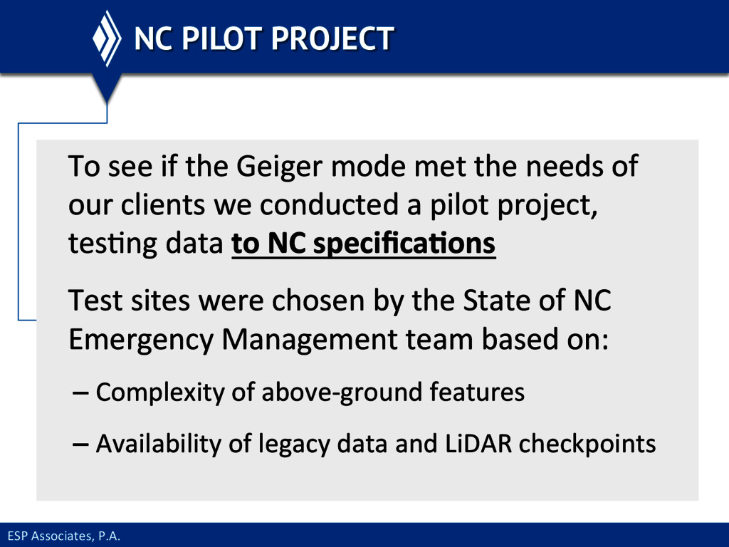
     the  Geiger  mode  met  the  needs  of   our  clients  we  conducted  a  pilot  project,   tesEng  data  to  NC  specifica@ons   Test  sites  were  chosen  by  the  State  of  NC   Emergency  Management  team  based  on:   – Complexity  of  above-­‐ground  features   – Availability  of  legacy  data  and  LiDAR  checkpoints  
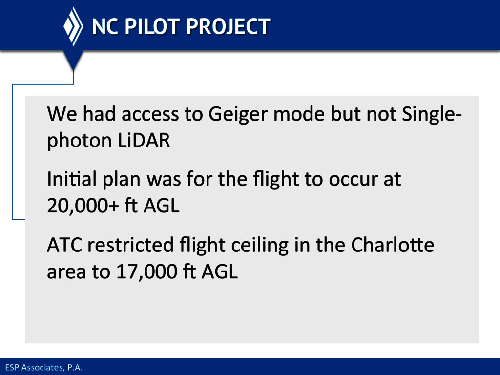
  12. ESP  Associates,  P.A.   NC PILOT PROJECT We  had  access

     to  Geiger  mode  but  not  Single-­‐ photon  LiDAR   IniEal  plan  was  for  the  flight  to  occur  at   20,000+  l  AGL   ATC  restricted  flight  ceiling  in  the  CharloWe   area  to  17,000  l  AGL  
  13. ESP  Associates,  P.A.   NC PILOT PROJECT All  Eles  were

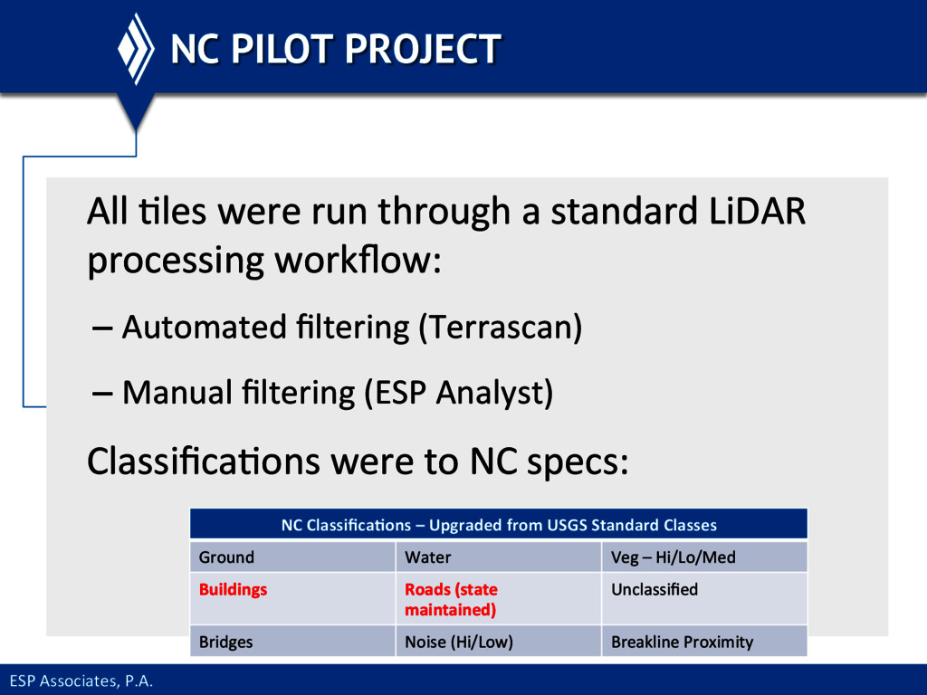
     run  through  a  standard  LiDAR   processing  workflow:   – Automated  filtering  (Terrascan)   – Manual  filtering  (ESP  Analyst)   ClassificaEons  were  to  NC  specs:   NC  Classifica@ons  –  Upgraded  from  USGS  Standard  Classes   Ground   Water   Veg  –  Hi/Lo/Med   Buildings   Roads  (state   maintained)   Unclassified   Bridges   Noise  (Hi/Low)   Breakline  Proximity  
  14. ESP  Associates,  P.A.   TEST DATA - VERTICAL ACCURACY Two

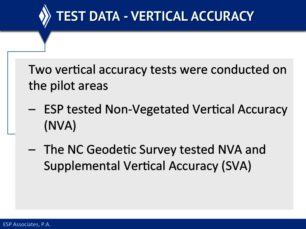
     verEcal  accuracy  tests  were  conducted  on   the  pilot  areas   –  ESP  tested  Non-­‐Vegetated  VerEcal  Accuracy   (NVA)   –  The  NC  GeodeEc  Survey  tested  NVA  and   Supplemental  VerEcal  Accuracy  (SVA)    
  15. ESP  Associates,  P.A.   TEST DATA - VERTICAL ACCURACY  

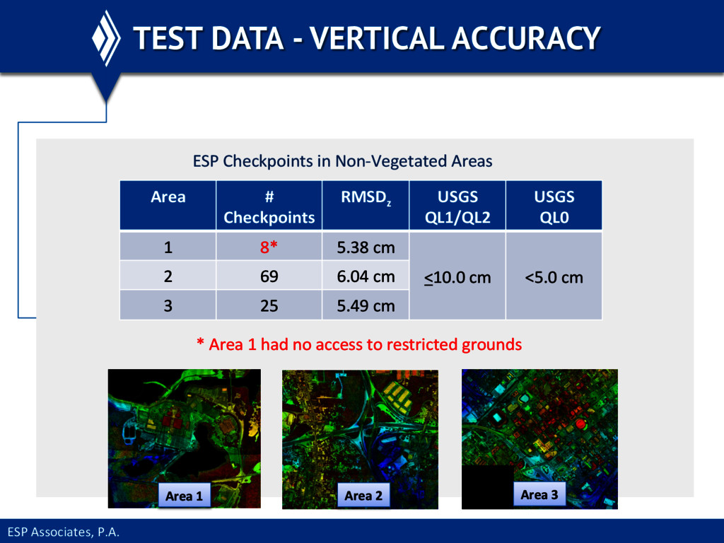
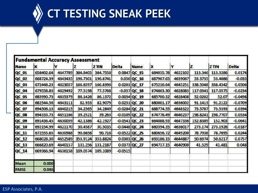
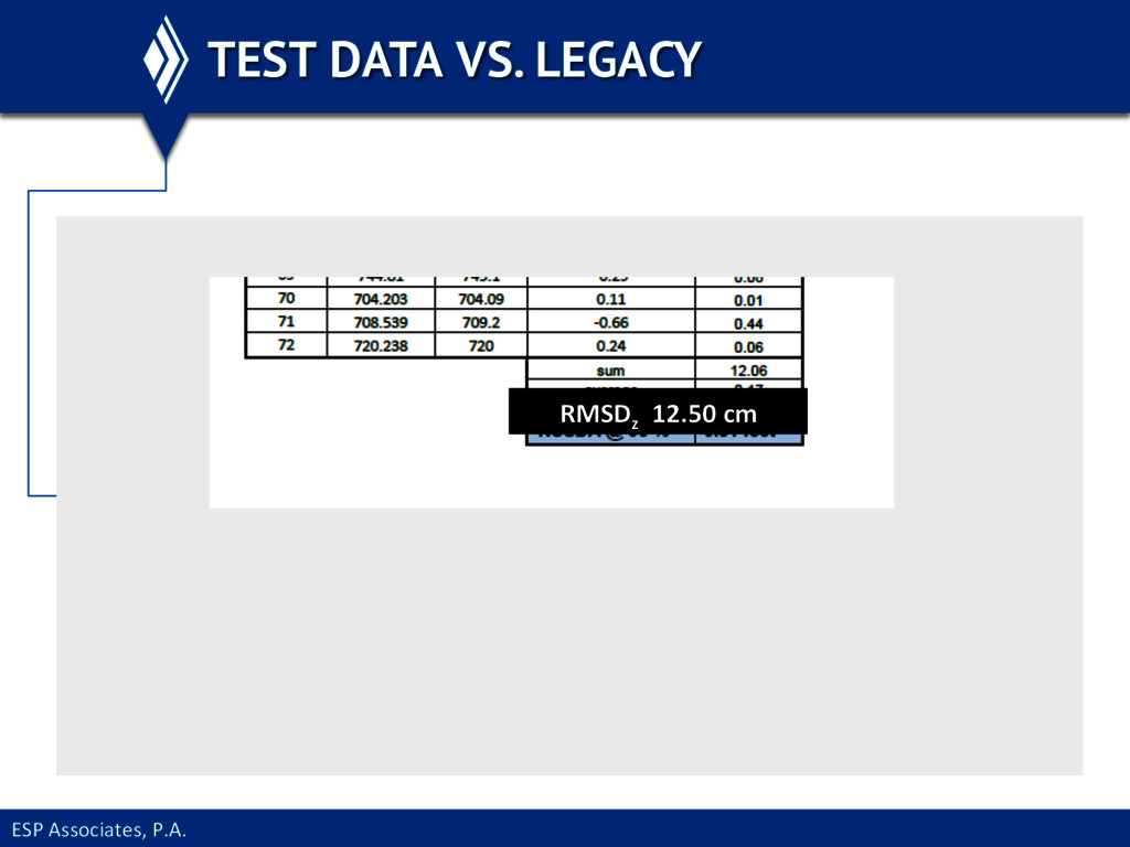
      Area   #   Checkpoints   RMSDz   USGS     QL1/QL2   USGS     QL0   1   8*   5.38  cm   <10.0  cm   <5.0  cm   2   69   6.04  cm   3   25   5.49  cm   *  Area  1  had  no  access  to  restricted  grounds   ESP  Checkpoints  in  Non-­‐Vegetated  Areas   Area  1   Area  2   Area  3  
  16. ESP  Associates,  P.A.   TEST DATA - VERTICAL ACCURACY The

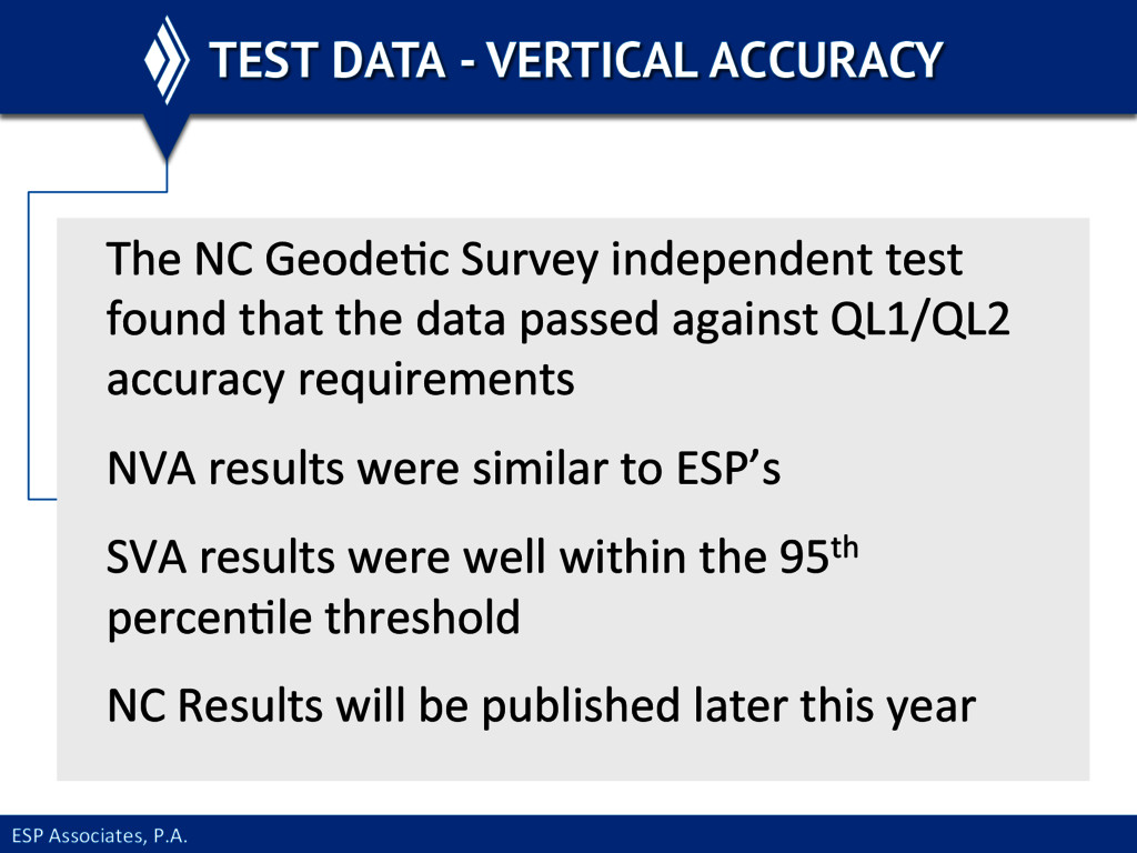
     NC  GeodeEc  Survey  independent  test   found  that  the  data  passed  against  QL1/QL2   accuracy  requirements   NVA  results  were  similar  to  ESP’s   SVA  results  were  well  within  the  95th   percenEle  threshold   NC  Results  will  be  published  later  this  year  
  17. ESP  Associates,  P.A.   CT TESTING SNEAK PEEK Test  flights

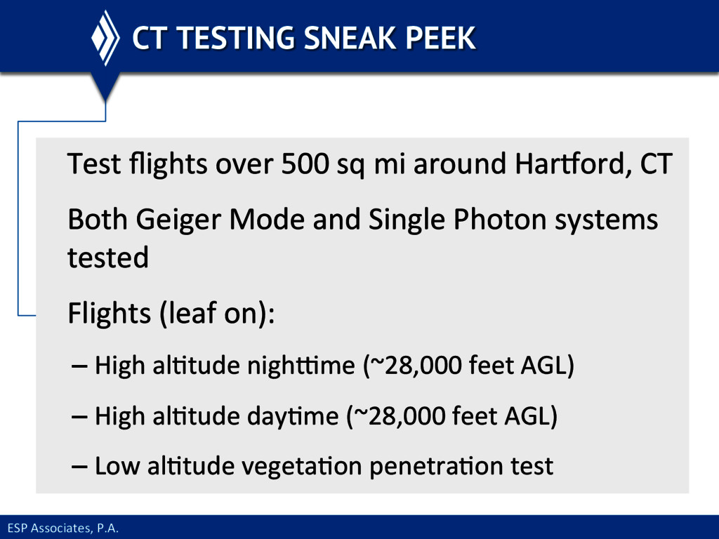
     over  500  sq  mi  around  Haruord,  CT   Both  Geiger  Mode  and  Single  Photon  systems   tested   Flights  (leaf  on):   – High  alEtude  nighvme  (~28,000  feet  AGL)   – High  alEtude  dayEme  (~28,000  feet  AGL)   – Low  alEtude  vegetaEon  penetraEon  test  
  18. ESP  Associates,  P.A.   TEST DATA – X & Y

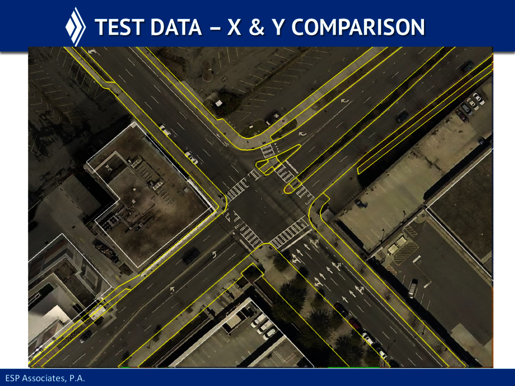
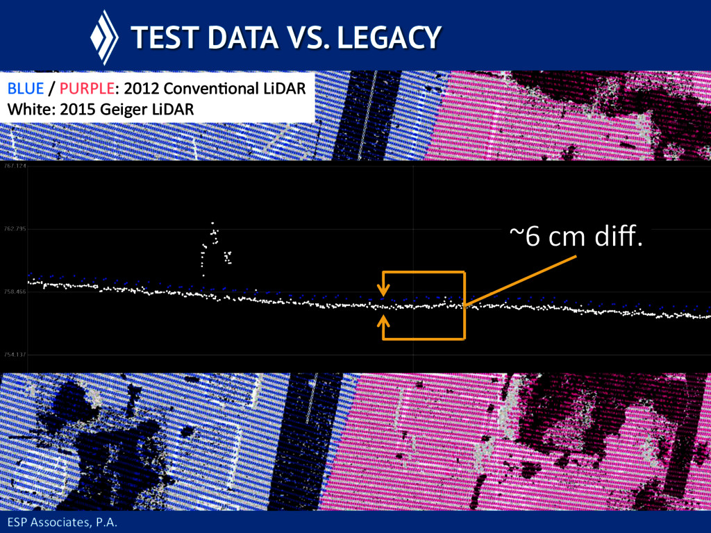
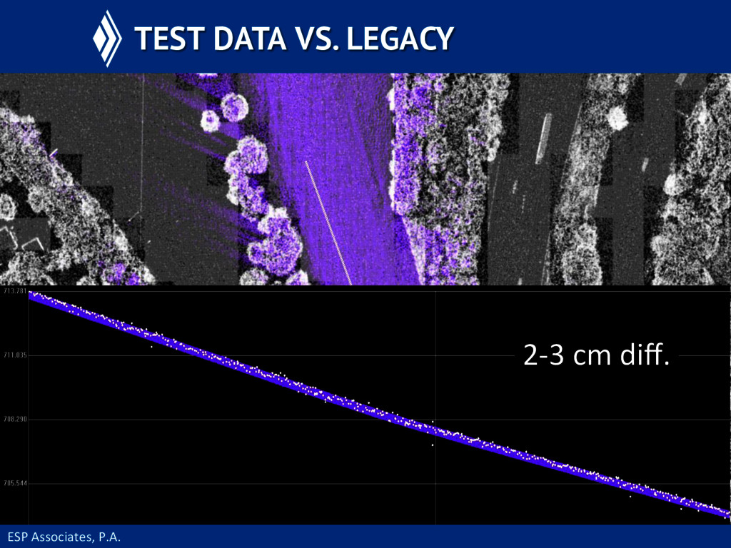
    COMPARISON To  ensure  the  data  were  in  the  correct  x,y   posiEon  ancillary  sources  were  used:   – Current,  2015  orthophotos   – Ground-­‐level  line  work  from  county  such  as  road   edges  or  impervious  surface  polygons   Legacy  elevaEon  data  
  19. ESP  Associates,  P.A.   TEST DATA VS. LEGACY BLUE  /

     PURPLE:  2012  ConvenEonal  LiDAR   White:  2015  Geiger  LiDAR   ~6  cm  diff.  
  20. ESP  Associates,  P.A.   EARLY DATA - NOISE Early  data

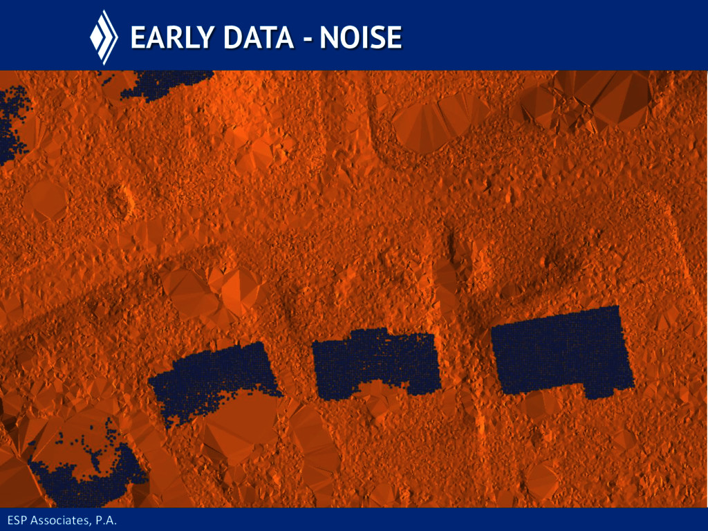
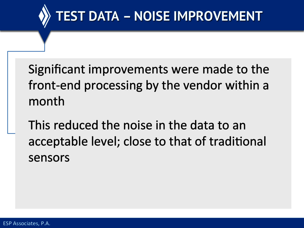
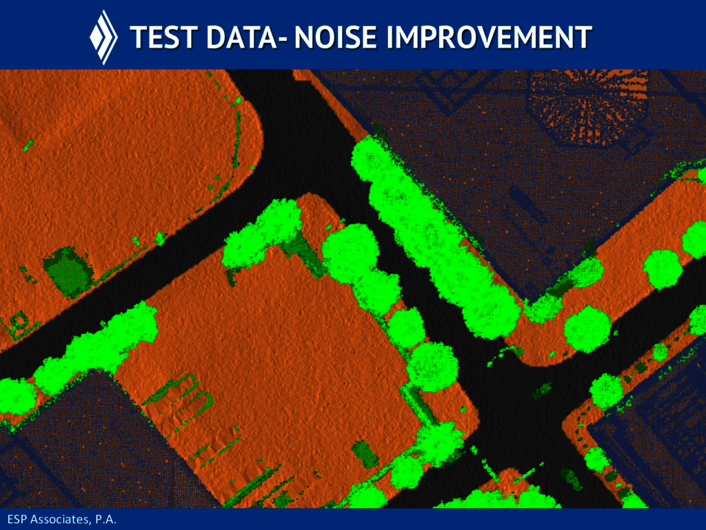
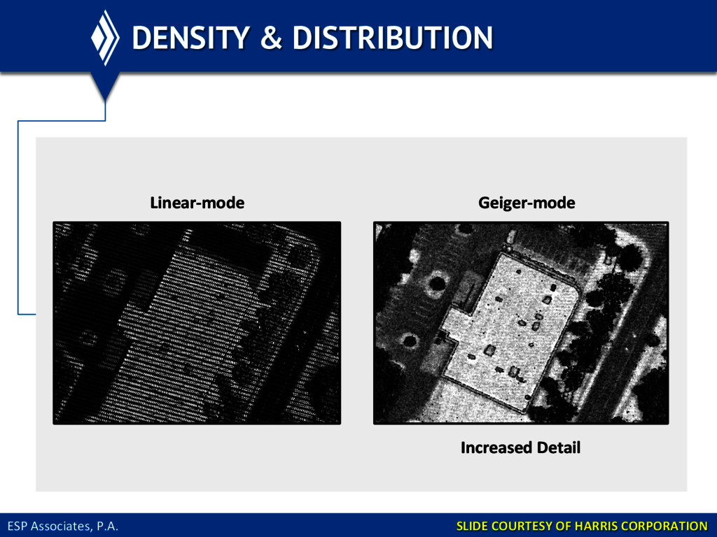
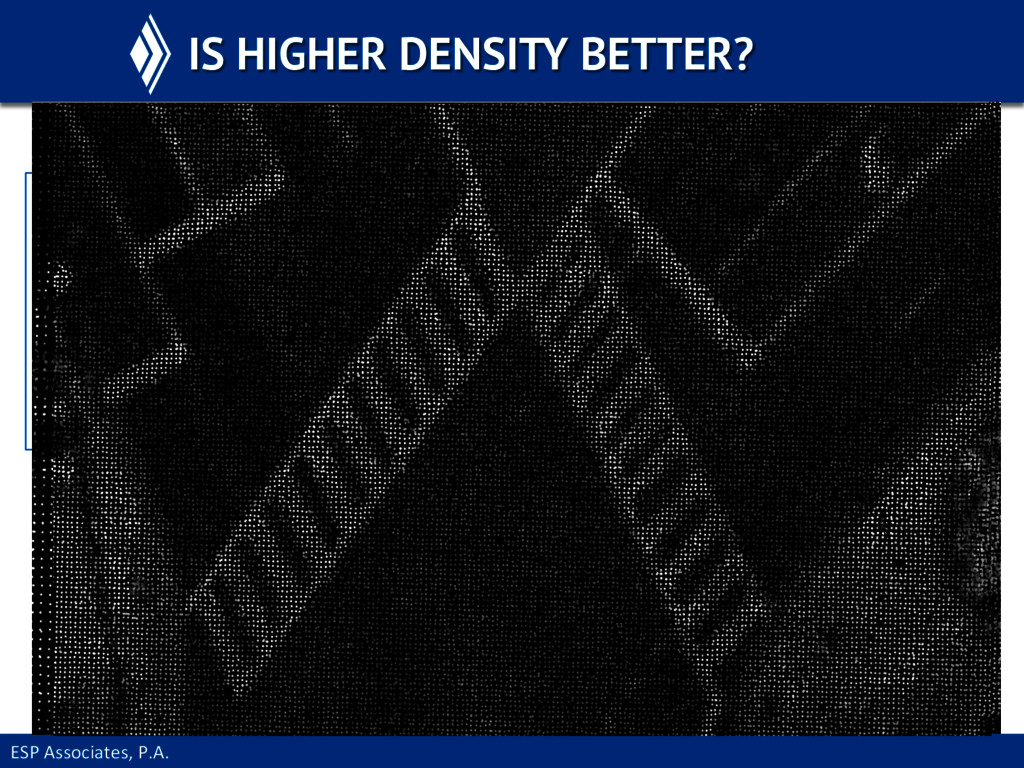
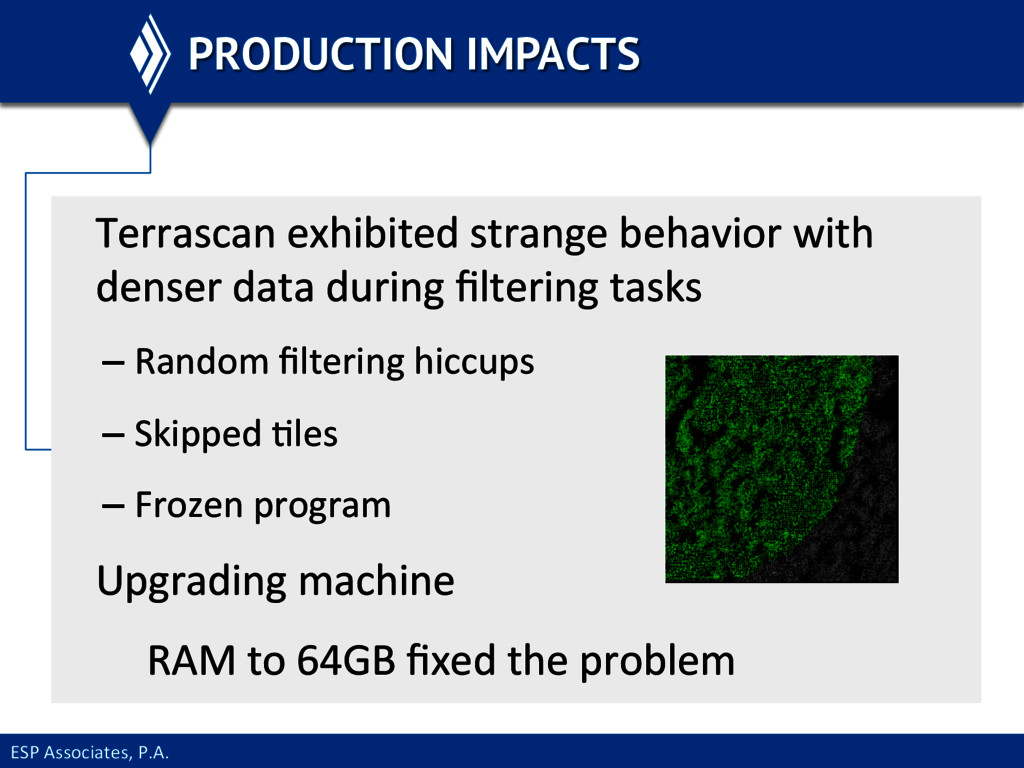
     from  the  system  during   development  contained  more  noise  than   acceptable   Raw  data  processing  steps  were  sEll  being   finalized   This  significantly  impacted  manual  processing   to  clean  out  noise    
  21. ESP  Associates,  P.A.   TEST DATA – NOISE IMPROVEMENT Significant

     improvements  were  made  to  the   front-­‐end  processing  by  the  vendor  within  a   month   This  reduced  the  noise  in  the  data  to  an   acceptable  level;  close  to  that  of  tradiEonal   sensors      
  22. ESP  Associates,  P.A.   DENSITY & DISTRIBUTION     Linear-­‐mode

      Geiger-­‐mode   Increased  Detail   SLIDE  COURTESY  OF  HARRIS  CORPORATION  
  23. ESP  Associates,  P.A.   IS HIGHER DENSITY BETTER? •  40-­‐60

     ppsm  used  for  experimentaEon  and  8   ppsm  used  for  tesEng  to  current  specs  
  24. ESP  Associates,  P.A.   Can  you  expect  data  overload?  

        Well…yes  and  no   Your  IT   Infrastructure   The  petabytes     of  raw  Geiger   flights  you   wanted  to  store   CONSUME MASS QUANTITIES (OF POINTS)
  25. ESP  Associates,  P.A.   CONSUME MASS QUANTITIES (OF POINTS) BoWom

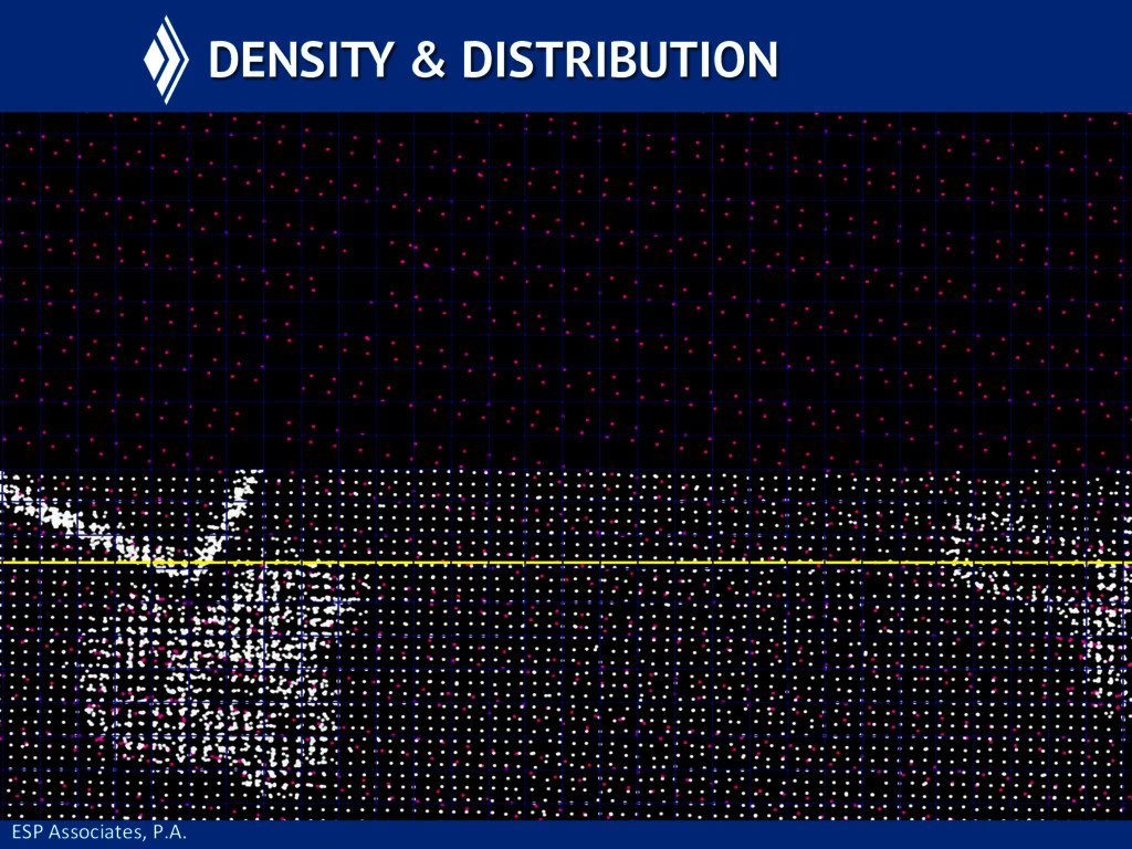
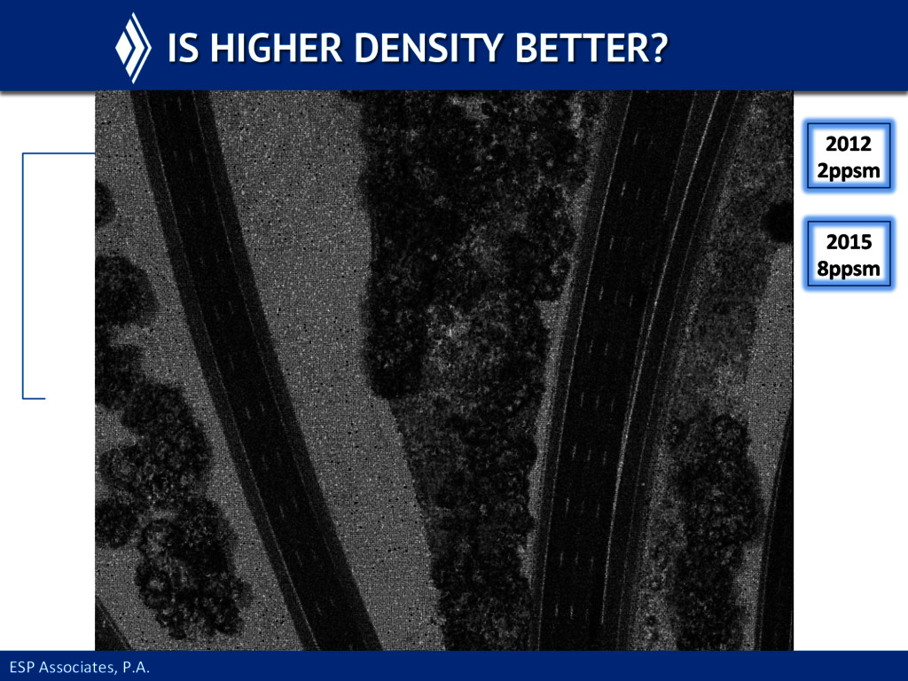
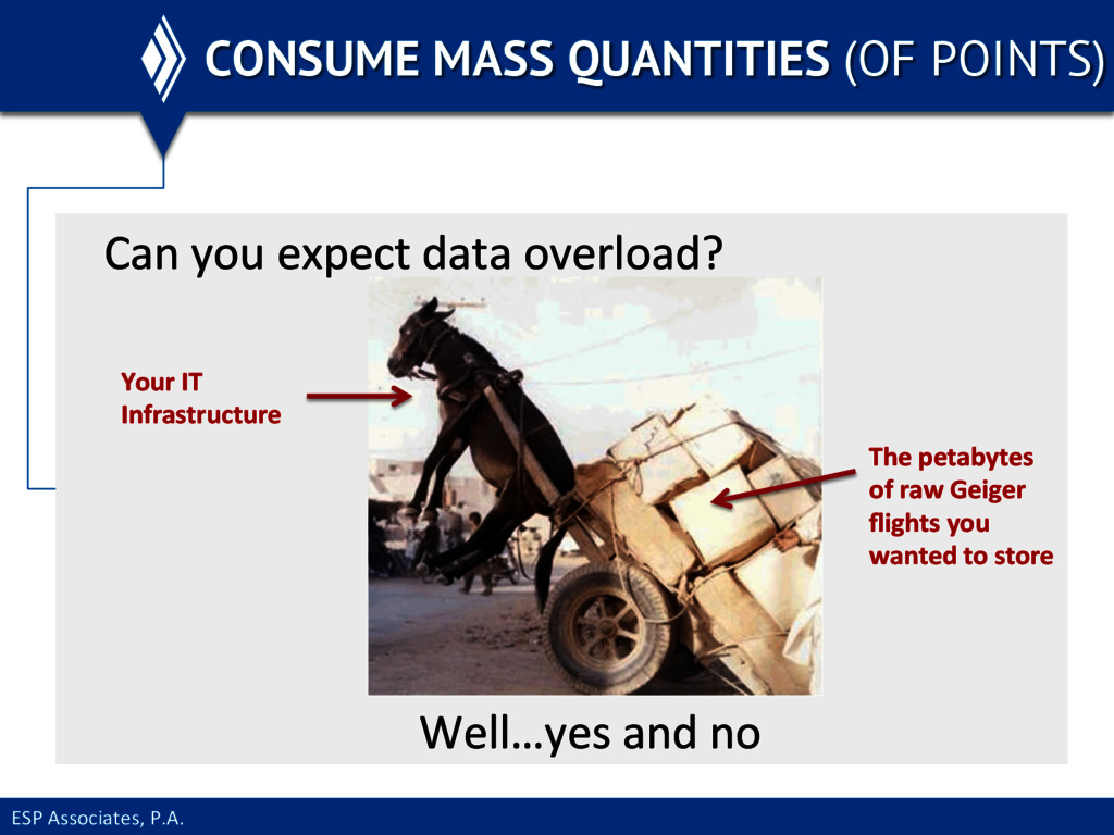
     line  –  if  you  ask  for  denser  data  from   Geiger  or  linear  LiDAR  be  prepared  to  increase   storage  requirements   Geiger  raw  data  should  only  be   stored  by  the  vendor  
  26. ESP  Associates,  P.A.   PRODUCTION IMPACTS Terrascan  exhibited  strange  behavior

     with   denser  data  during  filtering  tasks   – Random  filtering  hiccups   – Skipped  Eles   – Frozen  program   Upgrading  machine              RAM  to  64GB  fixed  the  problem  
  27. ESP  Associates,  P.A.   PRODUCTION IMPACTS •  No  change  in

     ability  to  produce  products  once   RAM  was  upgraded  on  producEon  machines   •  Human  interpretaEon  of  the  data  was  greatly   enhanced  
  28. ESP  Associates,  P.A.   BENEFITS OF GREATER DENSITY Water  bodies

     were  easier  to  delineate  with  the   improved  definiEon  
  29. ESP  Associates,  P.A.   BENEFITS OF GREATER DENSITY DifferenEaEng  between

     building  and  adjoining   vegetaEon  was  easier  (if  greater  building  class   detail  needed)  
  30. ESP  Associates,  P.A.   WHAT ABOUT THE USGS SPEC? Parts

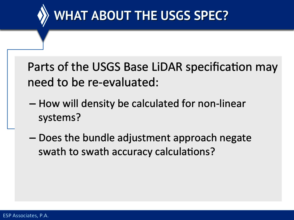
     of  the  USGS  Base  LiDAR  specificaEon  may   need  to  be  re-­‐evaluated:   – How  will  density  be  calculated  for  non-­‐linear   systems?   – Does  the  bundle  adjustment  approach  negate   swath  to  swath  accuracy  calculaEons?  
  31. ESP  Associates,  P.A.   FOOD FOR THOUGHT Should  specificaEons  drive

     advancement?   Or  should  specificaEons  be  adapted  to   every-­‐changing  technology  that  enables   us  to  provide  a  beWer  product  efficiently?  
  32. ESP  Associates,  P.A.   THE GIFT THAT KEEPS ON GIVING

    3DEP  Products   Transporta@on   GIS  Updates   Vegeta@on   Power   Fly  once…   Multiple Applications Assets