Upgrade to Pro — share decks privately, control downloads, hide ads and more …

REIMAGINING LAND MANAGEMENT ASSISTANCE IN TEXAS

REIMAGINING LAND MANAGEMENT ASSISTANCE IN TEXAS

More Decks by Texas Natural Resources Information System

Other Decks in Technology

Transcript

  1. Today’s Discussion 1. What is MLDP, how does it fit

    TPWD’s mission? 2. What is the problem being addressed? 3. Recognizing an opportunity 4. The data 5. The solution 6. Results Hint, it involves GIS:
  2. TPWD’s Mission To manage and conserve the natural and cultural

    resources of Texas and to provide hunting, fishing and outdoor recreation opportunities for the use and enjoyment of present and future generations.
  3. What is MLDP? • Texas is approximately 95% privately owned,

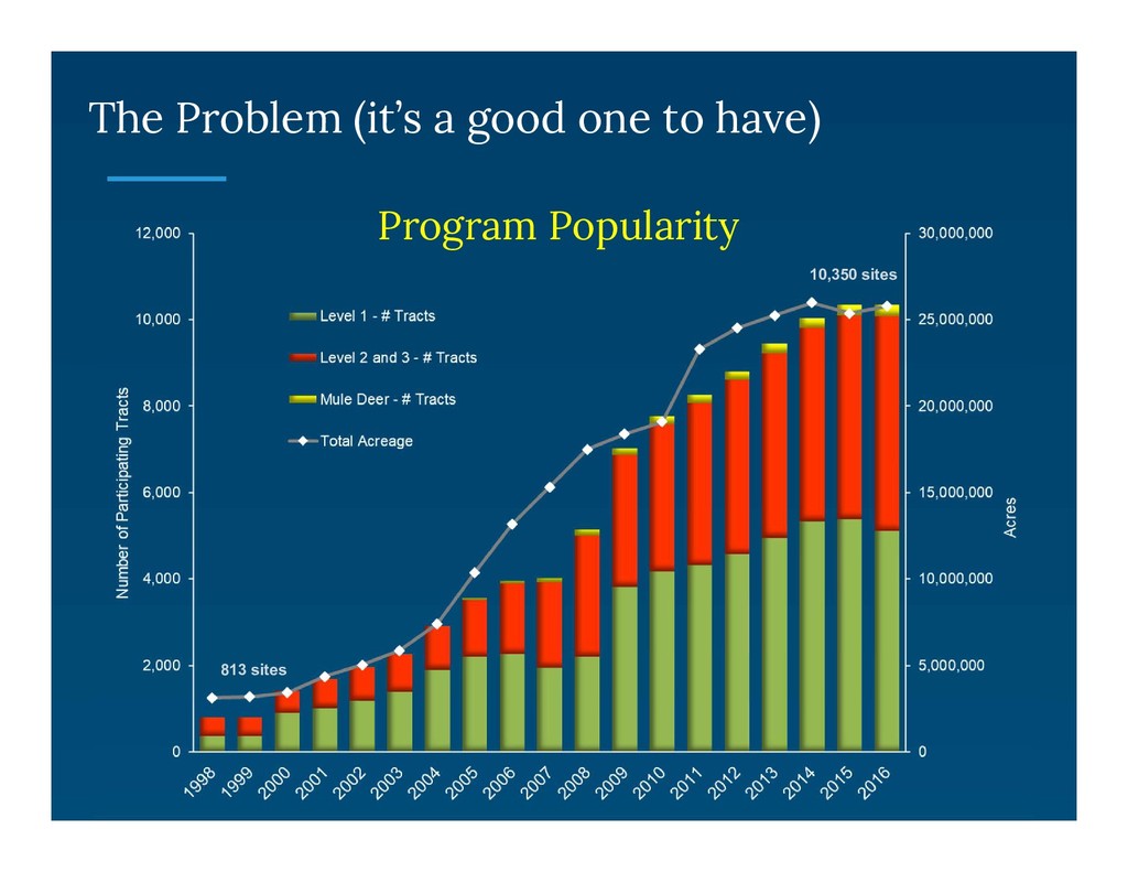
    so…. • The Managed Lands Deer Program (MLDP) is designed to foster and support sound management and stewardship of native wildlife and wildlife habitats on private lands in Texas.
  4. What is MLDP? • Deer harvest is an important aspect

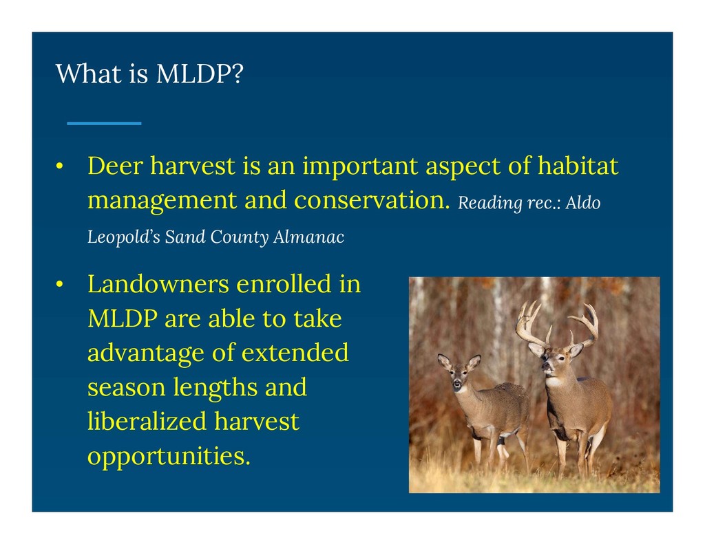
    of habitat management and conservation. Reading rec.: Aldo Leopold’s Sand County Almanac • Landowners enrolled in MLDP are able to take advantage of extended season lengths and liberalized harvest opportunities.
  5. Recognizing an Opportunity • MLDP was managed through the Texas

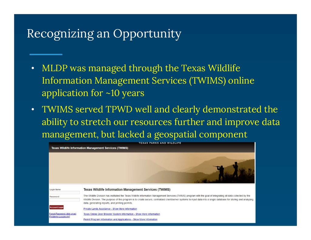
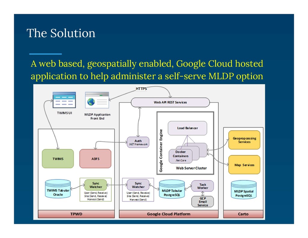
    Wildlife Information Management Services (TWIMS) online application for ~10 years • TWIMS served TPWD well and clearly demonstrated the ability to stretch our resources further and improve data management, but lacked a geospatial component
  6. Recognizing an Opportunity • Staff recognized a potential opportunity to

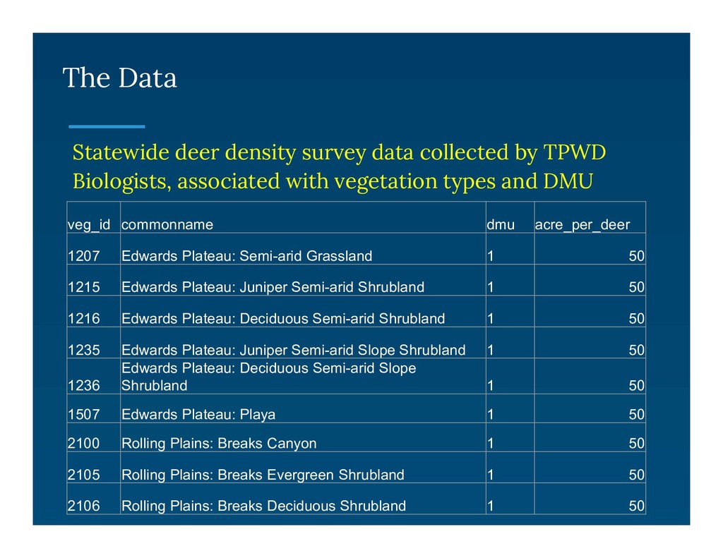
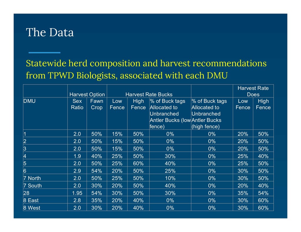
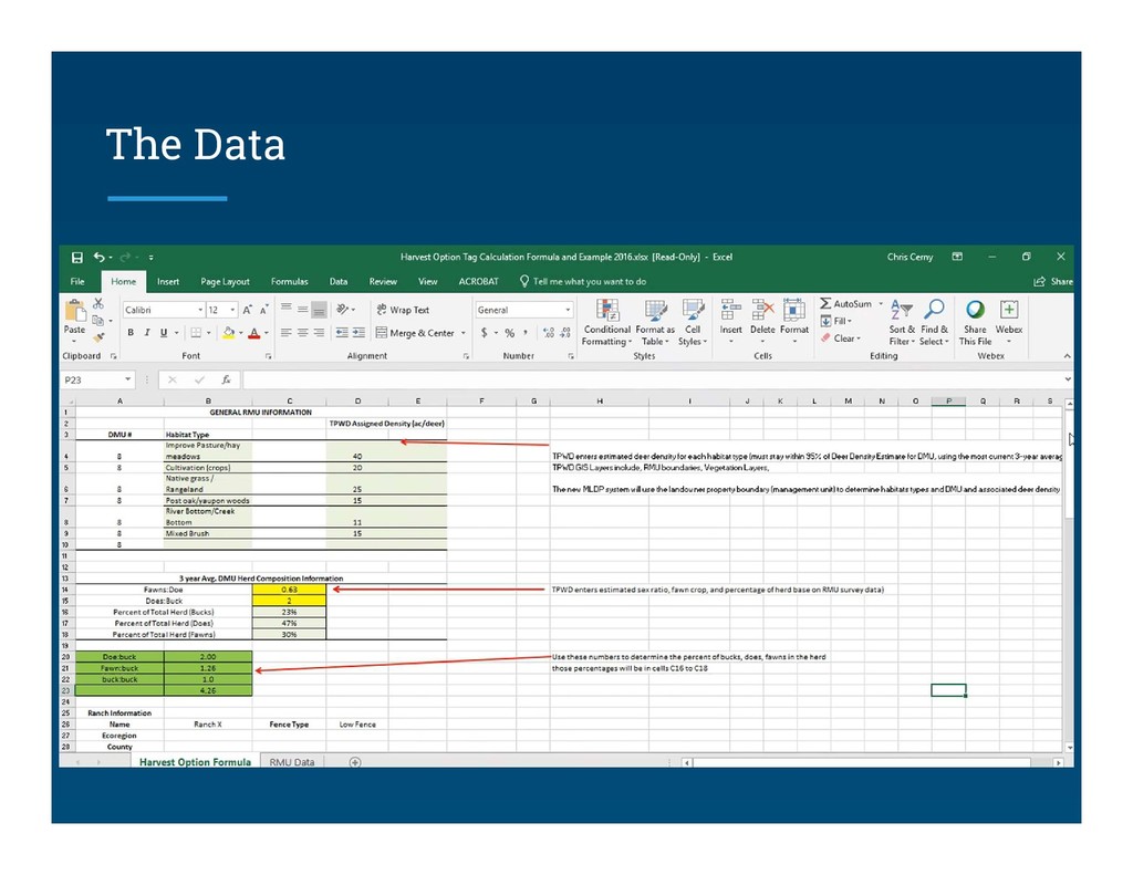
    produce automated harvest recommendations, which could lead to a ‘do-it-yourself’ tag issuance option • Two independent datasets were available, which together could be used to determine an estimated population of deer on a given property • With the development a third dataset, a harvest recommendation could be generated
  7. The Data A superb statewide vegetation dataset (check out the

    Texas Ecosystem Analytical Mapper): https://tpwd.texas.gov/gis/team/
  8. The Data Statewide deer density survey data collected by TPWD

    Biologists, associated with vegetation types and DMU veg_id commonname dmu acre_per_deer 1207 Edwards Plateau: Semi-arid Grassland 1 50 1215 Edwards Plateau: Juniper Semi-arid Shrubland 1 50 1216 Edwards Plateau: Deciduous Semi-arid Shrubland 1 50 1235 Edwards Plateau: Juniper Semi-arid Slope Shrubland 1 50 1236 Edwards Plateau: Deciduous Semi-arid Slope Shrubland 1 50 1507 Edwards Plateau: Playa 1 50 2100 Rolling Plains: Breaks Canyon 1 50 2105 Rolling Plains: Breaks Evergreen Shrubland 1 50 2106 Rolling Plains: Breaks Deciduous Shrubland 1 50
  9. The Data Statewide herd composition and harvest recommendations from TPWD

    Biologists, associated with each DMU Harvest Option Harvest Rate Bucks Harvest Rate Does DMU Sex Ratio Fawn Crop Low Fence High Fence % of Buck tags Allocated to Unbranched Antler Bucks (low fence) % of Buck tags Allocated to Unbranched Antler Bucks (high fence) Low Fence High Fence 1 2.0 50% 15% 50% 0% 0% 20% 50% 2 2.0 50% 15% 50% 0% 0% 20% 50% 3 2.0 50% 15% 50% 0% 0% 20% 50% 4 1.9 40% 25% 50% 30% 0% 25% 40% 5 2.0 50% 25% 60% 40% 0% 25% 50% 6 2.9 54% 20% 50% 25% 0% 30% 50% 7 North 2.0 50% 25% 50% 10% 0% 30% 50% 7 South 2.0 30% 20% 50% 40% 0% 20% 40% 28 1.95 54% 30% 50% 30% 0% 35% 54% 8 East 2.8 35% 20% 40% 0% 0% 30% 60% 8 West 2.0 30% 20% 40% 0% 0% 30% 60%
  10. What - • Servers, Databases & Storage • Email Services

    • Authentication & Sync Services Why – • Enterprise speed, scale and security • Increased Uptime • Low cost What - • Spatial Data – Property boundaries & Vegetation Layer • Deer Density and Harvest Rate Tables Why – • PostGIS processing, Location queries in SQL What - • Map & Drawing Controls Why – • Open Source • Mobile Friendly • Well Documented API
  11. The Solution A web based, geospatially enabled, Google Cloud hosted

    application to help administer a self-serve MLDP option
  12. The Solution: Mapping Properties Sites can be mapped using web-based

    drawing tools: • Leaflet drawing tools + Turf.js enable on-the-fly topology • Draw external fence-lines and clip adjacent polygons
  13. The Solution: Automated Tag Estimates Calculates tags by connecting DMU

    data to site location Rate Data Deer Density and Harvest Rate Data Site Map Veg Layer
  14. The Solution: Keeping Data Current Annual data updates and maintenance:

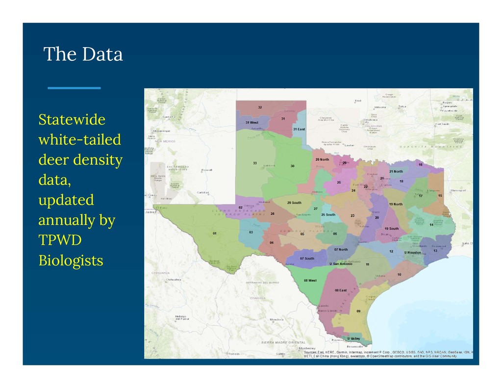
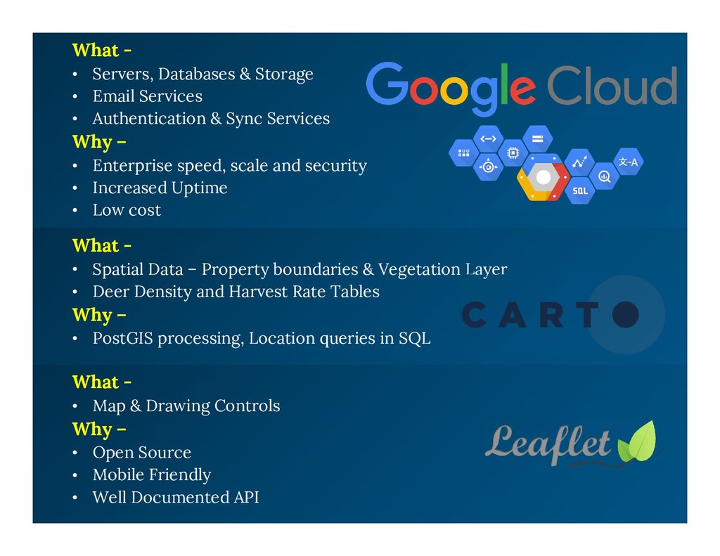
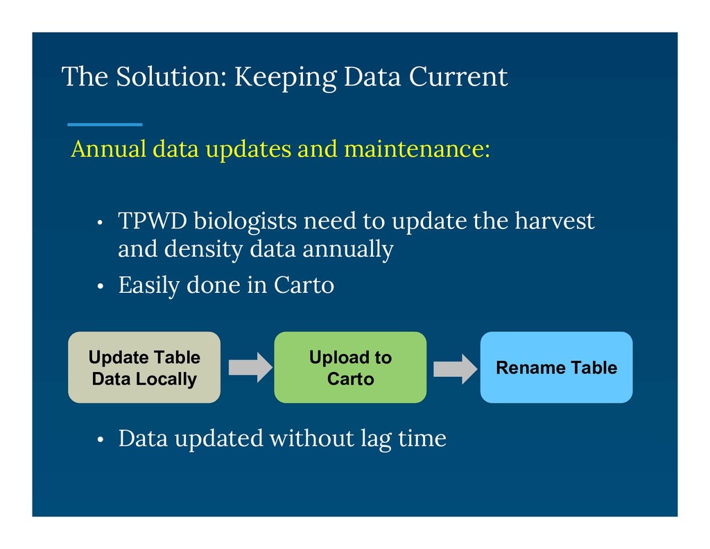
    • TPWD biologists need to update the harvest and density data annually • Easily done in Carto • Data updated without lag time Upload to Carto Rename Table Update Table Data Locally
  15. The Solution The Land Management Assistance (LMA) application went live

    summer 2017 and is now in its 2nd hunting season
  16. Thank you to the many folks who have contributed to

    this project, especially: Alan Cain Cristy Burch Amie Treuer-Kuehn Mike Sawyer TPWD Wildlife Biologists Statewide