Upgrade to Pro — share decks privately, control downloads, hide ads and more …

The Texas Geographic Information Landscape - 2016 Geographic Information Officer Report

The Texas Geographic Information Landscape - 2016 Geographic Information Officer Report

More Decks by Texas Natural Resources Information System

Other Decks in Technology

Transcript

  1. ~ 1 ~ Contents Executive Summary Purpose Vision Background Accomplishments

    Statewide Collaboration Operational Efficiency Technology Transfer Cross-Agency Collaboration Needs & Recommendations Data Acquisition Data Sharing Data Access 9-1-1 Emergency Communications Data Land Parcel Data Moving Forward Appendices Appendix A: Acronyms Used in this Report Appendix B: Texas Water Code, Sec. 16.021 Appendix C: Major Agency Business Functions Using GIS Technology Appendix D: Resources Appendix E: Acknowledgments 2 4 4 5 6 6 8 10 11 13 15 17 19 21 23 25 27 27 28 30 32 34
  2. ~ 2 ~ Executive Summary In 2011, the 82nd Texas

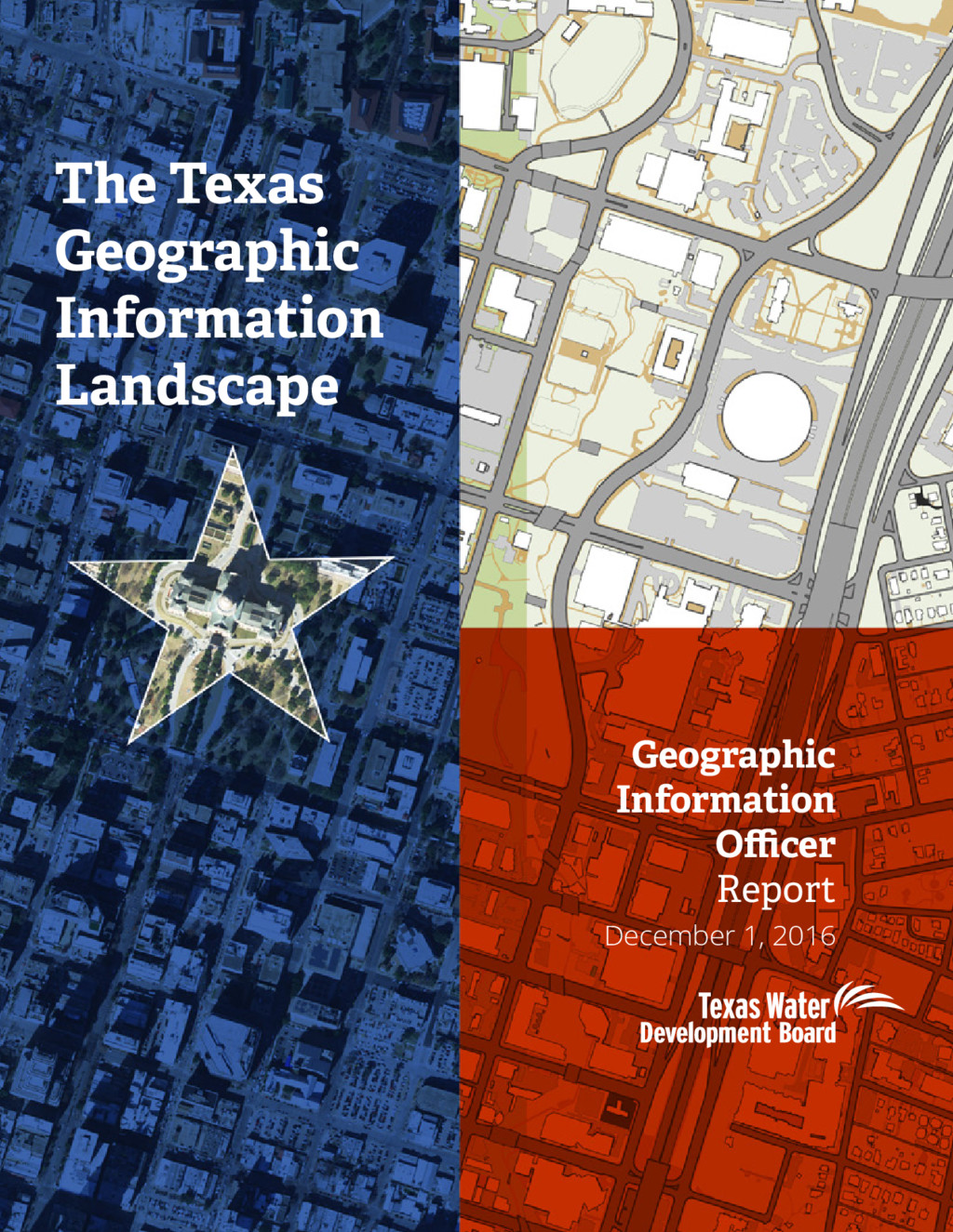
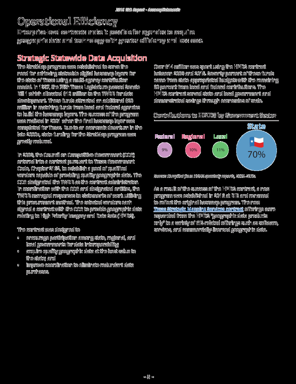
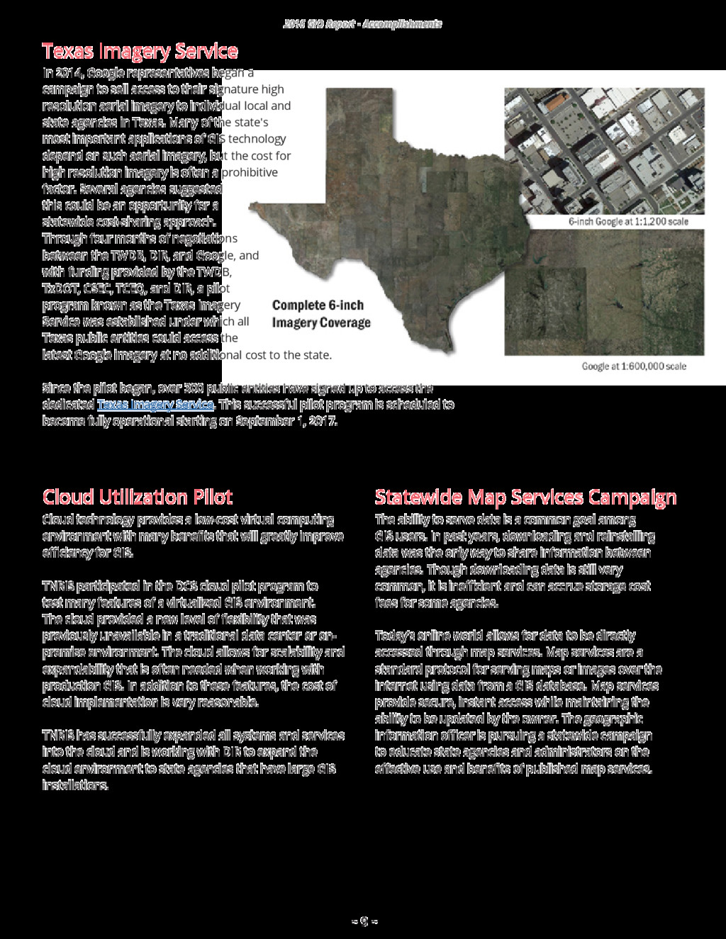
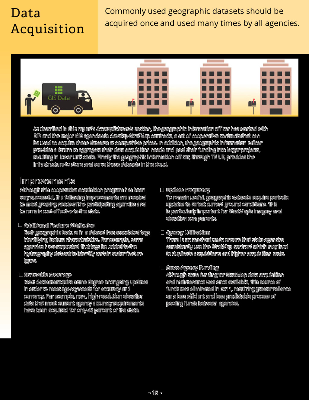
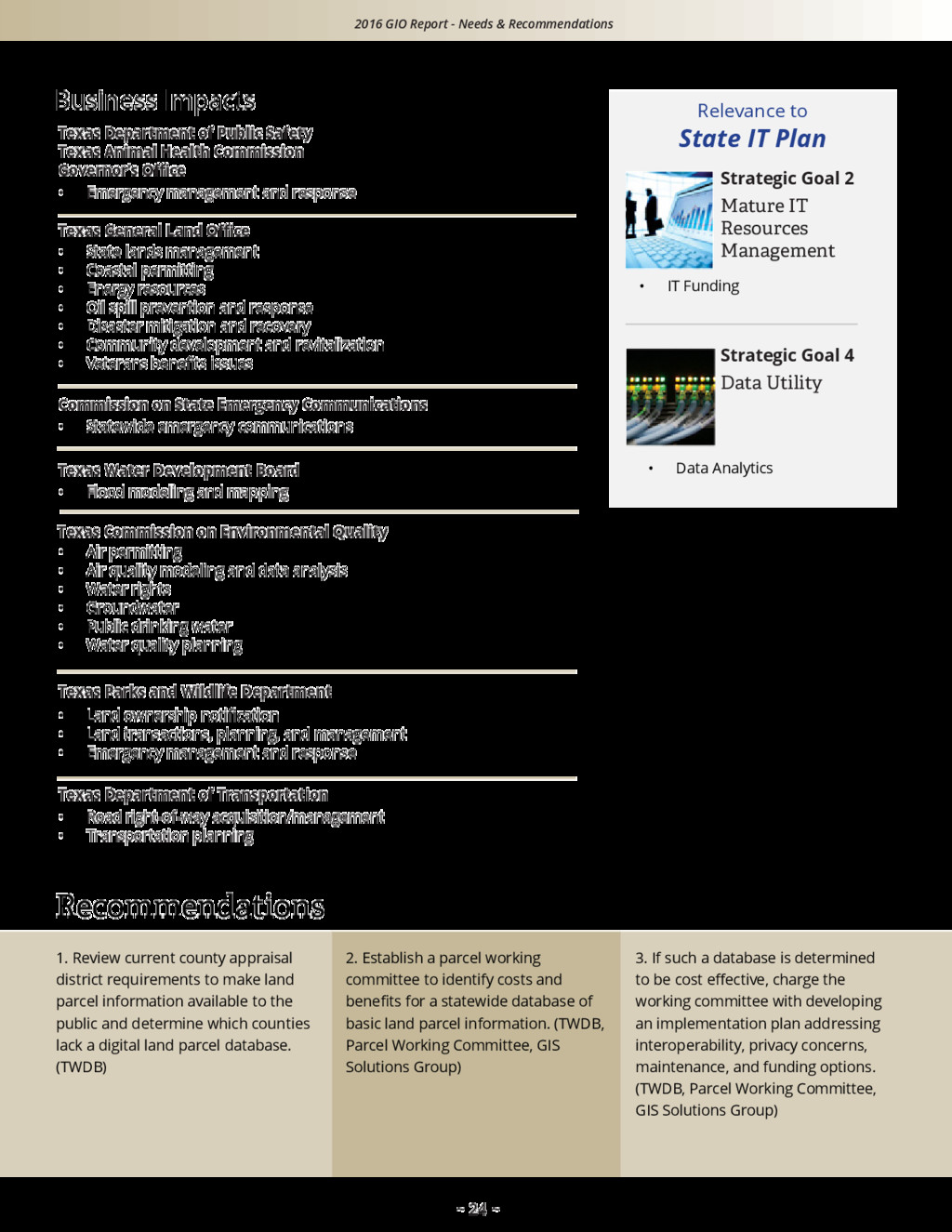
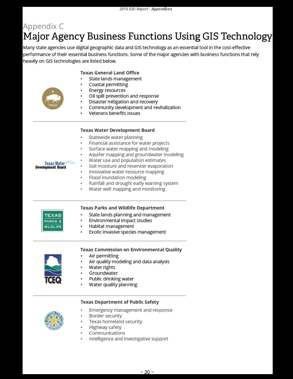
    Legislature amended the Texas Water Code (Sec. 16.021(c),(d)) to create a state geographic information officer position within the Texas Water Development Board (TWDB) and charged it with improving state government operations through coordinated acquisition, use, and dissemination of authoritative statewide digital geographic datasets. This document fulfills the requirement to report to the governor, lieutenant governor, and speaker of the house on the status of these coordination efforts and recommendations that could lead to further operational improvements and funding needs. Digital geographic datasets are a central component of Geographic Information Systems (GIS) technology, which is increasingly used by state agencies to more effectively carry out their missions. GIS supports a wide range of government activities including transportation, flood mapping, water resources, state lands management, industrial permitting, public safety, and emergency management. In response to the legislation, the TWDB designated the director of its division, the Texas Natural Resources Information System (TNRIS), to serve as the geographic information officer for Texas. Activities within TNRIS, already directed toward statewide geographic data coordination, were further focused and increased in response to the legislature’s specific charges. Recognizing that strong interagency collaboration would be needed to accomplish these charges, the geographic information officer created a GIS Community Group to facilitate informal information sharing and a smaller, governance-based GIS Solutions Group to assist in planning and decision-making. Through these groups, state agencies continue to expand a long tradition of working together to jointly achieve many of their overlapping GIS technology needs. The geographic information officer has partnered closely with the Texas Department of Information Resources (DIR) to ensure that the state’s GIS technology plans and policies align with the state’s overall information technology plans and policies. In addition, leveraging of DIR’s information technology contracting and data center services programs has enabled the geographic information officer to make significant progress on some of its objectives. Several major accomplishments of the geographic information officer and partnering agencies are summarized below. Strategic Statewide Data Acquisition Selected vendors that provide geographic datasets and GIS services have been pre-approved in DIR's cooperative contracts program. As a result, state agencies that use these contracts acquire quality data and services at lower prices with less procurement complexity. In addition, data purchased through these contracts are available to other agencies and the public at no additional charge. Texas Imagery Service In 2015, TWDB, DIR, Texas Commission on Environmental Quality (TCEQ), Texas Department of Transportation (TxDOT), and Commission on State Emergency Communications (CSEC) funded the first state pilot program with Google to provide unlimited access to Google’s online imagery service. Over 300 state agencies and other public entities have signed up to use this service at no additional cost during the pilot period. This successful pilot program is scheduled to become operational in 2017.
  3. ~ 3 ~ 2016 GIO Report - Executive Summary Cloud

    Utilization Pilot Cloud technology provides a low-cost virtual computing environment with many benefits that can greatly improve efficiency for GIS installations. TNRIS participated in DIR’s Data Center Services cloud pilot program to test many features of a virtualized GIS environment. Results were very promising in terms of flexibility, scalability, and cost. TNRIS is currently working with DIR to expand the cloud environment to other state agencies with large GIS installations. Technology Transfer TNRIS has expanded its education, training, and outreach programs to provide more opportunities for agencies to receive high quality GIS training at reduced cost. In addition, TNRIS hosts two annual professional development forums, the Texas GIS Forum and the Texas GeoRodeo. Needs and Recommendations The geographic information officer works closely with state agencies to identify and address needs and challenges to improve cost-effective use of GIS technology. The report addresses these needs in five categories. Data Acquisition Commonly used geographic data should be acquired once and used many times by all agencies. Data Sharing Barriers often impede the sharing of geographic datasets between the owning state agency and other agencies that have a valid need for the data. Data Access State agencies need immediate access to the state’s geographic information. 9-1-1 Emergency Communications Data The state lacks an interoperable platform for storing and accessing geographic emergency communications data. Land Parcel Data Texas lacks a statewide database of basic land parcel information. The full report includes specific recommendations for addressing each of these needs. The geographic information officer has identified no policy initiatives or statutory or rule impediments that would require legislative action at this time. Additionally, the geographic information officer has determined that no additional funding is necessary at the publication of this report. In the past five years, progress has been achieved through collaborative interagency cost sharing. To address the needs identified in this report, the geographic information officer is exploring future funding options with DIR and other state agencies. The next Texas GIO report may contain legislative and/or funding recommendations. The TWDB and the geographic information officer will continue to collaborate with state agencies and partner with DIR to improve the state’s geographic data and GIS technology environment, allowing agencies to perform their missions more cost effectively. The needs and recommendations identified in this report will provide a blueprint for these actions.
  4. ~ 4 ~ In 2011, the 82nd Texas Legislature amended

    Texas Water Code (Sec. 16.021(c),(d)) to 1. create the position of state geographic information officer within the TWDB; 2. assign certain responsibilities to the geographic information officer related to the coordinated statewide acquisition, use, and dissemination of geographic datasets; and 3. periodically report to state leadership about the status of these coordination efforts and offer recommendations that could lead to further improvements in state government operations through the use of geographic data. This document is the first report submitted to state leadership in fulfillment of item 3, above. The Texas Water Code amendments further specify that the report include recommendations regarding • statewide geographic data acquisition needs and priorities; • policy initiatives to address the acquisition, use, storage, and sharing of geographic data across the state; • funding needs to acquire data, implement technologies, or pursue statewide policy initiatives related to geographic data; and • opportunities for new initiatives to improve the efficiency, effectiveness, or accessibility of state government operations through the use of geographic data. The geographic information officer developed this report with valuable input from state agencies that extensively use geographic datasets and GIS technology in support of their regular business functions (see Appendix C). In addition, the geographic information officer worked closely with staff of DIR to ensure that its recommendations reflect and support the state’s plan for improved use of information technology contained in the State Strategic Plan for Information Resources Management. Finally, this report was approved by the Texas Water Development Board members at their November 17, 2016, meeting. Purpose The vision of the geographic information officer is improved accuracy and delivery of state government geographic data and services to state agencies and to the citizens of Texas. Consolidated acquisition and management of digital geographic information and GIS infrastructure will enable state agencies to provide modernized services while minimizing costs. The geographic information officer facilitates interagency collaboration through intergovernmental coordination with local, regional, and federal government entities. Through the geographic information officer, state agencies can speak with one voice to state leadership on needs and recommendations related to the improved, cost-effective use of geographic information technology in Texas. Strong collaboration and support between state agencies for both the acquisition and sharing of geographic information will continue to be our vision as Texas works to provide the highest quality geographic information to all Texas agencies and the public. Vision
  5. ~ 5 ~ Background In 1957, the 55th Texas Legislature,

    through an amendment to Texas Water Code (Sec. 11.070), introduced the need for the state of Texas to create a data bank to centralize geographic data collected by state agencies. These data would then be shared among all agencies to plan for the future needs of Texas citizens. Sixty years after that concept was introduced, the need to collect, develop, and share geographic data is more important than ever. All levels of government in Texas rely heavily on updated maps, aerial imagery, and terrain elevation data used for urban planning, land development, conservation, and managing emergency events across the state. Modern technology has greatly improved the way geographic data is developed, maintained, stored, analyzed, and shared. Costs and redundancy of data ownership have also been minimized, allowing all levels of government to incorporate geographic data into their everyday business processes. During its review of the TWDB in 2010, the Sunset Commission identified the need for stronger, enterprise level coordination of the state’s geographic data acquisition and management efforts. In 2011, the 82nd Texas Legislature amended Texas Water Code (Sec. 16.021(c),(d)), directing the TWDB to designate a state geographic information officer with responsibilities to • coordinate the acquisition and use of high-priority imagery and datasets; • establish, support, and disseminate authoritative statewide geographic datasets; • support geographic data needs of emergency management responders during emergencies; • monitor trends in geographic information technology; and • support public access to state geographic data and resources. Geographic Data is a universal element to help us understand our resources, our environment, and our communities. “Sixty years after that concept was introduced, the need for collecting, developing, and sharing geographic data is more important than ever.” 28 of the 79 agencies surveyed by DIR in 2015 use GIS Technology Source: DIR, 2015
  6. ~ 6 ~ Statewide Collaboration Technology Transfer Operational Efficiency Cross-agency

    Collaboration Accomplishments Over the last five years, successful initiatives and projects have been pursued jointly by the geographic information officer and multiple state agencies. These efforts have yielded a collection of noteworthy accomplishments in several categories: Statewide Collaboration State Agency Representatives GIS Community Meetings Nearly every state agency produces or uses geographic data; however, each has its own unique set of requirements and priorities. To accurately understand the needs of the state, formal consultation with each state agency is essential. In 2013, the TWDB executive administrator requested the appointment of representatives from 32 state agencies to help support the Texas geographic information officer initiatives. Twenty-four representatives now actively participate as a community to shape the geographic future of Texas while ensuring the needs of each state agency are adequately addressed. State agencies tend to have their own approaches when it comes to geographic data needs. In the past, decisions concerning data standards, acquisition, and processing were often made at the state agency level even though other agencies might have similar or overlapping geographic data needs. This would often result in the duplication of effort, inefficiency, high costs, and uninformed decisions across government entities in the state. To address this situation, the geographic information officer has focused substantially on improved interagency and intergovernmental communications. To better facilitate communication around the state, the geographic information officer implemented quarterly GIS Community meetings to bring agency representatives together to gain valuable information about the GIS activities around the state. These meetings provide statewide project and technology updates as well as a platform for agencies to inform the community about their individual projects or needs. These meetings foster a collaborative environment that improves efficiency around the state. Agencies helping each other to more effectivley accomplish their missions through sharing of geographic data, information, and resources.
  7. ~ 7 ~ In 1997, the 75th Texas Legislature passed

    Senate Bill 1 that established the Texas Strategic Mapping Program (StratMap) to develop consistent statewide digital data layers. Since then, its primary goal has been to acquire and improve digital geographic data for statewide mapping applications. StratMap maintains comprehensive data standard specifications to ensure consistent, high-quality data products across the state while providing cost-share initiatives to the state of Texas with the best value. StratMap basemap layers are geographic data representing the following features: 1. Orthoimagery (aerial imagery) 2. Elevation 3. Soils 4. Transportation 5. City, county, and cultural boundaries 6. Hydrography (surface-water features) In spring 2014, a meeting was held to survey state agencies regarding the need to update the StratMap basemap layers. The goal was to establish a new set of priorities for statewide geographic data and to provide a roadmap for future data acquisition projects. Twenty-six federal, state, and local agencies participated in the data needs assessment survey. The geographic data priorities identified in the survey are shown below. GIS Solutions Group Strategic Mapping Needs Assessment As the geographic needs of the state became more complex, the establishment of a governing entity was needed to address common issues and make decisions that best serve the state. In January 2015, TNRIS and DIR established the Data Center Services (DCS) GIS Solutions Group to help address the complexities of geographic information systems in the state. The group is composed of select senior representatives from state agencies that produce or use geographic information. The GIS Solutions Group meets monthly to discuss issues and provide solutions that directly impact state agency business. Emergency Management Emergency management operations represent some of the most important uses of geographic data in Texas. Current and accurate geographic data save lives and property. Over the past three years, areas in central and east Texas have experienced some of the worst flooding in decades. Using highly detailed geographic data, the Texas Department of Public Safety/Texas Division of Emergency Management (TDEM) has been able to mitigate emergency situations by accurately modeling and mapping areas to predict flooding along high-risk areas. This information was provided to local emergency responders to help with planning and early evacuation procedures. Support for emergency management operations is a key mandate for the geographic information officer. Support is reflected in the 2015-2020 Texas Homeland Security Strategic Plan as well as the 2015 Animal Disease Preparedness and Response Plan. 2016 GIO Report - Accomplishments Source: StratMap geographic data priorities survey results, April 2014. 12 12 14 14 17 3 StratMap Data Needs Assessment 2014 Number of agencies indicating data layer priorities Surface W ater Transportation Soils O rthoim agery Boundaries Elevation
  8. ~ 8 ~ The StratMap program was established to serve

    the need for achieving statewide digital basemap layers for the state of Texas using a multi-agency contribution model. In 1997, the 75th Texas Legislature passed Senate Bill 1 which allocated $10 million to the TWDB for data development. These funds attracted an additional $30 million in matching funds from local and federal agencies to build the basemap layers. The success of the program was realized in 2001 when the final basemap layer was completed for Texas. Due to an economic downturn in the late 2000s, state funding for the StratMap program was greatly reduced. In 2009, the Council on Competitive Government (CCG) entered into a contract pursuant to Texas Government Code, Chapter 2162, to establish a pool of qualified vendors capable of providing quality geographic data. The CCG designated the TWDB as the contract administrator. In coordination with the CCG and designated entities, the TWDB managed responses to statements of work utilizing this procurement method. The selected vendors each signed a contract with the CCG to provide geographic data relating to High Priority Imagery and Data Sets (HPIDS). The contract was designed to • encourage participation among state, regional, and local governments for data interoperability; • acquire quality geographic data at the best value to the state; and • improve coordination to eliminate redundant data purchases. Over $14 million was spent using the HPIDS contract between 2009 and 2015. Seventy percent of these funds came from state appropriated budgets with the remaining 30 percent from local and federal contributions. The HPIDS contract served state and local government and demonstrated savings through economies of scale. As a result of the success of the HPIDS contract, a new program was established in 2016 at DIR and renamed to reflect the original basemap program. The new Texas Strategic Mapping Services contract offerings were expanded from the HPIDS “geographic data products only” to a variety of GIS-related offerings such as software, services, and commercially-licensed geographic data.   Operational Efficiency Strategic Statewide Data Acquisition 70% 11% 10% 9% State Local Regional Federal Contributions to HPIDS by Government Sector Enterprise-level contracts make it possible for agencies to acquire geographic data and technology with greater efficiency and less cost. 2016 GIO Report - Accomplishments Source: Compiled from HPIDS quarterly reports, 2009–2015.
  9. ~ 9 ~ Cloud Utilization Pilot Statewide Map Services Campaign

    Cloud technology provides a low-cost virtual computing environment with many benefits that will greatly improve efficiency for GIS. TNRIS participated in the DCS cloud pilot program to test many features of a virtualized GIS environment. The cloud provided a new level of flexibility that was previously unavailable in a traditional data center or on- premise environment. The cloud allows for scalability and expandability that is often needed when working with production GIS. In addition to these features, the cost of cloud implementation is very reasonable. TNRIS has successfully expanded all systems and services into the cloud and is working with DIR to expand the cloud environment to state agencies that have large GIS installations. The ability to serve data is a common goal among GIS users. In past years, downloading and reinstalling data was the only way to share information between agencies. Though downloading data is still very common, it is inefficient and can accrue storage cost fees for some agencies. Today’s online world allows for data to be directly accessed through map services. Map services are a standard protocol for serving maps or images over the internet using data from a GIS database. Map services provide secure, instant access while maintaining the ability to be updated by the owner. The geographic information officer is pursuing a statewide campaign to educate state agencies and administrators on the effective use and benefits of published map services. Texas Imagery Service In 2014, Google representatives began a campaign to sell access to their signature high resolution aerial imagery to individual local and state agencies in Texas. Many of the state's most important applications of GIS technology depend on such aerial imagery, but the cost for high resolution imagery is often a prohibitive factor. Several agencies suggested this could be an opportunity for a statewide cost-sharing approach. Through four months of negotiations between the TWDB, DIR, and Google, and with funding provided by the TWDB, TxDOT, CSEC, TCEQ, and DIR, a pilot program known as the Texas Imagery Service was established under which all Texas public entities could access the latest Google imagery at no additional cost to the state. Since the pilot began, over 300 public entities have signed up to access the dedicated Texas Imagery Service. This successful pilot program is scheduled to become fully operational starting on September 1, 2017. 2016 GIO Report - Accomplishments
  10. ~ 10 ~ Technology Transfer Training Program Texas GeoRodeo Texas

    GIS Forum Education and training on the use of geographic data has been a priority of TNRIS since the 1970s. The Technical Training and Education Program benefits the state by bringing the latest GIS technologies to users and by improving their data creation and analytical skills. Experienced instructors are specifically selected to share their industry knowledge and the practical application of GIS. Courses are selected and offered at a negotiated discount to promote the use of geographic technologies throughout the state. An average of 560 people participate in this training program each year. The annual Texas GeoRodeo event was introduced in 2013 to bring GIS programmers and developers together from around the state to learn about new computer and web- based technologies. The GeoRodeo engages top speakers and presenters from around the country to share their expertise with over 200 attendees. Topics range from open data, to open-source technologies, to civic map hacking for the good of communities and their citizens. The GeoRodeo occurs each year in May. This event continues to attract great interest in the map application development community and has increased in attendance by nearly 15 percent each year. In existence since 1987, the annual Texas GIS Forum has garnered success for nearly 30 years, attracting professionals from around Texas, the United States, and other nations. This event features workshops taught by top instructors and presentations from professional peers and experts in the GIS industry. The GIS Forum has hosted keynote speakers such as astronaut Story Musgrave, America Unearthed TV show host Scott Wolter, and famed oceanographer Robert Ballard. The Forum is a self-sustaining event funded solely by attendance fees and industry sponsorship. State-hosted classes and events provide cost-effective opportunities for agencies to train staff in geographic technologies and to share code and techniques that may be useful for other agencies. 2016 GIO Report - Accomplishments
  11. ~ 11 ~ The Commission on State Emergency Communications (CSEC),

    with the assistance of an Emergency Communications Advisory Committee, is tasked with developing, implementing, and managing an interconnected digital replacement of the current 9-1­ -1 system. The new system is known as Next Generation 9­ -1-­ 1 (NG9­ -1-­ 1). GIS is the basis of NG9­ -1-1’s intelligent routing. The 83rd Texas Legislature appropriated funding and CSEC commenced its NG9-1-­ 1 initiative with the implementation of the Enterprise Geospatial Database Management System (EGDMS), a central repository of NG9-1-­ 1 GIS data covering 80 percent of the state maintained by 9-1-­ 1 entities in CSEC’s 9-1-1 Program. The NG9-1­ -1 GIS data is the authoritative dataset for road centerlines, site structures, public safety answering points, and other emergency response agency boundaries. The EGDMS processes monthly updates from local authoritative sources, provisions critical GIS updates to core NG9-1-1 call routing and location validation systems, and includes workflow processes for the purposes of quality assurance and control. CSEC has shared extracts of the EGDMS data with TNRIS, the University of Texas at Austin, and the Texas A&M Forest Service for: • review and comparison with existing StratMap data; • national mapping project for flood planning and response funded by a grant from the Federal Emergency Management Agency (FEMA) through TDEM to do the statewide flood inundation mapping project for Texas linked to the National Water Model; and • fire response agency boundaries. Additionally, CSEC has been working with the TCEQ Tier II Reporting Program to leverage the EGDMS and geo-­ enable the data reported to TCEQ. Information on Tier II Chemical Facilities will be delivered to the public safety answering points, in preparation of similar proposed legislation in House Bill 2513 of the 84th Texas Legislature. Cross-Agency Collaboration 9-1-1 Enterprise Geospatial Database Management System Collaboration on major initiatives among state and federal agencies can yield a broad range of benefits to the state and the public. GIS is the basis of NG9-1­ -1’s intelligent routing. Interagency Data Transparency Commission The 84th Texas Legislature, under the Texas Government Code (Sec. 2060.002), created the Interagency Data Transparency Commission (IDTC) in response to the need for improved coordination and sharing of data across state agencies for efficiency and informed decision making. The IDTC mission calls for reviewing and making recommendations on current state agency protocols concerning data structure, classification, cross sharing, reporting, and posting data in an open source format that is machine-readable, exportable, and easily accessible by the public. The IDTC presented its report to the governor, lieutenant governor, and the speaker of the house on September 1, 2016. This GIO report supports the needs and recommendations regarding data sharing and transparency as outlined in the IDTC report. The geographic information officer also participates in a related Statewide Data Program led by DIR's statewide data coordinator. Through this program, DIR encourages state agencies to adopt improved data management principles and to share data more openly with other agencies and the public. The Data Sharing section of this GIO report contains several recommendations specific to the sharing of geographic information. 2016 GIO Report - Accomplishments
  12. ~ 12 ~ Federal Activities and Partnerships The United States

    Geological Survey (USGS) has partnered with states for more than a century, relying on state assistance to complete the national effort to map the United States at a 1:24,000 scale known as the 7.5 minute topographic map series. Today, the USGS continues to work with each state through their network of national map liaisons. The geographic information officer recognizes the importance of working with the federal government to help shape the future of the National Geospatial Program administered by the USGS. Two significant partnerships between Texas and the USGS are described below. National Enhanced Elevation Assessment The USGS conducted a study regarding the use and benefits of digital elevation data. At the request of the USGS, TNRIS held a workshop and invited several state agencies to complete a survey in groups based on 27 predefined business uses of digital elevation data. The goal of the study was to identify the frequency of business use, determine refresh cycle requirements, and calculate the value and cost benefit of elevation for each of the 50 states. The final report, published in 2011, provided evidence that a national program, once fully implemented, has the potential to generate billions of dollars in benefits. At the time of the National Enhanced Elevation Assessment (NEEA) report release, Texas had invested over $7 million in digital elevation data covering 15 percent of the state from 2006 to 2011. The data were collected in cooperation with FEMA, and in some cases local entities, to update floodplain maps in areas with repetitive loss or repeated flood activity. Forty percent of Texas has high resolution elevation data coverage, and an increase of 10 percent is expected in 2017. This growth is a direct result of the NEEA report and the implementation of the National 3D Elevation Program (3DEP). 3DEP is a federal initiative dedicated to the procurement of digital elevation data. Grants are awarded to areas in need with a goal to re-collect every eight years. Texas is actively pursuing 3DEP grant funding to augment existing planned data acquisition projects. Hydrography Requirements and Benefits Study In early 2014, the USGS reached out to the geographic information officer for assistance with a new study regarding the direction and future of the National Hydrography Dataset (NHD). Key state agencies with missions to protect our natural resources and plan for water conservation such as the TWDB, TCEQ, and the Texas Parks and Wildlife Department (TPWD) were identified as stakeholders and asked to participate in the study. Texas identified eight mission critical activities that would benefit from an enhanced NHD. The study shows a trend toward better positional accuracy, more frequent updating and verification of the hydrography data, and integration with other datasets, especially elevation data. A final Hydrography Requirements and Benefits Study report was released in June, 2016. 2016 GIO Report - Accomplishments
  13. ~ 13 ~ Needs & Recommendations The geographic information officer

    works closely with state agencies to identify and address issues and challenges related to improved, cost-effective use of GIS technology. Several of the major needs that impact numerous state agencies are presented here, along with plans and recommended actions to address them. ~ 13 ~
  14. ~ 14 ~ Because most GIS needs involve underlying datasets,

    which by their nature are large, complex, and constantly changing, this section addresses needs in the categories of data acquisition, data sharing, and data access. Finally, this section addresses the lack of statewide datasets for emergency communications and land parcels. Although much of the work to resolve these needs must be performed by individual state agencies, enterprise- level planning and collaboration will be required to ensure that the solutions are timely, cost-effective, non- redundant, and available to all agencies. In developing the needs and recommendations of this section, close attention was paid to the state’s current strategic information technology goals as identified in DIR’s 2016-2020 State Strategic Plan for Information Resources Management and 2016 Biennial Performance Report. Each identified GIS need closely supports one or more of the state’s IT goals, as identified in each Needs & Recommendations section. Commonly used geographic data should be acquired once and used many times by all agencies. Barriers often impede the sharing of geographic datasets between the owning state agency and other agencies that have a valid need for the data. State agencies need immediate access to the state’s geographic information. The state lacks an interoperable platform for storing and accessing geographic emergency communications data. Texas lacks a statewide database of basic land parcel information. Data Acquisition Data Sharing Data Access 9-1-1 Emergency Communications Data Land Parcel Data ~ 14 ~
  15. ~ 15 ~ Although this cooperative acquisition program has been

    very successful, the following improvements are needed to meet growing needs of the participating agencies and to remain cost-effective to the state. Additional Feature Attributes Each geographic feature in a dataset has associated tags identifying feature characteristics. For example, some agencies have requested that tags be added to the hydrography dataset to identify certain water feature types. Statewide Coverage Most datasets require some degree of ongoing updates in order to meet agency needs for accuracy and currency. For example, new, high-resolution elevation data that meet current agency accuracy requirements have been acquired for only 40 percent of the state. Update Frequency To remain useful, geographic datasets require periodic updates to reflect current ground conditions. This is particularly important for StratMap’s imagery and elevation components. Agency Utilization There is no mechanism to ensure that state agencies consistently use the StratMap contract which may lead to duplicate acquisitions and higher acquisition costs. Cross-Agency Funding Although state funding for StratMap data acquisition and maintenance was once available, this source of funds was eliminated in 2011, requiring greater reliance on a less efficient and less predictable process of pooling funds between agencies. Data Acquisition Commonly used geographic datasets should be acquired once and used many times by all agencies. As described in this report’s Accomplishments section, the geographic information officer has worked with DIR and the major GIS agencies to develop StratMap contracts, a set of cooperative contracts that can be used to acquire these datasets at competitive prices. In addition, the geographic information officer provides a forum to aggregate their data acquisition needs and pool their funding into larger projects, resulting in lower unit costs. Finally the geographic information officer, through TNRIS, provides the infrastructure to store and serve these datasets in the cloud. Improvements
  16. ~ 16 ~ 1. Monitor specifications of strategic statewide datasets

    and revise as needed to ensure future dataset acquisition continues to meet state agency requirements. (TWDB, GIS Solutions Group) 2. Work with all impacted agencies to set priorities for funding based on the need for coverage or for refreshing the state’s elevation dataset. (TWDB) 3. Add geographic information officer review and approval to DIR’s waiver process when an agency requests acquisition of a geographic dataset outside of the StratMap contract. (DIR, TWDB) Recommendations Business Impacts Many agency business functions that use GIS technology are impacted by the need for completion, enhancement, and updates of basic, widely-used geographic datasets. These functions and impacts are documented in the StratMap 2014 Needs Assessment Survey. A sampling of these functions is listed below. Relevance to State IT Plan Texas General Land Office Commission on State Emergency Communications Texas Parks and Wildlife Department Texas Water Development Board Needs statewide elevation coverage and a defined update frequency to support flood modeling and mapping. Needs statewide elevation coverage to support (1) development and planning of state parks and wildlife management areas, (2) mapping vegetation and wildlife habitat, and (3) watershed delineation. Need better hydrography attributes to identify water feature types and to label maps. Needs elevation coverage in rural areas to enable the mapping of three-dimensional location information which the Federal Communications Commission requires wireless service providers to deliver for 9-1-1 call taking. Needs updated statewide elevation data for coastal permitting and project review, mine operations revenue appraisal, and post-storm/ disaster assessment. Strategic Goal 2 Mature IT Resources Management • IT Funding 2016 GIO Report - Needs & Recommendations
  17. ~ 17 ~ Data Sharing Barriers often impede the sharing

    of geographic datasets between the owning state agency and other agencies that have a valid need for the data. Unnecessary interagency data sharing barriers take several forms: • Discoverability When searching for particular types of geographic data, it is sometimes difficult to determine whether another state agency has already developed a similar dataset. • Data security and confidentiality considerations Some geographic datasets contain sensitive and/or personally-identifiable information which naturally limit the owning state agency’s ability to share the dataset externally. However, techniques such as data aggregation and redaction can produce a version of the dataset for sharing, while maintaining compliance with security and confidentiality laws and policies. • Data quality concerns In some cases the owning state agency is reluctant to share a geographic dataset due to concerns that the data is incomplete and/or inaccurate. However, such imperfections are common characteristics of most datasets. A requesting agency would typically benefit more from access to imperfect data than no data at all. Documentation standards exist to describe imperfections in a dataset to guard against users making invalid assumptions about the quality or intended use of the data. • Formal data sharing agreements While formal agreements (often in the form of memoranda of understanding) between state agencies are often appropriate and advisable, sometimes this requirement can take months to implement. Similar delays sometimes occur when the agreement expires and needs to be renewed. Development of these agreements can consume valuable resources in both the requesting agency and the agency that owns the data, and can impact the requesting agency’s ability to procure and use the data in a timely manner. • Data charges Some state agencies require other agencies to pay a fee for their shared data. While the Texas Public Information Act permits an agency to charge a cost- recovery fee in response to a public information request from a member of the public, most agencies do not charge other agencies with whom they share data. Requiring an interagency transfer of state funds to purchase data that is already paid for and owned by another state agency results in additional transaction and budget planning expenses, thereby impacting the timely delivery of the data to the requesting state agency. Although Texas agencies generally do a good job of properly sharing geographic data with other agencies, there are some barriers that unnecessarily limit or prevent sharing. This can result in (1) degrading of an agency’s business function as it has to “get by” without the beneficial efficiencies of needed data or (2) an extra expense to an agency because it has to develop and maintain a separate copy of the dataset. Barriers
  18. ~ 18 ~ Business Impacts Data sharing barriers have negatively

    impacted a number of state agency business functions, including those listed below. 1. Publish a comprehensive geographic dataset catalog, using a standard naming convention, to assist agencies in determining what data are available from other state agencies. (TWDB) 2. Support DIR’s emerging policies and guidelines for state open data and data sharing, and assist DIR in the development of such policies and guidelines to ensure that considerations specific to geographic datasets are addressed. (TWDB, DIR) 3. Develop a framework for formal interagency data sharing agreements, including a “Memorandum of Understanding” template and a “Data Use Agreement” template. (DIR, TWDB, GIS Solutions Group) 4. In alignment with the 2016 IDTC Report, Recommendation 3.2.C, assist the statewide data coordinator in analyzing current interagency data charging rules in order to standardize cost structures and remove barriers for interagency data sharing. (DIR, TWDB) Recommendations Relevance to State IT Plan Strategic Goal 4 Data Utility • Data Management & Governance • Open Data • Data Analytics Texas General Land Office Commission on State Emergency Communications Texas Commission on Environmental Quality Texas Parks and Wildlife Department Texas Department of Transportation Texas Department of Public Safety • County roadway inventory • State road maintenance • Road right-of-way acquisition/management • Transportation planning • Emergency management and response • Land transactions • State park boundaries • Wildlife management area boundaries • Emergency management and response • Abandoned oil/gas wells • Air permitting • Air quality modeling and data analysis • Water rights • Groundwater • Public drinking water • Water quality planning • 9-1-1 call delivery (call routing and mapping) • 9-1-1 call center backup • State lands management • Coastal permitting • Energy resources • Oil spill prevention and response • Disaster mitigation and recovery • Community development and revitalization • Veterans benefits issues 2016 GIO Report - Needs & Recommendations
  19. ~ 19 ~ Most of us routinely use internet map

    services such as Google Maps to locate a business, navigate to an address, check the weather, shop for a home, or find our way back to the trailhead. These services employ complex GIS and data compression algorithms allowing anyone to quickly visualize and interact with a wealth of geographic data that enable immediate decision making. Compared to earlier technologies, users of these mapping services need no specialized training, no massive local data storage, and no special software beyond an internet browser. In recent years many state agencies that use GIS technology have begun to modernize their programs to access geographic data via map services. Once implemented, these services offer the agencies significant advantages not only in speed of access, but also reduced storage volume, access via mobile devices, reduced project costs, and greater usability for agency staff who are not trained GIS professionals. For these reasons, map services are being widely adopted as a standard data access method in the GIS field. Currently, 16 out of 23 agencies that develop or maintain geographic data use map services for at least some of their data. Factors limiting full utilization of this method include: • Budget for the purchase of technology required to host online geographic data does not exist for the agency. • The knowledge required to set up and maintain the mapping technology required to host the geographic data is not available at all state agencies. Furthermore, since the data consumed by one state agency often includes specialized data owned and maintained by another state agency, full adoption of map services technology is required by each of the agencies that share geographic data. Data Access State agencies need immediate access to the state’s geographic information. Source: DIR, 2015 16 of the 23 agencies that develop or maintain GIS data have deployed online map services
  20. ~ 20 ~ 1. Continue to educate agencies regarding the

    benefits of publishing and consuming geographic data through mapping services. (TWDB) 2. Further develop capabilities to discover and visualize geographic information to support rapid decision making by emergency management personnel. (TWDB, DPS, TDEM, GLO, TCEQ, TPWD) 3. Perform a feasibility study of a service to allow state agencies with limited resources to publish geographic data on a cost-effective, hosted platform for government and public consumption. (DIR, TWDB) Business Impacts By not having geographic information readily available in real time, state agencies spend time searching for the appropriate agency to contact for the data, risk inaccurate analysis results by settling for an outdated geographic dataset that was obtained before the latest update, or purchase copyrighted, non-sharable data from a private firm in the business of developing similar geographic data. Relevance to State IT Plan Strategic Goal 3 Strategic Goal 5 Cost-Effective & Collaborative Solutions Mobile and Digital Services • Cloud Services • Shared Services • Mobile Applications • Digital Services Recommendations Strategic Goal 1 Reliable & Secure Services • Security • Connectivity State of Texas The inability to provide immediate access to geographic data using online map services affects emergency response and business activities for state agencies and the citizens of Texas. 2016 GIO Report - Needs & Recommendations
  21. ~ 21 ~ The Commission on State Emergency Communications (CSEC)

    administers the state's 9-1-1 emergency communications program, which is operated by 22 regional planning commissions. An additional 53 emergency communications districts operate under separate authority to provide emergency communications in their areas, which are primarily urban. The address location databases essential to 9-1-1 operations have been developed and maintained separately by the districts, with the inadvertent result that these databases are incompatible and cannot communicate or exchange vital information needed to assist emergency responders. This incompatibility, or lack of interoperability, limits the effective handling of 9-1-1 calls placed from locations that are near a boundary between jurisdictions. The ability to identify the caller’s precise location may be compromised, thus significantly delaying the time it takes for the correct emergency responder to reach the caller. The state's analog-based 9-1-1 systems are nearing end-of-life and will soon be obsolete. CSEC is working to establish a digital state-level Emergency Services IP network (ESInet). The ESInet would improve emergency services interoperability by providing access to emergency services from all connected communications sources, and providing multimedia data capabilities for public safety answering points and other emergency service organizations. To achieve interoperability as it pertains to GIS and maps, protocols and standards must be established and utilized across all 9-1-1 entities in the state. Much progress could be achieved by simply standardizing the way address components (such as address number, address number suffix, pre-directional, street name, and post-directional) are recorded across 9-1-1 entities. 9-1-1 Emergency Communications Data The state lacks an interoperable platform for storing and accessing geographic emergency communications data.
  22. ~ 22 ~ Business Impacts The lack of statewide interoperable

    9-1-1 data negatively impacts state agency emergency response functions, including: Commission on State Emergency Communications Texas Animal Health Commission Texas Parks and Wildlife Department • Game warden disaster response • Statewide 9-1-1 services • Animal disease outbreak response Texas Department of Public Safety, Division of Emergency Management • Disaster response and recovery Support the primary goal expressed in CSEC’s Strategic Plan for Statewide 9-1-1 Service: “Establish a more effective, efficient, resilient, and enhanced Next Generation 9-1-1 system.” Specifically, support the following objectives within that goal: • Objective 5. Identify, develop and adopt operational and technical guidelines and requirements that govern the state-level ESInet. • Objective 7. Develop and recommend standards for interoperability with public safety communications. (TWDB, GIS Solutions Group) Recommendation 2016 GIO Report - Needs & Recommendations Relevance to State IT Plan Strategic Goal 3 Cost-Effective & Collaborative Solutions • Legacy Modernization • Cloud Services • Shared Services Strategic Goal 1 Reliable & Secure Services • Security • Connectivity
  23. ~ 23 ~ Land parcel information is beneficial to state

    agencies using GIS to make strategic business decisions regarding land development, economic activities, regulation and compliance, and right-of-way acquisition/management. Land parcel information is collected and stored by county appraisal districts in Texas. These districts are responsible for the administration of property tax records that contain ownership, value, and tax information for each property in a county. State government needs access to basic land parcel information for several purposes, including emergency response. During an emergency event, land parcel information provides: • Critical details to first responders to determine at- risk property. Communication with the landowner can be made in attempts to save life and property during emergency events. Without adequate, near real-time access to parcel data, response time to warn, evacuate, or respond during an emergency event is greatly reduced and can amplify the loss of property and/or life. • Information about property value to mitigation experts. Experts can quantify the impact to property and establish the “cost of impact” to the area. This is used for insurance purposes and provides the overall cost of the event. However, state agencies do not have access to all available statewide digital land parcel information. A search for digital land parcel information available from county appraisal district websites revealed direct access and a download feature for 61 counties. The digital land parcel information for the remaining 193 counties could not be found or accessed from a website likely for one or more of the following reasons: • Proprietary information • Associated cost • Data not digitized According to the Texas State Comptroller 2014 Operations Survey Summary report, 27 counties reported having no GIS as a part of their business operations. Additional research is needed into the availability of digital land parcel information from county appraisal districts. Land Parcel Data Texas lacks a statewide database of basic land parcel information. Statewide land parcel information is the most requested dataset from state agencies.
  24. ~ 24 ~ 1. Review current county appraisal district requirements

    to make land parcel information available to the public and determine which counties lack a digital land parcel database. (TWDB) 2. Establish a parcel working committee to identify costs and benefits for a statewide database of basic land parcel information. (TWDB, Parcel Working Committee, GIS Solutions Group) 3. If such a database is determined to be cost effective, charge the working committee with developing an implementation plan addressing interoperability, privacy concerns, maintenance, and funding options. (TWDB, Parcel Working Committee, GIS Solutions Group) Business Impacts Texas General Land Office Commission on State Emergency Communications Texas Commission on Environmental Quality Texas Parks and Wildlife Department Texas Department of Transportation Texas Department of Public Safety Texas Animal Health Commission Governor’s Office • Emergency management and response • Land ownership notification • Land transactions, planning, and management • Emergency management and response • Air permitting • Air quality modeling and data analysis • Water rights • Groundwater • Public drinking water • Water quality planning • Statewide emergency communications • State lands management • Coastal permitting • Energy resources • Oil spill prevention and response • Disaster mitigation and recovery • Community development and revitalization • Veterans benefits issues Texas Water Development Board • Flood modeling and mapping • Road right-of-way acquisition/management • Transportation planning Recommendations Relevance to State IT Plan Strategic Goal 4 Data Utility • Data Analytics Strategic Goal 2 Mature IT Resources Management • IT Funding 2016 GIO Report - Needs & Recommendations
  25. ~ 25 ~ Moving Forward Building on progress already made,

    Texas agencies must further collaborate on geographic information technology to perform their missions more cost effectively. The geographic information officer’s role is to support the agencies through coordinated statewide acquisition, use, and dissemination of geographic datasets, resulting in reduced costs and increased benefits to the state. ~ 25 ~
  26. ~ 26 ~ This first Texas geographic information officer report

    summarizes progress made since creation of the geographic information officer position by statute in 2011 and identifies major needs and recommendations for further progress over the next two to five years. Most of the recommended actions involve continued interagency collaboration and an increased level of statewide and intergovernmental coordination by the geographic information officer. Moving forward, the geographic information officer will: • Provide a wealth of resources to aid state agencies seeking to begin, expand, and modernize GIS programs. These resources will be delivered primarily through the TNRIS website and its educational programs. • Continue the close partnership with DIR and its state data coordinator. This partnership, essential for accomplishment of the geographic information officer’s mission, will include a broad range of initiatives including: • enterprise acquisition of geographic data and services; • provision of cloud services; • establishment of collaborative pilot and operational programs; • hardware and software guidelines for GIS workstations; • review and revision of existing state rules on geographic information standards; and • adoption of interoperability standards and open data guidelines specifically applicable to geographic data. • Give particular attention to improving support for state emergency managers and responders by enabling rapid and secure access to the most current and accurate geographic data available regardless of which agency owns the data. This will include expanding and enhancing TNRIS’ existing online Geospatial Emergency Management Support System (GEMSS). • Monitor emerging geographic technologies to determine possible applicability to state agencies and to provide demonstration and training opportunities, as appropriate. Examples include automated sensor data collection and analysis, three-dimensional mapping of multi-story buildings, and data acquisition using unmanned aerial vehicles. The geographic information officer has identified no policy initiatives, statutory, or rule impediments that would require legislative action at this time. Additionally, the geographic information officer has determined that no additional funding is necessary at the publication of this report. In the past five years, progress has been achieved through collaborative interagency cost sharing. To address the needs identified in this report, future funding options are currently being explored through continued collaboration among state agencies and DIR. The next GIO Report may contain legislative and/or funding recommendations. Although state statute requires the geographic information officer to submit a report to state leadership only every five years, the geographic information officer will consider an option to report biennially due to the rapid pace of technology changes and to align with the state’s budgeting and IT planning and reporting cycles. ~ 26 ~
  27. ~ 27 ~ 2016 GIO Report - Appendices Acronyms Used

    in this Report 3DEP – National 3D Elevation Program (USGS) CCG – Council on Competitive Government CSEC – Commission on State Emergency Communications DCS – Data Center Services (DIR) DIR – Department of Information Resources EGDMS – Enterprise Geospatial Database Management System (CSEC) ESInet – Emergency Services IP Network (CSEC) FEMA – Federal Emergency Management Agency GEMSS – Geospatial Emergency Management Support System (TNRIS) GIO – Geographic Information Officer GIS – Geographic Information System HPIDS – High Priority Imagery and Data Sets IDTC – Interagency Data Transparency Commission IT – Information Technology NEEA – National Enhanced Elevation Assessment (USGS) NG9-1-1 – Next Generation 9-1-1 NHD – National Hydrography Dataset (USGS) StratMap – Strategic Mapping Program/Contract TCEQ – Texas Commission on Environmental Quality TDEM – Texas Division of Emergency Management TNRIS – Texas Natural Resources Information System TPWD – Texas Parks and Wildlife Department TWDB – Texas Water Development Board USGS – United States Geological Survey Appendix A
  28. ~ 28 ~ 2016 GIO Report - Appendices Texas Water

    Code, Sec. 16.021 Sec. 16.021. TEXAS NATURAL RESOURCES INFORMATION SYSTEM. (a) The executive administrator shall establish the Texas Natural Resources Information System (TNRIS) to serve Texas agencies and citizens as a centralized clearinghouse and referral center for: (1) natural resource data; (2) census data; (3) data related to emergency management; and (4) other socioeconomic data. (b) The executive administrator may, on behalf of TNRIS, enter into partnerships with private entities to provide additional funding for improved access to TNRIS information. The board shall adopt administrative rules to describe the process of establishing partnerships, define the types of partnerships that may be formed, establish the fee collection process, and define the nondiscriminatory methods used to determine which private entities may enter into partnerships. Any process developed by the board must comply with all applicable laws regarding ethics, purchasing, and contracts. (c) The executive administrator shall designate the director of the Texas Natural Resources Information System to serve as the state geographic information officer. The state geographic information officer shall: (1) coordinate the acquisition and use of high-priority imagery and data sets; (2) establish, support, and disseminate authoritative statewide geographic data sets; (3) support geographic data needs of emergency management responders during emergencies; (4) monitor trends in geographic information technology; and (5) support public access to state geographic data and resources. (d) Not later than December 1, 2016, and before the end of each successive five-year period after that date, the board shall submit to the governor, lieutenant governor, and speaker of the house of representatives a report that contains recommendations regarding: (1) statewide geographic data acquisition needs and priorities, including updates on progress in maintaining the statewide digital base maps described by Subsection (e)(6); (2) policy initiatives to address the acquisition, use, storage, and sharing of geographic data across the state; (3) funding needs to acquire data, implement technologies, or pursue statewide policy initiatives related to geographic data; and (4) opportunities for new initiatives to improve the efficiency, effectiveness, or accessibility of state government operations through the use of geographic data. (d-1) The board shall consult with stakeholders in preparing the report required by Subsection (d). (e) The executive administrator shall: (1) further develop the Texas Natural Resources Information System by promoting and providing for effective acquisition, archiving, documentation, indexing, and dissemination of natural resource and related digital and nondigital data and information; (2) obtain information in response to disagreements regarding names and name spellings for natural and cultural features in the state and provide this information to the Board on Geographic Names of the United States Department of the Interior; (3) make recommendations to the Board on Geographic Names of the United States Department of the Interior for naming any natural or cultural feature subject to the limitations provided by Subsection (f); Appendix B
  29. ~ 29 ~ 2016 GIO Report - Appendices (4) make

    recommendations to the Department of Information Resources to adopt and promote standards that facilitate sharing of digital natural resource data and related socioeconomic data among federal, state, and local governments and other interested parties; (5) acquire and disseminate natural resource and related socioeconomic data describing the Texas-Mexico border region; and (6) coordinate, conduct, and facilitate the development, maintenance, and use of mutually compatible statewide digital base maps depicting natural resources and man- made features. (f) A recommendation may not be made under Subsection (e)(3) for: (1) a feature previously named under statutory authority or recognized by an agency of the federal government, the state, or a political subdivision of the state; (2) a feature located on private property for which consent of the property owner cannot be obtained; or (3) naming a natural or cultural feature for a living person. (g) The board may establish one or more advisory committees to assist the board or the executive administrator in implementing this section, including by providing information in connection with the preparation of the report required by Subsection (d). In appointing members to an advisory committee, the board shall consider including representatives of: (1) state agencies that are major users of geographic data; (2) federal agencies; (3) local governments; and (4) the Department of Information Resources. Appendix B cont'd
  30. ~ 30 ~ 2016 GIO Report - Appendices Major Agency

    Business Functions Using GIS Technology Appendix C Many state agencies use digital geographic data and GIS technology as an essential tool in the cost-effective performance of their essential business functions. Some of the major agencies with business functions that rely heavily on GIS technologies are listed below. Texas General Land Office Texas Commission on Environmental Quality Texas Parks and Wildlife Department • State lands planning and management • Environmental impact studies • Habitat management • Exotic invasive species management • Air permitting • Air quality modeling and data analysis • Water rights • Groundwater • Public drinking water • Water quality planning • State lands management • Coastal permitting • Energy resources • Oil spill prevention and response • Disaster mitigation and recovery • Community development and revitalization • Veterans benefits issues Texas Water Development Board • Statewide water planning • Financial assistance for water projects • Surface water mapping and modeling • Aquifer mapping and groundwater modeling • Water use and population estimates • Soil moisture and reservoir evaporation • Innovative water resource mapping • Flood inundation modeling • Rainfall and drought early warning system • Water well mapping and monitoring Texas Department of Public Safety • Emergency management and response • Border security • Texas homeland security • Highway safety • Communications • Intelligence and investigative support
  31. ~ 31 ~ 2016 GIO Report - Appendices Appendix C

    cont'd Texas Department of Transportation • Short-, mid-, and long-range transportation planning • Highway design and construction • Roadway inventory maintenance • Highway project mapping, scoring, and publication • Traffic congestion management and mitigation • Crash records and safety improvement programs • Bridge deficiency and maintenance programs • Pavement condition and maintenance programs • Railroad line and railroad crossing inventory • Freight movement and freight planning Commission on State Emergency Communications Texas Public Utilities Commission Texas Department of Aging and Disability Services Texas Department of State Health Services Texas Legislative Council Texas Department of Insurance • 9­ -1-­ 1 caller location mapping • NG9­ -1-­ 1 call routing • NG9­ -1-­ 1 location validation • Emergency notification service • Electric utility service area mapping • Electric utility outage mapping • Electric utility infrastructure monitoring Texas Animal Health Commission • Animal disease tracking • Investigation and mitigation of animal disease outbreaks • Licensed facility mapping • Mortality tracking • Health data analysis • Health data query tool • Tracking house and senate districts boundaries • Fraud investigation • Licensing and compliance of firework facilities • Disaster response mitigation and mapping • Ammonium nitrate facility location and inspection • Fire Safety and analysis program outreach
  32. ~ 32 ~ 2016 GIO Report - Appendices Page Text

    Link Texas Water Code (Sec. 16.021(c),(d)) GIS Solutions Group 2015-2020 Texas Homeland Security Strategic Plan 2015 Animal Disease Preparedness and Response Plan Texas Strategic Mapping Services Contract Texas Imagery Service Technical Training and Education Program Texas GIS Forum Texas GeoRodeo - Annual Texas GeoDeveloper Conference National Water Model National Geospatial Program Interagency Data Transparency Commission Report National Enhanced Elevation Assessment Report National 3D Elevation Program Hydrography Requirements and Benefits Study 4 7 7 7 8 9 10 10 10 11 12 12 12 12 12 http://www.statutes.legis.state.tx.us/SOTWDocs/WA/htm/ WA.16.htm https://tnris.org/geographic-information-office/gis- solutions-group/ http://www.txdps.state.tx.us/director_staff/ txHomelandSecStratPlan2015-2020.pdf http://www.tahc.state.tx.us/emergency/ AnimalDiseasePreparednessResponsePlan.pdf https://tnris.org/stratmap/stratmap-contracts/ https://tnris.org/texas-google-imagery/ https://tnris.org/training/ https://tnris.org/texas-gis-forum/ https://tnris.org/georodeo/ http://water.noaa.gov/documents/wrn-national- water-model.pdf https://www2.usgs.gov/ngpo/ http://publishingext.dir.texas.gov/portal/internal/ about-dir/ImageLibrary/IDTC Final Report.pdf http://www.dewberry.com/docs/default-source/ documents/neea-final-report_revised-3-29-12_appendix-c_ state-territory-local-functional-activities.pdf?sfvrsn=0 http://nationalmap.gov/3DEP/index.html http://www.dewberry.com/services/geospatial/national- hydrography-requirements-and-benefits-study Resources Appendix D
  33. ~ 33 ~ 2016 GIO Report - Appendices Page Text

    Link 2016-2020 State Strategic Plan for Information Resources Management 2016 Biennial Performance Report Strategic Plan for Statewide 9-1-1 Service 2014 Operations Survey Summary Report TNRIS Website Geospatial Emergency Management Support System 14 14 22 23 26 26 http://publishingext.dir.texas.gov/portal/internal/ resources/DocumentLibrary/2016-2020 State Strategic Plan for Information Resources.pdf http://publishingext.dir.texas.gov/portal/internal/ resources/DocumentLibrary/2014%20Biennial%20 Performance%20Report.pdf https://csec.app.box.com/s/ m0y7yk2k16895haj5ax0ojif9rl94q9i https://www.comptroller.texas.gov/taxes/property-tax/ reports/index.php https://tnris.org/ https://gemss2.tnris.org/ Appendix D cont'd
  34. ~ 34 ~ 2016 GIO Report - Appendices Acknowledgments Appendix

    E Development of this report required many hours of work by managers and GIS specialists from numerous agencies. The Texas Water Development Board wishes to thank the following for their invaluable assistance, and for their ongoing commitment to cross-agency collaboration in addressing the state’s geographic information needs identified in this report. TWDB/TNRIS • Richard A. Wade, State Geographic Information Officer • Felicia D. Retiz, Deputy Geographic Information Officer • Rob Aanstoos, Report Consultant • Kathleen Mack, TNRIS Program Specialist • Chris Ledesma, TNRIS Web and Graphic Designer GIS Solutions Group • Department of Transportation - Michael Chamberlain • Commission on Environmental Quality - Raj Nadkarni, Greg Smithhart • Commission on State Emergency Communications - Susan Seet, Monica Watt • Parks and Wildlife Department - Stephanie Long, Dr. Kim Ludeke • General Land Office - Scot Friedman • Department of Public Safety - Bryan Lane DIR • Statewide Data Coordinator - Ed Kelly • Technology Planning and Policy - Deborah Hujar • Data Center Services - Sally Ward, Brooks Myers, Terese Shade, Michael Kersey Texas GIS Community - Report Review Team • Texas Demographic Center - Jeff Jordan, Lila Valencia • Department of Public Safety - Linda Prosperie, Michael Ouimet • Rio Grande Council of Governments - Catherine Crumpton Federal • U.S. Geological Survey - Claire DeVaughan