Upgrade to Pro — share decks privately, control downloads, hide ads and more …

World Water Online

World Water Online

By Fernando Salas and David Maidment

More Decks by Texas Natural Resources Information System

Other Decks in Technology

Transcript

  1. World Water Online Linking People Everywhere with Water Data, Maps

    and Models Presentation by: Fernando Salas and David Maidment Center for Research in Water Resources University of Texas at Austin Texas GIS Forum October 3rd, 2012
  2. World Water Online -  Global Maps and Water Services - 

    National Water Data Services -  Regional/State Information HUBs -  Texas Drought Planning
  3. 6th World Water Forum Marseille, France – March 2012 - 

    Convenes once every 3 years -  35,000 participants -  145 represented countries -  15 heads of state -  750 elected officials -  Platform of solutions -  7th Forum in South Korea …time for solutions…
  4. HydroDesign Leverage geospatial and temporal information to design sustainable homes,

    communities, industries and societies with respect to their dependence on water ~ David Maidment
  5. Too much water Four water problems to be solved Not

    enough water Dirty water Environmental Issues
  6. Geospatial Technology Is Improving Our World Data Information Knowledge Understanding

    Mapping Integration Sharing and Collaboration . . . How do we apply this to water?
  7. Thousands 100’s of Thousands Millions Billions Application Users Water Resources

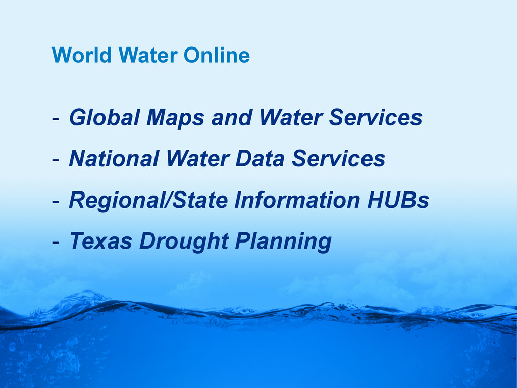
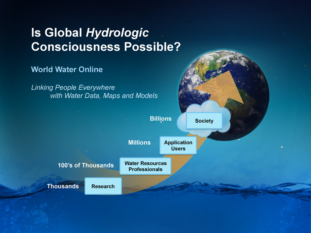
    Professionals Research Society Is Global Hydrologic Consciousness Possible? Linking People Everywhere with Water Data, Maps and Models World Water Online
  8. World Water Online . . . a transformation of our

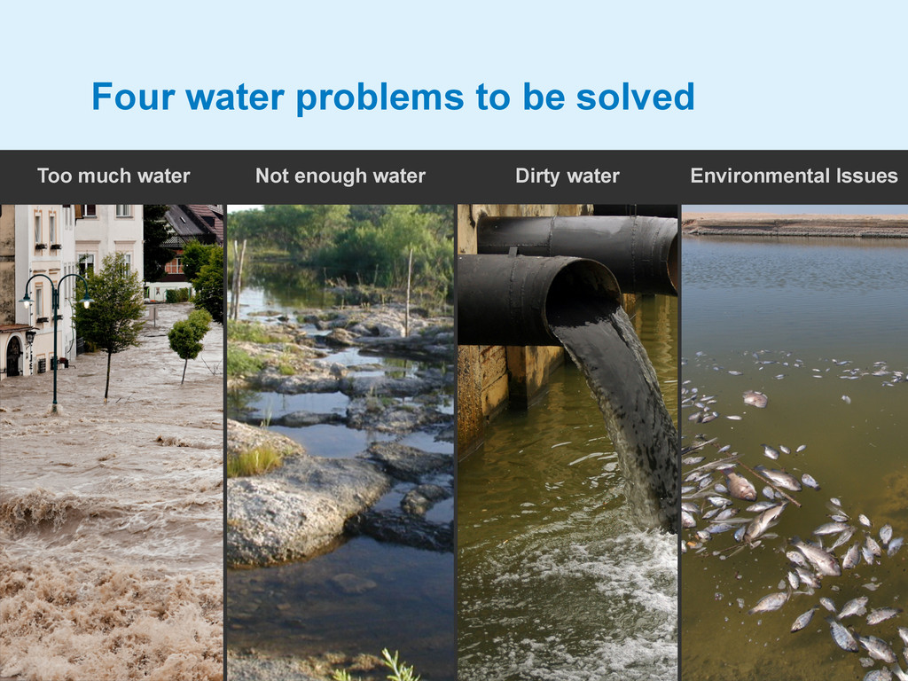
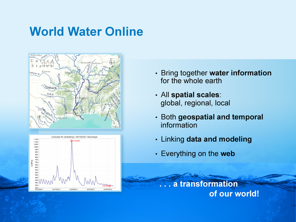
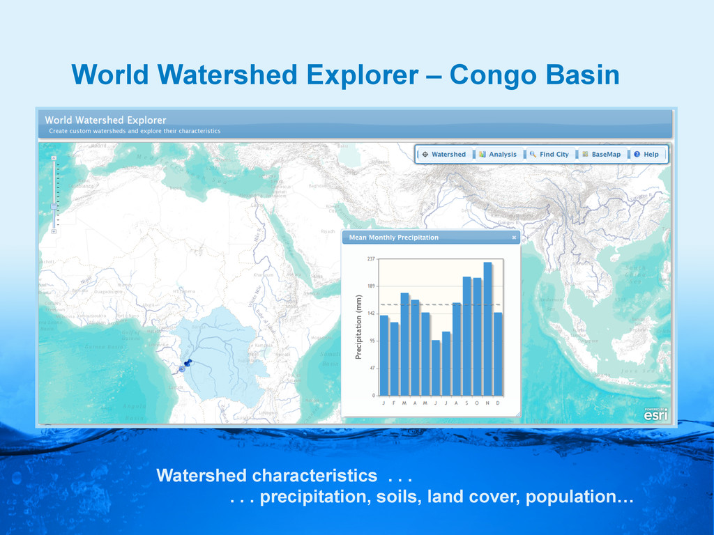
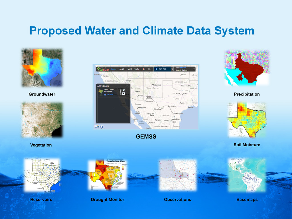
    world! •  Bring together water information for the whole earth •  All spatial scales: global, regional, local •  Both geospatial and temporal information •  Linking data and modeling •  Everything on the web
  9. Scales of Application World Landscape River Basin, Aquifer My house,

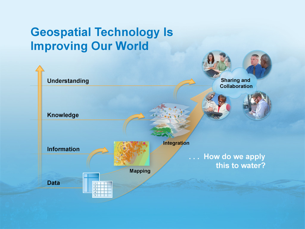
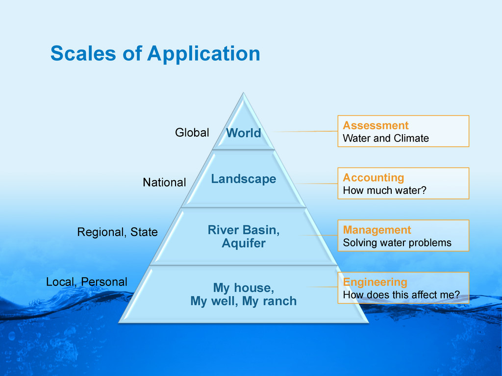
    My well, My ranch Global Regional, State Local, Personal National Assessment Water and Climate Accounting How much water? Management Solving water problems Engineering How does this affect me?
  10. Watershed of My Stream ESRI Base Map and Delineation Services

    My watershed My stream Delineate the watershed of any stream or river anywhere on earth
  11. Watershed of My Stream ESRI Base Map and Delineation Services

    My watershed My stream Delineate the watershed of any stream or river anywhere on earth
  12. Congo River Basin Global river mapping and watershed delineation World

    Hydro Overlay Map River Basin Delineation Delineate a watershed from any point on a river
  13. Collecting Water Data Globally (GRACE) Gravity Anomaly of Texas, 2002

    – 2012 In 2011, we lost 100 Km3 of water or 70 Lake Travis’s Normal Reservoir Storage in Texas, 2002 – 2012
  14. Land Data Assimilation Systems (LDAS) National LDAS Global LDAS …crossing

    the digital divide… NLDAS Soil Moisture 1979-2012 Data Rods
  15. Land Data Assimilation Systems (LDAS) National LDAS Global LDAS Data

    Rods …crossing the digital divide… NLDAS Soil Moisture 1979-2012
  16. World Watershed Explorer – Congo Basin Watershed characteristics . .

    . . . . precipitation, soils, land cover, population…
  17. World Water Online -  Global Maps and Services -  National

    Water Data Services -  Regional/State Information HUB -  Texas Drought Planning
  18. We Lack a Global Water Information System! Every Country Collects

    These Data United States Mexico Australia
  19. World Water Online -  Global Maps and Services -  National

    Water Data Services -  Regional/State Information HUB -  Texas Drought Planning
  20. Central Texas “Hub” Synthesis of Water Observations Networks into Thematic

    Maps Precipitation map for storm of 20 March 2012 at my home
  21. Flow Mas and Charts in the Hub Colorado River at

    Austin, Texas Real-time information from a “network of networks”
  22. ESRI/Kisters Integration Fusion Servers REST/JSON services KISTERS Database Time Services

    OGC, CUAHSI, REST… ArcGIS GIS Services ArcGIS Server WebSolution Time Series widget Station pages Browser Server
  23. KIsters Web Interoperability Solution (KIWIS) Produces information in WaterML and

    WaterML2 web services Time series aggregation services (hourly, daily, monthly etc.)
  24. World Water Online -  Global Information Services -  National Information

    Services -  Regional/State Information Services -  Texas Drought Planning
  25. •  Drought Forum, Feb 13, 2012 •  State water agencies

    and academic speakers •  Formed a Drought Technology Steering Committee to continue dialog -  TWDB, TCEQ, TPWD, TDEM -  UT Austin, TAMU – College Station, Texas Tech …Texas has myriad resources to take advantage of…
  26. River Flow in Texas (RAPID) March to June 2004 River

    maps . . . . . . River models David et al., 201x
  27. Land Surface Calculations for Texas Temperature Precipitation Wind speed Specific

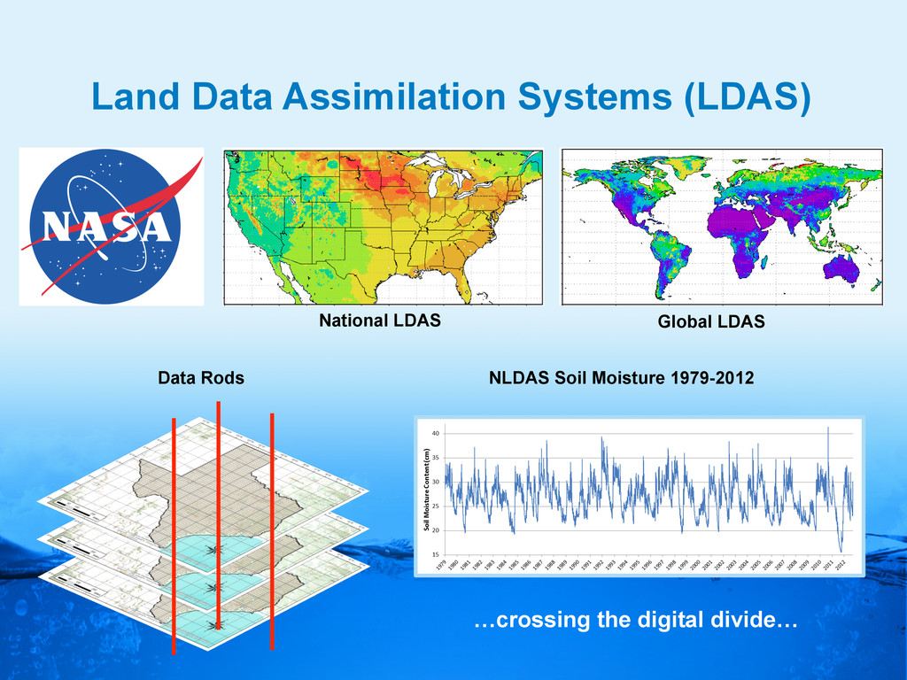
    humidity Surface pressure Downward SW radiation Downward LW radiation Noah-­‐MP   land  surface   model   Surface runoff Sub-surface runoff Soil moisture Evapotranspiration Water table … Soil type Soil color Green vegetation fraction Land cover Model output NLDAS atmospheric forcing Land surface features
  28. Proposed Water and Climate Data System Groundwater Vegetation GEMSS Reservoirs

    Drought Monitor Observations Basemaps Soil Moisture Precipitation
  29. World Water Online Hydrology on the web Observations Models Global

    to Local Watersheds Maps A combination of proven industry technologies and open standards