The Ever-Evolving world of Aerial Imagery - Oblique Style by Christian Stitz
See how georeferenced oblique imagery is changing how GIS professionals distribute data. By sharing this vital information with other agencies, GIS departments become an even more vital resource, particularly for safety, assessment, and planning.
how GIS professionals distribute data. By sharing this vital information with other agencies, GIS departments become an even more vital resource to all entities in their organization.
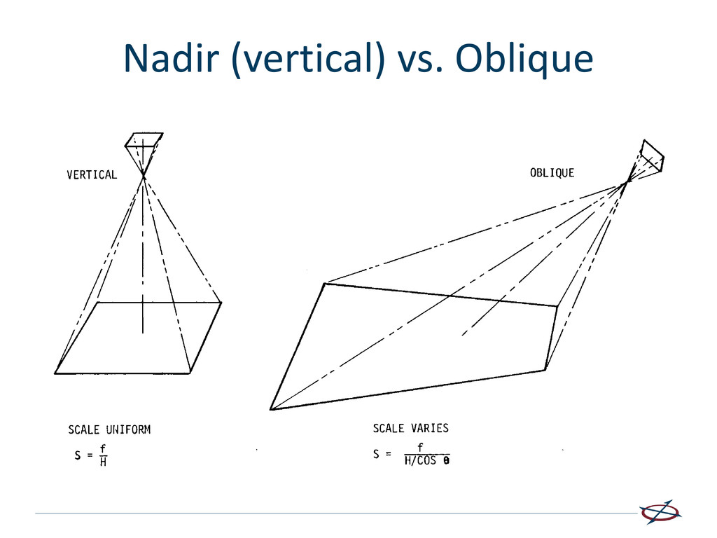
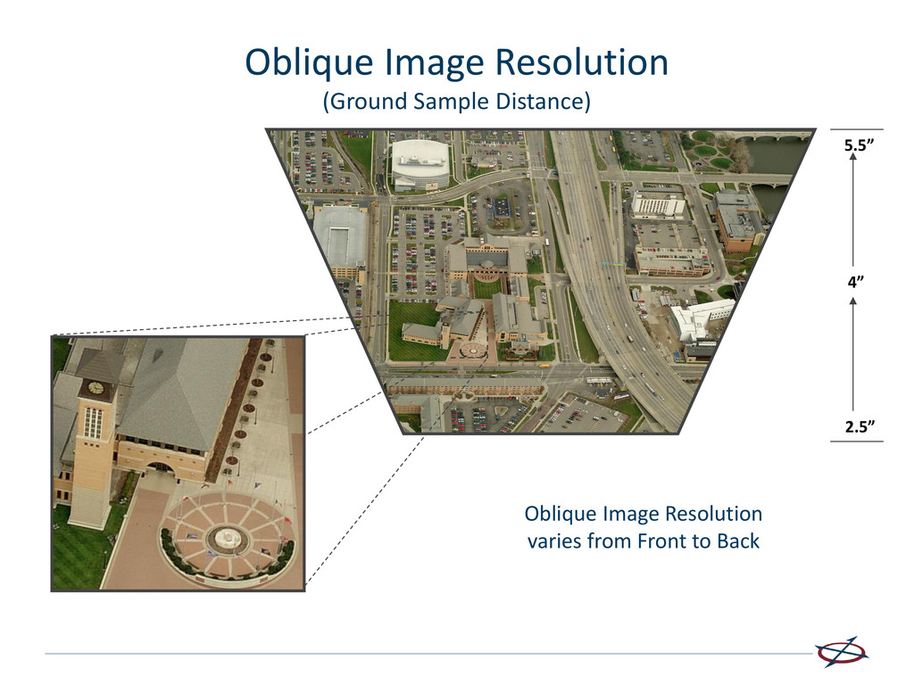
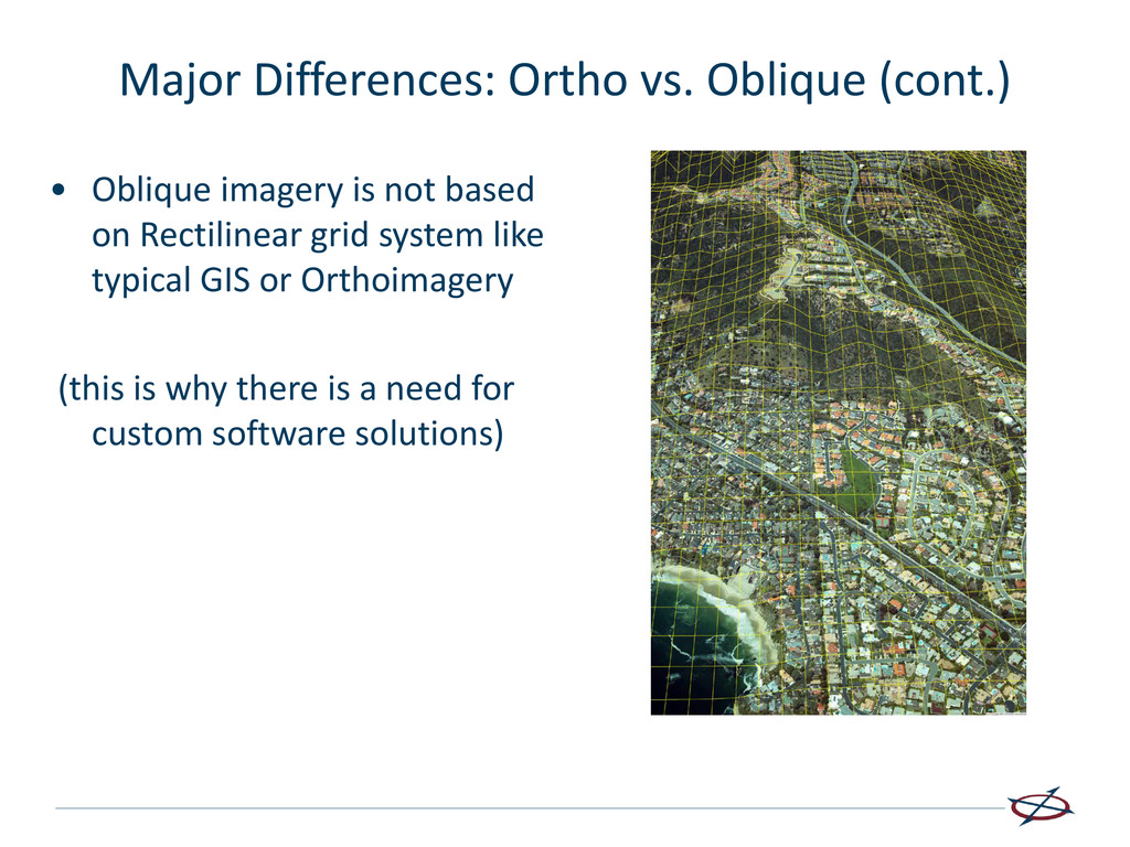
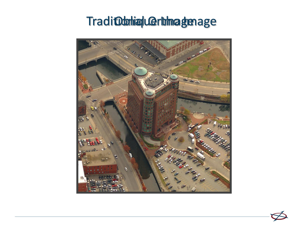
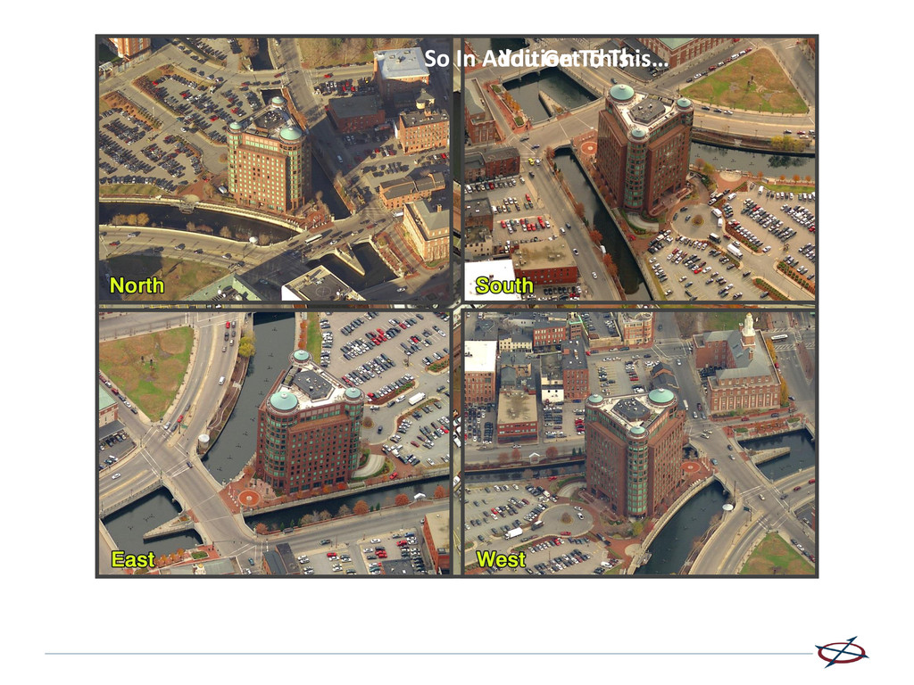
“Non Traditional” image footprint • Oblique Imagery does not have a uniform pixel resolution (GSD) • Oblique Imagery offers the ability to measure Height and other unique aspects • Oblique Imagery provides a 360 degree view of any location
of an image • Reduces or even eliminates field visits - users can “simulate” field visits from the office • When in the field, oblique imagery allows field crews an “over the fence” view of a property • Increase accuracy (data verification & collection) • Easier and more advanced Information gathering through analysis and measurements • Makes GIS more familiar to the masses. The more folks you have using your GIS, the more recognition, funding, and kudos you receive.
the cost of field visits by pre-reviewing properties from the desktop, tailor visits and trips to be more effective and productive from your desktop (do half of the work with the mouse) • Check high resolution oblique and orthogonal imagery (up to 3” GSD) providing multiple views of difficult to access properties and help improve communication during an appeals process (access locked gates, avoid dangerous properties, see the middle of the woods) • Accurately calculate areas, distances and heights, and a choice of deployment and integration options helps meet your workflow requirements (again, do half of the work with the mouse)
surveillance areas · Search, raid, and seizure planning · Photo documentation for search warrant applications · Traffic control analysis, evacuation planning, and routing · Land/air coordination in search and rescue efforts · Turn night into day-winter into summer · Identify ingress / egress points
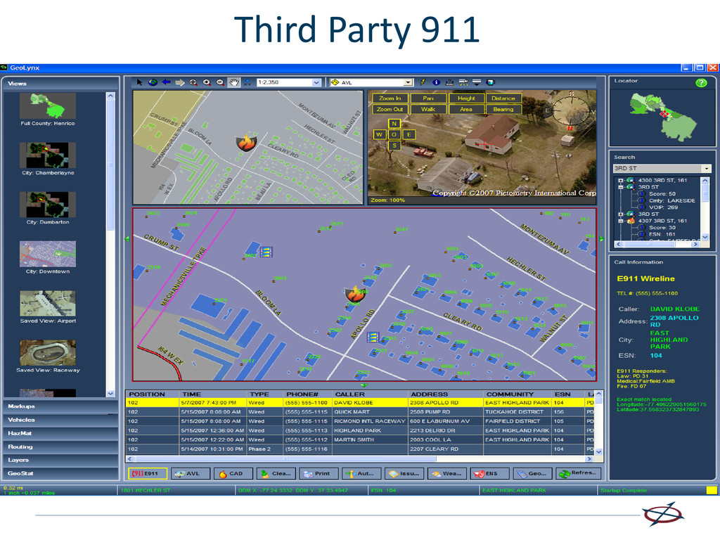
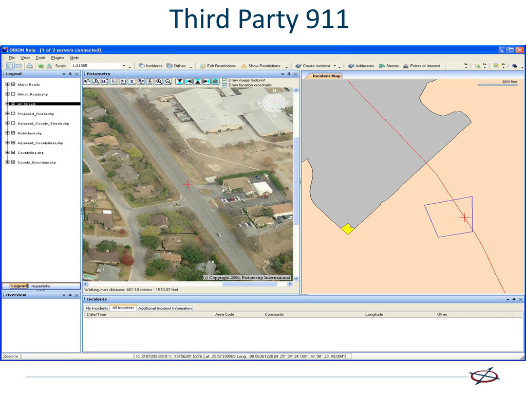
of caller location at time of call · View address from multiple angles for entry and escape points · Measure height, length and width of buildings · Provide remote guidance on location of electrical wires and other obstacles that might impair equipment or helicopter access · Integrate third-party information such as dispatch software and records management systems · Monitor foot chases through visual clues and provide assistance to officers on the scene · Using visual clues, help identify true location of incidents that are called in that may not be the actual incident areas
major structures and facilities · Locate and establish field command centers · Zoom in and inspect structural compositions, roof layout, and access points
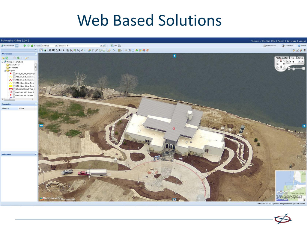
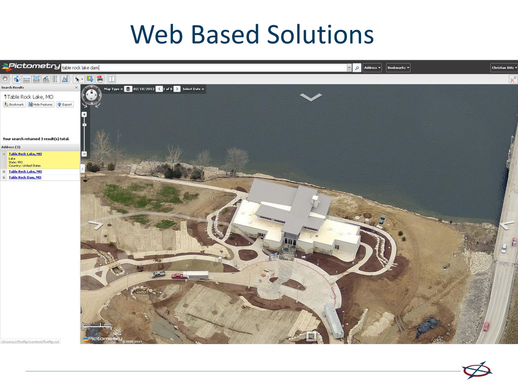
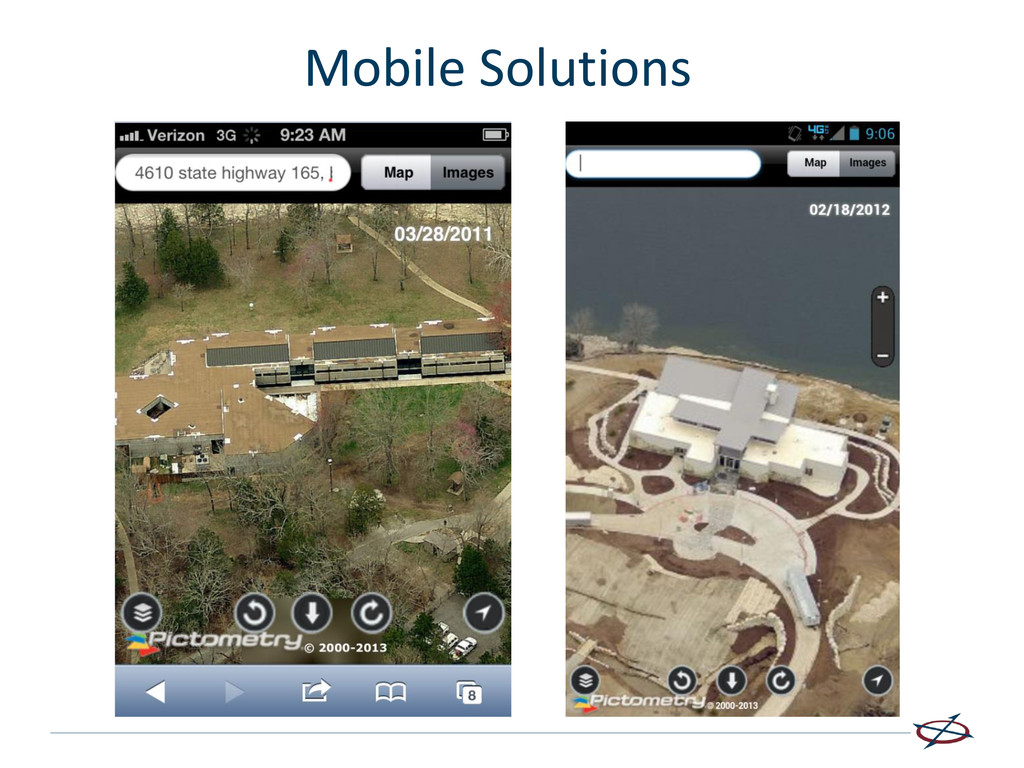
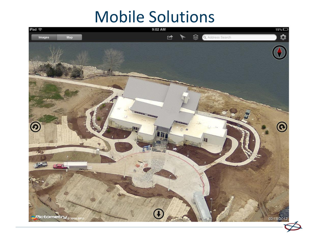
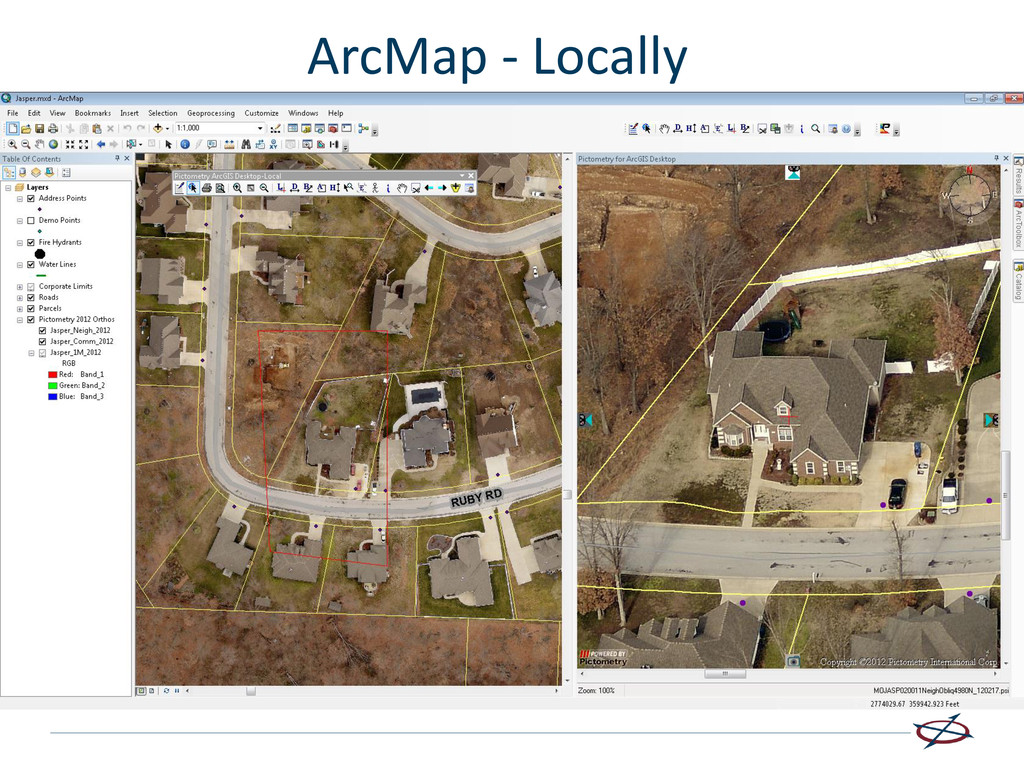
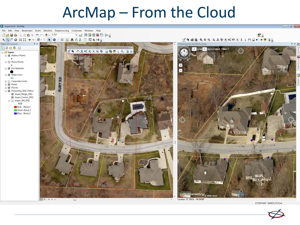
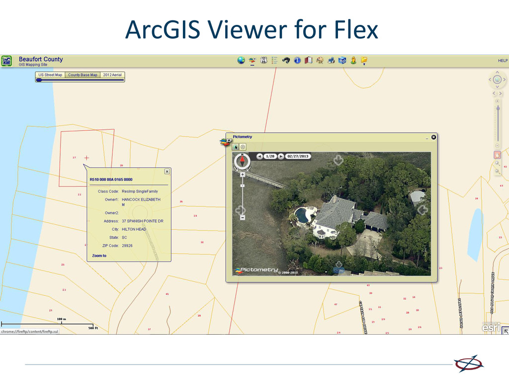
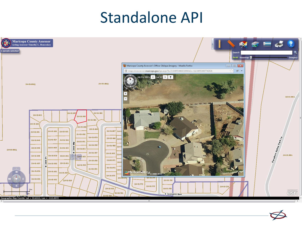
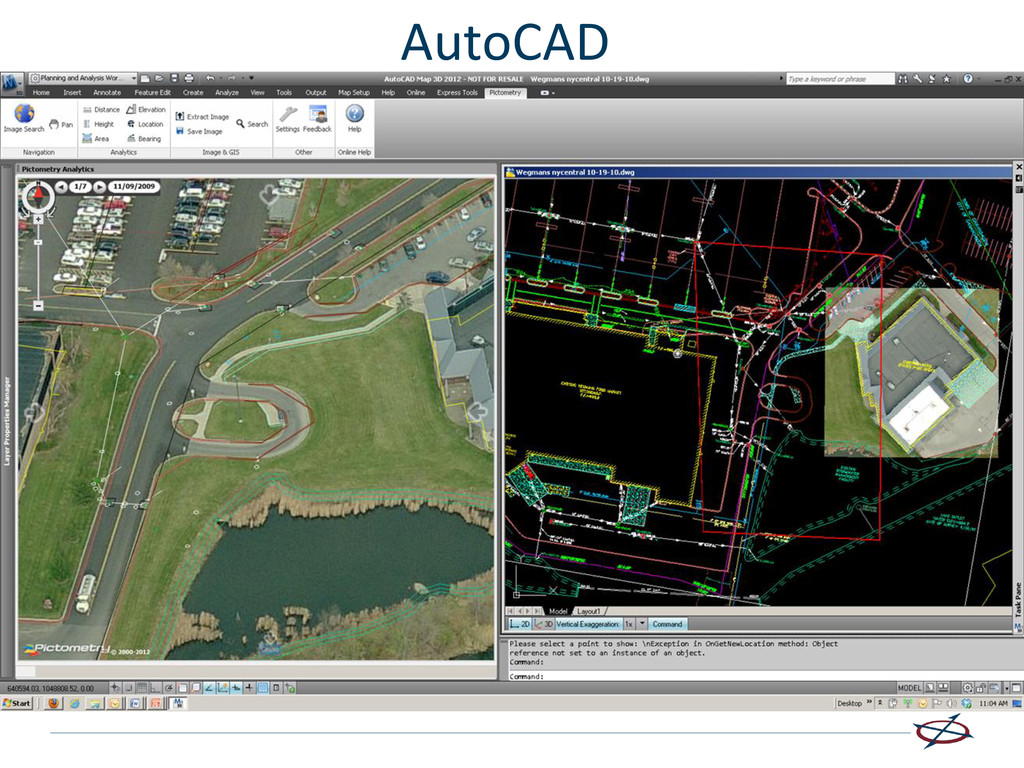
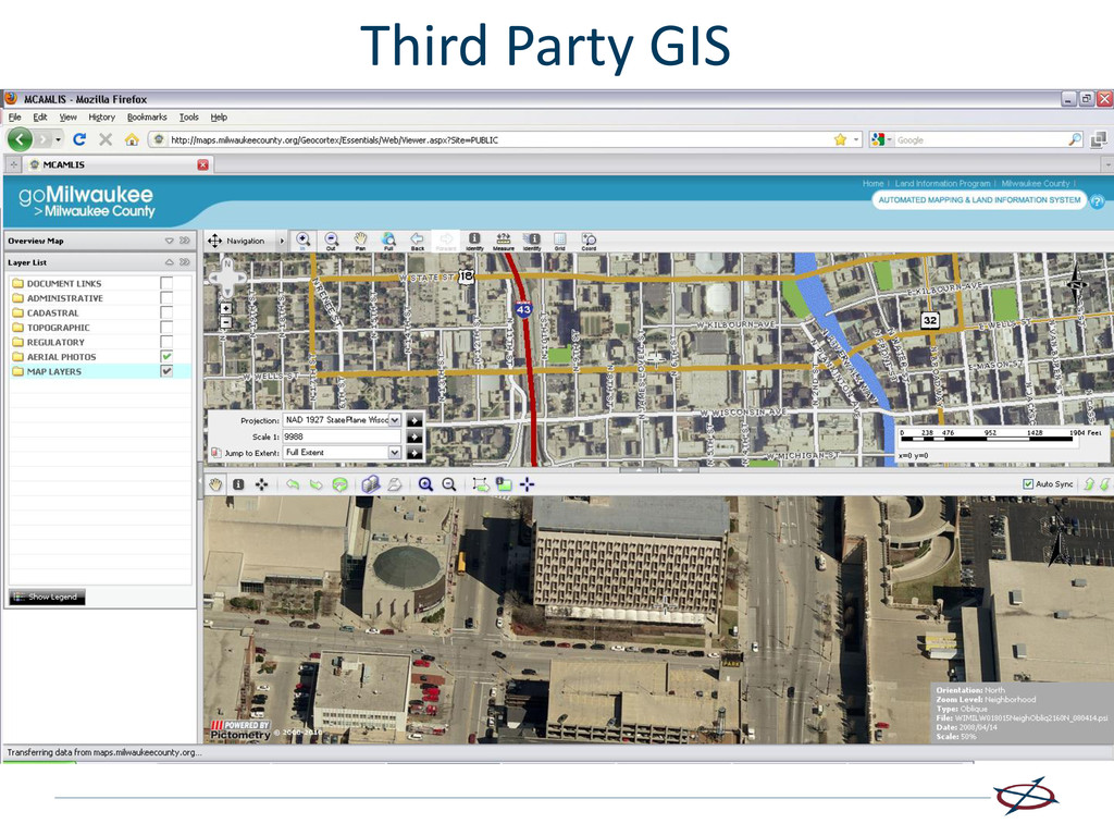
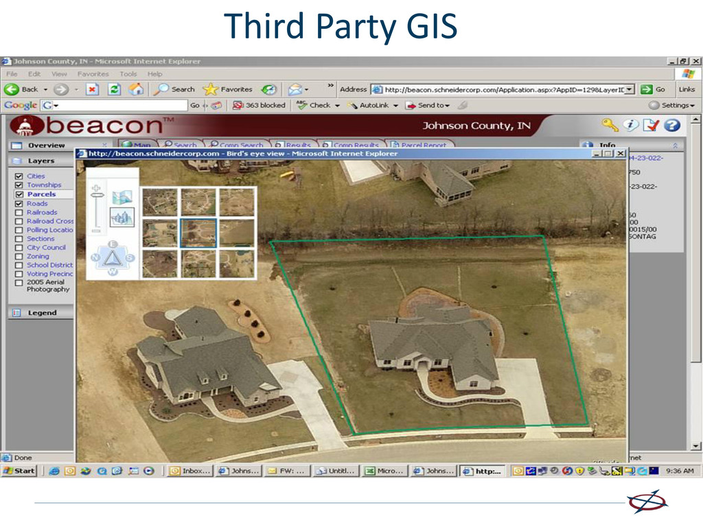
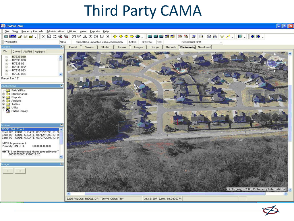
• Proprietary Desktop Software • Web-based Solutions • Full Browser Apps • iPad Apps • Smartphone Apps (Android and iOS) • Esri – integration options with ArcGIS Desktop/ArcMap and ArcGIS Server via custom applications or ArcGIS Viewer applications • Autodesk – direct integration with Autocad • SDKs are available for customers and business partners to build custom integrations within a variety of environments, utilizing both desktop and web technologies • Various GIS, CAMA and 911 mapping vendors already offer existing, proven integrations with their software packages
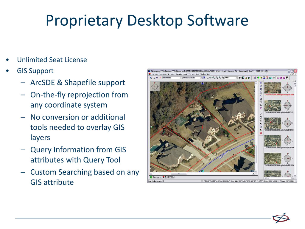
Shapefile support – On-the-fly reprojection from any coordinate system – No conversion or additional tools needed to overlay GIS layers – Query Information from GIS attributes with Query Tool – Custom Searching based on any GIS attribute Proprietary Desktop Software
• Experience – Oblique imagery is a very different technology than ortho imagery • Satisfied Customers – Are there any? • Applications and Integrations – Can everyone use it within their normal workflow? • True oblique believer