Upgrade to Pro
— share decks privately, control downloads, hide ads and more …
Speaker Deck
Features
Speaker Deck
PRO
Sign in
Sign up for free
Search
Search
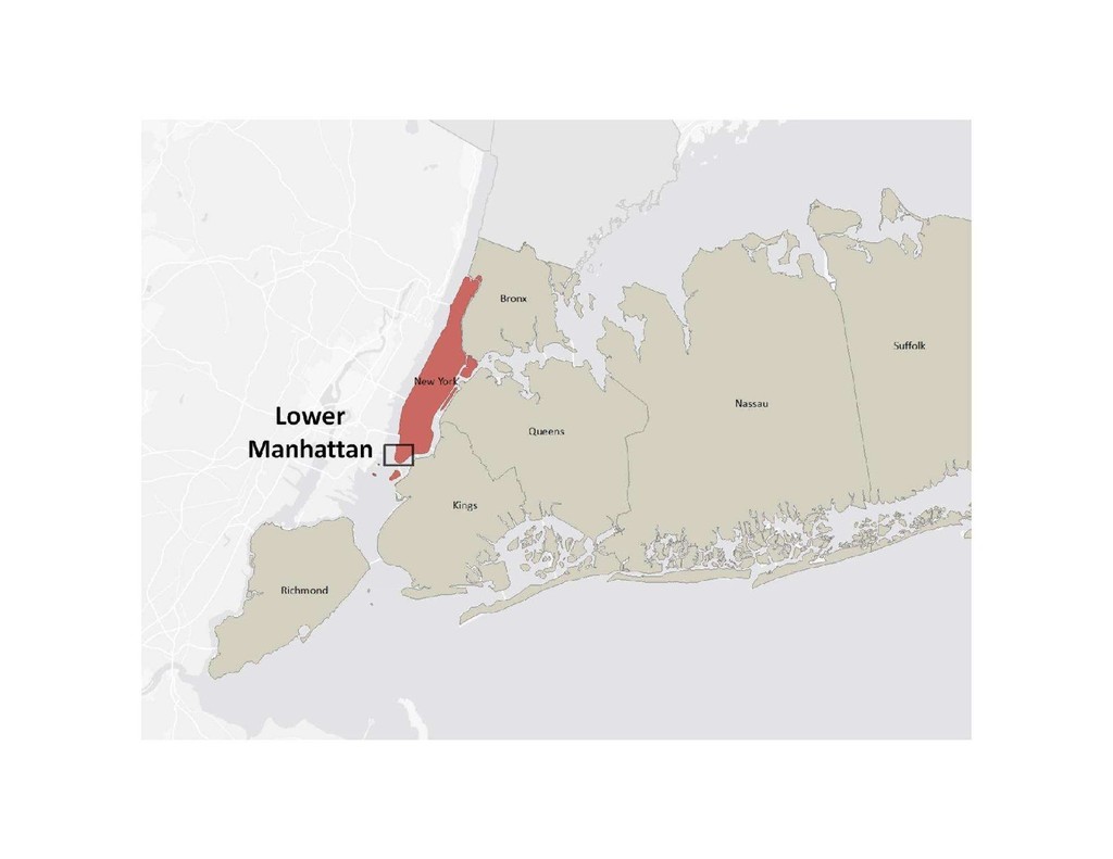
Carpe Geo & Parvum Momentum
Search
Texas Natural Resources Information System
November 12, 2018
Technology
280
0
Share
Embed
Copy iframe code
Copy JS code
Copy link
Start on current slide
Carpe Geo & Parvum Momentum
Bill F. Johnson
Carpe Geo Evangelist
Texas Natural Resources Information System
November 12, 2018
More Decks by Texas Natural Resources Information System
See All by Texas Natural Resources Information System
The 3rd Quarter GIS Community Meeting of 2020
texasnaturalresourcesinformationsytem
0
200
The 2nd Quarter GIS Community Meeting of 2020
texasnaturalresourcesinformationsytem
0
640
2020 1st Quarter GIS Community Meeting
texasnaturalresourcesinformationsytem
0
760
PLANET OVERVIEW for TNRIS first Quarter Meeting
texasnaturalresourcesinformationsytem
0
650
Hurricane Harvey H-E-B Disaster Response
texasnaturalresourcesinformationsytem
0
530
Improving Community Services by Helping Citizens Find Their Lost Pets
texasnaturalresourcesinformationsytem
0
360
National Address Database (NAD) and NG9-1-1
texasnaturalresourcesinformationsytem
0
280
StratMap Celebrating Successful Public and Private Partnerships
texasnaturalresourcesinformationsytem
1
370
2019 State of the State Town Hall Meeting
texasnaturalresourcesinformationsytem
1
350
Other Decks in Technology
See All in Technology
iOS/Androidの二刀流エンジニアがFlutter & TypeScriptへ越境後の現在地 - Flutterがメインになって見えた景色と現在の醍醐味 / Dual-Platform Mobile Engineer Shifts to Flutter & TypeScript - The View and Real Thrill of Going Flutter-First
bitkey
PRO
0
110
それでも、技術なブログを書く理由 #kichijojipm / Why I Still Write Tech Blogs Even Now
shinkufencer
0
1k
人とエージェントが高め合う協業設計
kintotechdev
0
990
カメラ×AIで挑む「ホワイト物流」― 車両管理、自動化の壁と突破口【SORACOM Discovery 2026】
soracom
PRO
0
130
StepFunctionsとGraphRAGを活用した暗黙知活用のためのRAG基盤
yakumo
0
180
現場との対話から始める “作る前に問い直す”業務改善
mochico50
2
320
A Bag-of-Documents Model for Query Specificity
dtunkelang
0
110
歴史から理解するクラウドインフラのしくみ
kizawa2020
0
170
コンポーネント名には何を含めるべきなのか? / what-should-be-included-in-component-names
airrnot1106
0
120
reFACToring
moznion
1
700
人手不足への挑戦:車両保全を支えるIoTとクラウド内製化の道【SORACOM Discovery 2026】
soracom
PRO
0
100
エンタープライズデータへ安全につなぐ Production-ready なエージェント設計 ― AI × MCP リファレンスアーキテクチャ ― #AIDevDay
cdataj
1
150
Featured
See All Featured
Designing Dashboards & Data Visualisations in Web Apps
destraynor
231
55k
Exploring anti-patterns in Rails
aemeredith
3
450
Highjacked: Video Game Concept Design
rkendrick25
PRO
1
410
Designing Powerful Visuals for Engaging Learning
tmiket
1
460
10 Git Anti Patterns You Should be Aware of
lemiorhan
PRO
659
62k
[SF Ruby Conf 2025] Rails X
palkan
2
1.2k
Reflections from 52 weeks, 52 projects
jeffersonlam
356
21k
VelocityConf: Rendering Performance Case Studies
addyosmani
333
25k
No one is an island. Learnings from fostering a developers community.
thoeni
21
3.8k
How to build an LLM SEO readiness audit: a practical framework
nmsamuel
1
810
4 Signs Your Business is Dying
shpigford
187
22k
Why Our Code Smells
bkeepers
PRO
340
58k
Transcript
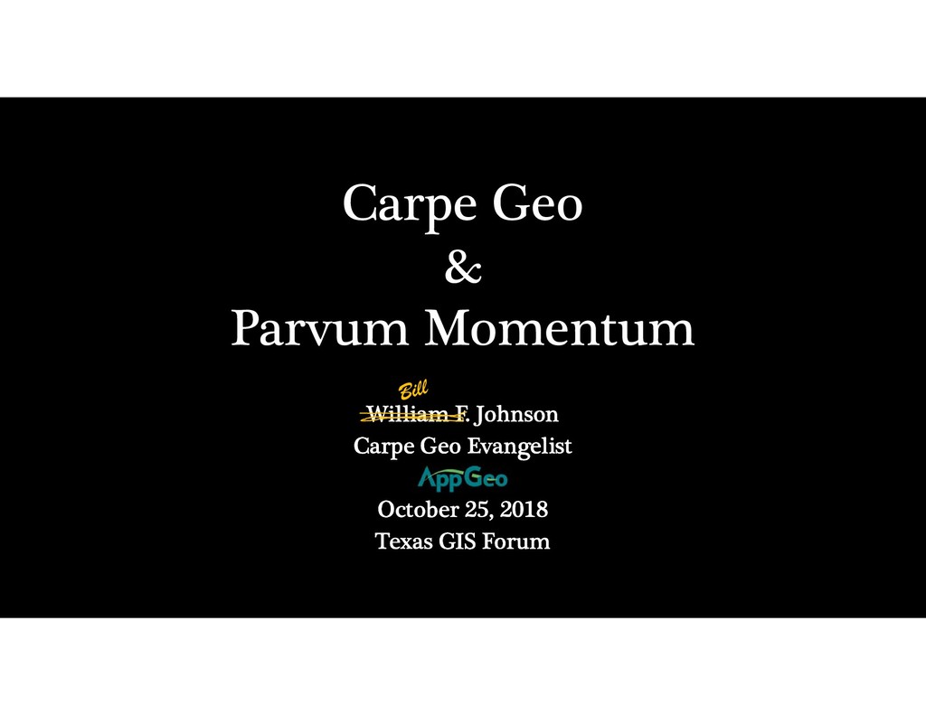
Carpe Geo & Parvum Momentum William F. Johnson Carpe Geo
Evangelist October 25, 2018 Texas GIS Forum
None
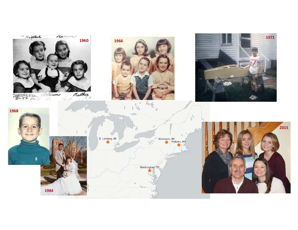
1960 1966 1971 1984 2015 1968
None
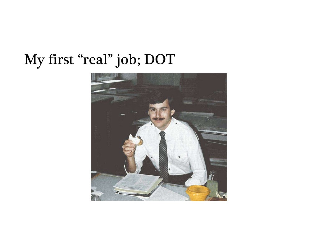
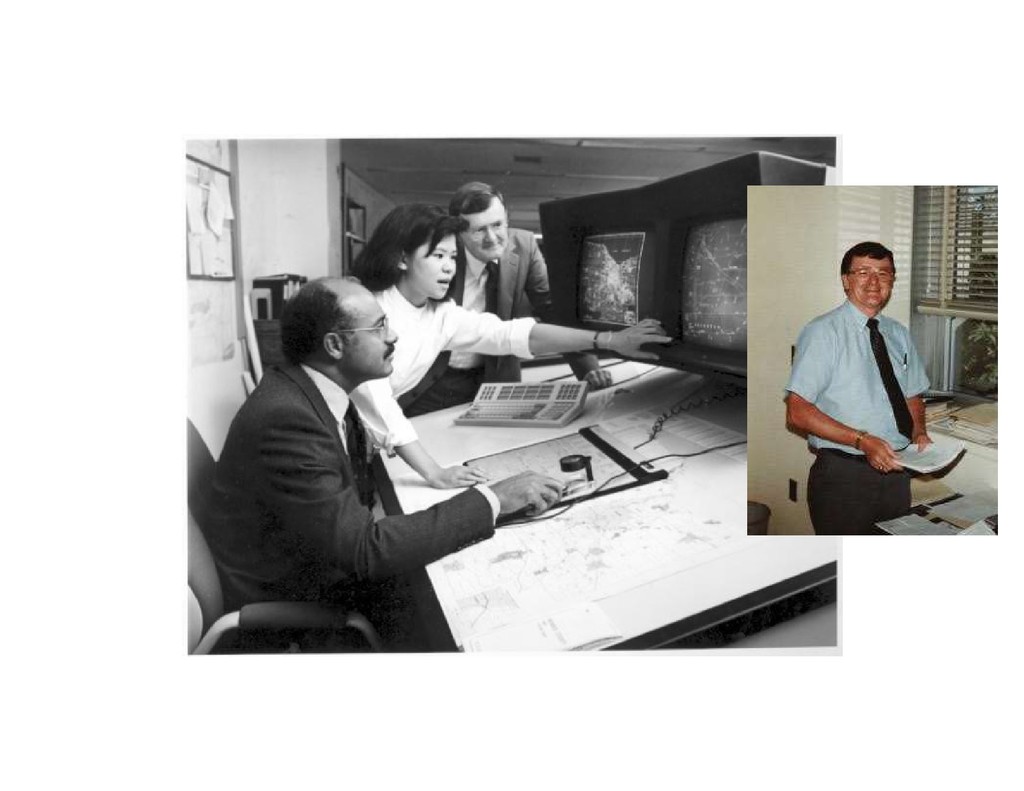
My first “real” job; DOT
• Initially at the Dept of Transportation (DOT) • Then
the Office For Technology (OFT) • Then Cyber Security and Critical Infrastructure Coordination (CSCIC) • Then Homeland Security & Emergency Svcs (DHSES) • Finally Information Technology Services (ITS) 31 year GIS career in State of NY 33 31 29 27 23 19 15 15 04 06 08 10 12 14 07 09 11 13 95 97 99 01 03 05 96 98 00 02 85 86 88 90 92 94 87 89 91 93
None
None
None
Carpe Diem
Carpe Diem
None
http://www.governor.ny.gov/assets/documents/NYS2100.pdf or just Google “NYS 2100”
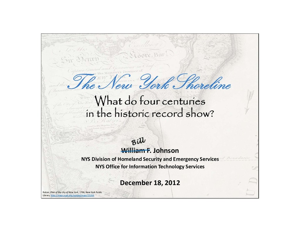
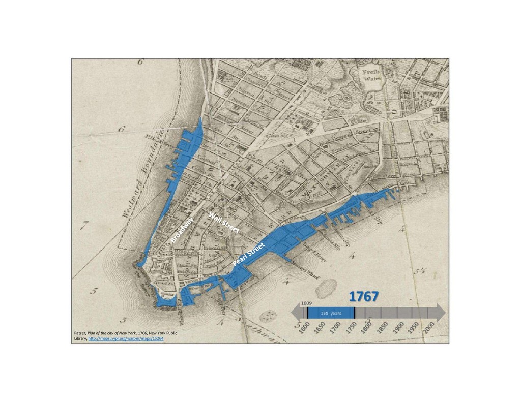
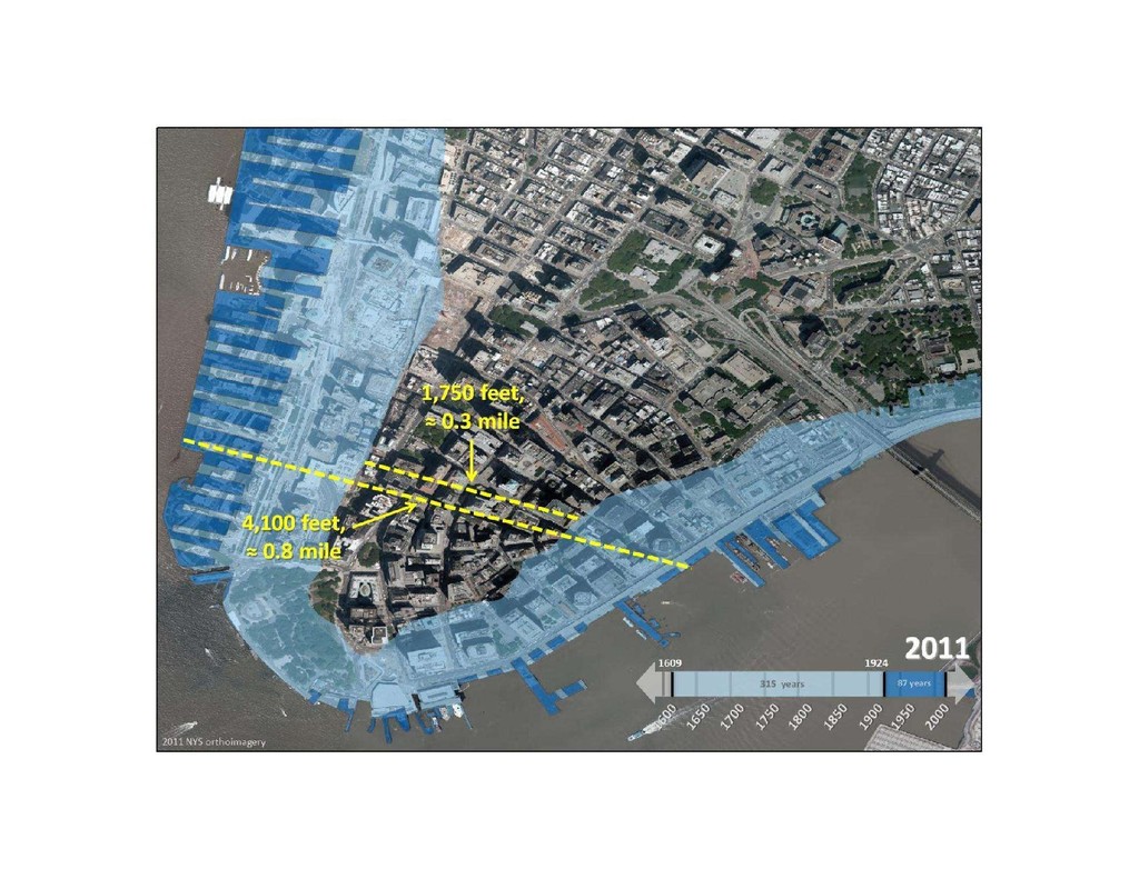
What do four centuries in the historic record show? Ratzer,
Plan of the city of New York, 1766, New York Public Library, http://maps.nypl.org/warper/maps/15264 William F. Johnson NYS Division of Homeland Security and Emergency Services NYS Office for Information Technology Services December 18, 2012
None
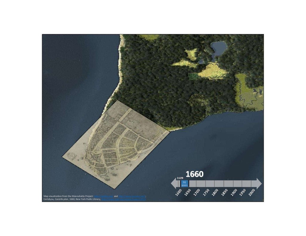
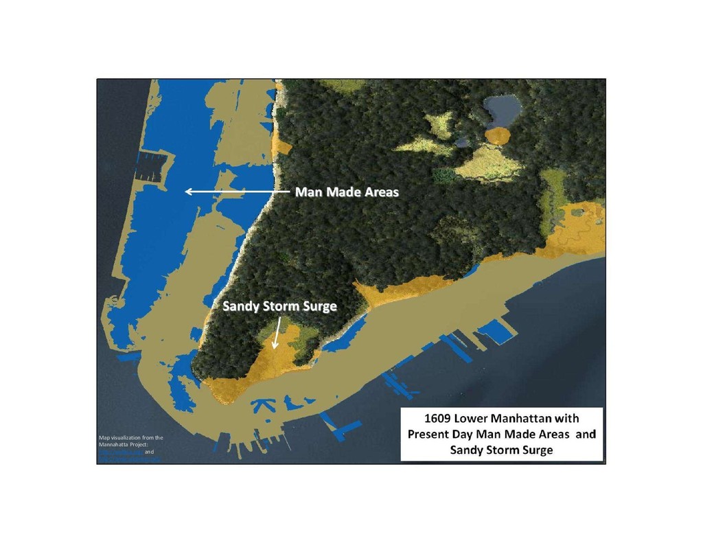
Map visualization from the Mannahatta Project: http://welikia.org/ and http://www.oasisnyc.net/
Map visualization from the Mannahatta Project: http://welikia.org/ and http://www.oasisnyc.net/; Cortelyou,
Castello plan, 1660, New York Public Library, http://maps.nypl.org/warper/maps/13913
Ratzer, Plan of the city of New York, 1766, New
York Public Library, http://maps.nypl.org/warper/maps/15264
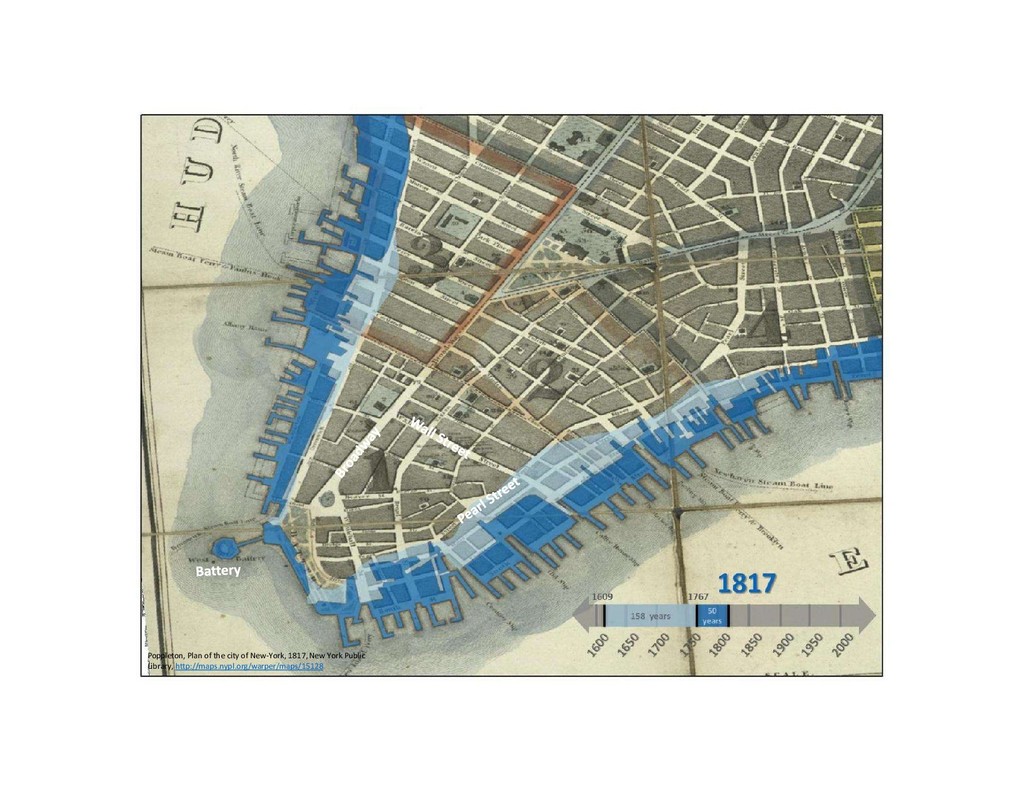
Poppleton, Plan of the city of New-York, 1817, New York
Public Library, http://maps.nypl.org/warper/maps/15128
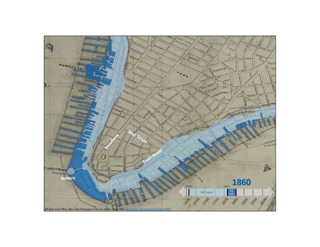
NY State Land Office, New map of that part of
the city of New York, 1860, http://maps.nypl.org/warper/maps/15072
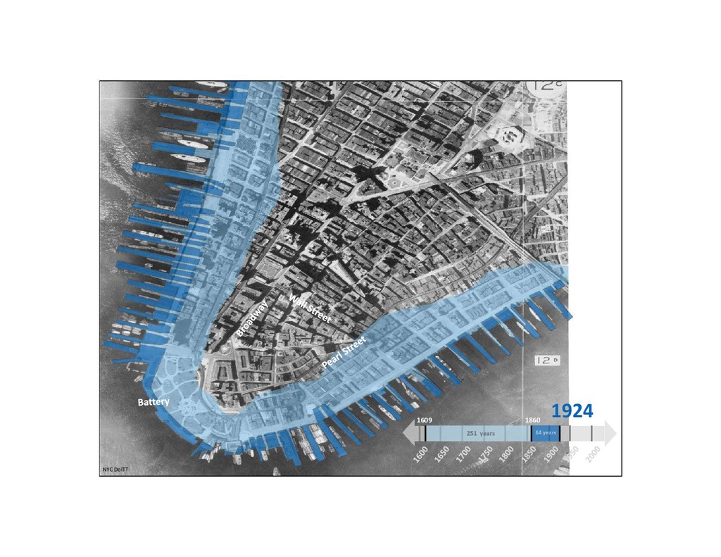
1924 1609 1860 NYC DoITT
None
Map visualization from the Mannahatta Project: http://welikia.org/ and http://www.oasisnyc.net/
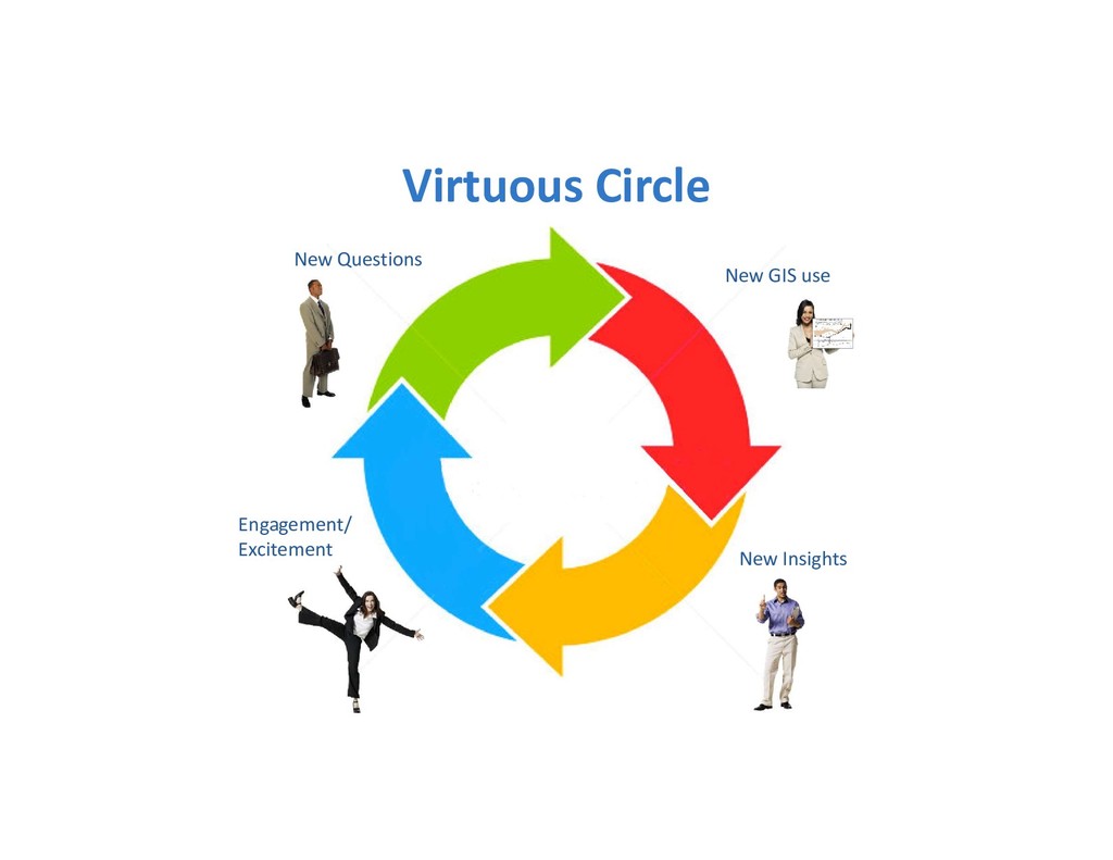
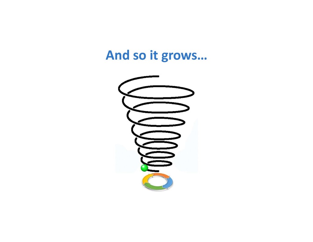
New Insights Engagement/ Excitement New GIS use New Questions Virtuous
Circle
And so it grows…
None
Parvum Momentum
None
Thank You