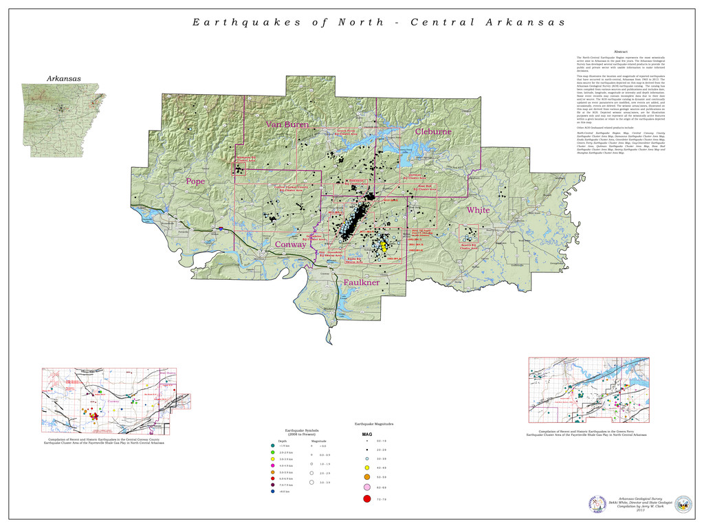
This map illustrates the location and magnitude of reported earthquakes that have occurred in north-central Arkansas from 1965 to 2013. The data source for the earthquakes depicted on this map is derived from the Arkansas Geological Survey (AGS) earthquake catalog. The catalog has been compiled from various sources and publications and includes date, time, latitude, longitude, magnitude or intensity and depth information. Some event records may contain incomplete data due to their date and/or source. The AGS earthquake catalog is dynamic and continually updated as event parameters are modified, new events are added, and occasionally, events are deleted. The seismic areas/zones, illustrated on this map are derived from various geologic sources and publications on file at the AGS. Depicted seismic areas/zones, are for illustration purposes only and may not represent all the seismically active features within a given location or relate to the origin of the earthquakes depicted on this map.