Upgrade to Pro — share decks privately, control downloads, hide ads and more …

ikeGPS Spike Intro & Demo

ikeGPS Spike Intro & Demo

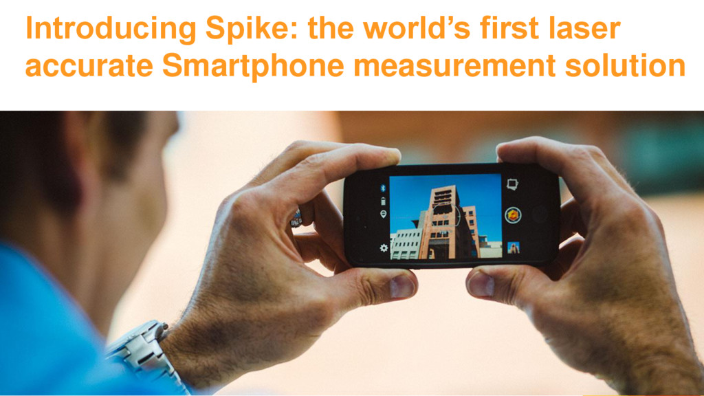
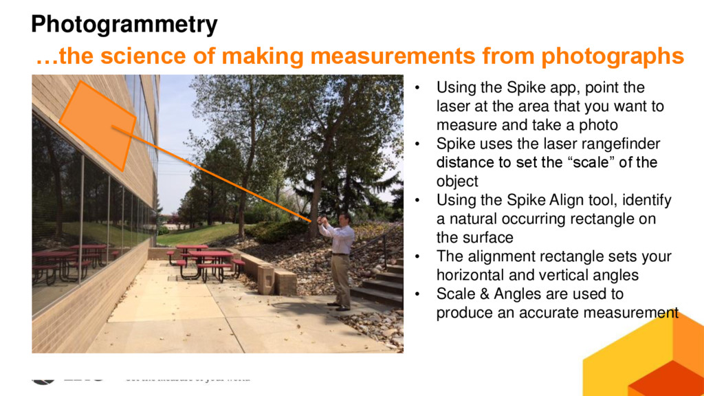
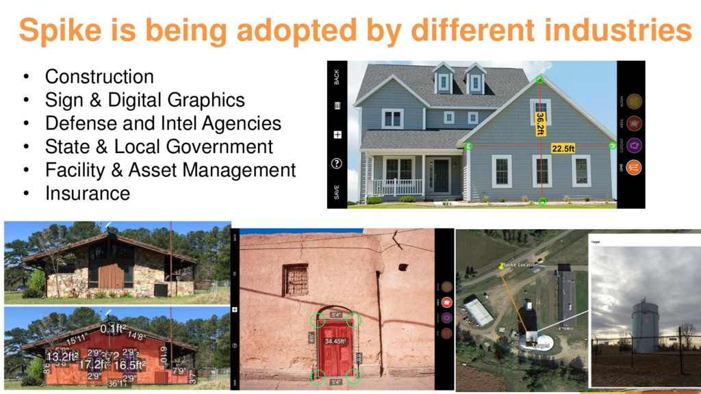
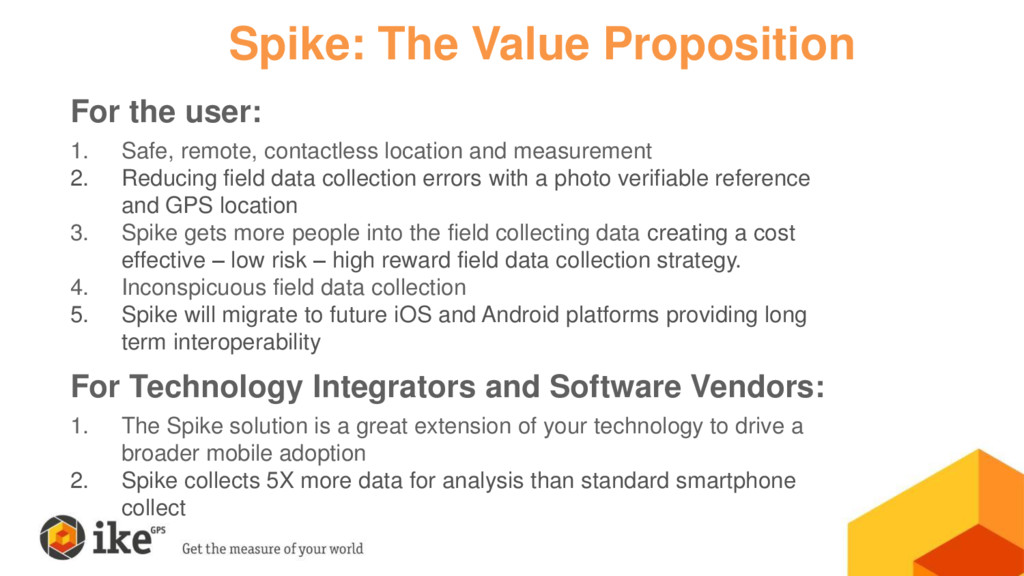
Most private organizations and government agencies are looking to reduce field data collection costs and improve the effectiveness of their field data collection. As a growing trend mobile devices such as smartphones and tablets are a great way to do that. In order to get the best bang for the buck you need to use a commercial off-the-shelf solution that will adequately replace the multitude of tools that are taken into the field today, reduce time in the field, and collect a wide range of field data. Spike accomplishes that task.

SecondaryCities

June 14, 2016
Tweet

More Decks by SecondaryCities

Other Decks in Technology

Transcript

  1. James Pardue Vice President, Sales [email protected] January 11, 2016 Dynamic

    Mapping of Secondary Cities Symposium June 14, 2016
  2. Quick and easy location and measurement ...time to measure is

    reduced to minutes https://youtu.be/pqL_6kSzA-g
  3. Basic Technical Specifications Category Details Device & OS iOS v8.0

    & Android 4.4+ / Smartphone & Tablet Spike Size & Weight 3.30in (h) x 2.35in (w) x .82in (d) / 2.05 ounces 83.70mm (h) x 59.8mm (w) x 20.80mm (d) / 58 grams Connectivity Bluetooth Smart 4.0 – Bluetooth Low Energy Laser rangefinder Eye safe laser supports 2 – 200 meters(6 - 650 feet ) Accuracy Laser rangefinder accuracy is ± 3%; Photo measure accuracy is ± 3% Units Meters + Centimeters or Feet + Inches Resolution Dependent on Smartphone or Tablet digital camera Output Formats Spike File (XML), PDF, and KMZ. (HTML, JPG – Android Only)
  4. How to use Spike: 3 Phases Setup • Attach Spike

    to a Smartphone case • Install & launch app • Calibrate laser & compass Measure • Take a photo • Draw measurements (no manual input) • Measure in feet, inches, meters, or centimeters Report & Share • Export as PDF, JPG, Spike file (XML), KMZ • Measure from your desktop using online, cloud-based tools
  5. • Using the Spike app, point the laser at the

    area that you want to measure and take a photo • Spike uses the laser rangefinder distance to set the “scale” of the object • Using the Spike Align tool, identify a natural occurring rectangle on the surface • The alignment rectangle sets your horizontal and vertical angles • Scale & Angles are used to produce an accurate measurement Photogrammetry …the science of making measurements from photographs
  6. Spike is being adopted by different industries • Construction •

    Sign & Digital Graphics • Defense and Intel Agencies • State & Local Government • Facility & Asset Management • Insurance
  7. Performs 6 Core Field Functions: 1. PHOTO MEASURE: Accurately measure

    objects and features within a geotagged photo; 2. POINT TO POINT MEASUREMENT: Laser measure distances between two objects in 3D space 3. REMOTE CAPTURE: Laser-based targeting of features safely, accurately and remotely; 4. COLLECT GPS LOCATIONS of features with an offset; and 5. CREATE A GEOTAGGED PHOTO with an offset of the assets physical location 6. PUBLISH, COMMUNICATE AND COLLABORATE with location and measurement data in common industry file formats Spike Turns a Smartphone or Tablet Into a Geospatial Multi-Tool
  8. One site visit for your measurements access the photo at

    anytime to remeasure or view measurements In the field At the office
  9. Pick the export format that works best for you …select

    from PDF, JPG, Spike file (XML), shareable URL, KMZ From the mobile app From the cloud
  10. For the user: 1. Safe, remote, contactless location and measurement

    2. Reducing field data collection errors with a photo verifiable reference and GPS location 3. Spike gets more people into the field collecting data creating a cost effective – low risk – high reward field data collection strategy. 4. Inconspicuous field data collection 5. Spike will migrate to future iOS and Android platforms providing long term interoperability For Technology Integrators and Software Vendors: 1. The Spike solution is a great extension of your technology to drive a broader mobile adoption 2. Spike collects 5X more data for analysis than standard smartphone collect Spike: The Value Proposition
  11. Measuring a Structure – Urban Tactical Apps 11’5” 1.5’ 3.2’

    4.8ft2 • What are the dimensions of that 2nd floor window? • How many 3ft sections of tactical ladder do I need for access?