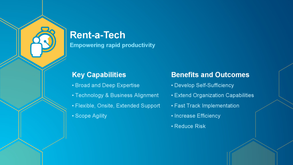
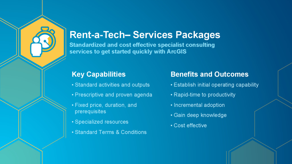
• Fixed price, duration, and prerequisites • Specialized resources • Standard Terms & Conditions Benefits and Outcomes • Establish initial operating capability • Rapid-time to productivity • Incremental adoption • Gain deep knowledge • Cost effective Rent-a-Tech– Services Packages Standardized and cost effective specialist consulting services to get started quickly with ArcGIS
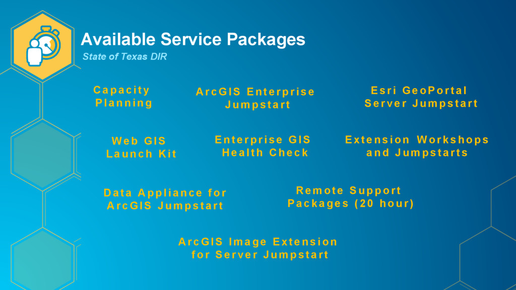
a c i t y Planning Web GIS Launch Kit Enter pr ise G I S H e a l t h C h e c k A r c G I S E n t e r p r i s e J u m p s t a r t R e m o t e S u p p o r t Packages ( 20 hour ) Esri GeoPortal Serv er Jumpstar t Data Appliance for A r c G I S J u m p s t a r t Extension Workshops a n d J u m p s t a r t s A r c G I S I m a g e E x t e n s i o n for Server Jum pst ar t
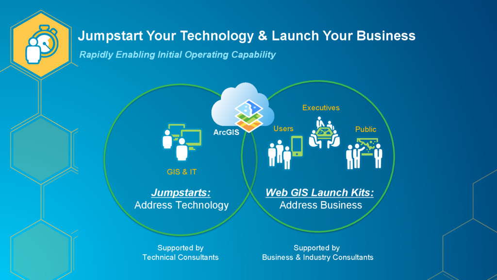
Operating Capability Executives Users Public Web GIS Launch Kits: Address Business GIS & IT Jumpstarts: Address Technology ArcGIS Supported by Technical Consultants Supported by Business & Industry Consultants
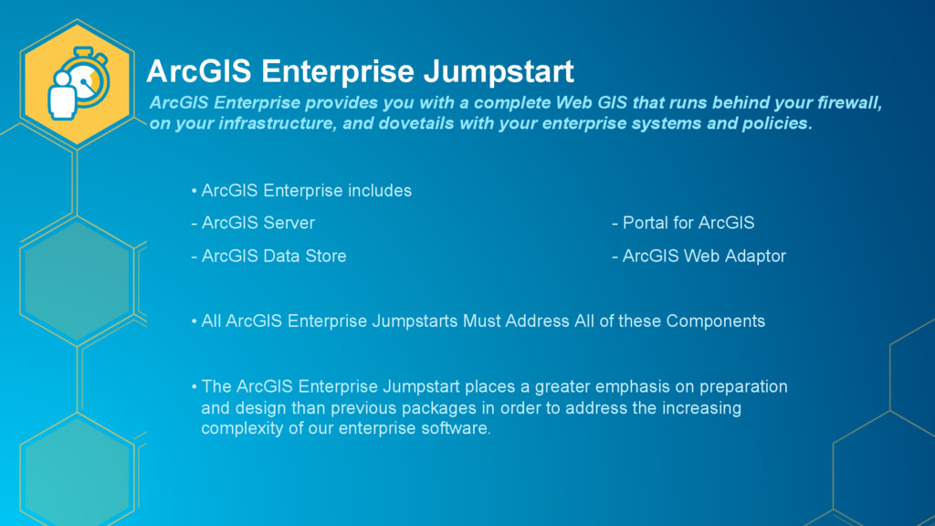
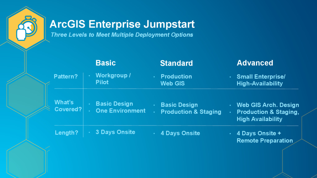
Portal for ArcGIS - ArcGIS Data Store - ArcGIS Web Adaptor • All ArcGIS Enterprise Jumpstarts Must Address All of these Components • The ArcGIS Enterprise Jumpstart places a greater emphasis on preparation and design than previous packages in order to address the increasing complexity of our enterprise software. ArcGIS Enterprise provides you with a complete Web GIS that runs behind your firewall, on your infrastructure, and dovetails with your enterprise systems and policies.
Standard Basic Advanced Pattern? • Workgroup / Pilot • Basic Design • One Environment • 3 Days Onsite • Production Web GIS • Basic Design • Production & Staging • 4 Days Onsite • Small Enterprise/ High-Availability • Web GIS Arch. Design • Production & Staging, High Availability • 4 Days Onsite + Remote Preparation What’s Covered? Length?
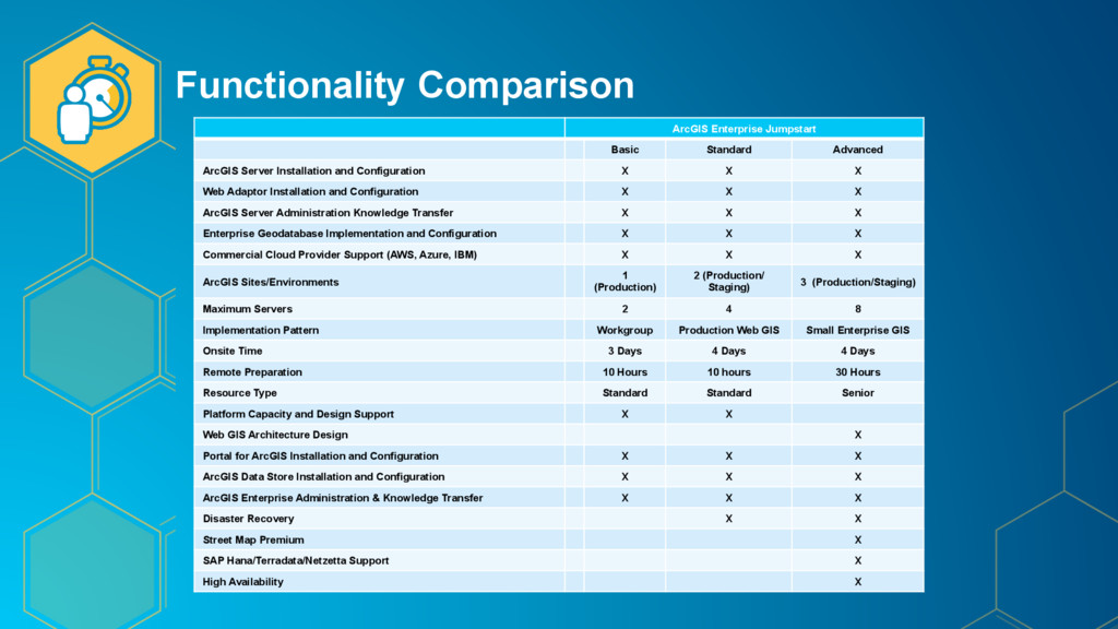
Installation and Configuration X X X Web Adaptor Installation and Configuration X X X ArcGIS Server Administration Knowledge Transfer X X X Enterprise Geodatabase Implementation and Configuration X X X Commercial Cloud Provider Support (AWS, Azure, IBM) X X X ArcGIS Sites/Environments 1 (Production) 2 (Production/ Staging) 3 (Production/Staging) Maximum Servers 2 4 8 Implementation Pattern Workgroup Production Web GIS Small Enterprise GIS Onsite Time 3 Days 4 Days 4 Days Remote Preparation 10 Hours 10 hours 30 Hours Resource Type Standard Standard Senior Platform Capacity and Design Support X X Web GIS Architecture Design X Portal for ArcGIS Installation and Configuration X X X ArcGIS Data Store Installation and Configuration X X X ArcGIS Enterprise Administration & Knowledge Transfer X X X Disaster Recovery X X Street Map Premium X SAP Hana/Terradata/Netzetta Support X High Availability X
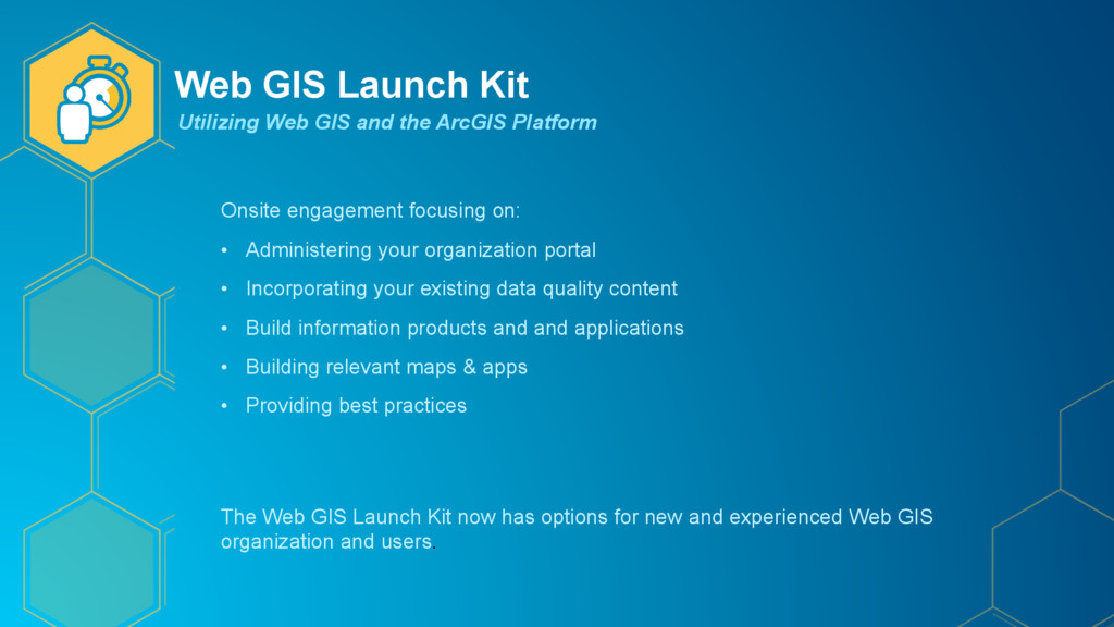
your organization portal • Incorporating your existing data quality content • Build information products and and applications • Building relevant maps & apps • Providing best practices The Web GIS Launch Kit now has options for new and experienced Web GIS organization and users. Utilizing Web GIS and the ArcGIS Platform
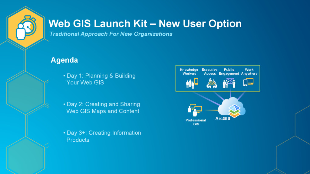
For New Organizations Agenda • Day 1: Planning & Building Your Web GIS • Day 2: Creating and Sharing Web GIS Maps and Content • Day 3+: Creating Information Products ArcGIS Knowledge Workers Work Anywhere Public Engagement Executive Access Professional GIS
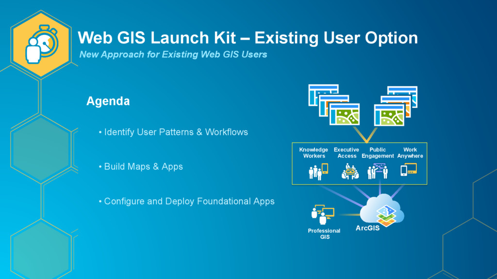
for Existing Web GIS Users Agenda • Identify User Patterns & Workflows • Build Maps & Apps • Configure and Deploy Foundational Apps ArcGIS Knowledge Workers Work Anywhere Public Engagement Executive Access Professional GIS
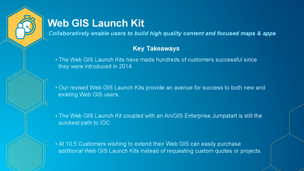
quality content and focused maps & apps Key Takeaways • The Web GIS Launch Kits have made hundreds of customers successful since they were introduced in 2014. • Our revised Web GIS Launch Kits provide an avenue for success to both new and existing Web GIS users. • The Web GIS Launch Kit coupled with an ArcGIS Enterprise Jumpstart is still the quickest path to IOC • At 10.5 Customers wishing to extend their Web GIS can easily purchase additional Web GIS Launch Kits instead of requesting custom quotes or projects.
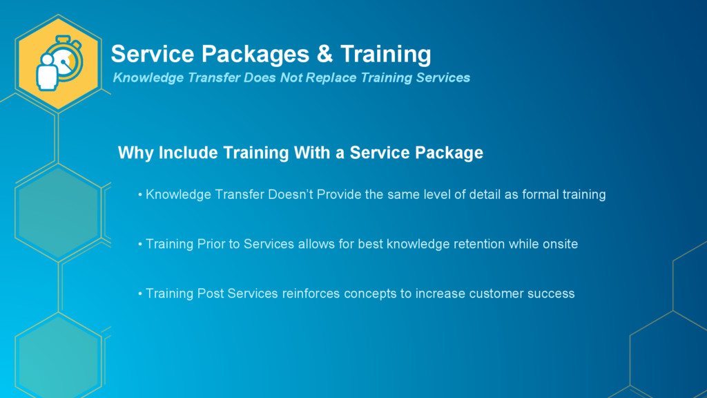
Package • Knowledge Transfer Doesn’t Provide the same level of detail as formal training • Training Prior to Services allows for best knowledge retention while onsite • Training Post Services reinforces concepts to increase customer success Knowledge Transfer Does Not Replace Training Services
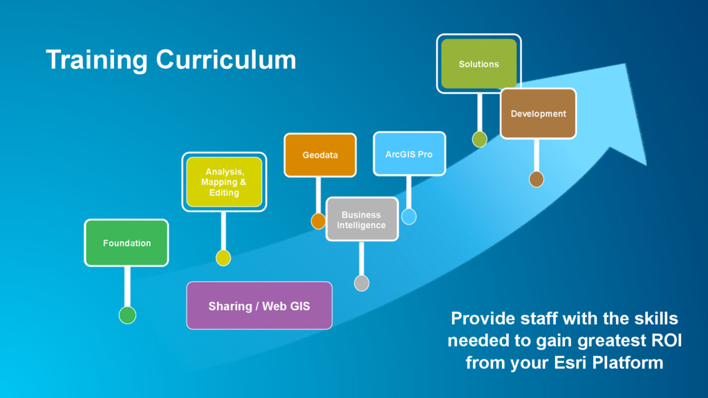
from your Esri Platform Sharing / Web GIS Foundation Analysis, Mapping & Editing Geodata ArcGIS Pro Business Intelligence Solutions Development Training Curriculum
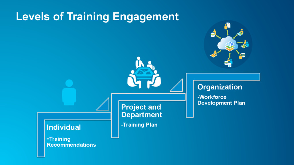
with goals and objectives Deploy training resources effectively Goals identification Business case for GIS investment Easy access to training materials and information Benefits of a Training / Workforce Development Plan
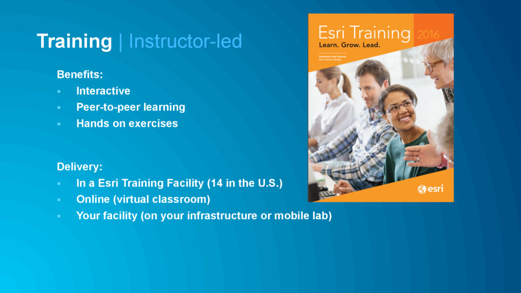
Delivery: § In a Esri Training Facility (14 in the U.S.) § Online (virtual classroom) § Your facility (on your infrastructure or mobile lab) Training | Instructor-led
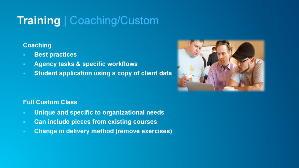
§ Student application using a copy of client data Full Custom Class § Unique and specific to organizational needs § Can include pieces from existing courses § Change in delivery method (remove exercises) Training | Coaching/Custom
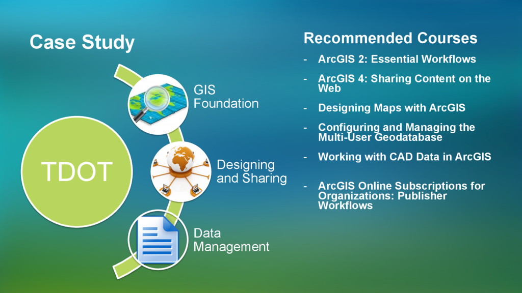
Recommended Courses - ArcGIS 2: Essential Workflows - ArcGIS 4: Sharing Content on the Web - Designing Maps with ArcGIS - Configuring and Managing the Multi-User Geodatabase - Working with CAD Data in ArcGIS - ArcGIS Online Subscriptions for Organizations: Publisher Workflows
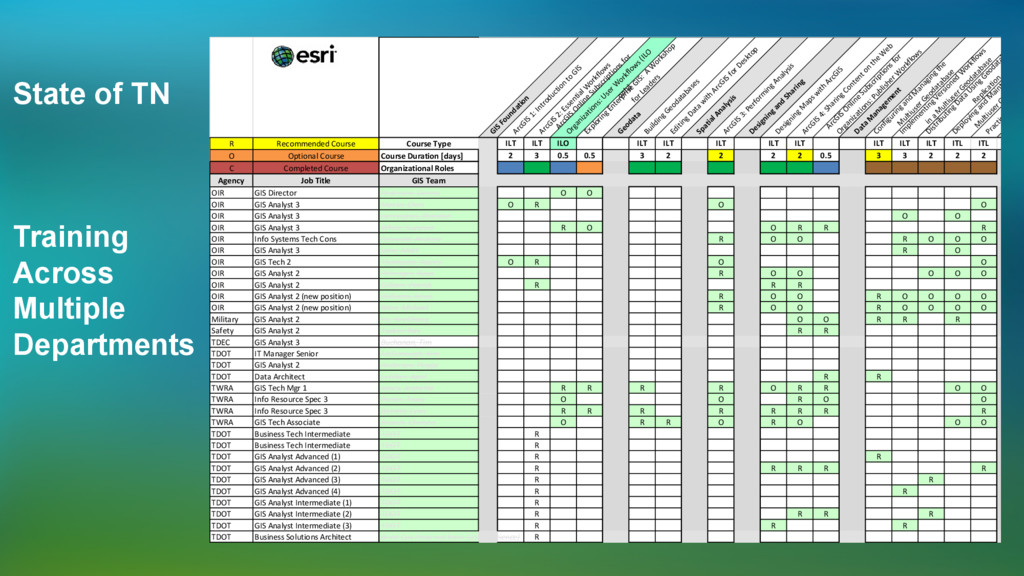
W orkflow s ArcGIS Online Subscriptions for Organizations: User W orkflow s (ILO only) Exploring Enterprise GIS: A W orkshop for Leaders Geodata Building Geodatabases Editing Data with ArcGIS for Desktop Spatial Analysis ArcGIS 3: Perform ing Analysis Designing and Sharing Designing M aps with ArcGIS ArcGIS 4: Sharing Content on the W eb ArcGIS Online Subscriptions for Organizations: Publisher W orkflow s Data M anagem ent Configuring and M anaging the M ultiuser Geodatabase Im plem enting Versioned W orkflow s in a M ultiuser Geodatabase Distributing Data Using Geodatabase Replication Deploying and M aintaining a M ultiuser Geodatab Practicing Geod Serv R Recommended Course Course Type ILT ILT ILO ILT ILT ILT ILT ILT ILT ILT ILT ITL ITL O Optional Course Course Duration [days] 2 3 0.5 0.5 3 2 2 2 2 0.5 3 3 2 2 2 C Completed Course Organizational Roles Agency Job Title GIS Team OIR GIS Director Pedersen, Dennis O O OIR GIS Analyst 3 Meeks, Chris O R O O OIR GIS Analyst 3 Herrington, Brandon O O OIR GIS Analyst 3 White, Suzanne R O O R R R OIR Info Systems Tech Cons Griswold, Andrew R O O R O O O OIR GIS Analyst 3 Lane, Matt R O OIR GIS Tech 2 Thompson, Nancy O R O O OIR GIS Analyst 2 Pittenger, Ryan R O O O O O OIR GIS Analyst 2 Gilliam, Patrick R R R OIR GIS Analyst 2 (new position) Williams, Kevin R O O R O O O O OIR GIS Analyst 2 (new position) Riter, Michael R O O R O O O O Military GIS Analyst 2 Yu, HeeChong O O R R R Safety GIS Analyst 2 Tucker, Ray R R TDEC GIS Analyst 3 Buchanan, Tim TDOT IT Manager Senior McDonough, Kim TDOT GIS Analyst 2 Anderson, Peggy TDOT Data Architect Letillier, April R R TWRA GIS Tech Mgr 1 Jones, Jeanette R R R R O R R O O TWRA Info Resource Spec 3 Porter, Tracy O O R O O TWRA Info Resource Spec 3 Barrett, Lynn R R R R R R R R TWRA GIS Tech Associate Broach, Chelsea O R R O R O O O TDOT Business Tech Intermediate TDOT R TDOT Business Tech Intermediate TDOT R TDOT GIS Analyst Advanced (1) TDOT R R TDOT GIS Analyst Advanced (2) TDOT R R R R R TDOT GIS Analyst Advanced (3) TDOT R R TDOT GIS Analyst Advanced (4) TDOT R R TDOT GIS Analyst Intermediate (1) TDOT R TDOT GIS Analyst Intermediate (2) TDOT R R R R TDOT GIS Analyst Intermediate (3) TDOT R R R TDOT Business Solutions Architect Brian Cox (may not have GIS experience) R State of TN Training Across Multiple Departments