The Texas General Land Office primarily serves the schoolchildren, veterans, and the environment of Texas. The agency does so by preserving our history, maximizing state revenue through innovative administration, and through the prudent stewardship of state lands and natural resources.
Geospatial Team at the General Land Office provides a foundation of tools, data, analyses, and solutions to agency staff, other agencies, project partners, and the general public. We strive to understand the technology, democratize access to location intelligence, set the standard for GIS in the state, and enhance geospatial information technologies to further the agency mission. Contact the Geospatial Team: [email protected] | 512-463-4352 Geospatial Technology Services Providing the tools to enable better decision-making through the power of location.
P. Bush, Commissioner • GLO was created in 1836 by the Republic of Texas • 1844 – DEAL – Statehood & $10 million Debt Acquisition for 175 million acres of unappropriated land – NO DEAL • 1845 – Statehood – Texas Retains Public Lands and Debt • 1853 – Legislature set up the Permanent School Fund (PSF) and dedicated the remaining unappropriated land as either Public School, Asylum or University lands – approximately 52 million acres
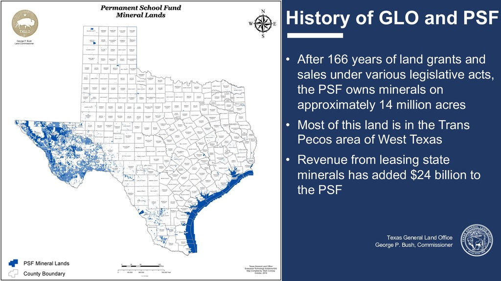
P. Bush, Commissioner • After 166 years of land grants and sales under various legislative acts, the PSF owns minerals on approximately 14 million acres • Most of this land is in the Trans Pecos area of West Texas • Revenue from leasing state minerals has added $24 billion to the PSF
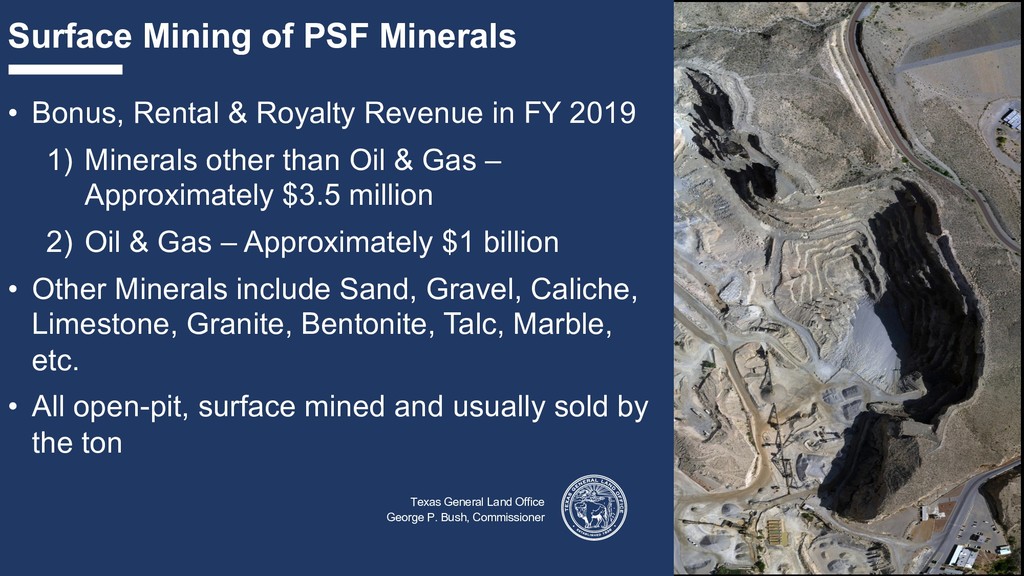
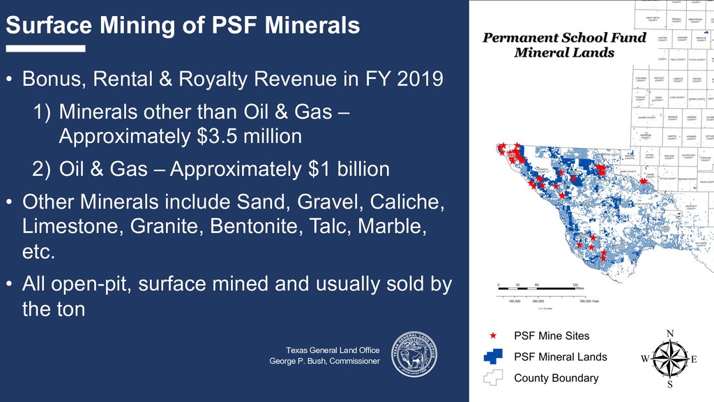
P. Bush, Commissioner • Bonus, Rental & Royalty Revenue in FY 2019 1) Minerals other than Oil & Gas – Approximately $3.5 million 2) Oil & Gas – Approximately $1 billion • Other Minerals include Sand, Gravel, Caliche, Limestone, Granite, Bentonite, Talc, Marble, etc. • All open-pit, surface mined and usually sold by the ton Texas General Land Office George P. Bush, Commissioner
Revenue in FY 2019 1) Minerals other than Oil & Gas – Approximately $3.5 million 2) Oil & Gas – Approximately $1 billion • Other Minerals include Sand, Gravel, Caliche, Limestone, Granite, Bentonite, Talc, Marble, etc. • All open-pit, surface mined and usually sold by the ton Texas General Land Office George P. Bush, Commissioner
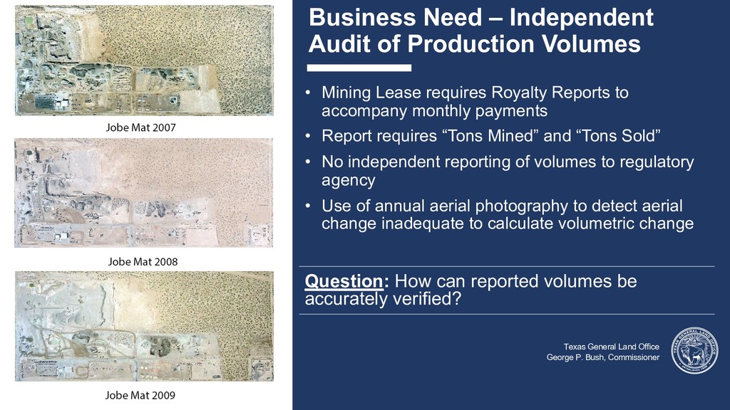
Land Office George P. Bush, Commissioner • Mining Lease requires Royalty Reports to accompany monthly payments • Report requires “Tons Mined” and “Tons Sold” • No independent reporting of volumes to regulatory agency • Use of annual aerial photography to detect aerial change inadequate to calculate volumetric change Question: How can reported volumes be accurately verified?
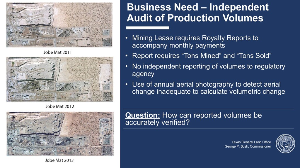
Land Office George P. Bush, Commissioner • Mining Lease requires Royalty Reports to accompany monthly payments • Report requires “Tons Mined” and “Tons Sold” • No independent reporting of volumes to regulatory agency • Use of annual aerial photography to detect aerial change inadequate to calculate volumetric change Question: How can reported volumes be accurately verified?
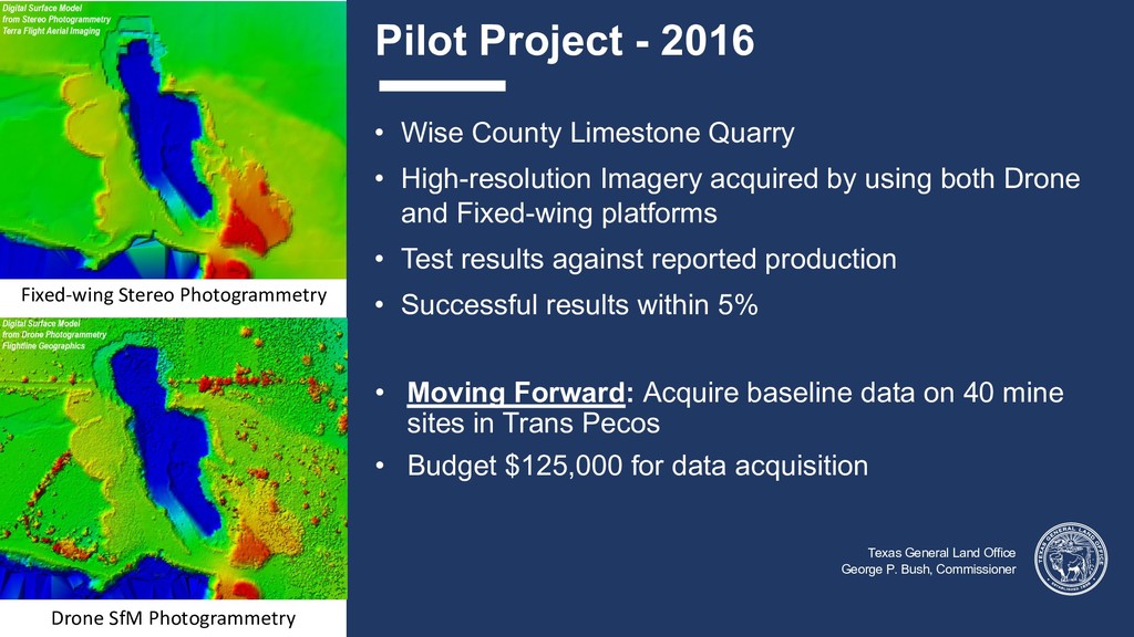
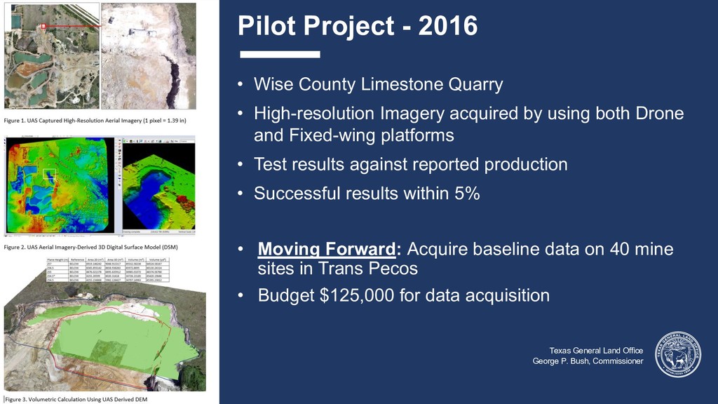
Bush, Commissioner • Wise County Limestone Quarry • High-resolution Imagery acquired by using both Drone and Fixed-wing platforms • Test results against reported production • Successful results within 5% • Moving Forward: Acquire baseline data on 40 mine sites in Trans Pecos • Budget $125,000 for data acquisition Fixed-wing Stereo Photogrammetry Drone SfM Photogrammetry
Bush, Commissioner • Wise County Limestone Quarry • High-resolution Imagery acquired by using both Drone and Fixed-wing platforms • Test results against reported production • Successful results within 5% • Moving Forward: Acquire baseline data on 40 mine sites in Trans Pecos • Budget $125,000 for data acquisition
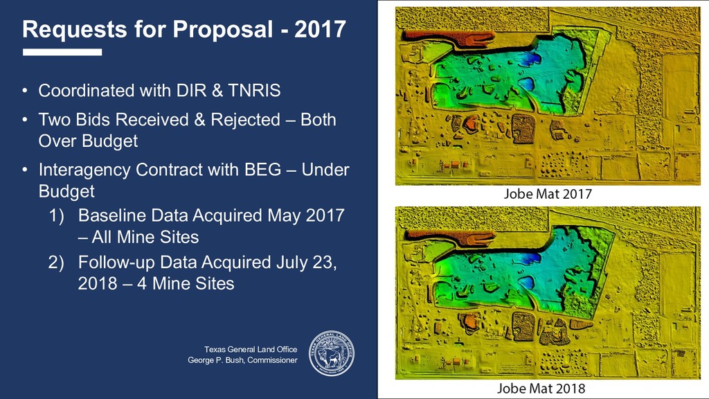
P. Bush, Commissioner • Coordinated with DIR & TNRIS • Two Bids Received & Rejected – Both Over Budget • Interagency Contract with BEG – Under Budget 1) Baseline Data Acquired May 2017 – All Mine Sites 2) Follow-up Data Acquired July 23, 2018 – 4 Mine Sites
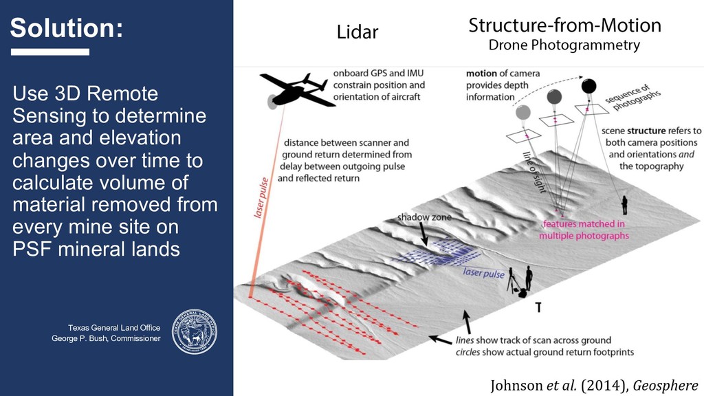
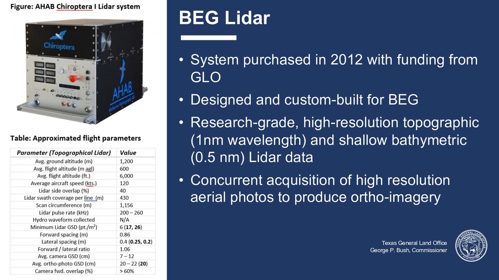
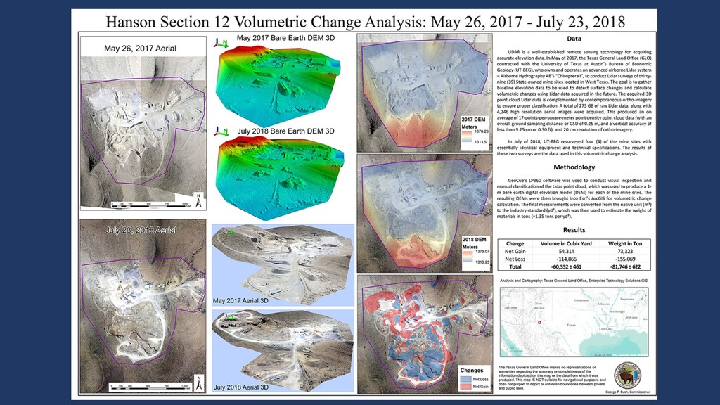
• System purchased in 2012 with funding from GLO • Designed and custom-built for BEG • Research-grade, high-resolution topographic (1nm wavelength) and shallow bathymetric (0.5 nm) Lidar data • Concurrent acquisition of high resolution aerial photos to produce ortho-imagery
George P. Bush, Commissioner • Software: GeoCue LP360, Esri ArcGIS • Data Processing 1. Classify LAS using LP360 2. Generate Bare Earth DEM (LP360) 3. Assess elevation difference of resulting DEMs (ArcGIS 3D Analyst) • Volumetric Change Calculation 1. Calculate volumetric changes with original DEM using ArcGIS (Cut/Fill) 2. Reclassify the difference grid to exclude unchanged areas (binary grid) 3. Apply the elevation adjustment and binary grid to the original BE DEM 4. Re-run Cut/Fill and summarize the results
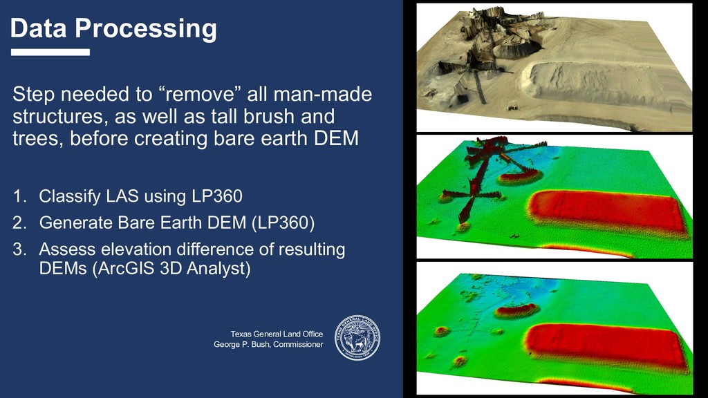
Step needed to “remove” all man-made structures, as well as tall brush and trees, before creating bare earth DEM 1. Classify LAS using LP360 2. Generate Bare Earth DEM (LP360) 3. Assess elevation difference of resulting DEMs (ArcGIS 3D Analyst)
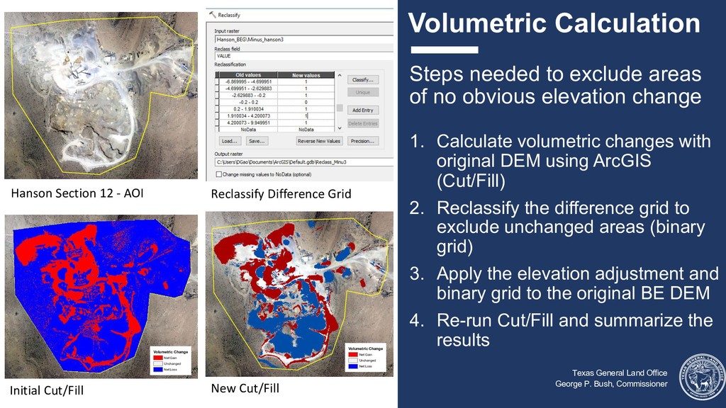
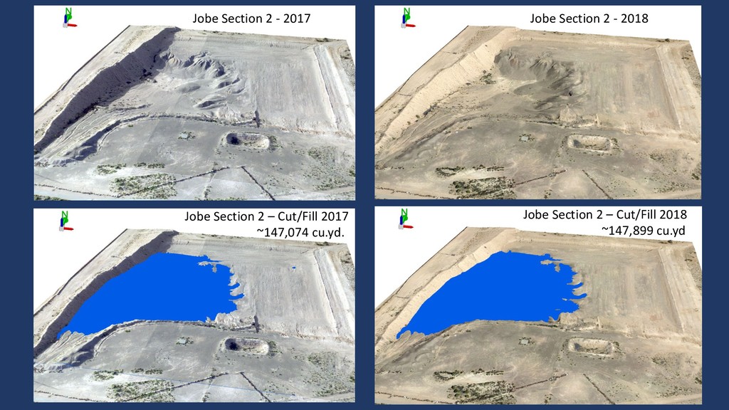
Steps needed to exclude areas of no obvious elevation change 1. Calculate volumetric changes with original DEM using ArcGIS (Cut/Fill) 2. Reclassify the difference grid to exclude unchanged areas (binary grid) 3. Apply the elevation adjustment and binary grid to the original BE DEM 4. Re-run Cut/Fill and summarize the results Hanson Section 12 - AOI Initial Cut/Fill Reclassify Difference Grid New Cut/Fill Volumetric Change Net Gain Unchanged Net Loss Volumetric Change Net Gain Unchanged Net Loss
Office George P. Bush, Commissioner • LP360 has many Point Cloud Tasks tools for stockpile volumetric calculation, but the stockpile/mining pit approach requires more on the ground knowledge to be useful • The difference of DEM approach is adopted and proven to be effective • Issues Affecting Accuracy • Topography of terrain • Size and complexity of mine site • Concurrent acquisition of high-resolution ortho-imagery aids classification
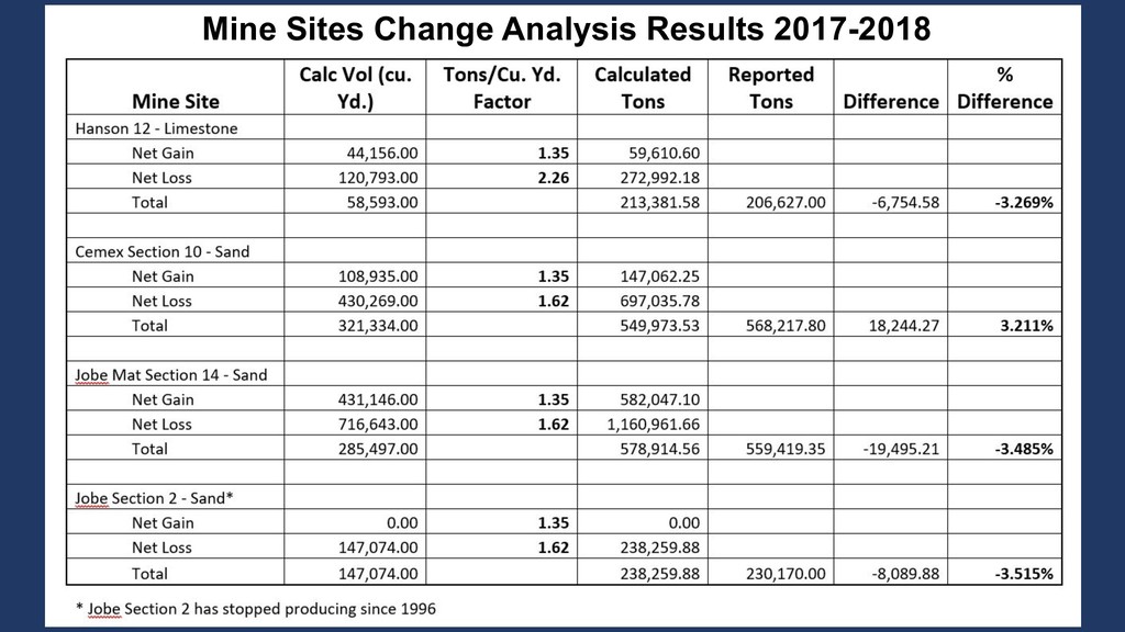
Original Question: “How can reported volumes be accurately verified?” • Answer: They probably can’t be accurately verified • Issues Affecting Accuracy • Timing Data acquisition with production reporting requirements • Density Variation • Density variation within rock types • Density variation in the same rock type within a single mine • Use of this technology is promising in: • Detection of Audit Targets • Quantifying Claims at Volume Audit Initiation
project leads would like to thank: • GLO management of Energy Resources and Enterprise Technology Solutions for their support. • DIR and TNRIS for assisting in the initial RFP effort. • The UT Bureau of Economic Geology for completing the Lidar surveys on time and under budget. • All of our GIS interns, past and present, who worked on this project.