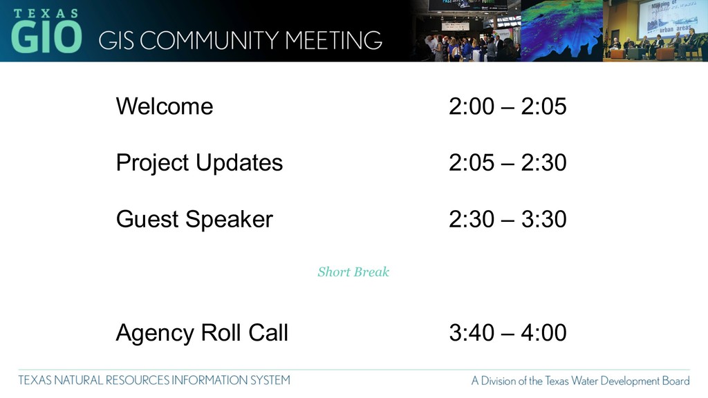
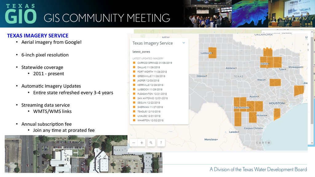
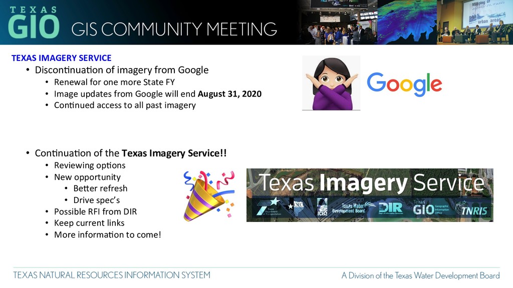
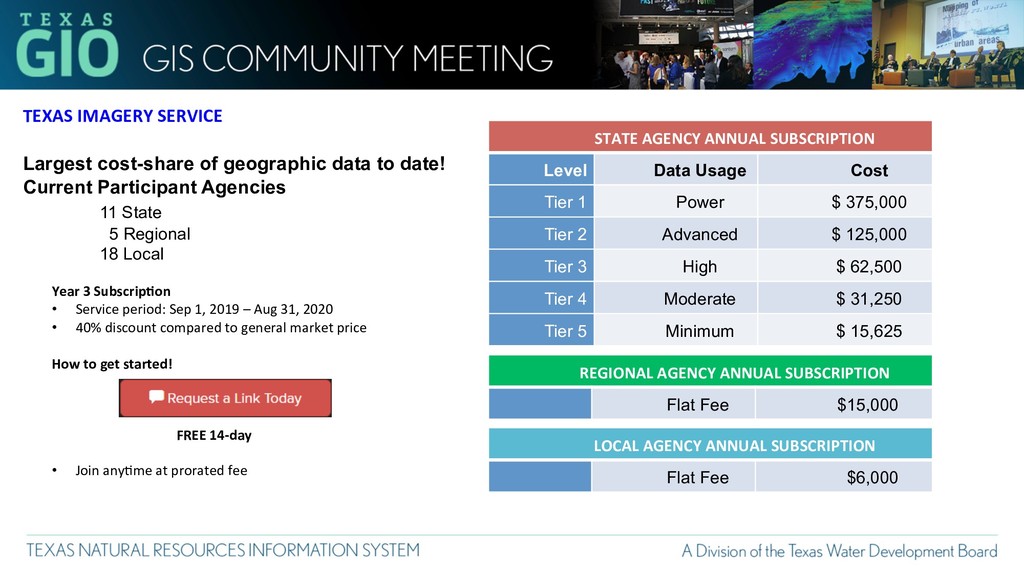
Renewal for one more State FY • Image updates from Google will end August 31, 2020 • Con8nued access to all past imagery • Con8nua8on of the Texas Imagery Service!! • Reviewing op8ons • New opportunity • BeTer refresh • Drive spec’s • Possible RFI from DIR • Keep current links • More informa8on to come!
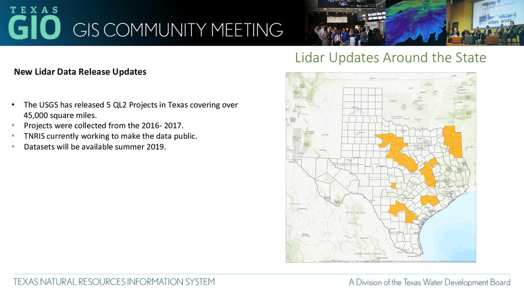
• The USGS has released 5 QL2 Projects in Texas covering over 45,000 square miles. • Projects were collected from the 2016- 2017. • TNRIS currently working to make the data public. • Datasets will be available summer 2019.
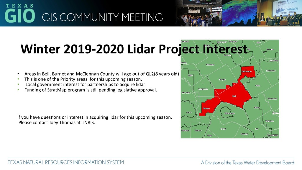
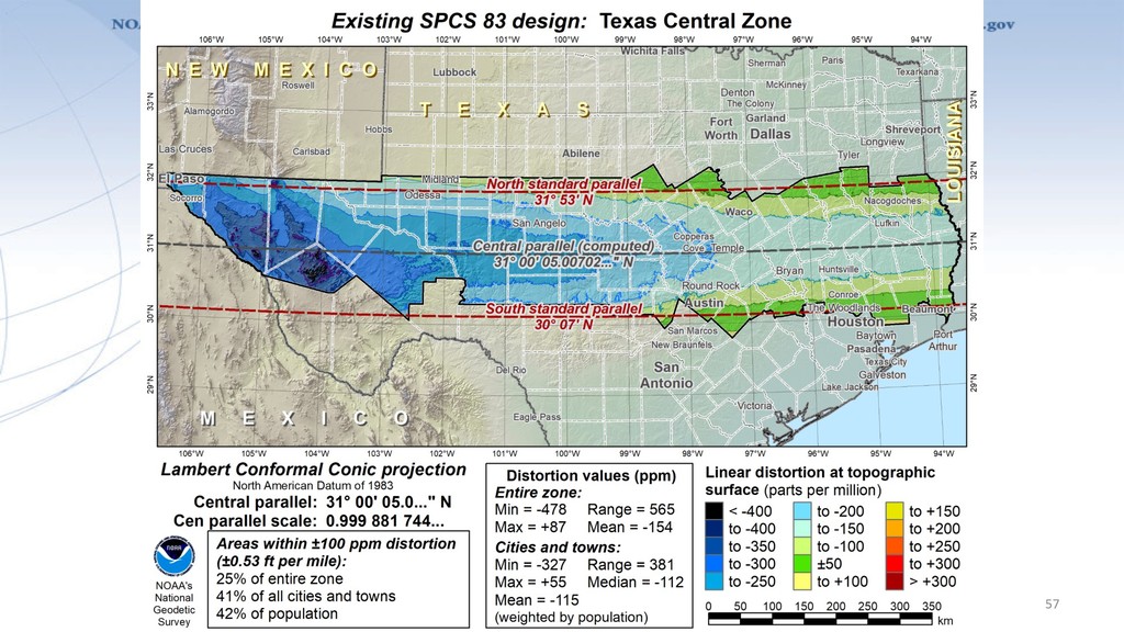
and McClennan County will age out of QL2(8 years old) • This is one of the Priority areas for this upcoming season. • Local government interest for partnerships to acquire lidar • Funding of StratMap program is s8ll pending legisla8ve approval. If you have ques8ons or interest in acquiring lidar for this upcoming season, Please contact Joey Thomas at TNRIS.
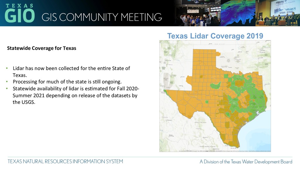
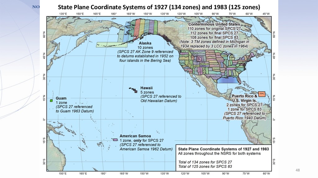
has now been collected for the en8re State of Texas. • Processing for much of the state is s8ll ongoing. • Statewide availability of lidar is es8mated for Fall 2020- Summer 2021 depending on release of the datasets by the USGS.
of customer feedback • Overview of SPCS2022 Policy & Procedures • Zone design approach and linear distor8on • Preliminary statewide and default zone designs • Zone layers and uniqueness • Making requests/proposals and subminng designs • Low distor8on projec8on (LDP) zones • Poll ques)ons! – Note that many ques)ons will be state-specific
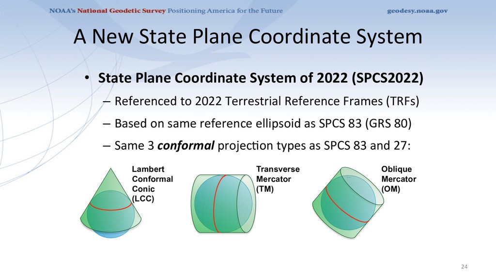
System of 2022 (SPCS2022) – Referenced to 2022 Terrestrial Reference Frames (TRFs) – Based on same reference ellipsoid as SPCS 83 (GRS 80) – Same 3 conformal projec8on types as SPCS 83 and 27: 24 Transverse Mercator (TM) Oblique Mercator (OM) Lambert Conformal Conic (LCC)
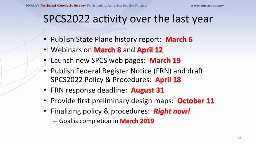
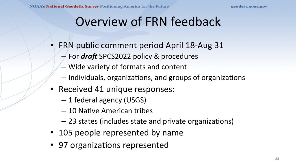
history report: March 6 • Webinars on March 8 and April 12 • Launch new SPCS web pages: March 19 • Publish Federal Register No8ce (FRN) and drao SPCS2022 Policy & Procedures: April 18 • FRN response deadline: August 31 • Provide first preliminary design maps: October 11 • Finalizing policy & procedures: Right now! – Goal is comple8on in March 2019 25
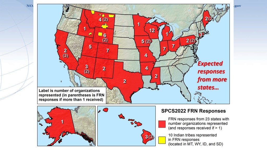
18-Aug 31 – For dra> SPCS2022 policy & procedures – Wide variety of formats and content – Individuals, organiza8ons, and groups of organiza8ons • Received 41 unique responses: – 1 federal agency (USGS) – 10 Na8ve American tribes – 23 states (includes state and private organiza8ons) • 105 people represented by name • 97 organiza8ons represented 28
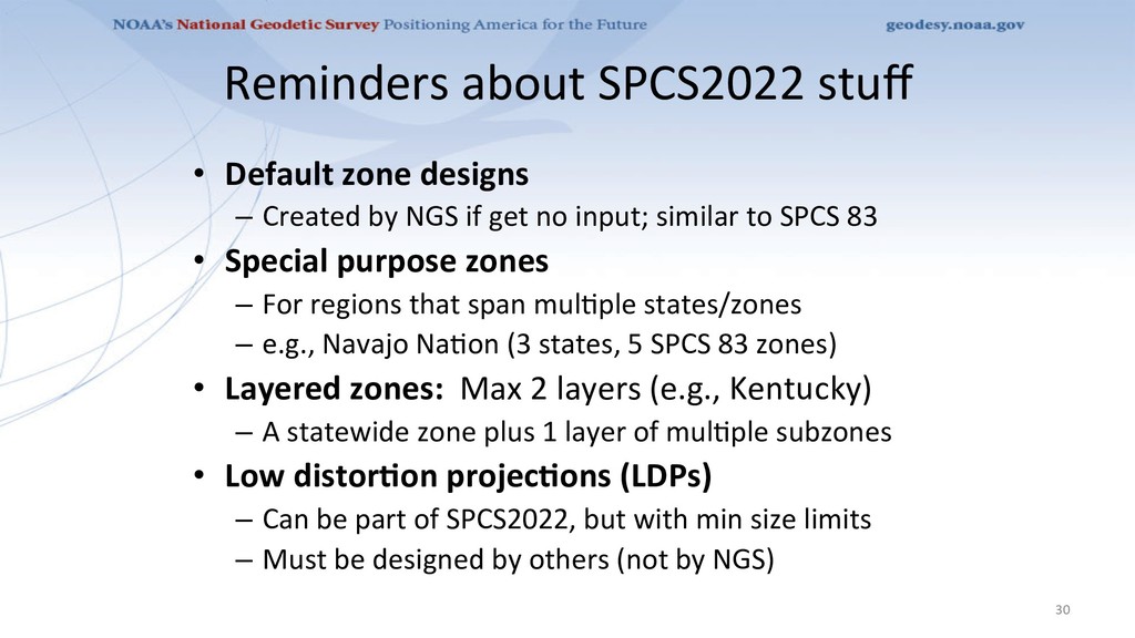
by NGS if get no input; similar to SPCS 83 • Special purpose zones – For regions that span mul8ple states/zones – e.g., Navajo Na8on (3 states, 5 SPCS 83 zones) • Layered zones: Max 2 layers (e.g., Kentucky) – A statewide zone plus 1 layer of mul8ple subzones • Low distorCon projecCons (LDPs) – Can be part of SPCS2022, but with min size limits – Must be designed by others (not by NGS) 30
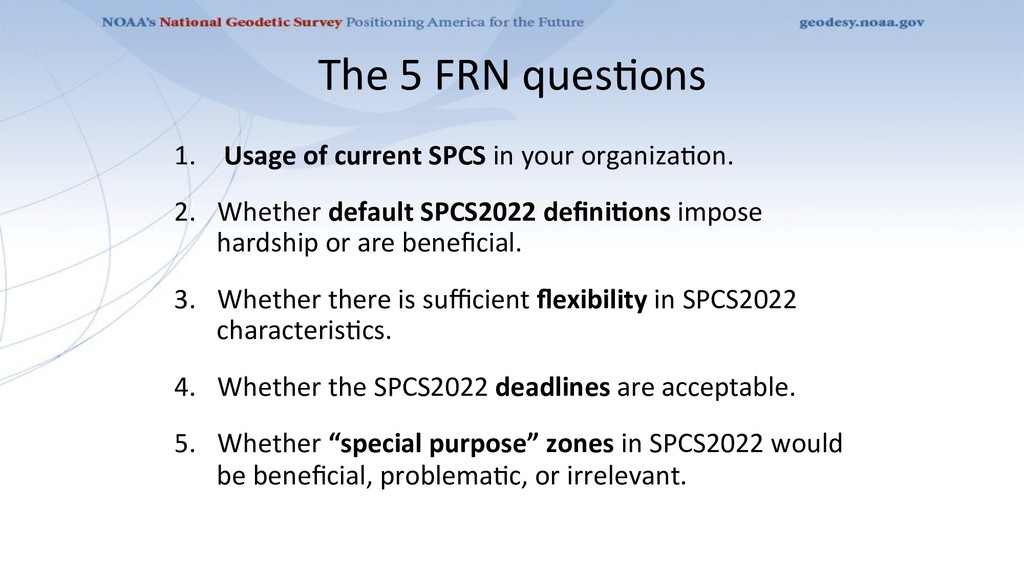
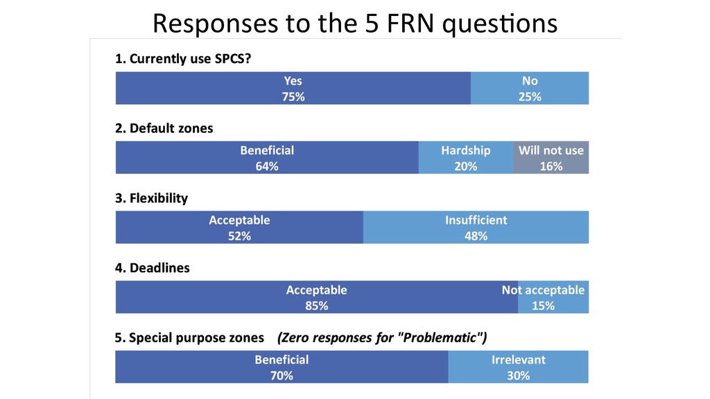
your organiza8on. 2. Whether default SPCS2022 definiCons impose hardship or are beneficial. 3. Whether there is sufficient flexibility in SPCS2022 characteris8cs. 4. Whether the SPCS2022 deadlines are acceptable. 5. Whether “special purpose” zones in SPCS2022 would be beneficial, problema8c, or irrelevant.
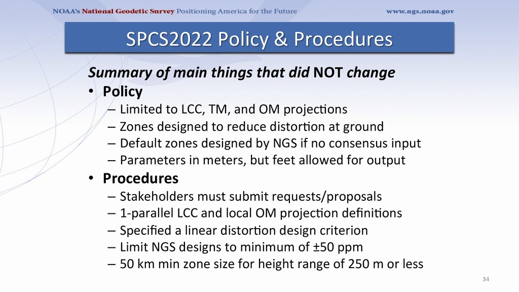
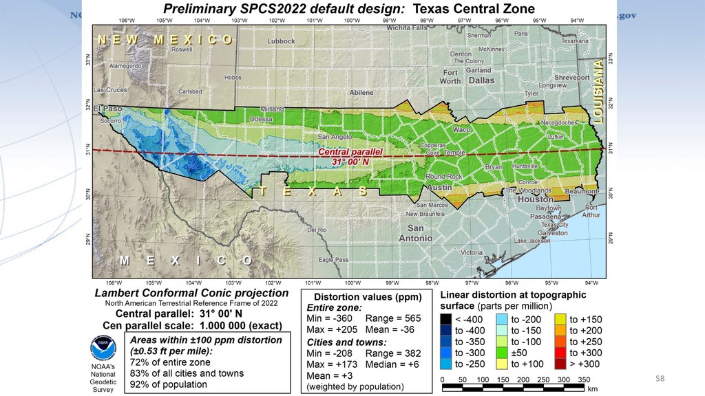
– Limited to LCC, TM, and OM projec8ons – Zones designed to reduce distor8on at ground – Default zones designed by NGS if no consensus input – Parameters in meters, but feet allowed for output • Procedures – Stakeholders must submit requests/proposals – 1-parallel LCC and local OM projec8on defini8ons – Specified a linear distor8on design criterion – Limit NGS designs to minimum of ±50 ppm – 50 km min zone size for height range of 250 m or less 34 SPCS2022 Policy & Procedures
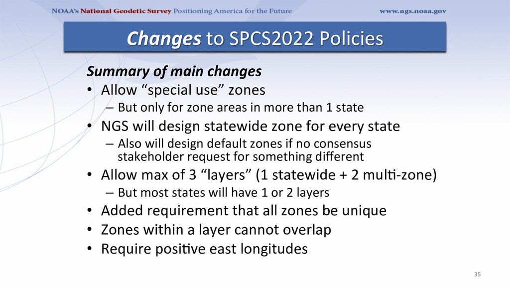
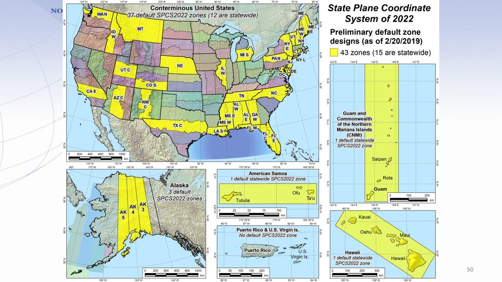
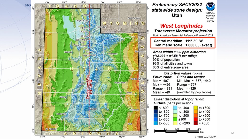
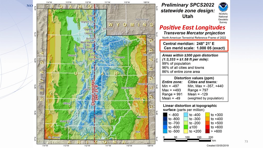
But only for zone areas in more than 1 state • NGS will design statewide zone for every state – Also will design default zones if no consensus stakeholder request for something different • Allow max of 3 “layers” (1 statewide + 2 mul8-zone) – But most states will have 1 or 2 layers • Added requirement that all zones be unique • Zones within a layer cannot overlap • Require posi8ve east longitudes 35 Changes to SPCS2022 Policies
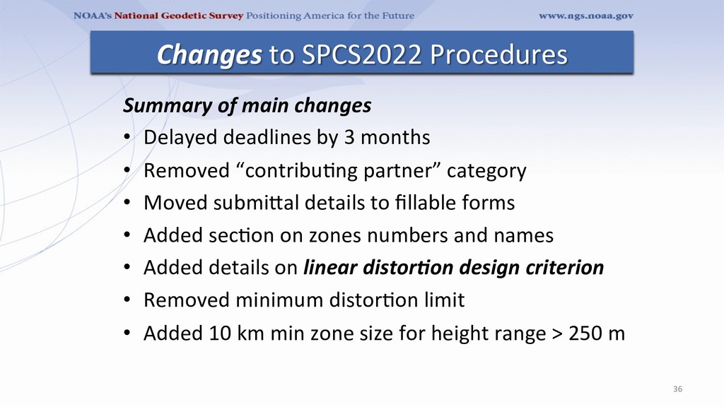
• Removed “contribu8ng partner” category • Moved submiTal details to fillable forms • Added sec8on on zones numbers and names • Added details on linear distor)on design criterion • Removed minimum distor8on limit • Added 10 km min zone size for height range > 250 m 36 Changes to SPCS2022 Procedures
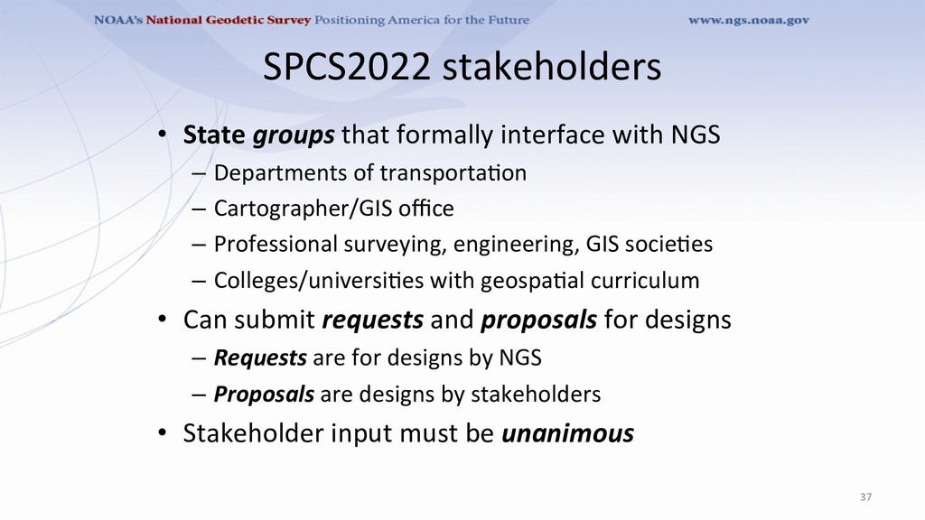
– Departments of transporta8on – Cartographer/GIS office – Professional surveying, engineering, GIS socie8es – Colleges/universi8es with geospa8al curriculum • Can submit requests and proposals for designs – Requests are for designs by NGS – Proposals are designs by stakeholders • Stakeholder input must be unanimous 37
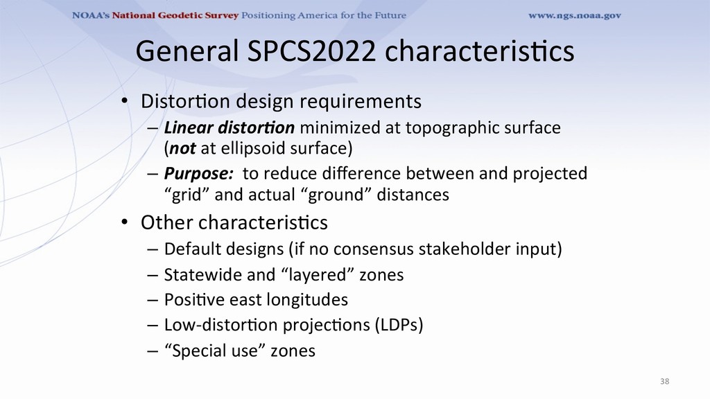
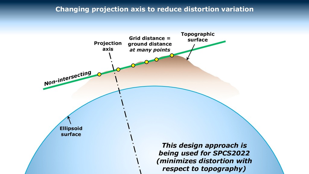
minimized at topographic surface (not at ellipsoid surface) – Purpose: to reduce difference between and projected “grid” and actual “ground” distances • Other characteris8cs – Default designs (if no consensus stakeholder input) – Statewide and “layered” zones – Posi8ve east longitudes – Low-distor8on projec8ons (LDPs) – “Special use” zones 38
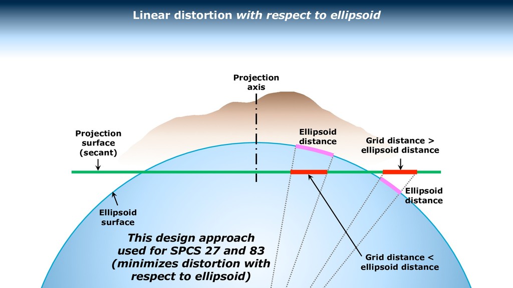
respect to ellipsoid Grid distance < ellipsoid distance Ellipsoid distance Ellipsoid distance Projection surface (secant) This design approach used for SPCS 27 and 83 (minimizes distortion with respect to ellipsoid) Ellipsoid surface
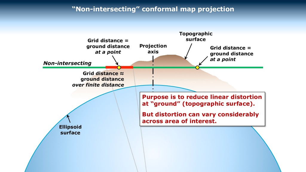
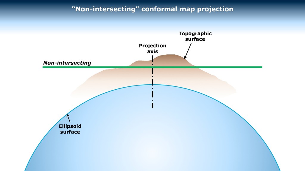
is to reduce linear distortion at “ground” (topographic surface). But distortion can vary considerably across area of interest. Grid distance = ground distance at a point Grid distance = ground distance at a point Grid distance ≈ ground distance over finite distance Topographic surface
Ellipsoid surface Grid distance = ground distance at many points Topographic surface This design approach is being used for SPCS2022 (minimizes distortion with respect to topography)
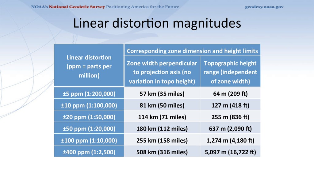
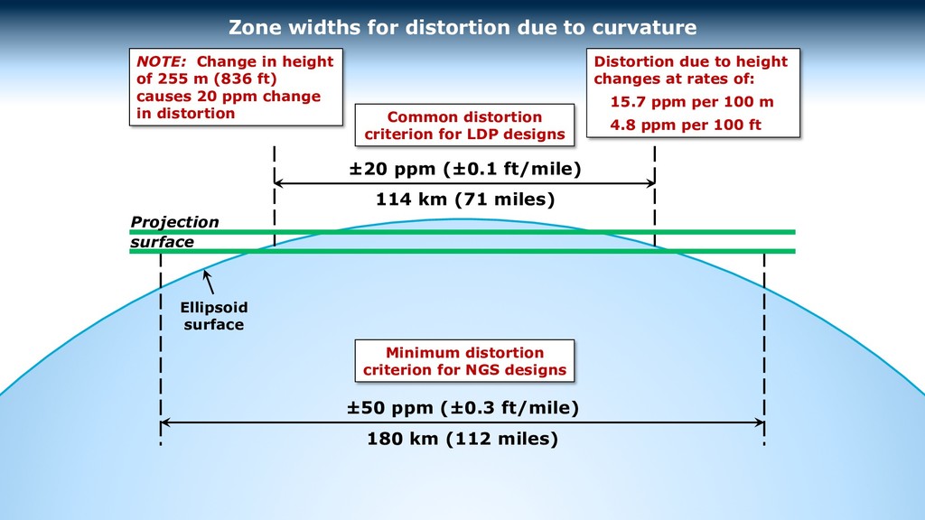
Corresponding zone dimension and height limits Zone width perpendicular to projecCon axis (no variaCon in topo height) Topographic height range (independent of zone width) ±5 ppm (1:200,000) 57 km (35 miles) 64 m (209 m) ±10 ppm (1:100,000) 81 km (50 miles) 127 m (418 m) ±20 ppm (1:50,000) 114 km (71 miles) 255 m (836 m) ±50 ppm (1:20,000) 180 km (112 miles) 637 m (2,090 m) ±100 ppm (1:10,000) 255 km (158 miles) 1,274 m (4,180 m) ±400 ppm (1:2,500) 508 km (316 miles) 5,097 m (16,722 m)
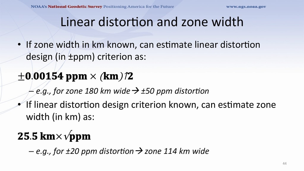
km known, can es8mate linear distor8on design (in ±ppm) criterion as: ±. × ()↑ – e.g., for zone 180 km wideà ±50 ppm distor8on • If linear distor8on design criterion known, can es8mate zone width (in km) as: . ×√ – e.g., for ±20 ppm distor8onà zone 114 km wide 44
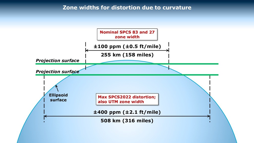
for distortion due to curvature Ellipsoid surface ±400 ppm (±2.1 ft/mile) 508 km (316 miles) Projection surface Projection surface Max SPCS2022 distortion; also UTM zone width Nominal SPCS 83 and 27 zone width
for distortion due to curvature Ellipsoid surface ±50 ppm (±0.3 ft/mile) 180 km (112 miles) Projection surface Minimum distortion criterion for NGS designs Common distortion criterion for LDP designs NOTE: Change in height of 255 m (836 ft) causes 20 ppm change in distortion Distortion due to height changes at rates of: 15.7 ppm per 100 m 4.8 ppm per 100 ft
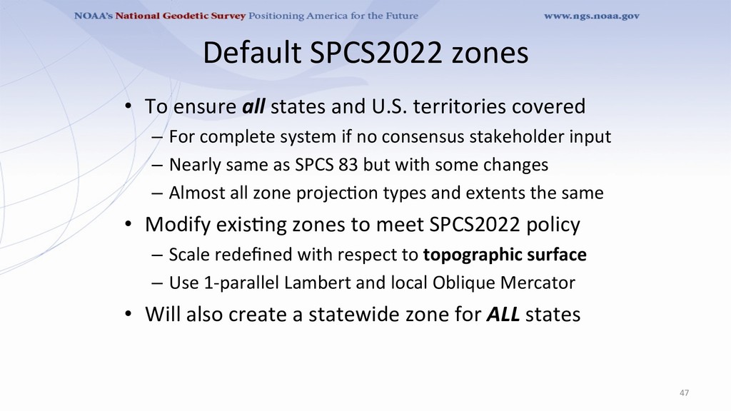
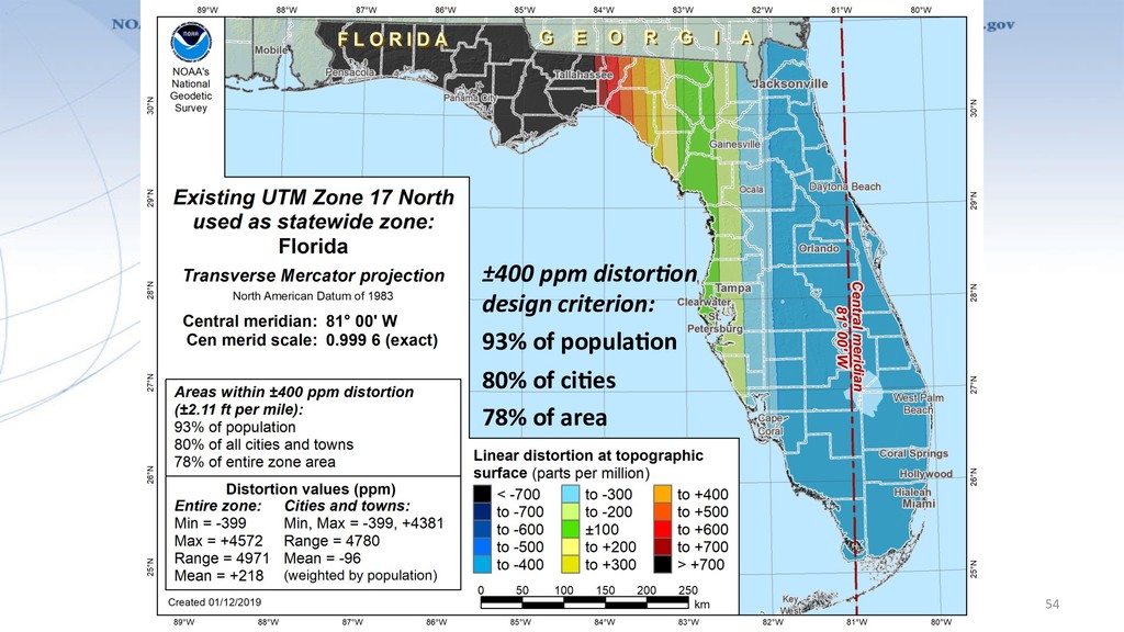
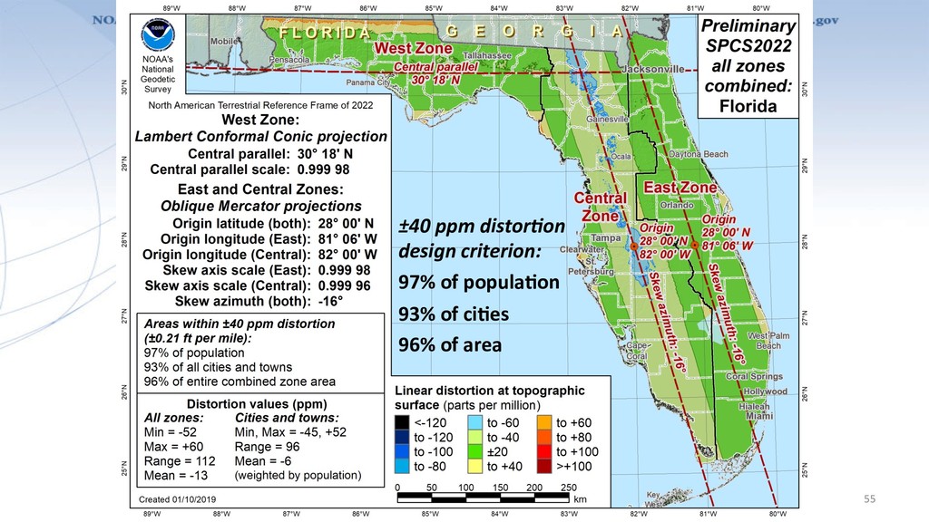
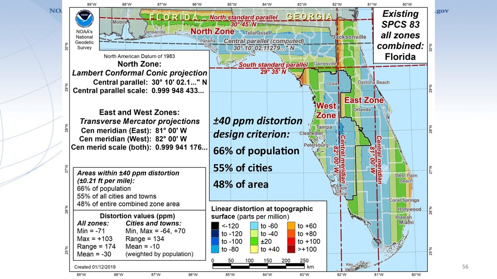
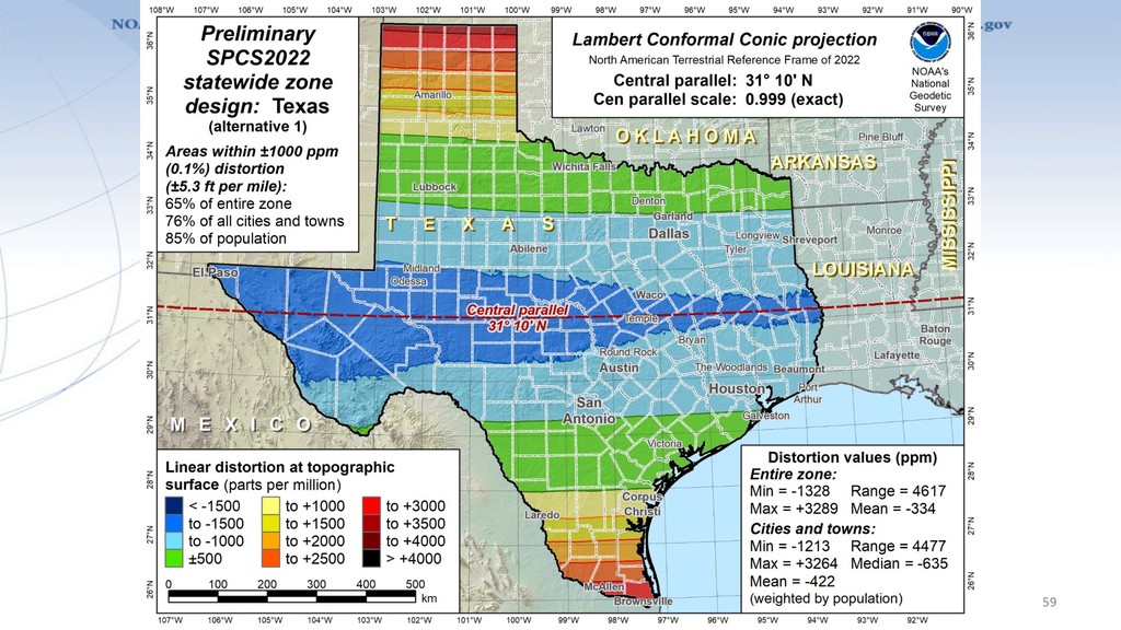
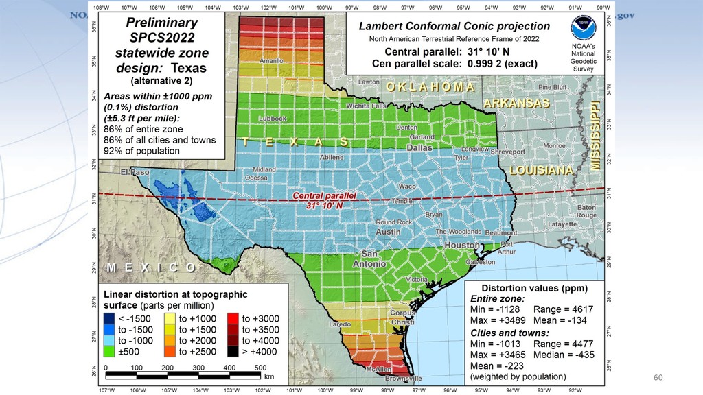
territories covered – For complete system if no consensus stakeholder input – Nearly same as SPCS 83 but with some changes – Almost all zone projec8on types and extents the same • Modify exis8ng zones to meet SPCS2022 policy – Scale redefined with respect to topographic surface – Use 1-parallel Lambert and local Oblique Mercator • Will also create a statewide zone for ALL states 47
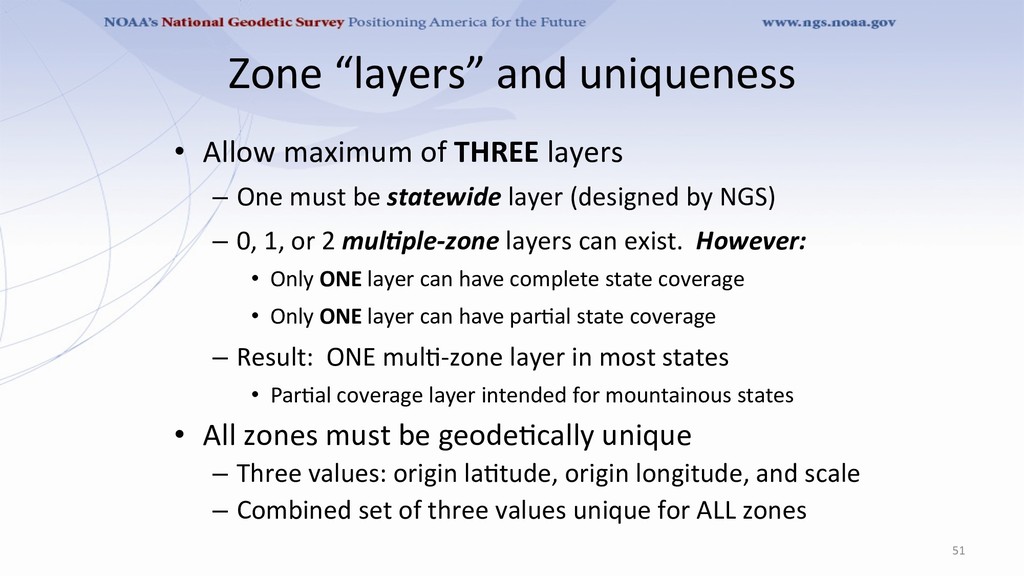
– One must be statewide layer (designed by NGS) – 0, 1, or 2 mul)ple-zone layers can exist. However: • Only ONE layer can have complete state coverage • Only ONE layer can have par8al state coverage – Result: ONE mul8-zone layer in most states • Par8al coverage layer intended for mountainous states • All zones must be geode8cally unique – Three values: origin la8tude, origin longitude, and scale – Combined set of three values unique for ALL zones 51
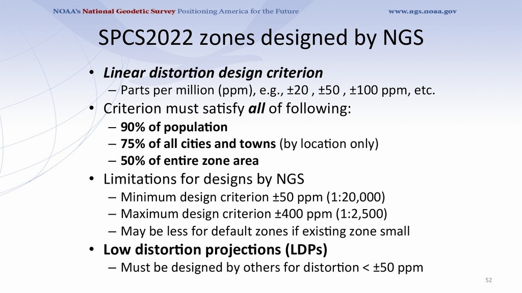
– Parts per million (ppm), e.g., ±20 , ±50 , ±100 ppm, etc. • Criterion must sa8sfy all of following: – 90% of populaCon – 75% of all ciCes and towns (by loca8on only) – 50% of enCre zone area • Limita8ons for designs by NGS – Minimum design criterion ±50 ppm (1:20,000) – Maximum design criterion ±400 ppm (1:2,500) – May be less for default zones if exis8ng zone small • Low distorCon projecCons (LDPs) – Must be designed by others for distor8on < ±50 ppm 52
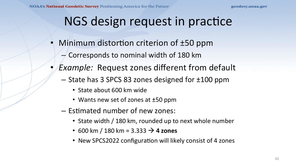
±50 ppm – Corresponds to nominal width of 180 km • Example: Request zones different from default – State has 3 SPCS 83 zones designed for ±100 ppm • State about 600 km wide • Wants new set of zones at ±50 ppm – Es8mated number of new zones: • State width / 180 km, rounded up to next whole number • 600 km / 180 km = 3.333 à 4 zones • New SPCS2022 configura8on will likely consist of 4 zones 62
Form – To request zones designed by NGS – To propose zones that stakeholders will design • SPCS2022 Zone Design SubmiTal Form – For stakeholders to submit designs – Based in NGS-approved previously submiTed proposal • For default designs, no request form needed – But submiNng a request will expedite final design 63
LDPs – Designed by stakeholders – Coverage can be complete or par8al (discon8nuous) • Minimum zone width – 50 km (31 miles) if height range <= 250 m – 10 km (6 miles) if height range > 250 m • What is zone “width” anyway? – Width of rectangle that completely encloses zone – “Minimum bounding rectangle by width” – Rectangle in same projec8on as zone, any orienta8on 65
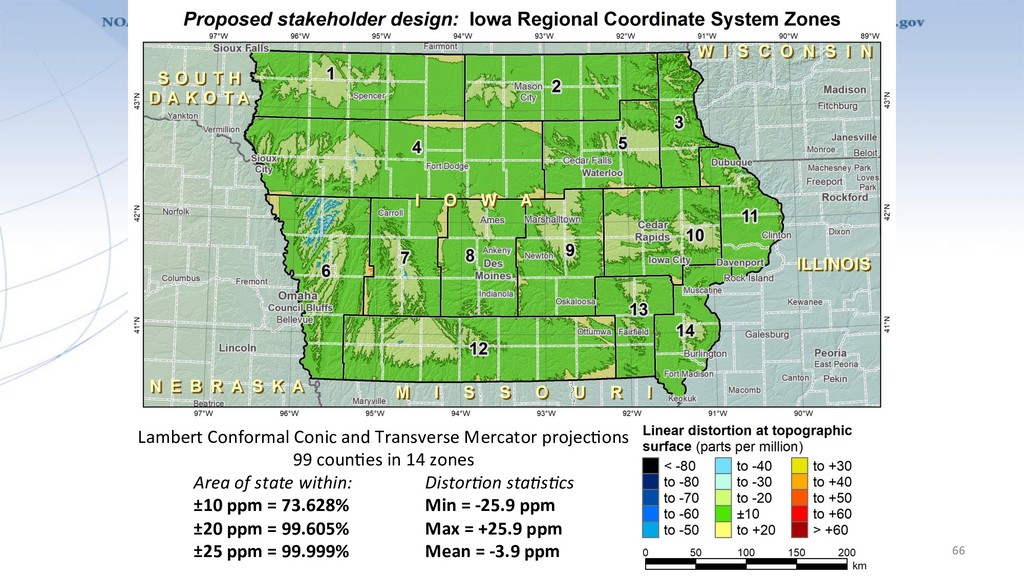
projec8ons 99 coun8es in 14 zones Area of state within: Distor8on sta8s8cs ±10 ppm = 73.628% Min = -25.9 ppm ±20 ppm = 99.605% Max = +25.9 ppm ±25 ppm = 99.999% Mean = -3.9 ppm
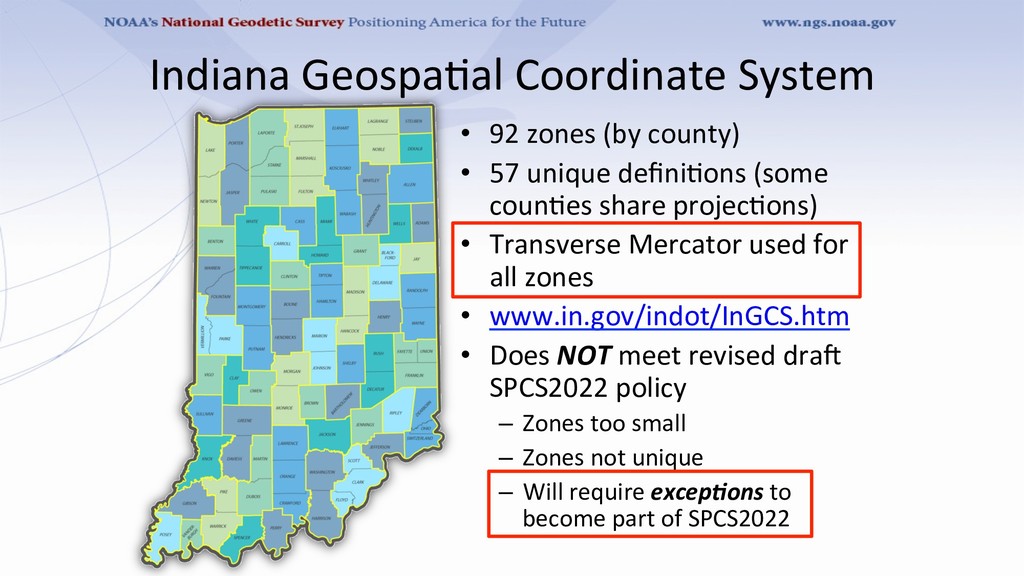
57 unique defini8ons (some coun8es share projec8ons) • Transverse Mercator used for all zones • www.in.gov/indot/InGCS.htm • Does NOT meet revised drao SPCS2022 policy – Zones too small – Zones not unique – Will require excep)ons to become part of SPCS2022
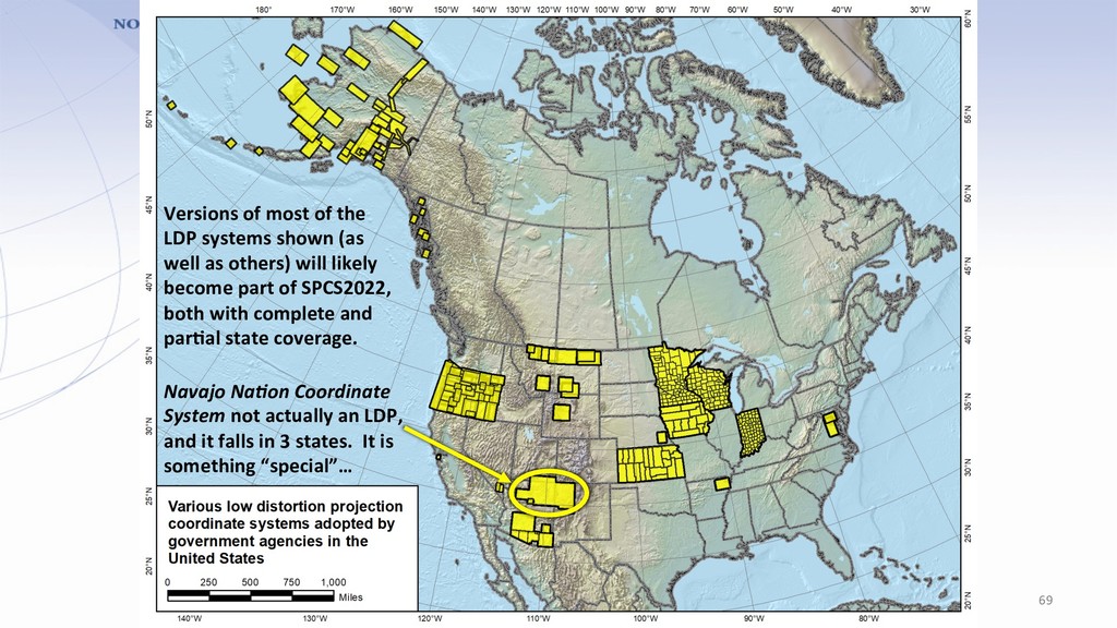
it falls in 3 states. It is something “special”… Versions of most of the LDP systems shown (as well as others) will likely become part of SPCS2022, both with complete and parCal state coverage.
Zones for regions in more than one state • Categories: – Major urban areas (e.g., New York, Chicago, St. Louis) – Large American Indian reserva8ons (e.g., Navajo Na8on) – Large federal jurisdic8ons or applica8ons (e.g., Yellowstone Na8onal Park, mapping of Atlan8c Coast) • Requires NGS Director approval (case-by-case basis) 70
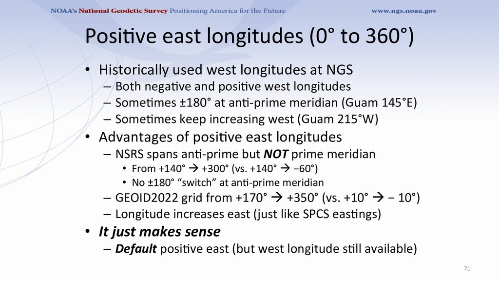
longitudes at NGS – Both nega8ve and posi8ve west longitudes – Some8mes ±180° at an8-prime meridian (Guam 145°E) – Some8mes keep increasing west (Guam 215°W) • Advantages of posi8ve east longitudes – NSRS spans an8-prime but NOT prime meridian • From +140° à +300° (vs. +140° à −60°) • No ±180° “switch” at an8-prime meridian – GEOID2022 grid from +170° à +350° (vs. +10° à − 10°) – Longitude increases east (just like SPCS eas8ngs) • It just makes sense – Default posi8ve east (but west longitude s8ll available) 71
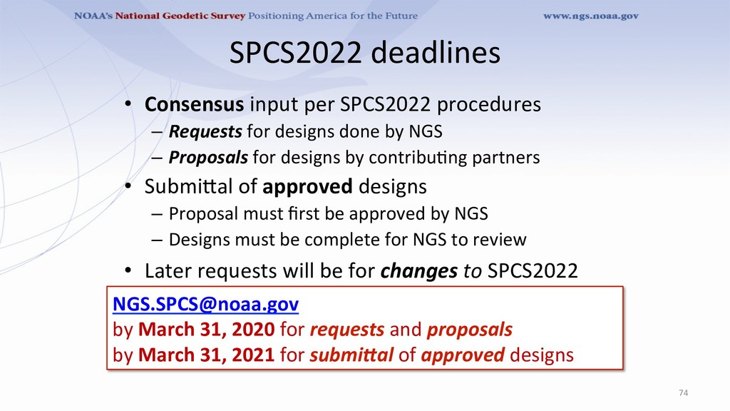
for designs done by NGS – Proposals for designs by contribu8ng partners • SubmiTal of approved designs – Proposal must first be approved by NGS – Designs must be complete for NGS to review • Later requests will be for changes to SPCS2022 74 [email protected] by March 31, 2020 for requests and proposals by March 31, 2021 for submiWal of approved designs
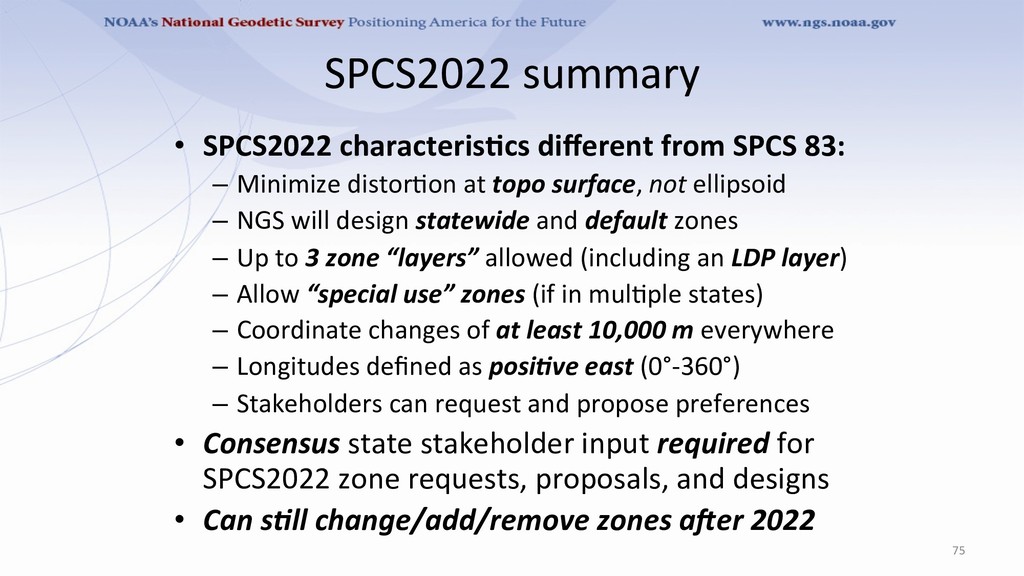
Minimize distor8on at topo surface, not ellipsoid – NGS will design statewide and default zones – Up to 3 zone “layers” allowed (including an LDP layer) – Allow “special use” zones (if in mul8ple states) – Coordinate changes of at least 10,000 m everywhere – Longitudes defined as posi)ve east (0°-360°) – Stakeholders can request and propose preferences • Consensus state stakeholder input required for SPCS2022 zone requests, proposals, and designs • Can s)ll change/add/remove zones a>er 2022 75